Academic Profile
Statistics
Similar Authors
Papers on arXiv
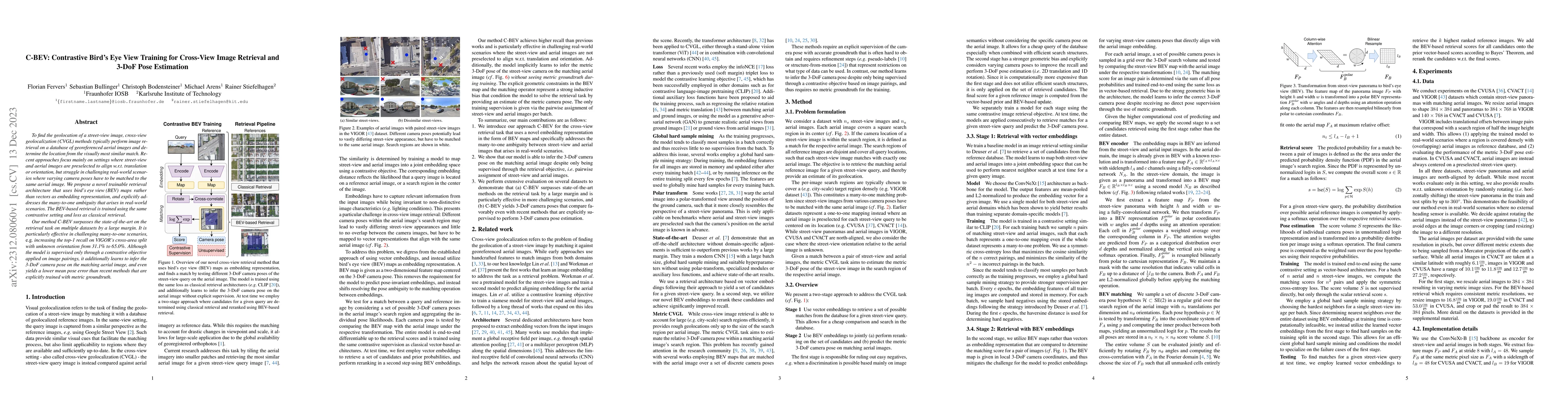
To find the geolocation of a street-view image, cross-view geolocalization (CVGL) methods typically perform image retrieval on a database of georeferenced aerial images and determine the location fr...
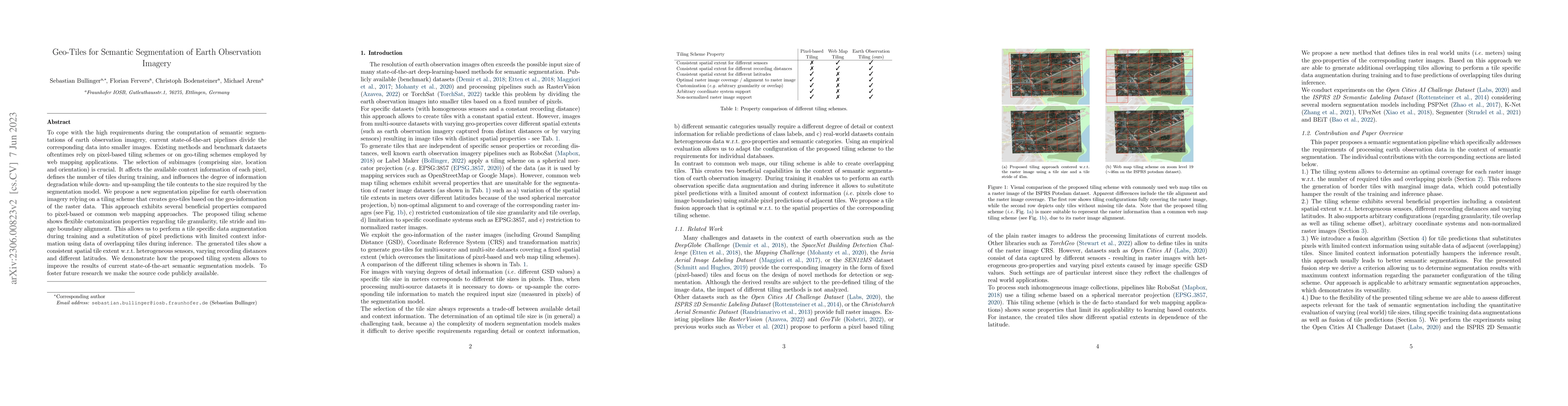
To cope with the high requirements during the computation of semantic segmentations of earth observation imagery, current state-of-the-art pipelines divide the corresponding data into smaller images...
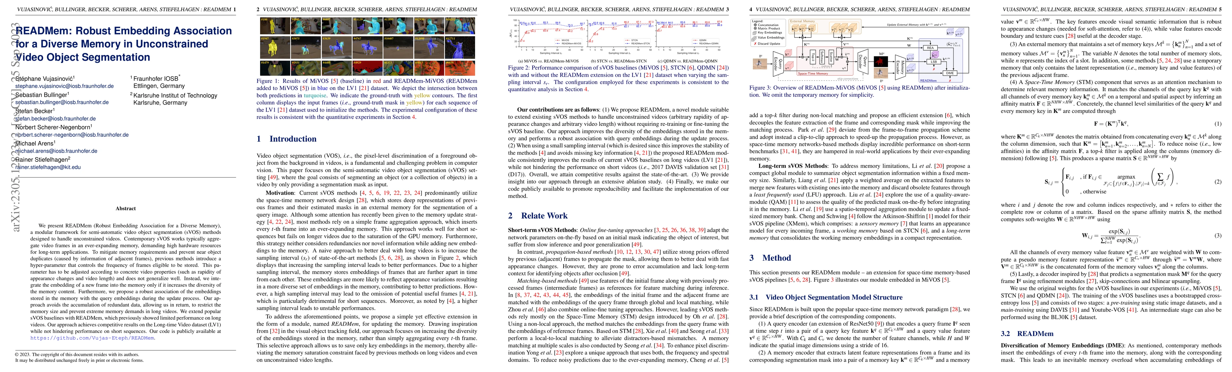
We present READMem (Robust Embedding Association for a Diverse Memory), a modular framework for semi-automatic video object segmentation (sVOS) methods designed to handle unconstrained videos. Conte...
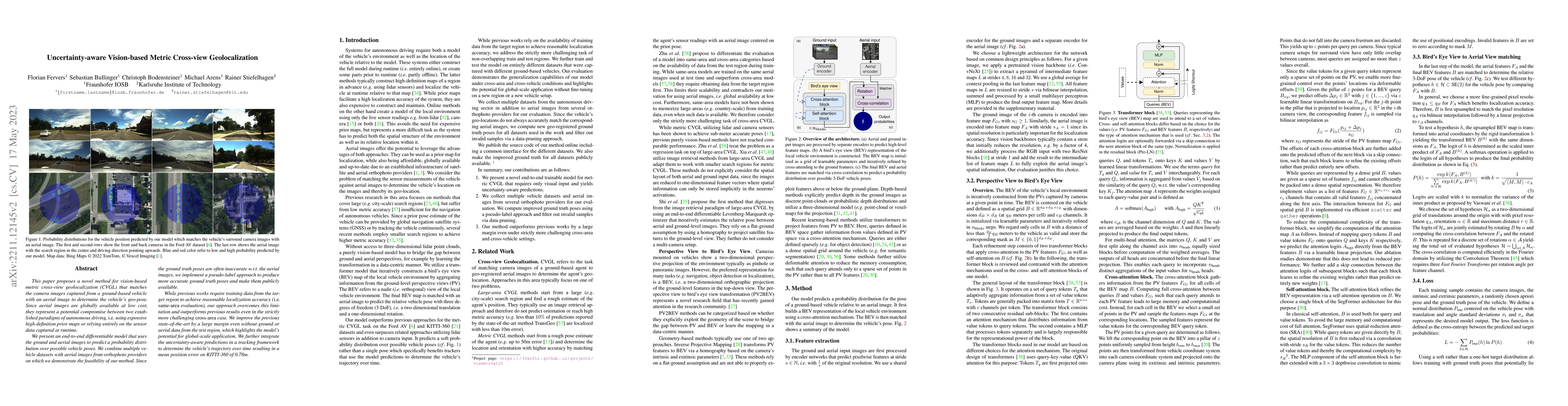
This paper proposes a novel method for vision-based metric cross-view geolocalization (CVGL) that matches the camera images captured from a ground-based vehicle with an aerial image to determine the...
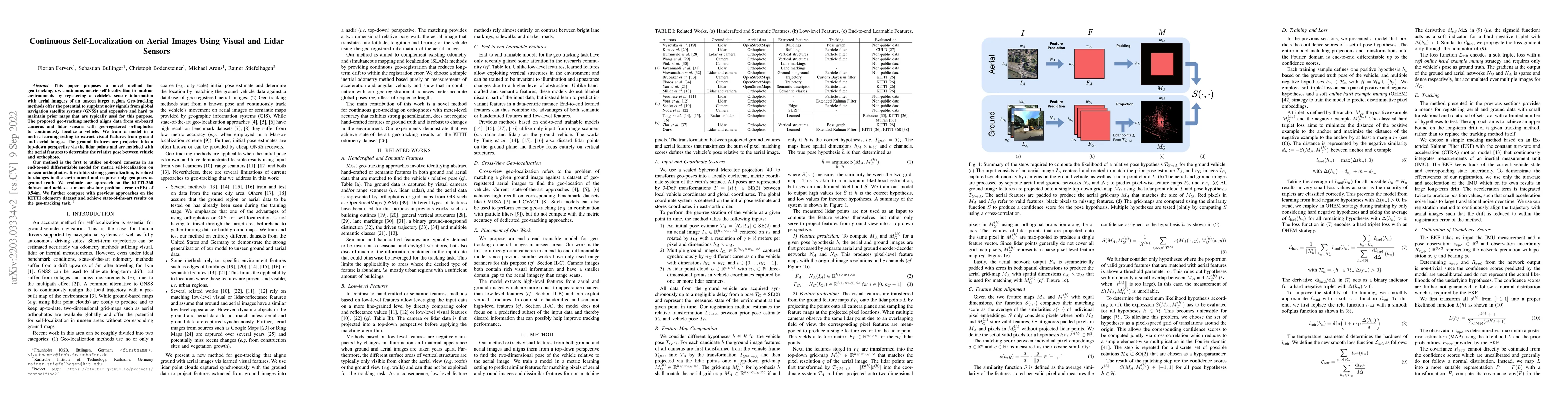
This paper proposes a novel method for geo-tracking, i.e. continuous metric self-localization in outdoor environments by registering a vehicle's sensor information with aerial imagery of an unseen t...
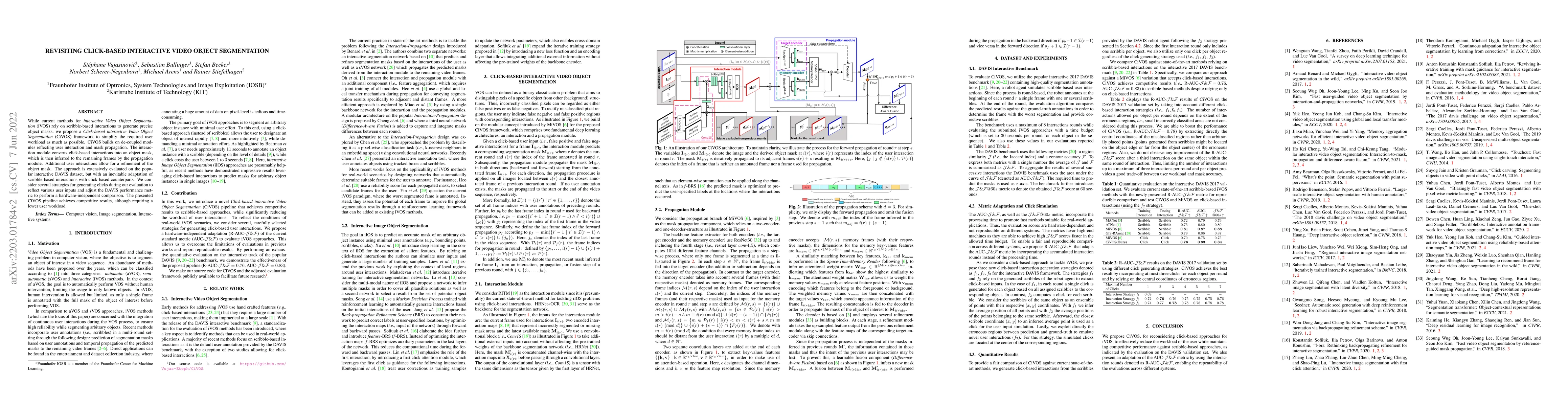
While current methods for interactive Video Object Segmentation (iVOS) rely on scribble-based interactions to generate precise object masks, we propose a Click-based interactive Video Object Segment...
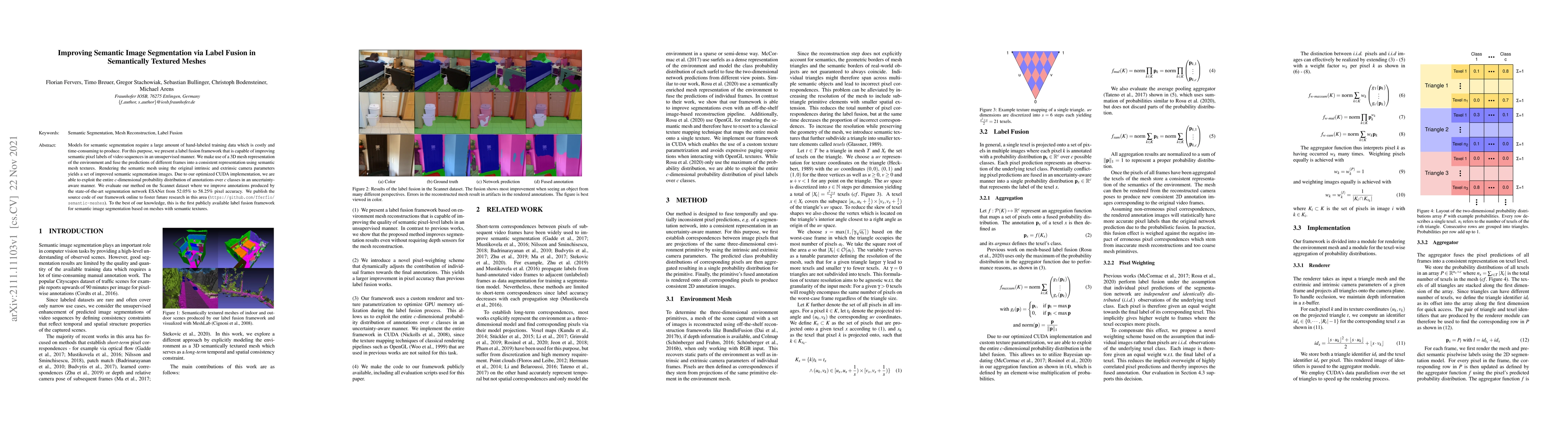
Models for semantic segmentation require a large amount of hand-labeled training data which is costly and time-consuming to produce. For this purpose, we present a label fusion framework that is cap...
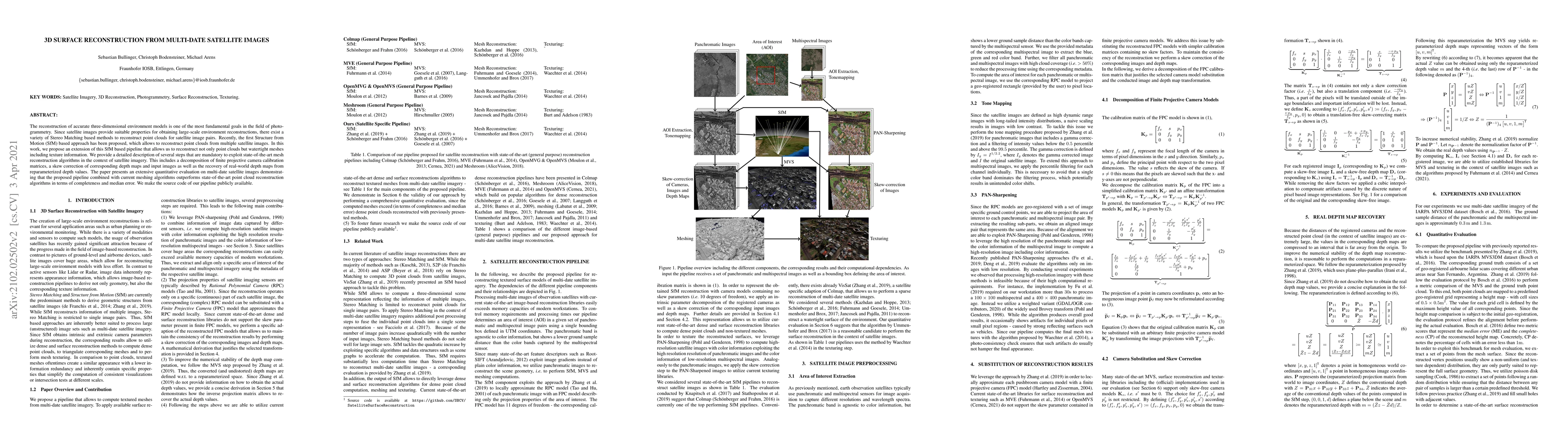
The reconstruction of accurate three-dimensional environment models is one of the most fundamental goals in the field of photogrammetry. Since satellite images provide suitable properties for obtain...
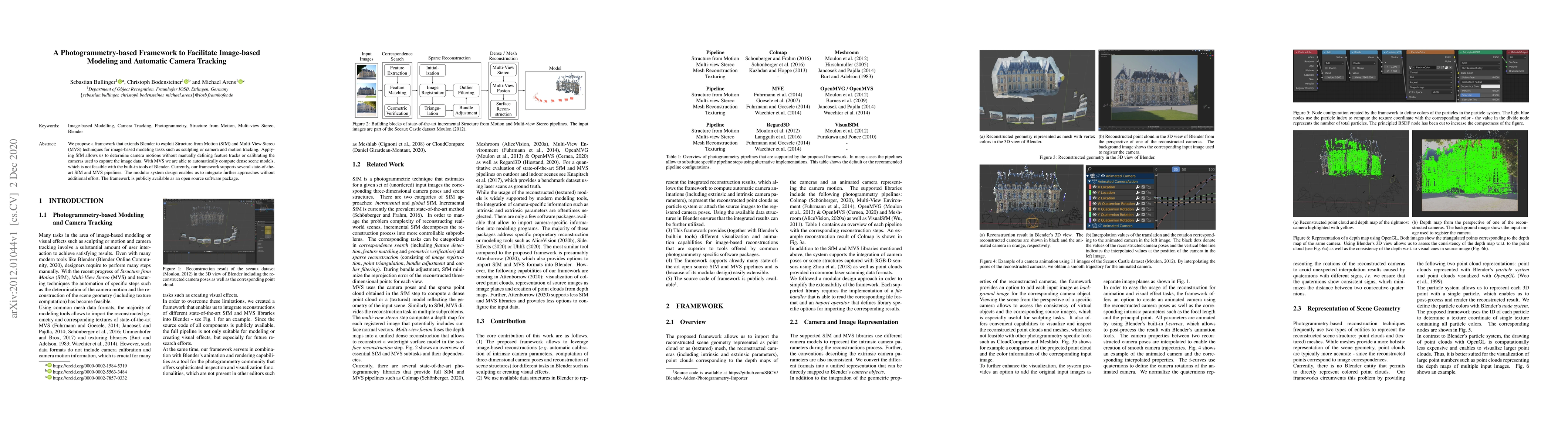
We propose a framework that extends Blender to exploit Structure from Motion (SfM) and Multi-View Stereo (MVS) techniques for image-based modeling tasks such as sculpting or camera and motion tracki...
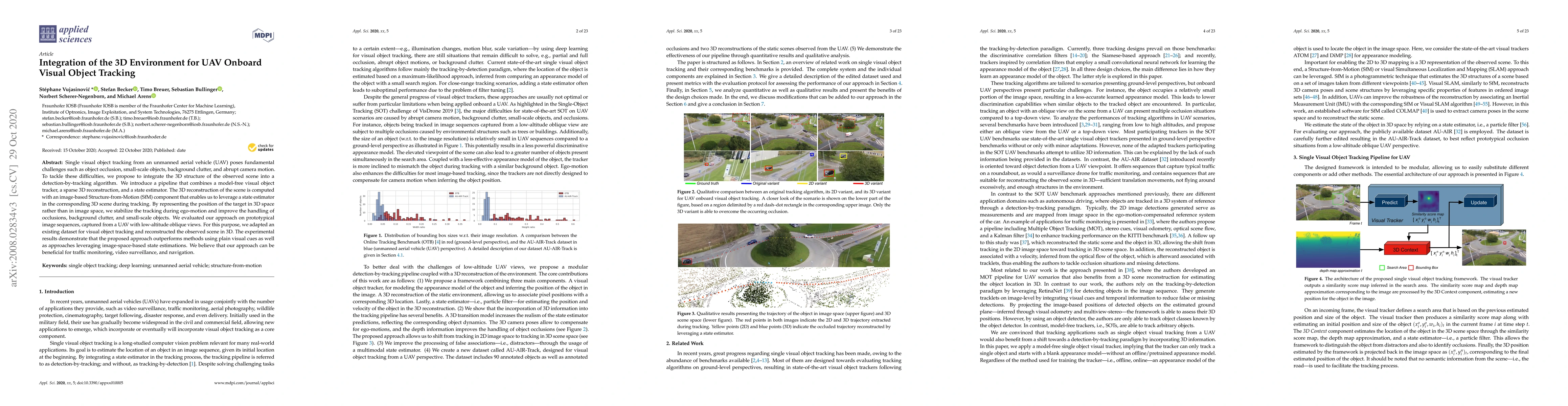
Single visual object tracking from an unmanned aerial vehicle (UAV) poses fundamental challenges such as object occlusion, small-scale objects, background clutter, and abrupt camera motion. To tackl...
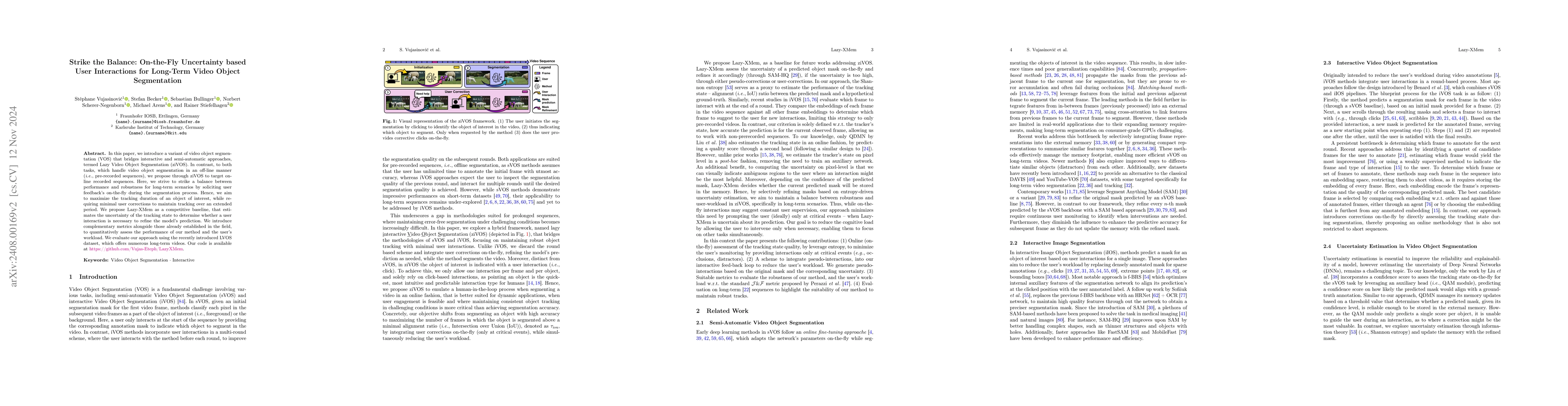
In this paper, we introduce a variant of video object segmentation (VOS) that bridges interactive and semi-automatic approaches, termed Lazy Video Object Segmentation (ziVOS). In contrast, to both tas...
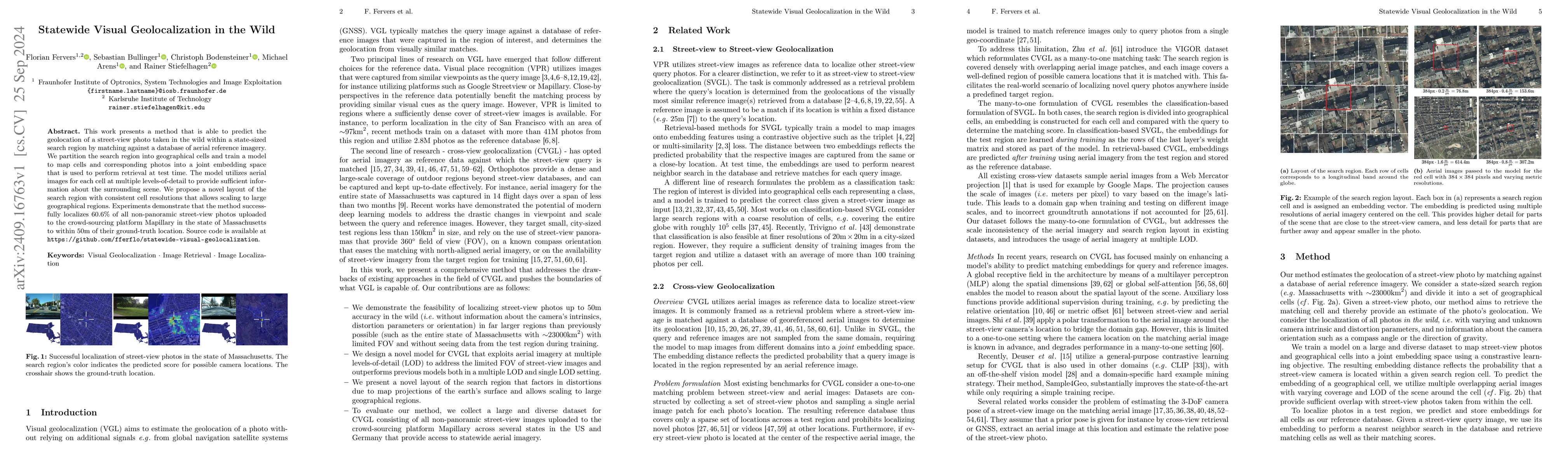
This work presents a method that is able to predict the geolocation of a street-view photo taken in the wild within a state-sized search region by matching against a database of aerial reference image...
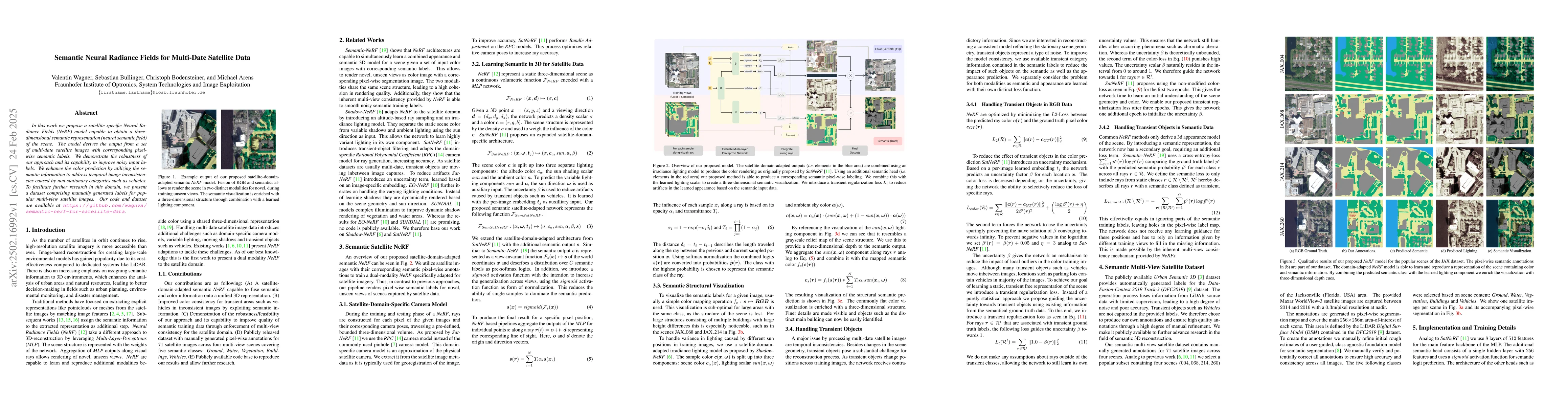
In this work we propose a satellite specific Neural Radiance Fields (NeRF) model capable to obtain a three-dimensional semantic representation (neural semantic field) of the scene. The model derives t...
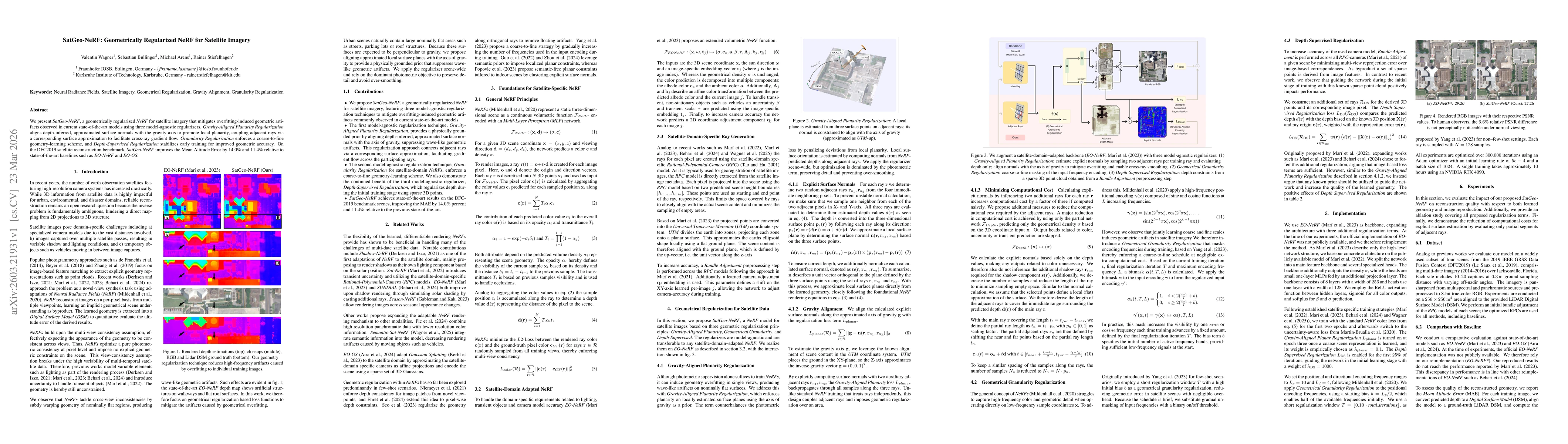
We present SatGeo-NeRF, a geometrically regularized NeRF for satellite imagery that mitigates overfitting-induced geometric artifacts observed in current state-of-the-art models using three model-agno...
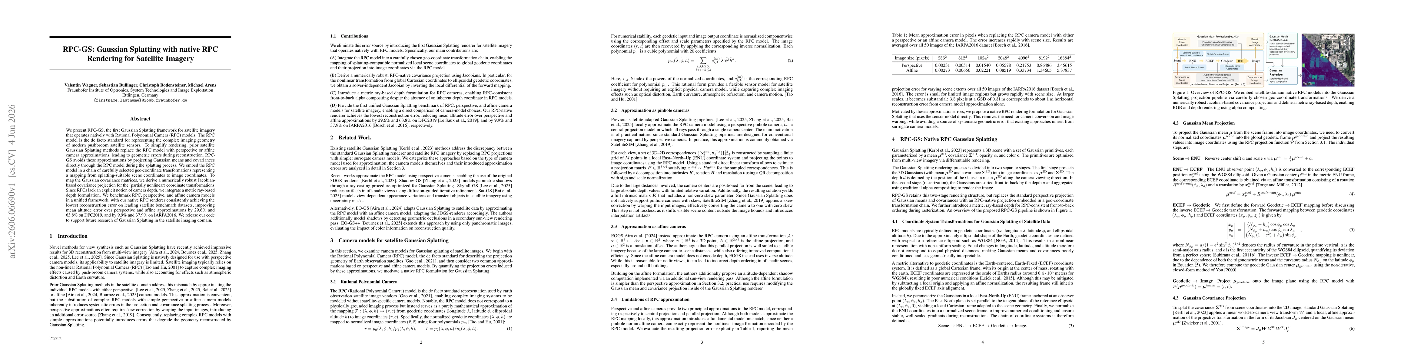
We present RPC-GS, the first Gaussian Splatting framework for satellite imagery that operates natively with Rational Polynomial Camera (RPC) models. The RPC model is the de facto standard for represen...