01
MethodologyHow they did it
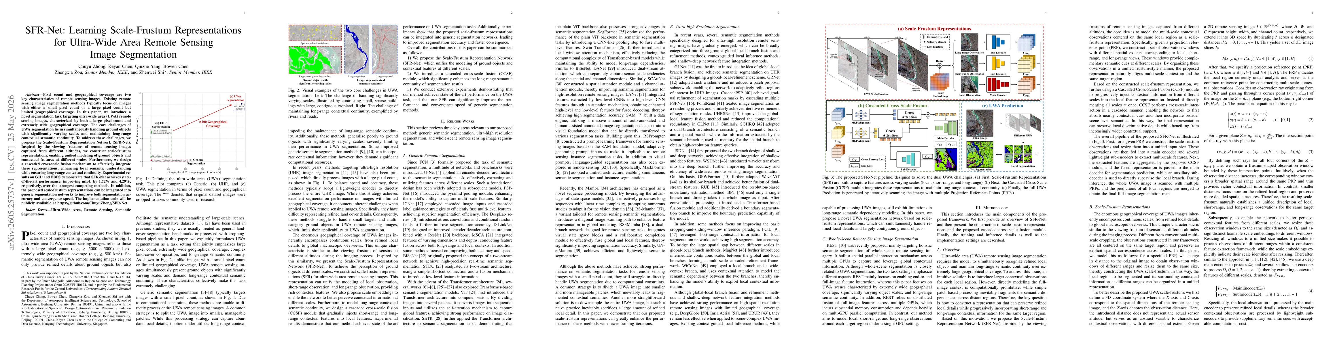
SFR-Net introduces Scale-Frustum Representations (SFR) to unify modeling of ground objects and contextual features across multiple scales, inspired by viewing frustums at different altitudes. A cascaded cross-scale fusion (CCSF) module is designed to gradually integrate short-range, mid-range, and long-range contextual features into local representations to preserve long-range semantic continuity while enhancing local understanding. The approach includes scale embeddings to help the network perceive contextual information at various scales and a training regime demonstrating integration of SFR into generic segmentation networks to improve accuracy and convergence speed.
Discussion 0