Academic Profile
Statistics
Similar Authors
Papers on arXiv
Cardiac cine magnetic resonance imaging (MRI) is one of the important means to assess cardiac functions and vascular abnormalities. Mitigating artifacts arising during image reconstruction and acceler...
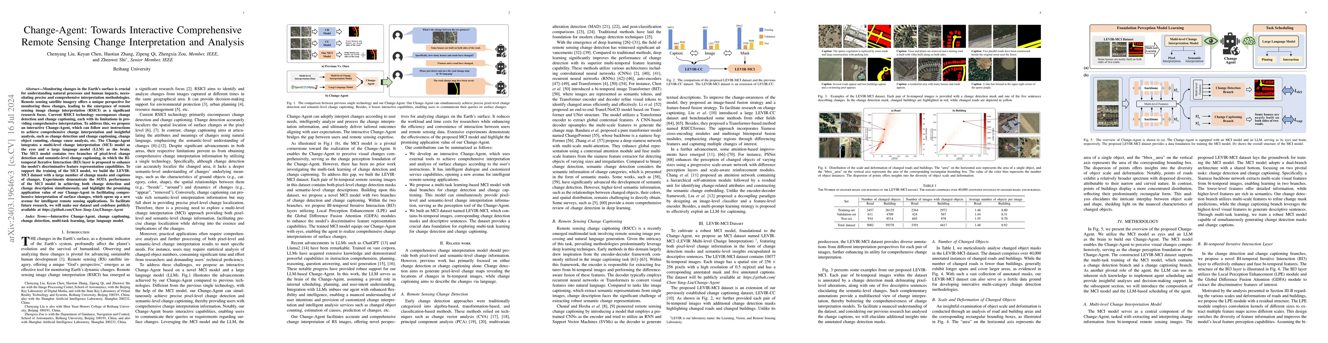
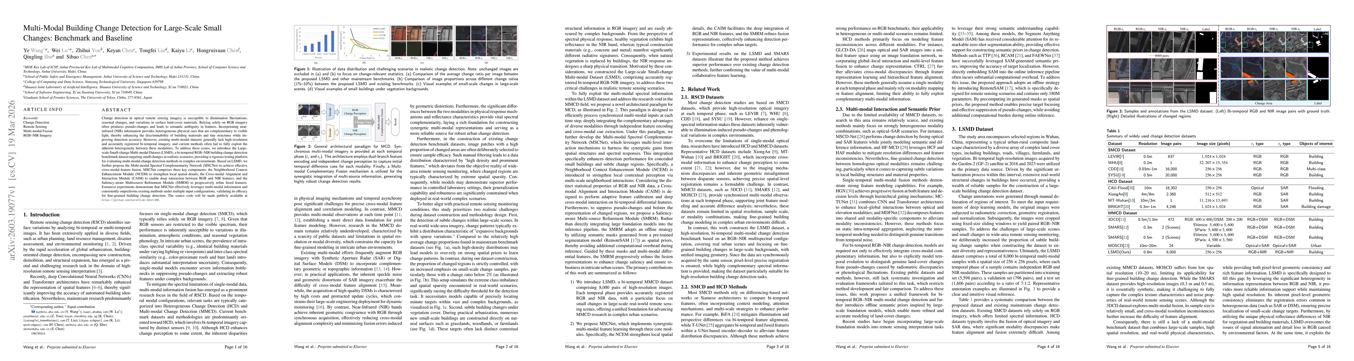
Monitoring changes in the Earth's surface is crucial for understanding natural processes and human impacts, necessitating precise and comprehensive interpretation methodologies. Remote sensing satelli...
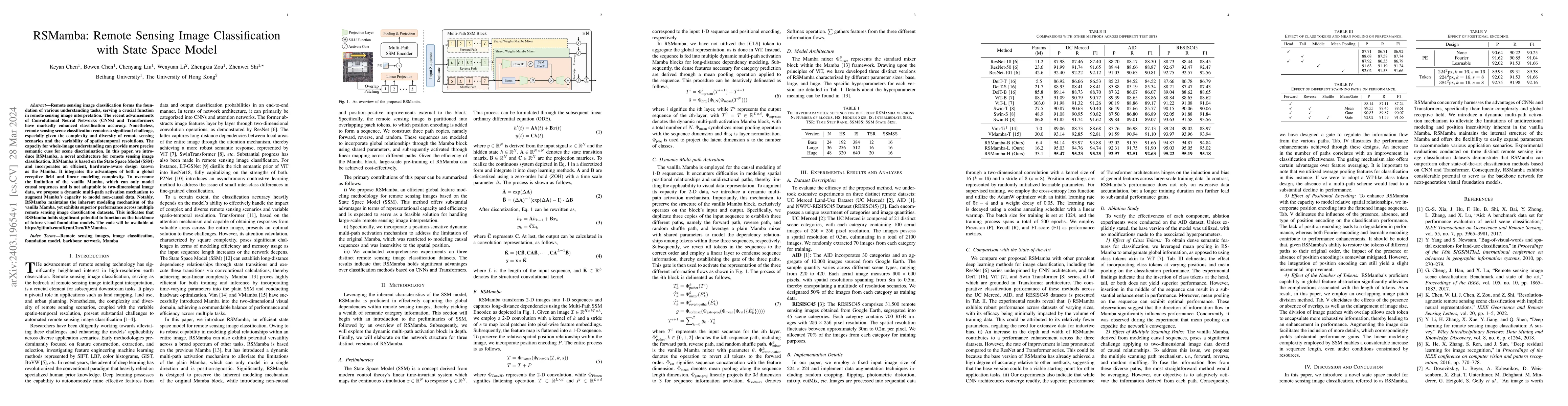
Recently, the Mamba architecture based on state space models has demonstrated remarkable performance in a series of natural language processing tasks and has been rapidly applied to remote sensing c...
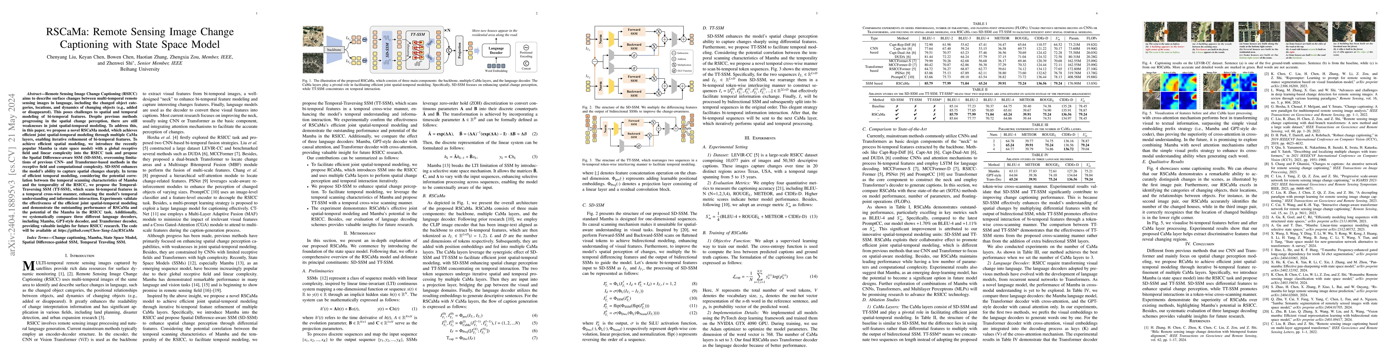
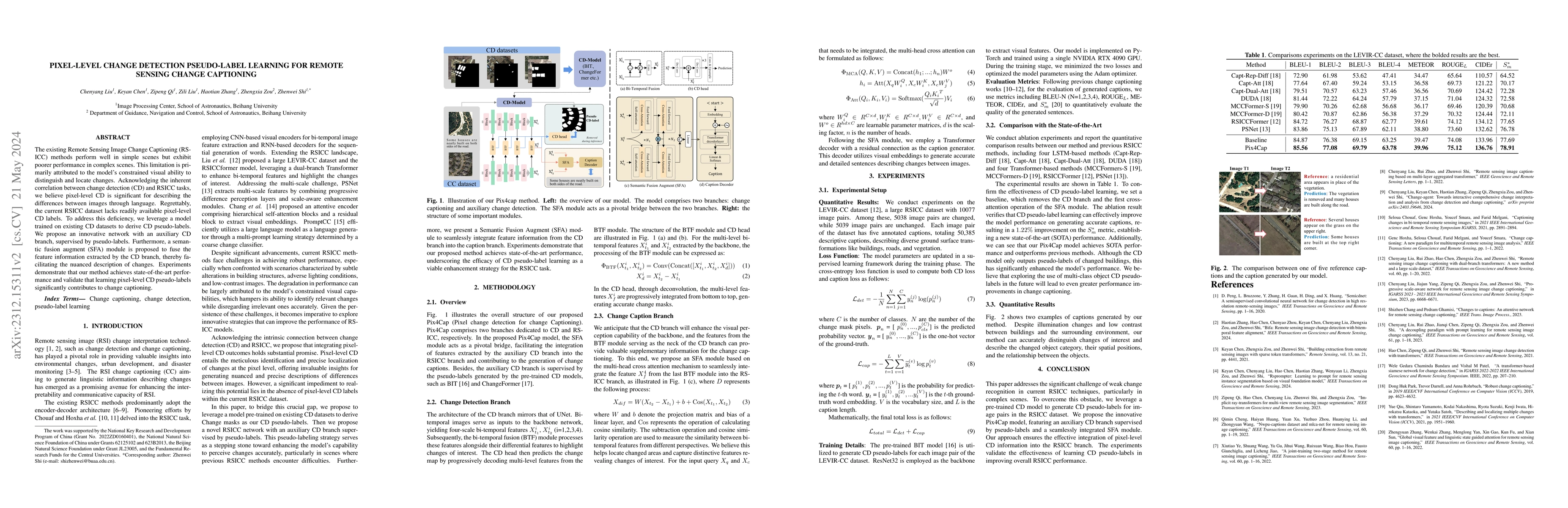
Remote Sensing Image Change Captioning (RSICC) aims to describe surface changes between multi-temporal remote sensing images in language, including the changed object categories, locations, and dyna...
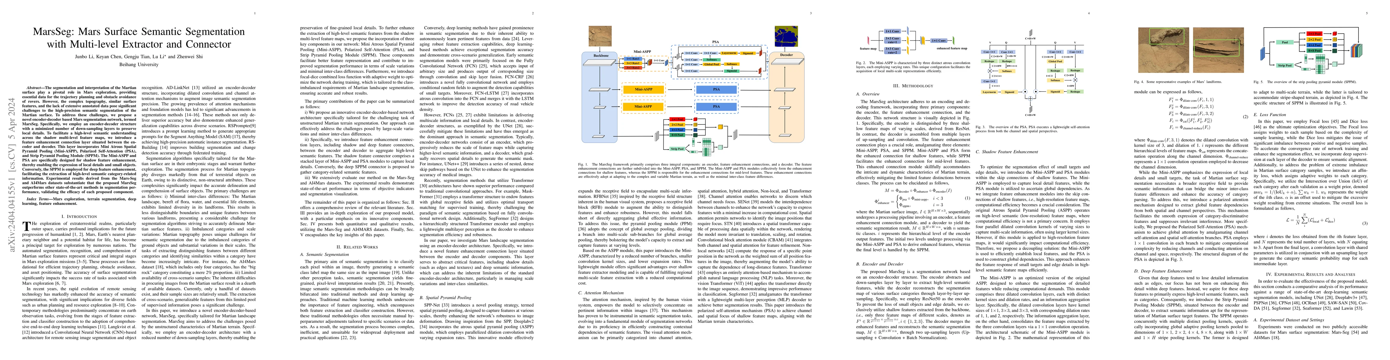
The segmentation and interpretation of the Martian surface play a pivotal role in Mars exploration, providing essential data for the trajectory planning and obstacle avoidance of rovers. However, th...
Remote sensing image classification forms the foundation of various understanding tasks, serving a crucial function in remote sensing image interpretation. The recent advancements of Convolutional N...
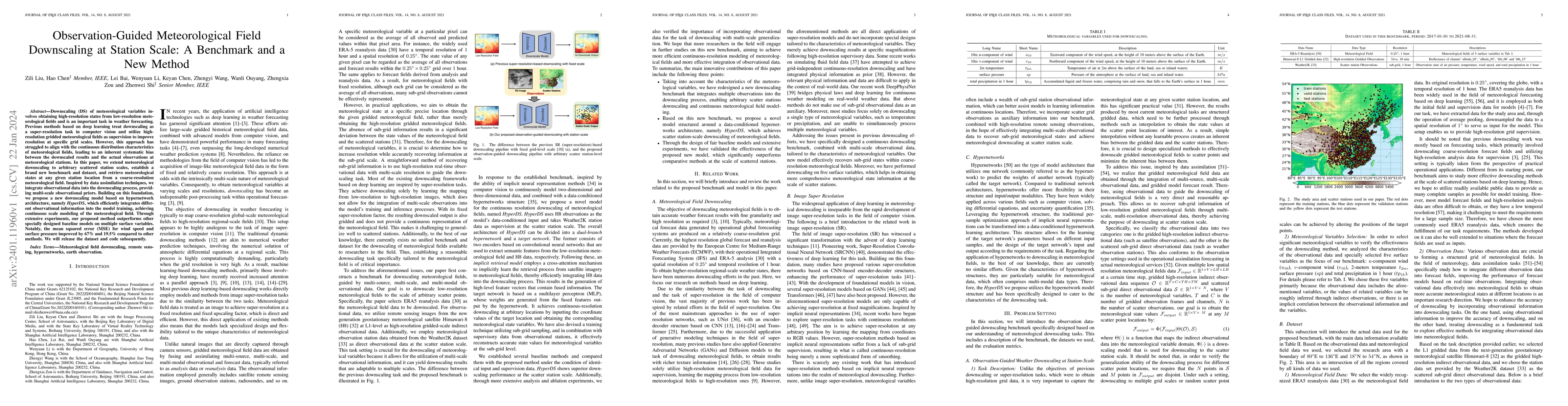
Downscaling (DS) of meteorological variables involves obtaining high-resolution states from low-resolution meteorological fields and is an important task in weather forecasting. Previous methods bas...
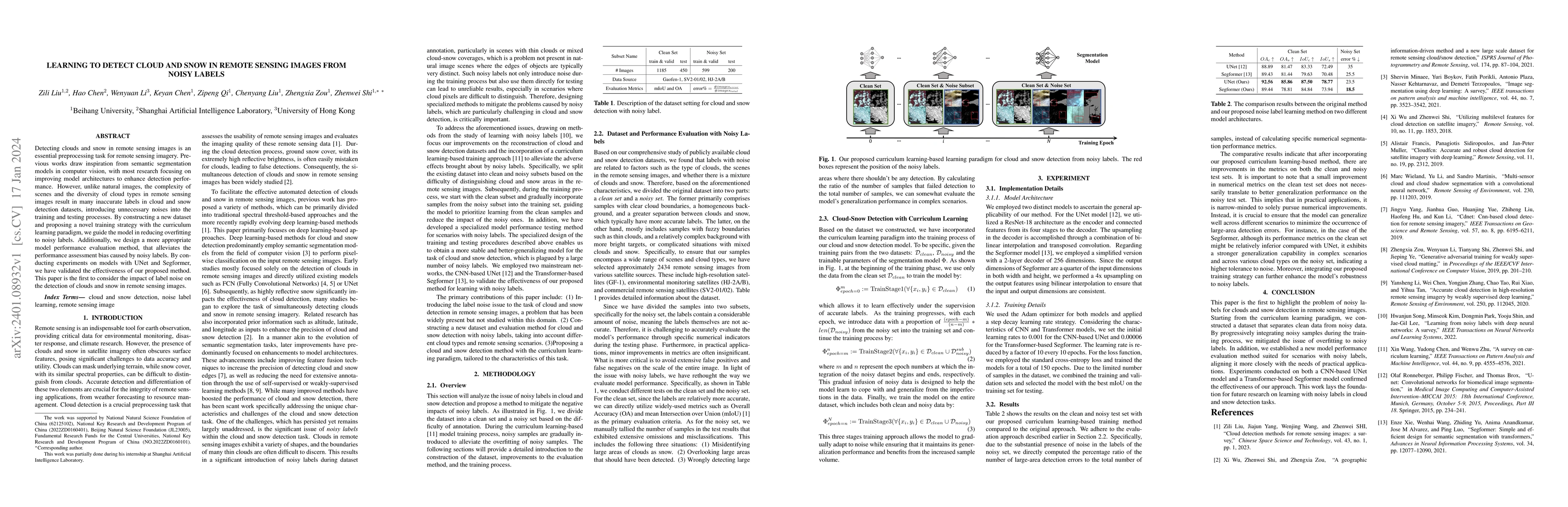
Detecting clouds and snow in remote sensing images is an essential preprocessing task for remote sensing imagery. Previous works draw inspiration from semantic segmentation models in computer vision...

Accurate weather forecasting holds significant importance to human activities. Currently, there are two paradigms for weather forecasting: Numerical Weather Prediction (NWP) and Deep Learning-based ...
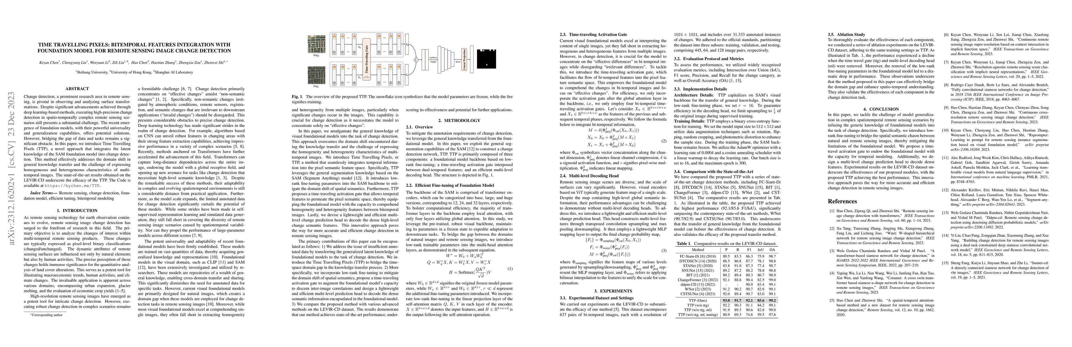
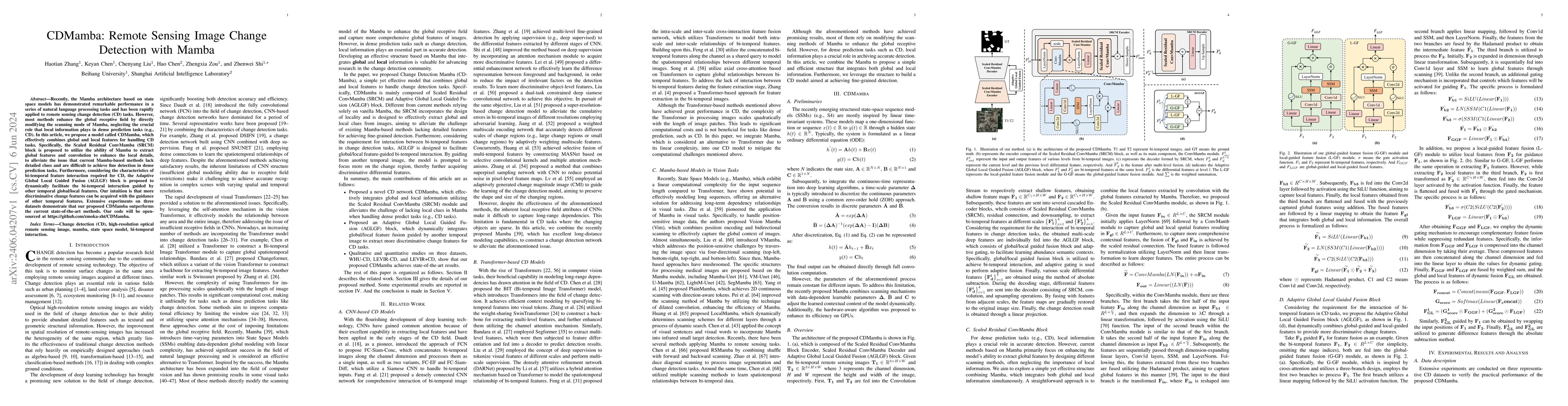
Change detection, a prominent research area in remote sensing, is pivotal in observing and analyzing surface transformations. Despite significant advancements achieved through deep learning-based me...
The existing methods for Remote Sensing Image Change Captioning (RSICC) perform well in simple scenes but exhibit poorer performance in complex scenes. This limitation is primarily attributed to the...
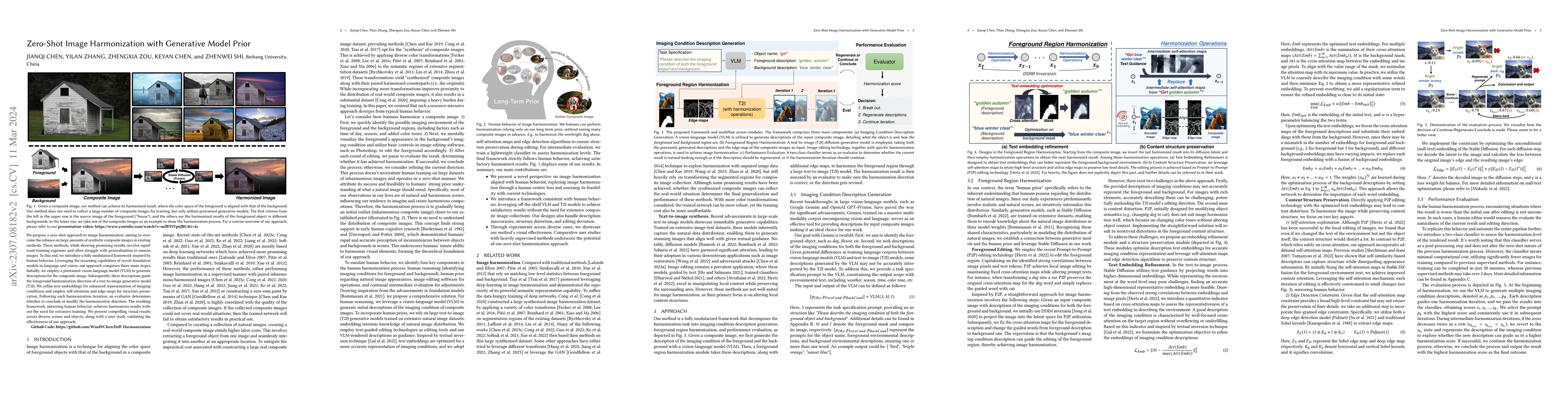
We propose a zero-shot approach to image harmonization, aiming to overcome the reliance on large amounts of synthetic composite images in existing methods. These methods, while showing promising res...
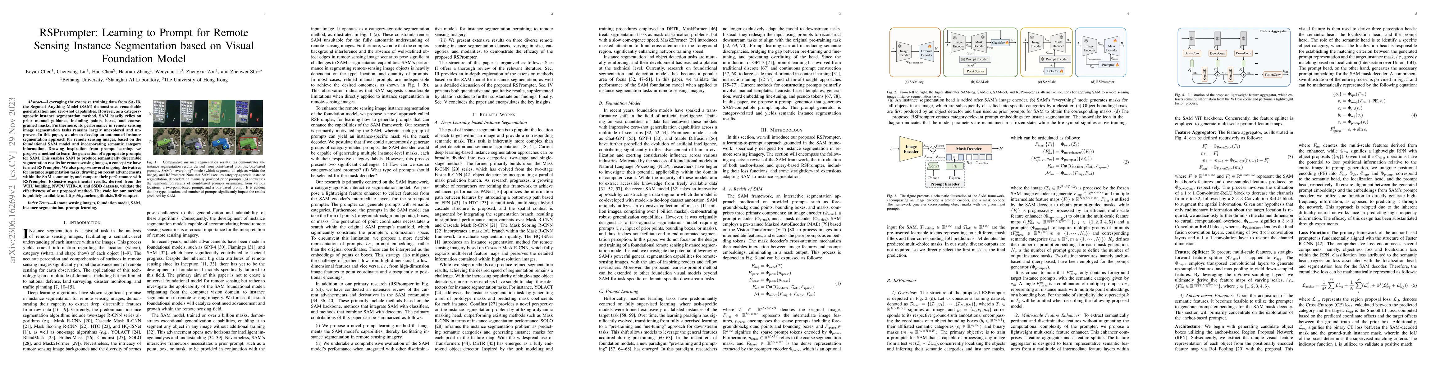
Leveraging the extensive training data from SA-1B, the Segment Anything Model (SAM) demonstrates remarkable generalization and zero-shot capabilities. However, as a category-agnostic instance segmen...
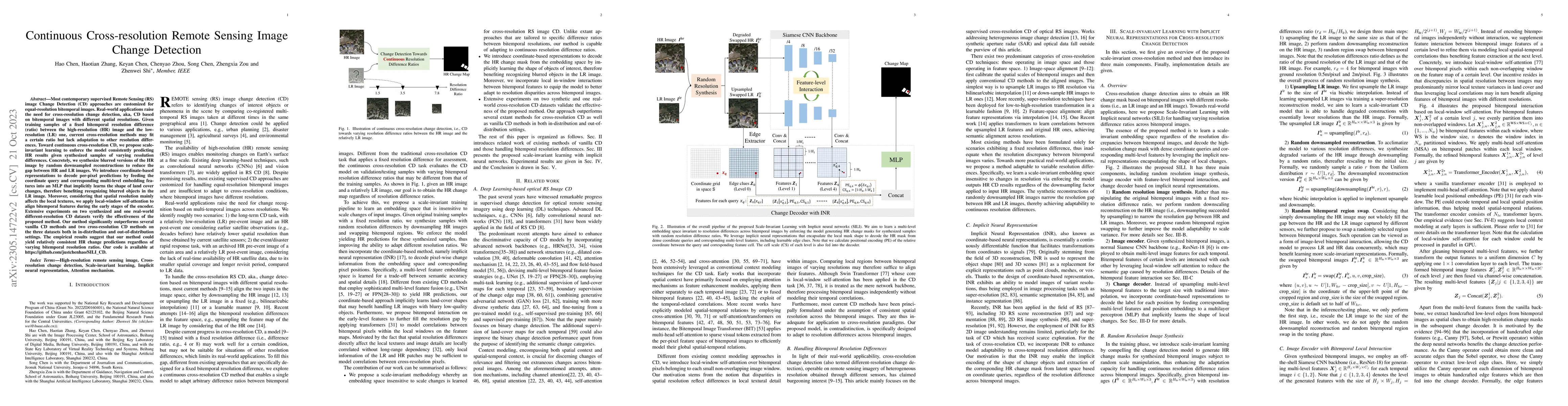
Most contemporary supervised Remote Sensing (RS) image Change Detection (CD) approaches are customized for equal-resolution bitemporal images. Real-world applications raise the need for cross-resolu...
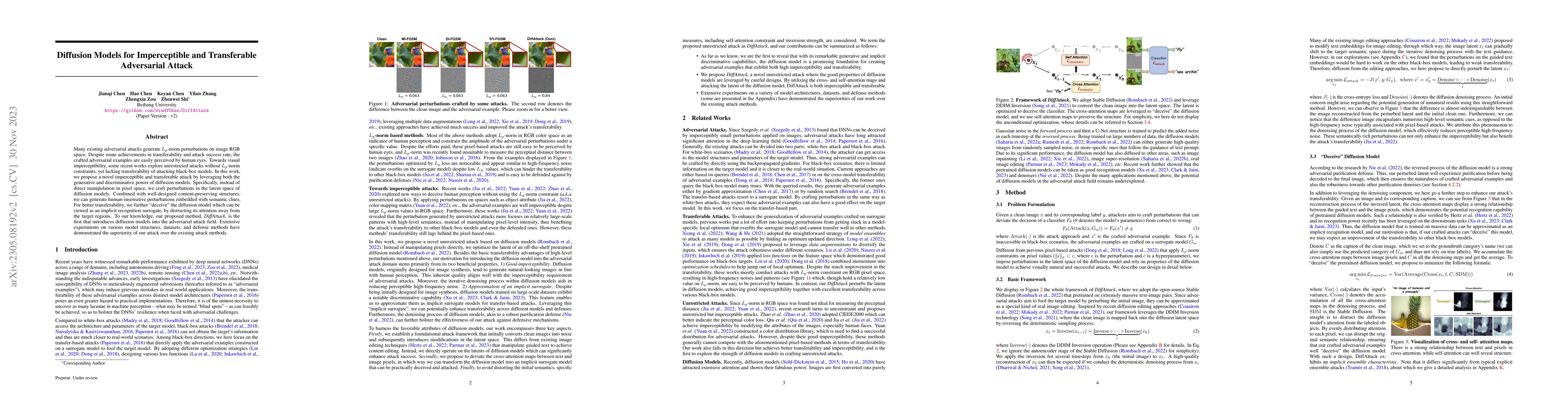
Many existing adversarial attacks generate $L_p$-norm perturbations on image RGB space. Despite some achievements in transferability and attack success rate, the crafted adversarial examples are eas...
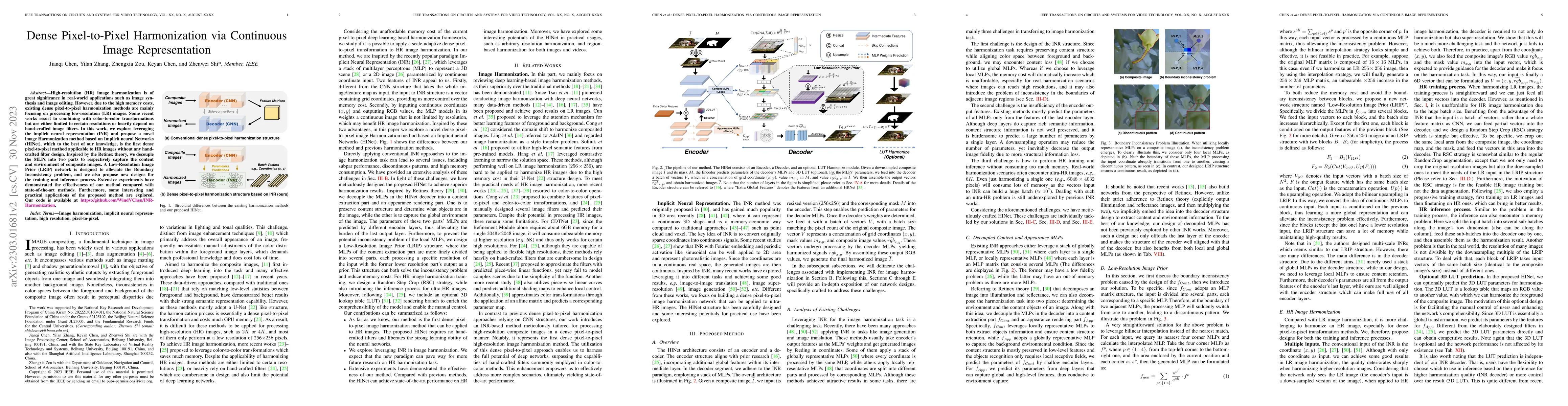
High-resolution (HR) image harmonization is of great significance in real-world applications such as image synthesis and image editing. However, due to the high memory costs, existing dense pixel-to...
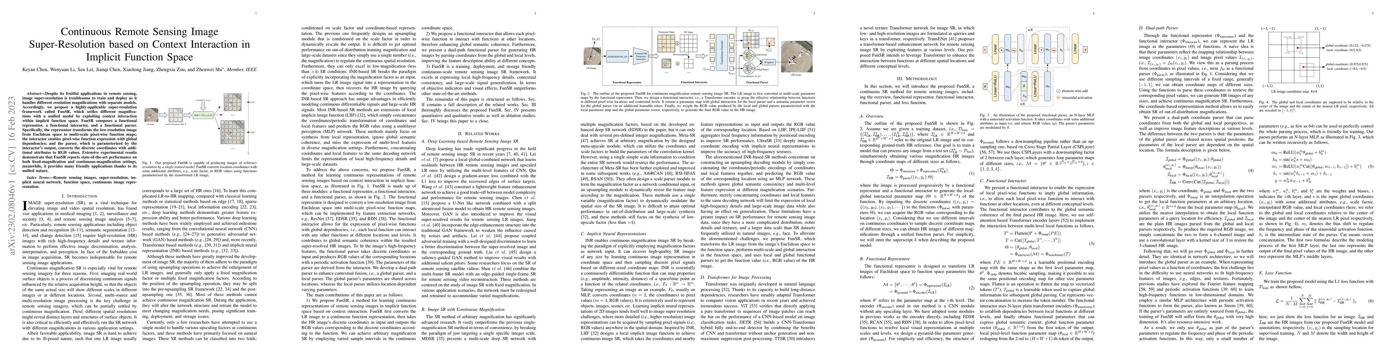
Despite its fruitful applications in remote sensing, image super-resolution is troublesome to train and deploy as it handles different resolution magnifications with separate models. Accordingly, we...
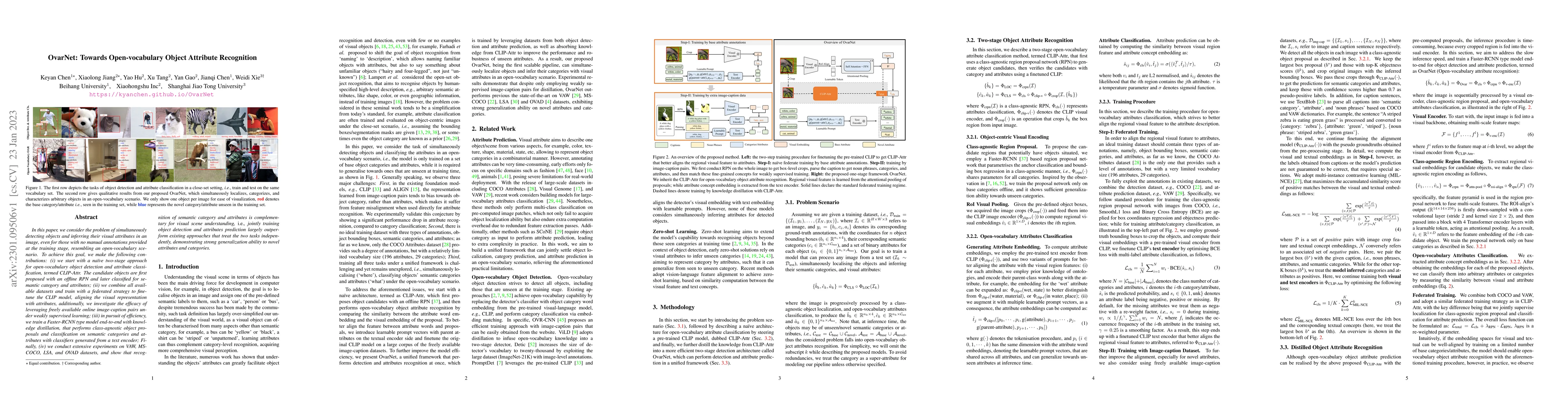
In this paper, we consider the problem of simultaneously detecting objects and inferring their visual attributes in an image, even for those with no manual annotations provided at the training stage...
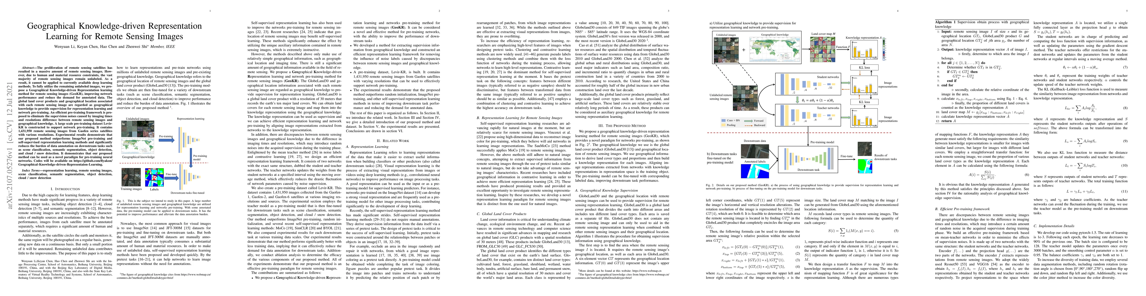
The proliferation of remote sensing satellites has resulted in a massive amount of remote sensing images. However, due to human and material resource constraints, the vast majority of remote sensing...
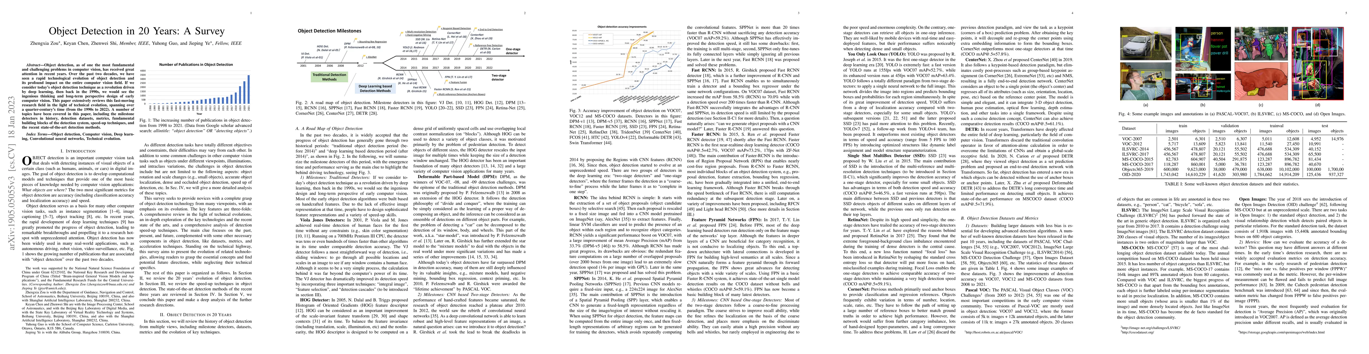
Object detection, as of one the most fundamental and challenging problems in computer vision, has received great attention in recent years. Over the past two decades, we have seen a rapid technologi...
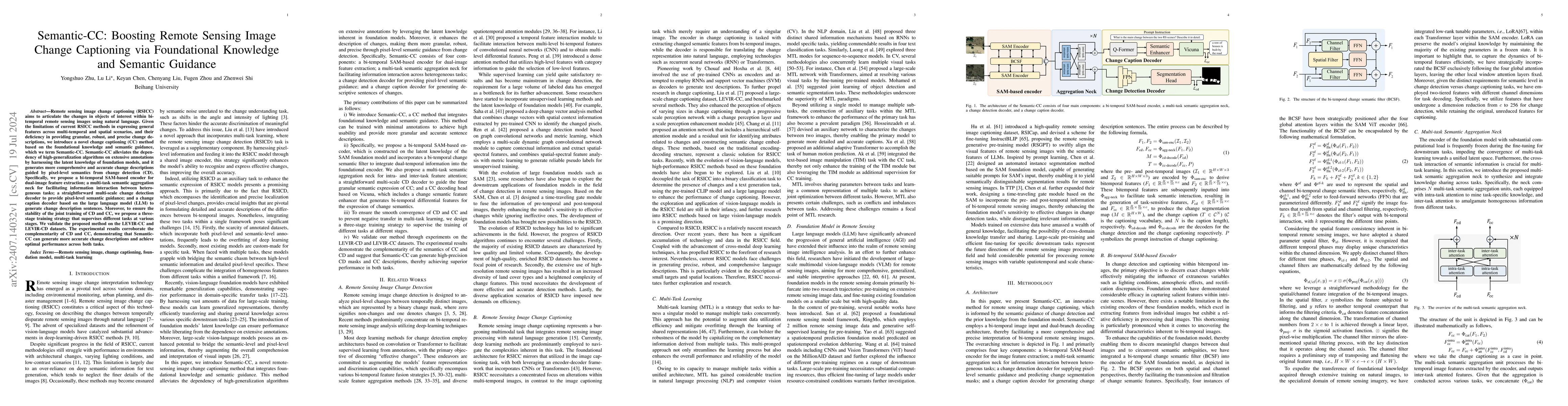
Remote sensing image change captioning (RSICC) aims to articulate the changes in objects of interest within bi-temporal remote sensing images using natural language. Given the limitations of current R...
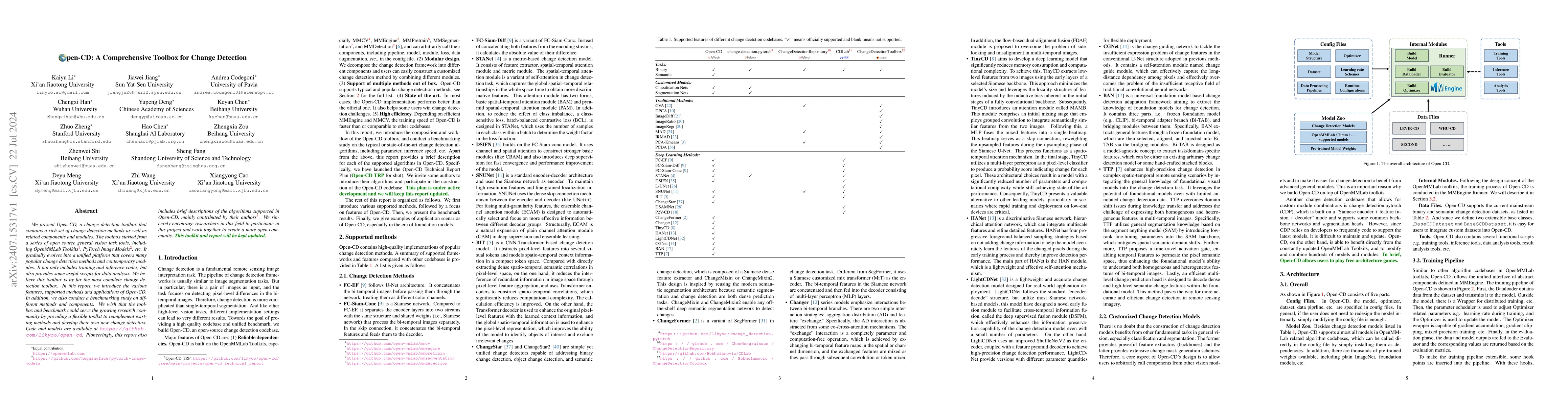
We present Open-CD, a change detection toolbox that contains a rich set of change detection methods as well as related components and modules. The toolbox started from a series of open source general ...
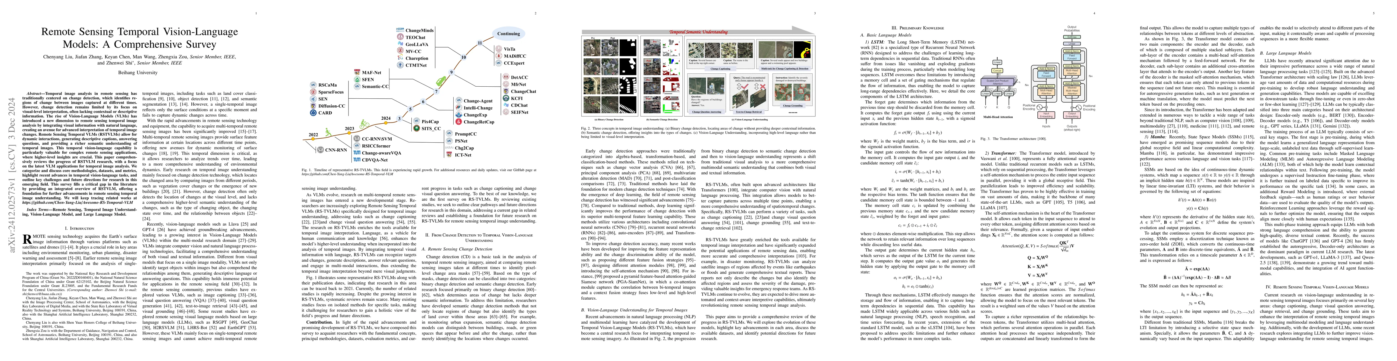
Temporal image analysis in remote sensing has traditionally centered on change detection, which identifies regions of change between images captured at different times. However, change detection remai...
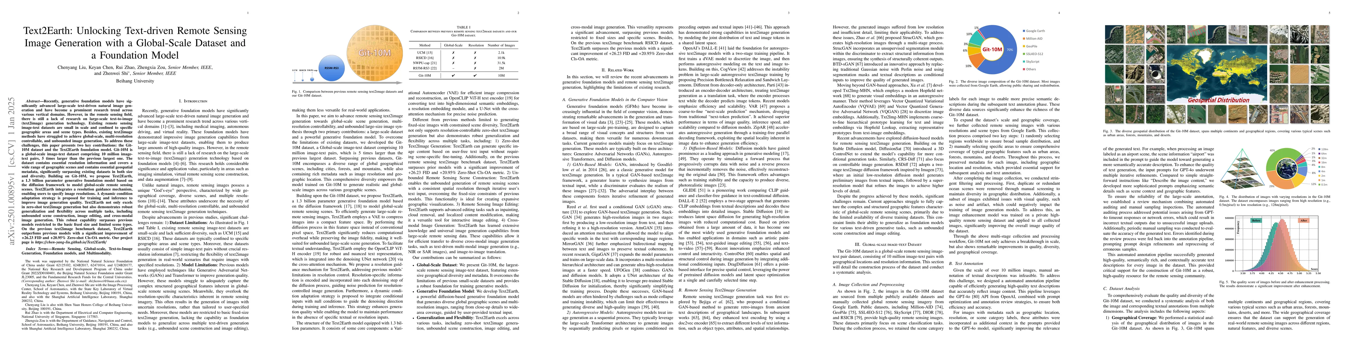
Generative foundation models have advanced large-scale text-driven natural image generation, becoming a prominent research trend across various vertical domains. However, in the remote sensing field, ...
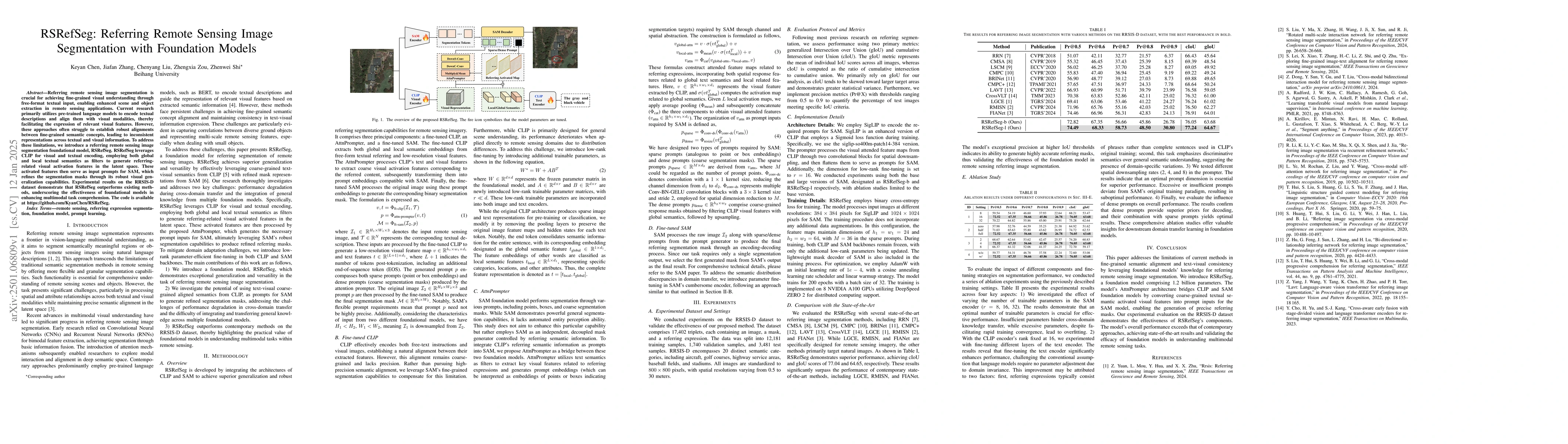
Referring remote sensing image segmentation is crucial for achieving fine-grained visual understanding through free-format textual input, enabling enhanced scene and object extraction in remote sensin...
Remote sensing image semantic change detection is a method used to analyze remote sensing images, aiming to identify areas of change as well as categorize these changes within images of the same locat...
Neural operators have shown great potential in surrogate modeling. However, training a well-performing neural operator typically requires a substantial amount of data, which can pose a major challenge...
Remote sensing image super-resolution (SR) aims to reconstruct high-resolution remote sensing images from low-resolution inputs, thereby addressing limitations imposed by sensors and imaging condition...
The advancement of remote sensing technology has improved the spatial resolution of satellite imagery, facilitating more detailed visual representations for diverse interpretations. However, existing ...
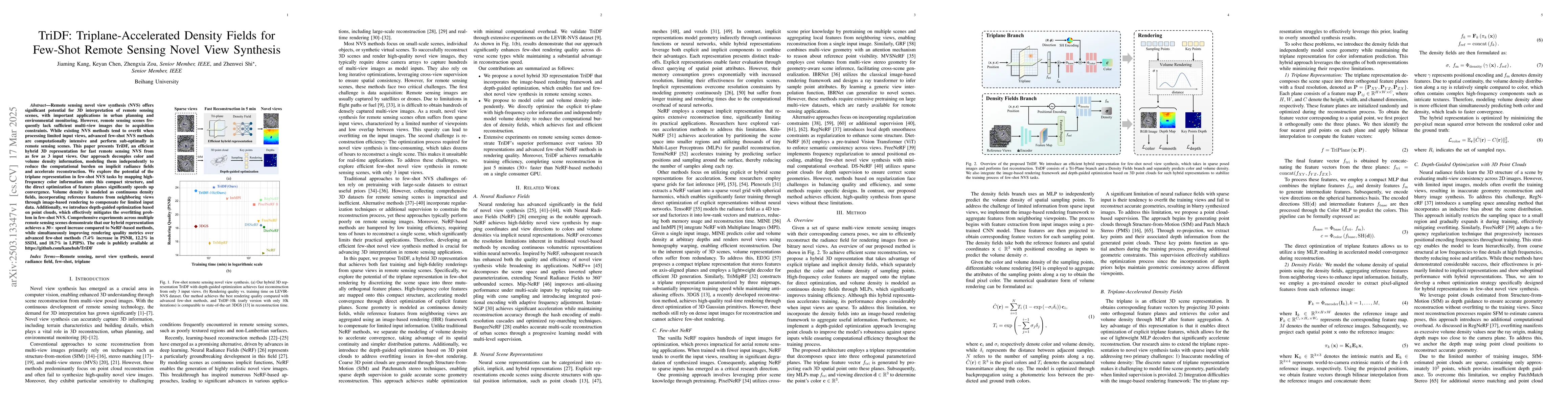
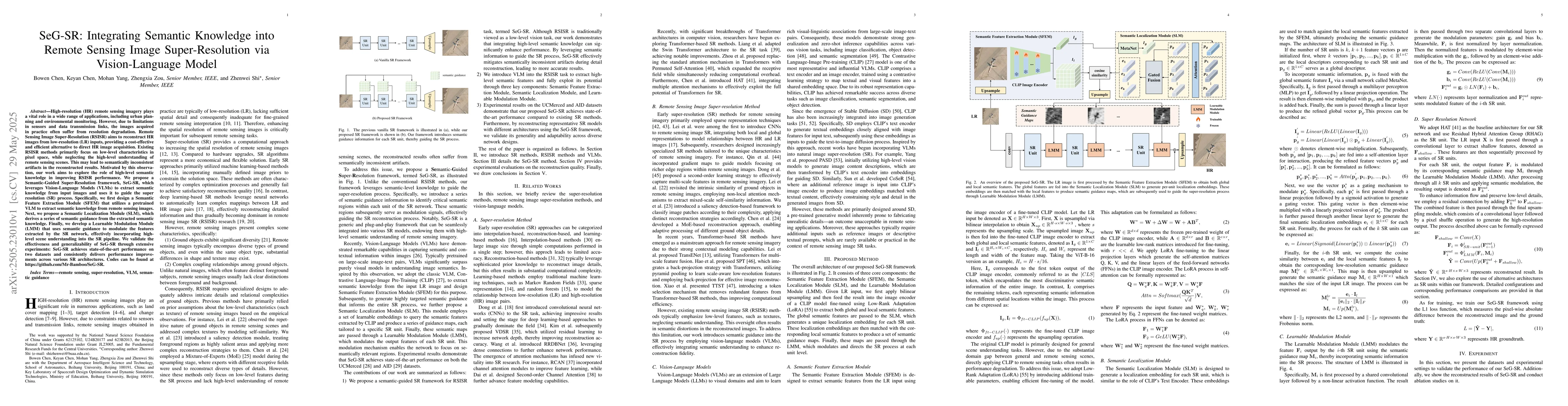
Remote sensing novel view synthesis (NVS) offers significant potential for 3D interpretation of remote sensing scenes, with important applications in urban planning and environmental monitoring. Howev...
High-resolution (HR) remote sensing imagery plays a vital role in a wide range of applications, including urban planning and environmental monitoring. However, due to limitations in sensors and data t...
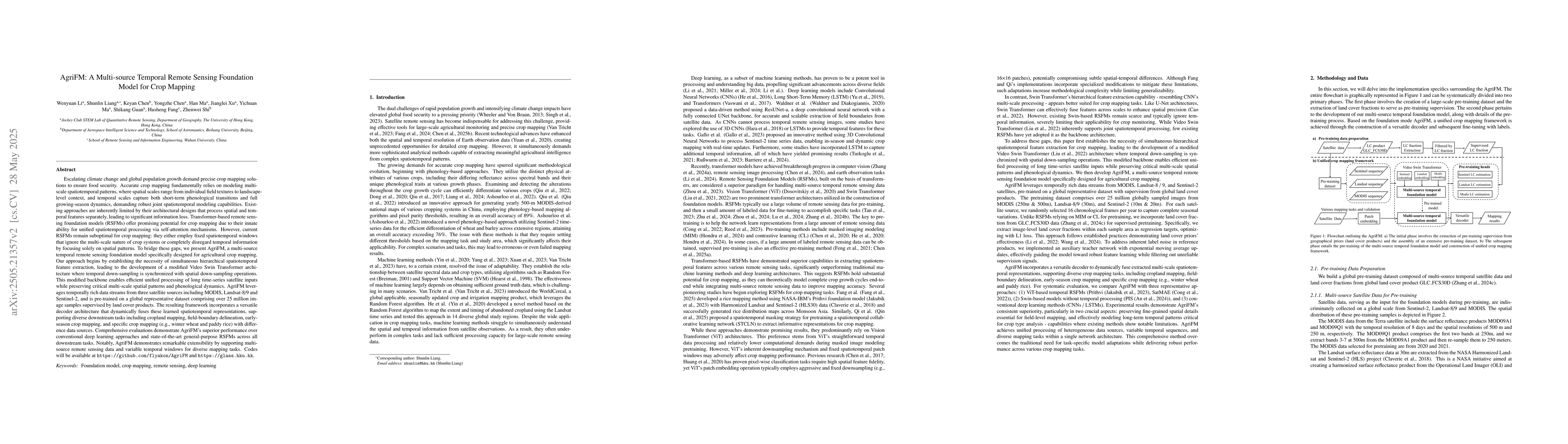
Accurate crop mapping fundamentally relies on modeling multi-scale spatiotemporal patterns, where spatial scales range from individual field textures to landscape-level context, and temporal scales ca...
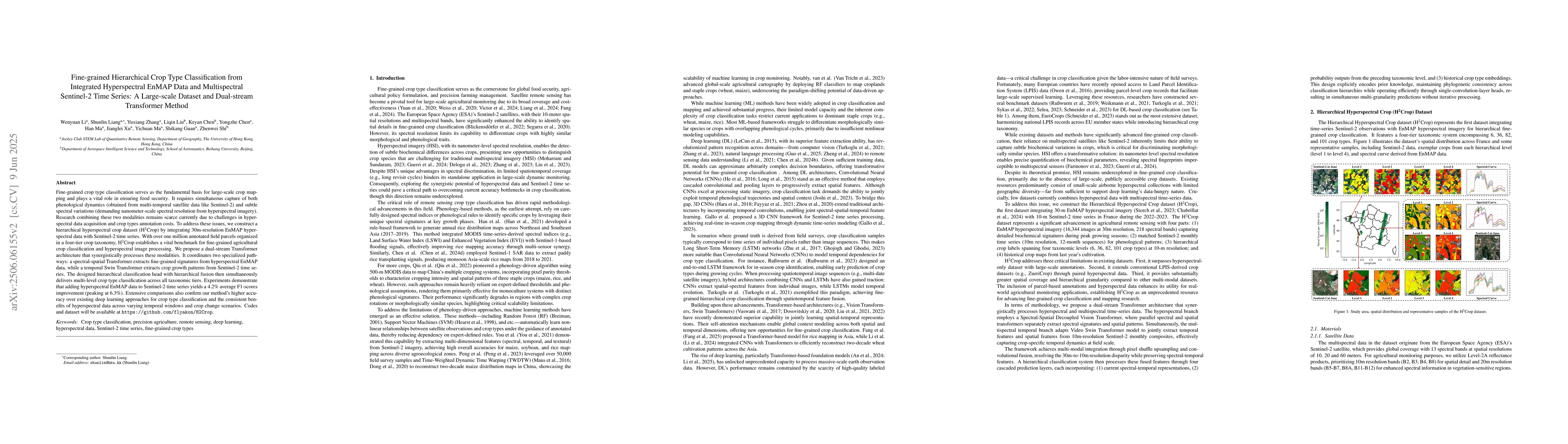
Fine-grained crop classification is crucial for precision agriculture and food security monitoring. It requires simultaneous capture of both phenological dynamics (obtained from multi-temporal satelli...
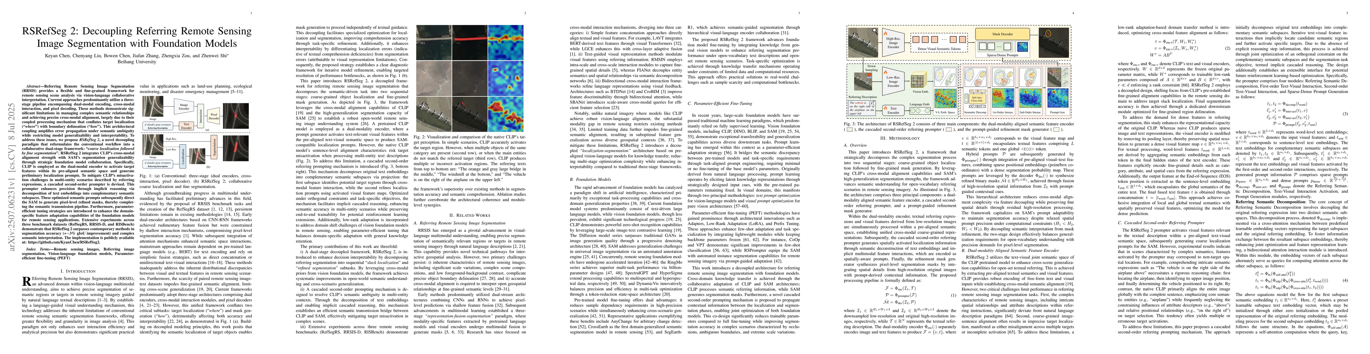
Referring Remote Sensing Image Segmentation provides a flexible and fine-grained framework for remote sensing scene analysis via vision-language collaborative interpretation. Current approaches predom...
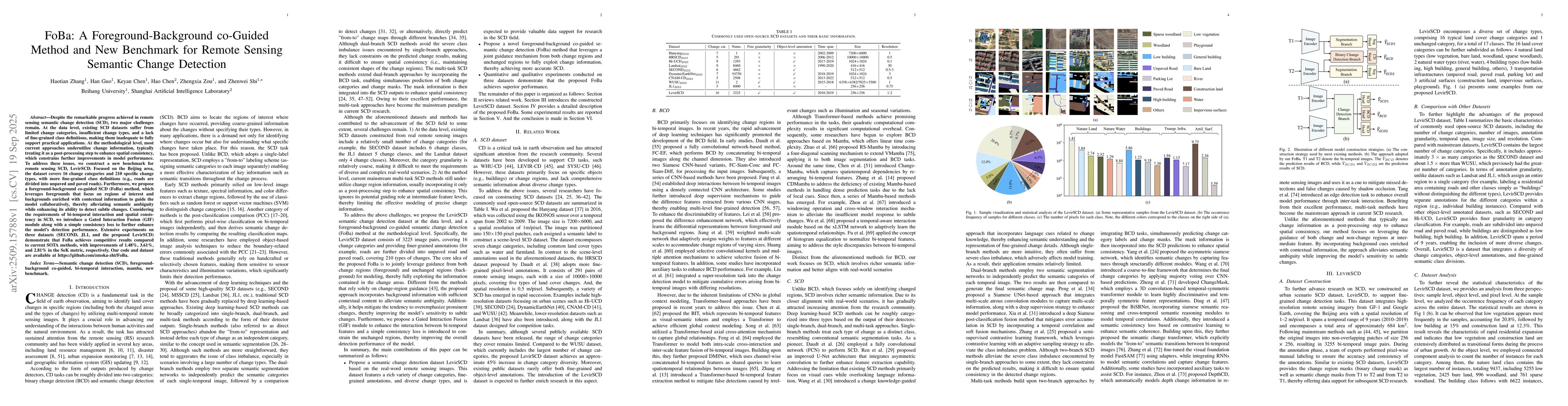
Despite the remarkable progress achieved in remote sensing semantic change detection (SCD), two major challenges remain. At the data level, existing SCD datasets suffer from limited change categories,...
Learning mappings between functional spaces, also known as function-on-function regression, plays a crucial role in functional data analysis and has broad applications, e.g. spatiotemporal forecasting...
Change detection in optical remote sensing imagery is susceptible to illumination fluctuations, seasonal changes, and variations in surface land-cover materials. Relying solely on RGB imagery often pr...
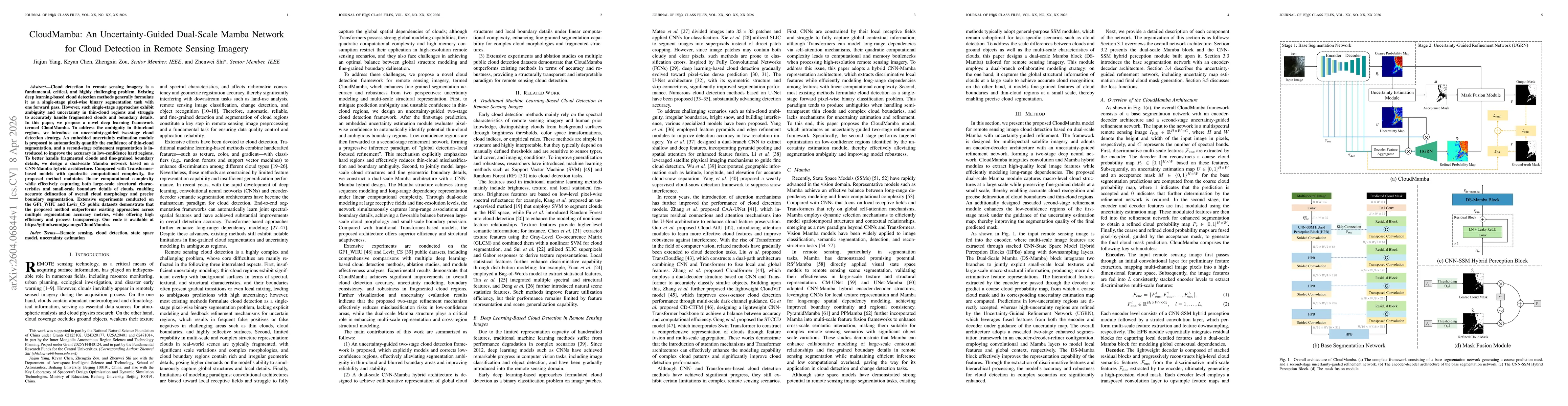
Cloud detection in remote sensing imagery is a fundamental, critical, and highly challenging problem. Existing deep learning-based cloud detection methods generally formulate it as a single-stage pixe...
Events in spatiotemporal systems are ubiquitous, yet modeling their complex distributions remains challenging. Existing point process models often rely on strong structural assumptions and are typical...
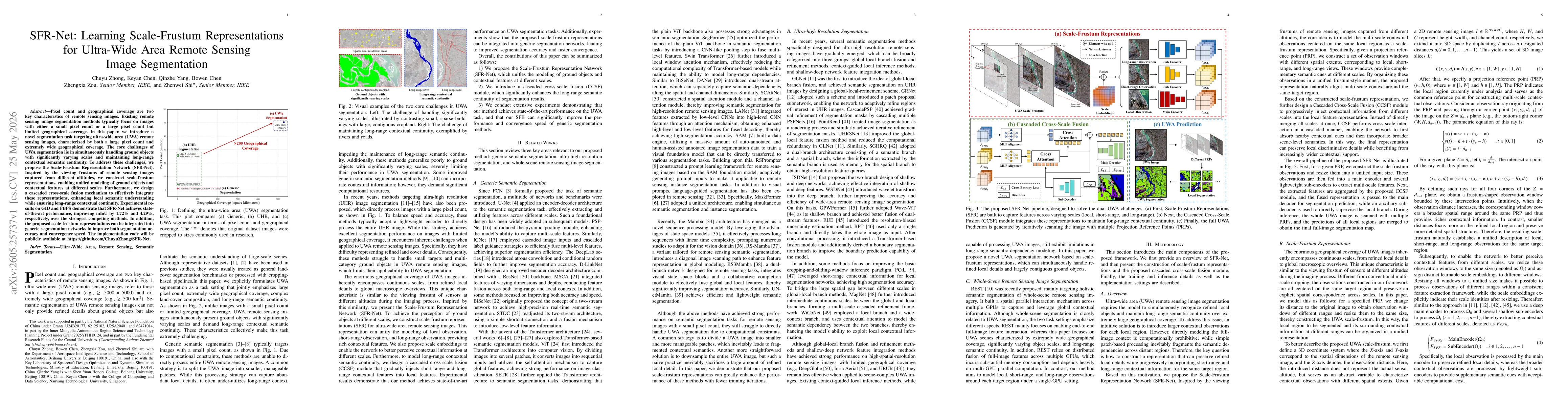
Pixel count and geographical coverage are two key characteristics of remote sensing images. Existing remote sensing image segmentation methods typically focus on images with either a small pixel count...
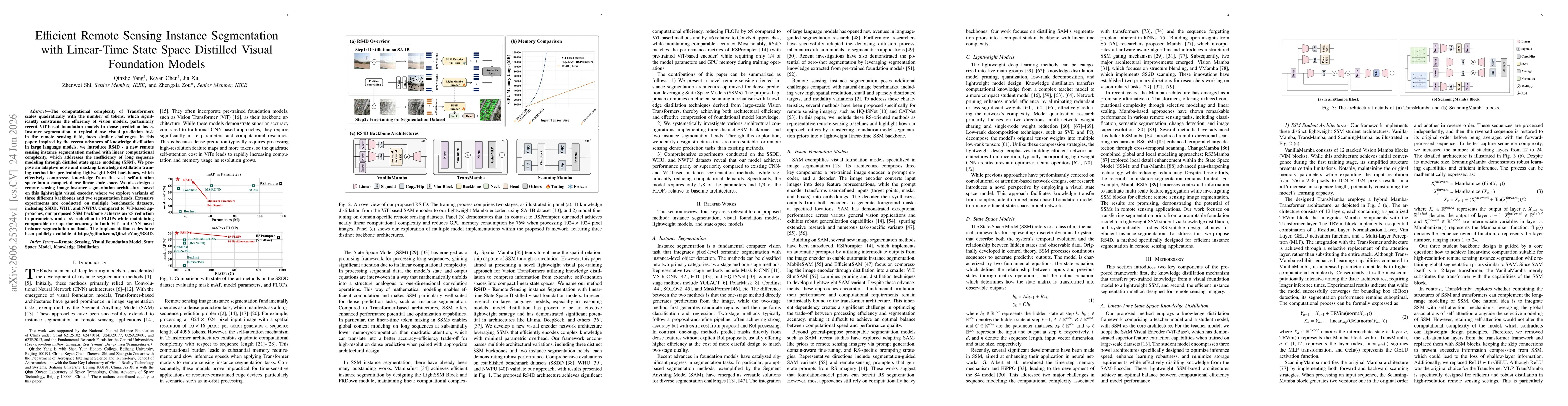
The computational complexity of Transformers scales quadratically with the number of tokens, which significantly constrains the efficiency of vision models, particularly recent ViT-based foundation mo...