Authors
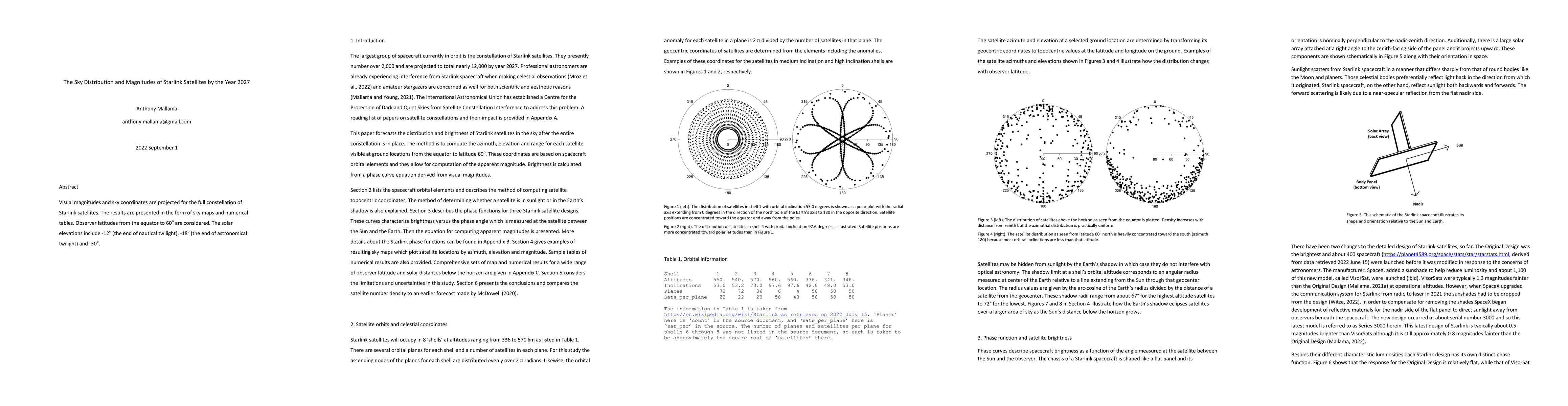
Summary
Visual magnitudes and sky coordinates are projected for the full constellation of Starlink satellites. The results are presented in the form of sky maps and numerical tables. Observer latitudes from the equator to 60 degrees are considered. The solar elevations include -12 deg (the end of nautical twilight), -18 deg (the end of astronomical twilight) and -30 deg.
AI Key Findings
Get AI-generated insights about this paper's methodology, results, and significance.
Paper Details
PDF Preview
Key Terms
Citation Network
Current paper (gray), citations (green), references (blue)
Display is limited for performance on very large graphs.
Similar Papers
Found 4 papersStarlink Mini Satellite Brightness Distributions Across the Sky
Anthony Mallama, Richard E. Cole, Scott Harrington et al.
Plaskett 1.8 metre Observations of Starlink Satellites
Aaron C. Boley, Paul Hickson, Ewan Wright et al.
The Brightness of Starlink Mini Satellites During Orbit-Raising
Anthony Mallama, Richard E. Cole, Scott Harrington et al.
| Title | Authors | Year | Actions |
|---|
Comments (0)