Publication
Metrics
Paper Preview
Abstract
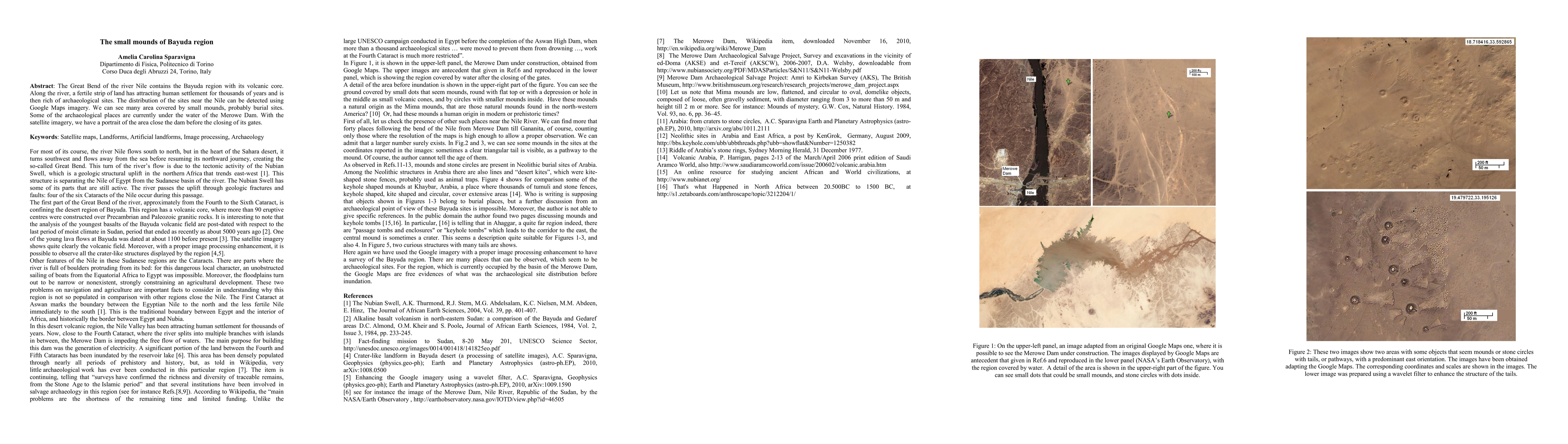
The Great Bend of the river Nile contains the Bayuda region with its volcanic core. Along the river, a fertile strip of land has attracting human settlement for thousands of years and is then rich of archaeological sites. The distribution of the sites near the Nile can be detected using Google Maps imagery. We can see many area covered by small mounds, probably burial sites. Some of the archaeological places are currently under the water of the Merowe Dam. With the satellite imagery, we have a portrait of the area close the dam before the closing of its gates.
AI Key Findings
Get AI-generated insights about this paper's methodology, results, significance, and more — seven facets brought into focus.
Impact
Paper Details
PDF Preview
Key Terms
Citation Network
Current paper (gray), citations (green), references (blue)
Display is limited for performance on very large graphs.
Discussion 0