This paper explores the use of deep learning to identify regular vegetation patterns and termite mounds from satellite imagery, aiming to estimate their global extent and assess their role in climate change resilience. While initial results are promising, the authors stress the need for further research to automate the mapping of these earth mounds effectively.
Regular patterns of vegetation are considered widespread landscapes, although their global extent has never been estimated. Among them, spotted landscapes are of particular interest in the context of climate change. Indeed, regularly spaced vegetation spots in semi-arid shrublands result from extreme resource depletion and prefigure catastrophic shift of the ecosystem to a homogeneous desert, while termite mounds also producing spotted landscapes were shown to increase robustness to climate change. Yet, their identification at large scale calls for automatic methods, for instance using the popular deep learning framework, able to cope with a vast amount of remote sensing data, e.g., optical satellite imagery. In this paper, we tackle this problem and benchmark some state-of-the-art deep networks on several landscapes and geographical areas. Despite the promising results we obtained, we found that more research is needed to be able to map automatically these earth mounds from space.
Generated Sep 03, 2025
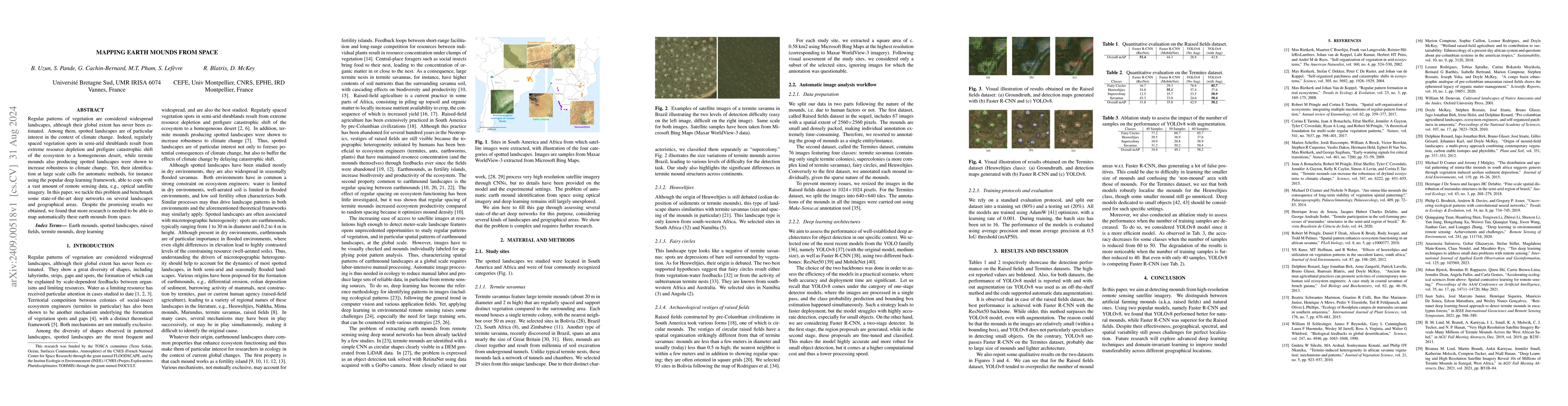
The study assesses the performance of well-established deep learning architectures (Faster R-CNN and YOLOv8) for detecting earth mounds from high-resolution remote sensing satellite imagery, distinguishing between artificial (raised fields) and natural mounds. The datasets are split into training (80%) and testing (20%) sets, and models are trained using AdamW optimizer with a learning rate of 0.001 and batch size of 16. Performance is evaluated using average precision and mean average precision at 0.5 IoU threshold (mAP50).
This research is important for understanding and monitoring earth mound patterns, which play a crucial role in ecosystem functioning and resilience to climate change. Accurate detection and mapping of these mounds can help in assessing their impact on biodiversity and productivity.
The paper benchmarks state-of-the-art deep networks (Faster R-CNN and YOLOv8) for automatic identification of earth mounds from satellite imagery, providing insights into their performance across different landscape types and geographical areas.
This work contributes to the growing body of research on using deep learning for ecological pattern recognition from remote sensing data, specifically focusing on earth mounds and addressing the challenges of small object detection in such imagery.
Current paper (gray), citations (green), references (blue)
Display is limited for performance on very large graphs.
No citations found for this paper.
Comments (0)