Academic Profile
Statistics
Similar Authors
Papers on arXiv
Hyperspectral imaging provides precise classification for land use and cover due to its exceptional spectral resolution. However, the challenges of high dimensionality and limited spatial resolution...
The study explores the synergistic combination of Synthetic Aperture Radar (SAR) and Visible-Near Infrared-Short Wave Infrared (VNIR-SWIR) imageries for land use/land cover (LULC) classification. Im...
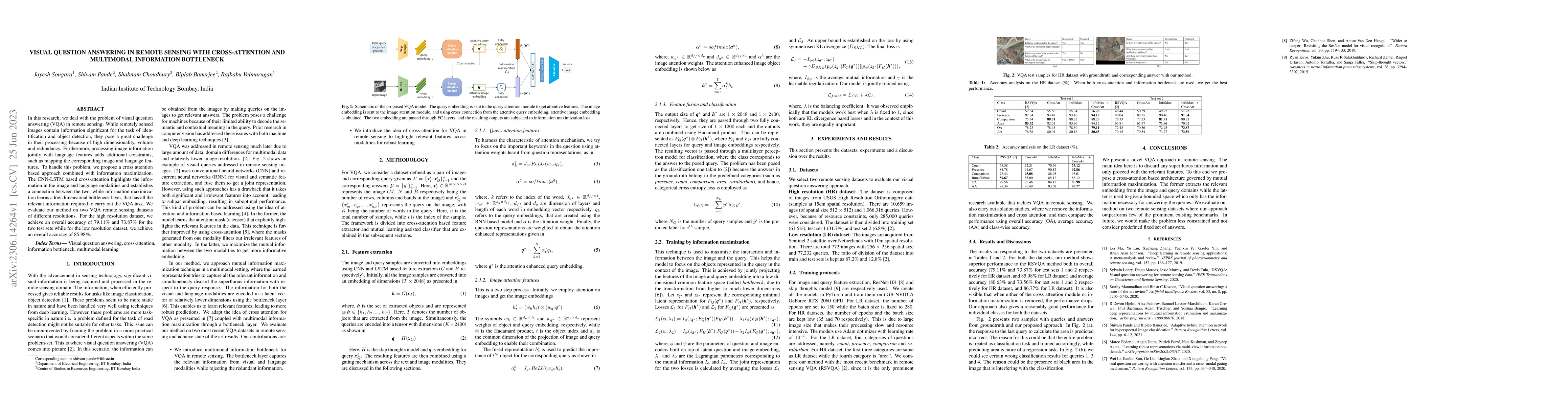
In this research, we deal with the problem of visual question answering (VQA) in remote sensing. While remotely sensed images contain information significant for the task of identification and objec...
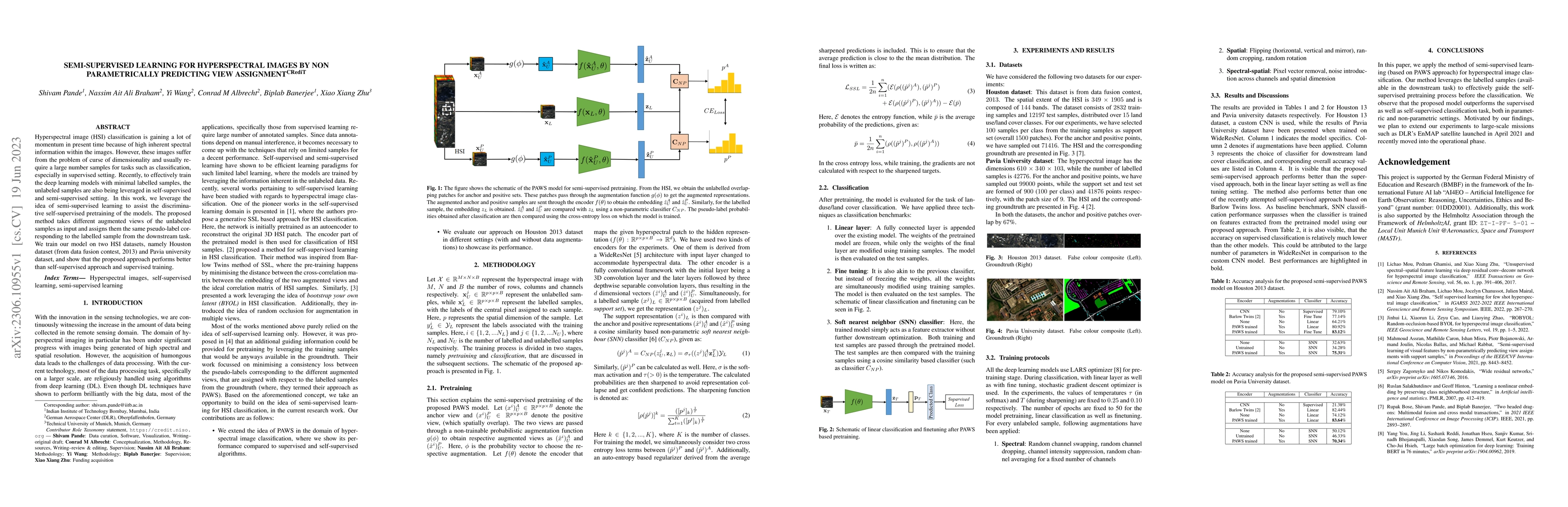
Hyperspectral image (HSI) classification is gaining a lot of momentum in present time because of high inherent spectral information within the images. However, these images suffer from the problem o...
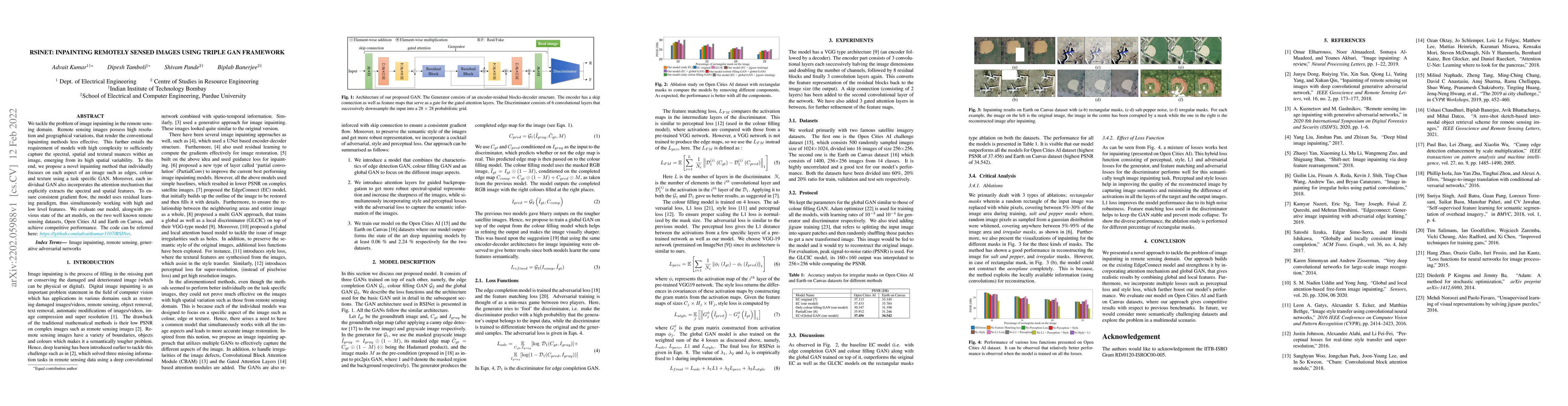
We tackle the problem of image inpainting in the remote sensing domain. Remote sensing images possess high resolution and geographical variations, that render the conventional inpainting methods les...
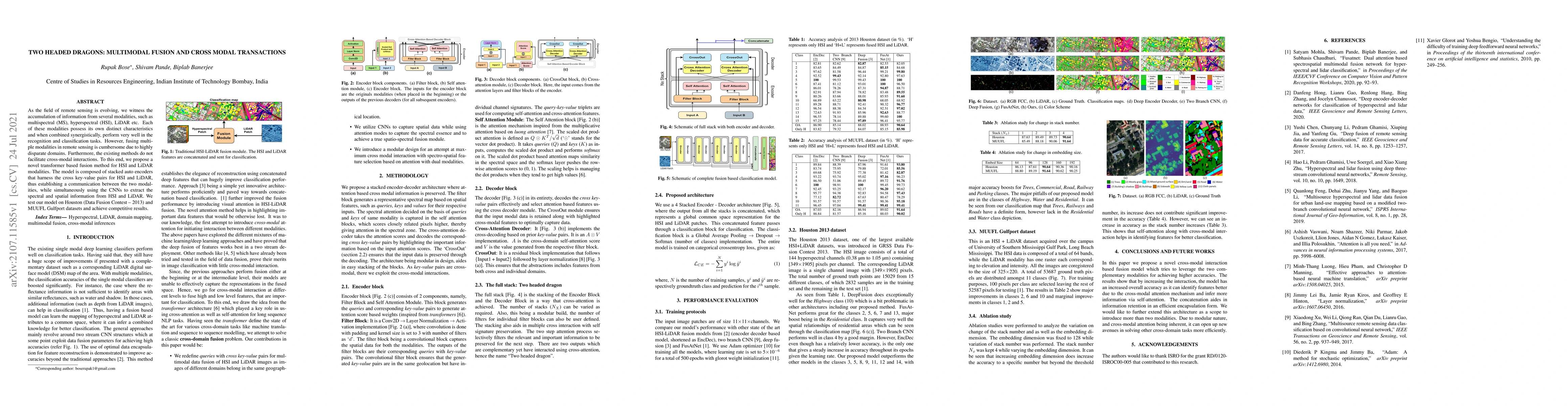
As the field of remote sensing is evolving, we witness the accumulation of information from several modalities, such as multispectral (MS), hyperspectral (HSI), LiDAR etc. Each of these modalities p...
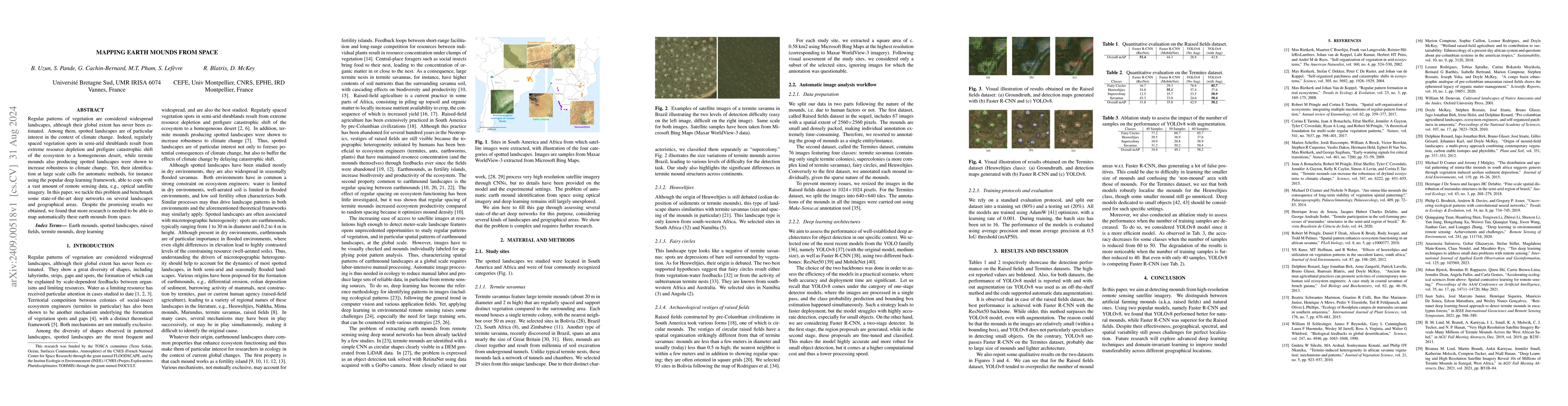
Regular patterns of vegetation are considered widespread landscapes, although their global extent has never been estimated. Among them, spotted landscapes are of particular interest in the context of ...
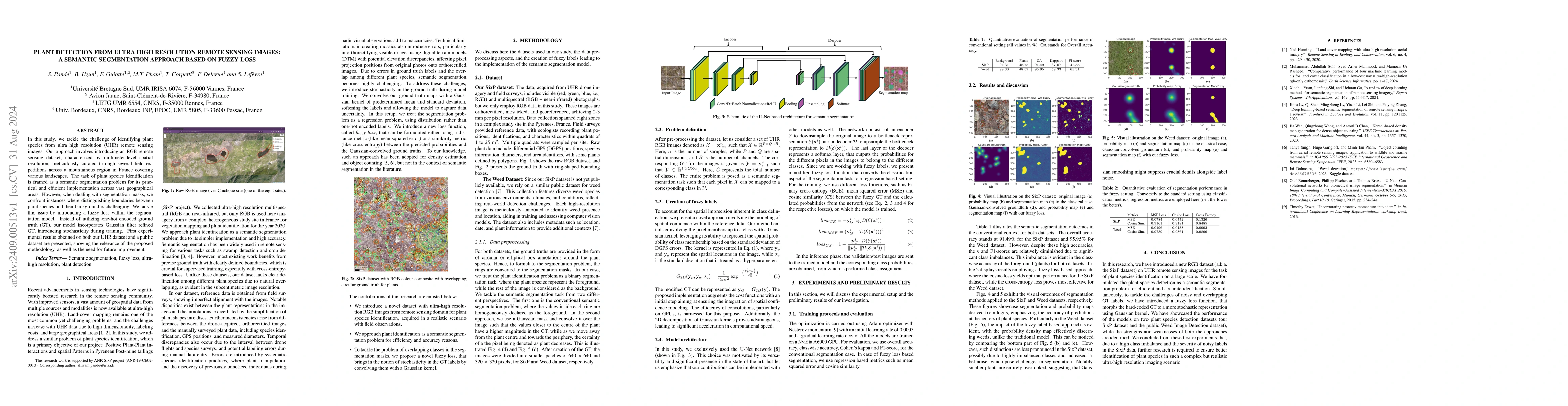
In this study, we tackle the challenge of identifying plant species from ultra high resolution (UHR) remote sensing images. Our approach involves introducing an RGB remote sensing dataset, characteriz...
Spectroscopic imaging (SI) has become central to heritage science because it enables non-invasive, spatially resolved characterisation of materials in artefacts. In particular, attenuated total reflec...