Academic Profile
Statistics
Similar Authors
Papers on arXiv
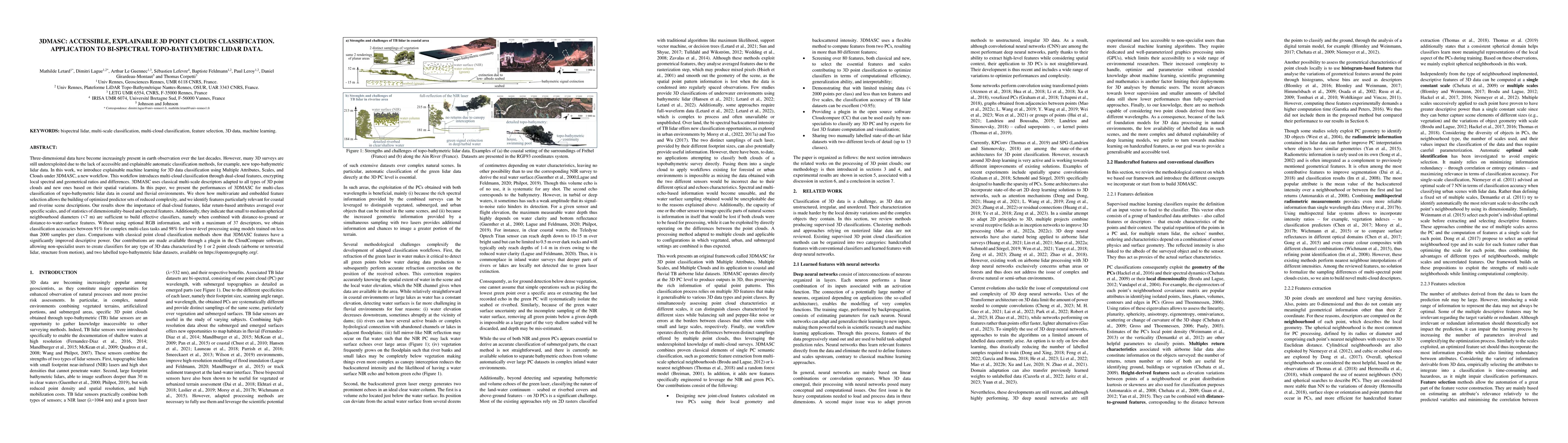
Three-dimensional data have become increasingly present in earth observation over the last decades. However, many 3D surveys are still underexploited due to the lack of accessible and explainable au...
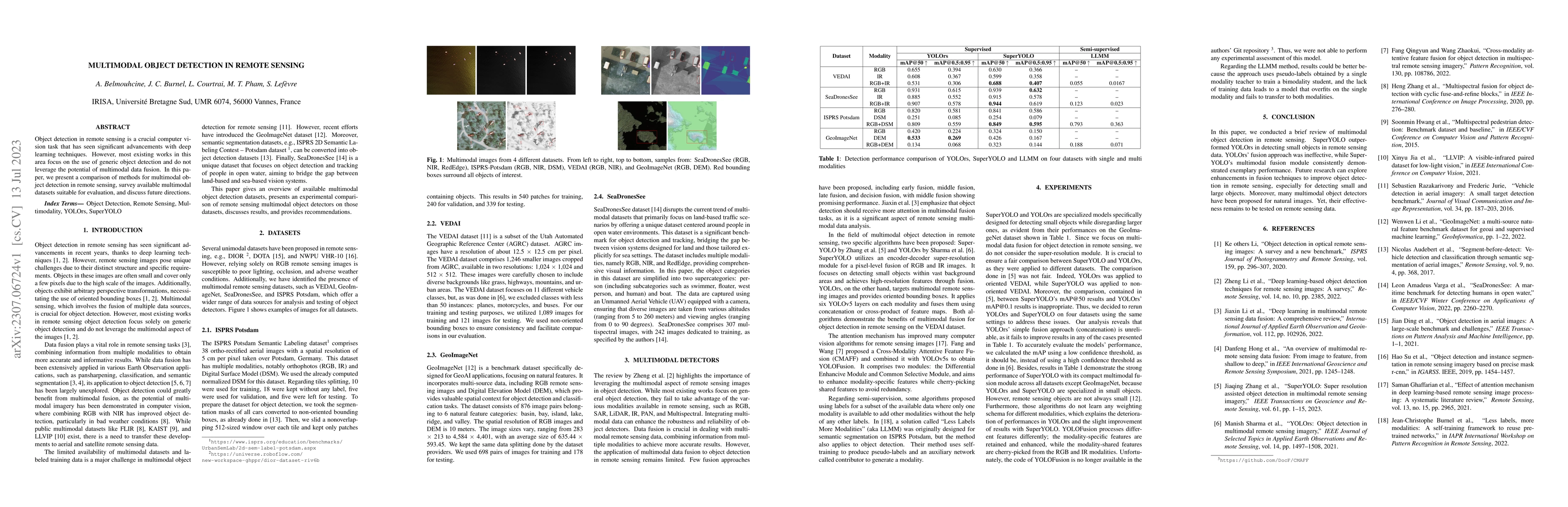
Object detection in remote sensing is a crucial computer vision task that has seen significant advancements with deep learning techniques. However, most existing works in this area focus on the use ...
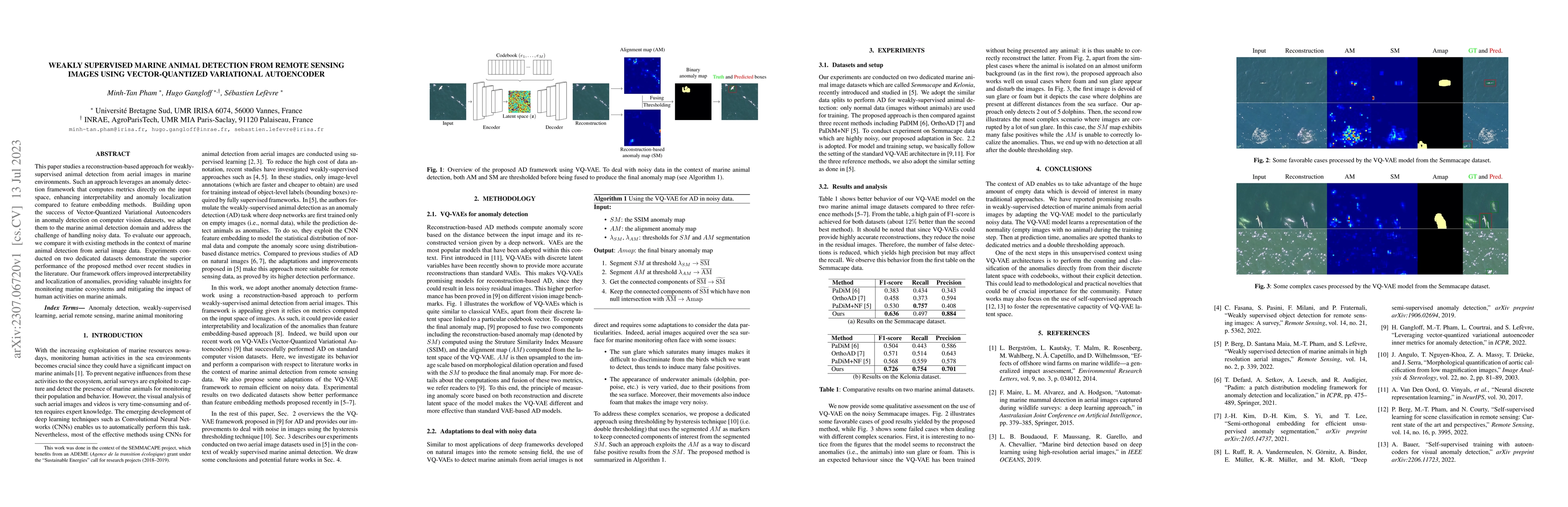
This paper studies a reconstruction-based approach for weakly-supervised animal detection from aerial images in marine environments. Such an approach leverages an anomaly detection framework that co...
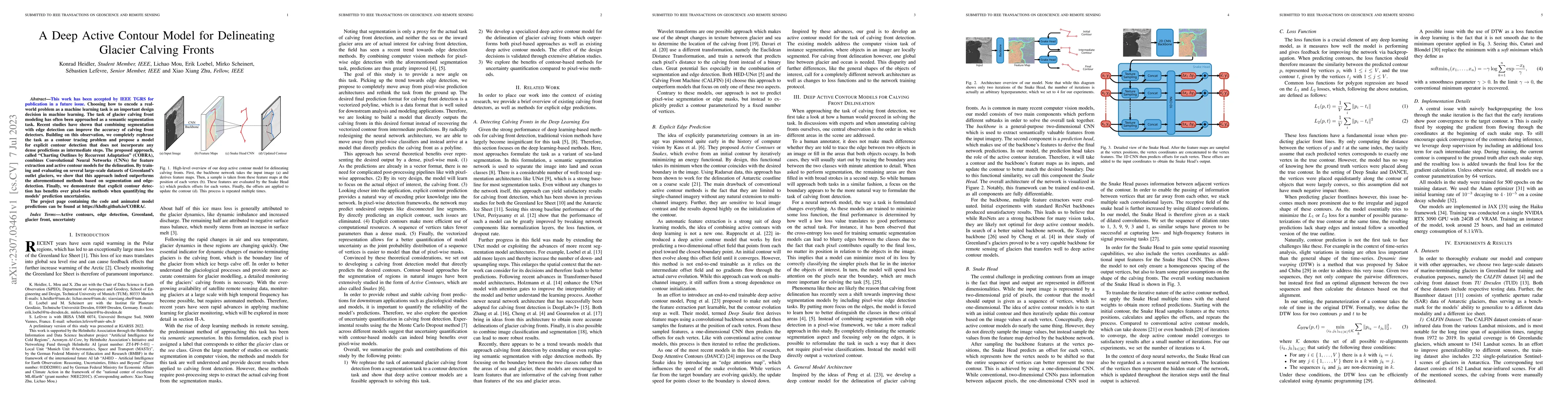
Choosing how to encode a real-world problem as a machine learning task is an important design decision in machine learning. The task of glacier calving front modeling has often been approached as a ...
In a constant evolving world, change detection is of prime importance to keep updated maps. To better sense areas with complex geometry (urban areas in particular), considering 3D data appears to be...
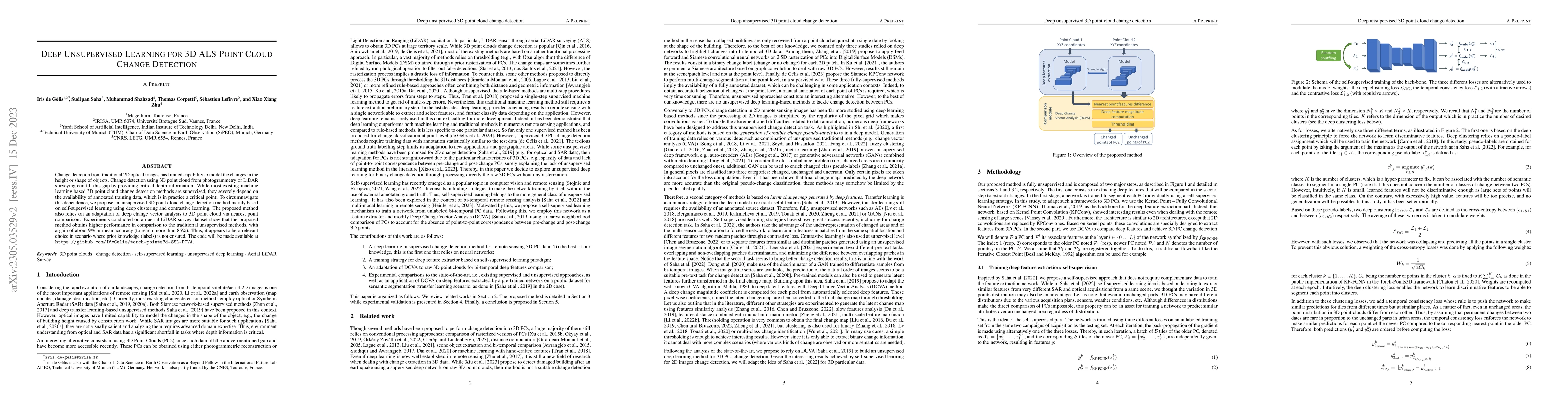
Change detection from traditional \added{2D} optical images has limited capability to model the changes in the height or shape of objects. Change detection using 3D point cloud \added{from photogram...
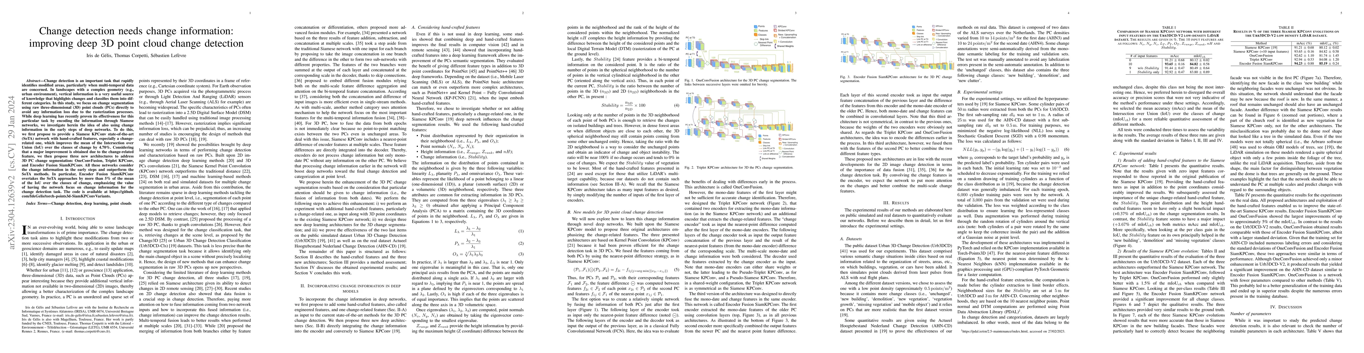
Change detection is an important task that rapidly identifies modified areas, particularly when multi-temporal data are concerned. In landscapes with a complex geometry (e.g., urban environment), ve...
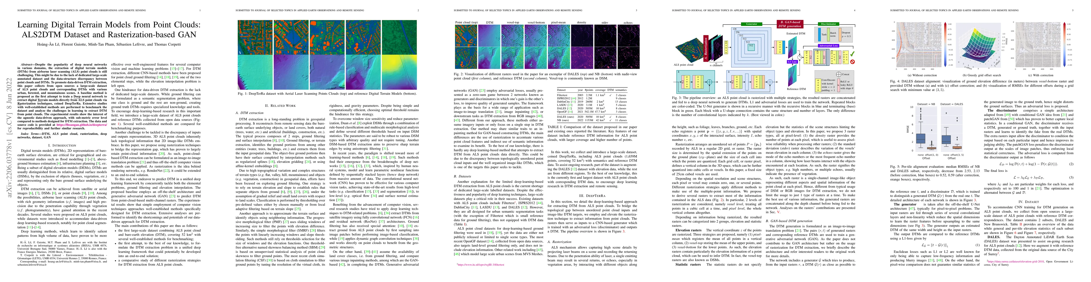
Despite the popularity of deep neural networks in various domains, the extraction of digital terrain models (DTMs) from airborne laser scanning (ALS) point clouds is still challenging. This might be...
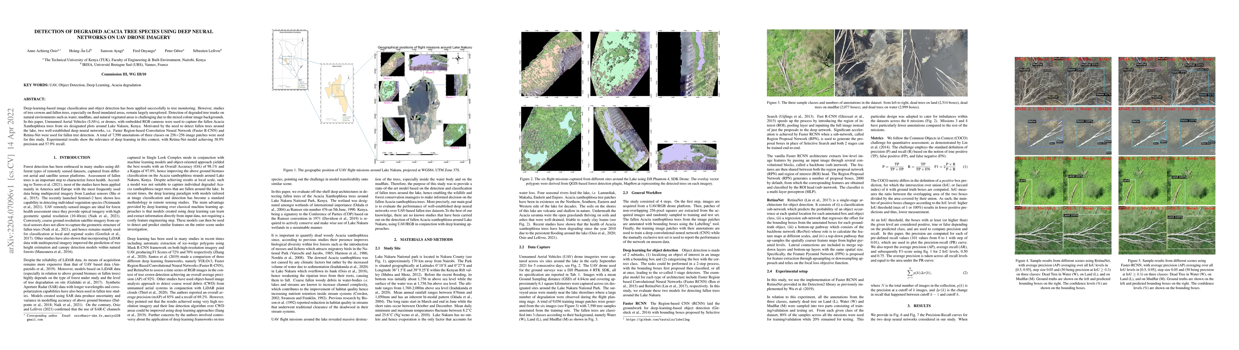
Deep-learning-based image classification and object detection has been applied successfully to tree monitoring. However, studies of tree crowns and fallen trees, especially on flood inundated areas,...
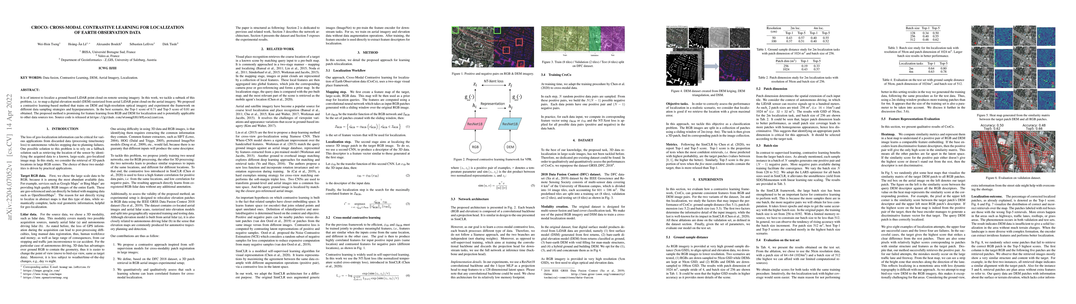
It is of interest to localize a ground-based LiDAR point cloud on remote sensing imagery. In this work, we tackle a subtask of this problem, i.e. to map a digital elevation model (DEM) rasterized fr...
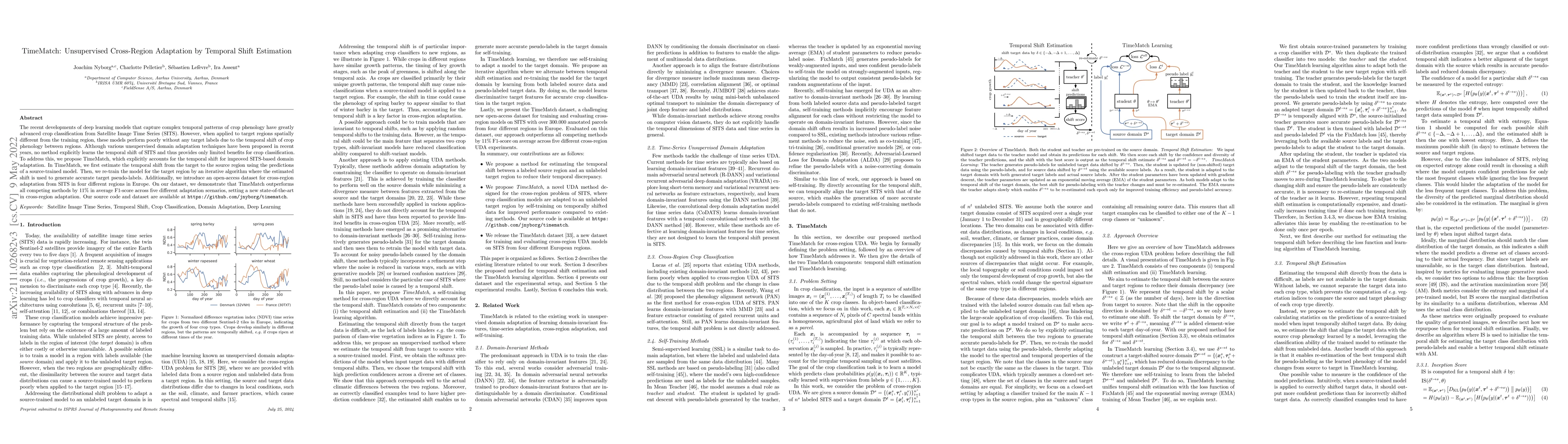
The recent developments of deep learning models that capture complex temporal patterns of crop phenology have greatly advanced crop classification from Satellite Image Time Series (SITS). However, w...
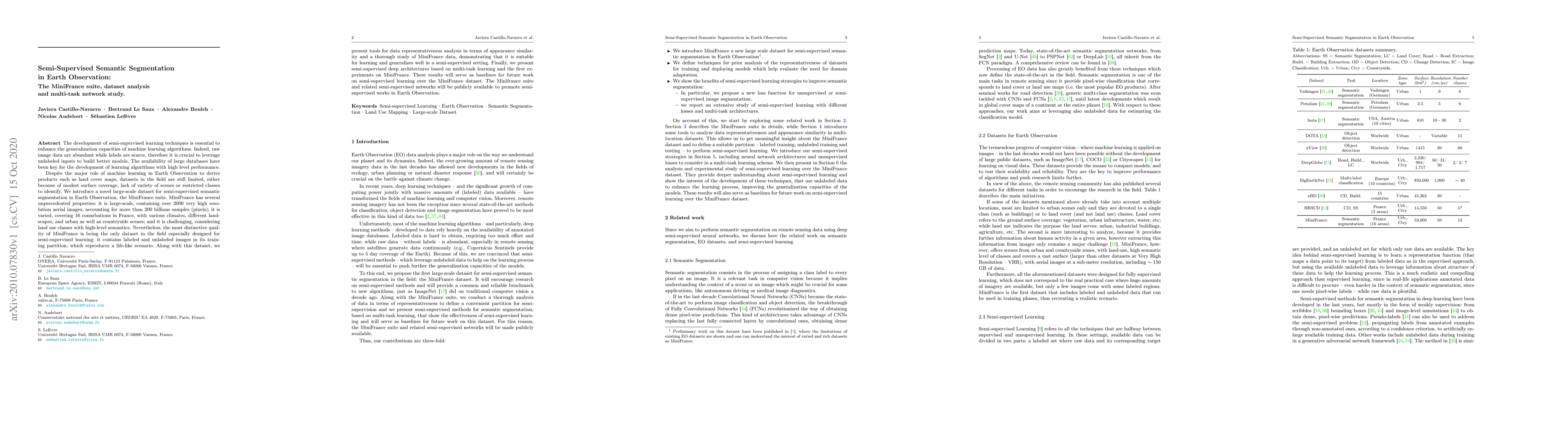
The development of semi-supervised learning techniques is essential to enhance the generalization capacities of machine learning algorithms. Indeed, raw image data are abundant while labels are scar...
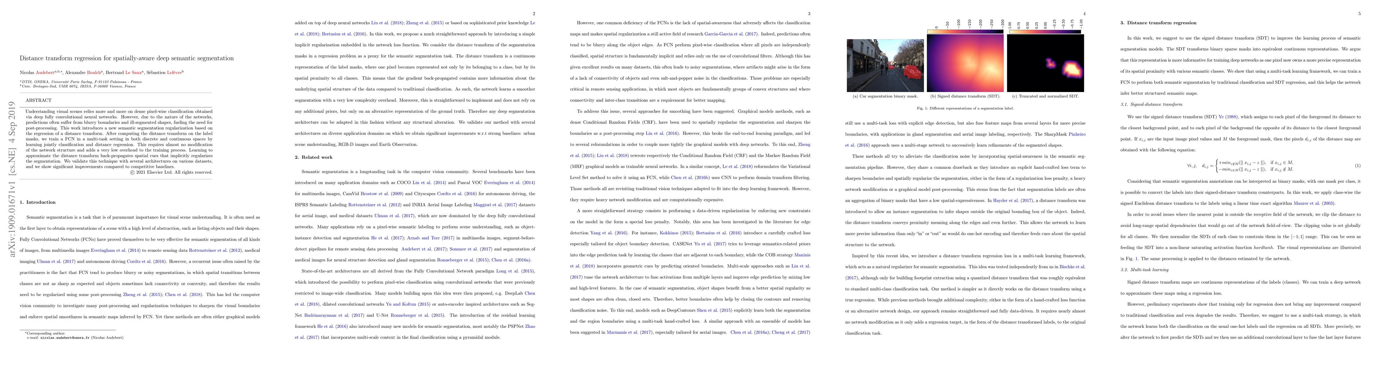
Understanding visual scenes relies more and more on dense pixel-wise classification obtained via deep fully convolutional neural networks. However, due to the nature of the networks, predictions oft...
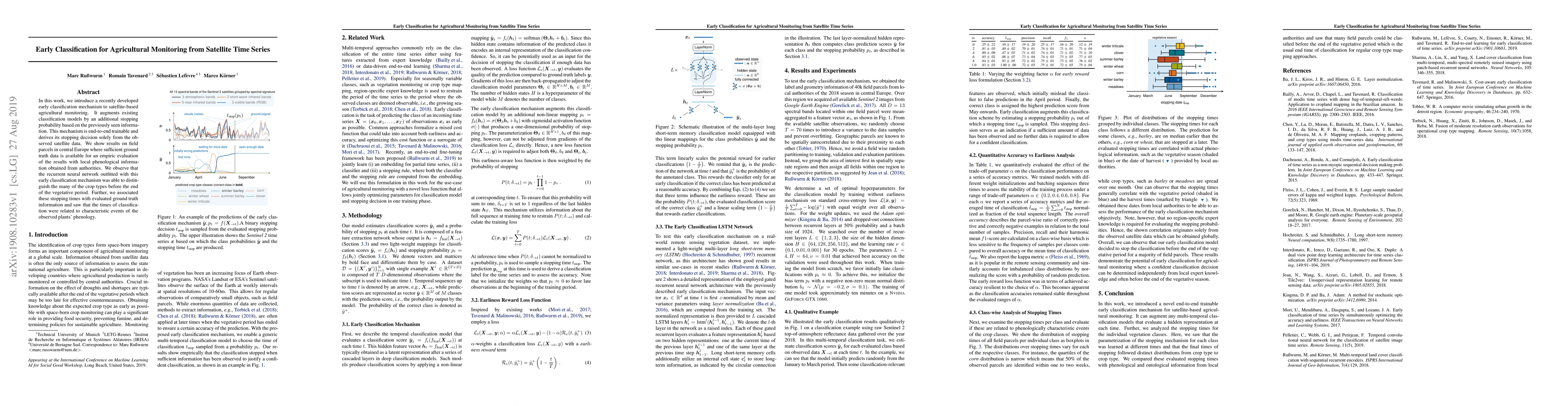
In this work, we introduce a recently developed early classification mechanism to satellite-based agricultural monitoring. It augments existing classification models by an additional stopping probab...
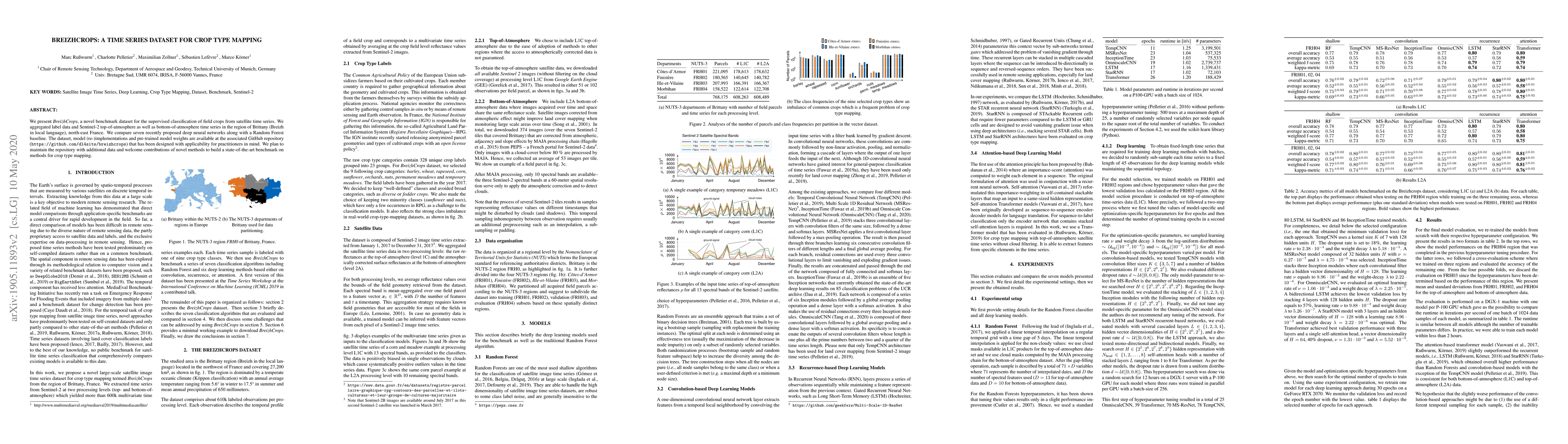
We present Breizhcrops, a novel benchmark dataset for the supervised classification of field crops from satellite time series. We aggregated label data and Sentinel-2 top-of-atmosphere as well as bo...
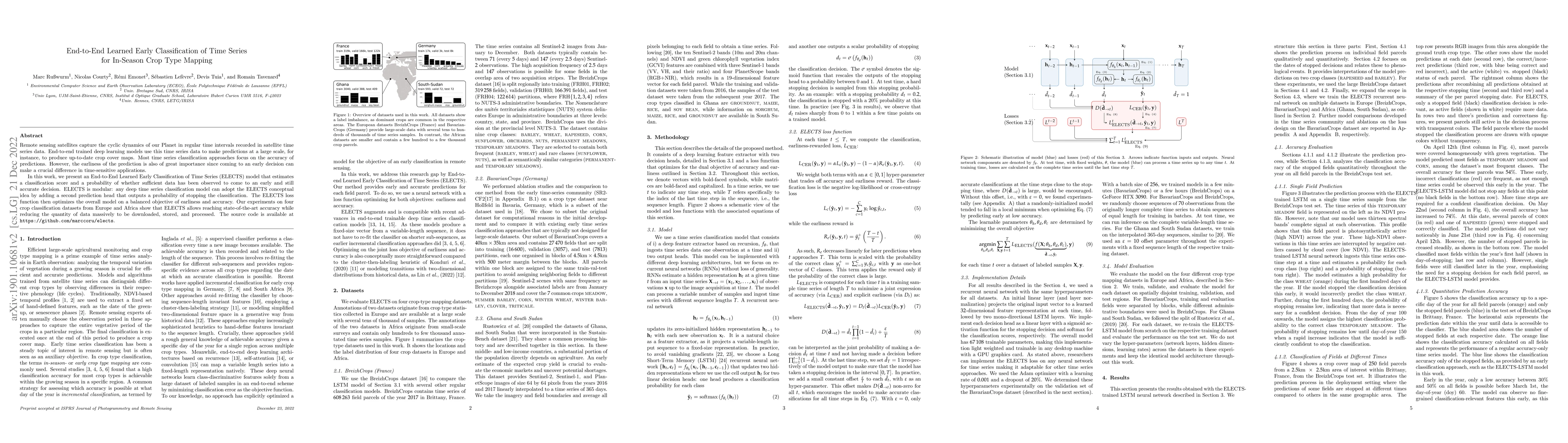
Remote sensing satellites capture the cyclic dynamics of our Planet in regular time intervals recorded in satellite time series data. End-to-end trained deep learning models use this time series dat...
Regular patterns of vegetation are considered widespread landscapes, although their global extent has never been estimated. Among them, spotted landscapes are of particular interest in the context of ...
In this study, we tackle the challenge of identifying plant species from ultra high resolution (UHR) remote sensing images. Our approach involves introducing an RGB remote sensing dataset, characteriz...

Foundation models constitute a significant advancement in computer vision: after a single, albeit costly, training phase, they can address a wide array of tasks. In the field of Earth observation, ove...
The Earth's surface is subject to complex and dynamic processes, ranging from large-scale phenomena such as tectonic plate movements to localized changes associated with ecosystems, agriculture, or hu...
Few-shot multispectral object detection (FSMOD) addresses the challenge of detecting objects across visible and thermal modalities with minimal annotated data. In this paper, we explore this complex t...
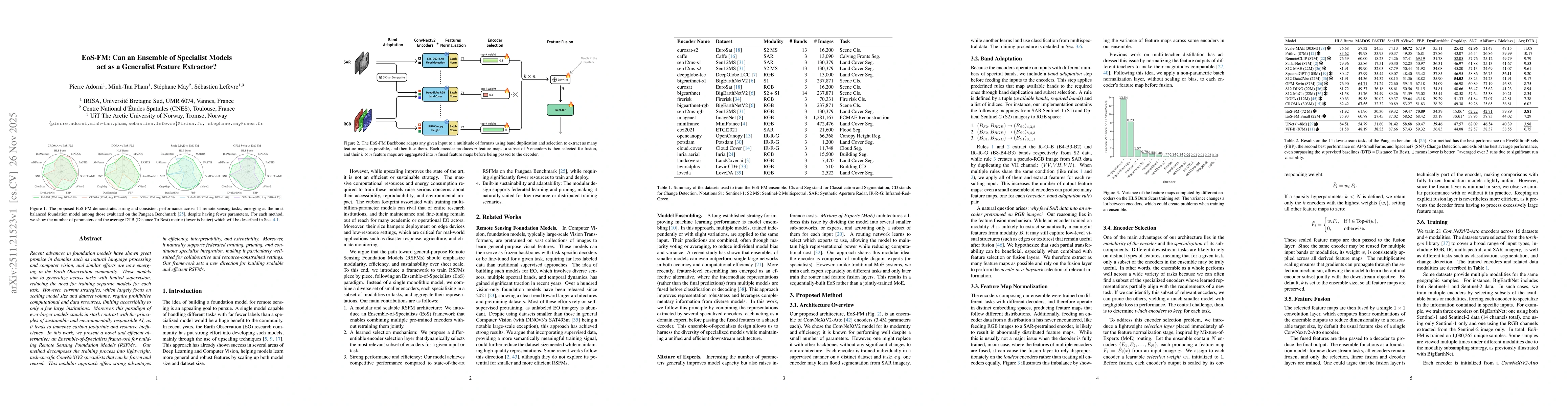
Recent advances in foundation models have shown great promise in domains such as natural language processing and computer vision, and similar efforts are now emerging in the Earth Observation communit...
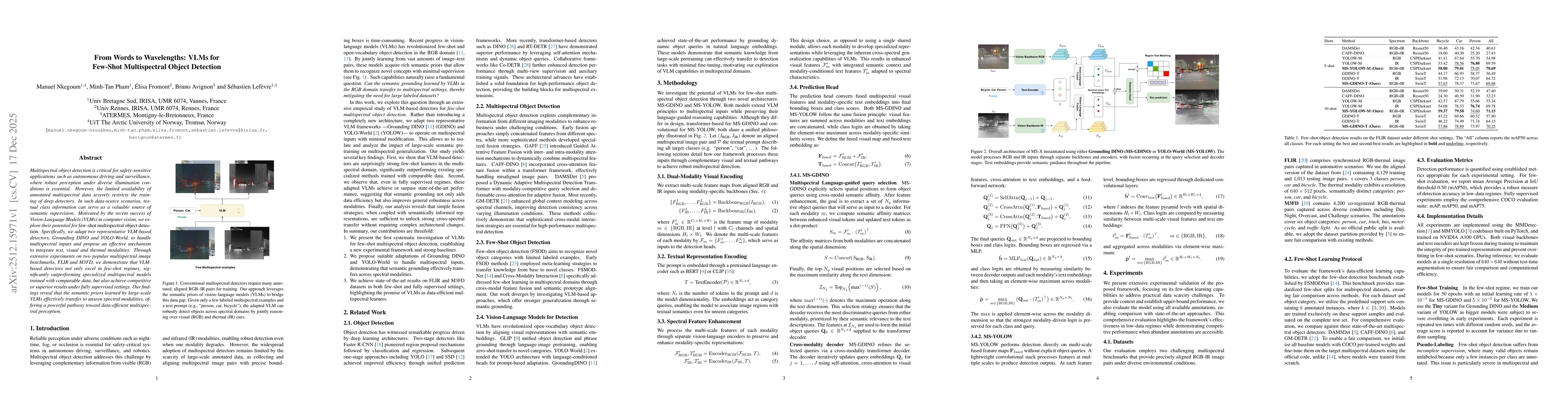
Multispectral object detection is critical for safety-sensitive applications such as autonomous driving and surveillance, where robust perception under diverse illumination conditions is essential. Ho...
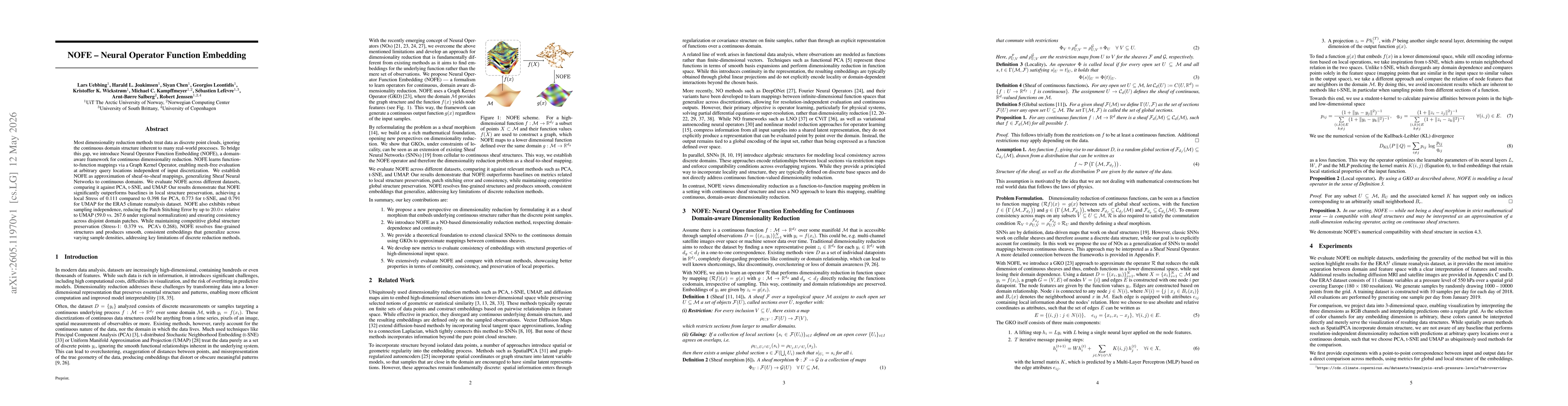
Most dimensionality reduction methods treat data as discrete point clouds, ignoring the continuous domain structure inherent to many real-world processes. To bridge this gap, we introduce Neural Opera...