Utilizing Remote Sensing to Analyze Land Usage and Rice Planting Patterns
Publication
Metrics
AI Quick Summary
This paper examines the interplay between human decisions and ecosystem processes in Bali's rice terrace management using remote sensing. It employs an evolutionary game theoretic model to analyze spatial patterns in rice planting, highlighting the influence of factors like pest damage and water shortage, and visualizes rice growth stages through colored patches.
Paper Preview
Abstract
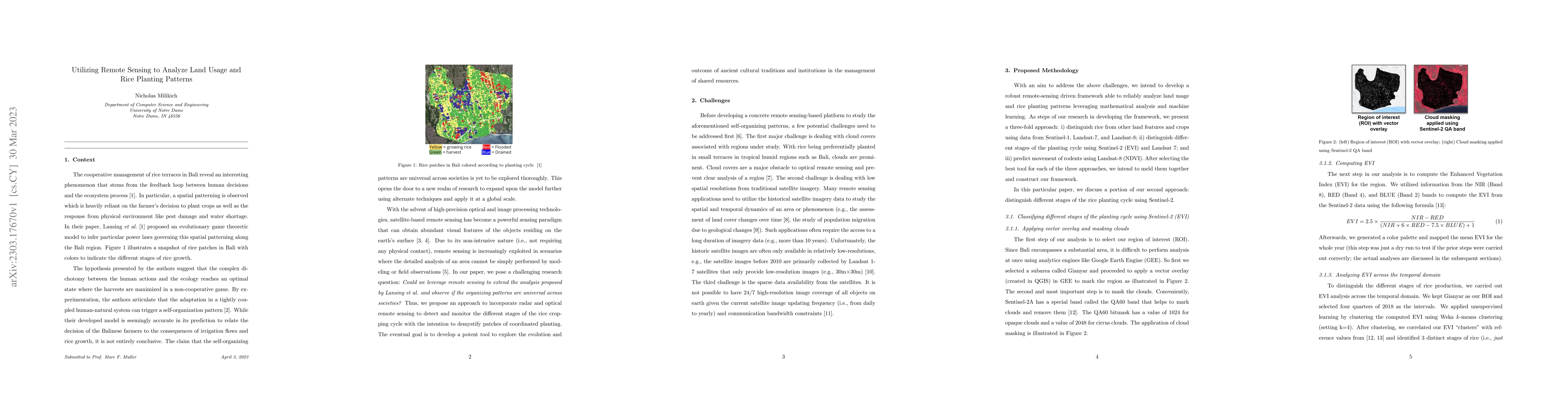
The cooperative management of rice terraces in Bali reveals an interesting phenomenon that stems from the feedback loop between human decisions and the ecosystem process. In particular, spatial patterning is observed, which is heavily reliant on the farmer's decision to plant crops as well as the response from the physical environment like pest damage and water shortage. A recent study proposed an evolutionary game theoretic model to infer particular power laws governing this spatial patterning along the Bali region. In this paper, we show a snapshot of rice patches in Bali with colors to indicate the different stages of rice growth
AI Key Findings
Get AI-generated insights about this paper's methodology, results, significance, and more — seven facets brought into focus.
Impact
Paper Details
Authors
PDF Preview
Key Terms
Citation Network
Current paper (gray), citations (green), references (blue)
Display is limited for performance on very large graphs.
Discussion 0