Benchmarking Geospatial Foundation Models for Agriculture Applications
Publication
Metrics
Paper Preview
Abstract
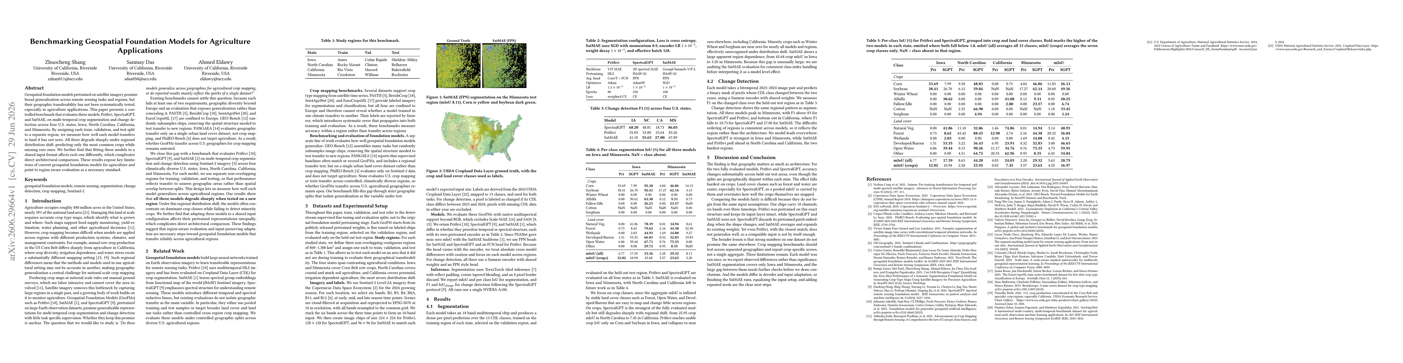
Geospatial foundation models pretrained on satellite imagery promise broad generalization across remote sensing tasks and regions, but their geographic transferability has not been systematically tested, especially in agriculture applications. This paper presents a controlled benchmark that evaluates three models, Prithvi, SpectralGPT, and SatMAE, on multi-temporal crop segmentation and change detection across four U.S. states, Iowa, North Carolina, California, and Minnesota. By assigning each train, validation, and test split to a separate region, we measure how well each model transfers to land it has not seen. All three degrade sharply under regional distribution shift, predicting only the most common crops while missing rare ones. We further find that fitting these models to a shared input format affects each one differently, which complicates direct architectural comparison. These results expose key limitations of current geospatial foundation models for agriculture and point to region aware evaluation as a necessary standard.
AI Key Findings
Get AI-generated insights about this paper's methodology, results, significance, and more — seven facets brought into focus.
Discussion 0