Publication
Metrics
Paper Preview
Abstract
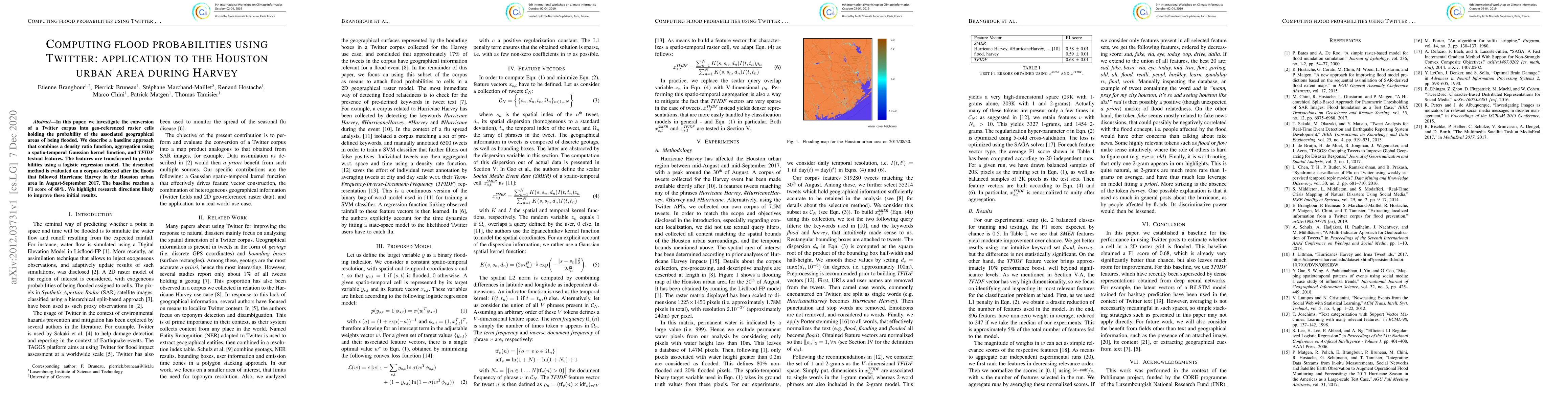
In this paper, we investigate the conversion of a Twitter corpus into geo-referenced raster cells holding the probability of the associated geographical areas of being flooded. We describe a baseline approach that combines a density ratio function, aggregation using a spatio-temporal Gaussian kernel function, and TFIDF textual features. The features are transformed to probabilities using a logistic regression model. The described method is evaluated on a corpus collected after the floods that followed Hurricane Harvey in the Houston urban area in August-September 2017. The baseline reaches a F1 score of 68%. We highlight research directions likely to improve these initial results.
AI Key Findings
Get AI-generated insights about this paper's methodology, results, significance, and more — seven facets brought into focus.
Impact
Paper Details
Authors
PDF Preview
Key Terms
Citation Network
Current paper (gray), citations (green), references (blue)
Display is limited for performance on very large graphs.
Discussion 0