DCT Maps: Compact Differentiable Lidar Maps Based on the Cosine Transform
Publication
Metrics
AI Quick Summary
This paper introduces DCT maps, a novel differentiable lidar mapping technique that uses the discrete cosine transform to represent maps in the frequency domain, avoiding tessellation and uniformity assumptions. DCT maps provide a continuously differentiable scalar field, accurately modeling varying laser permeabilities.
Paper Preview
Abstract
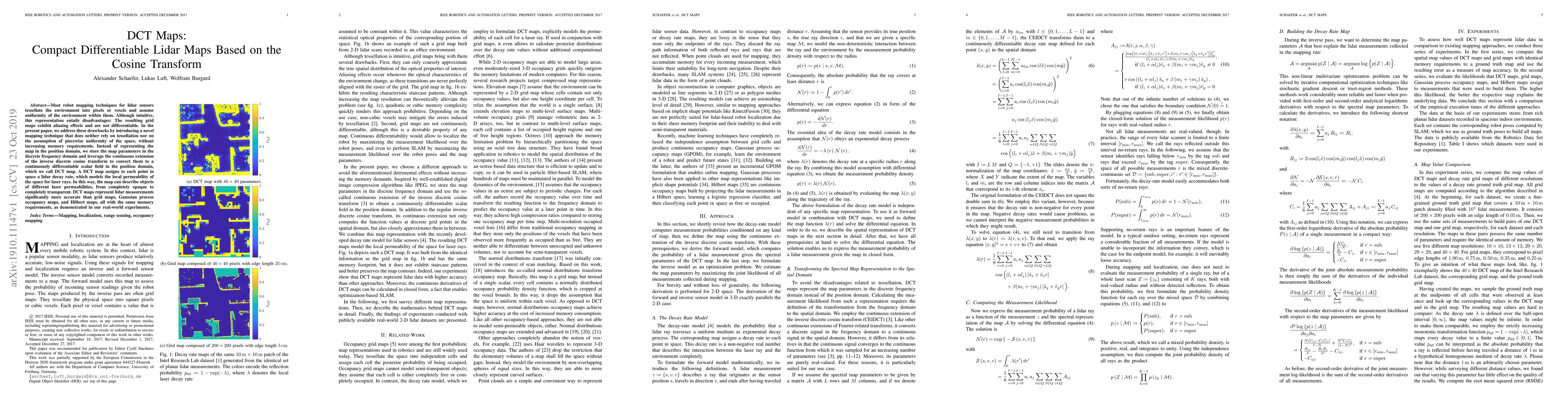
Most robot mapping techniques for lidar sensors tessellate the environment into pixels or voxels and assume uniformity of the environment within them. Although intuitive, this representation entails disadvantages: The resulting grid maps exhibit aliasing effects and are not differentiable. In the present paper, we address these drawbacks by introducing a novel mapping technique that does neither rely on tessellation nor on the assumption of piecewise uniformity of the space, without increasing memory requirements. Instead of representing the map in the position domain, we store the map parameters in the discrete frequency domain and leverage the continuous extension of the inverse discrete cosine transform to convert them to a continuously differentiable scalar field in the position domain, which we call DCT map. A DCT map assigns to each point in space a lidar decay rate, which models the local permeability of the space for laser rays. In this way, the map can describe objects of different laser permeabilities, from completely opaque to completely transparent. DCT maps represent lidar measurements significantly more accurate than grid maps, Gaussian process occupancy maps, and Hilbert maps, all with the same memory requirements, as demonstrated in our real-world experiments.
AI Key Findings
Get AI-generated insights about this paper's methodology, results, significance, and more — seven facets brought into focus.
Impact
Paper Details
Authors
PDF Preview
Key Terms
Citation Network
Current paper (gray), citations (green), references (blue)
Display is limited for performance on very large graphs.
Discussion 0