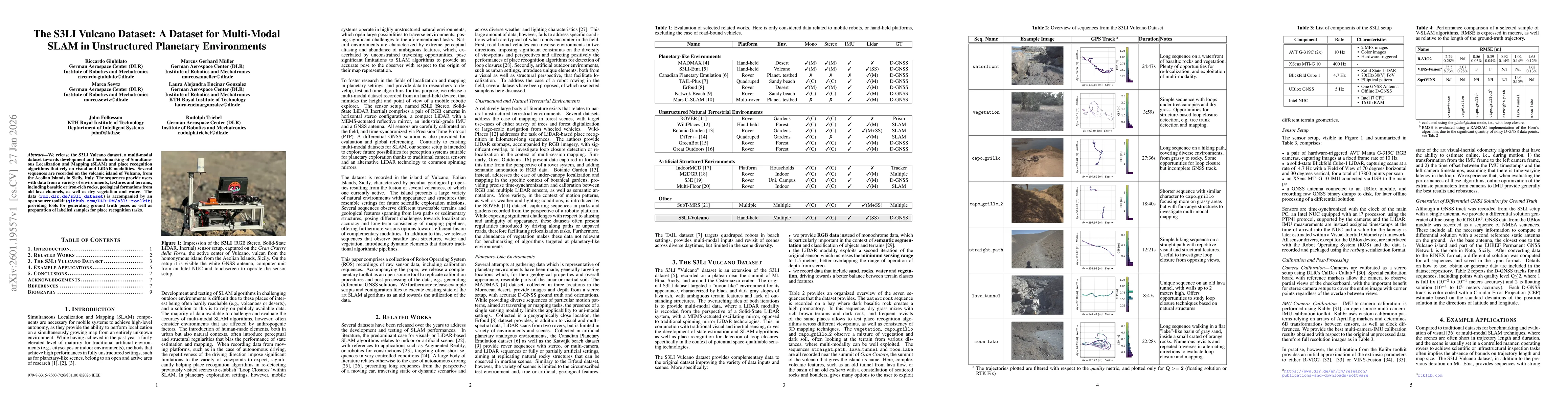
The authors developed the S3LI Vulcano dataset by recording multi-modal data (RGB, LiDAR, IMU, GNSS) from various environments on the volcanic island of Vulcano. They also created an open-source toolkit for generating ground truth poses and preparing labelled samples for place recognition tasks.
The S3LI Vulcano Dataset: A Dataset for Multi-Modal SLAM in Unstructured Planetary Environments
Publication
Metrics
Quick Answers
What methodology did the authors use?
The authors developed the S3LI Vulcano dataset by recording multi-modal data (RGB, LiDAR, IMU, GNSS) from various environments on the volcanic island of Vulcano. They also created an open-source toolkit for generating ground truth poses and preparing labelled samples for place recognition tasks. More in Methodology →
What are the key results?
The dataset includes seven sequences with diverse environments like basaltic rocks, vegetation, water, and lava tunnels. — The dataset provides RGB data, improved LiDAR sensing range, and multi-modal data for better terrain classification and place recognition. More in Key Results →
Why is this work significant?
This dataset addresses the need for realistic, unstructured planetary environments for SLAM and place recognition research, supporting development of robust algorithms for space exploration and autonomous navigation. More in Significance →
What are the main limitations?
Limited to volcanic environments, which may not cover all planetary scenarios. — The dataset's utility depends on the availability of GNSS data for ground truth, which may not be available in all real-world scenarios. More in Limitations →
Abstract
We release the S3LI Vulcano dataset, a multi-modal dataset towards development and benchmarking of Simultaneous Localization and Mapping (SLAM) and place recognition algorithms that rely on visual and LiDAR modalities. Several sequences are recorded on the volcanic island of Vulcano, from the Aeolian Islands in Sicily, Italy. The sequences provide users with data from a variety of environments, textures and terrains, including basaltic or iron-rich rocks, geological formations from old lava channels, as well as dry vegetation and water. The data (rmc.dlr.de/s3li_dataset) is accompanied by an open source toolkit (github.com/DLR-RM/s3li-toolkit) providing tools for generating ground truth poses as well as preparation of labelled samples for place recognition tasks.
Key Findings, in focus
Seven facets of this paper, analysed and brought into focus by AI.
This dataset addresses the need for realistic, unstructured planetary environments for SLAM and place recognition research, supporting development of robust algorithms for space exploration and autonomous navigation.
- The dataset includes seven sequences with diverse environments like basaltic rocks, vegetation, water, and lava tunnels.
- The dataset provides RGB data, improved LiDAR sensing range, and multi-modal data for better terrain classification and place recognition.
- The toolkit enables generation of ground truth poses and labelled samples for training place recognition models.
This dataset addresses the need for realistic, unstructured planetary environments for SLAM and place recognition research, supporting development of robust algorithms for space exploration and autonomous navigation.
The dataset and toolkit provide comprehensive multi-modal data and tools for benchmarking SLAM and place recognition algorithms in unstructured environments.
The dataset extends previous S3LI datasets with improved LiDAR sensing, RGB data, and diverse environments, while the toolkit offers functionalities for generating ground truth and labelled samples for place recognition.
- Limited to volcanic environments, which may not cover all planetary scenarios.
- The dataset's utility depends on the availability of GNSS data for ground truth, which may not be available in all real-world scenarios.
- Expanding the dataset to include more diverse planetary environments.
- Developing algorithms that can operate without reliance on GNSS for ground truth.
- Enhancing place recognition techniques for ambiguous and dynamic terrains.
Discussion 0