ArxivLens

Publication

Published: Oct 12, 2025
Categories: cs.RO, cs.MA, cs.SY

Metrics

Source: ArXiv

Quick Answers

What methodology did the authors use?

The research employs a two-layer Voronoi coverage control method for coordinating hybrid aerial-ground robot teams in emergency response scenarios. It combines bounded Voronoi diagrams with importance-weighted centroid calculations to optimize sensor placement. More in Methodology →

What are the key results?

Achieved 88% reduction in time to target sensor coverage (25 seconds vs. 220 seconds) — Eliminated agent trapping through temporal and spatial decoupling of layers More in Key Results →

Why is this work significant?

This approach enables rapid threat diagnosis and reduces human exposure to hazardous environments in emergency scenarios, with applications extending to disaster response, environmental monitoring, and search-and-rescue operations. More in Significance →

What are the main limitations?

Assumes known leak locations — Static importance function during deployment phase More in Limitations →

Paper Preview

Abstract

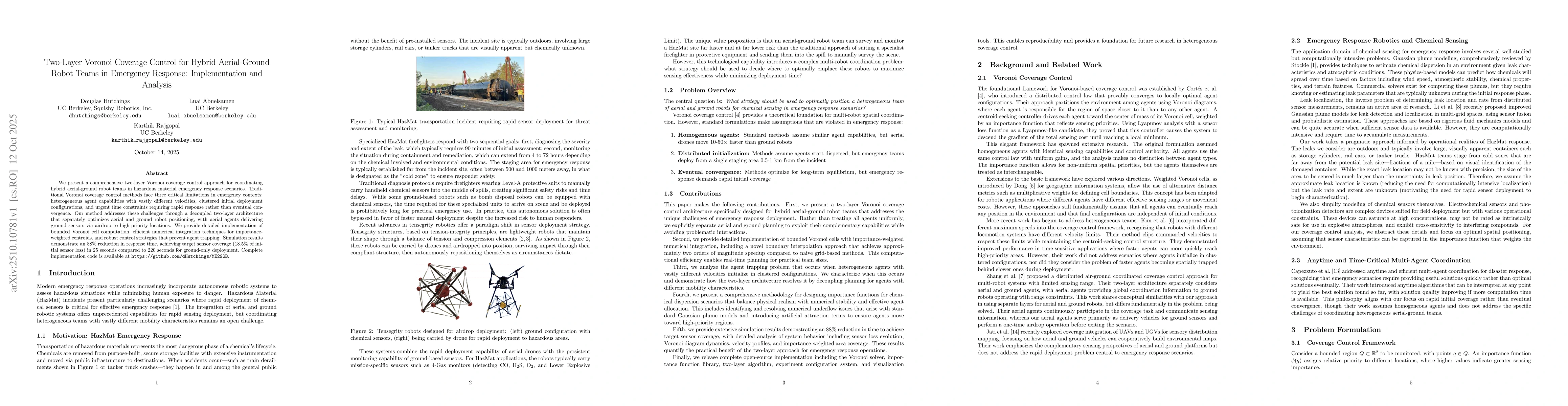
We present a comprehensive two-layer Voronoi coverage control approach for coordinating hybrid aerial-ground robot teams in hazardous material emergency response scenarios. Traditional Voronoi coverage control methods face three critical limitations in emergency contexts: heterogeneous agent capabilities with vastly different velocities, clustered initial deployment configurations, and urgent time constraints requiring rapid response rather than eventual convergence. Our method addresses these challenges through a decoupled two-layer architecture that separately optimizes aerial and ground robot positioning, with aerial agents delivering ground sensors via airdrop to high-priority locations. We provide detailed implementation of bounded Voronoi cell computation, efficient numerical integration techniques for importance-weighted centroids, and robust control strategies that prevent agent trapping. Simulation results demonstrate an 88% reduction in response time, achieving target sensor coverage (18.5% of initial sensor loss) in 25 seconds compared to 220 seconds for ground-only deployment. Complete implementation code is available at https://github.com/dHutchings/ME292B.

Key Findings, in focus

Seven facets of this paper, analysed and brought into focus by AI.

AI-generated · verify against source Generated Oct 31, 2025
In focus · one-line synthesis

This approach enables rapid threat diagnosis and reduces human exposure to hazardous environments in emergency scenarios, with applications extending to disaster response, environmental monitoring, and search-and-rescue operations.

01
MethodologyHow they did it

The research employs a two-layer Voronoi coverage control method for coordinating hybrid aerial-ground robot teams in emergency response scenarios. It combines bounded Voronoi diagrams with importance-weighted centroid calculations to optimize sensor placement.

02
ResultsWhat they found
  • Achieved 88% reduction in time to target sensor coverage (25 seconds vs. 220 seconds)
  • Eliminated agent trapping through temporal and spatial decoupling of layers
  • Demonstrated effective integration of heterogeneous capabilities in deployment
03
SignificanceWhy it matters

This approach enables rapid threat diagnosis and reduces human exposure to hazardous environments in emergency scenarios, with applications extending to disaster response, environmental monitoring, and search-and-rescue operations.

04
Technical ContributionsWhat's new technically

Developed a bounded Voronoi solver with importance-weighted integration and a novel boundary interpolation approach for efficient computation.

05
NoveltyWhat sets it apart

Introduces a temporal-spatial decoupling architecture that addresses agent trapping in heterogeneous teams, differing from existing single-layer coverage control methods.

06
LimitationsWhat to be cautious about
  • Assumes known leak locations
  • Static importance function during deployment phase
  • Simplifies real-world complexities like GPS degradation and sensor saturation
07
Future WorkWhere it goes next
  • Extend to dynamic environments with time-varying importance functions
  • Validate with hardware experiments and field trials
  • Explore multi-objective optimization balancing multiple competing objectives

Paper Details

Paper ID: 2510.10781
Comments: 23 pages, 7 figures. Technical report with complete implementation details and open-source code
Categories:
cs.RO cs.MA cs.SY eess.SY I.2.9; I.2.11

How to Cite This Paper

Reference manager: RIS EndNote


Discussion 0

This website uses cookies to ensure you get the best experience. Learn more