Academic Profile
Statistics
Similar Authors
Papers on arXiv
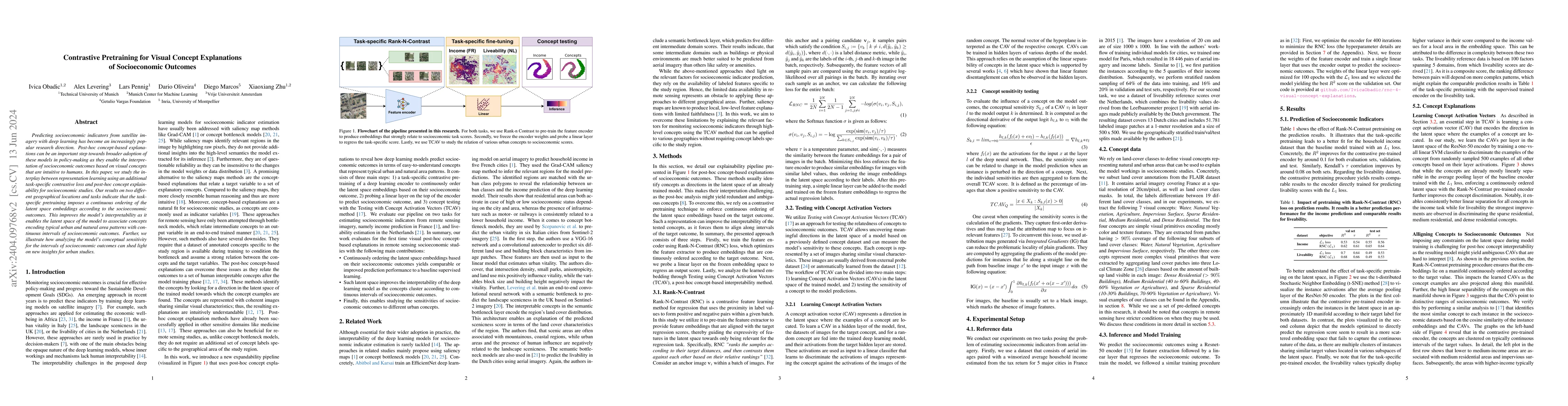
Predicting socioeconomic indicators from satellite imagery with deep learning has become an increasingly popular research direction. Post-hoc concept-based explanations can be an important step towa...
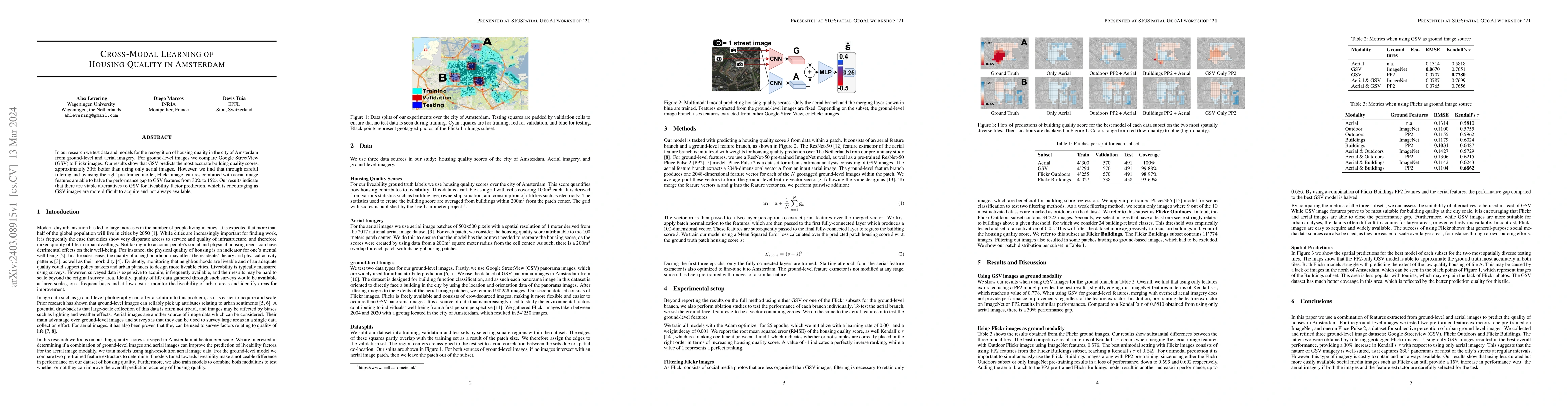
In our research we test data and models for the recognition of housing quality in the city of Amsterdam from ground-level and aerial imagery. For ground-level images we compare Google StreetView (GS...
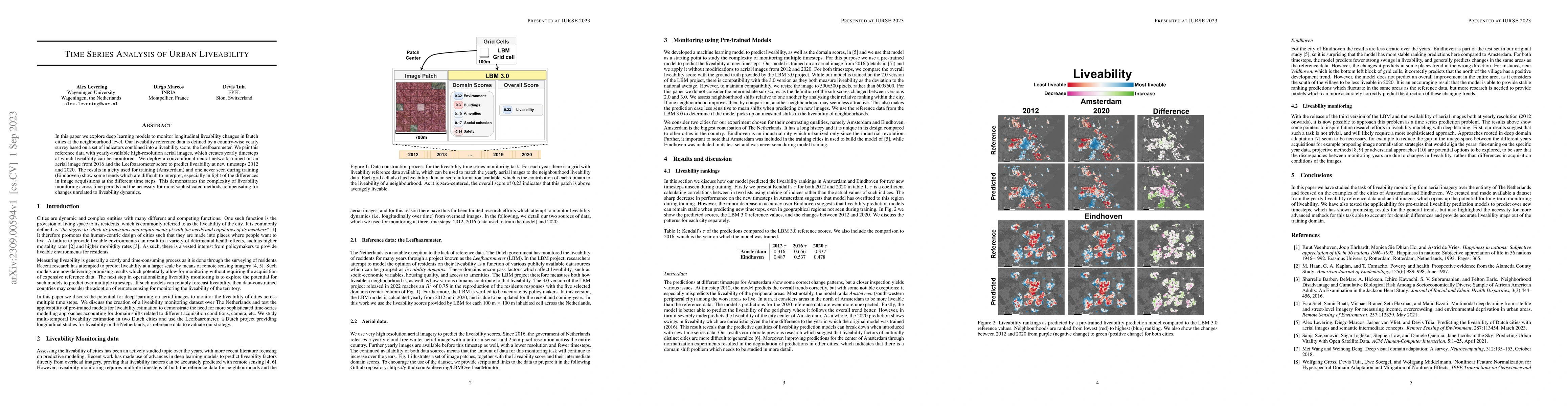
In this paper we explore deep learning models to monitor longitudinal liveability changes in Dutch cities at the neighbourhood level. Our liveability reference data is defined by a country-wise year...
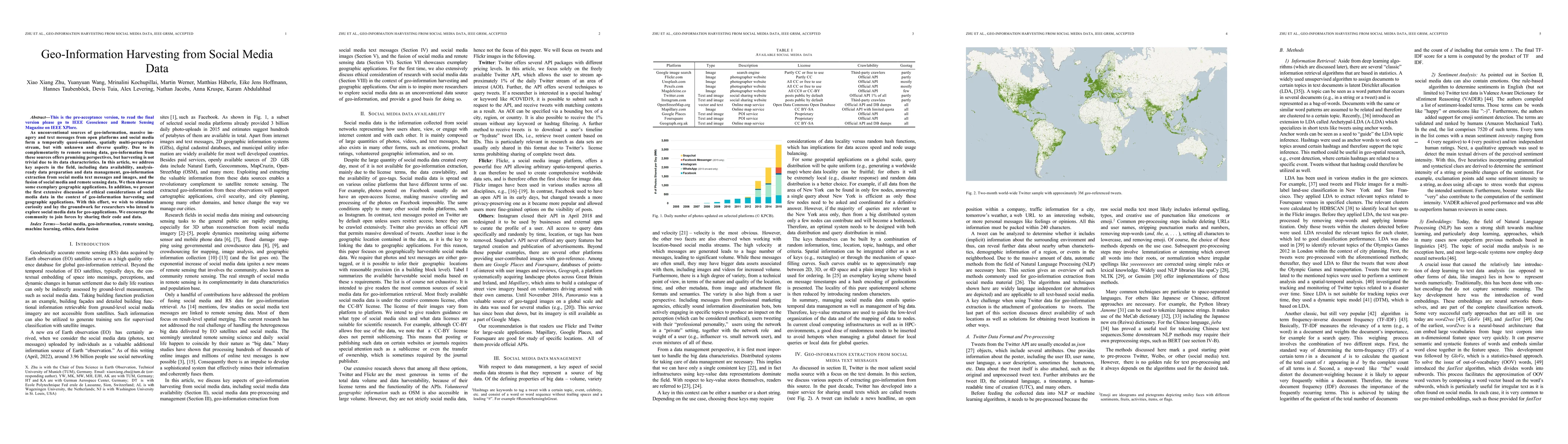
As unconventional sources of geo-information, massive imagery and text messages from open platforms and social media form a temporally quasi-seamless, spatially multi-perspective stream, but with un...
Safety on roads is of uttermost importance, especially in the context of autonomous vehicles. A critical need is to detect and communicate disruptive incidents early and effectively. In this paper w...