Academic Profile
Statistics
Papers on arXiv
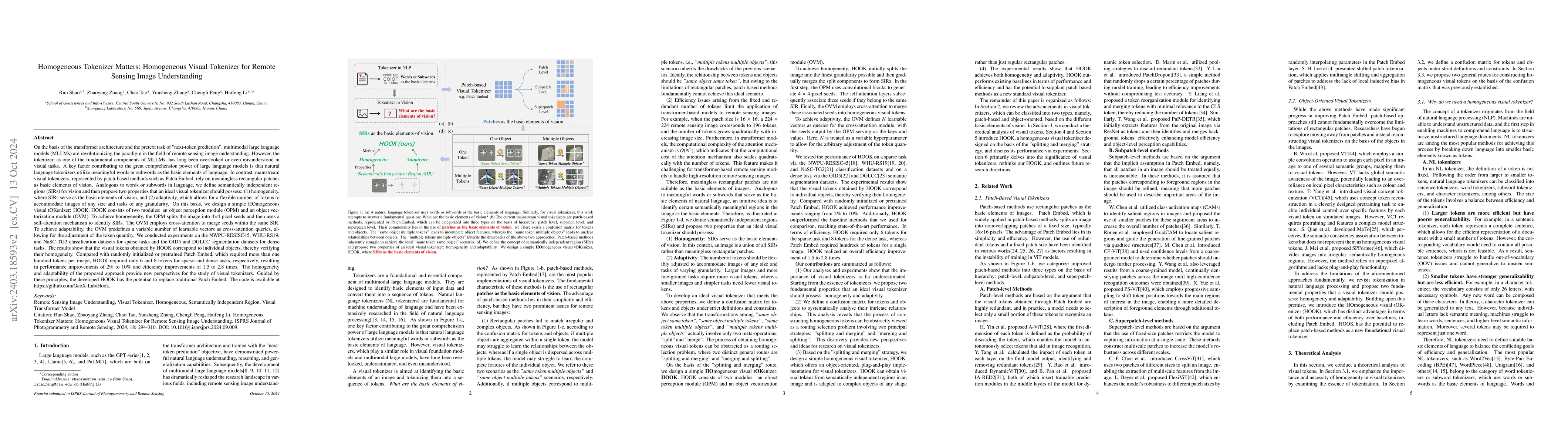
The tokenizer, as one of the fundamental components of large models, has long been overlooked or even misunderstood in visual tasks. One key factor of the great comprehension power of the large lang...
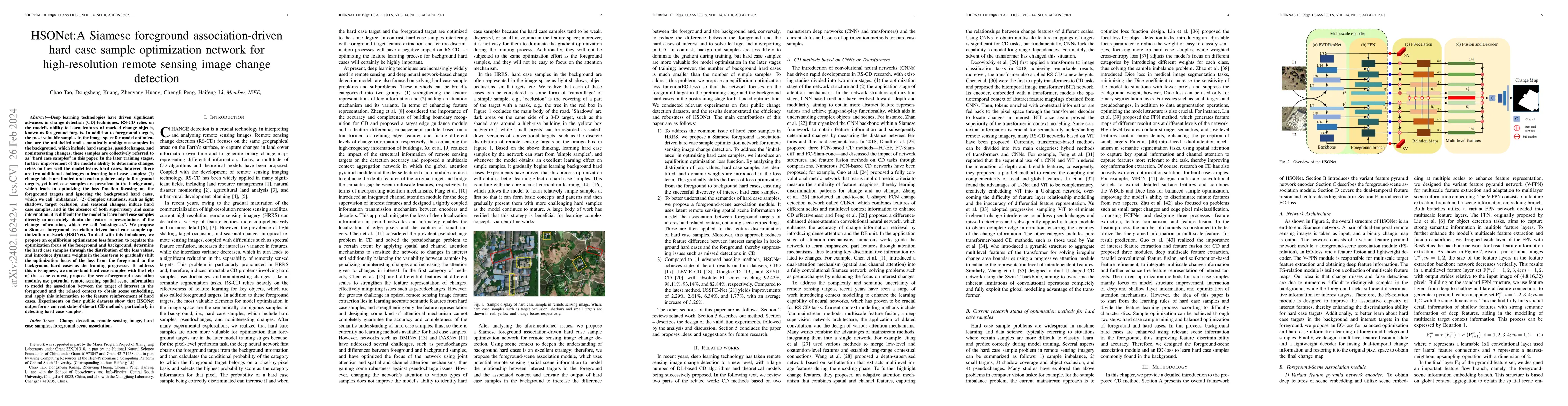
In the later training stages, further improvement of the models ability to determine changes relies on how well the change detection (CD) model learns hard cases; however, there are two additional c...
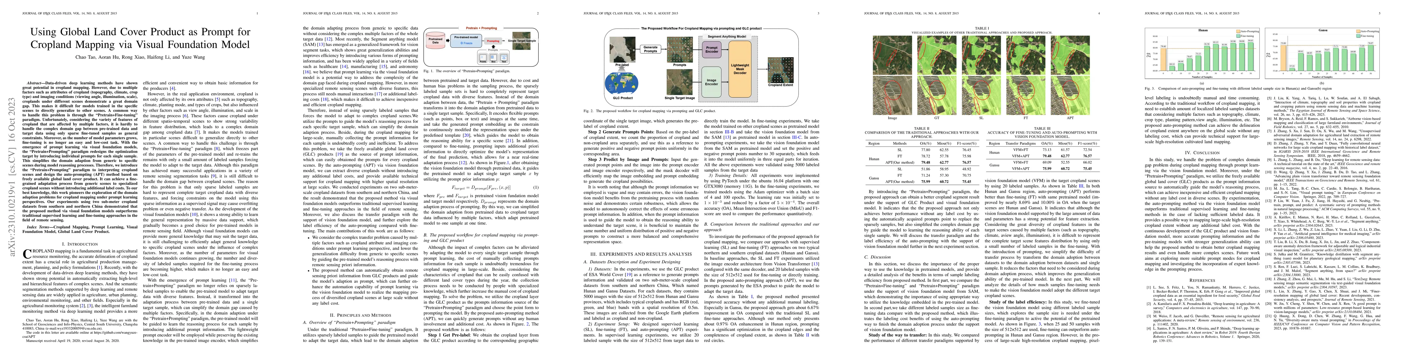
Data-driven deep learning methods have shown great potential in cropland mapping. However, due to multiple factors such as attributes of cropland (topography, climate, crop type) and imaging conditi...
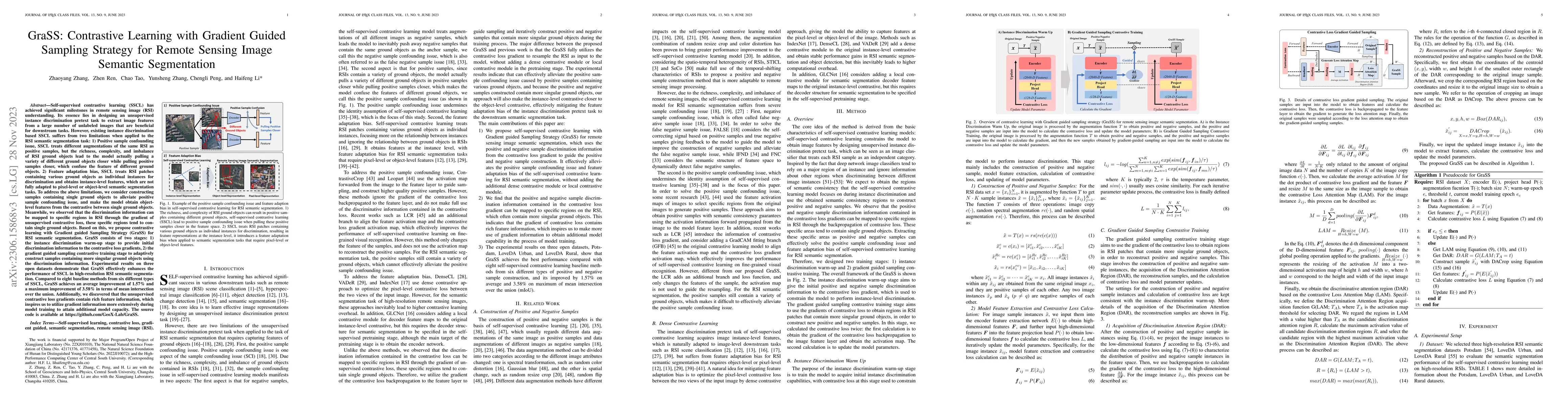
Self-supervised contrastive learning (SSCL) has achieved significant milestones in remote sensing image (RSI) understanding. Its essence lies in designing an unsupervised instance discrimination pre...
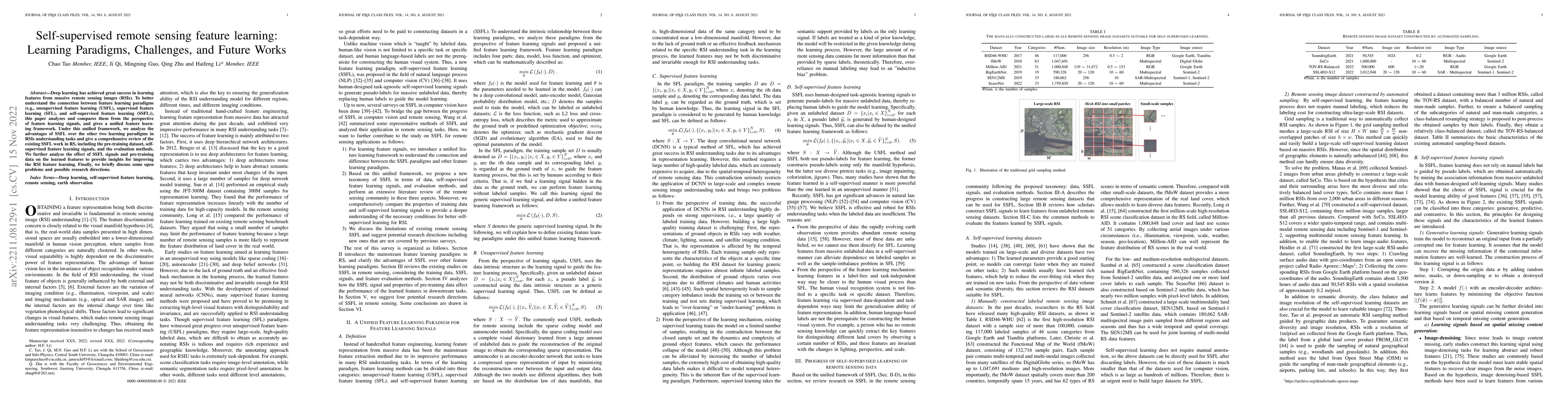
Deep learning has achieved great success in learning features from massive remote sensing images (RSIs). To better understand the connection between feature learning paradigms (e.g., unsupervised fe...
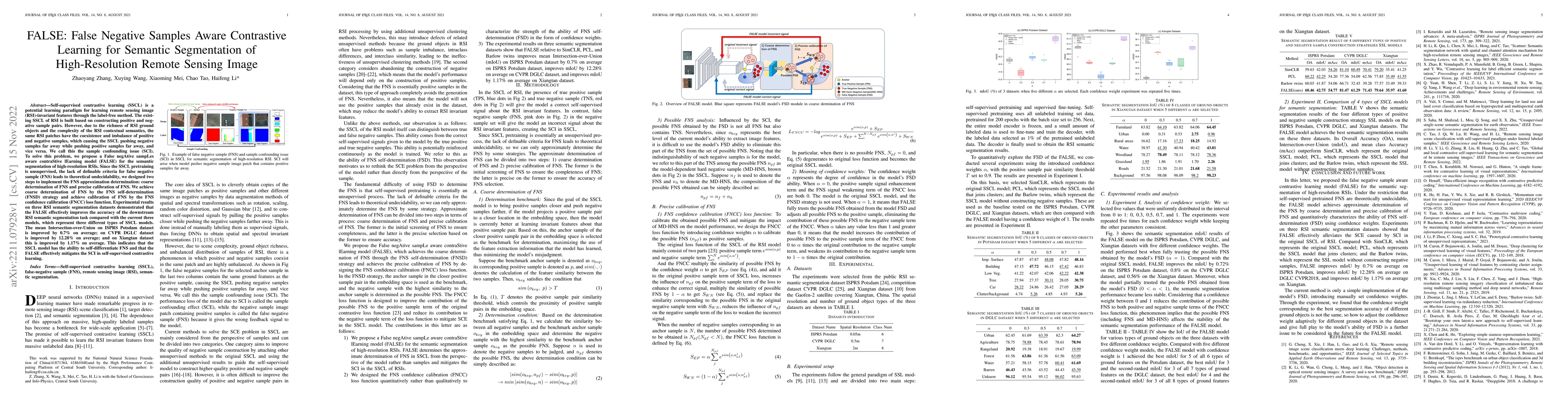
The existing SSCL of RSI is built based on constructing positive and negative sample pairs. However, due to the richness of RSI ground objects and the complexity of the RSI contextual semantics, the...
Do we on the right way for remote sensing image understanding (RSIU) by training models via supervised data-dependent and task-dependent way, instead of human vision in a label-free and task-indepen...
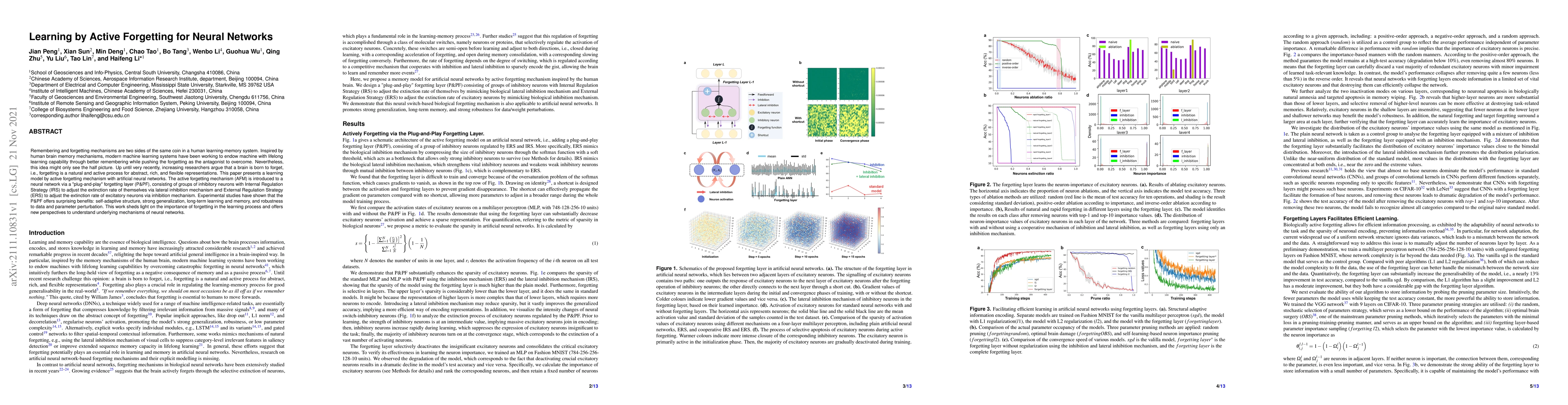
Remembering and forgetting mechanisms are two sides of the same coin in a human learning-memory system. Inspired by human brain memory mechanisms, modern machine learning systems have been working t...
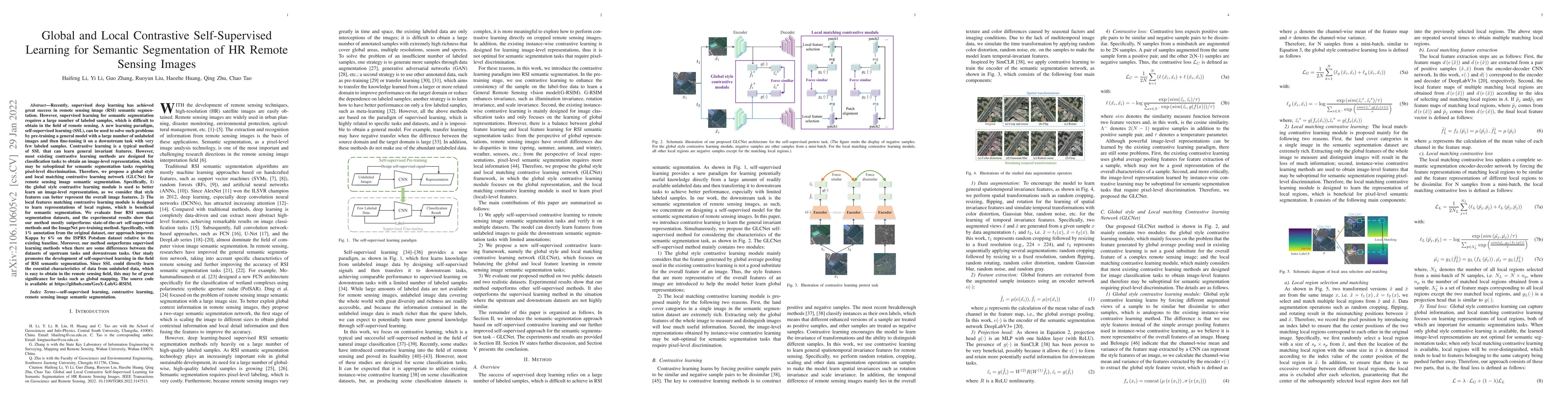
Supervised learning for semantic segmentation requires a large number of labeled samples, which is difficult to obtain in the field of remote sensing. Self-supervised learning (SSL), can be used to ...
We study the problem of identifying the best arm in a stochastic multi-armed bandit game. Given a set of $n$ arms indexed from $1$ to $n$, each arm $i$ is associated with an unknown reward distribut...
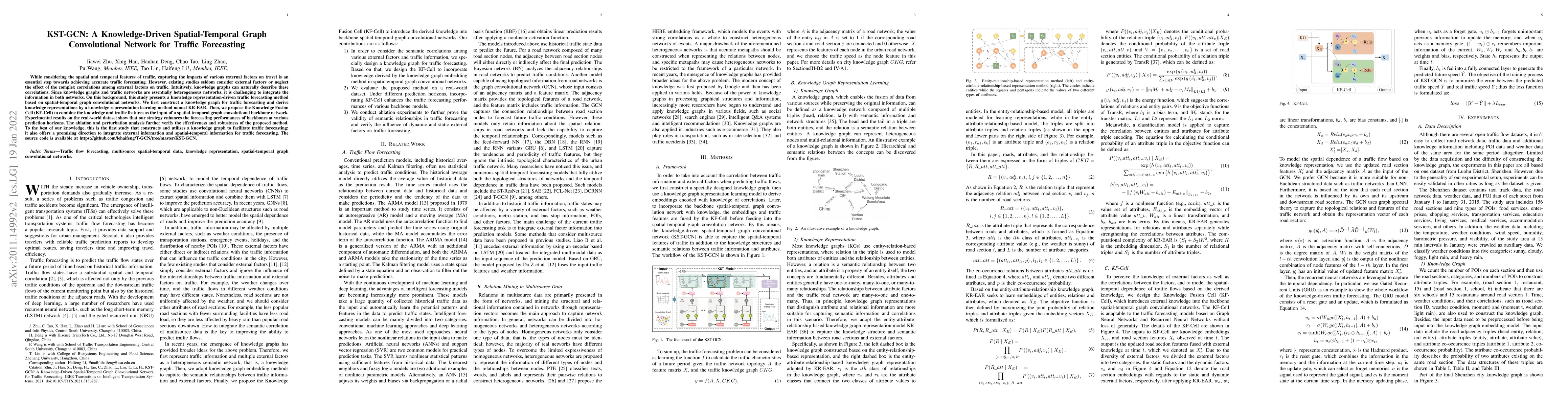
While considering the spatial and temporal features of traffic, capturing the impacts of various external factors on travel is an essential step towards achieving accurate traffic forecasting. Howev...
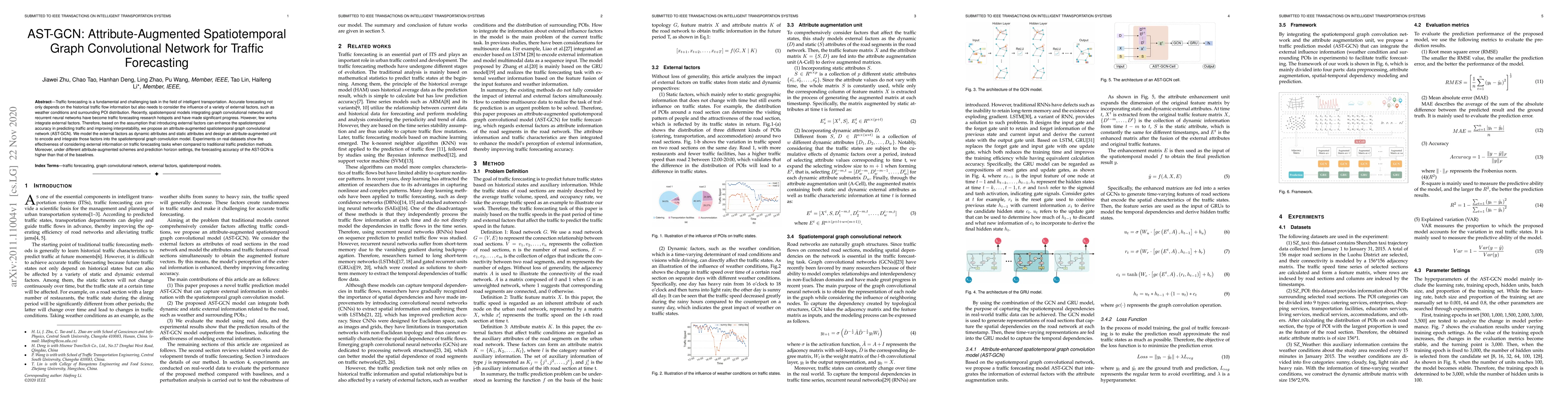
Traffic forecasting is a fundamental and challenging task in the field of intelligent transportation. Accurate forecasting not only depends on the historical traffic flow information but also needs ...
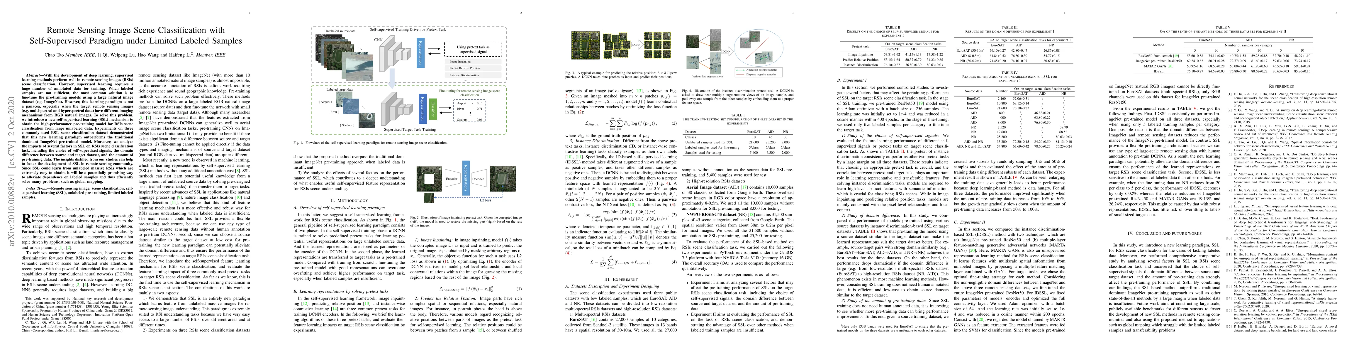
With the development of deep learning, supervised learning methods perform well in remote sensing images (RSIs) scene classification. However, supervised learning requires a huge number of annotated...
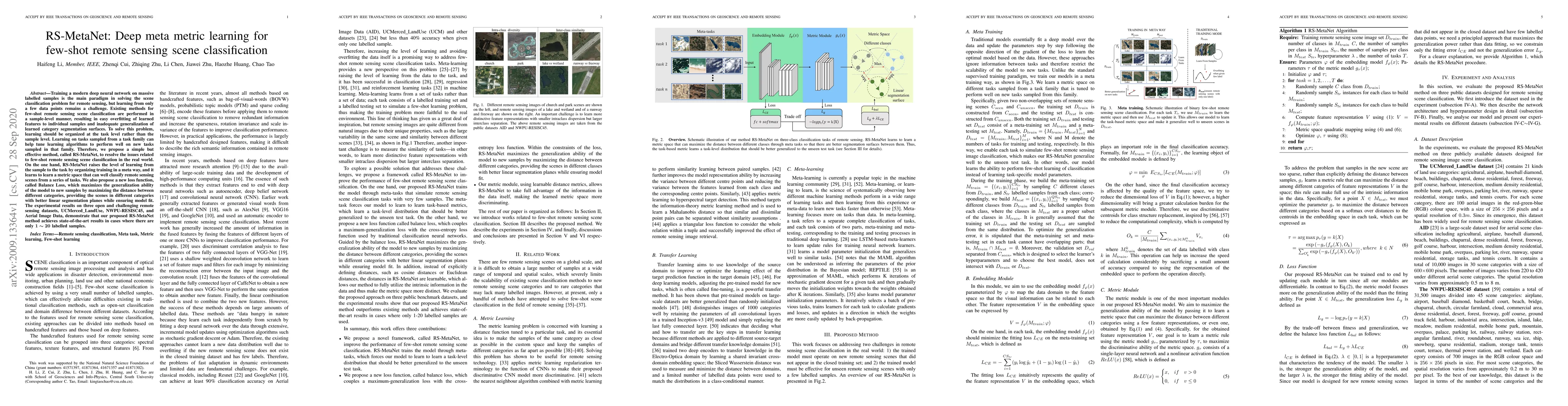
Training a modern deep neural network on massive labeled samples is the main paradigm in solving the scene classification problem for remote sensing, but learning from only a few data points remains...
We study MNL bandits, which is a variant of the traditional multi-armed bandit problem, under risk criteria. Unlike the ordinary expected revenue, risk criteria are more general goals widely used in...
We consider the thresholding bandit problem, whose goal is to find arms of mean rewards above a given threshold $\theta$, with a fixed budget of $T$ trials. We introduce LSA, a new, simple and anyti...
End-to-end interpretation is currently the prevailing paradigm for remote sensing fine-grained ship classification (RS-FGSC) task. However, its inference process is uninterpretable, leading to critici...
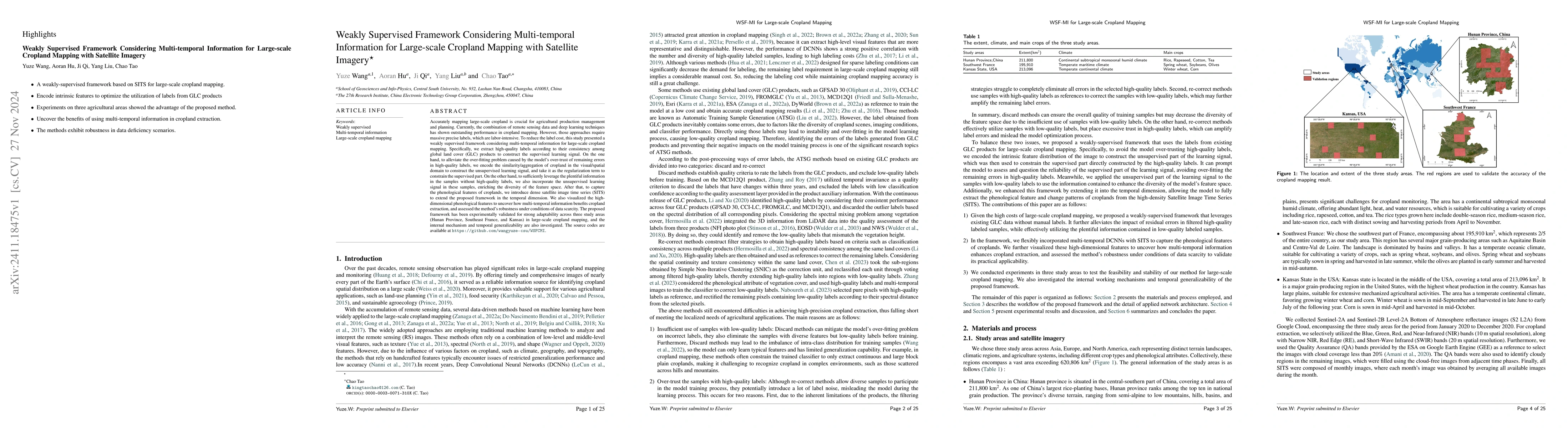
Accurately mapping large-scale cropland is crucial for agricultural production management and planning. Currently, the combination of remote sensing data and deep learning techniques has shown outstan...
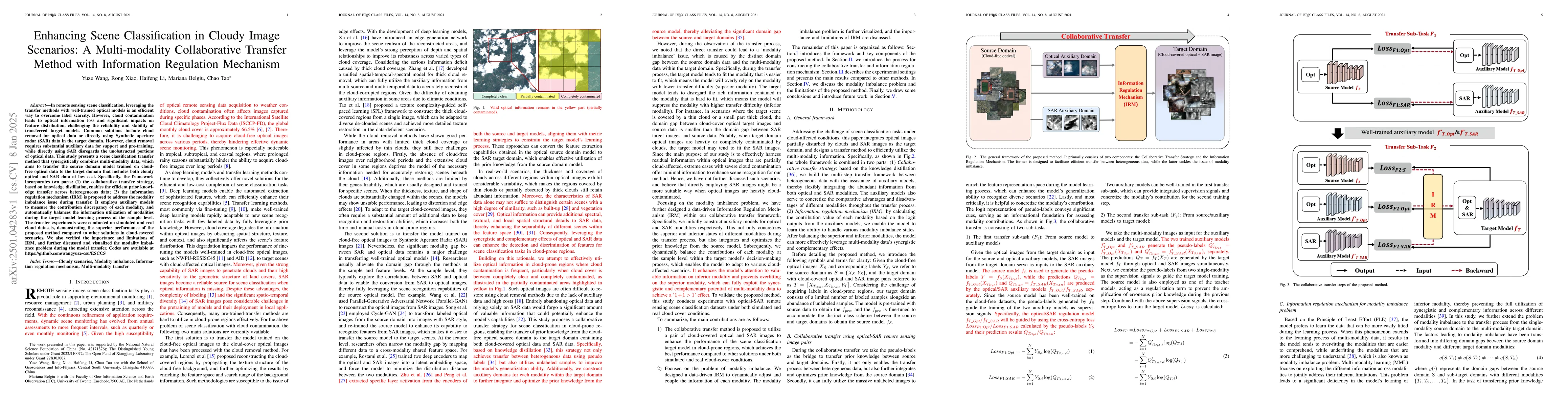
In remote sensing scene classification, leveraging the transfer methods with well-trained optical models is an efficient way to overcome label scarcity. However, cloud contamination leads to optical i...
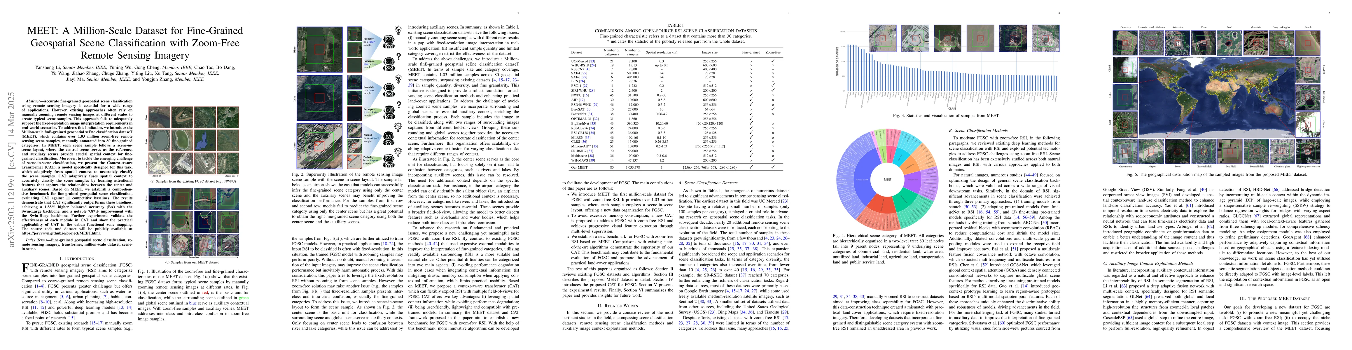
Accurate fine-grained geospatial scene classification using remote sensing imagery is essential for a wide range of applications. However, existing approaches often rely on manually zooming remote sen...
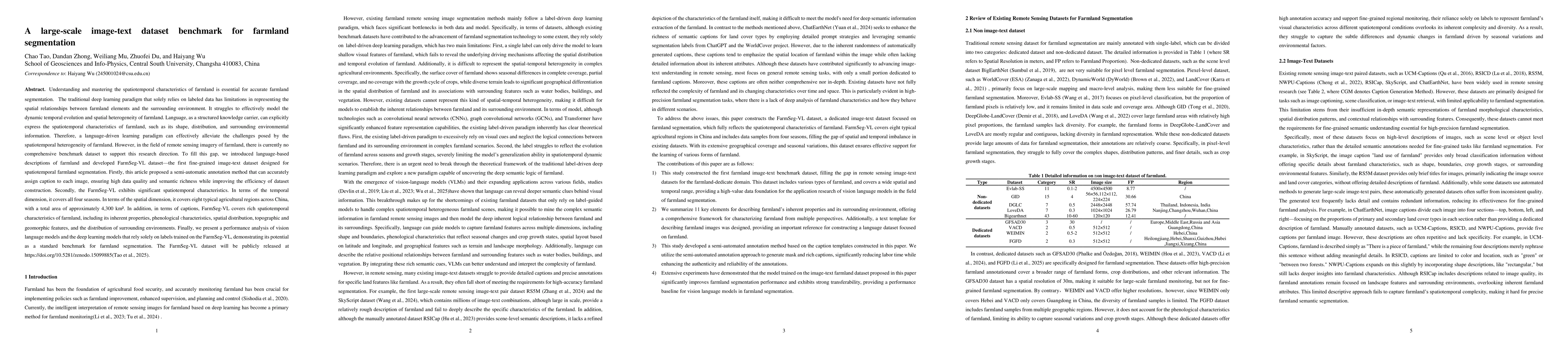
The traditional deep learning paradigm that solely relies on labeled data has limitations in representing the spatial relationships between farmland elements and the surrounding environment.It struggl...
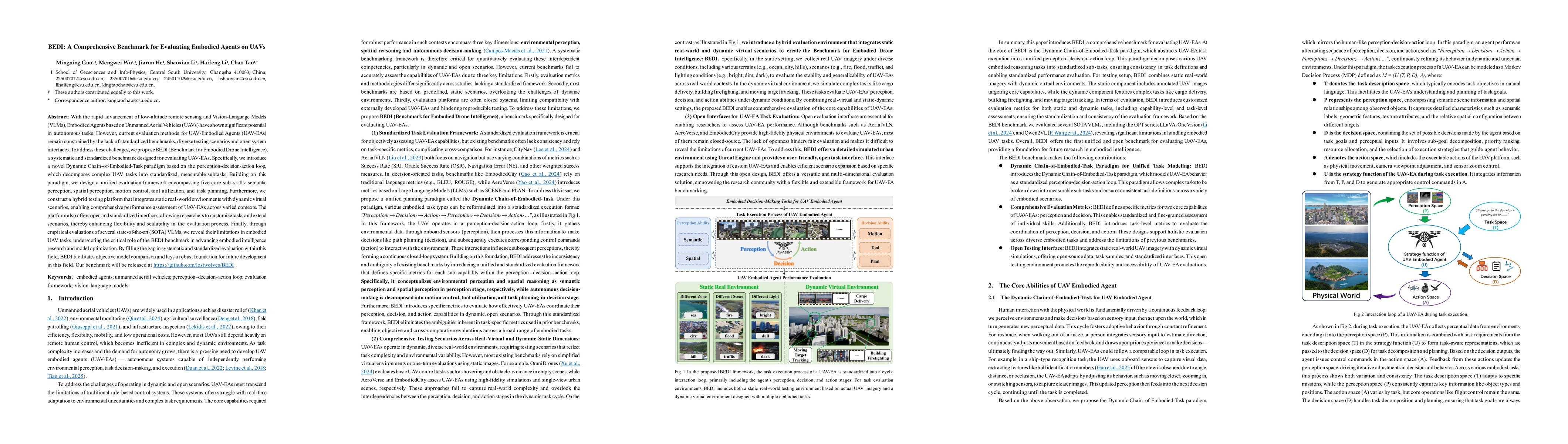
With the rapid advancement of low-altitude remote sensing and Vision-Language Models (VLMs), Embodied Agents based on Unmanned Aerial Vehicles (UAVs) have shown significant potential in autonomous tas...
Satellite Image Time Series (SITS) is crucial for agricultural semantic segmentation. However, Cloud contamination introduces time gaps in SITS, disrupting temporal dependencies and causing feature sh...
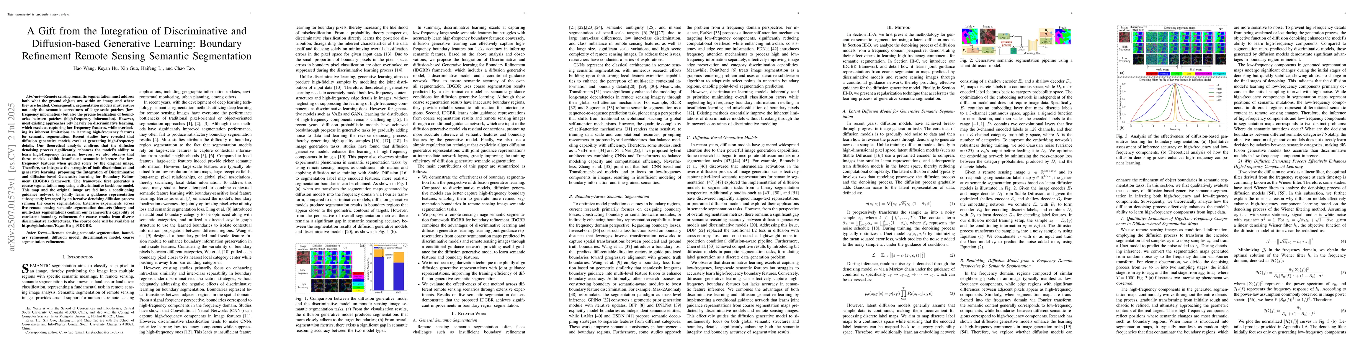
Remote sensing semantic segmentation must address both what the ground objects are within an image and where they are located. Consequently, segmentation models must ensure not only the semantic corre...
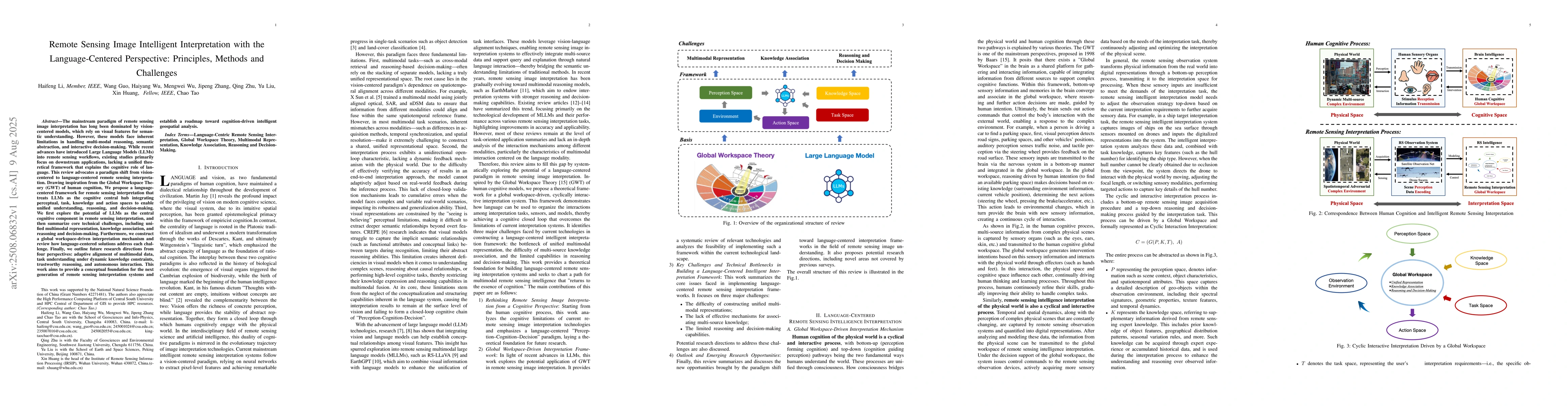
The mainstream paradigm of remote sensing image interpretation has long been dominated by vision-centered models, which rely on visual features for semantic understanding. However, these models face i...
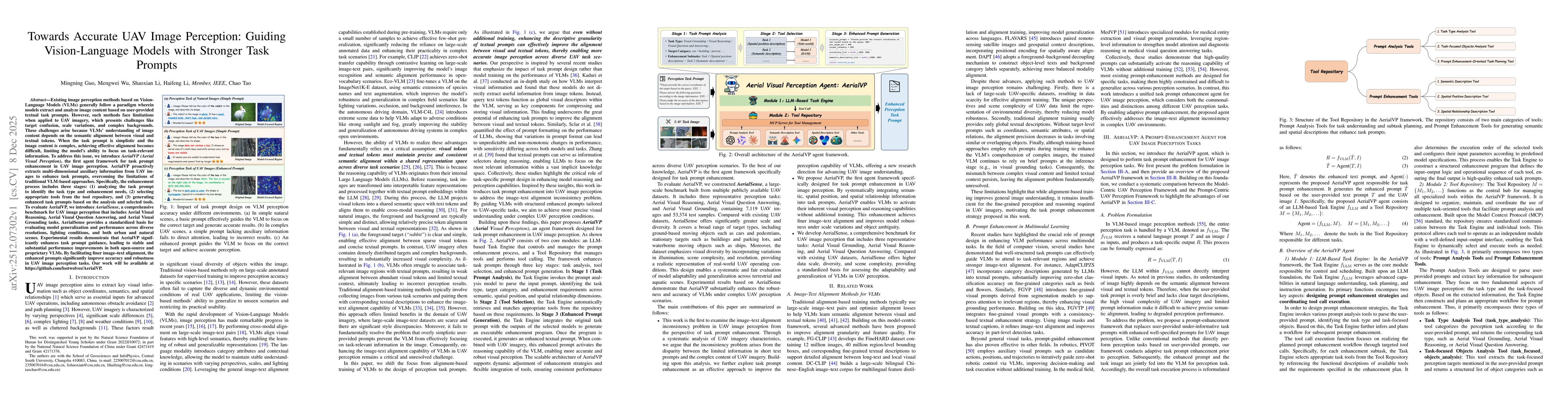
Existing image perception methods based on VLMs generally follow a paradigm wherein models extract and analyze image content based on user-provided textual task prompts. However, such methods face lim...
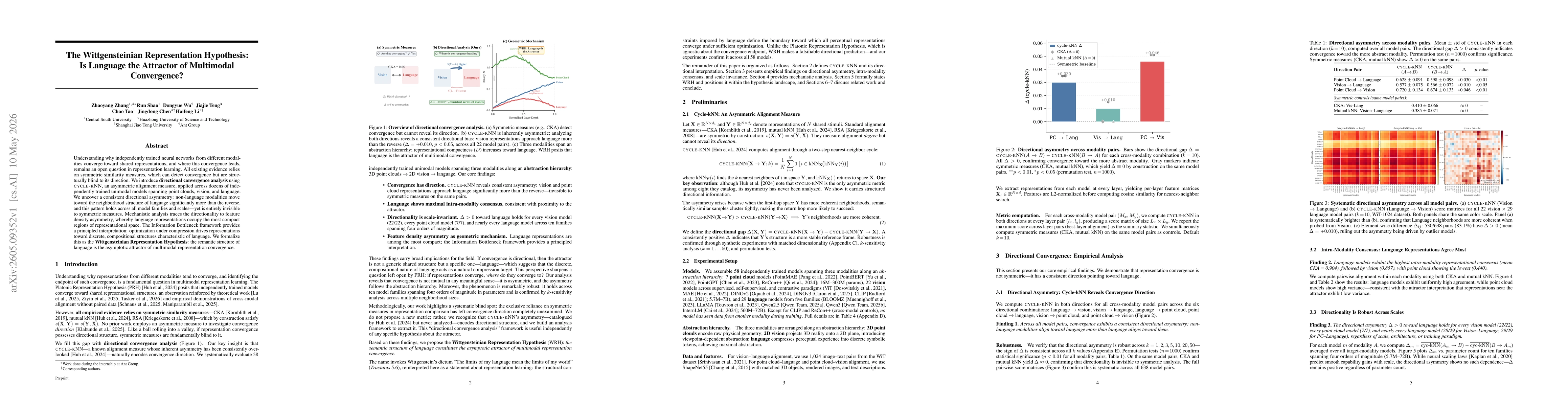
Understanding why independently trained neural networks from different modalities converge toward shared representations, and where this convergence leads, remains an open question in representation l...
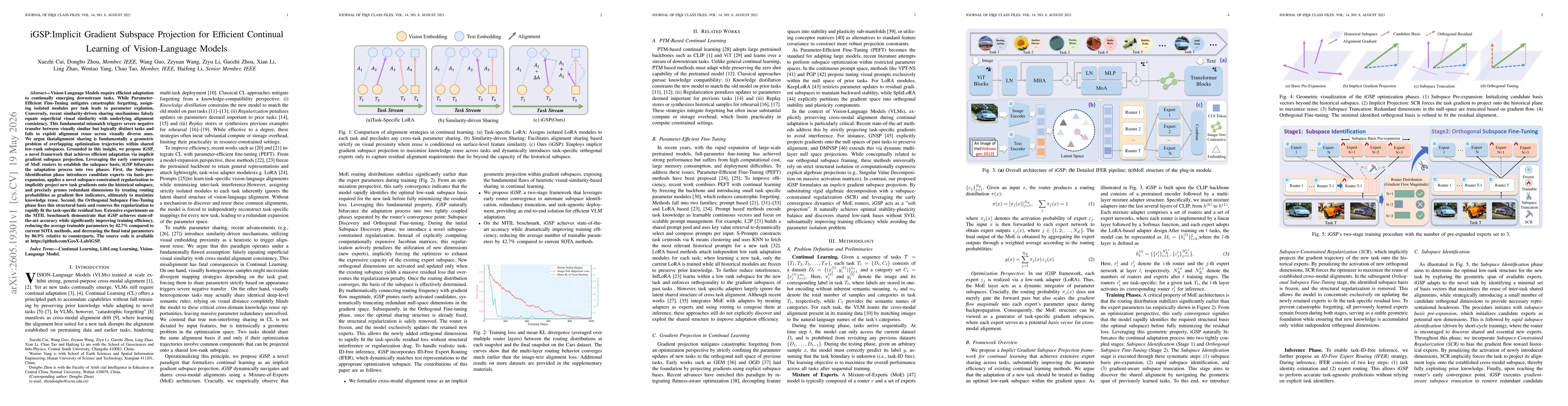
Vision-Language Models require efficient adaptation to continually emerging downstream tasks. While Parameter-Efficient Fine-Tuning mitigates catastrophic forgetting, assigning isolated modules per ta...