Academic Profile
Statistics
Similar Authors
Papers on arXiv
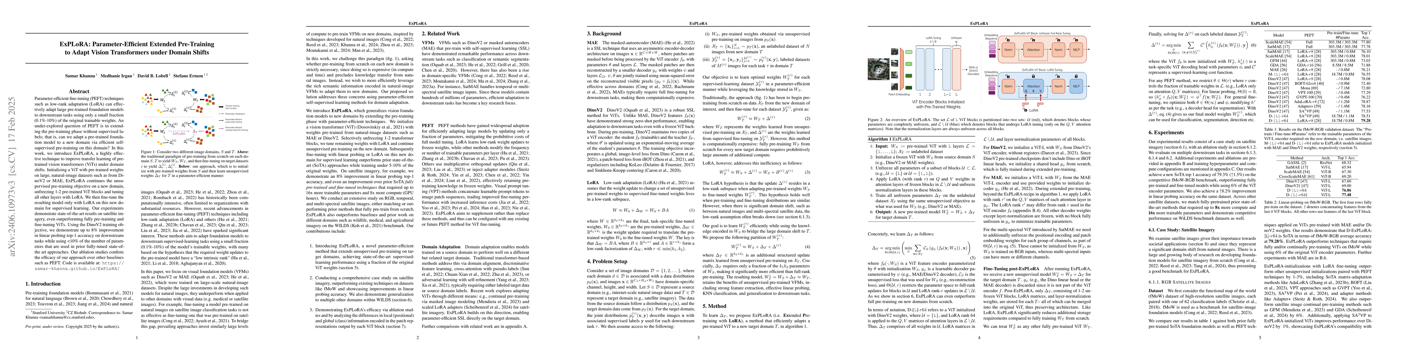
Parameter-efficient fine-tuning (PEFT) techniques such as low-rank adaptation (LoRA) can effectively adapt large pre-trained foundation models to downstream tasks using only a small fraction (0.1%-10%...
Increasing agricultural productivity is a gradual process with significant time lags between research and development (R&D) investment and the resulting gains. We estimate the response of US agricul...
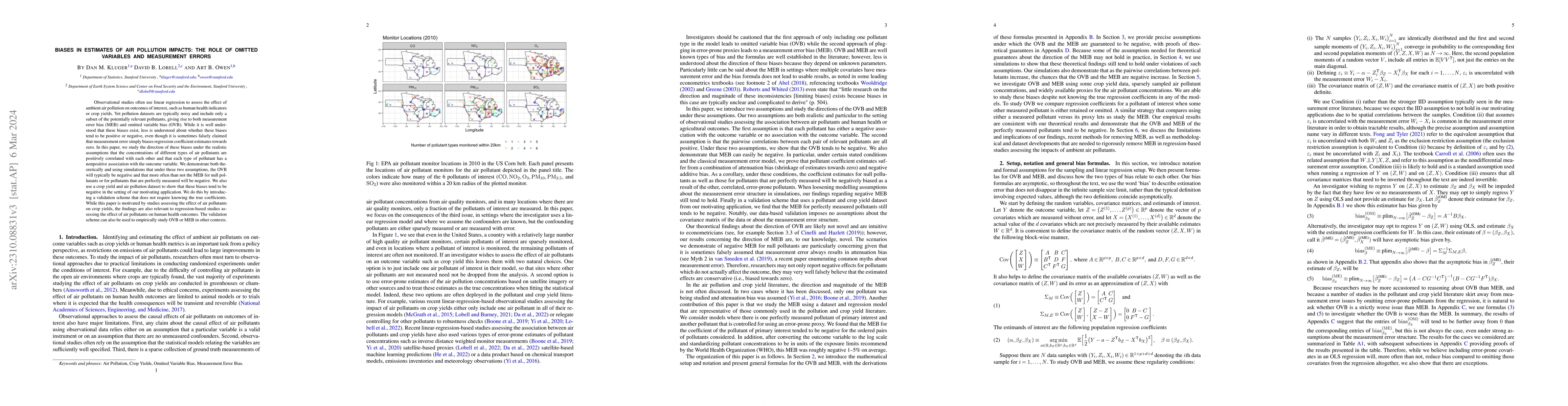
Observational studies often use linear regression to assess the effect of ambient air pollution on outcomes of interest, such as human health indicators or crop yields. Yet pollution datasets are ty...
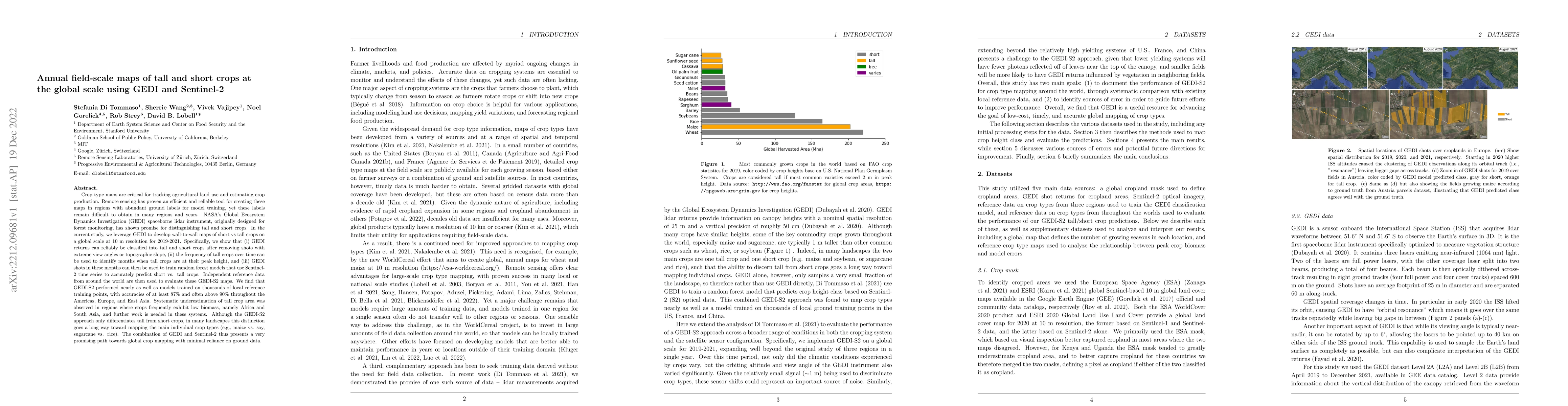
Crop type maps are critical for tracking agricultural land use and estimating crop production. Remote sensing has proven an efficient and reliable tool for creating these maps in regions with abunda...
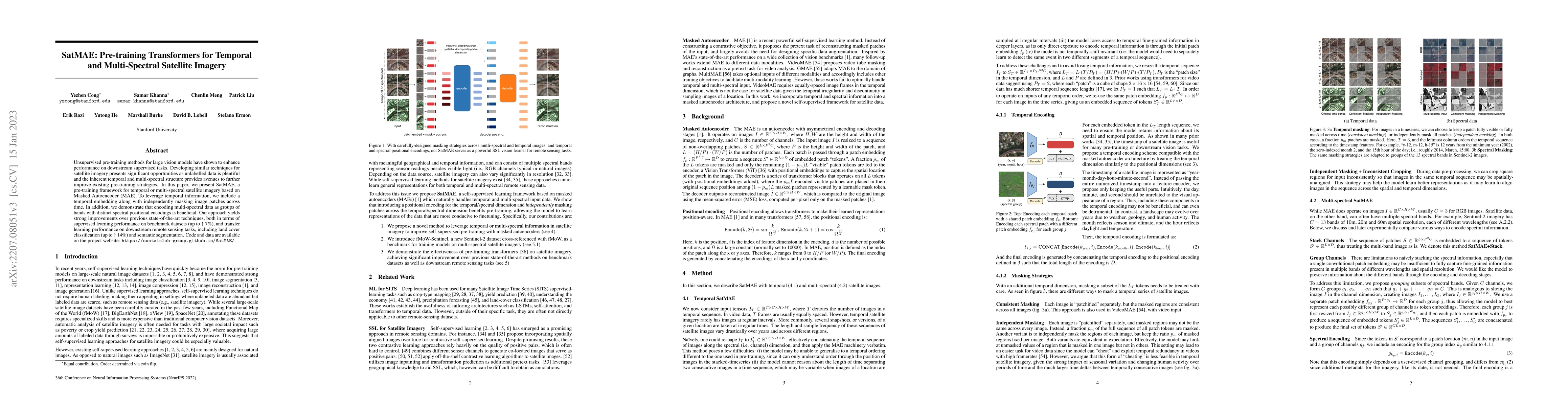
Unsupervised pre-training methods for large vision models have shown to enhance performance on downstream supervised tasks. Developing similar techniques for satellite imagery presents significant o...
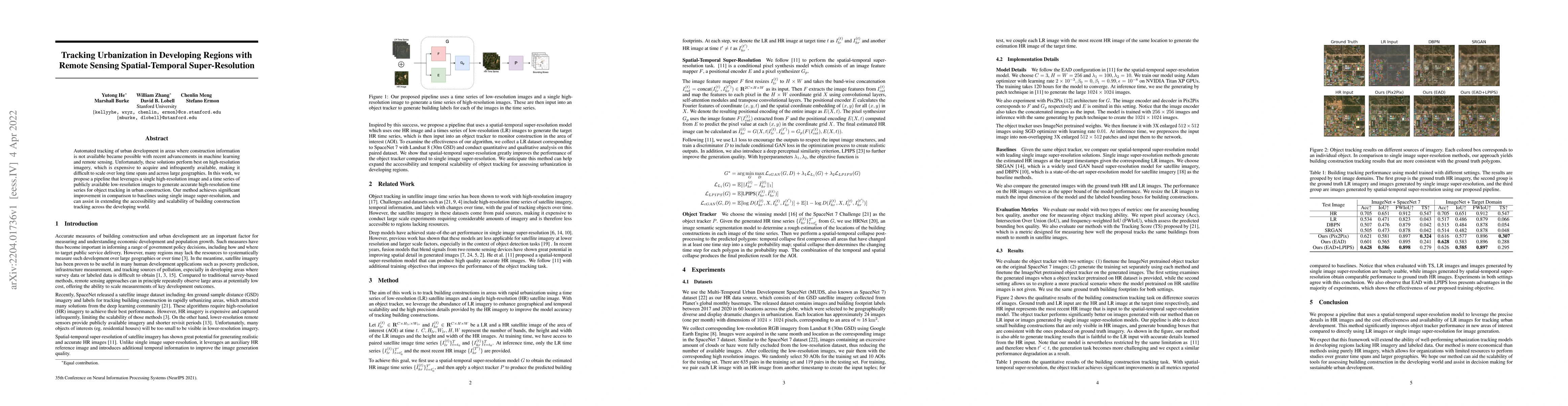
Automated tracking of urban development in areas where construction information is not available became possible with recent advancements in machine learning and remote sensing. Unfortunately, these...
Crop field boundaries aid in mapping crop types, predicting yields, and delivering field-scale analytics to farmers. Recent years have seen the successful application of deep learning to delineating...
With climate change threatening agricultural productivity and global food demand increasing, it is important to better understand which farm management practices will maximize crop yields in various...
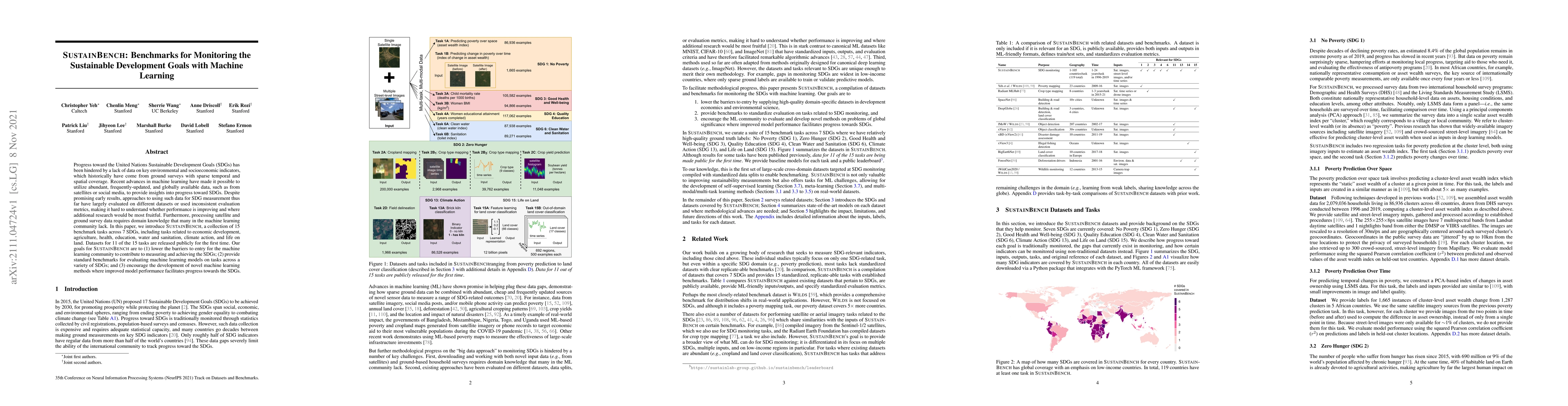
Progress toward the United Nations Sustainable Development Goals (SDGs) has been hindered by a lack of data on key environmental and socioeconomic indicators, which historically have come from groun...
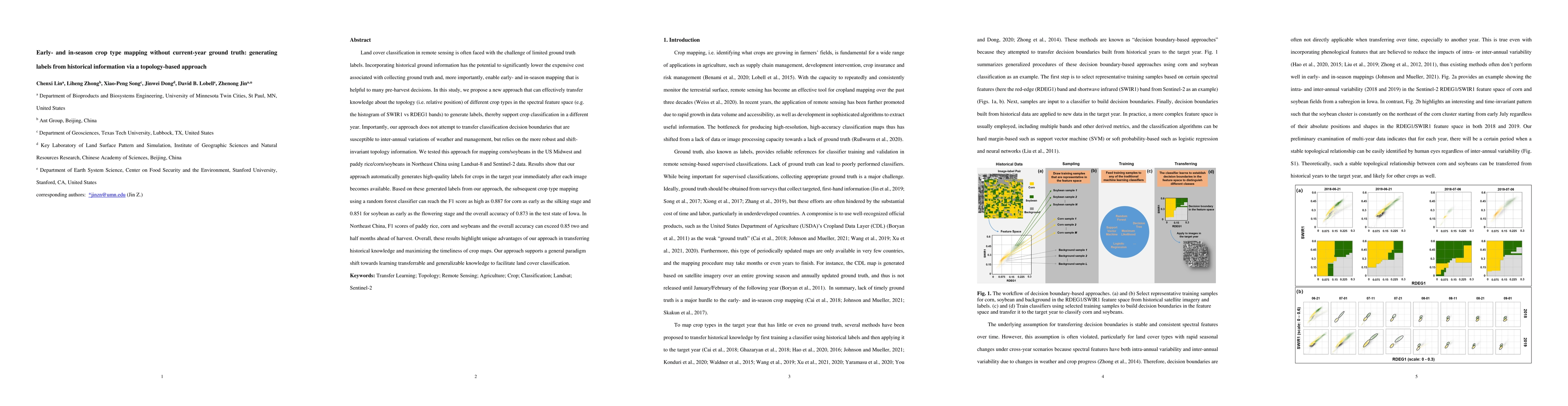
Land cover classification in remote sensing is often faced with the challenge of limited ground truth. Incorporating historical information has the potential to significantly lower the expensive cos...
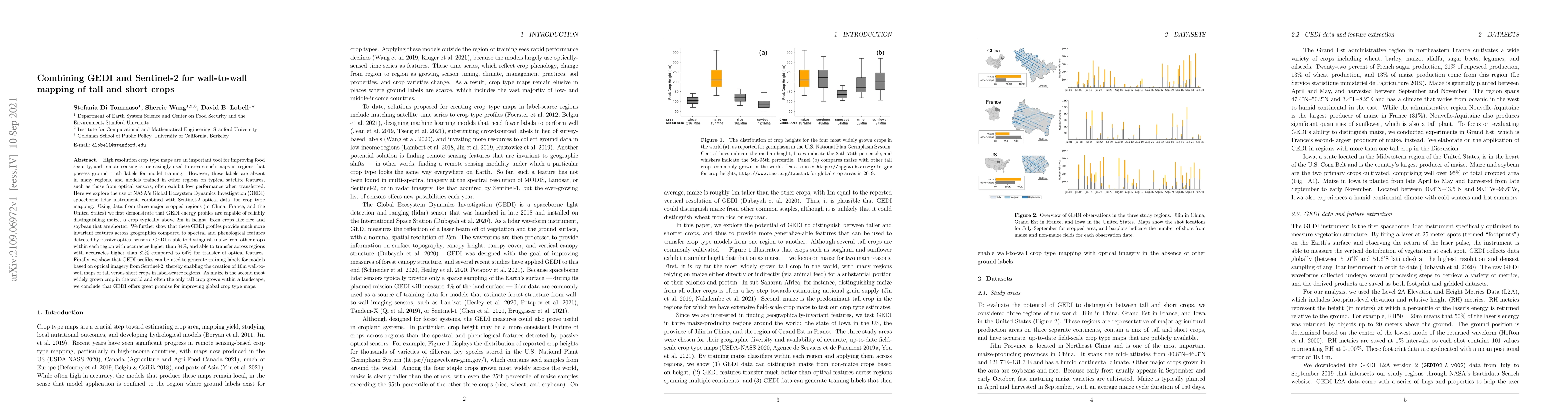
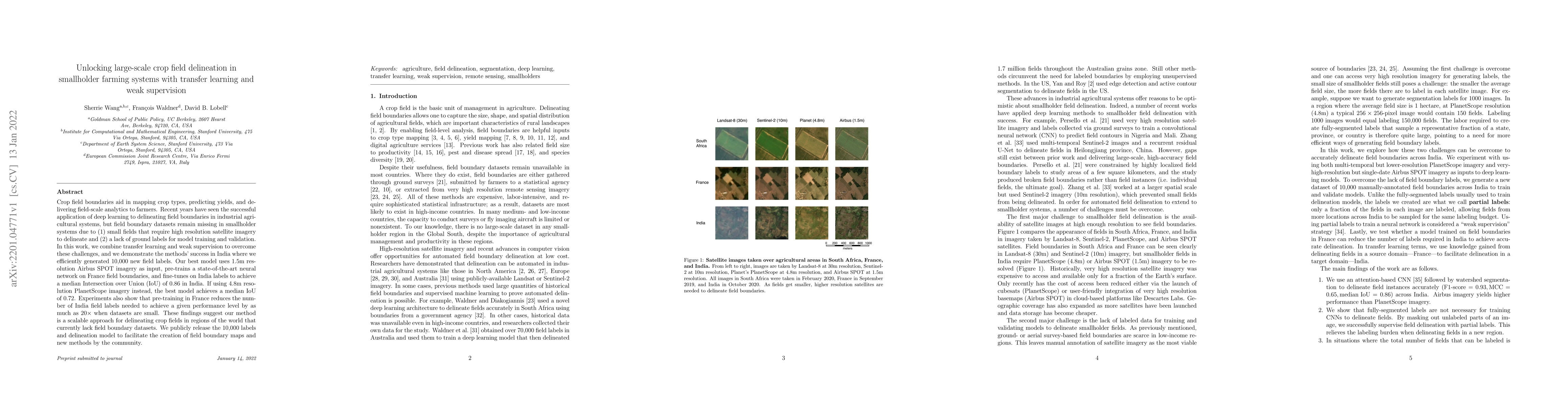
High resolution crop type maps are an important tool for improving food security, and remote sensing is increasingly used to create such maps in regions that possess ground truth labels for model tr...
Crop type mapping at the field level is critical for a variety of applications in agricultural monitoring, and satellite imagery is becoming an increasingly abundant and useful raw input from which ...
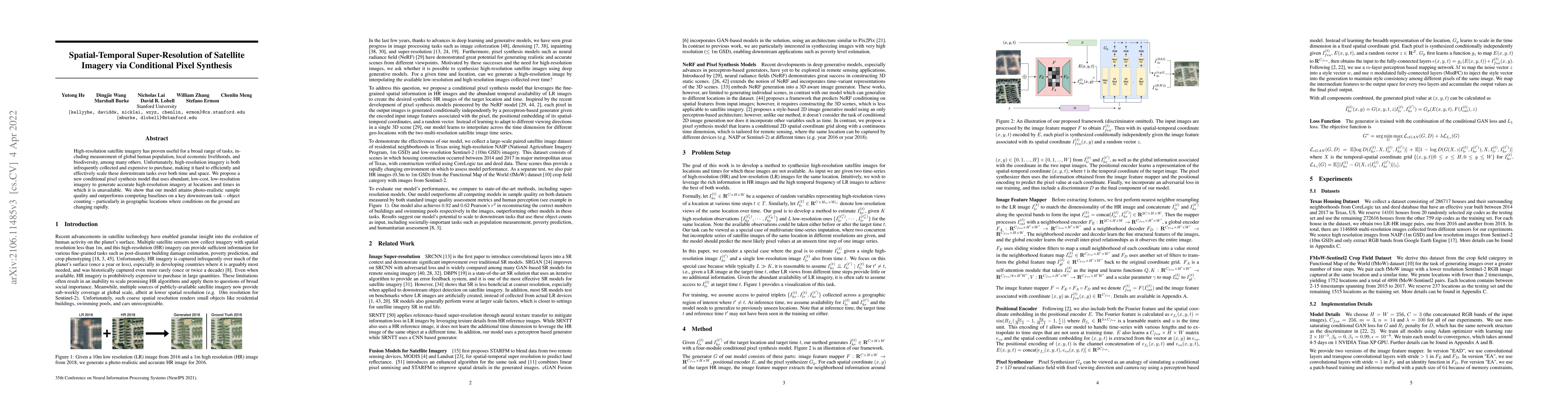
High-resolution satellite imagery has proven useful for a broad range of tasks, including measurement of global human population, local economic livelihoods, and biodiversity, among many others. Unf...
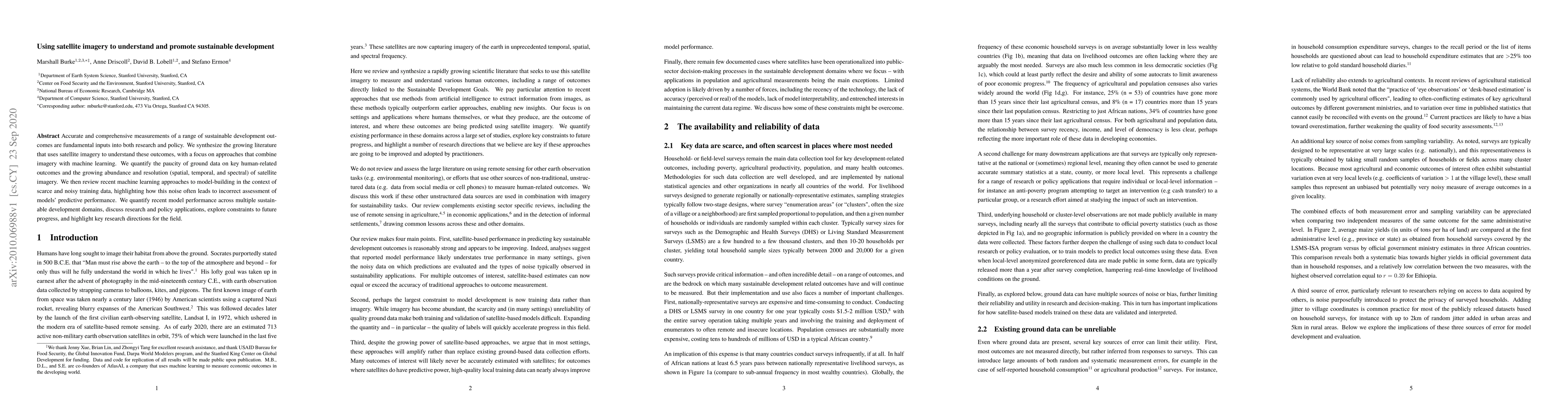
Accurate and comprehensive measurements of a range of sustainable development outcomes are fundamental inputs into both research and policy. We synthesize the growing literature that uses satellite ...
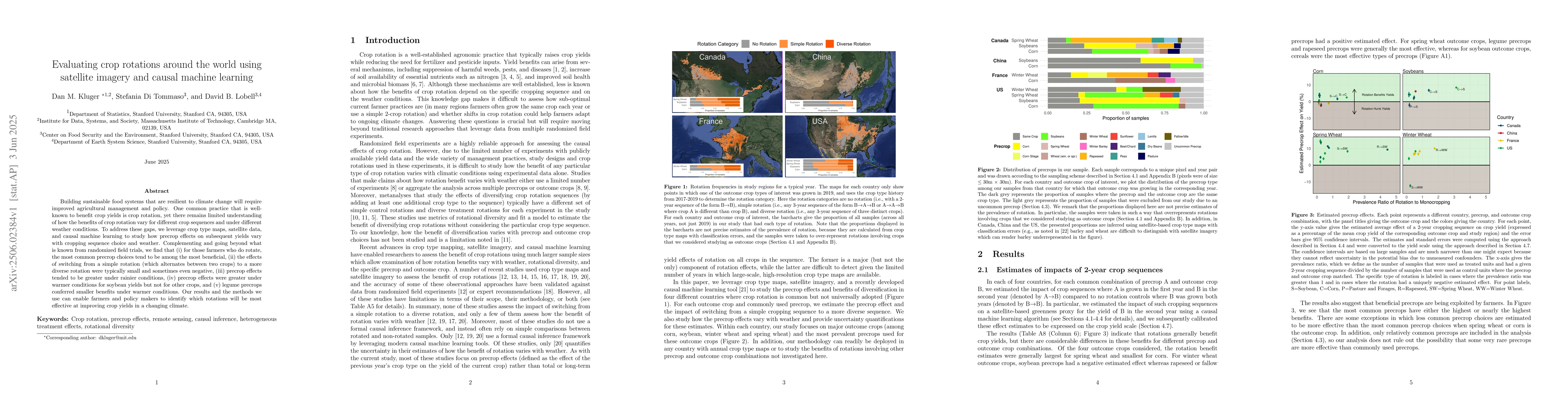
Building sustainable food systems that are resilient to climate change will require improved agricultural management and policy. One common practice that is well-known to benefit crop yields is crop r...
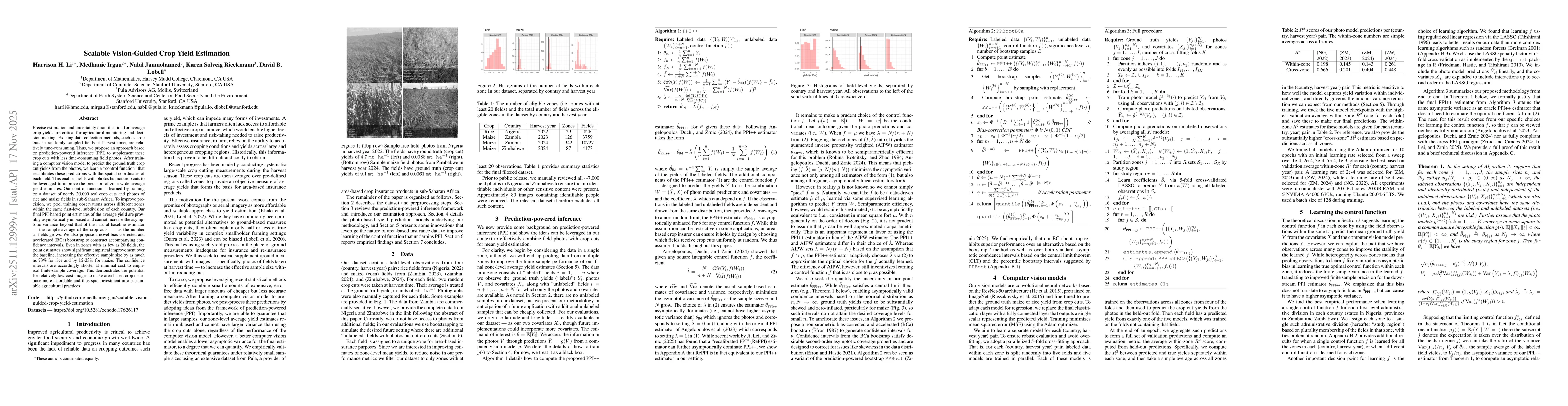
Precise estimation and uncertainty quantification for average crop yields are critical for agricultural monitoring and decision making. Existing data collection methods, such as crop cuts in randomly ...
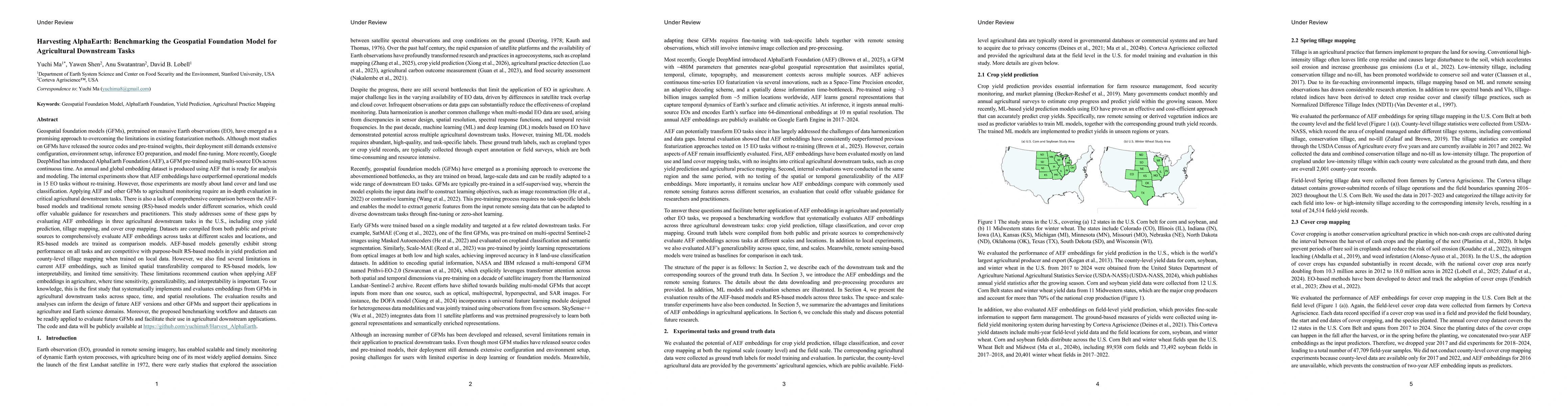
Geospatial foundation models (GFMs) have emerged as a promising approach to overcoming the limitations in existing featurization methods. More recently, Google DeepMind has introduced AlphaEarth Found...
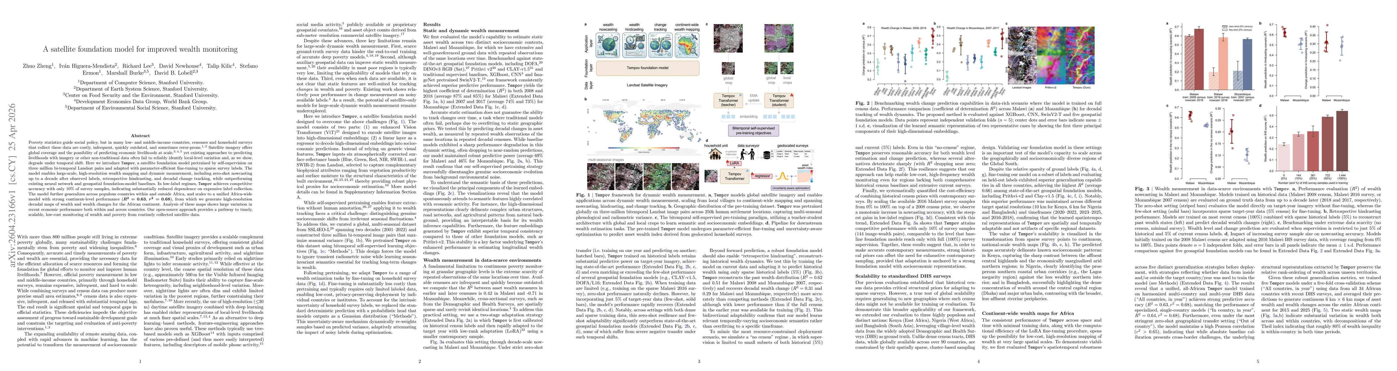
Poverty statistics guide social policy, but in many low- and middle-income countries, censuses and household surveys that collect these data are costly, infrequent, quickly outdated, and sometimes err...