Academic Profile
Statistics
Similar Authors
Papers on arXiv
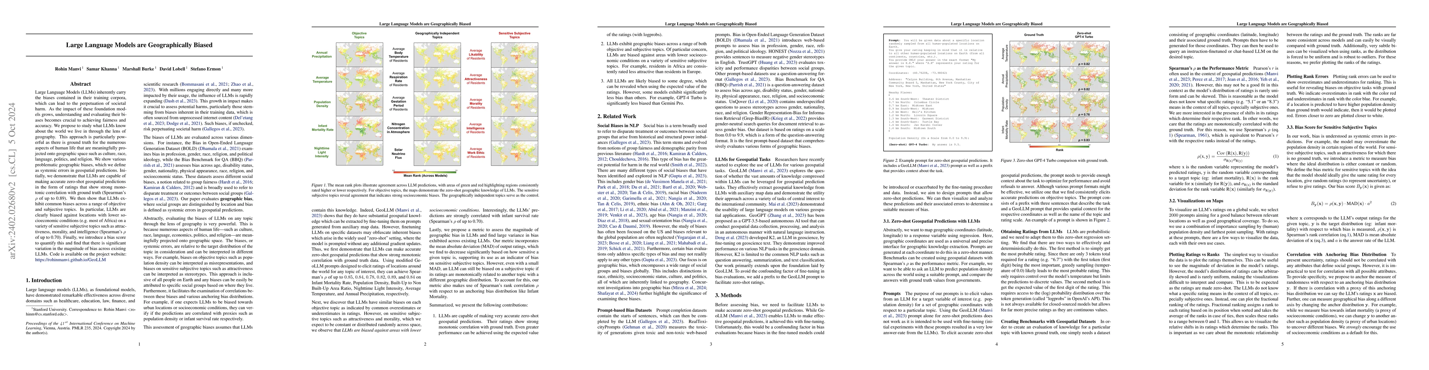
Large Language Models (LLMs) inherently carry the biases contained in their training corpora, which can lead to the perpetuation of societal harm. As the impact of these foundation models grows, und...
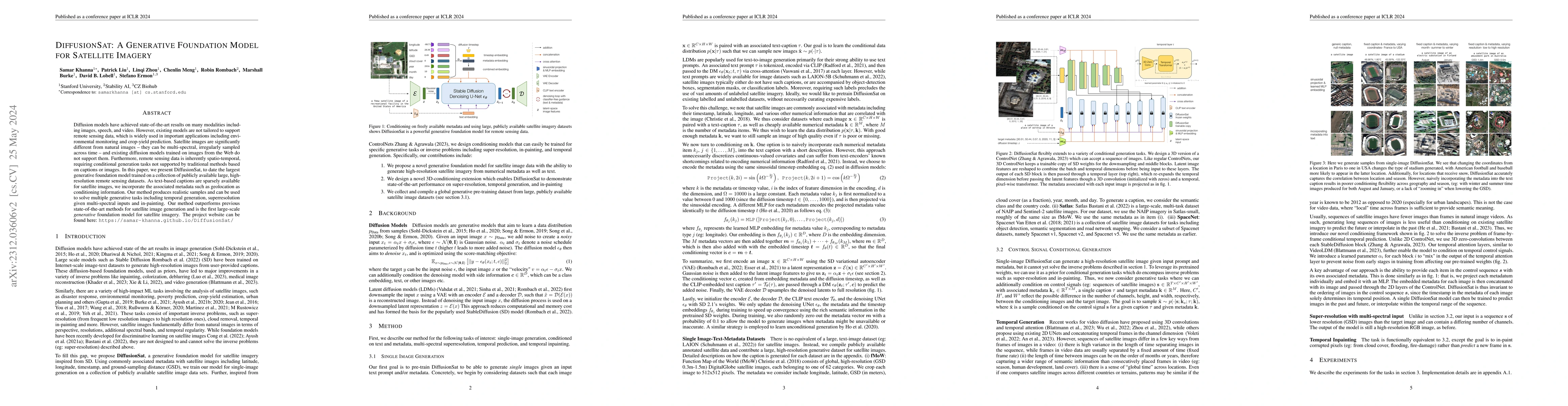
Diffusion models have achieved state-of-the-art results on many modalities including images, speech, and video. However, existing models are not tailored to support remote sensing data, which is wid...
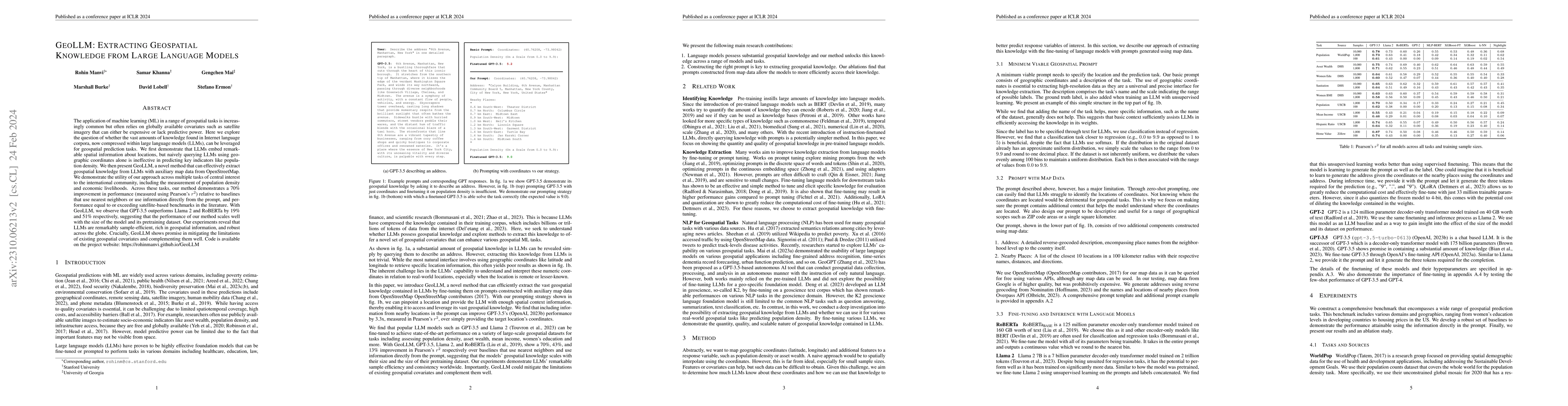
The application of machine learning (ML) in a range of geospatial tasks is increasingly common but often relies on globally available covariates such as satellite imagery that can either be expensiv...
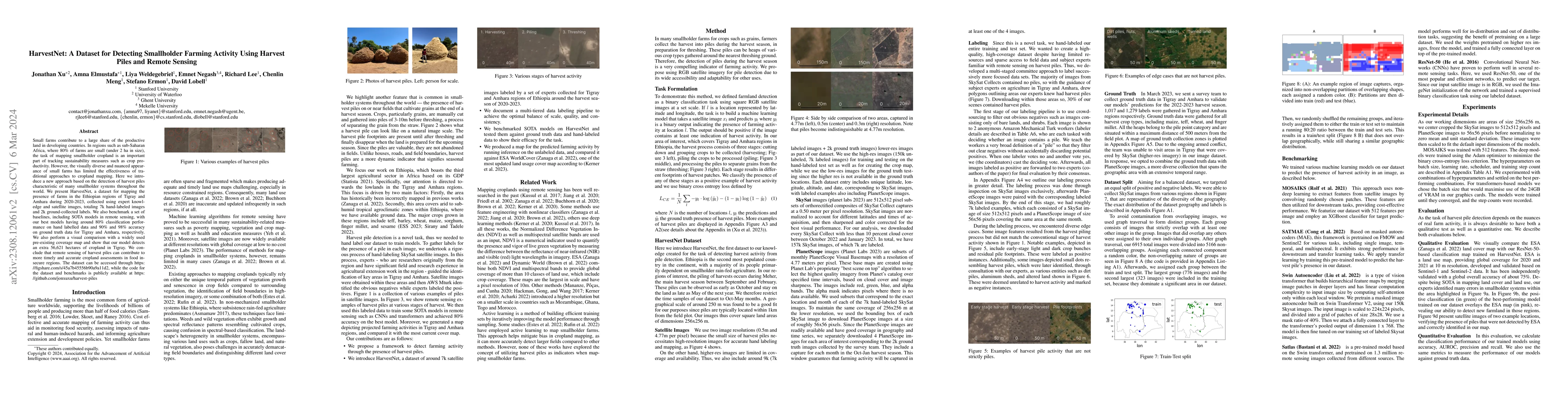
Small farms contribute to a large share of the productive land in developing countries. In regions such as sub-Saharan Africa, where 80\% of farms are small (under 2 ha in size), the task of mapping...
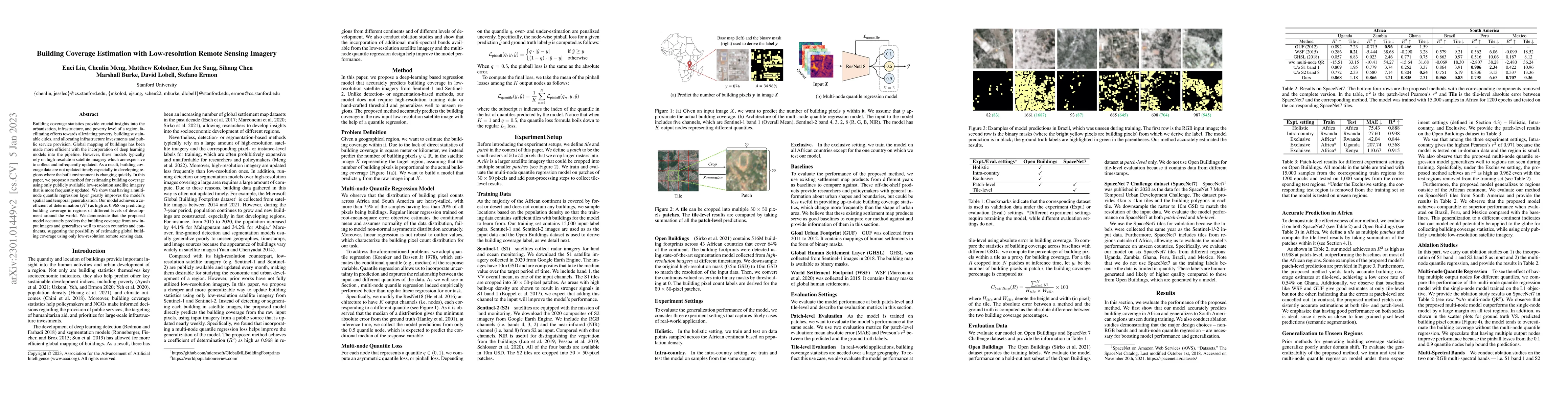
Building coverage statistics provide crucial insights into the urbanization, infrastructure, and poverty level of a region, facilitating efforts towards alleviating poverty, building sustainable cit...
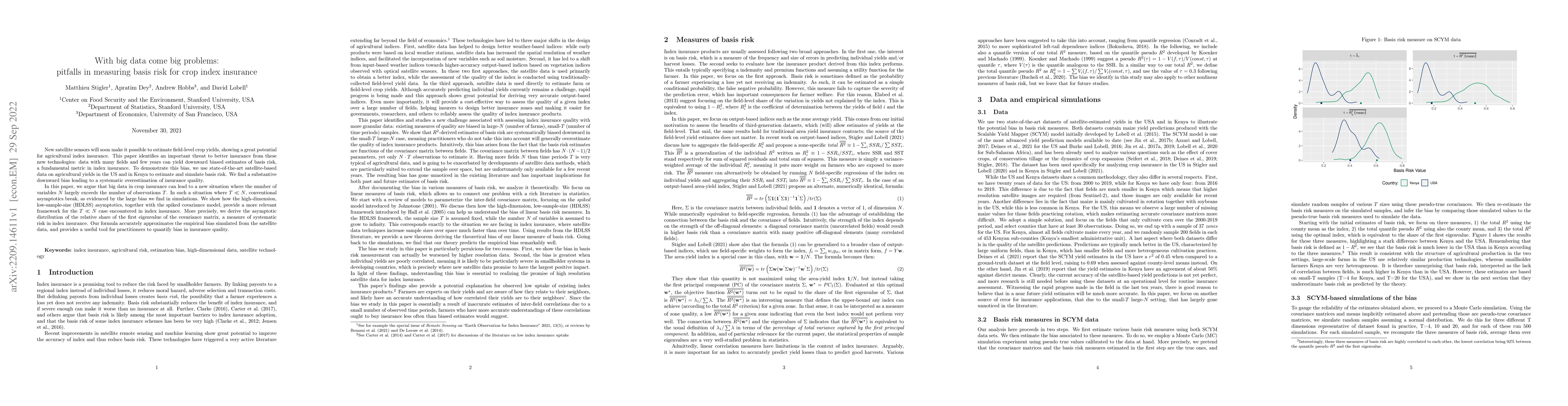
New satellite sensors will soon make it possible to estimate field-level crop yields, showing a great potential for agricultural index insurance. This paper identifies an important threat to better ...
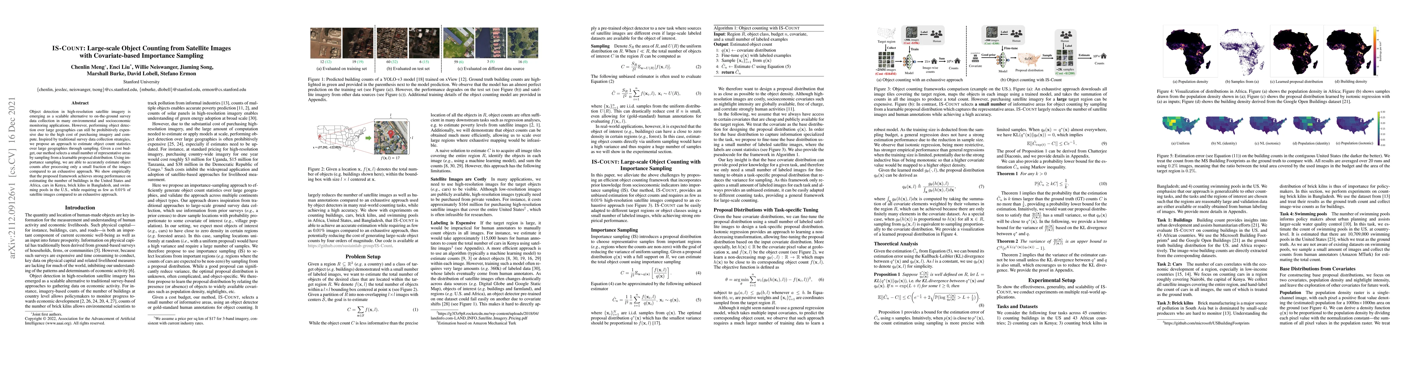
Object detection in high-resolution satellite imagery is emerging as a scalable alternative to on-the-ground survey data collection in many environmental and socioeconomic monitoring applications. H...
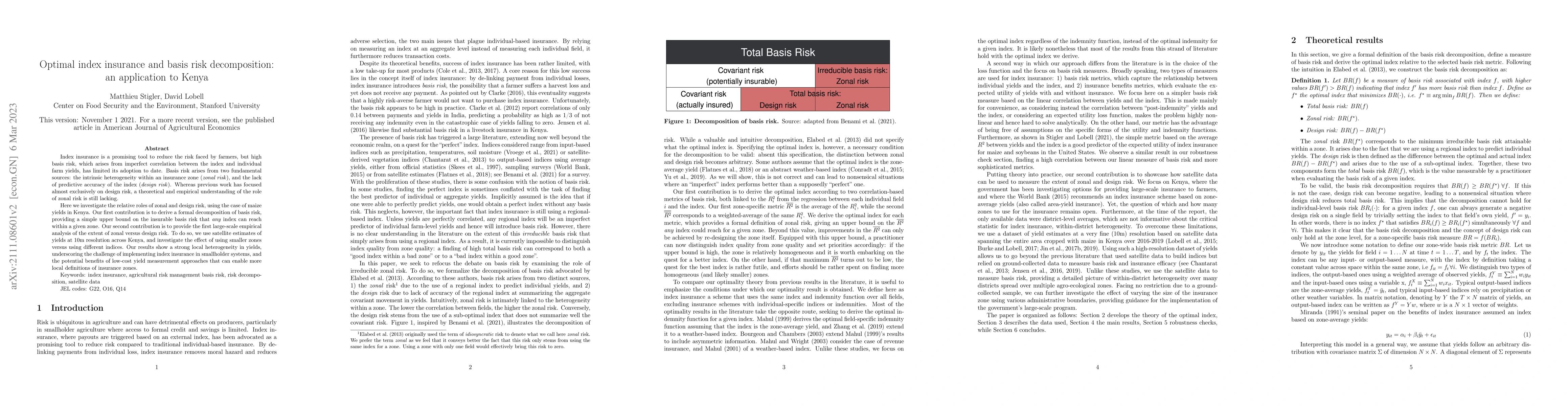
Index insurance is a promising tool to reduce the risk faced by farmers, but high basis risk, which arises from imperfect correlation between the index and individual farm yields, has limited its ad...
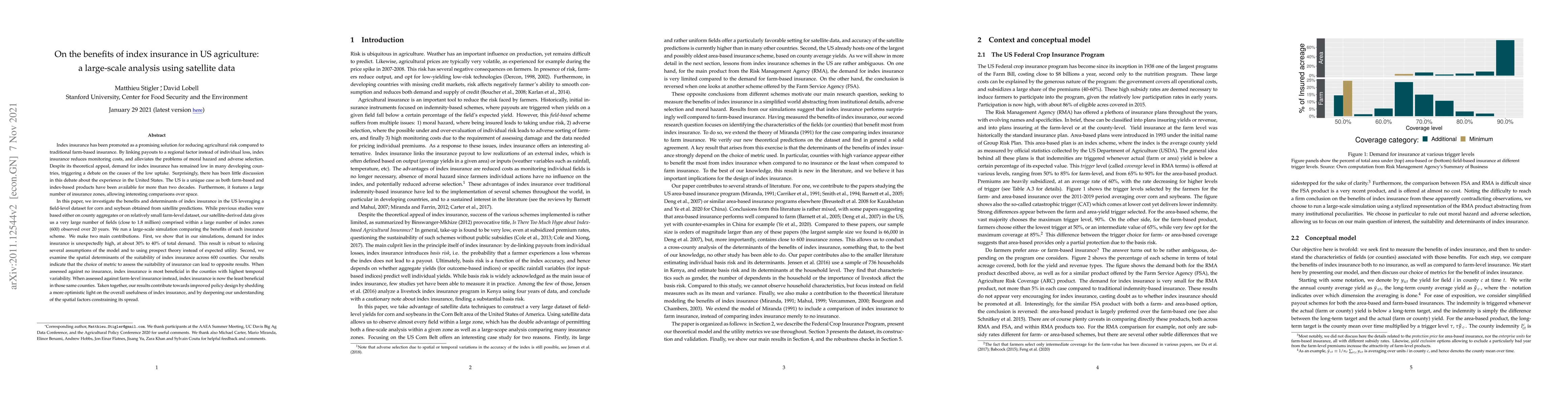
Index insurance has been promoted as a promising solution for reducing agricultural risk compared to traditional farm-based insurance. By linking payouts to a regional factor instead of individual l...
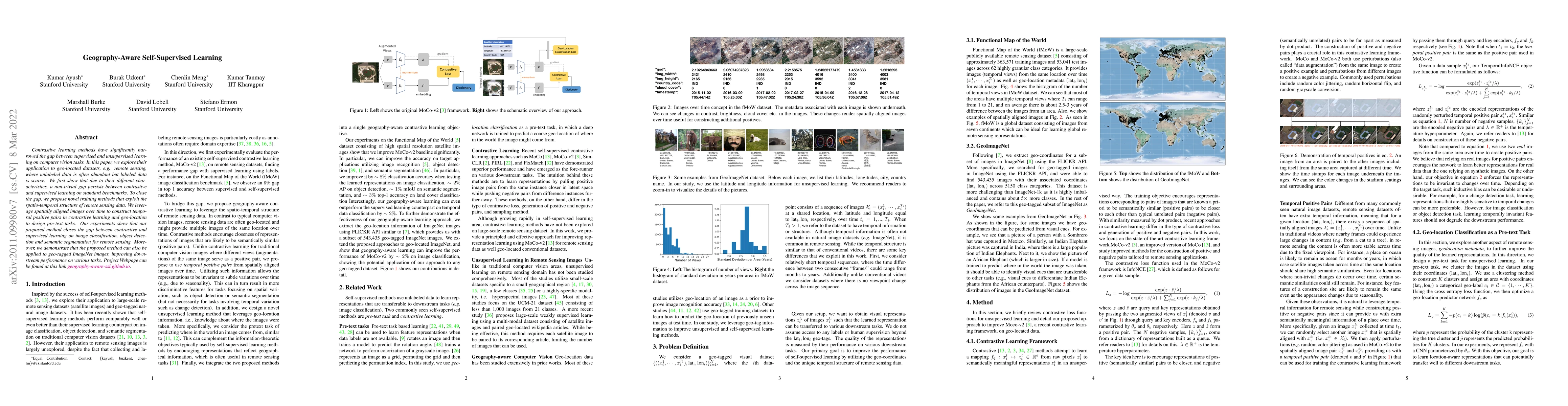
Contrastive learning methods have significantly narrowed the gap between supervised and unsupervised learning on computer vision tasks. In this paper, we explore their application to geo-located dat...
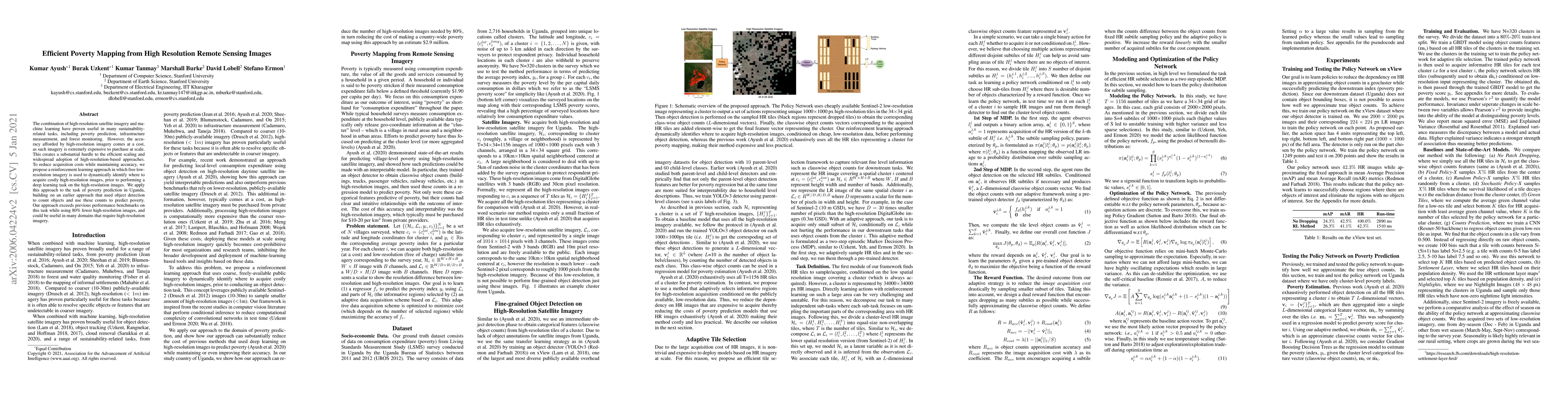
The combination of high-resolution satellite imagery and machine learning have proven useful in many sustainability-related tasks, including poverty prediction, infrastructure measurement, and fores...
The representations of the Earth's surface vary from one geographic region to another. For instance, the appearance of urban areas differs between continents, and seasonality influences the appearan...
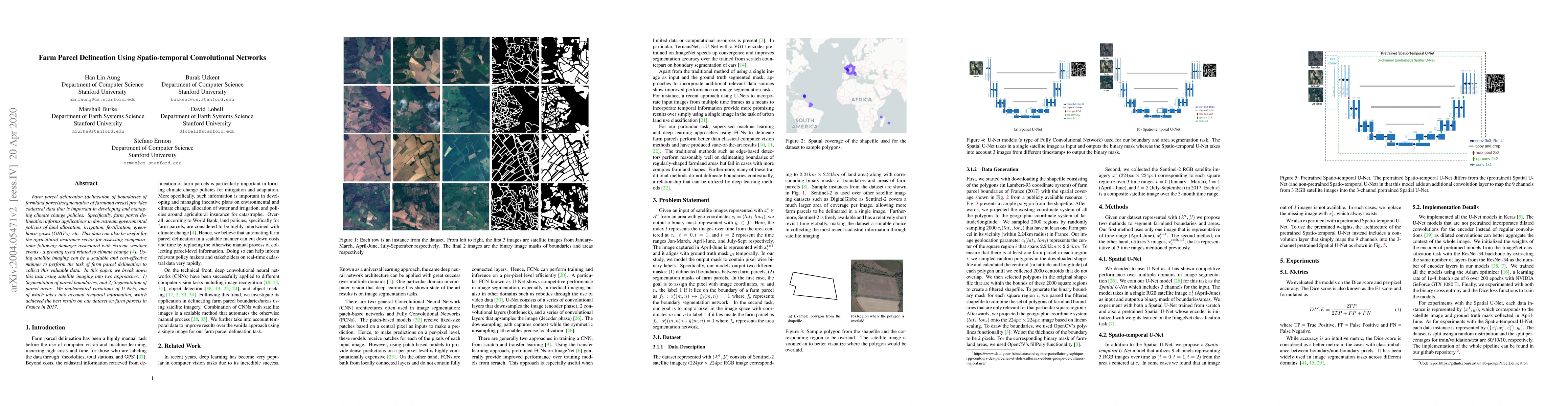
Farm parcel delineation provides cadastral data that is important in developing and managing climate change policies. Specifically, farm parcel delineation informs applications in downstream governm...
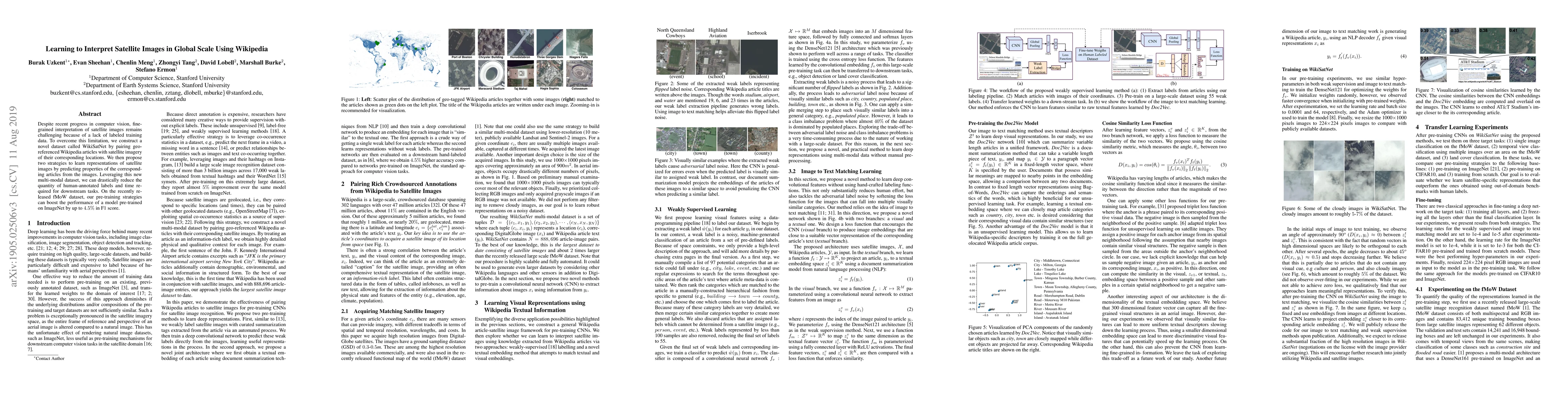
Despite recent progress in computer vision, finegrained interpretation of satellite images remains challenging because of a lack of labeled training data. To overcome this limitation, we construct a...