Academic Profile
Statistics
Similar Authors
Papers on arXiv
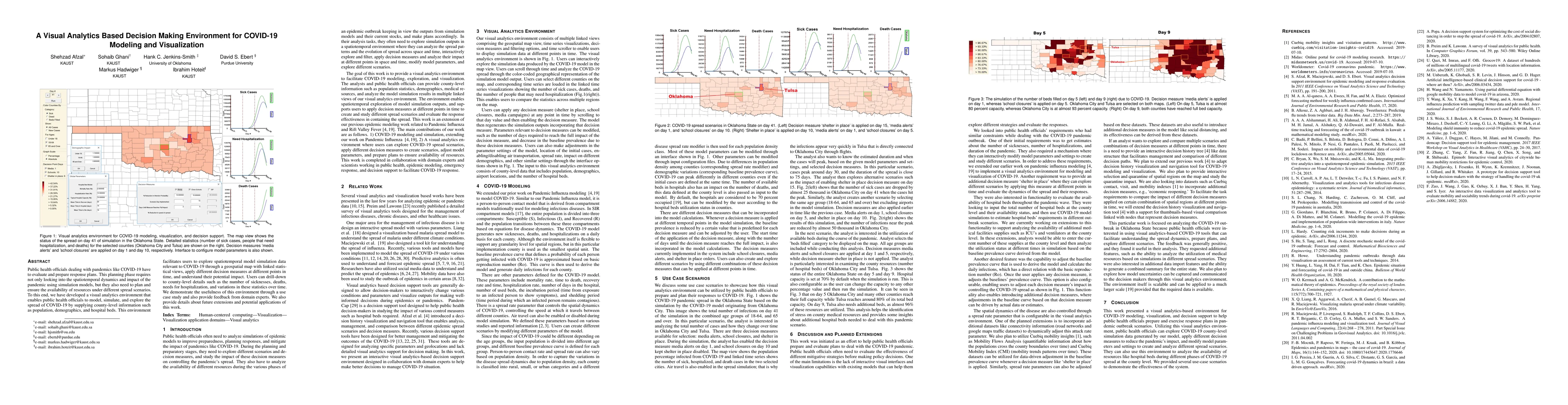
Public health officials dealing with pandemics like COVID-19 have to evaluate and prepare response plans. This planning phase requires not only looking into the spatiotemporal dynamics and impact of...
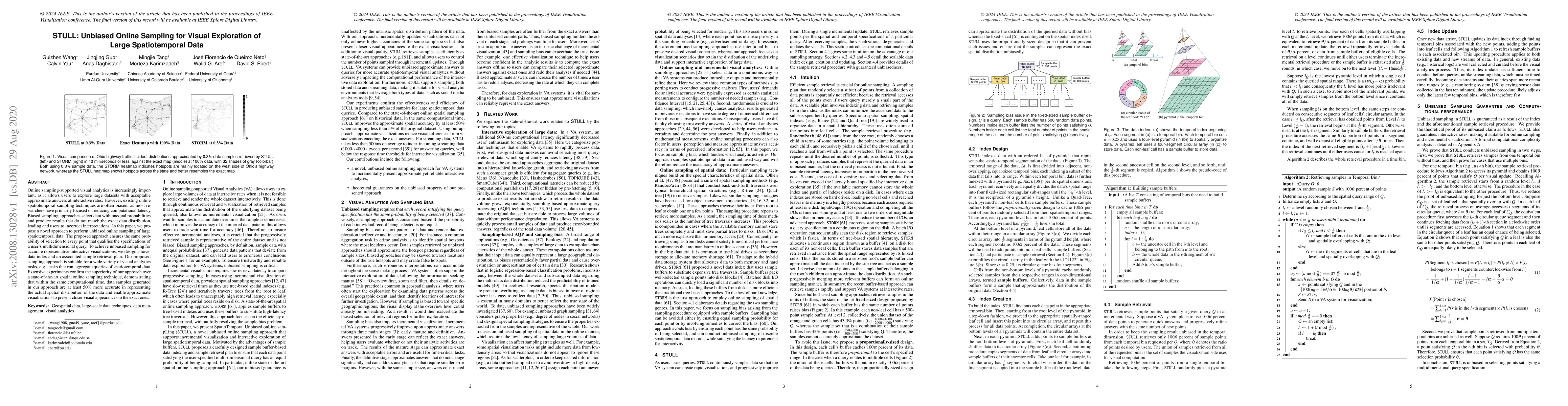
Online sampling-supported visual analytics is increasingly important, as it allows users to explore large datasets with acceptable approximate answers at interactive rates. However, existing online ...
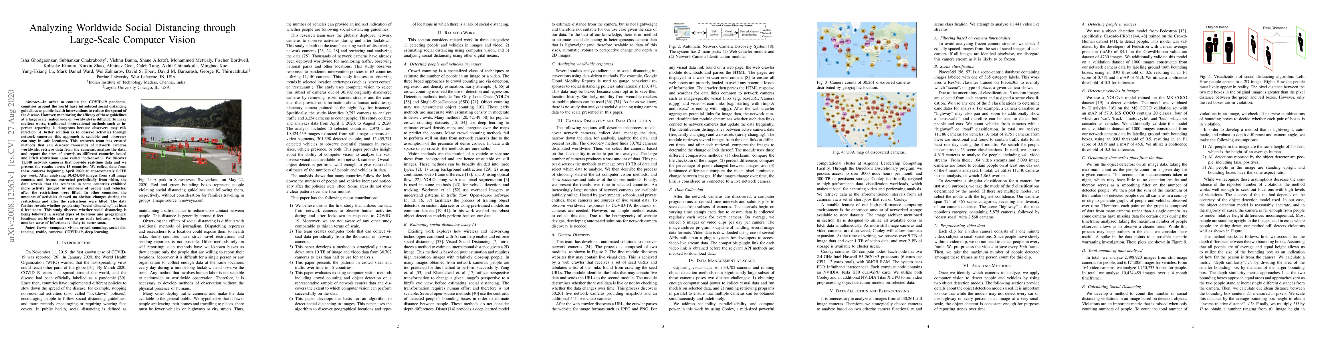
In order to contain the COVID-19 pandemic, countries around the world have introduced social distancing guidelines as public health interventions to reduce the spread of the disease. However, monito...
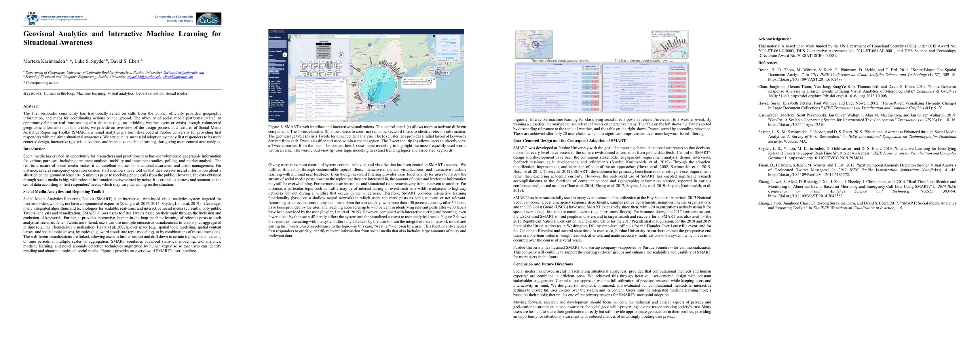
The first responder community has traditionally relied on calls from the public, officially-provided geographic information and maps for coordinating actions on the ground. The ubiquity of social me...
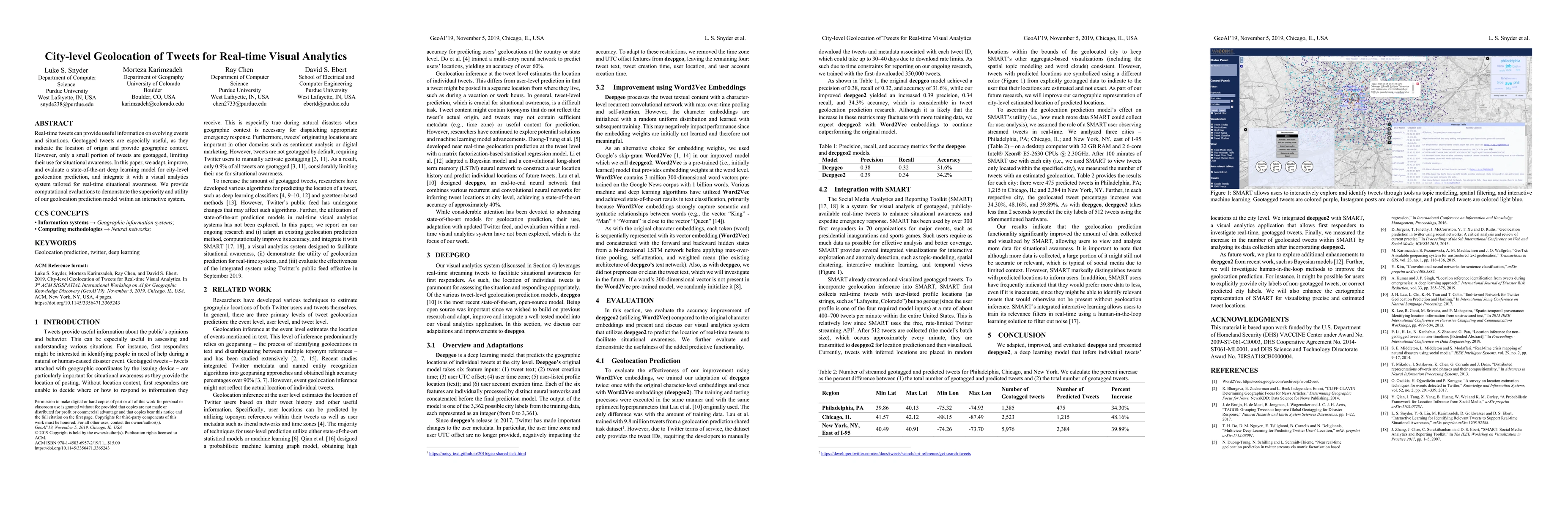
Real-time tweets can provide useful information on evolving events and situations. Geotagged tweets are especially useful, as they indicate the location of origin and provide geographic context. How...
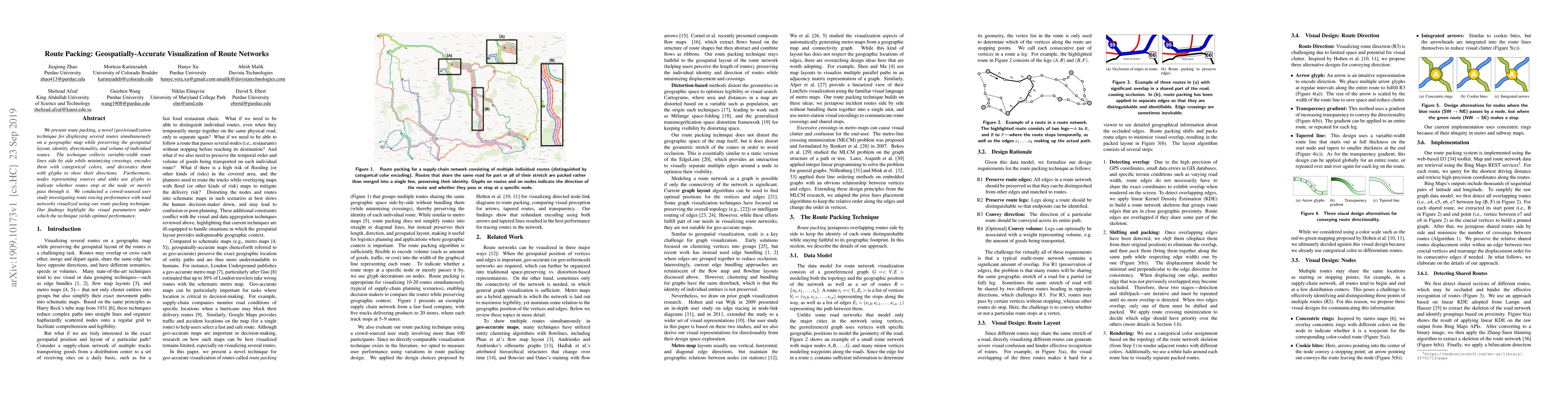
We present route packing, a novel (geo)visualization technique for displaying several routes simultaneously on a geographic map while preserving the geospatial layout, identity, directionality, and ...
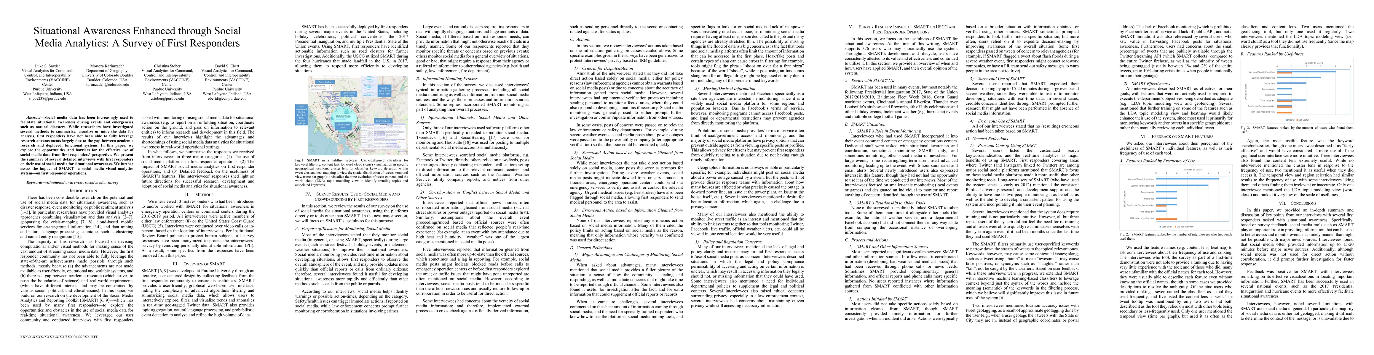
Social media data has been increasingly used to facilitate situational awareness during events and emergencies such as natural disasters. While researchers have investigated several methods to summa...
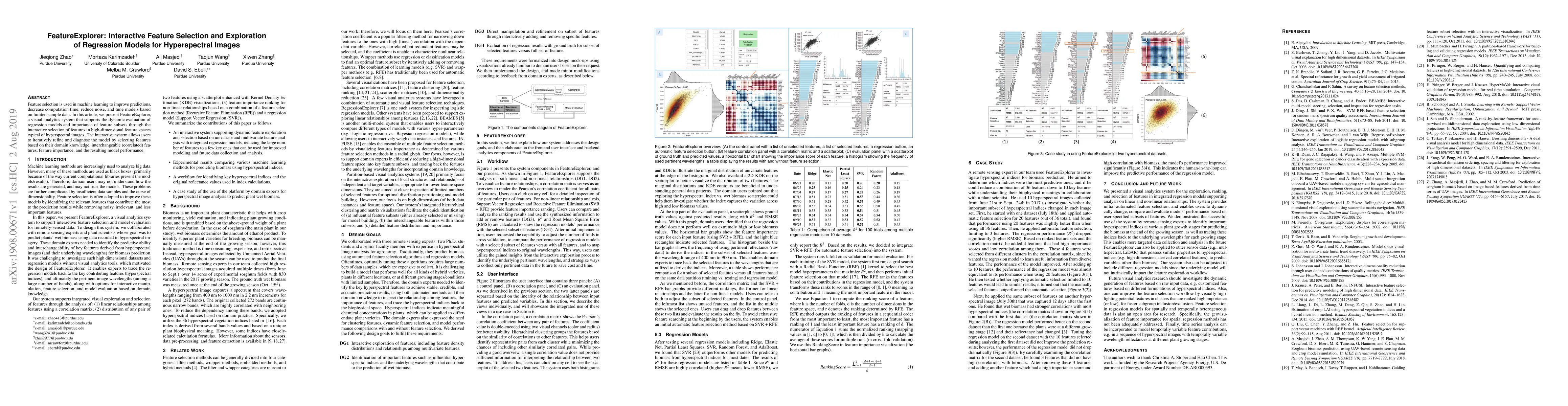
Feature selection is used in machine learning to improve predictions, decrease computation time, reduce noise, and tune models based on limited sample data. In this article, we present FeatureExplor...
Social media platforms such as Twitter are filled with social spambots. Detecting these malicious accounts is essential, yet challenging, as they continually evolve and evade traditional detection t...