Academic Profile
Statistics
Similar Authors
Papers on arXiv
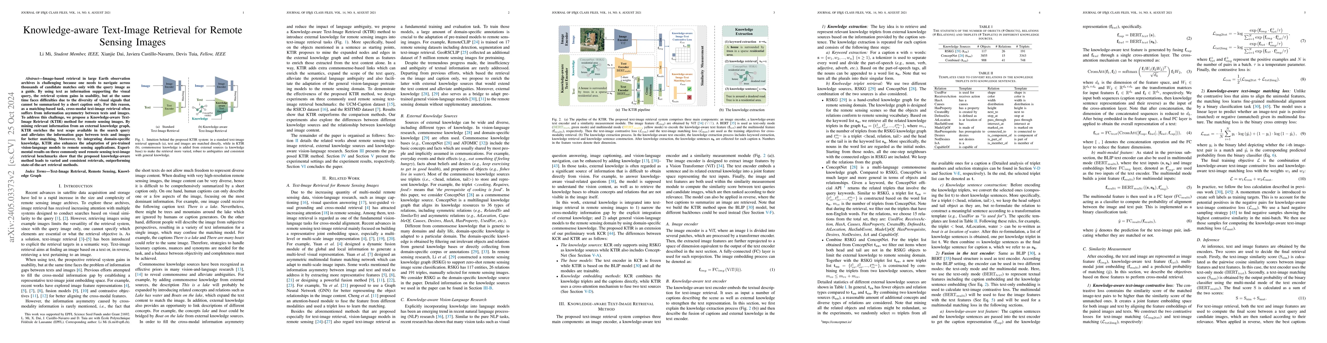
Image-based retrieval in large Earth observation archives is challenging because one needs to navigate across thousands of candidate matches only with the query image as a guide. By using text as in...
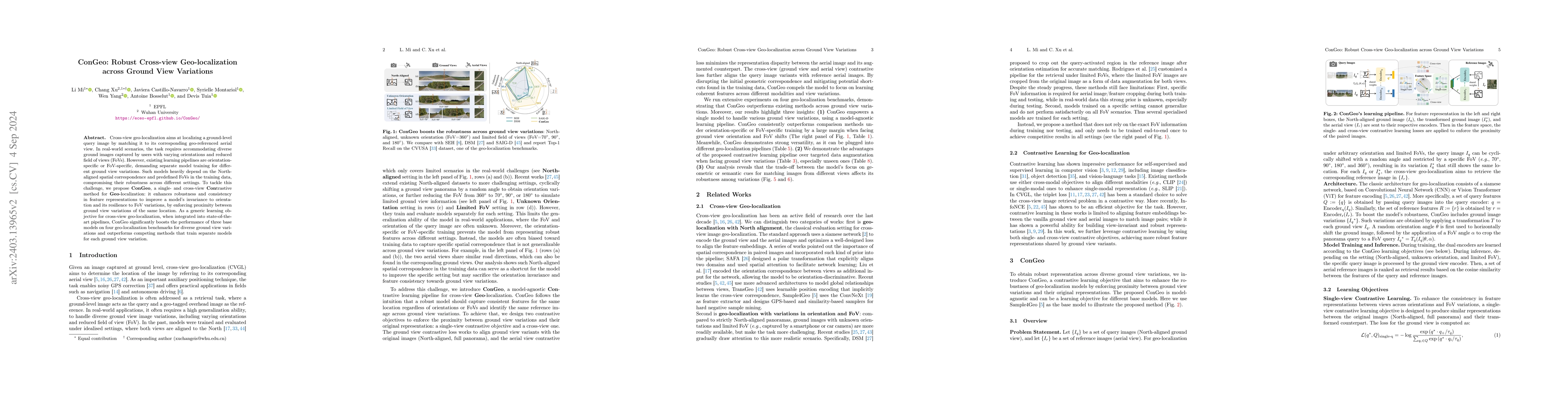
Cross-view geo-localization aims at localizing a ground-level query image by matching it to its corresponding geo-referenced aerial view. In real-world scenarios, the task requires accommodating div...
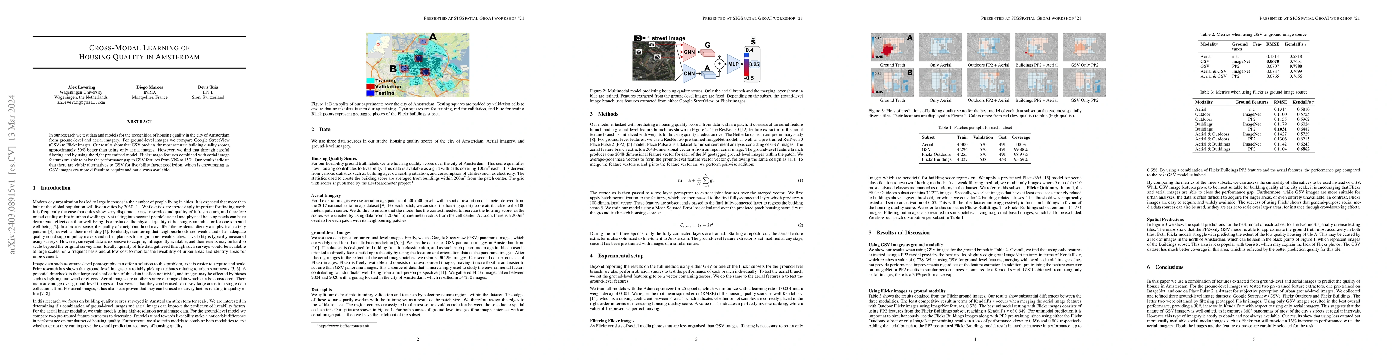
In our research we test data and models for the recognition of housing quality in the city of Amsterdam from ground-level and aerial imagery. For ground-level images we compare Google StreetView (GS...
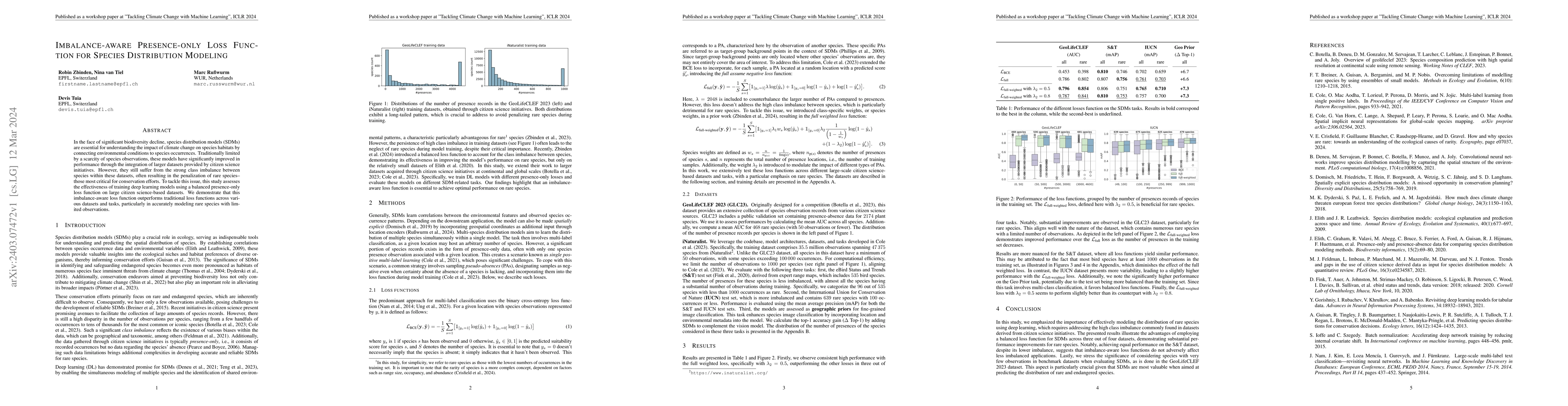
In the face of significant biodiversity decline, species distribution models (SDMs) are essential for understanding the impact of climate change on species habitats by connecting environmental condi...
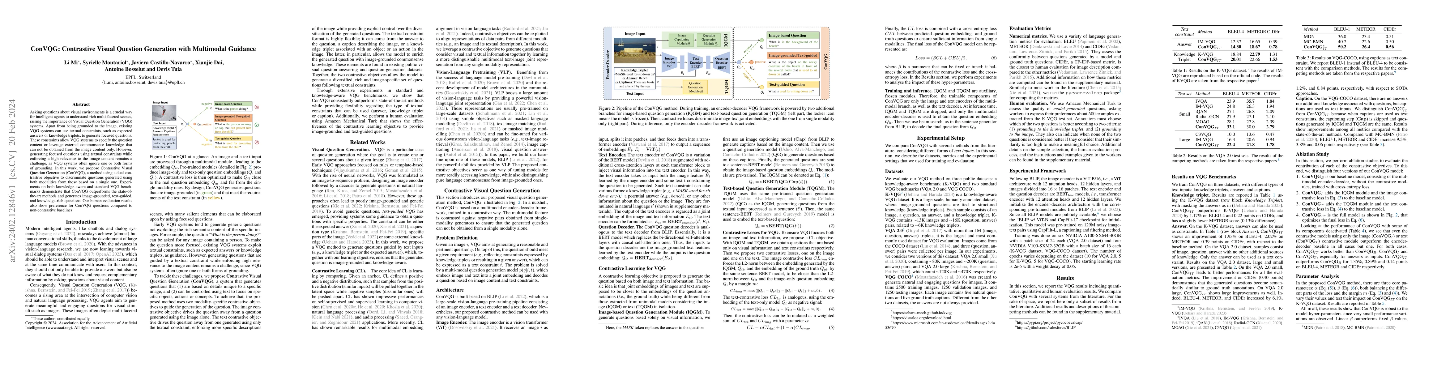
Asking questions about visual environments is a crucial way for intelligent agents to understand rich multi-faceted scenes, raising the importance of Visual Question Generation (VQG) systems. Apart ...
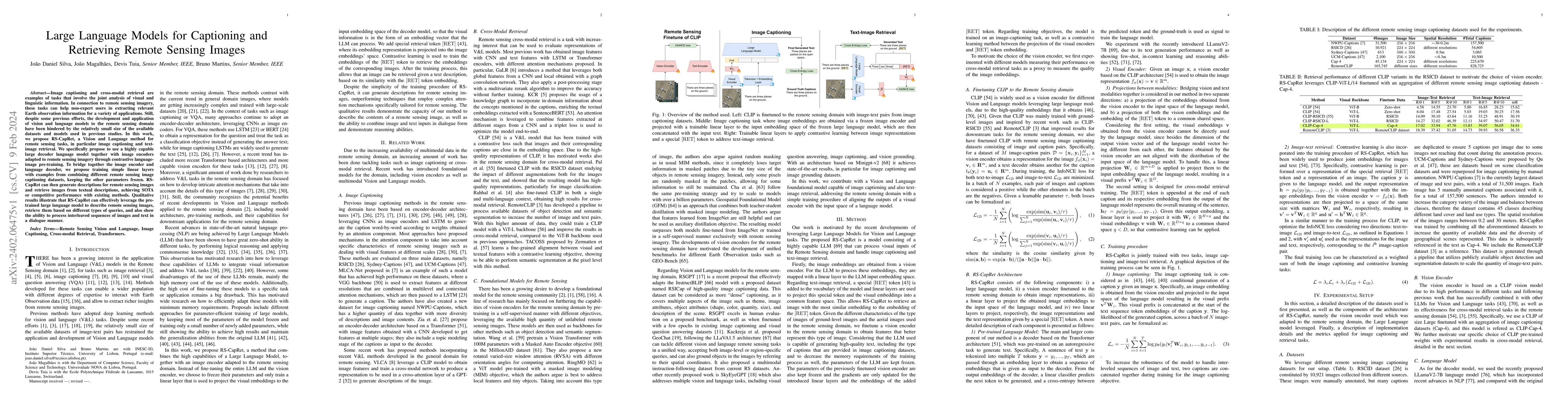
Image captioning and cross-modal retrieval are examples of tasks that involve the joint analysis of visual and linguistic information. In connection to remote sensing imagery, these tasks can help n...
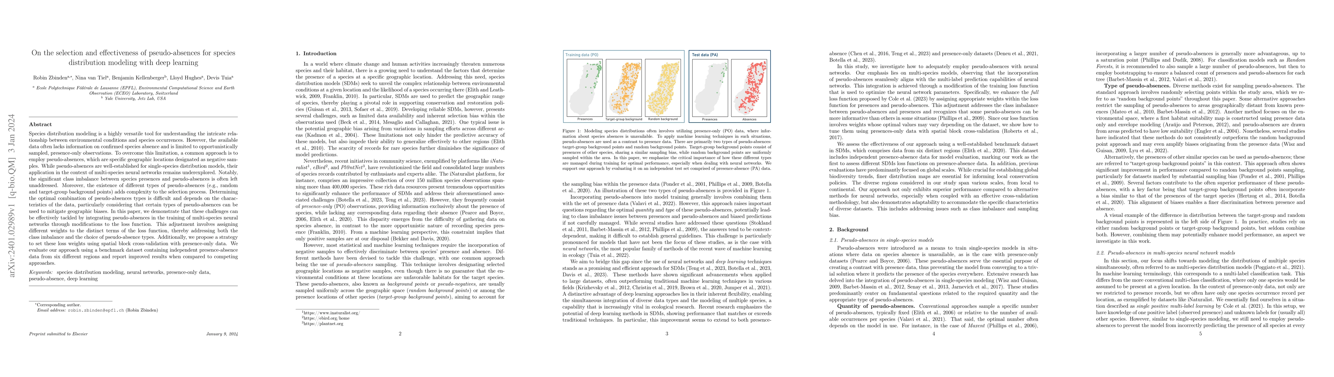
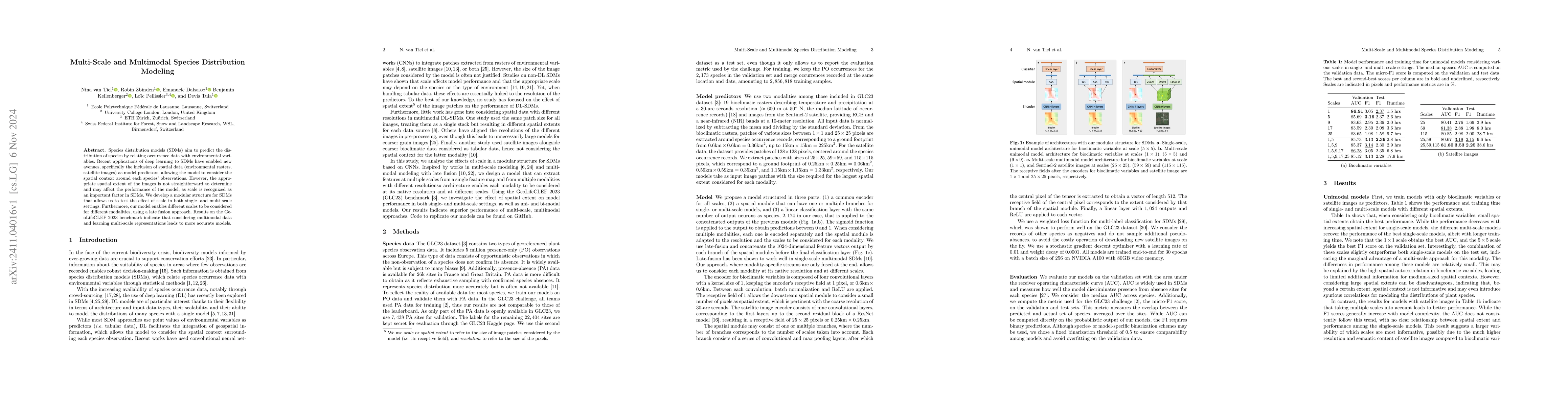
Species distribution modeling is a highly versatile tool for understanding the intricate relationship between environmental conditions and species occurrences. However, the available data often lack...
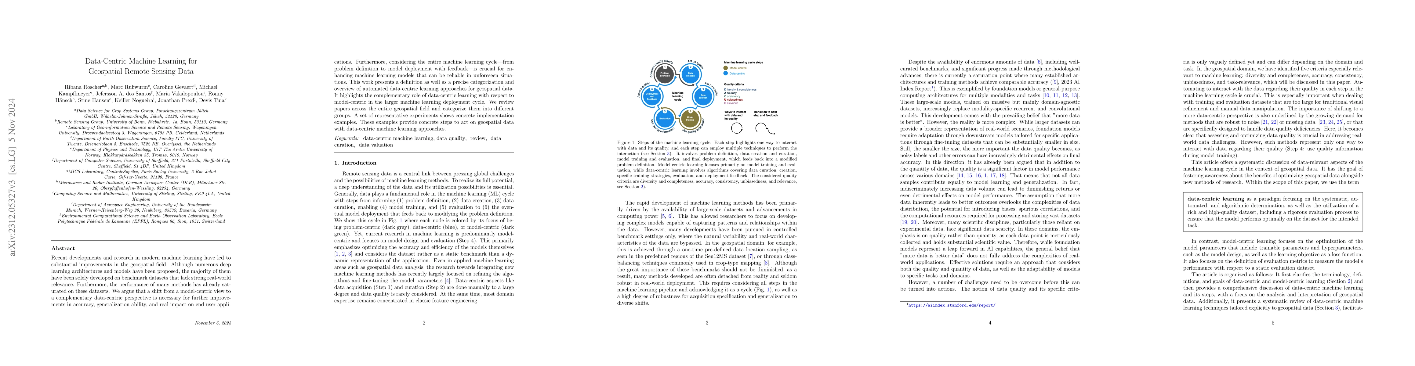
Recent developments and research in modern machine learning have led to substantial improvements in the geospatial field. Although numerous deep learning architectures and models have been proposed,...
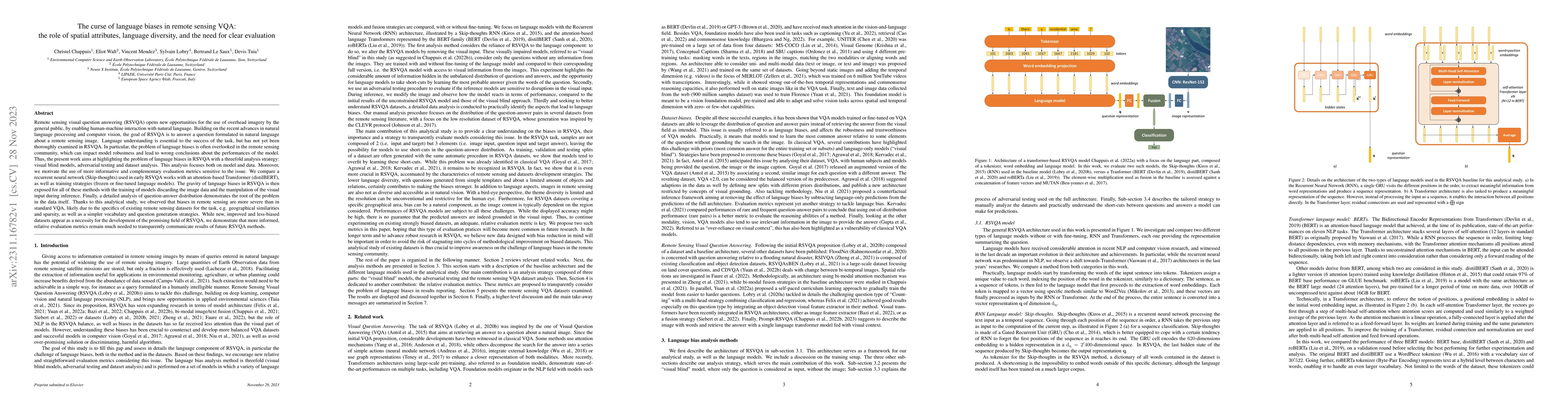
Remote sensing visual question answering (RSVQA) opens new opportunities for the use of overhead imagery by the general public, by enabling human-machine interaction with natural language. Building ...
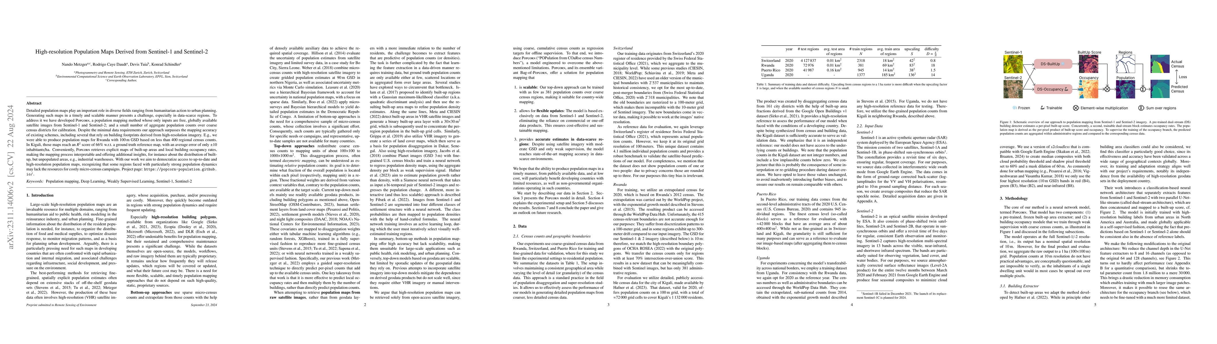
Detailed population maps play an important role in diverse fields ranging from humanitarian action to urban planning. Generating such maps in a timely and scalable manner presents a challenge, espec...
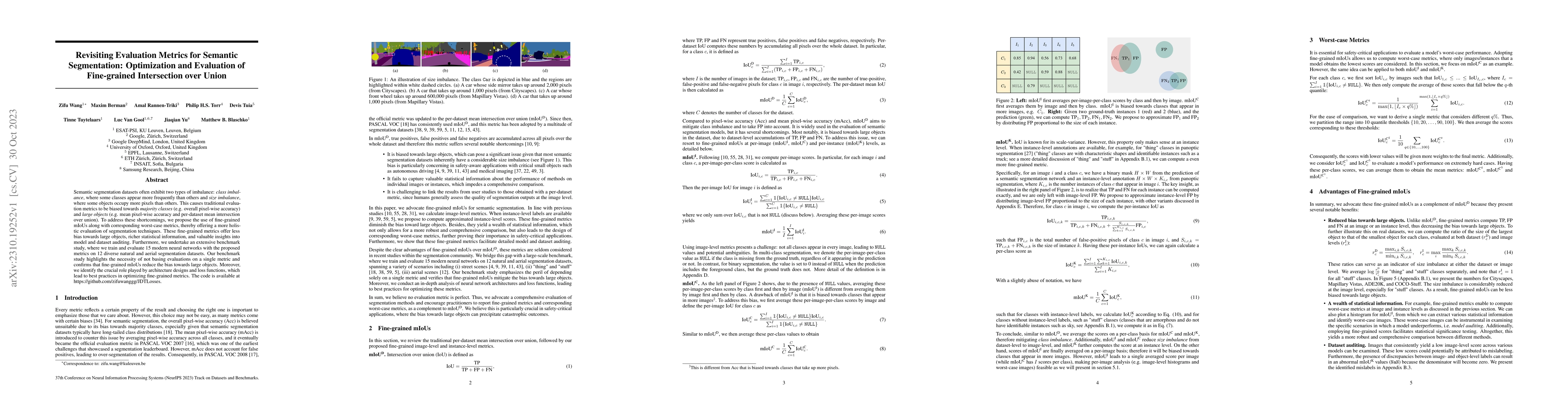
Semantic segmentation datasets often exhibit two types of imbalance: \textit{class imbalance}, where some classes appear more frequently than others and \textit{size imbalance}, where some objects o...
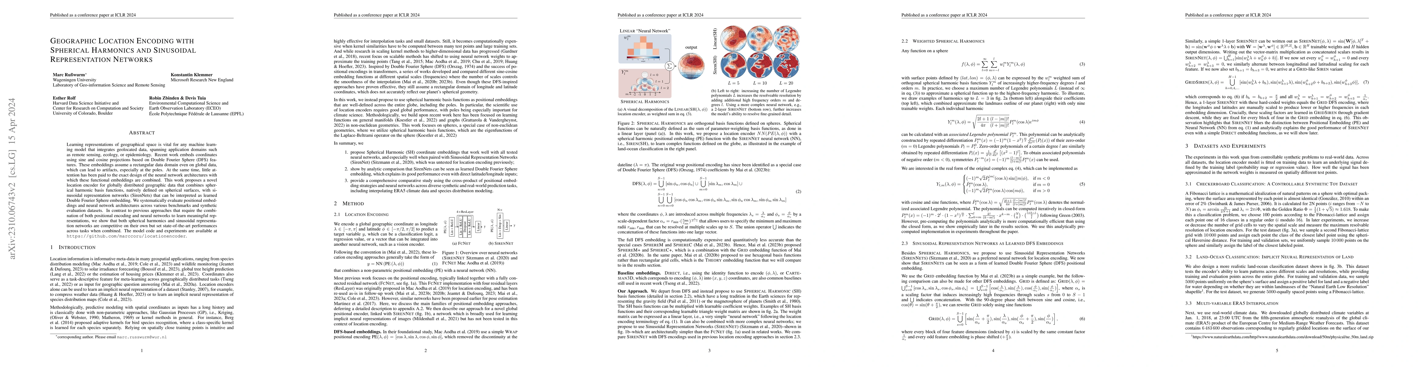
Learning representations of geographical space is vital for any machine learning model that integrates geolocated data, spanning application domains such as remote sensing, ecology, or epidemiology....
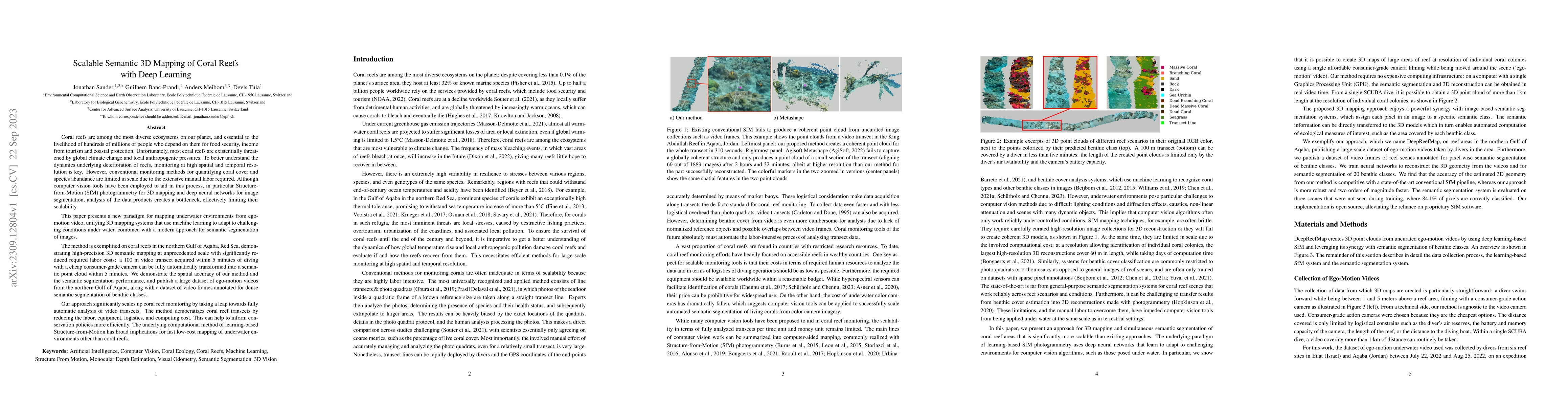
Coral reefs are among the most diverse ecosystems on our planet, and are depended on by hundreds of millions of people. Unfortunately, most coral reefs are existentially threatened by global climate...
Monitoring surface cracks in infrastructure is crucial for structural health monitoring. Automatic visual inspection offers an effective solution, especially in hard-to-reach areas. Machine learning...
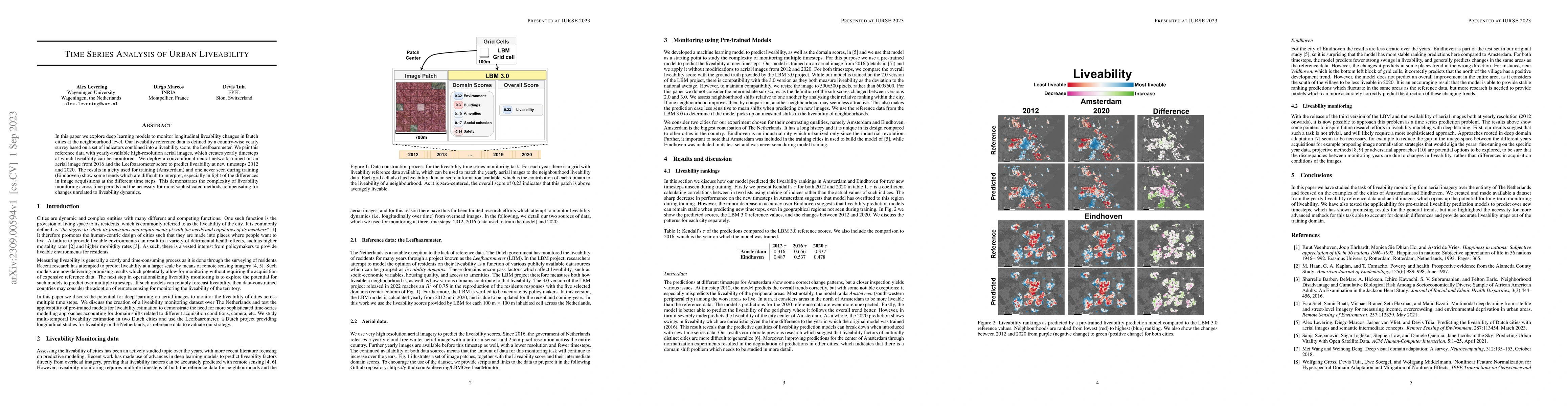
In this paper we explore deep learning models to monitor longitudinal liveability changes in Dutch cities at the neighbourhood level. Our liveability reference data is defined by a country-wise year...
Detecting and quantifying marine pollution and macro-plastics is an increasingly pressing ecological issue that directly impacts ecology and human health. Efforts to quantify marine pollution are of...
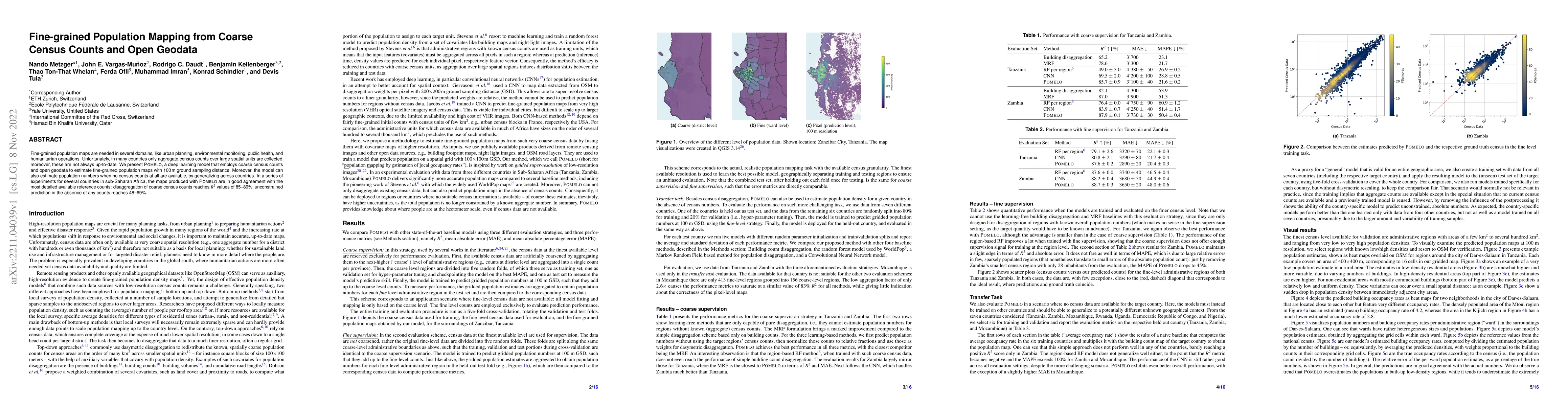
Fine-grained population maps are needed in several domains, like urban planning, environmental monitoring, public health, and humanitarian operations. Unfortunately, in many countries only aggregate...
As unconventional sources of geo-information, massive imagery and text messages from open platforms and social media form a temporally quasi-seamless, spatially multi-perspective stream, but with un...
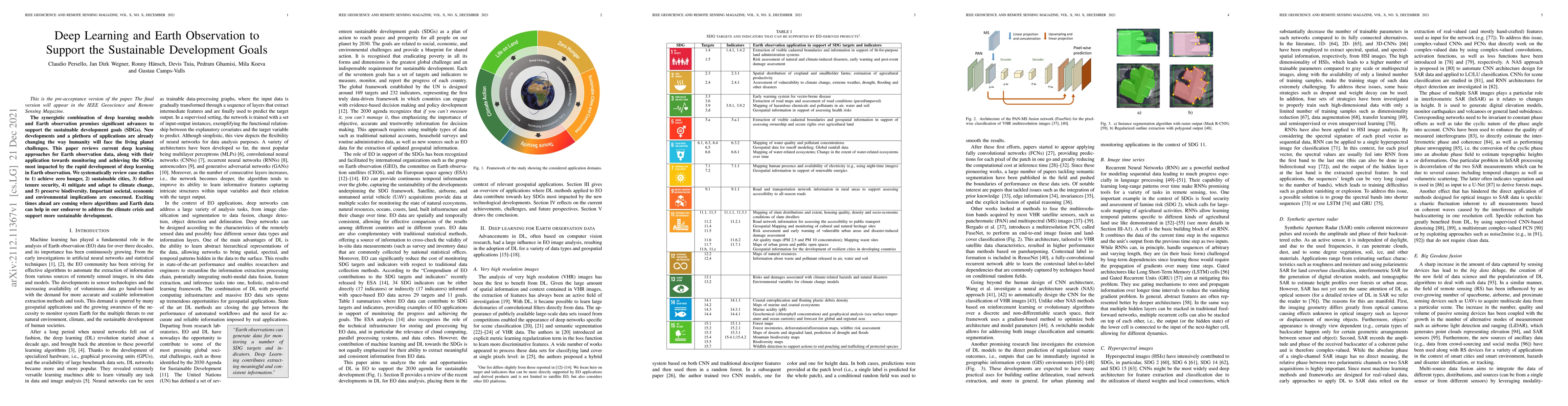
The synergistic combination of deep learning models and Earth observation promises significant advances to support the sustainable development goals (SDGs). New developments and a plethora of applic...
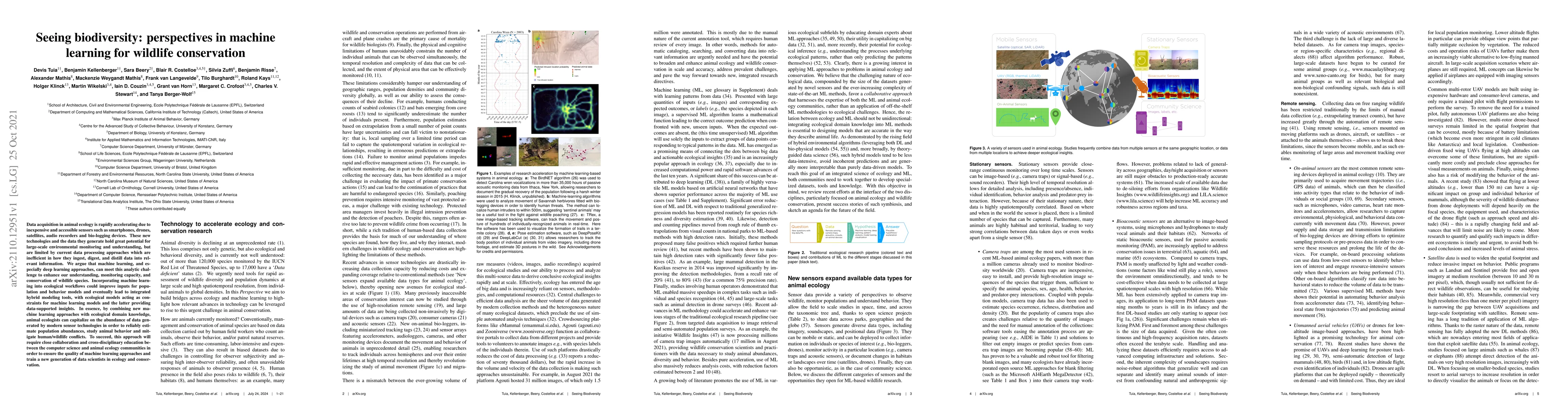
Data acquisition in animal ecology is rapidly accelerating due to inexpensive and accessible sensors such as smartphones, drones, satellites, audio recorders and bio-logging devices. These new techn...
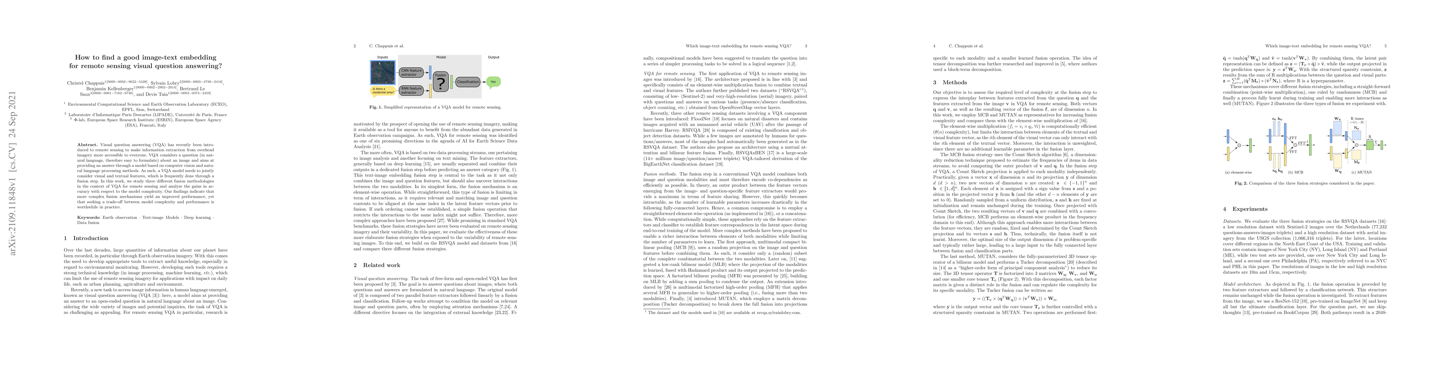
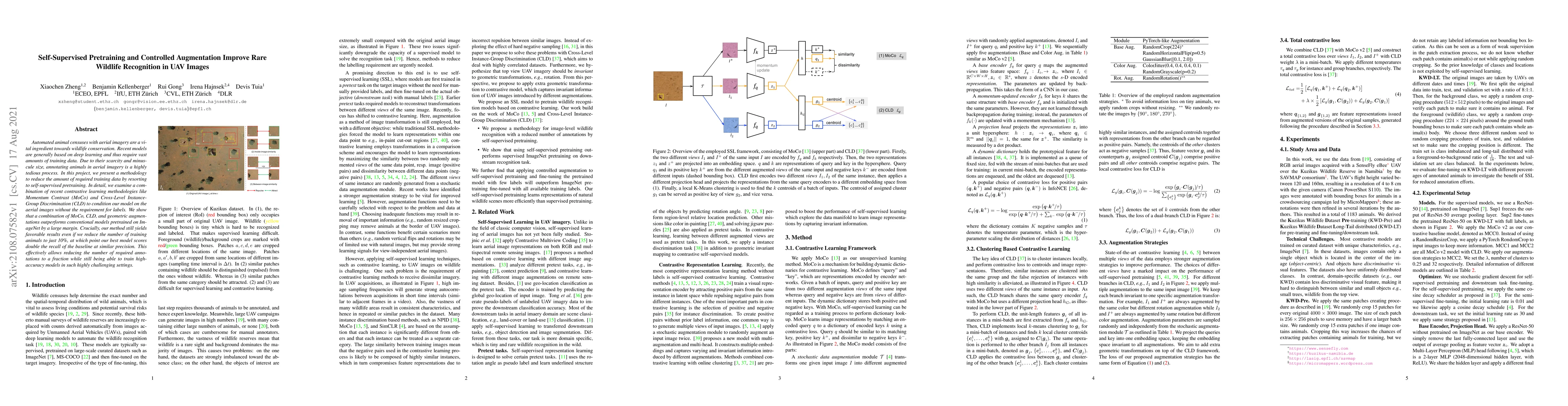
Visual question answering (VQA) has recently been introduced to remote sensing to make information extraction from overhead imagery more accessible to everyone. VQA considers a question (in natural ...
Automated animal censuses with aerial imagery are a vital ingredient towards wildlife conservation. Recent models are generally based on deep learning and thus require vast amounts of training data....
Humanitarian actions require accurate information to efficiently delegate support operations. Such information can be maps of building footprints, building functions, and population densities. While...
We introduce a method for manifold alignment of different modalities (or domains) of remote sensing images. The problem is recurrent when a set of multitemporal, multisource, multisensor and multian...
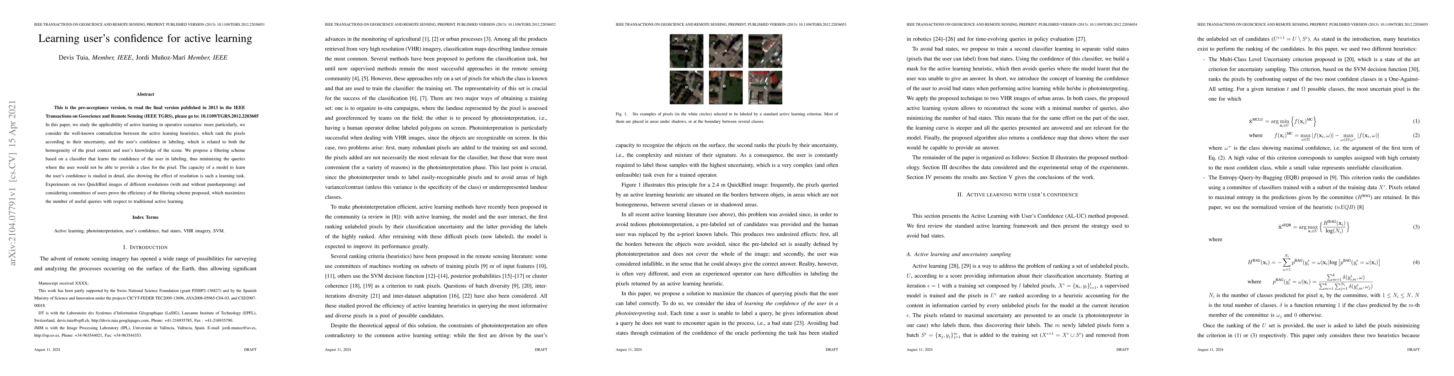
In this paper, we study the applicability of active learning in operative scenarios: more particularly, we consider the well-known contradiction between the active learning heuristics, which rank th...
Defining an efficient training set is one of the most delicate phases for the success of remote sensing image classification routines. The complexity of the problem, the limited temporal and financi...
The success of supervised classification of remotely sensed images acquired over large geographical areas or at short time intervals strongly depends on the representativity of the samples used to t...
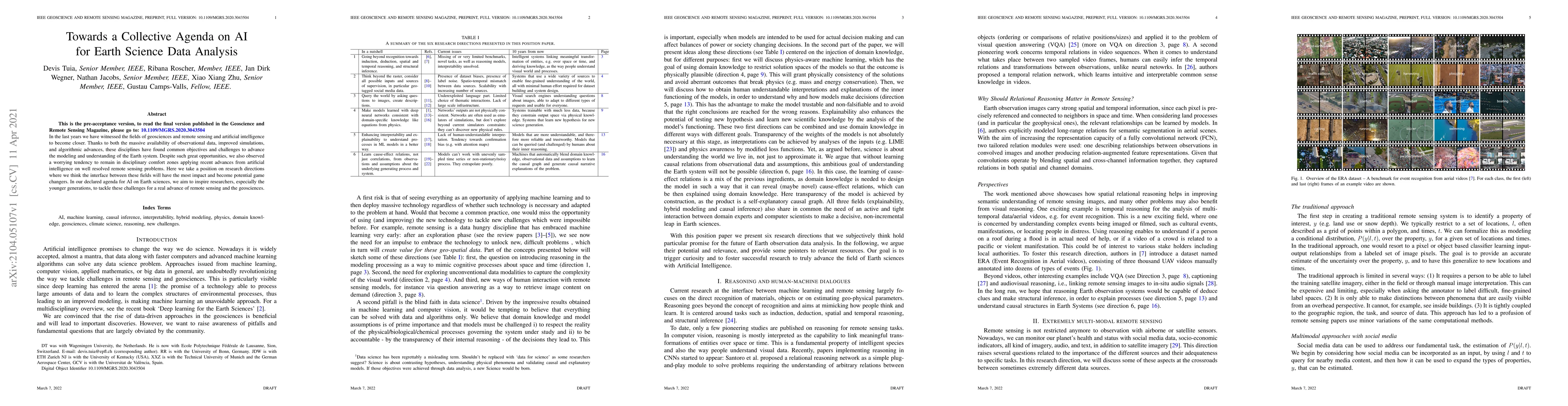
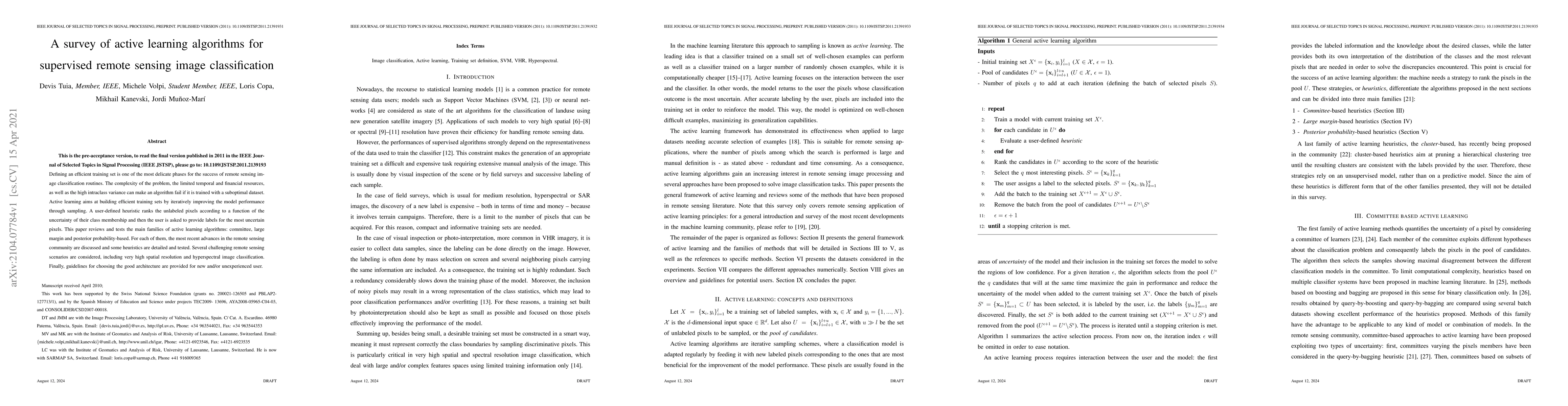
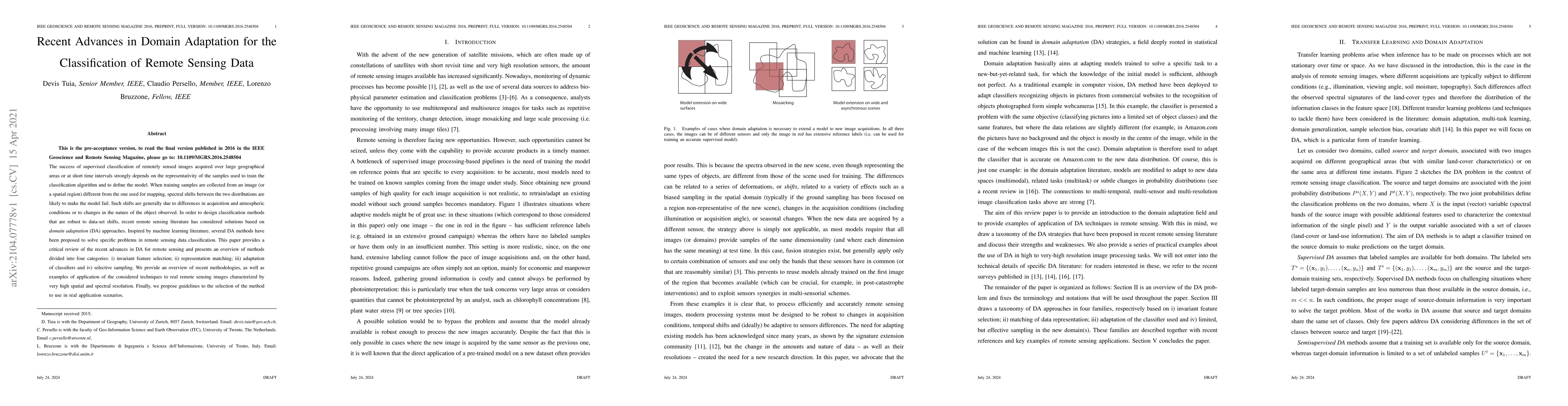
In the last years we have witnessed the fields of geosciences and remote sensing and artificial intelligence to become closer. Thanks to both the massive availability of observational data, improved...
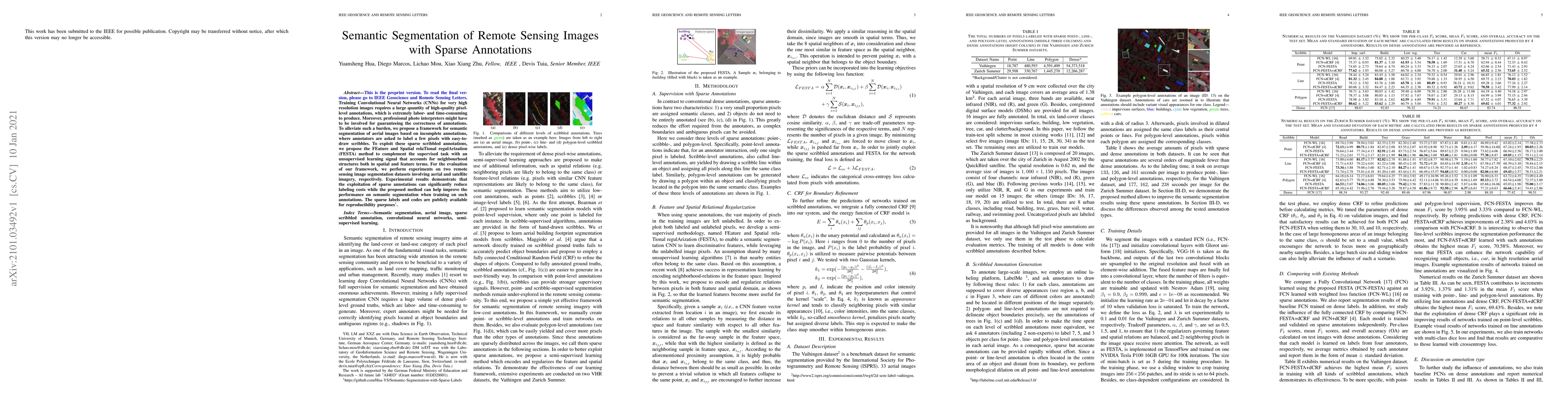
Training Convolutional Neural Networks (CNNs) for very high resolution images requires a large quantity of high-quality pixel-level annotations, which is extremely labor- and time-consuming to produ...
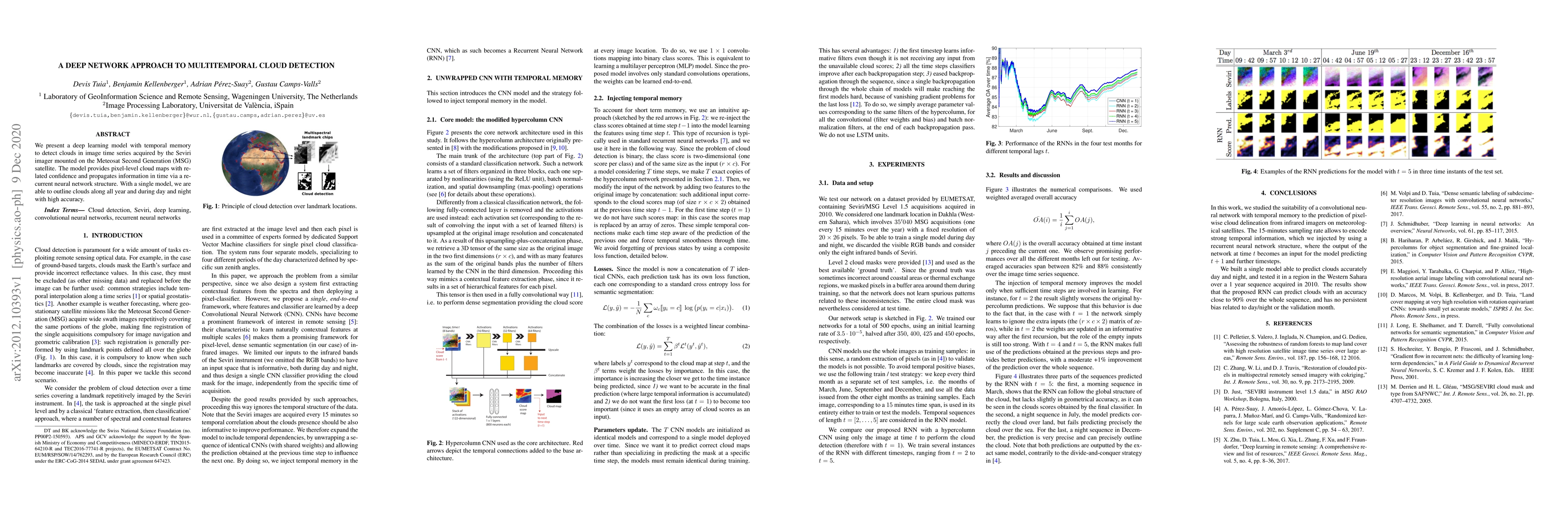
We present a deep learning model with temporal memory to detect clouds in image time series acquired by the Seviri imager mounted on the Meteosat Second Generation (MSG) satellite. The model provide...
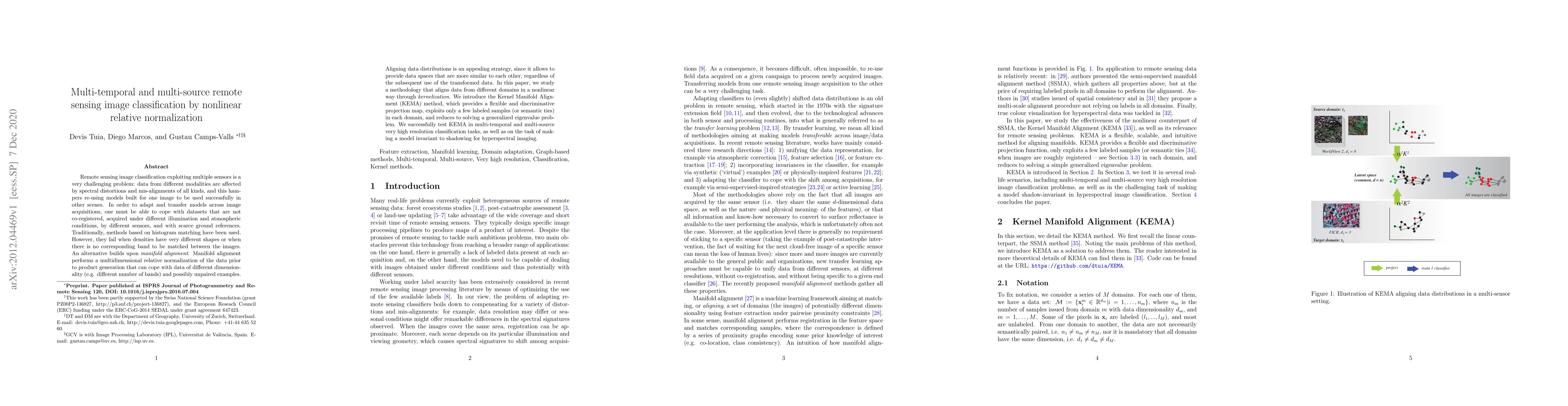
Remote sensing image classification exploiting multiple sensors is a very challenging problem: data from different modalities are affected by spectral distortions and mis-alignments of all kinds, an...

Deep learning (DL) has proven to be a suitable approach for despeckling synthetic aperture radar (SAR) images. So far, most DL models are trained to reduce speckle that follows a particular distribu...
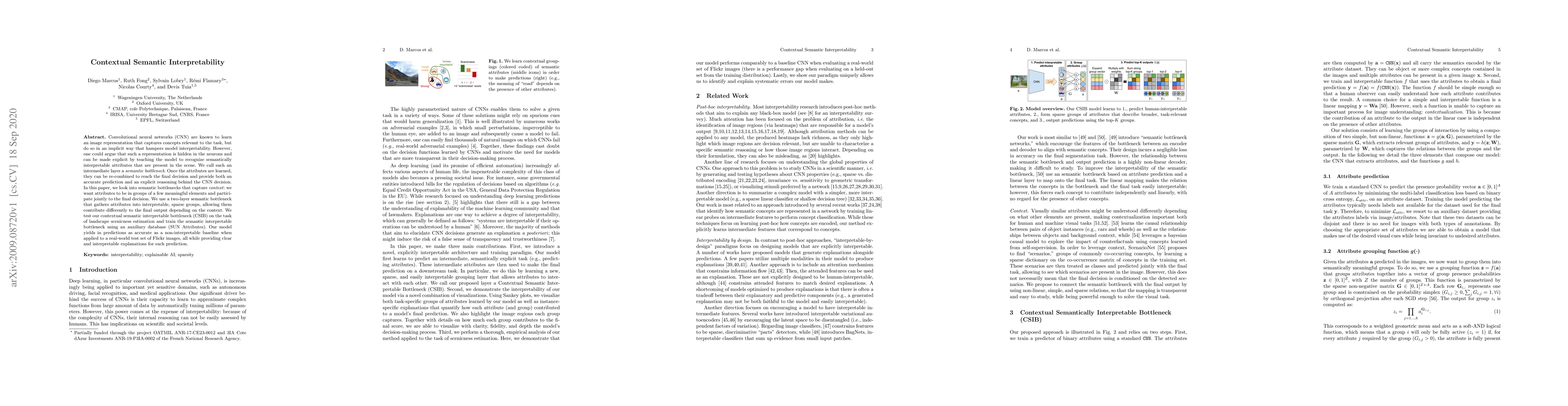
Convolutional neural networks (CNN) are known to learn an image representation that captures concepts relevant to the task, but do so in an implicit way that hampers model interpretability. However,...
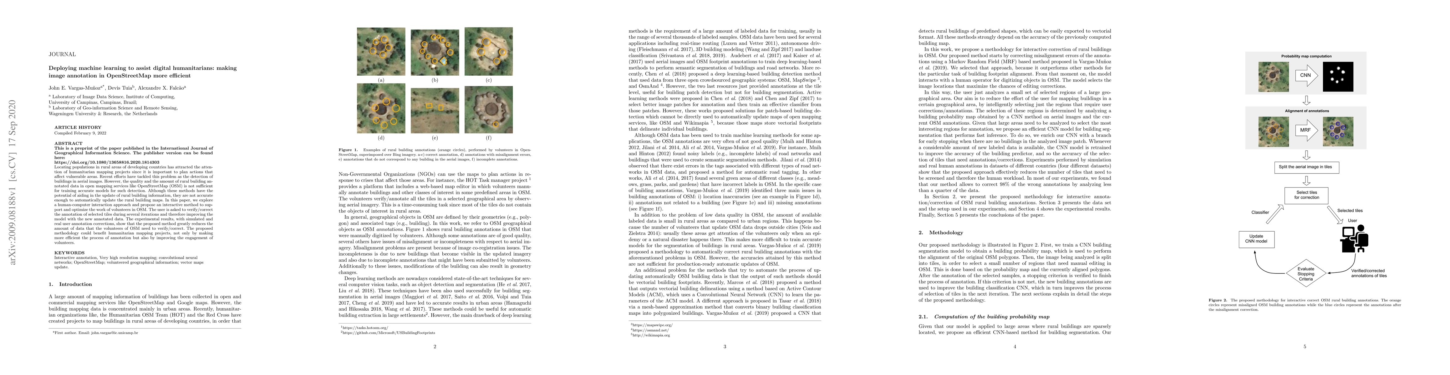
Locating populations in rural areas of developing countries has attracted the attention of humanitarian mapping projects since it is important to plan actions that affect vulnerable areas. Recent ef...
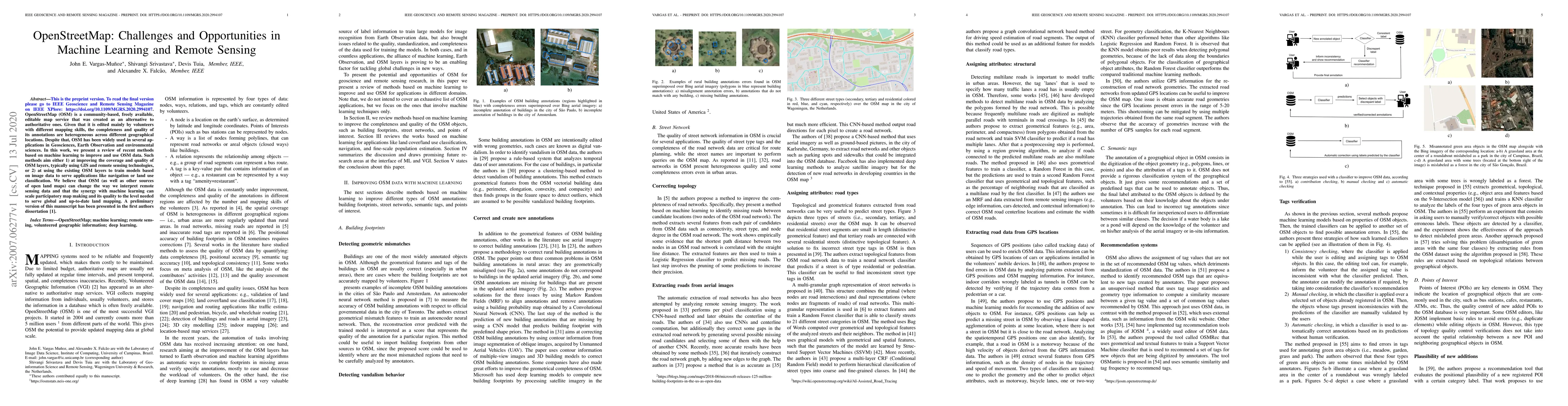
OpenStreetMap (OSM) is a community-based, freely available, editable map service that was created as an alternative to authoritative ones. Given that it is edited mainly by volunteers with different...
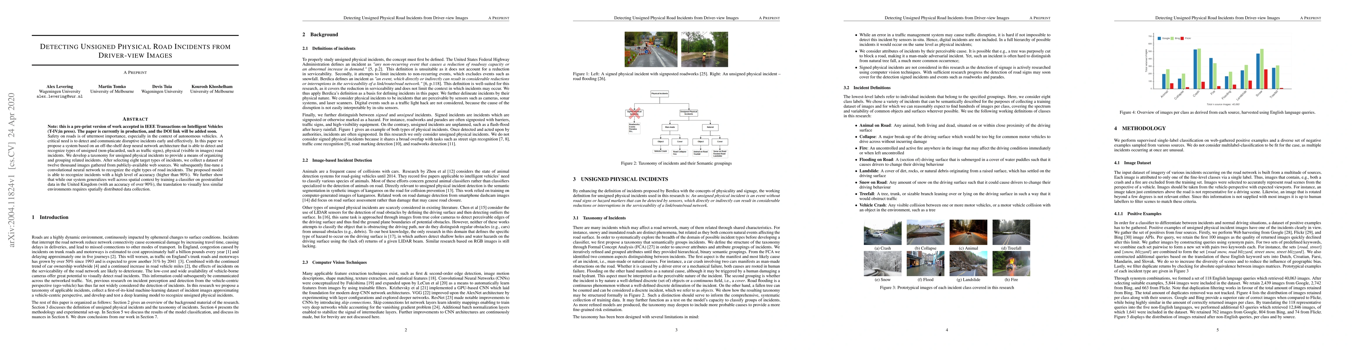
Safety on roads is of uttermost importance, especially in the context of autonomous vehicles. A critical need is to detect and communicate disruptive incidents early and effectively. In this paper w...
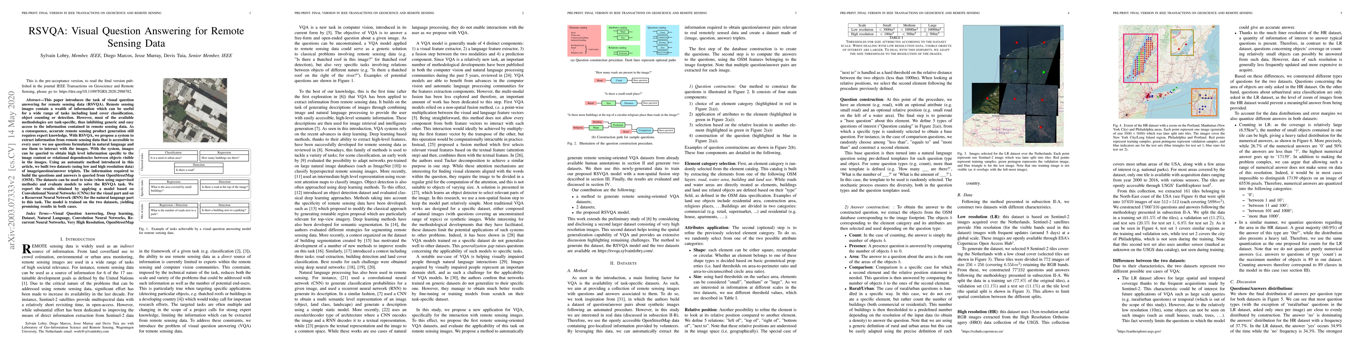
This paper introduces the task of visual question answering for remote sensing data (RSVQA). Remote sensing images contain a wealth of information which can be useful for a wide range of tasks inclu...
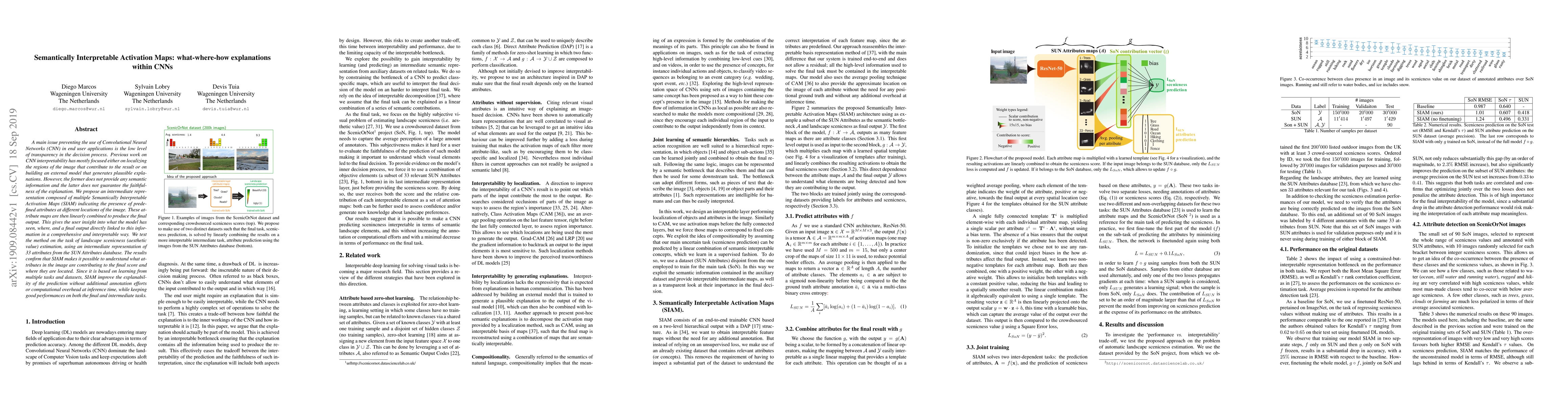
A main issue preventing the use of Convolutional Neural Networks (CNN) in end user applications is the low level of transparency in the decision process. Previous work on CNN interpretability has mo...
The problem of a deep learning model losing performance on a previously learned task when fine-tuned to a new one is a phenomenon known as Catastrophic forgetting. There are two major ways to mitiga...
We present an Active Learning (AL) strategy for re-using a deep Convolutional Neural Network (CNN)-based object detector on a new dataset. This is of particular interest for wildlife conservation: g...
Noisy labels often occur in vision datasets, especially when they are obtained from crowdsourcing or Web scraping. We propose a new regularization method, which enables learning robust classifiers i...
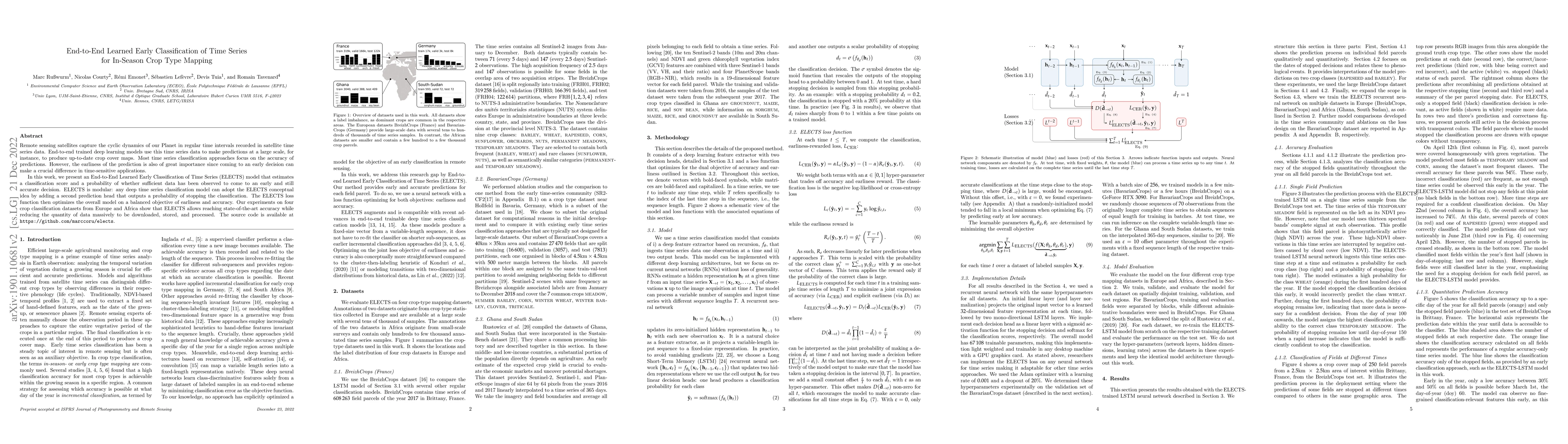
Remote sensing satellites capture the cyclic dynamics of our Planet in regular time intervals recorded in satellite time series data. End-to-end trained deep learning models use this time series dat...

AI assistants are being increasingly used by students enrolled in higher education institutions. While these tools provide opportunities for improved teaching and education, they also pose significant...
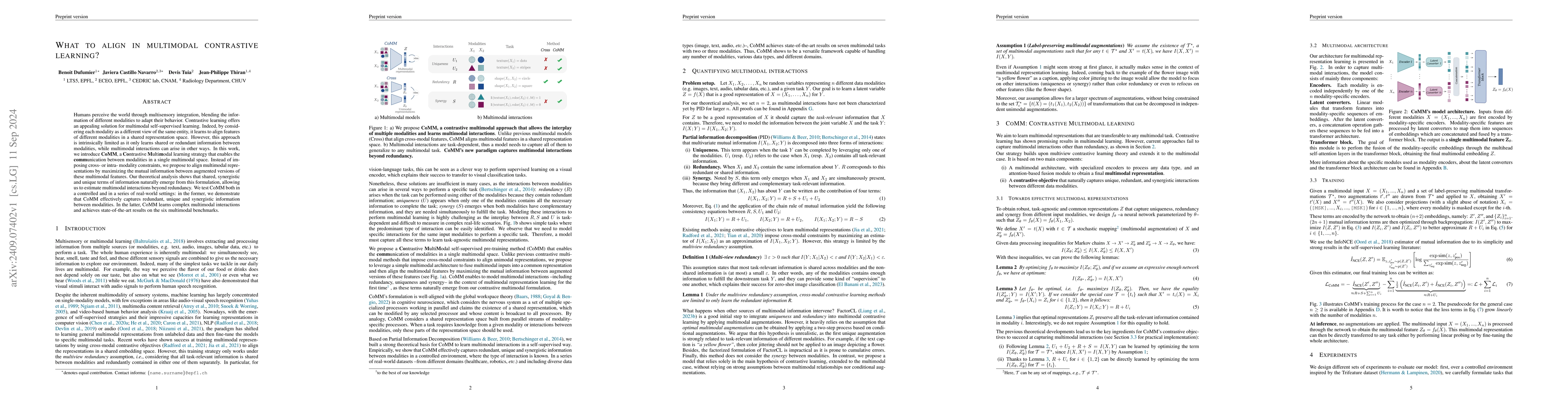
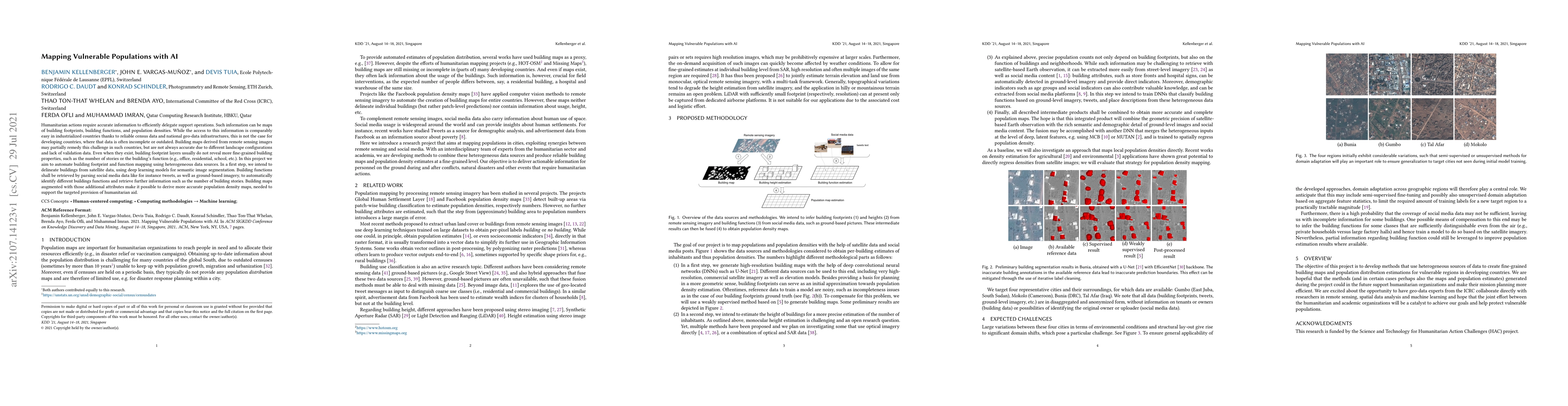
Humans perceive the world through multisensory integration, blending the information of different modalities to adapt their behavior. Contrastive learning offers an appealing solution for multimodal s...
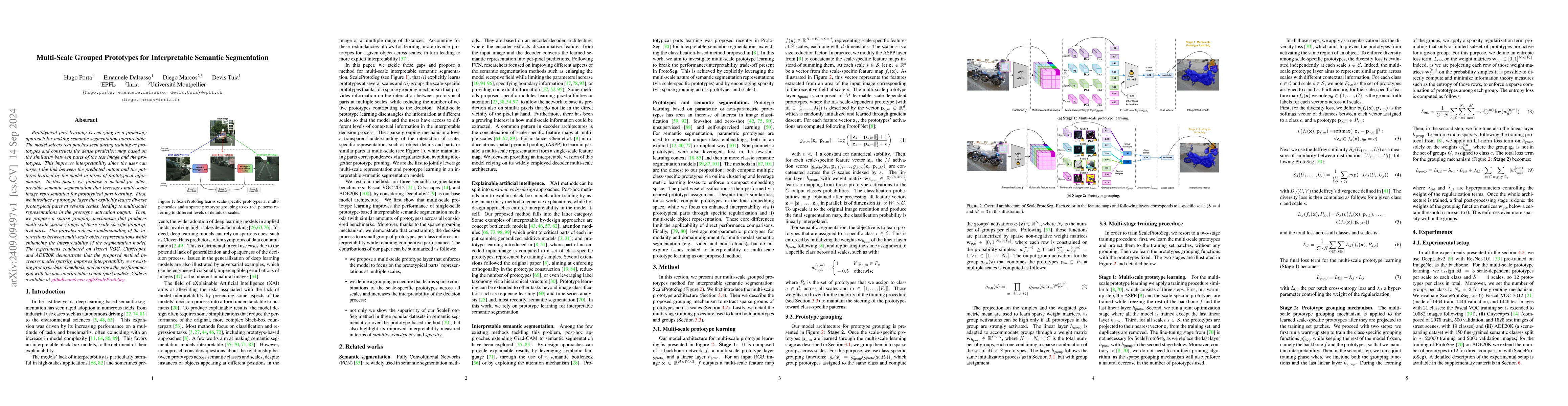
Prototypical part learning is emerging as a promising approach for making semantic segmentation interpretable. The model selects real patches seen during training as prototypes and constructs the dens...
Automated wildlife surveys based on drone imagery and object detection technology are a powerful and increasingly popular tool in conservation biology. Most detectors require training images with anno...
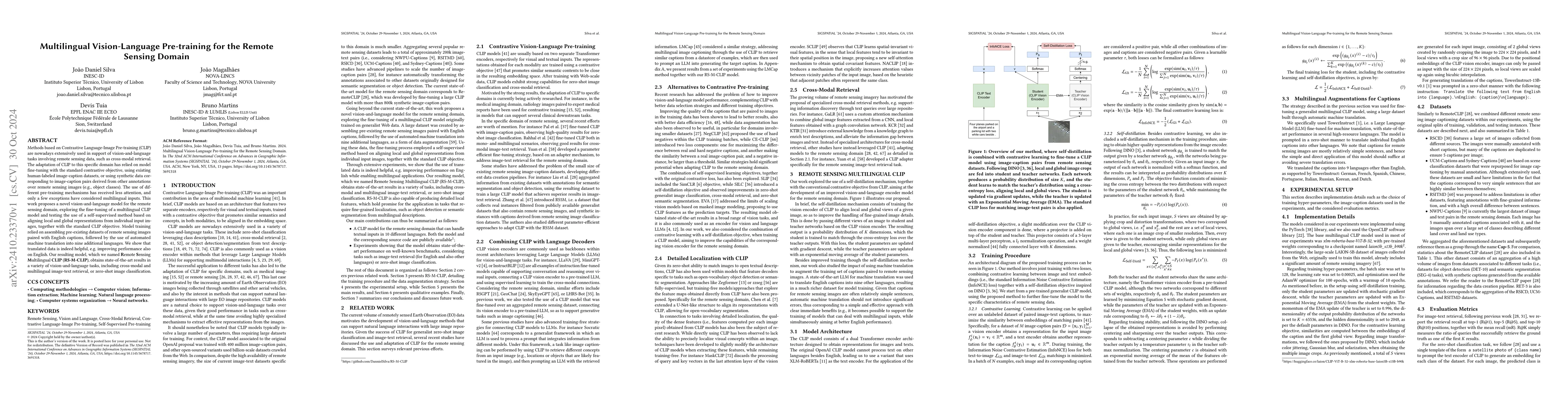
Methods based on Contrastive Language-Image Pre-training (CLIP) are nowadays extensively used in support of vision-and-language tasks involving remote sensing data, such as cross-modal retrieval. The ...
Species distribution models (SDMs) aim to predict the distribution of species by relating occurrence data with environmental variables. Recent applications of deep learning to SDMs have enabled new av...
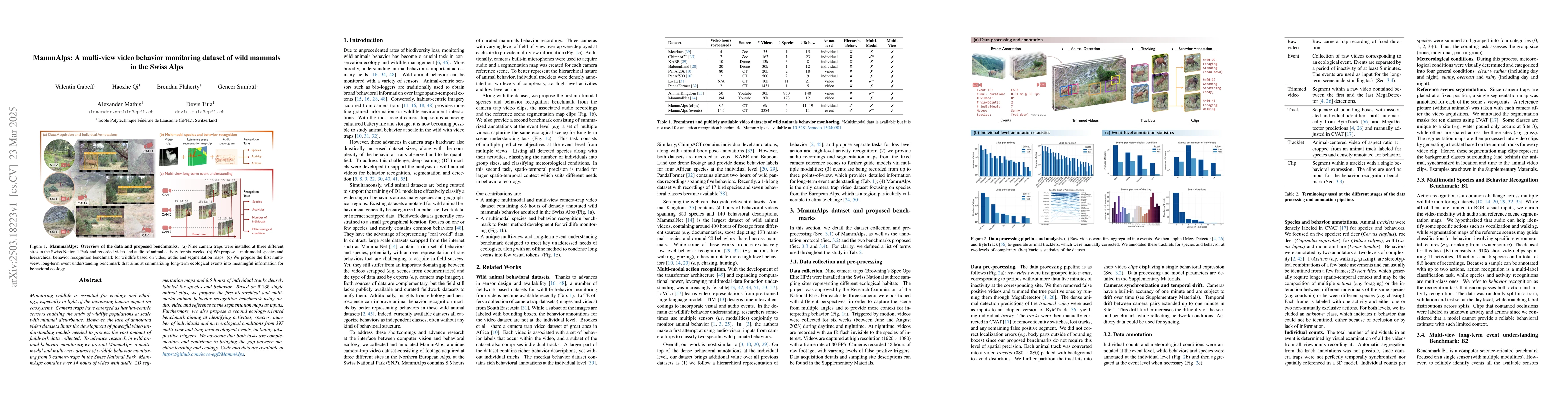
Monitoring wildlife is essential for ecology and ethology, especially in light of the increasing human impact on ecosystems. Camera traps have emerged as habitat-centric sensors enabling the study of ...
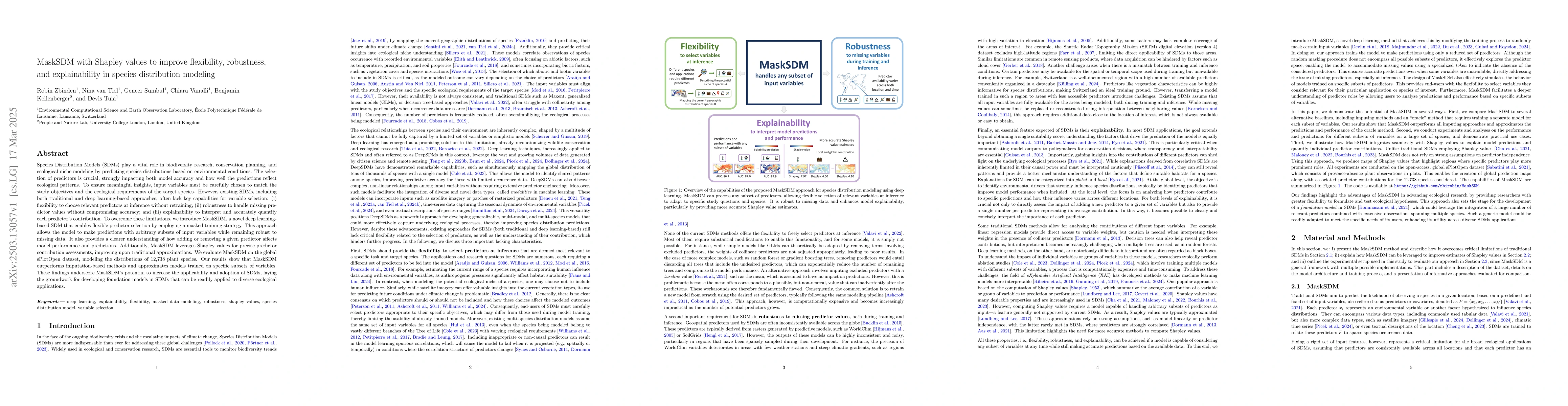
Species Distribution Models (SDMs) play a vital role in biodiversity research, conservation planning, and ecological niche modeling by predicting species distributions based on environmental condition...
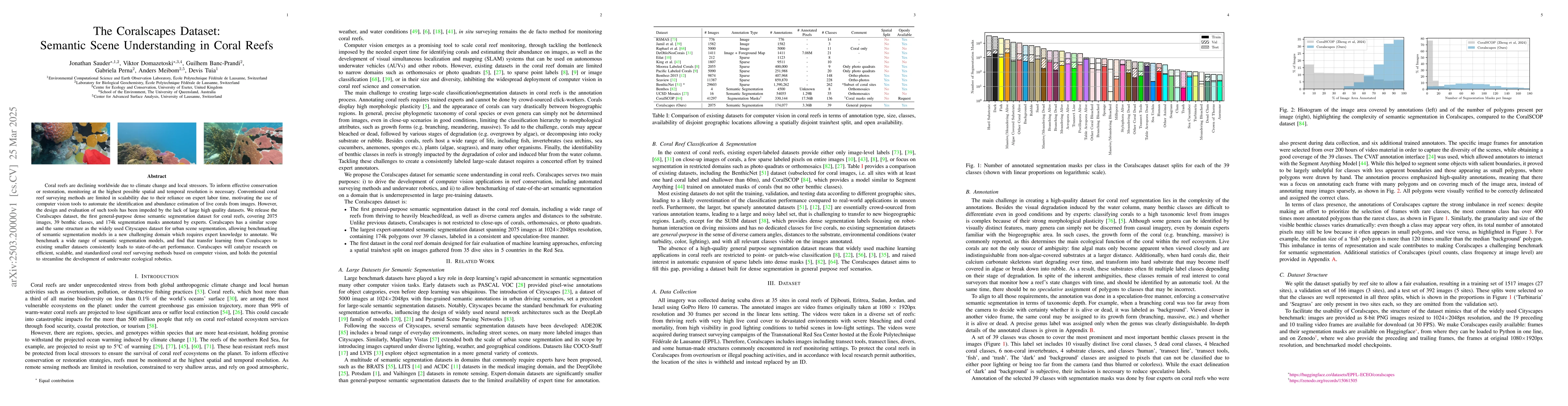
Coral reefs are declining worldwide due to climate change and local stressors. To inform effective conservation or restoration, monitoring at the highest possible spatial and temporal resolution is ne...
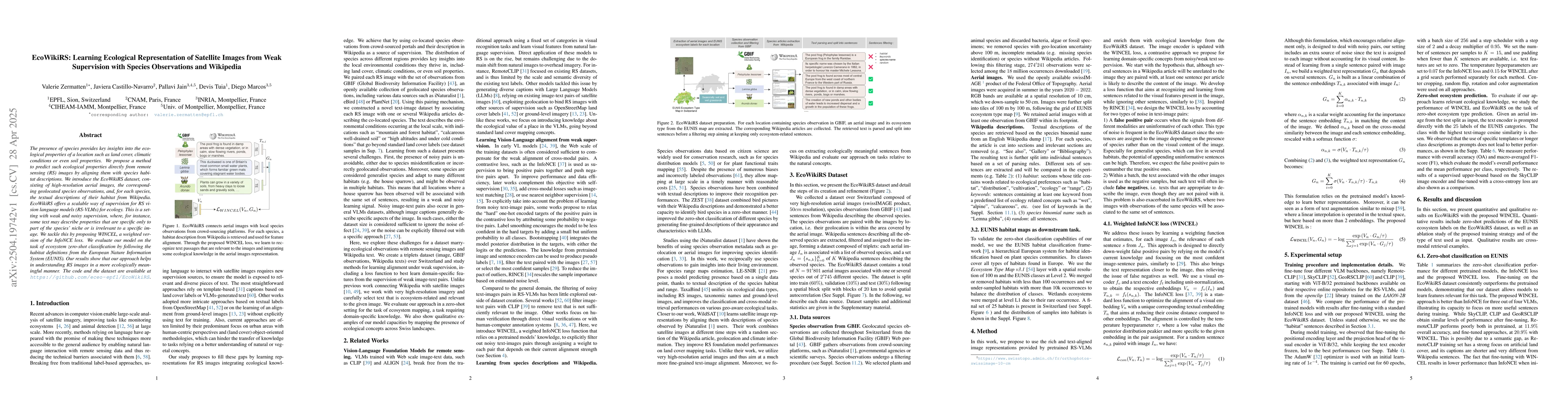
The presence of species provides key insights into the ecological properties of a location such as land cover, climatic conditions or even soil properties. We propose a method to predict such ecologic...
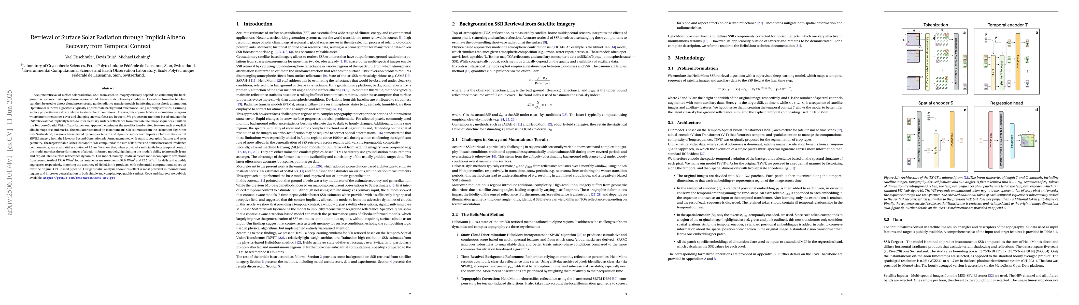
Accurate retrieval of surface solar radiation (SSR) from satellite imagery critically depends on estimating the background reflectance that a spaceborne sensor would observe under clear-sky conditions...
Canada experienced in 2023 one of the most severe wildfire seasons in recent history, causing damage across ecosystems, destroying communities, and emitting large quantities of CO2. This extreme wildf...
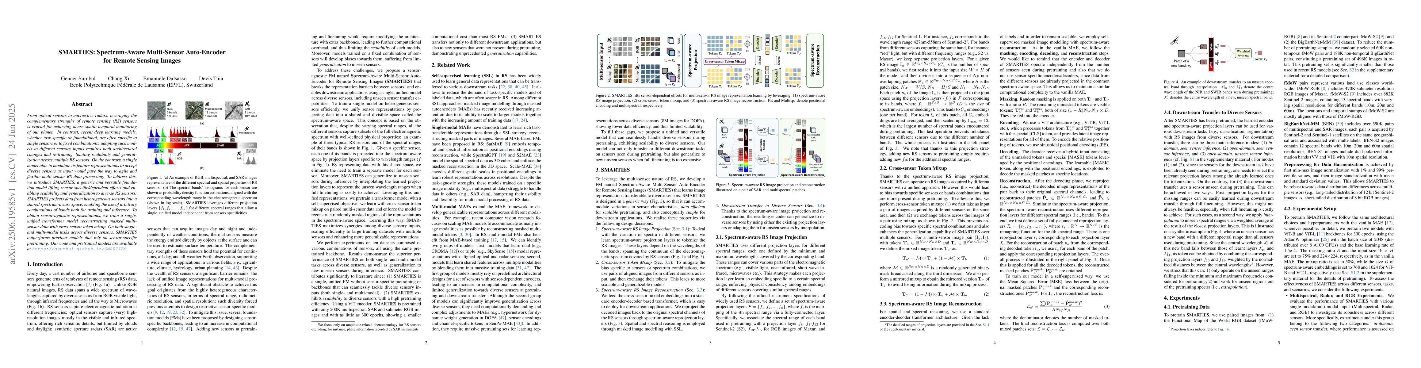
From optical sensors to microwave radars, leveraging the complementary strengths of remote sensing (RS) sensors is crucial for achieving dense spatio-temporal monitoring of our planet. In contrast, re...
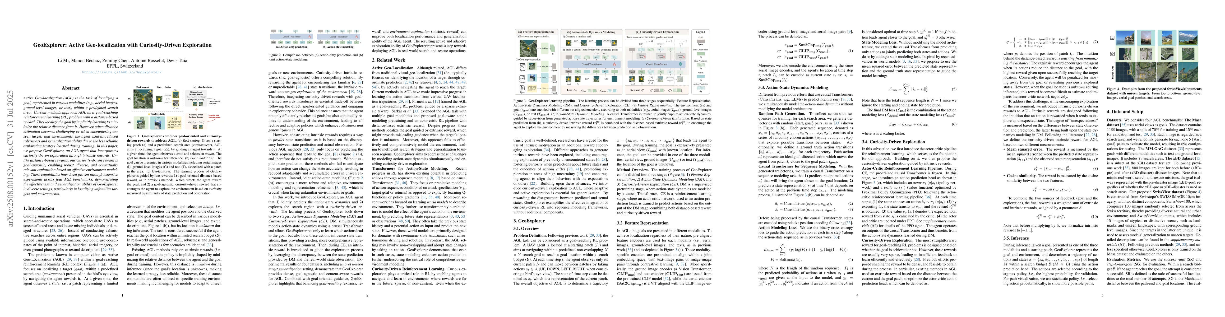
Active Geo-localization (AGL) is the task of localizing a goal, represented in various modalities (e.g., aerial images, ground-level images, or text), within a predefined search area. Current methods ...
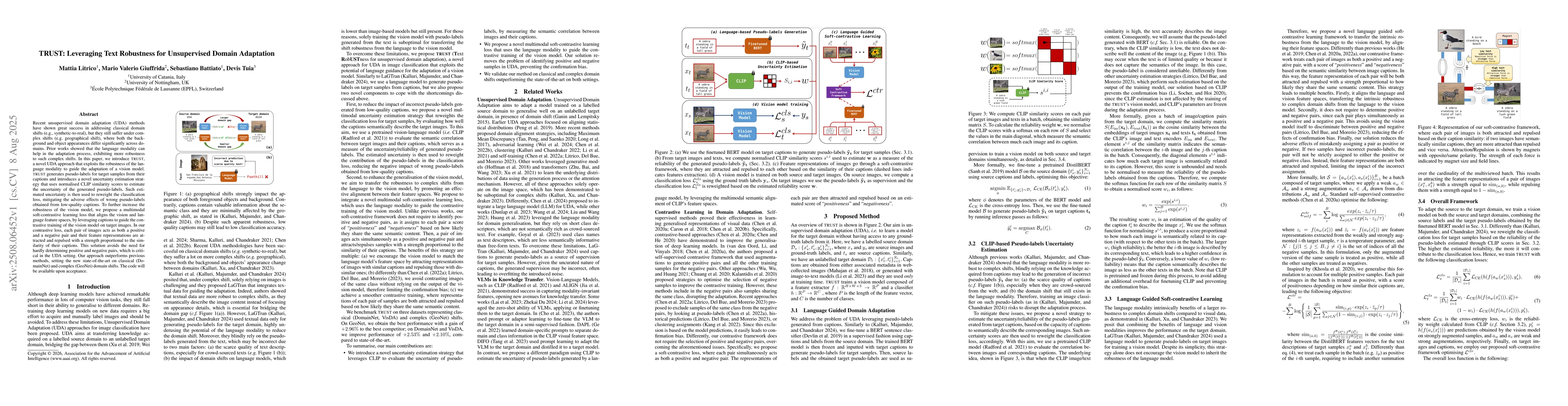
Recent unsupervised domain adaptation (UDA) methods have shown great success in addressing classical domain shifts (e.g., synthetic-to-real), but they still suffer under complex shifts (e.g. geographi...
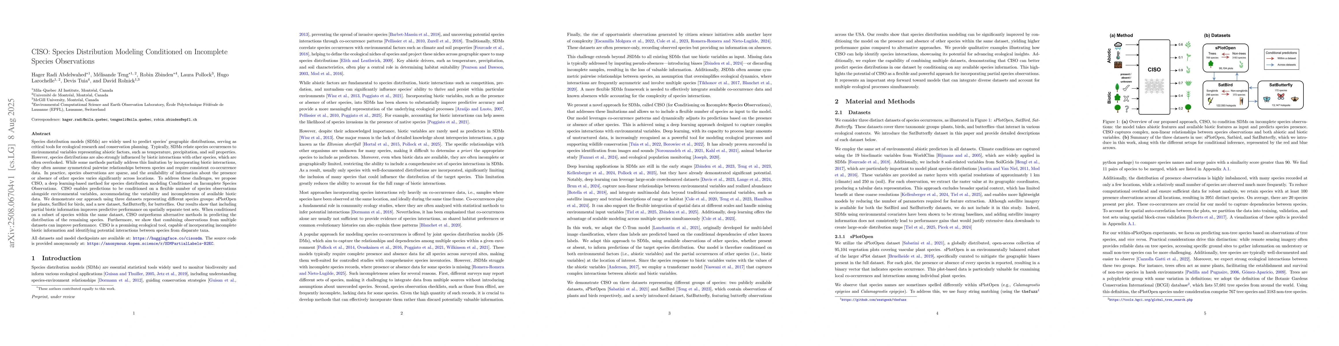
Species distribution models (SDMs) are widely used to predict species' geographic distributions, serving as critical tools for ecological research and conservation planning. Typically, SDMs relate spe...
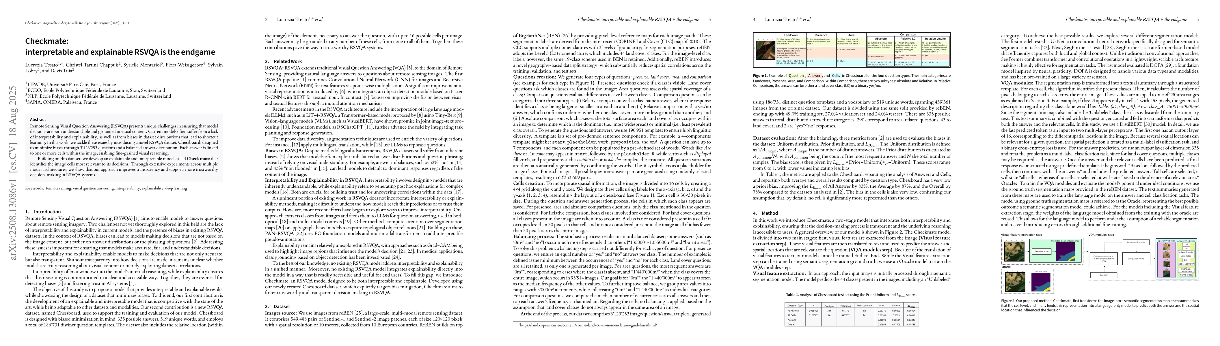
Remote Sensing Visual Question Answering (RSVQA) presents unique challenges in ensuring that model decisions are both understandable and grounded in visual content. Current models often suffer from a ...
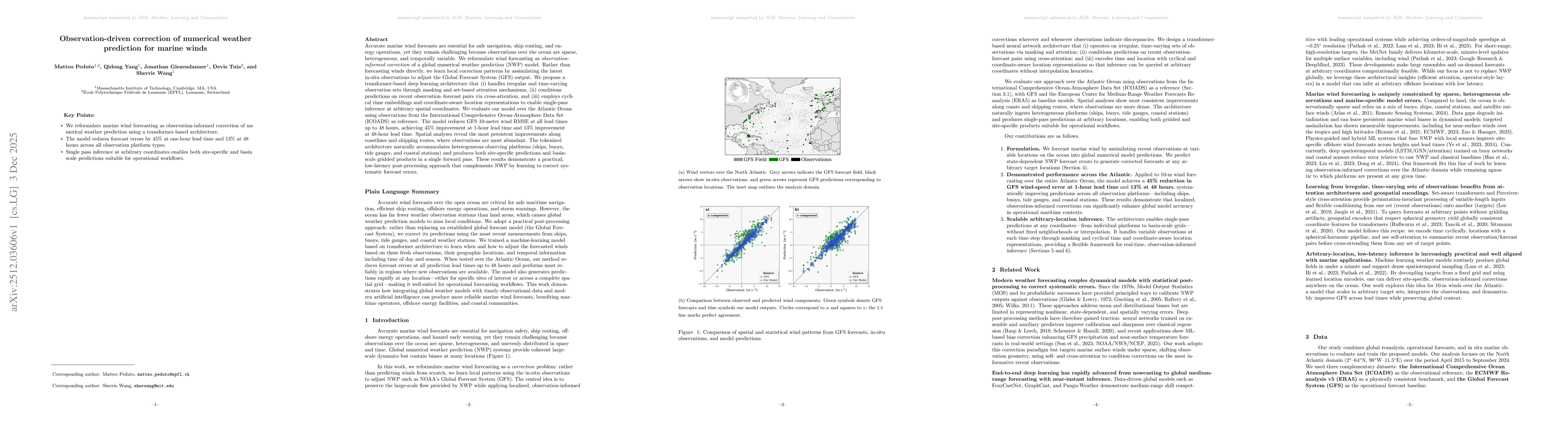
Accurate marine wind forecasts are essential for safe navigation, ship routing, and energy operations, yet they remain challenging because observations over the ocean are sparse, heterogeneous, and te...
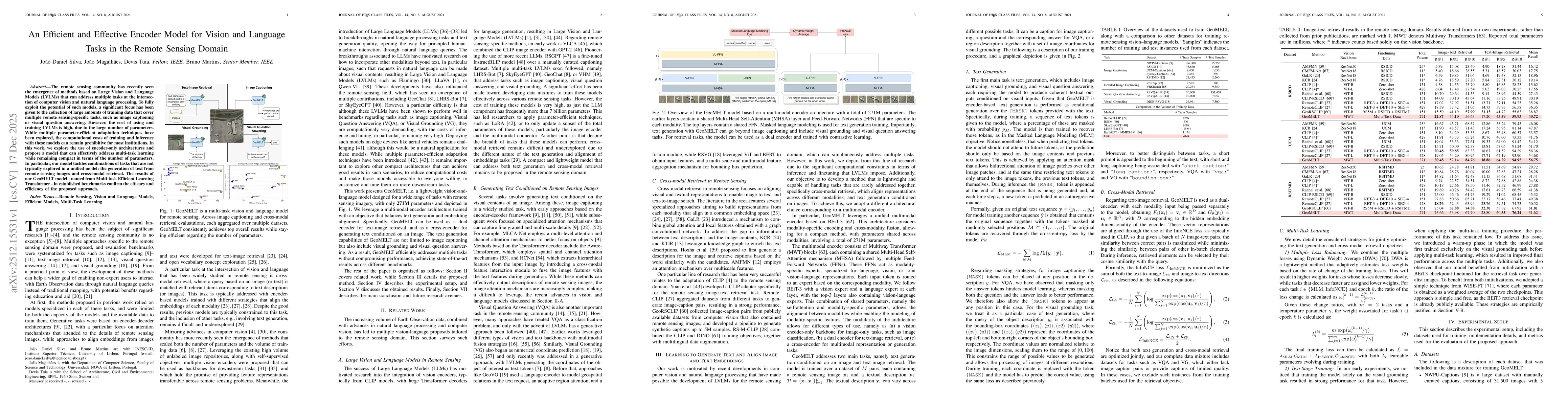
The remote sensing community has recently seen the emergence of methods based on Large Vision and Language Models (LVLMs) that can address multiple tasks at the intersection of computer vision and nat...
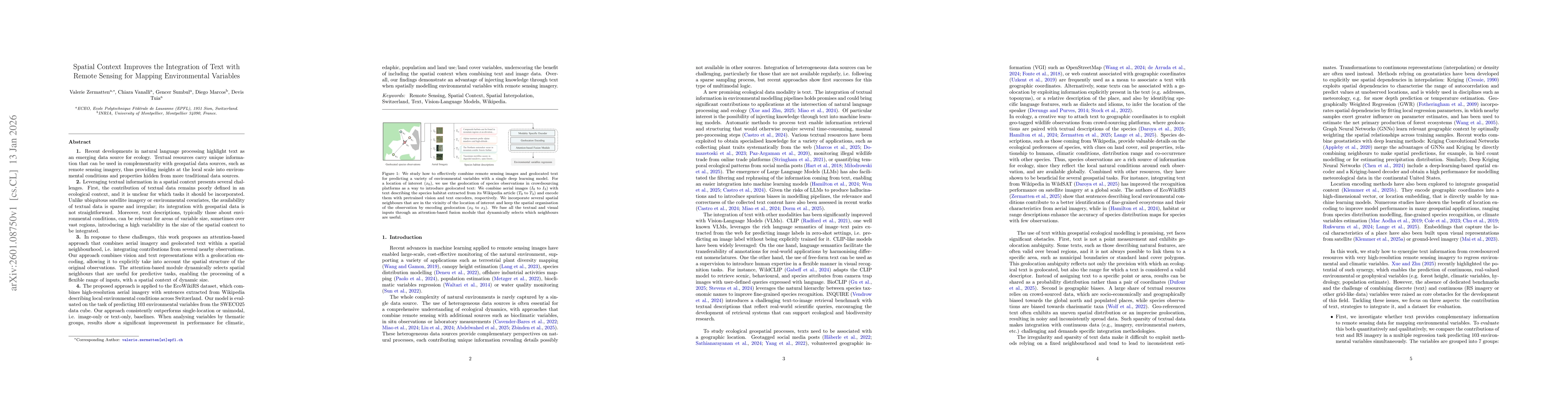
Recent developments in natural language processing highlight text as an emerging data source for ecology. Textual resources carry unique information that can be used in complementarity with geospatial...
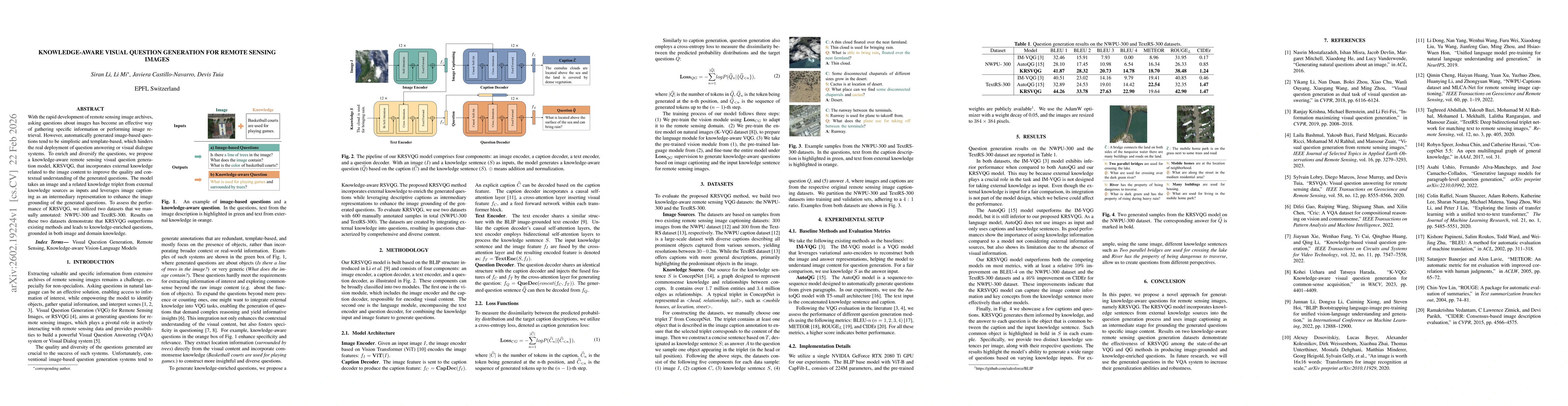
With the rapid development of remote sensing image archives, asking questions about images has become an effective way of gathering specific information or performing image retrieval. However, automat...
With the rapid development of remote sensing image archives, asking questions about images has become an effective way of gathering specific information or performing semantic image retrieval. However...
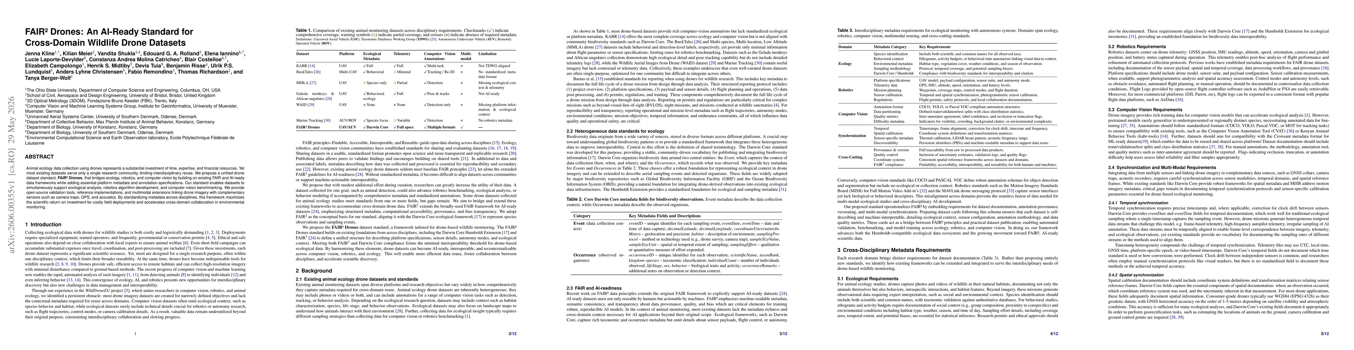
Animal ecology data collection using drones represents a substantial investment of time, expertise, and financial resources. Yet most existing datasets serve only a single research community, limiting...
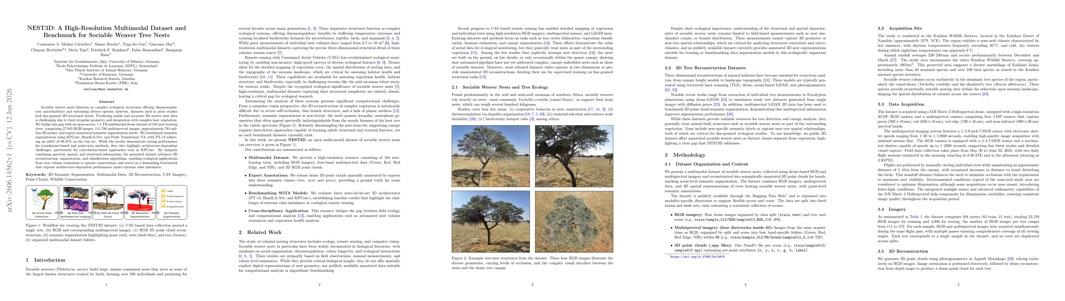
Sociable weaver nests function as complex ecological structures offering thermoregulatory microhabitats and sustaining diverse species; however, datasets used in prior studies lack fine-grained 3D str...
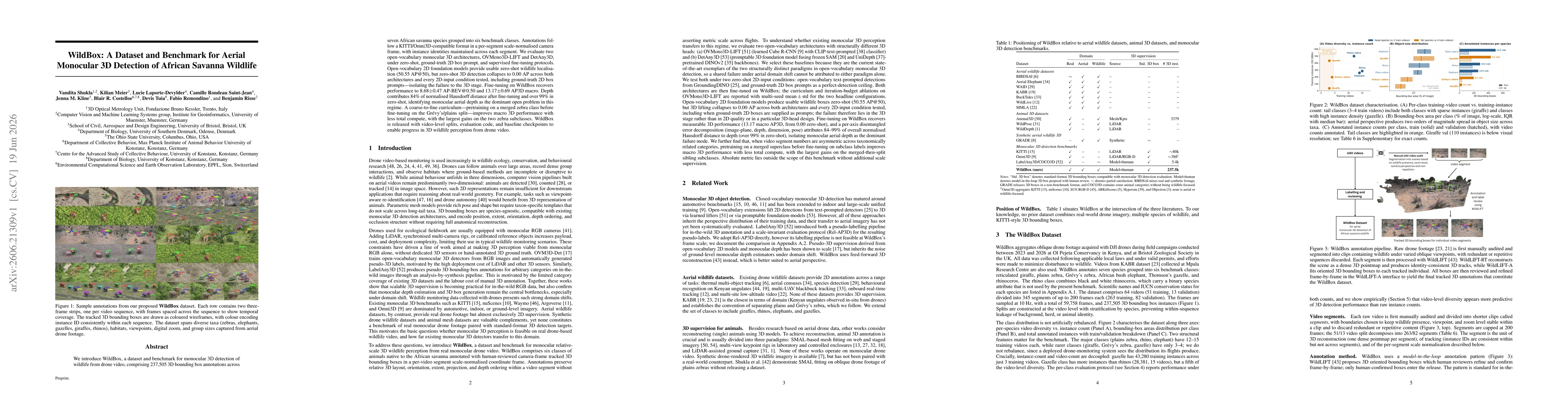
We introduce WildBox, a dataset and benchmark for monocular 3D detection of wildlife from drone video, comprising 237,505 3D bounding box annotations across seven African savanna species grouped into ...
Automatically retrieving videos from large camera-trap datasets remains challenging. Text-to-Video retrieval (TVR) methods based on large video-language models (VLMs) have potential to retrieve events...