Academic Profile
Statistics
Similar Authors
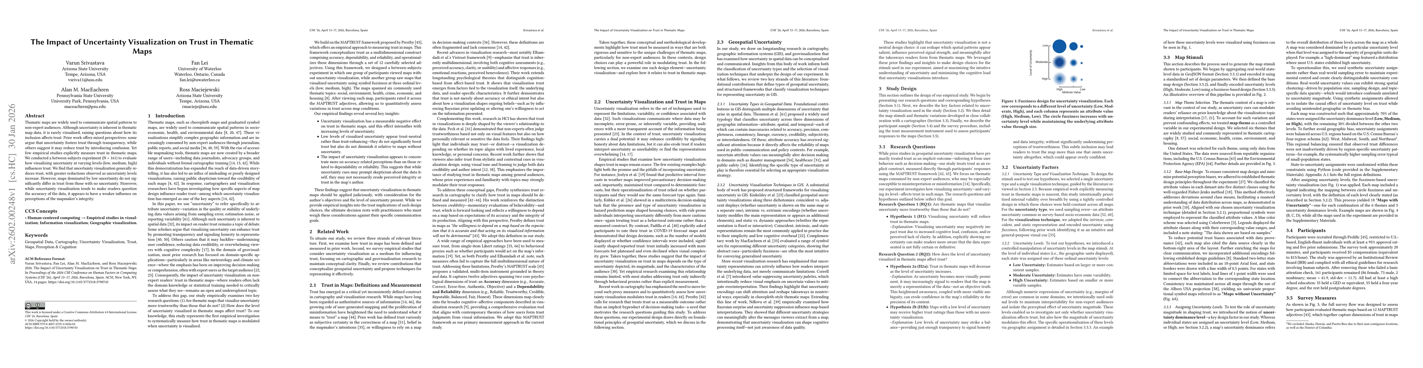
Papers on arXiv
AniMAIRE (Anisotropic Model for Atmospheric Ionising Radiation Effects) is a new model and Python toolkit for calculating radiation dose rates experienced by aircraft during anisotropic solar energe...
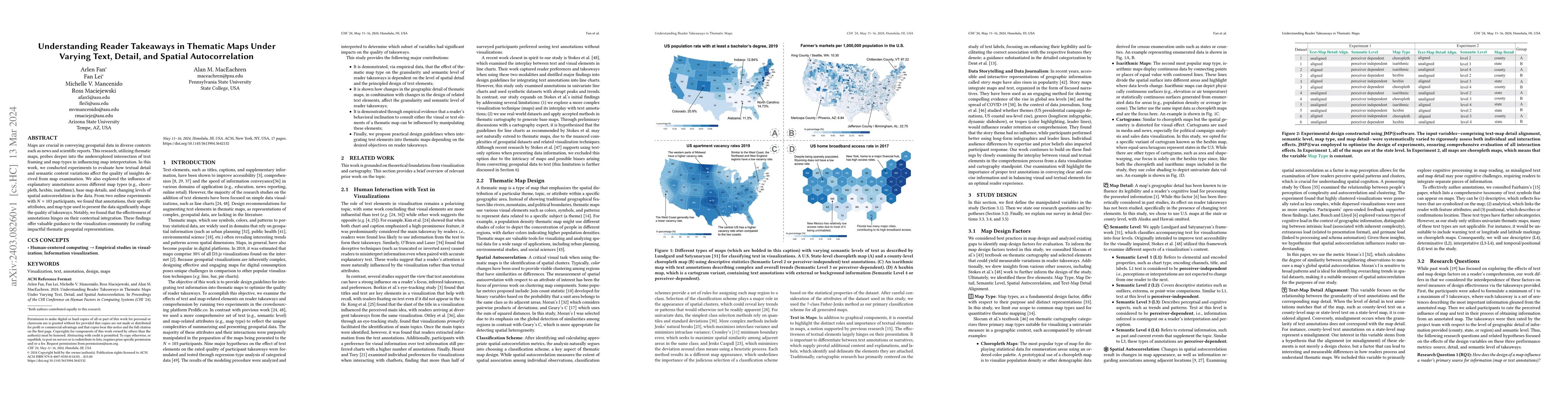
Maps are crucial in conveying geospatial data in diverse contexts such as news and scientific reports. This research, utilizing thematic maps, probes deeper into the underexplored intersection of te...
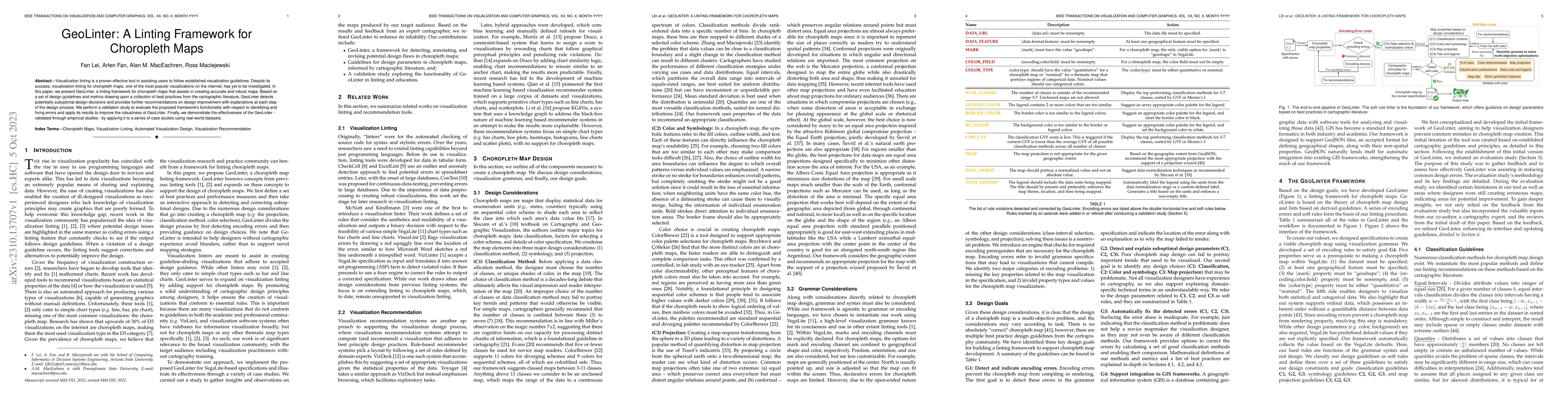
Visualization linting is a proven effective tool in assisting users to follow established visualization guidelines. Despite its success, visualization linting for choropleth maps, one of the most po...
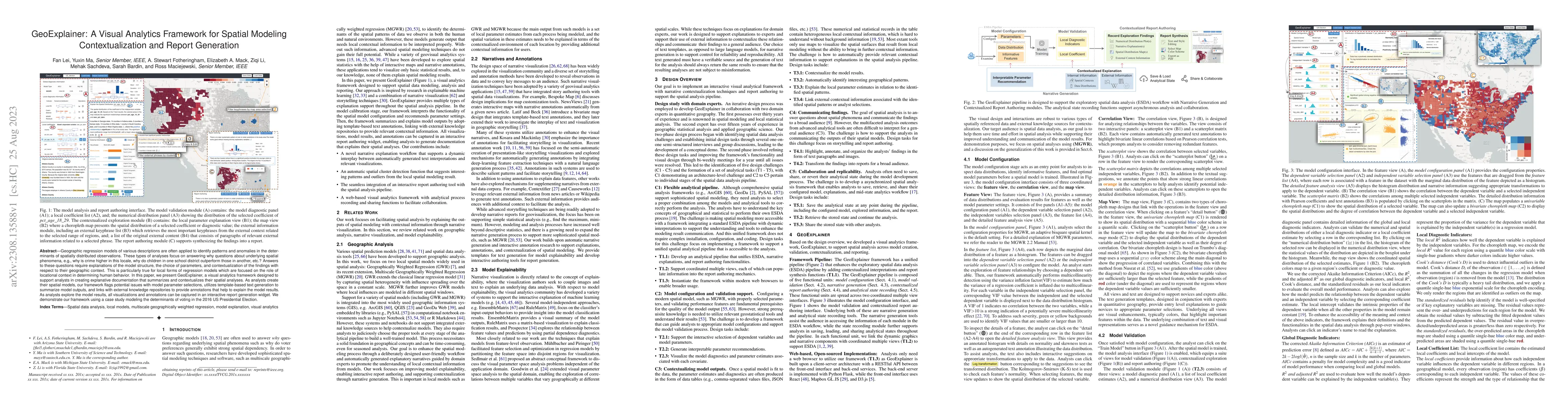
Geographic regression models of various descriptions are often applied to identify patterns and anomalies in the determinants of spatially distributed observations. These types of analyses focus on ...
The geographic structure of radiation dose rates at aircraft altitudes in Earth's atmosphere during the irradiation of Earth by proton spectra from incoming solar particle events is examined using t...
Low energy protons (< 300 keV) can enter the field of view of X-ray space telescopes, scatter at small incident angles, and deposit energy on the detector, causing intense background flares at the f...
Superlubricity, a state where friction between two contact surfaces is nearly zero, has a great potential to revolutionize various mechanical systems by significantly reducing energy dissipation and e...
Fluid flow is a widely applied physical problem, crucial in various fields. Due to the highly nonlinear and chaotic nature of fluids, analyzing fluid-related problems is exceptionally challenging. Com...
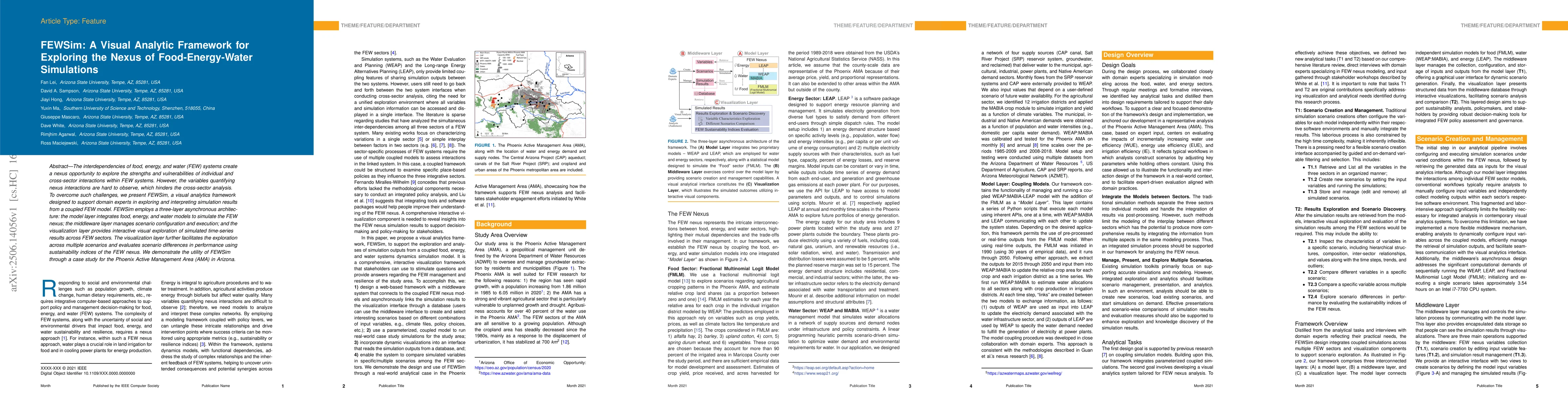
The interdependencies of food, energy, and water (FEW) systems create a nexus opportunity to explore the strengths and vulnerabilities of individual and cross-sector interactions within FEW systems. H...
Cherenkov detectors have been used in space missions for many decades, and for a variety of purposes, including for example, for Galactic Cosmic Ray (GCR) and Solar Energetic Particle (SEP) measuremen...
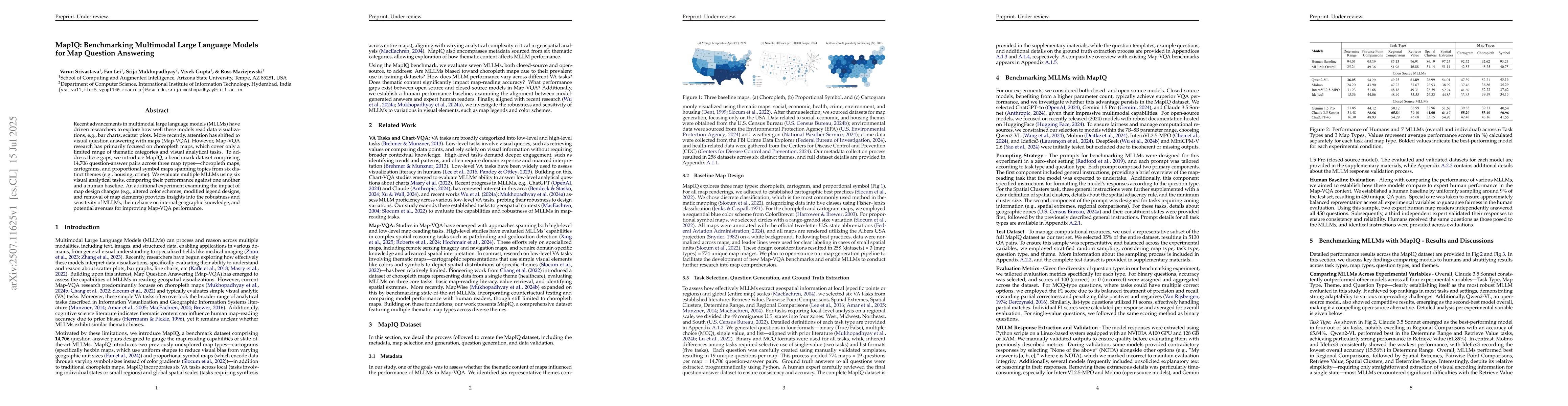
Recent advancements in multimodal large language models (MLLMs) have driven researchers to explore how well these models read data visualizations, e.g., bar charts, scatter plots. More recently, atten...
The proliferation of misinformation in journalism, often stemming from flawed reasoning and logical fallacies, poses significant challenges to public understanding and trust in news media. Traditional...
Thematic maps are widely used to communicate spatial patterns to non-expert audiences. Although uncertainty is inherent in thematic map data, it is rarely visualized, raising questions about how its i...