Publication
Metrics
AI Quick Summary
GeoLinter is a linting framework designed to assist in creating accurate and robust choropleth maps by detecting suboptimal design decisions and providing actionable recommendations. The framework's effectiveness is validated through empirical studies and demonstrated via case studies using real-world datasets.
Paper Preview
Abstract
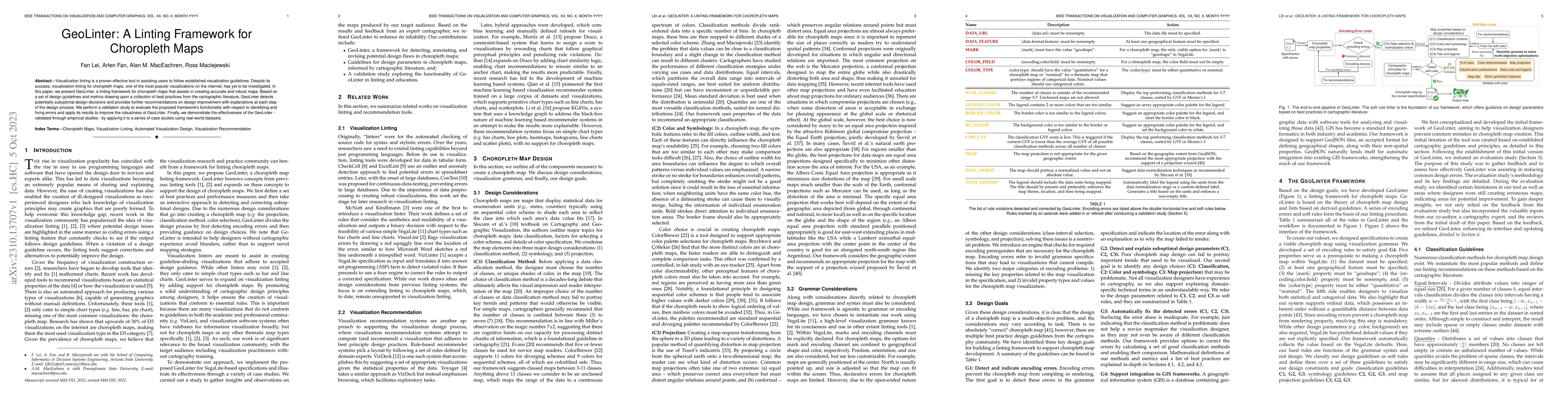
Visualization linting is a proven effective tool in assisting users to follow established visualization guidelines. Despite its success, visualization linting for choropleth maps, one of the most popular visualizations on the internet, has yet to be investigated. In this paper, we present GeoLinter, a linting framework for choropleth maps that assists in creating accurate and robust maps. Based on a set of design guidelines and metrics drawing upon a collection of best practices from the cartographic literature, GeoLinter detects potentially suboptimal design decisions and provides further recommendations on design improvement with explanations at each step of the design process. We perform a validation study to evaluate the proposed framework's functionality with respect to identifying and fixing errors and apply its results to improve the robustness of GeoLinter. Finally, we demonstrate the effectiveness of the GeoLinter - validated through empirical studies - by applying it to a series of case studies using real-world datasets.
AI Key Findings
Get AI-generated insights about this paper's methodology, results, significance, and more — seven facets brought into focus.
Impact
Paper Details
Authors
PDF Preview
Key Terms
Citation Network
Current paper (gray), citations (green), references (blue)
Display is limited for performance on very large graphs.
Discussion 0