Academic Profile
Statistics
Similar Authors
Papers on arXiv
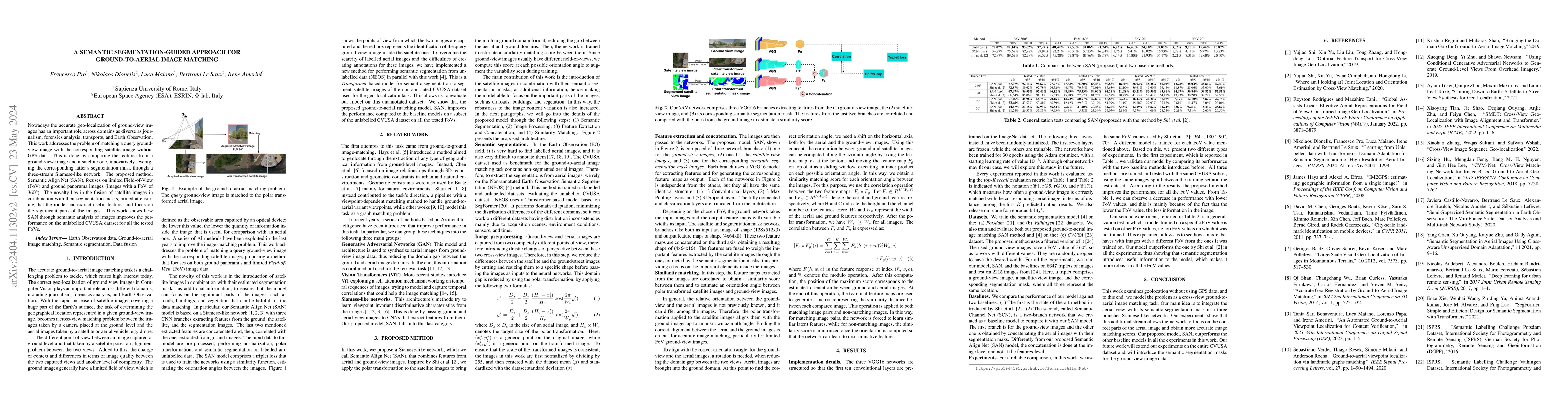
Nowadays the accurate geo-localization of ground-view images has an important role across domains as diverse as journalism, forensics analysis, transports, and Earth Observation. This work addresses...
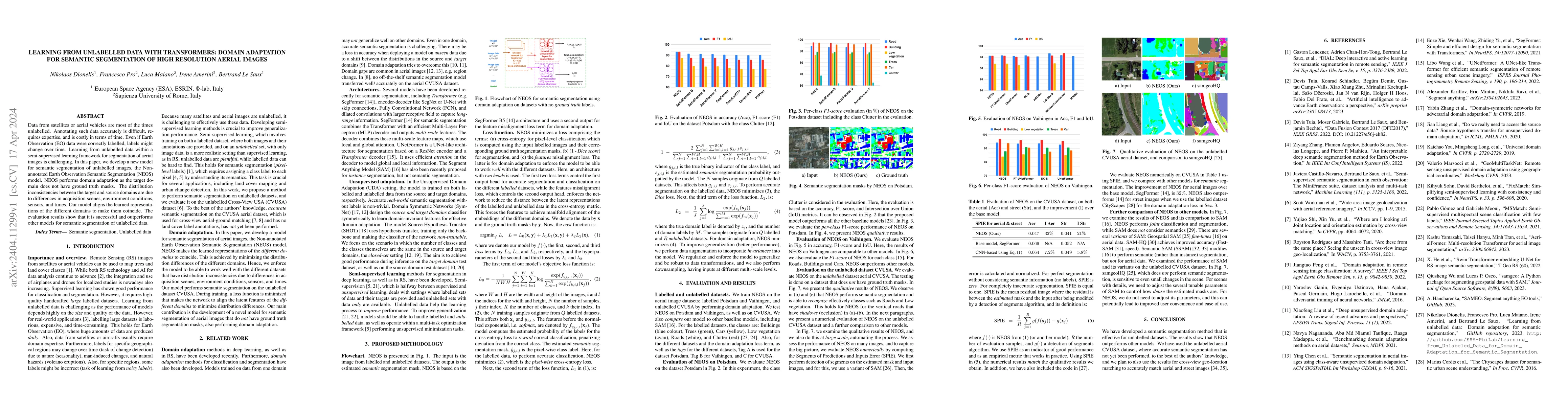
Data from satellites or aerial vehicles are most of the times unlabelled. Annotating such data accurately is difficult, requires expertise, and is costly in terms of time. Even if Earth Observation ...
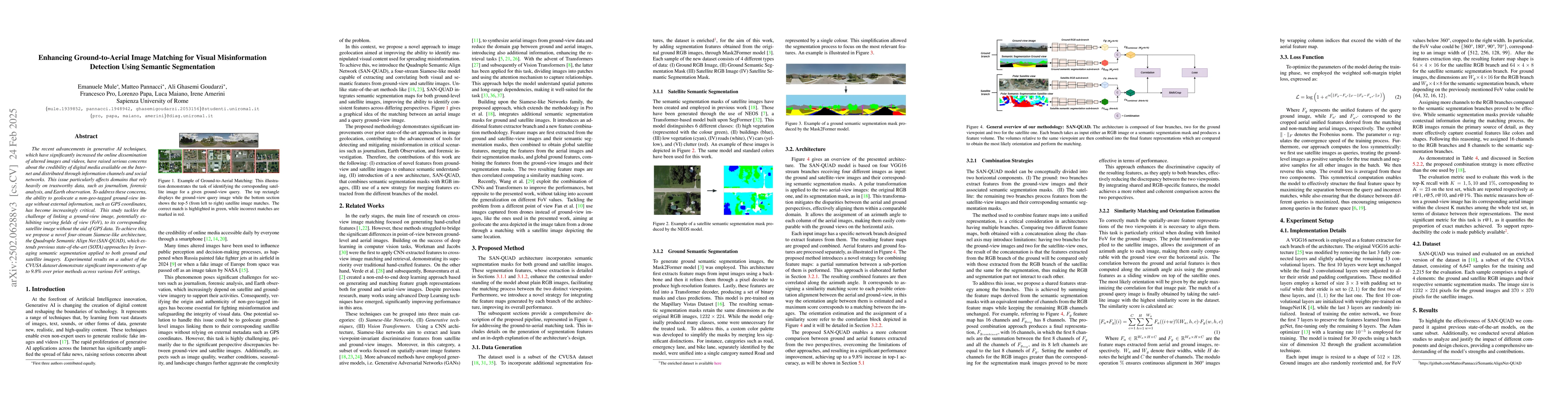
The recent advancements in generative AI techniques, which have significantly increased the online dissemination of altered images and videos, have raised serious concerns about the credibility of dig...
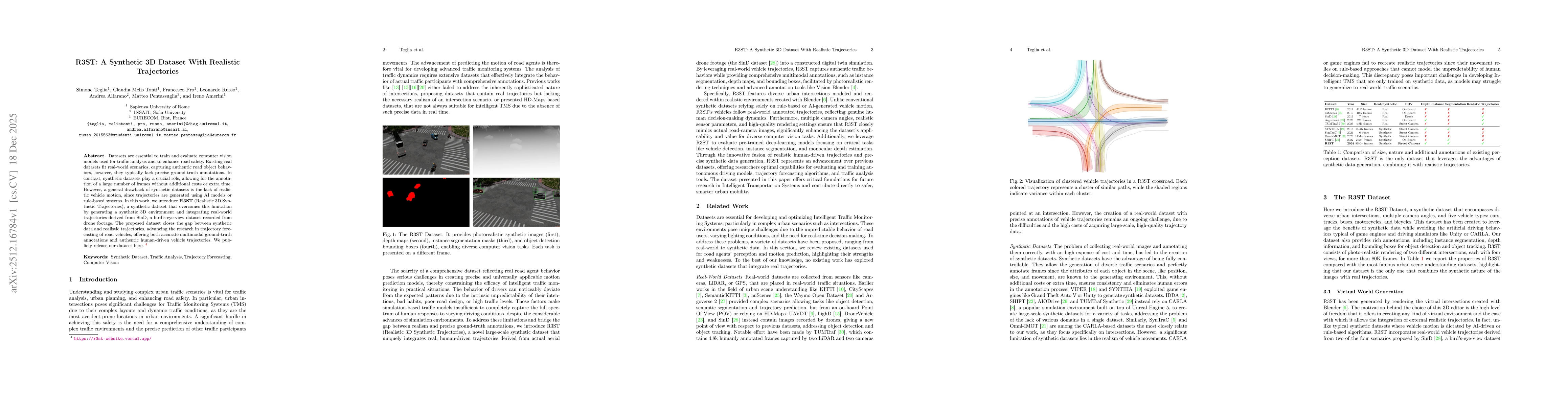
Datasets are essential to train and evaluate computer vision models used for traffic analysis and to enhance road safety. Existing real datasets fit real-world scenarios, capturing authentic road obje...