Academic Profile
Statistics
Similar Authors
Papers on arXiv
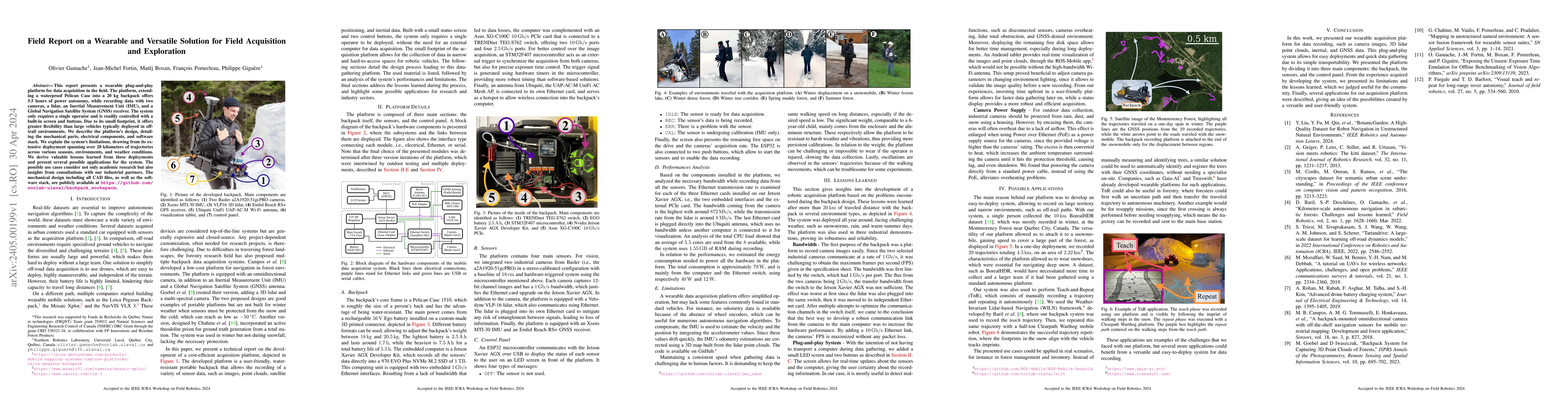
This report presents a wearable plug-and-play platform for data acquisition in the field. The platform, extending a waterproof Pelican Case into a 20 kg backpack offers 5.5 hours of power autonomy, ...
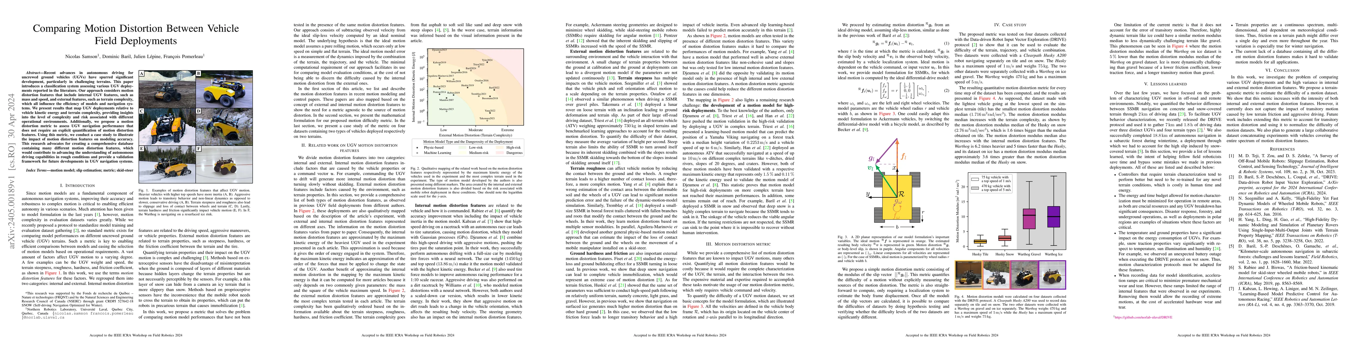
Recent advances in autonomous driving for uncrewed ground vehicles (UGVs) have spurred significant development, particularly in challenging terrains. This paper introduces a classification system as...
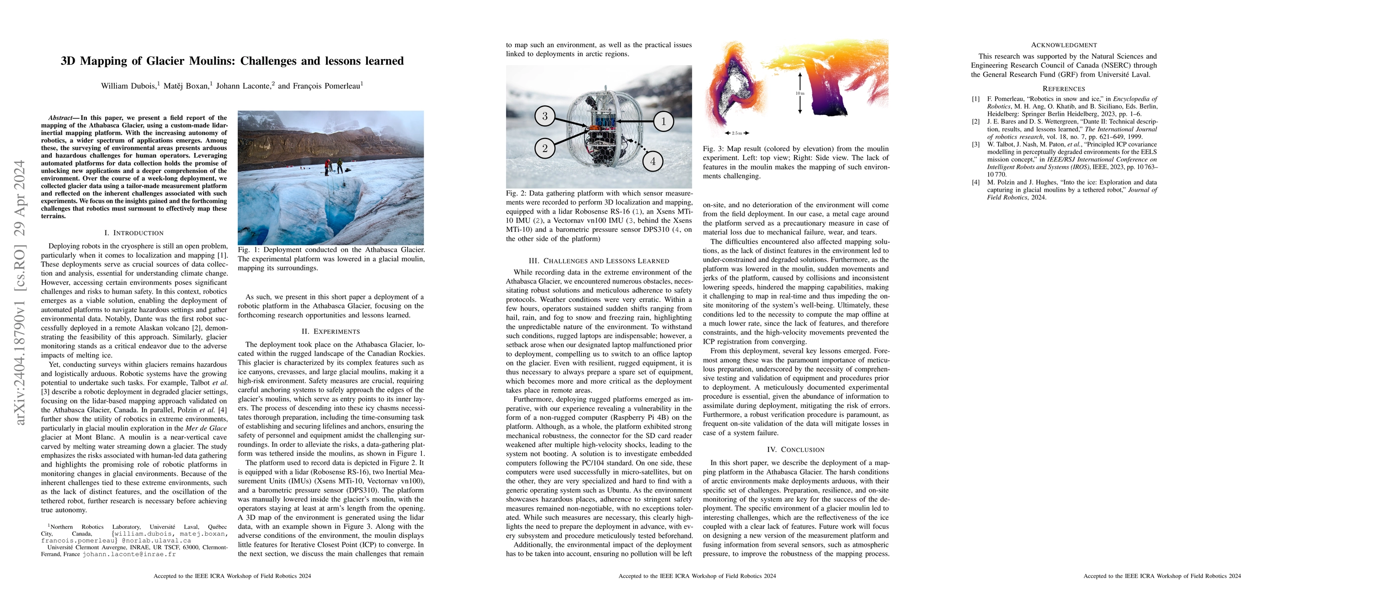
In this paper, we present a field report of the mapping of the Athabasca Glacier, using a custom-made lidar-inertial mapping platform. With the increasing autonomy of robotics, a wider spectrum of a...
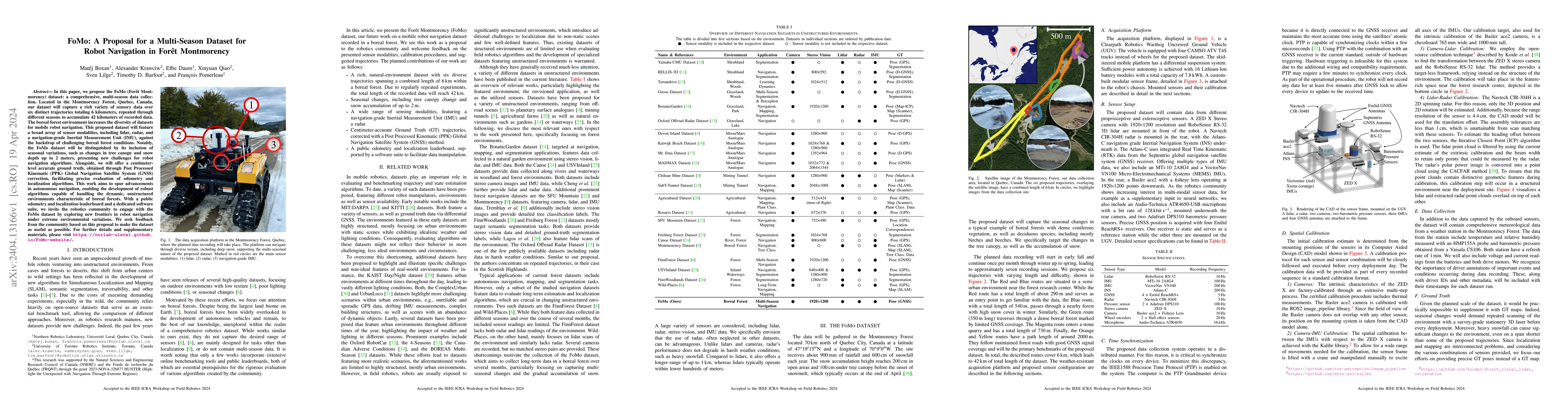
In this paper, we propose the FoMo (For\^et Montmorency) dataset: a comprehensive, multi-season data collection. Located in the Montmorency Forest, Quebec, Canada, our dataset will capture a rich va...
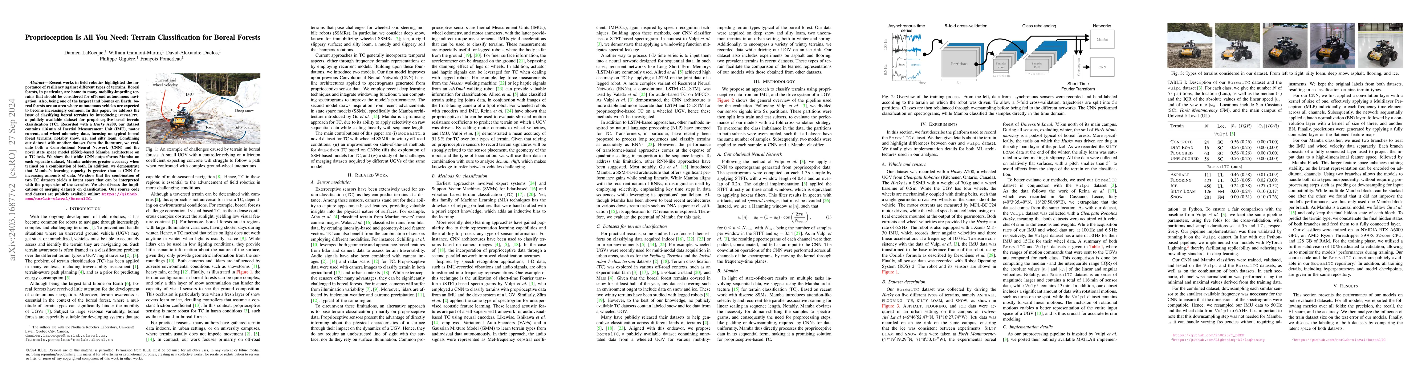
Recent works in field robotics highlighted the importance of resiliency against different types of terrains. Boreal forests, in particular, are home to many mobility-impeding terrains that should be...
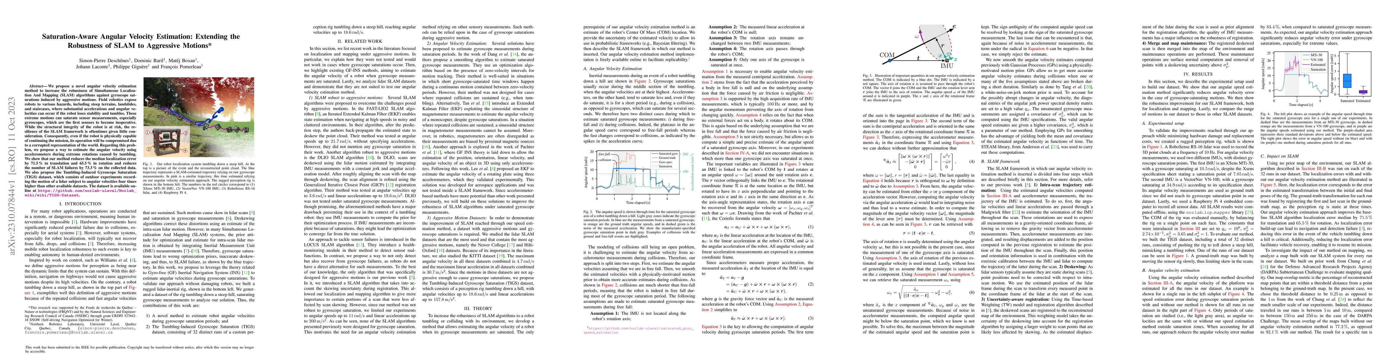
We propose a novel angular velocity estimation method to increase the robustness of Simultaneous Localization And Mapping (SLAM) algorithms against gyroscope saturations induced by aggressive motion...
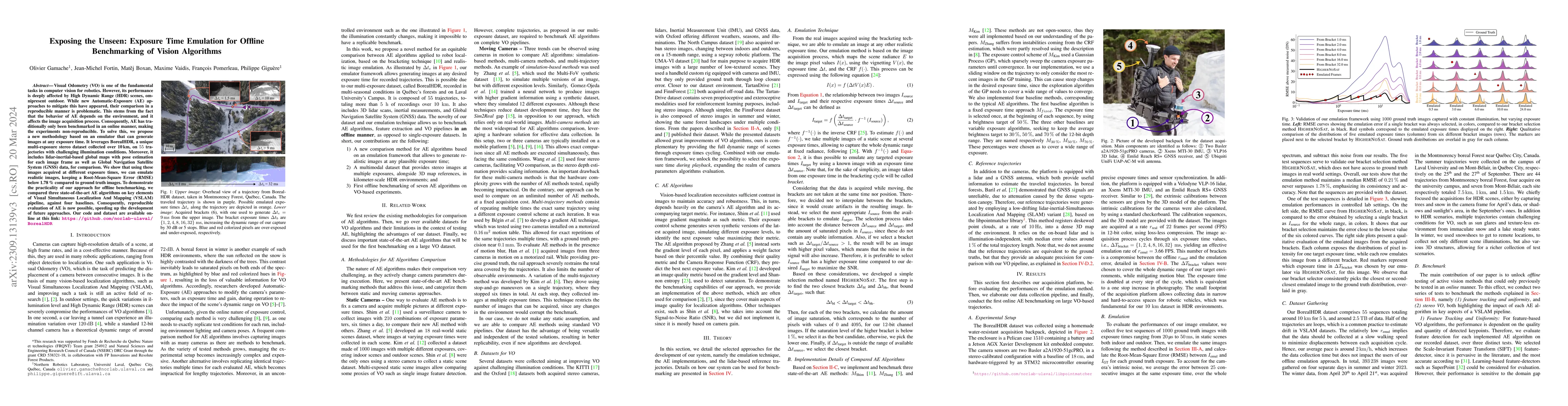
Visual Odometry (VO) is one of the fundamental tasks in computer vision for robotics. However, its performance is deeply affected by High Dynamic Range (HDR) scenes, omnipresent outdoor. While new A...
Numerous datasets and benchmarks exist to assess and compare Simultaneous Localization and Mapping (SLAM) algorithms. Nevertheless, their precision must follow the rate at which SLAM algorithms impr...
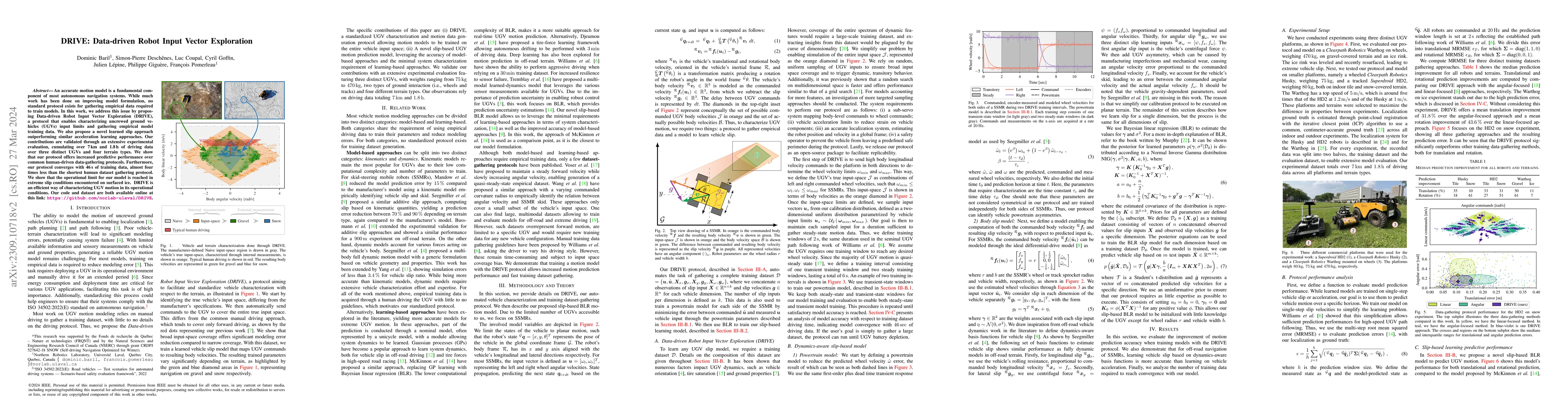
An accurate motion model is a fundamental component of most autonomous navigation systems. While much work has been done on improving model formulation, no standard protocol exists for gathering emp...
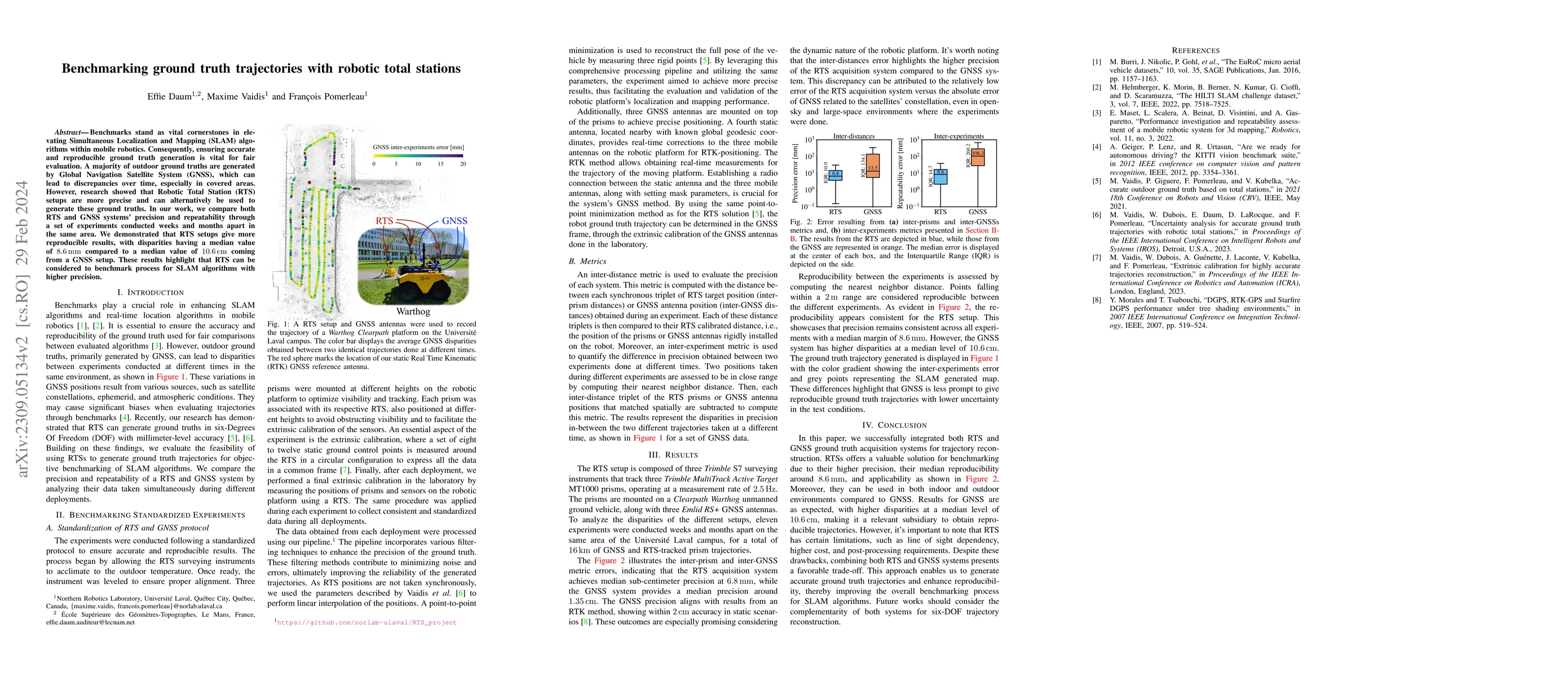
Benchmarks stand as vital cornerstones in elevating SLAM algorithms within mobile robotics. Consequently, ensuring accurate and reproducible ground truth generation is vital for fair evaluation. A m...
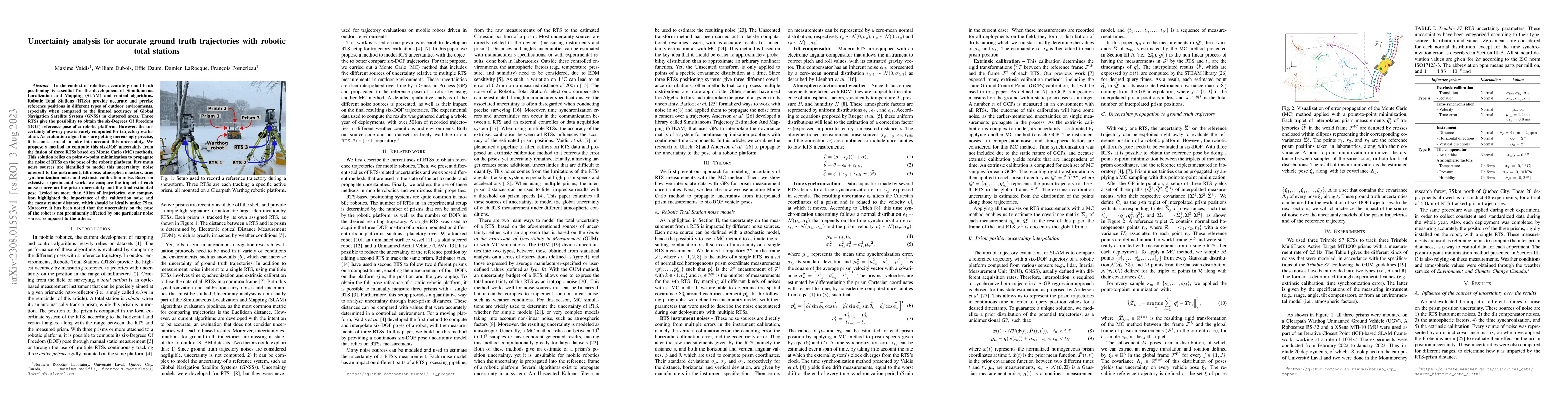
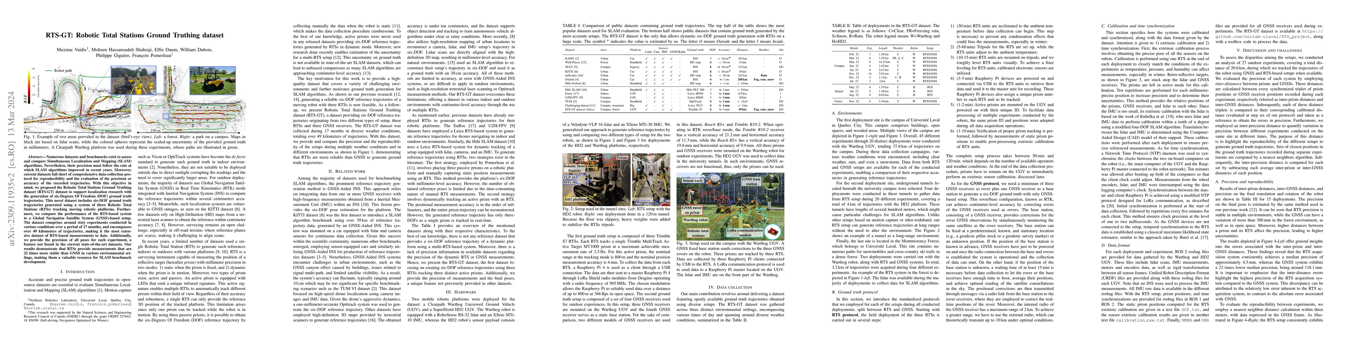
In the context of robotics, accurate ground truth positioning is essential for the development of Simultaneous Localization and Mapping (SLAM) and control algorithms. Robotic Total Stations (RTSs) p...
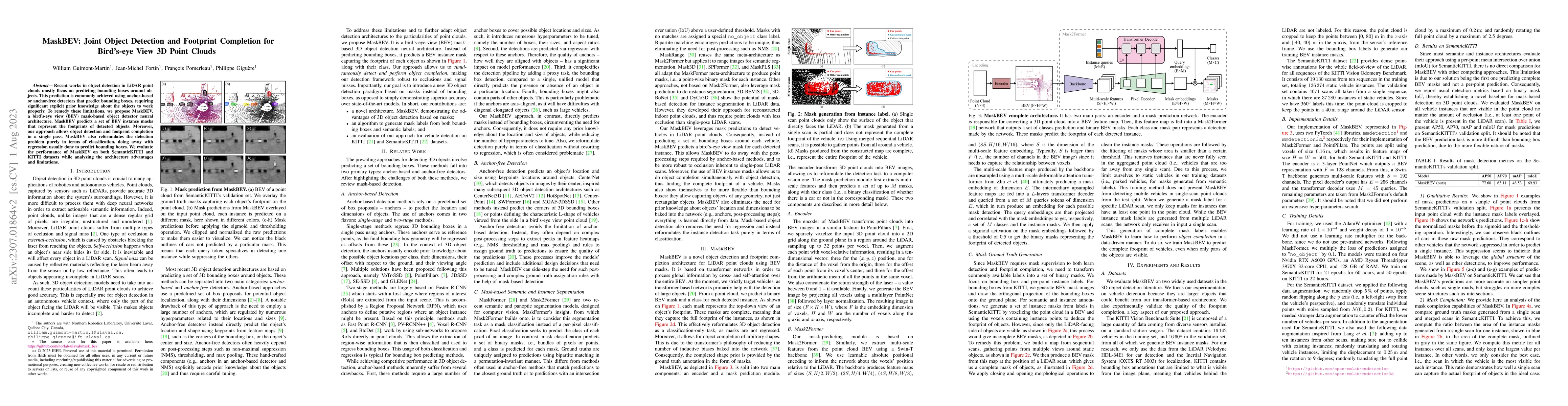
Recent works in object detection in LiDAR point clouds mostly focus on predicting bounding boxes around objects. This prediction is commonly achieved using anchor-based or anchor-free detectors that...
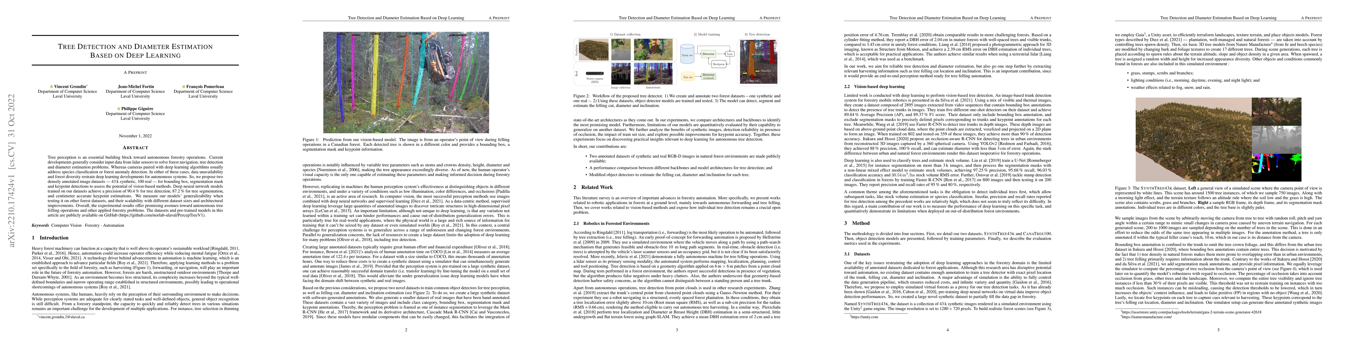
Tree perception is an essential building block toward autonomous forestry operations. Current developments generally consider input data from lidar sensors to solve forest navigation, tree detection...
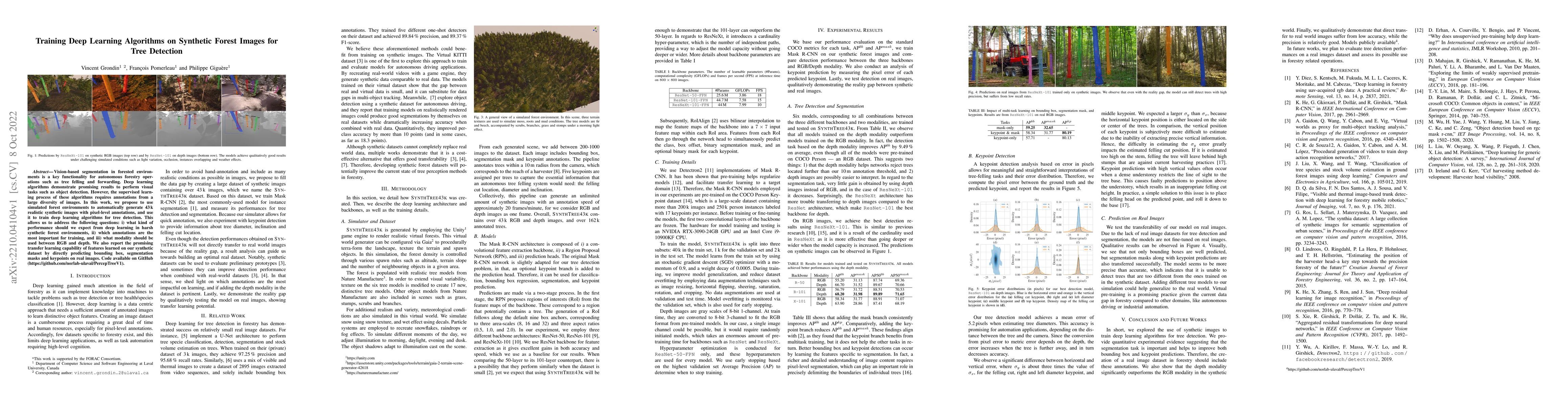
Vision-based segmentation in forested environments is a key functionality for autonomous forestry operations such as tree felling and forwarding. Deep learning algorithms demonstrate promising resul...
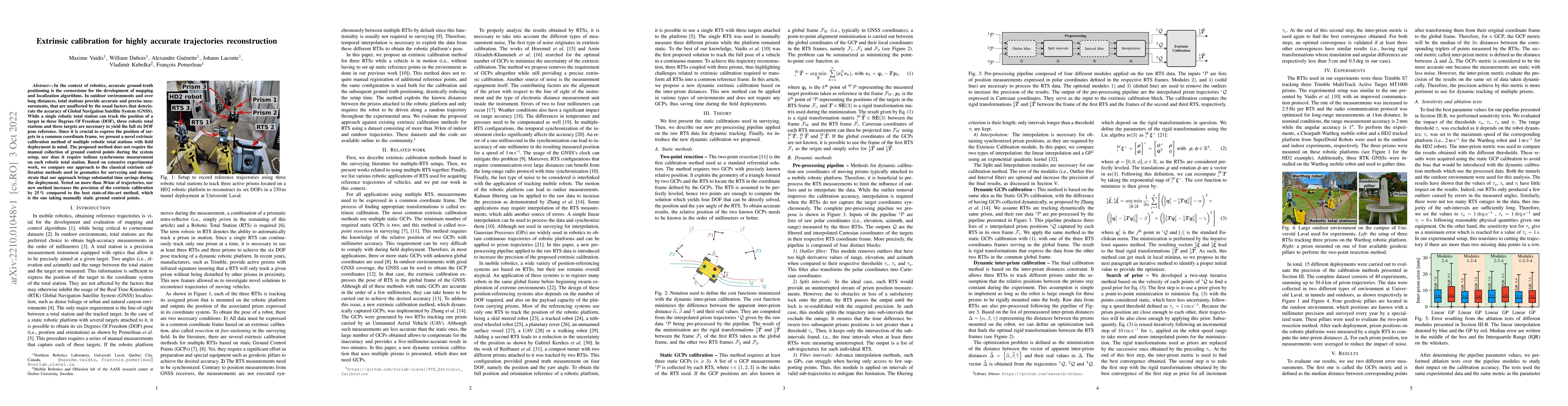
In the context of robotics, accurate ground-truth positioning is the cornerstone for the development of mapping and localization algorithms. In outdoor environments and over long distances, total st...
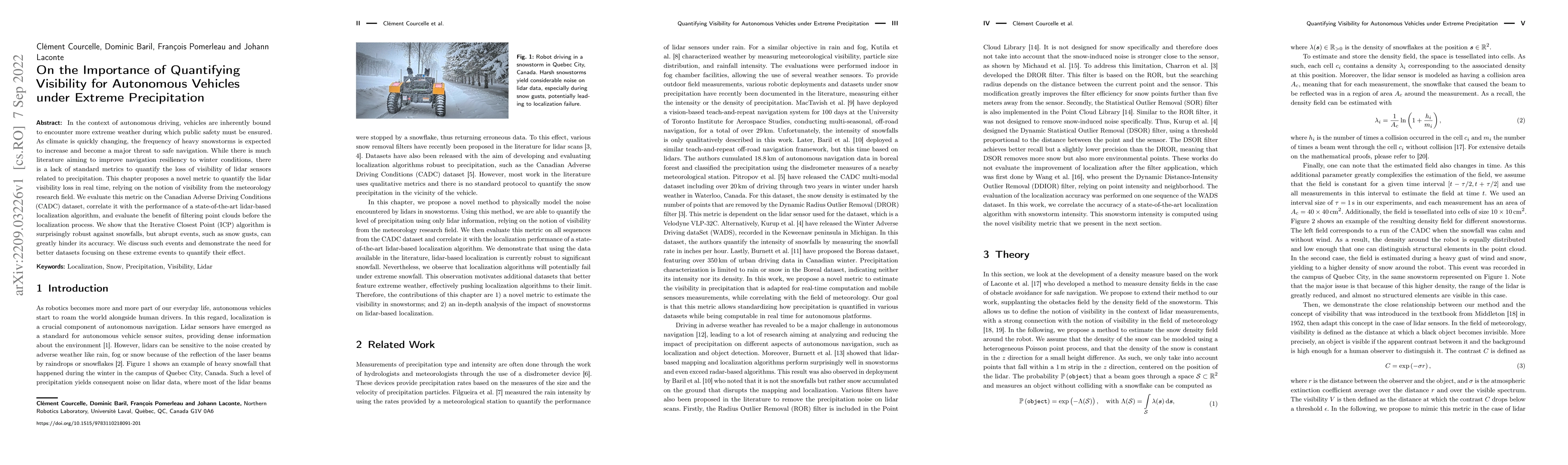
In the context of autonomous driving, vehicles are inherently bound to encounter more extreme weather during which public safety must be ensured. As climate is quickly changing, the frequency of hea...
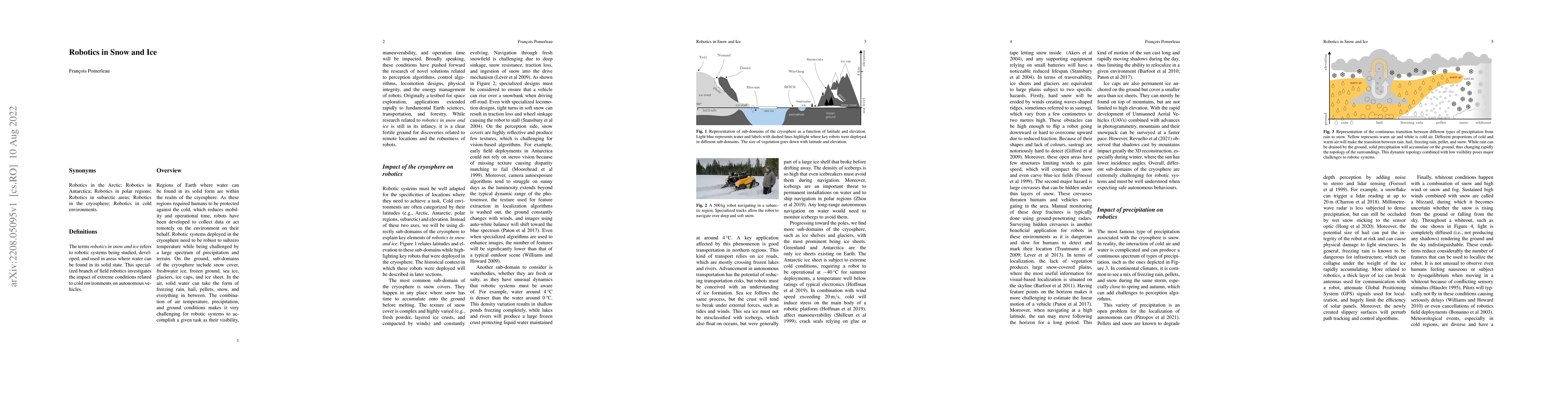
Definition: The terms "robotics in snow and ice" refers to robotic systems being studied, developed, and used in areas where water can be found in its solid state. This specialized branch of field r...
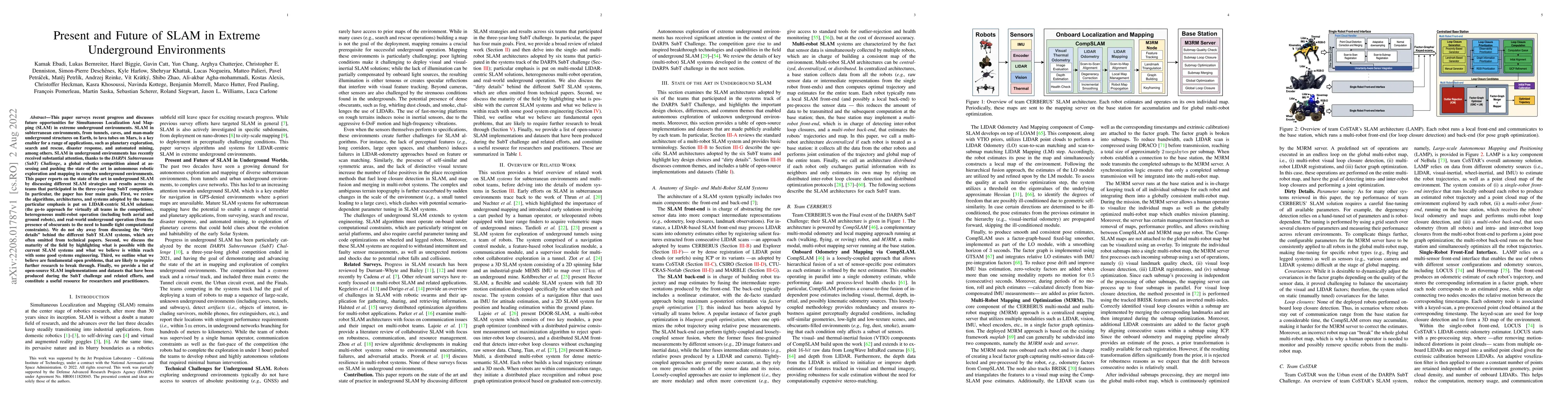
This paper reports on the state of the art in underground SLAM by discussing different SLAM strategies and results across six teams that participated in the three-year-long SubT competition. In part...
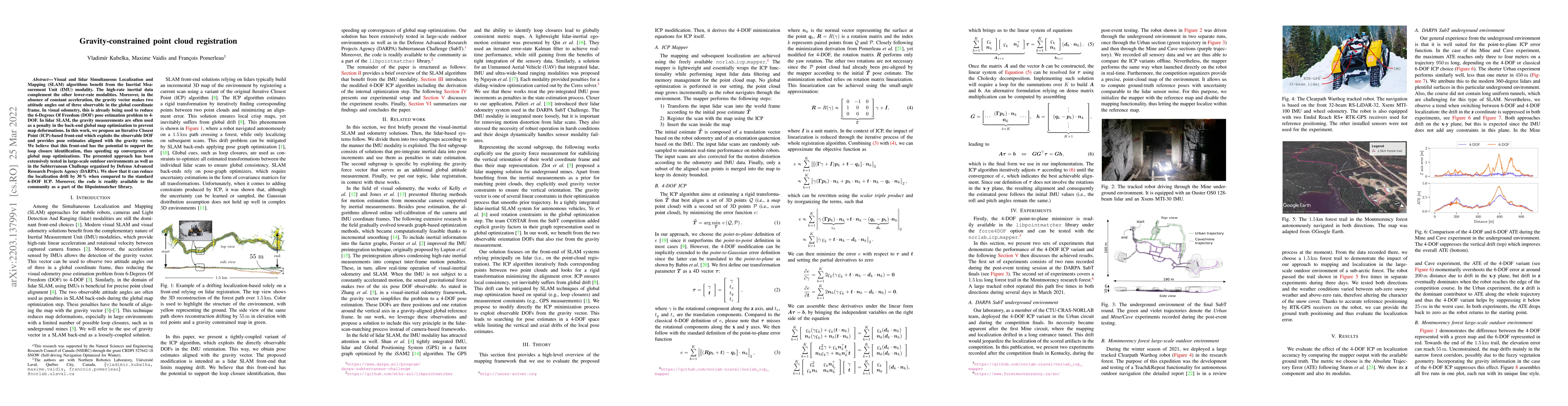
Visual and lidar Simultaneous Localization and Mapping (SLAM) algorithms benefit from the Inertial Measurement Unit (IMU) modality. The high-rate inertial data complement the other lower-rate modali...
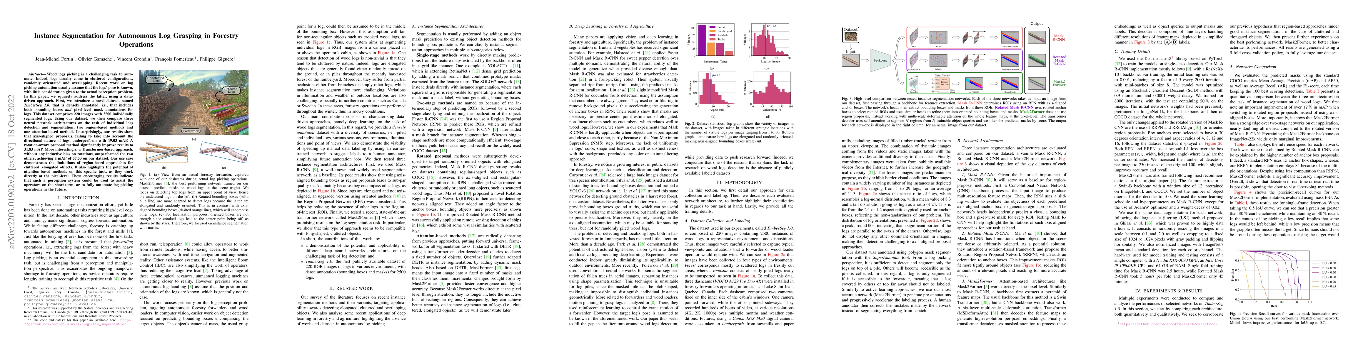
Wood logs picking is a challenging task to automate. Indeed, logs usually come in cluttered configurations, randomly orientated and overlapping. Recent work on log picking automation usually assume ...
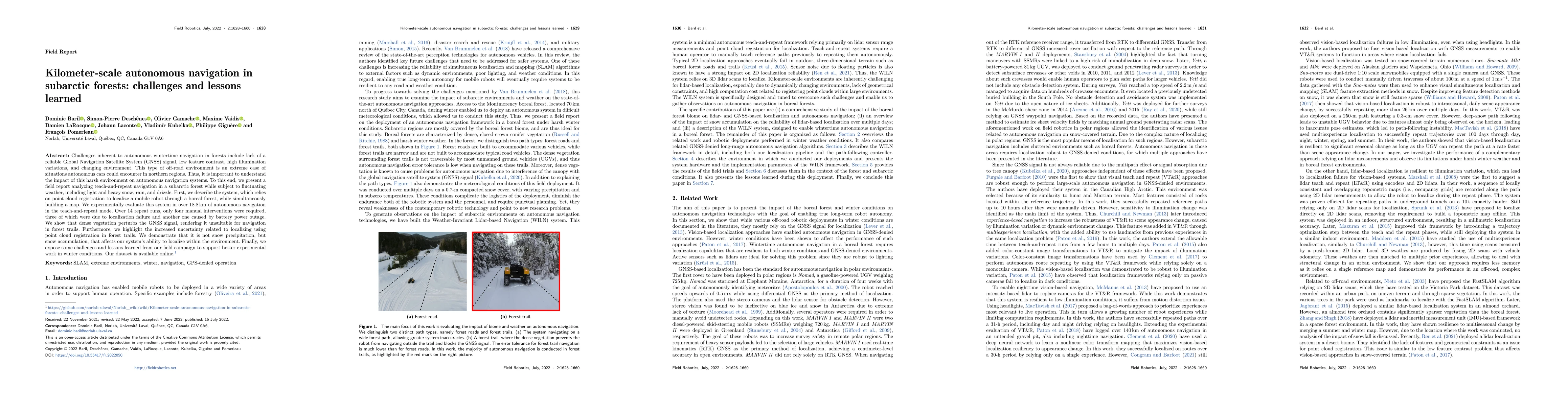
Challenges inherent to autonomous wintertime navigation in forests include lack of reliable a Global Navigation Satellite System (GNSS) signal, low feature contrast, high illumination variations and...
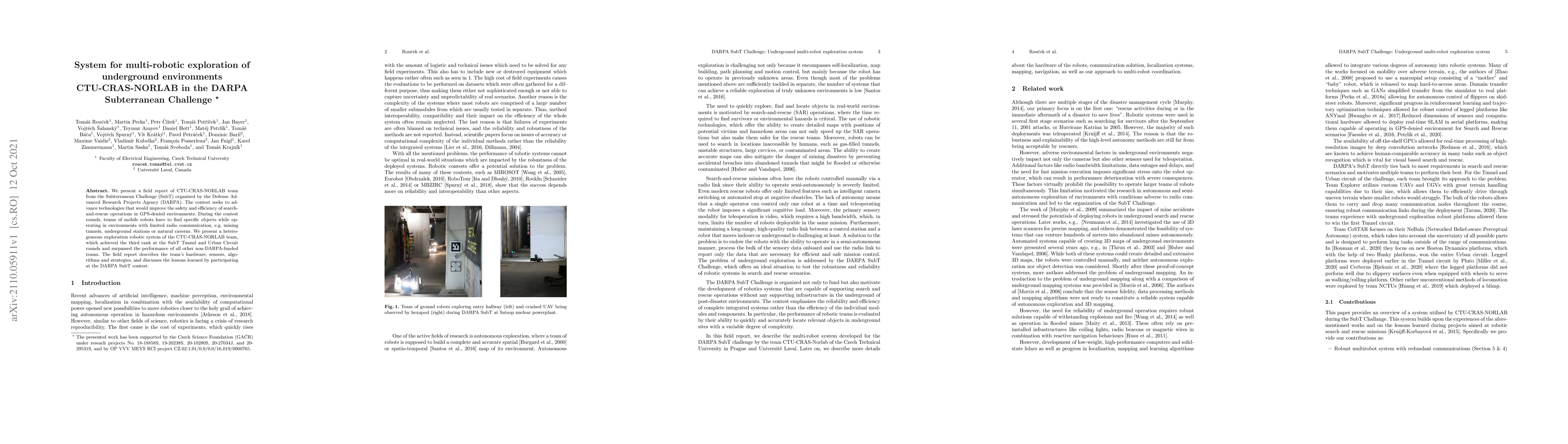
We present a field report of CTU-CRAS-NORLAB team from the Subterranean Challenge (SubT) organised by the Defense Advanced Research Projects Agency (DARPA). The contest seeks to advance technologies...
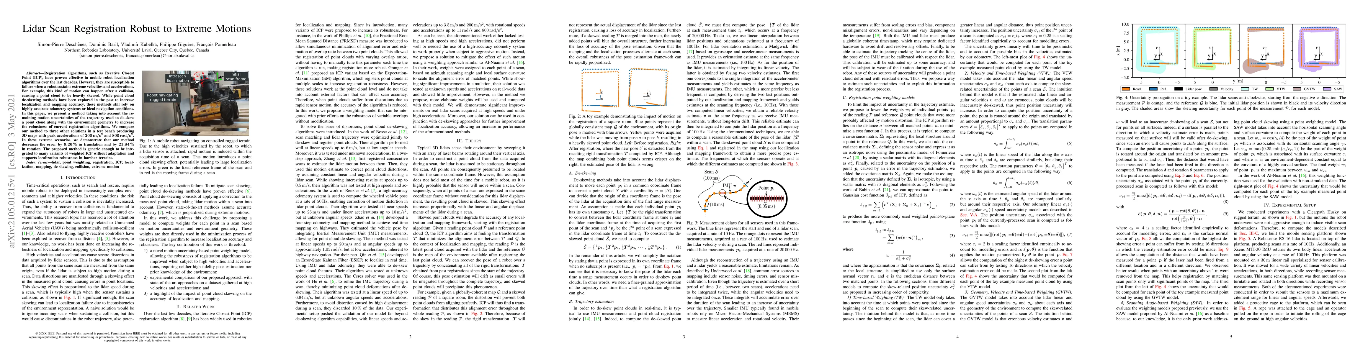
Registration algorithms, such as Iterative Closest Point (ICP), have proven effective in mobile robot localization algorithms over the last decades. However, they are susceptible to failure when a r...
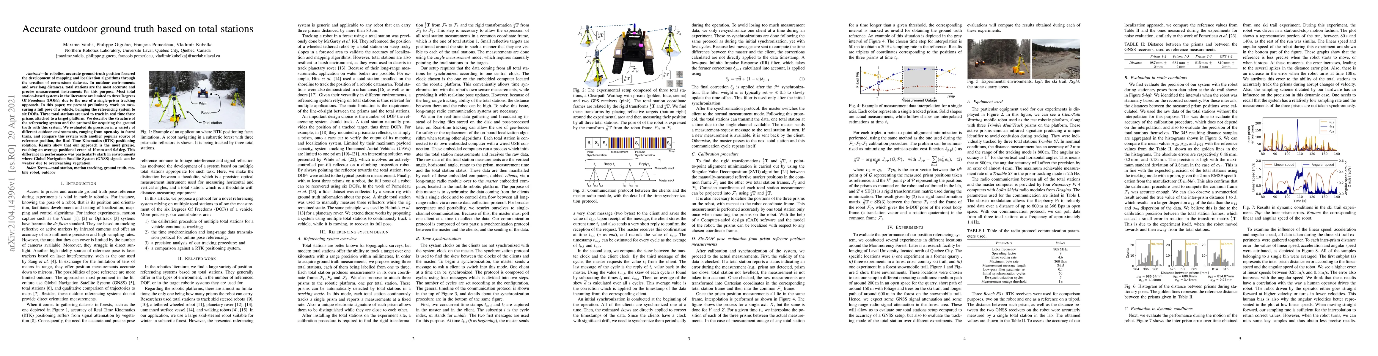
In robotics, accurate ground-truth position fostered the development of mapping and localization algorithms through the creation of cornerstone datasets. In outdoor environments and over long distan...
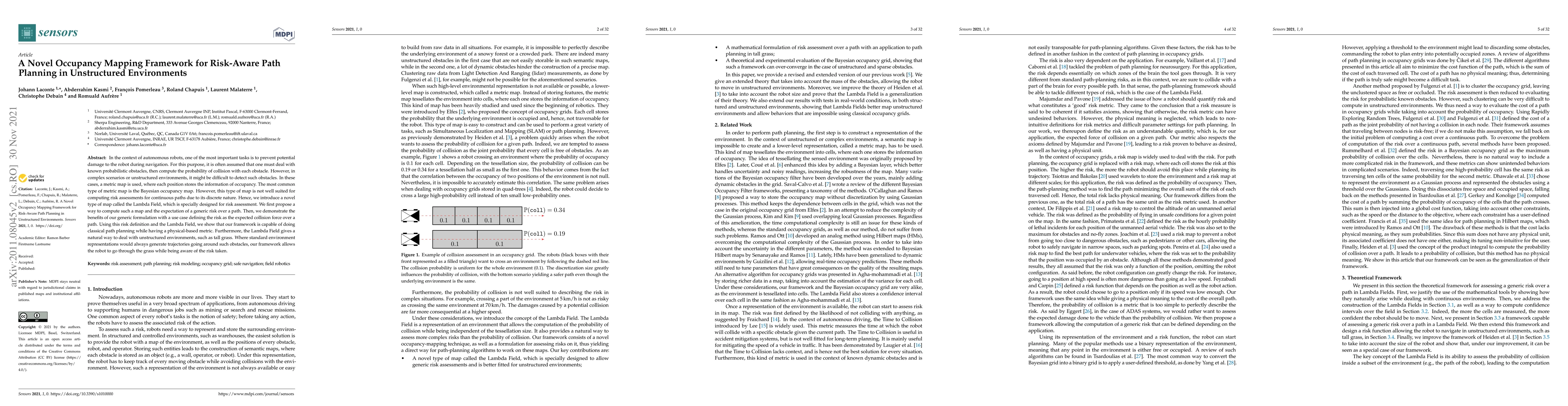
In the context of autonomous robots, one of the most important tasks is to prevent potential damage to the robot during navigation. For this purpose, it is often assumed that one must deal with know...
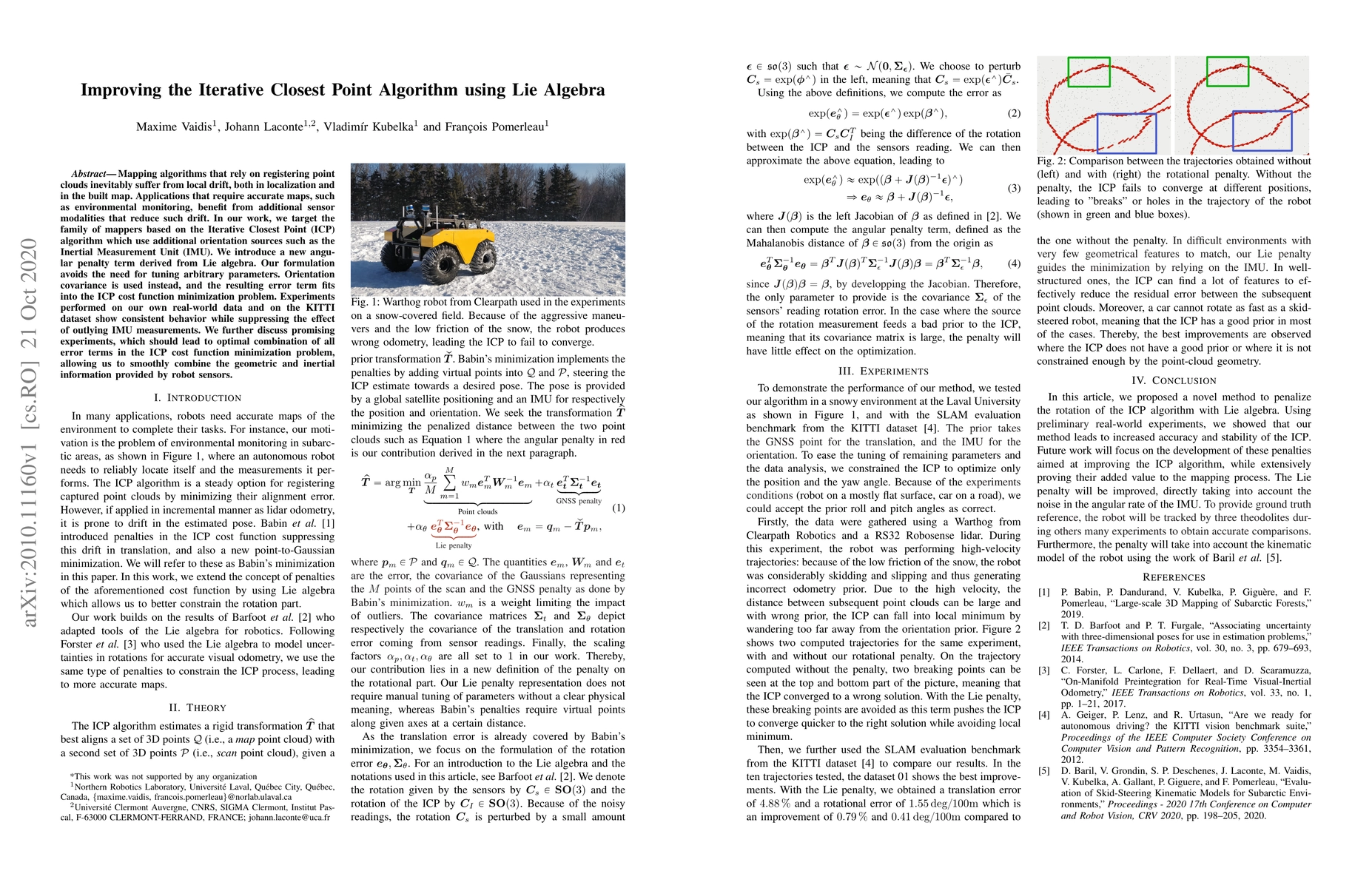
Mapping algorithms that rely on registering point clouds inevitably suffer from local drift, both in localization and in the built map. Applications that require accurate maps, such as environmental...
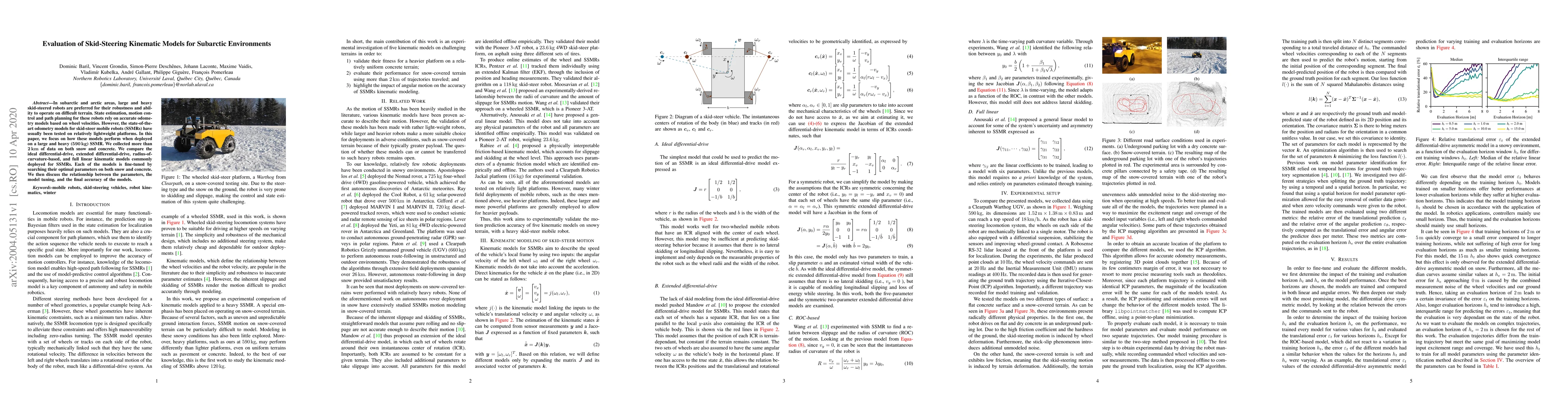
In subarctic and arctic areas, large and heavy skid-steered robots are preferred for their robustness and ability to operate on difficult terrain. State estimation, motion control and path planning ...
This report is a survey of the different autonomous driving datasets which have been published up to date. The first section introduces the many sensor types used in autonomous driving datasets. The...
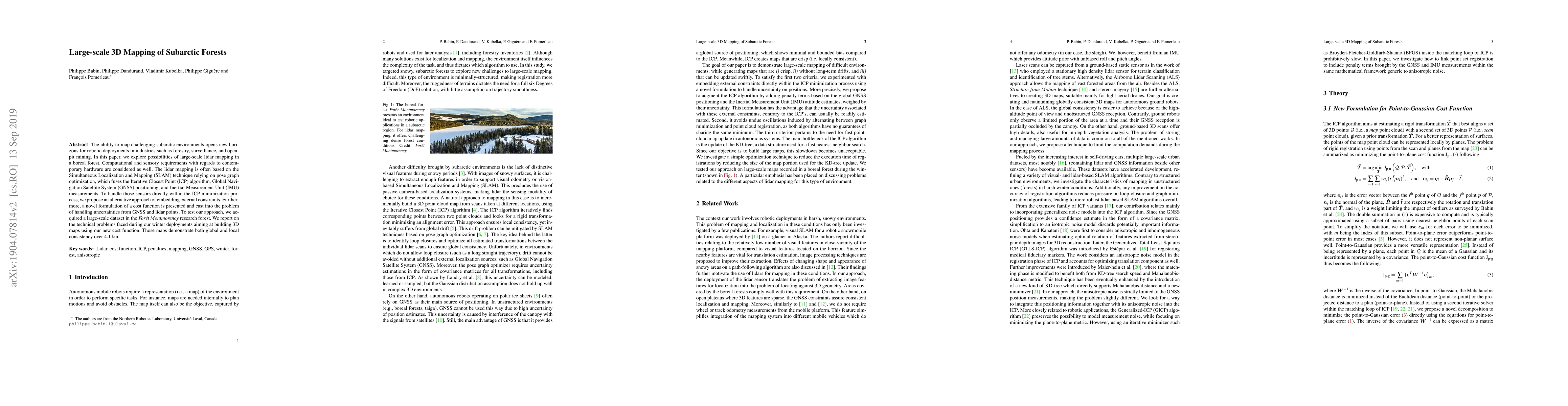
The ability to map challenging subarctic environments opens new horizons for robotic deployments in industries such as forestry, surveillance, and open-pit mining. In this paper, we explore possibil...
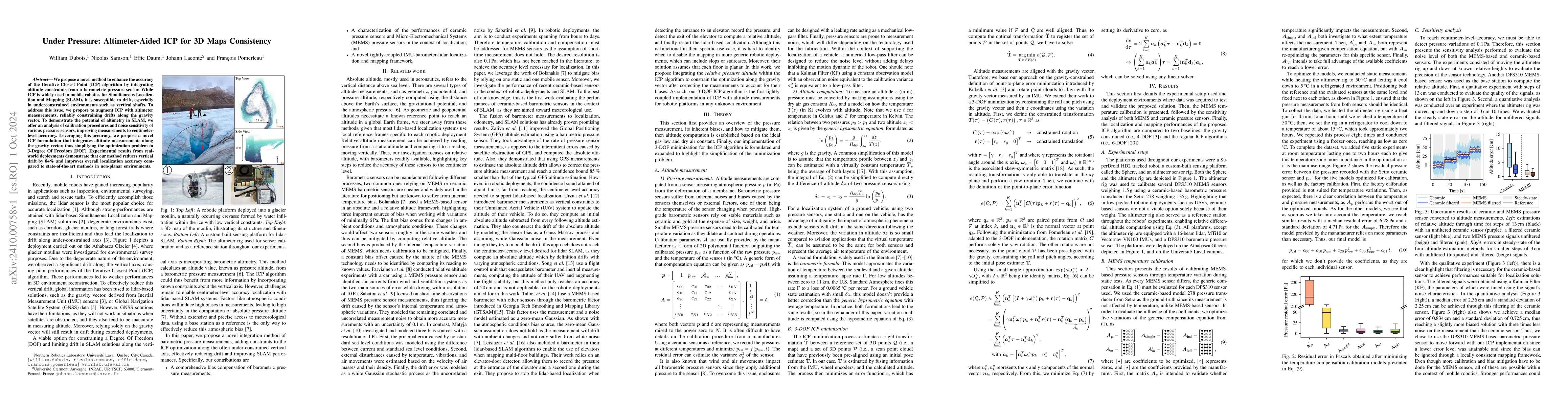
We propose a novel method to enhance the accuracy of the Iterative Closest Point (ICP) algorithm by integrating altitude constraints from a barometric pressure sensor. While ICP is widely used in mobi...
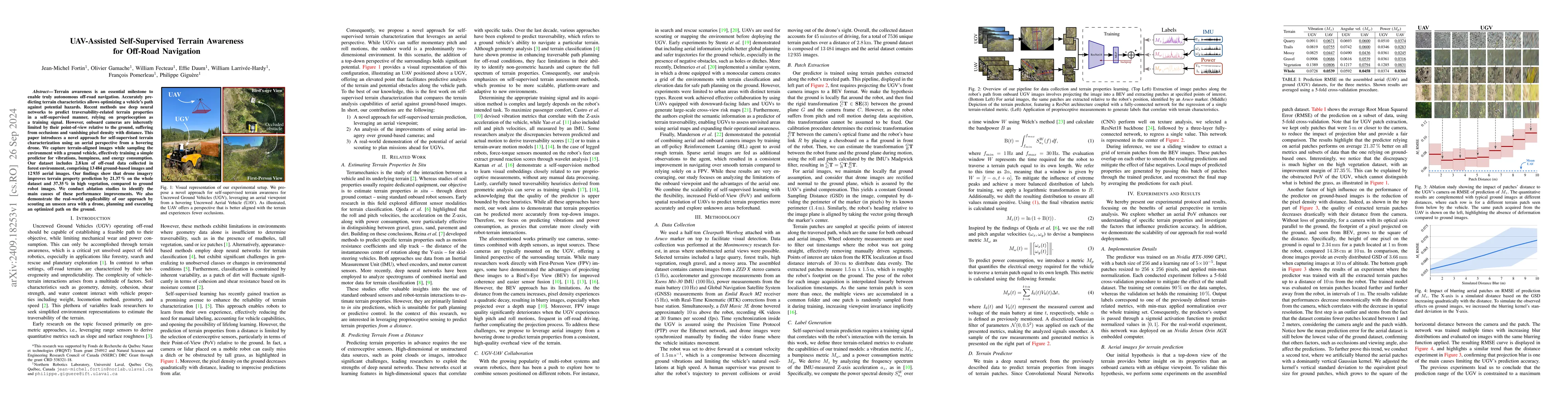
Terrain awareness is an essential milestone to enable truly autonomous off-road navigation. Accurately predicting terrain characteristics allows optimizing a vehicle's path against potential hazards. ...
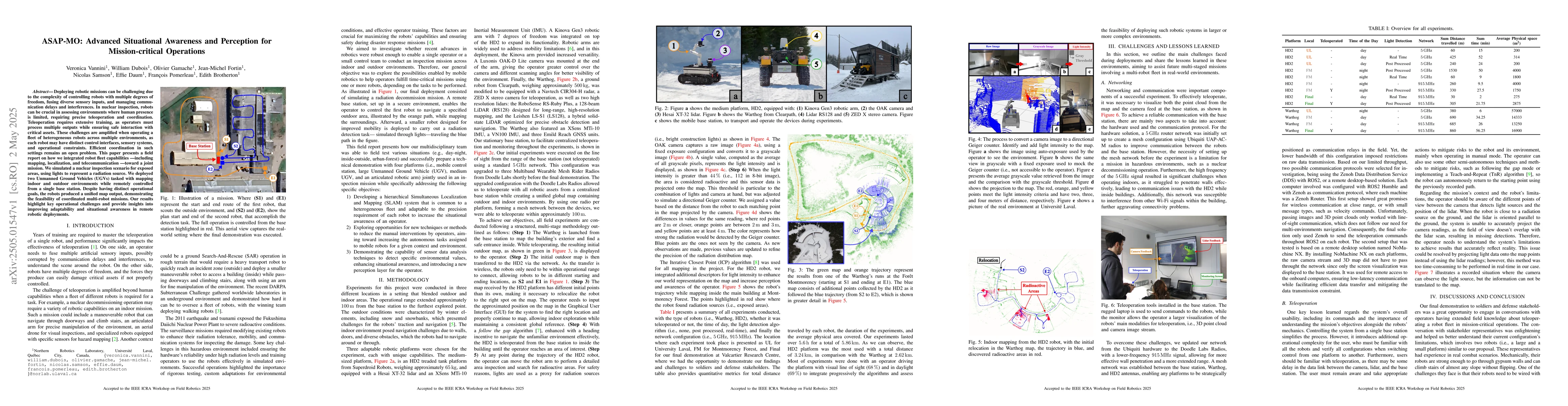
Deploying robotic missions can be challenging due to the complexity of controlling robots with multiple degrees of freedom, fusing diverse sensory inputs, and managing communication delays and interfe...
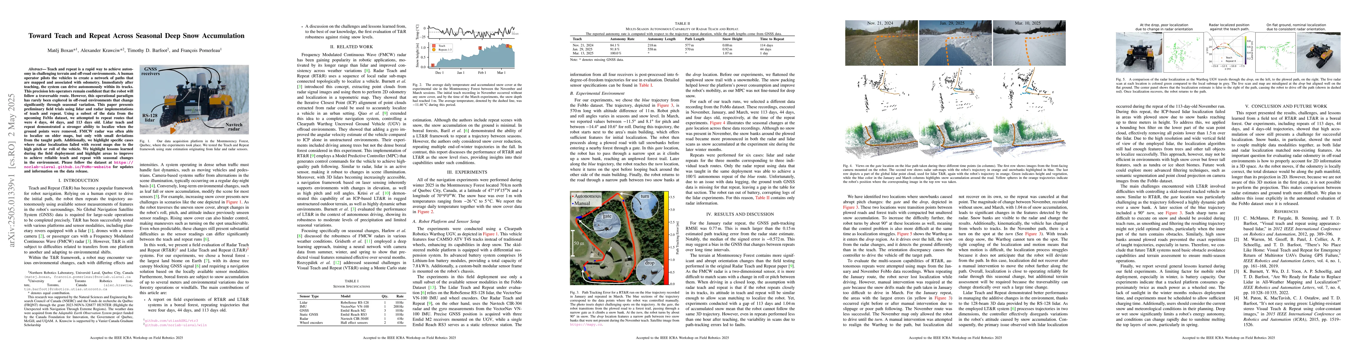
Teach and repeat is a rapid way to achieve autonomy in challenging terrain and off-road environments. A human operator pilots the vehicles to create a network of paths that are mapped and associated w...
Off-road autonomous navigation is a challenging task as it is mainly dependent on the accuracy of the motion model. Motion model performances are limited by their ability to predict the interaction be...
Standard datasets often present limitations, particularly due to the fixed nature of input data sensors, which makes it difficult to compare methods that actively adjust sensor parameters to suit envi...
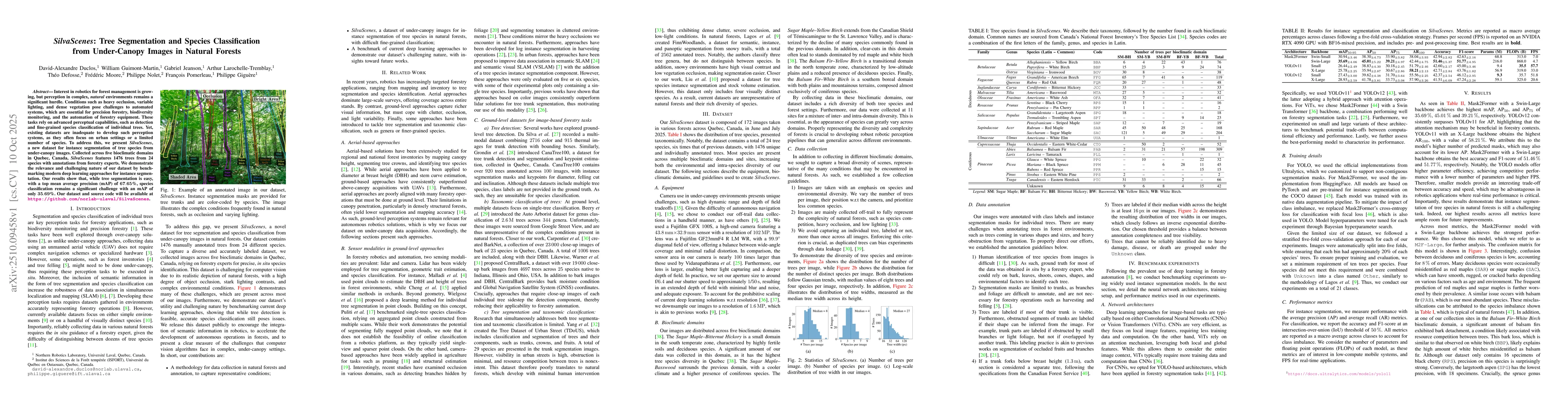
Interest in robotics for forest management is growing, but perception in complex, natural environments remains a significant hurdle. Conditions such as heavy occlusion, variable lighting, and dense ve...
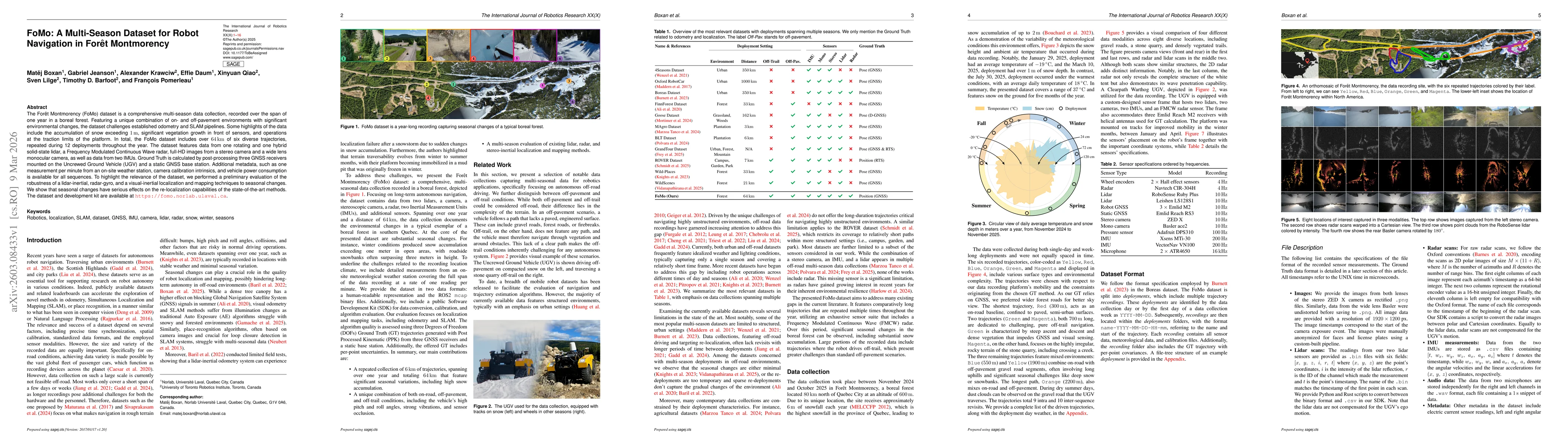
The Forêt Montmorency (FoMo) dataset is a comprehensive multi-season data collection, recorded over the span of one year in a boreal forest. Featuring a unique combination of on- and off-pavement envi...
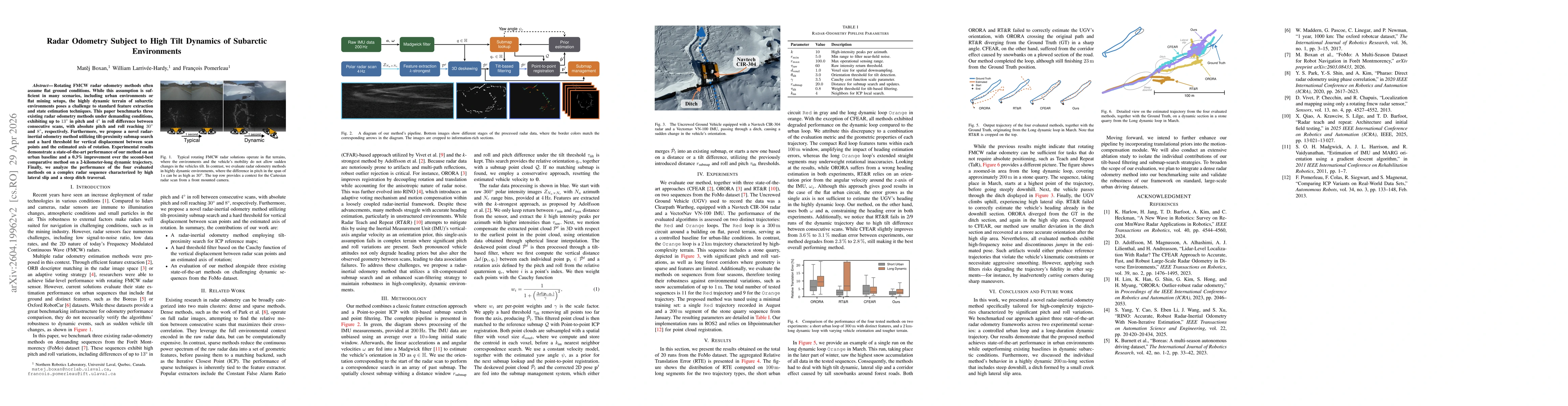
Rotating FMCW radar odometry methods often assume flat ground conditions. While this assumption is sufficient in many scenarios, including urban environments or flat mining setups, the highly dynamic ...
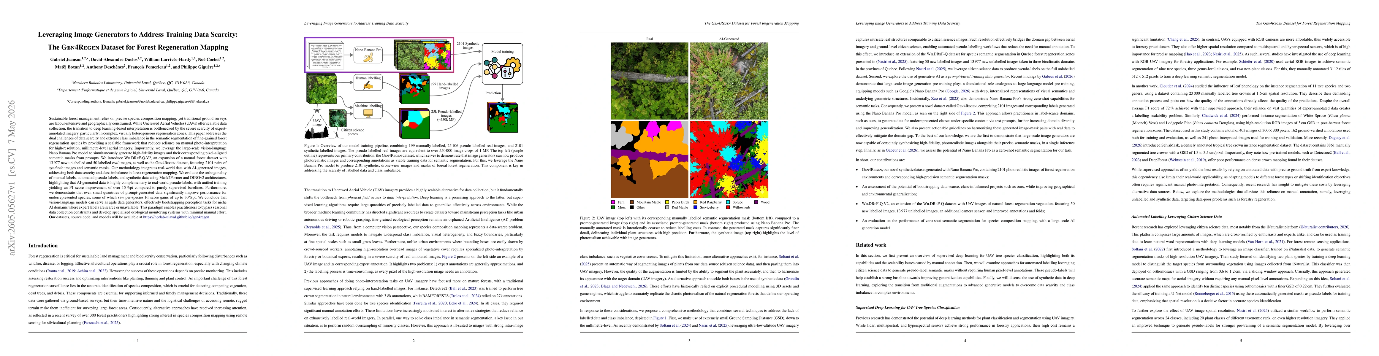
Sustainable forest management relies on precise species composition mapping, yet traditional ground surveys are labour-intensive and geographically constrained. While Uncrewed Aerial Vehicles (UAVs) o...
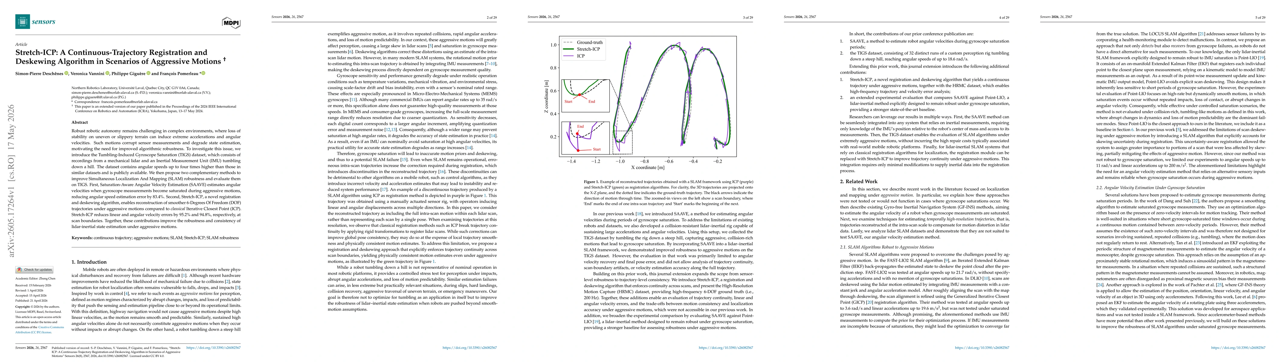
Robust robotic autonomy remains challenging in complex environments, where loss of stability on uneven or slippery terrain can induce extreme accelerations and angular velocities. Such motions corrupt...