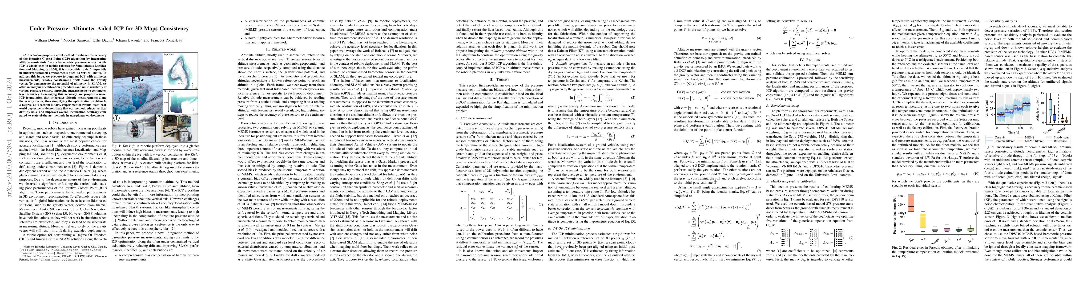
01
MethodologyHow they did it
A novel 3-DOF ICP algorithm was proposed based on barometer constraints.
This paper introduces an enhanced Iterative Closest Point (ICP) method for 3D mapping in mobile robotics by incorporating altitude data from a barometric sensor to constrain vertical drift. The proposed approach reduces vertical drift by 84% and improves localization accuracy in underconstrained environments.
This paper introduces an enhanced Iterative Closest Point (ICP) method for 3D mapping in mobile robotics by incorporating altitude data from a barometric sensor to constrain vertical drift. The proposed approach reduces vertical drift by 84% and improves localization accuracy in underconstrained environments.
A novel 3-DOF ICP algorithm was proposed based on barometer constraints. More in Methodology →
MEMS sensors reached centimeter-level accuracy with lower filtering requirements — Ceramic sensors could be used with advanced signal filtering to avoid bias caused by internal temperature More in Key Results →
This research contributes to the development of more accurate and robust navigation systems for robotics applications. More in Significance →
The experiment was limited by the lack of large-scale experiments — The proposed algorithm may not be suitable for all environments or applications More in Limitations →
We propose a novel method to enhance the accuracy of the Iterative Closest Point (ICP) algorithm by integrating altitude constraints from a barometric pressure sensor. While ICP is widely used in mobile robotics for Simultaneous Localization and Mapping ( SLAM ), it is susceptible to drift, especially in underconstrained environments such as vertical shafts. To address this issue, we propose to augment ICP with altimeter measurements, reliably constraining drifts along the gravity vector. To demonstrate the potential of altimetry in SLAM , we offer an analysis of calibration procedures and noise sensitivity of various pressure sensors, improving measurements to centimeter-level accuracy. Leveraging this accuracy, we propose a novel ICP formulation that integrates altitude measurements along the gravity vector, thus simplifying the optimization problem to 3-Degree Of Freedom (DOF). Experimental results from real-world deployments demonstrate that our method reduces vertical drift by 84% and improves overall localization accuracy compared to state-of-the-art methods in non-planar environments.
Seven facets of this paper, analysed and brought into focus by AI.
This research contributes to the development of more accurate and robust navigation systems for robotics applications.
A novel 3-DOF ICP algorithm was proposed based on barometer constraints.
This research contributes to the development of more accurate and robust navigation systems for robotics applications.
A novel 3-DOF ICP algorithm was proposed that leverages barometer constraints for improved accuracy.
The use of barometer constraints in ICP algorithms is a new and innovative approach to navigation system development.
Discussion 0