Academic Profile
Statistics
Similar Authors
Papers on arXiv
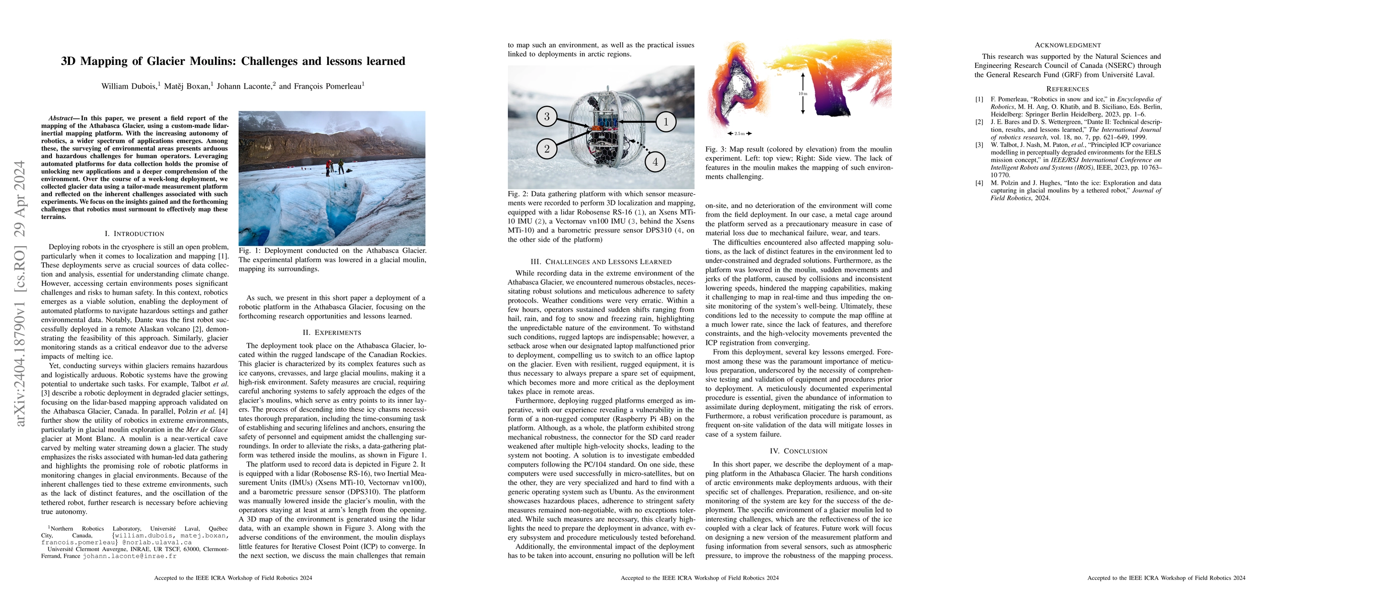
In this paper, we present a field report of the mapping of the Athabasca Glacier, using a custom-made lidar-inertial mapping platform. With the increasing autonomy of robotics, a wider spectrum of a...
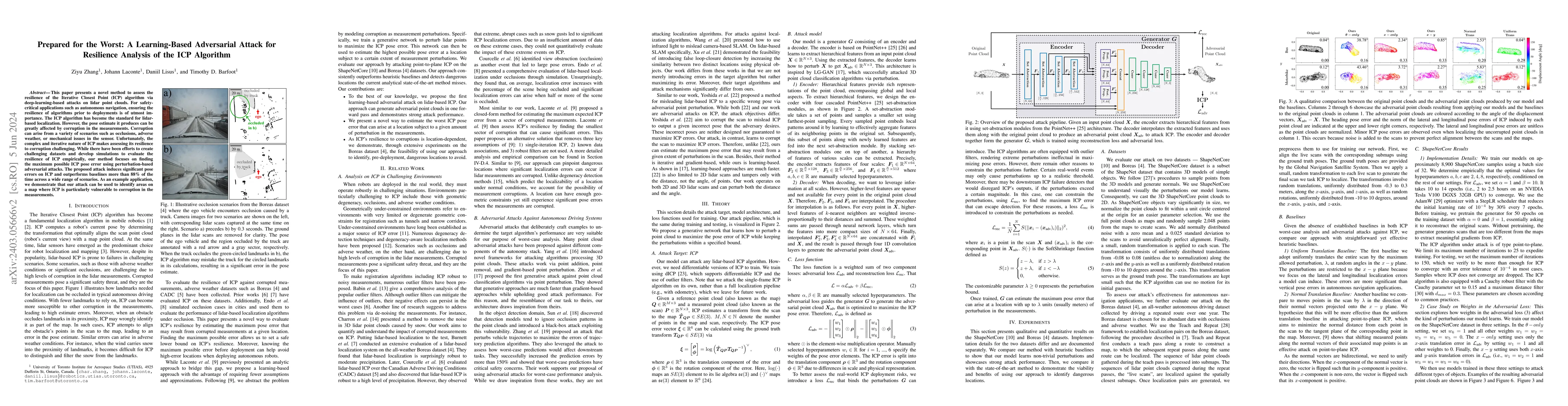
This paper presents a novel method to assess the resilience of the Iterative Closest Point (ICP) algorithm via deep-learning-based attacks on lidar point clouds. For safety-critical applications suc...
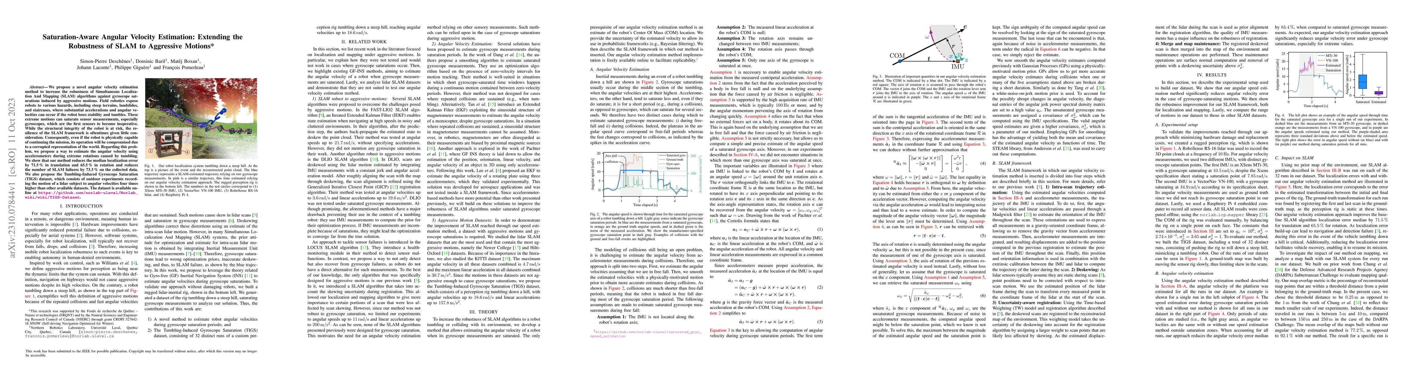
We propose a novel angular velocity estimation method to increase the robustness of Simultaneous Localization And Mapping (SLAM) algorithms against gyroscope saturations induced by aggressive motion...
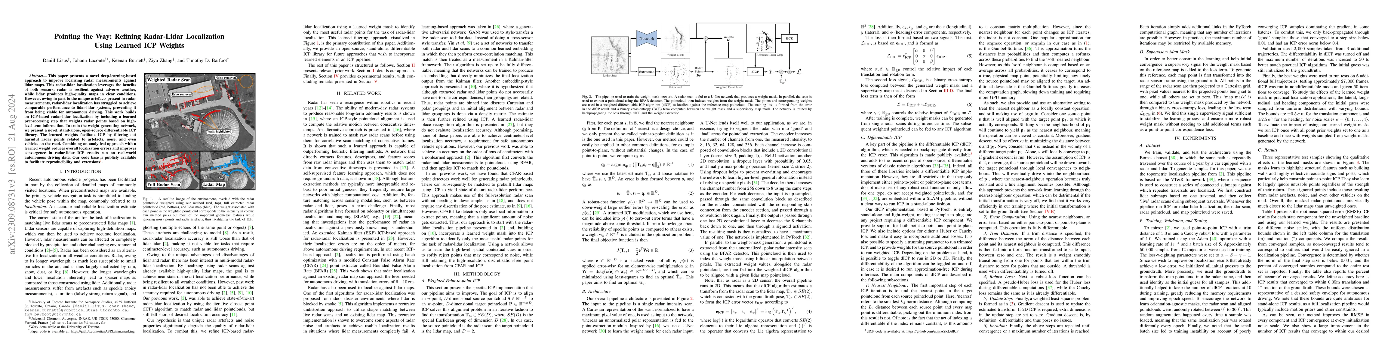
This paper presents a novel deep-learning-based approach to improve localizing radar measurements against lidar maps. Although the state of the art for localization is matching lidar data to lidar m...
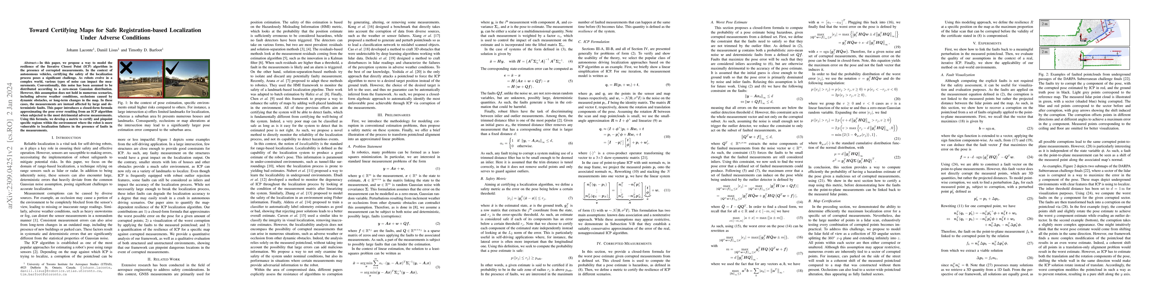
In this paper, we propose a way to model the resilience of the Iterative Closest Point (ICP) algorithm in the presence of corrupted measurements. In the context of autonomous vehicles, certifying th...
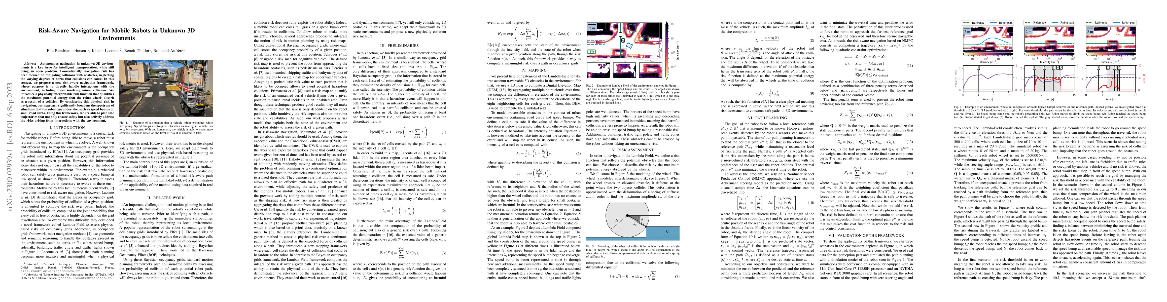
Autonomous navigation in unknown 3D environments is a key issue for intelligent transportation, while still being an open problem. Conventionally, navigation risk has been focused on mitigating coll...
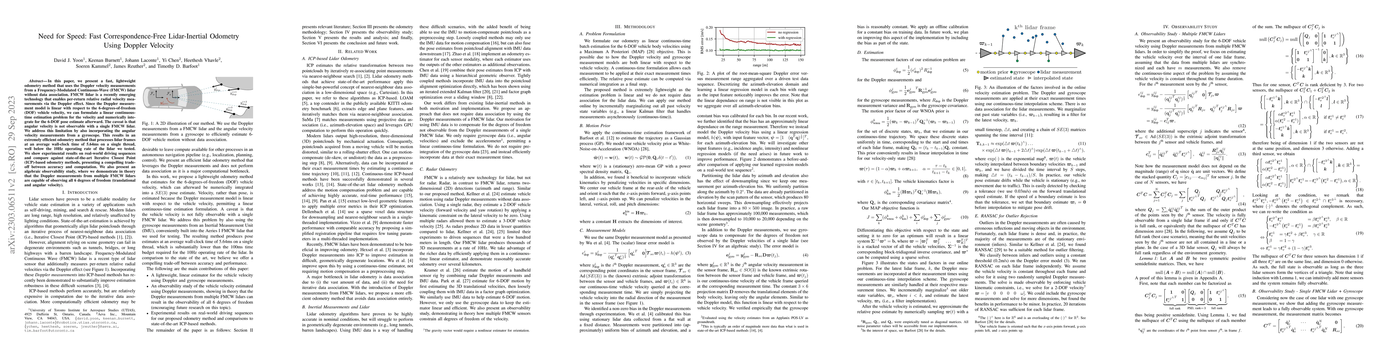
In this paper, we present a fast, lightweight odometry method that uses the Doppler velocity measurements from a Frequency-Modulated Continuous-Wave (FMCW) lidar without data association. FMCW lidar...
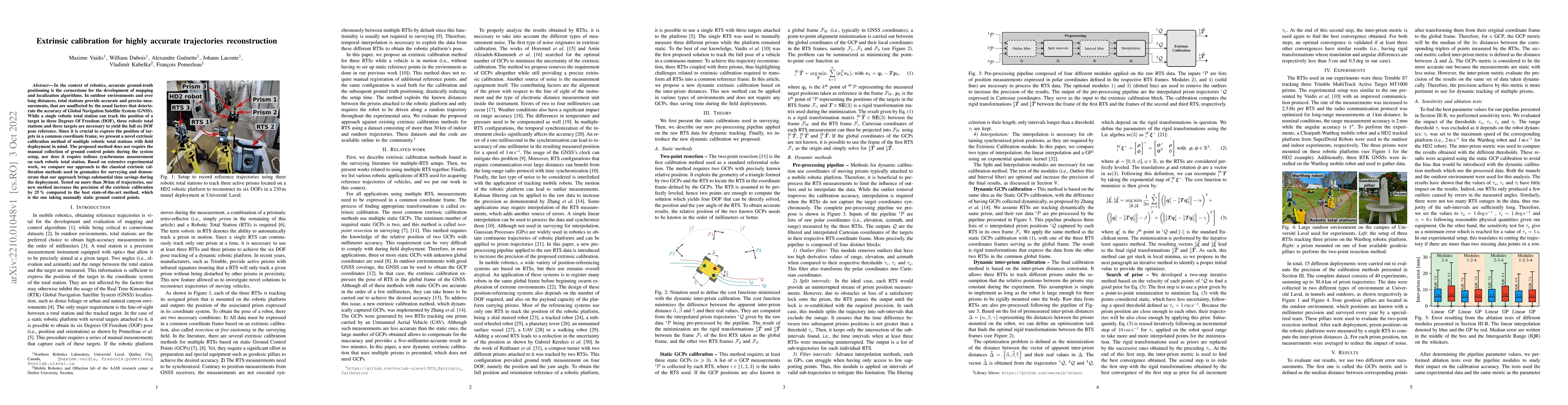
In the context of robotics, accurate ground-truth positioning is the cornerstone for the development of mapping and localization algorithms. In outdoor environments and over long distances, total st...
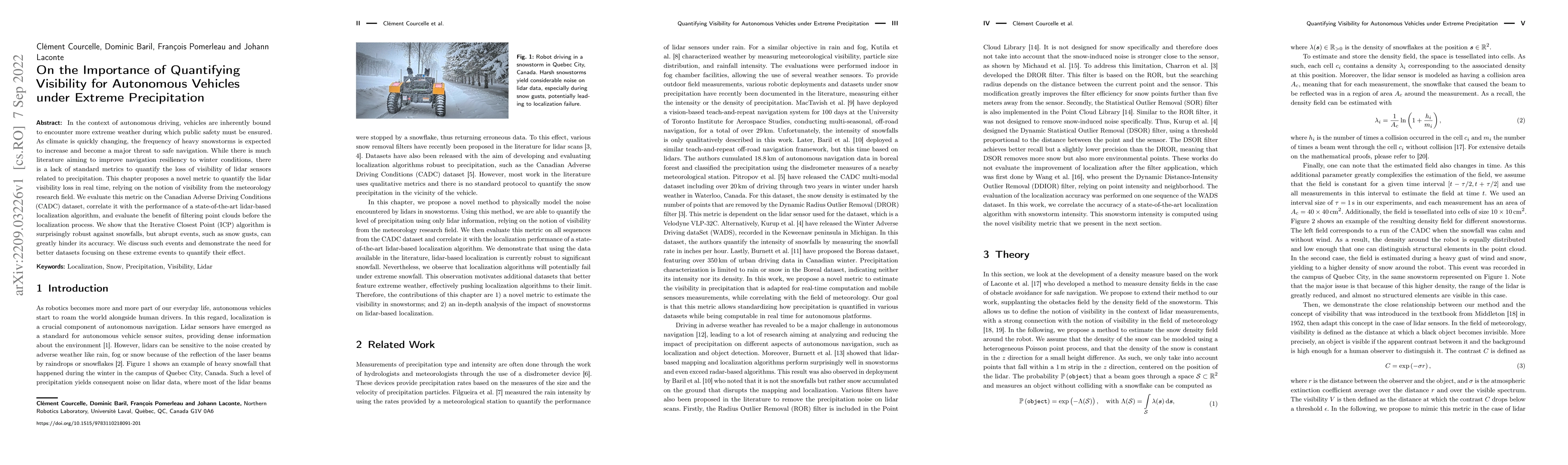
In the context of autonomous driving, vehicles are inherently bound to encounter more extreme weather during which public safety must be ensured. As climate is quickly changing, the frequency of hea...
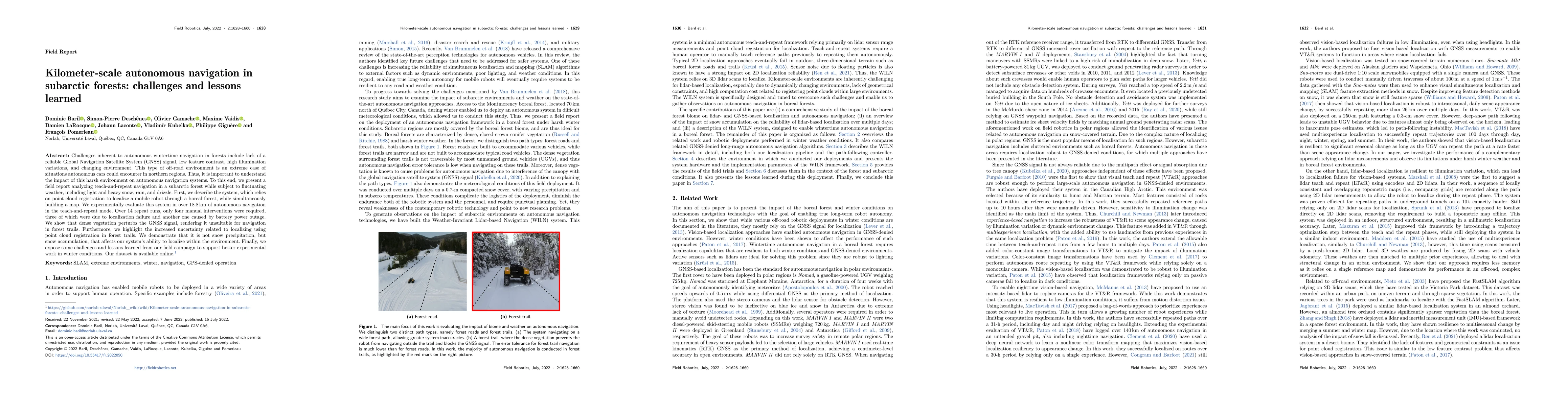
Challenges inherent to autonomous wintertime navigation in forests include lack of reliable a Global Navigation Satellite System (GNSS) signal, low feature contrast, high illumination variations and...
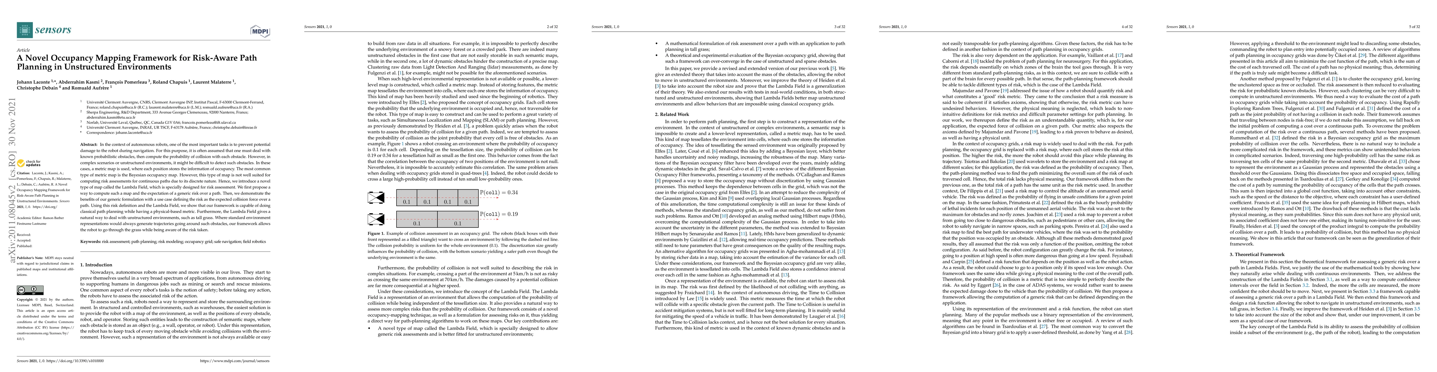
In the context of autonomous robots, one of the most important tasks is to prevent potential damage to the robot during navigation. For this purpose, it is often assumed that one must deal with know...
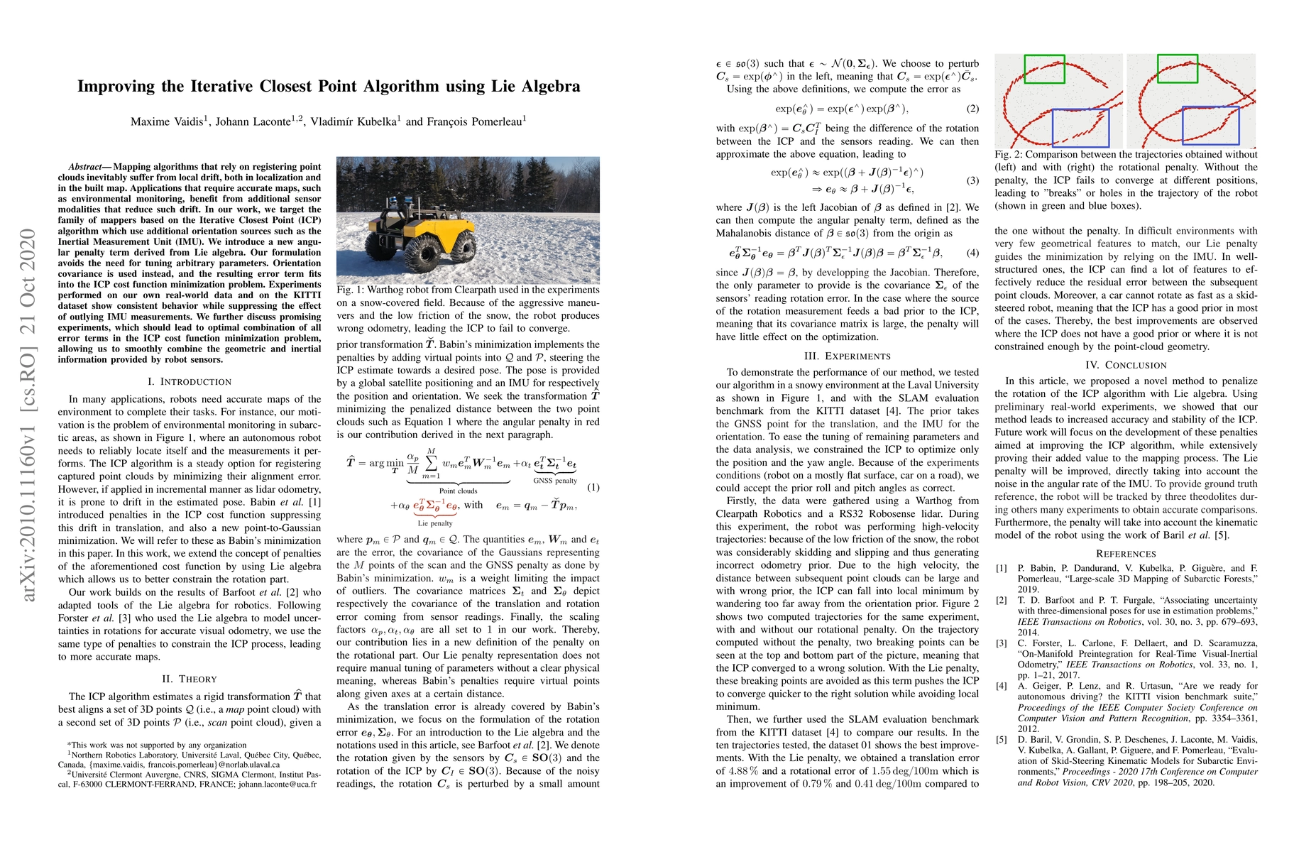
Mapping algorithms that rely on registering point clouds inevitably suffer from local drift, both in localization and in the built map. Applications that require accurate maps, such as environmental...
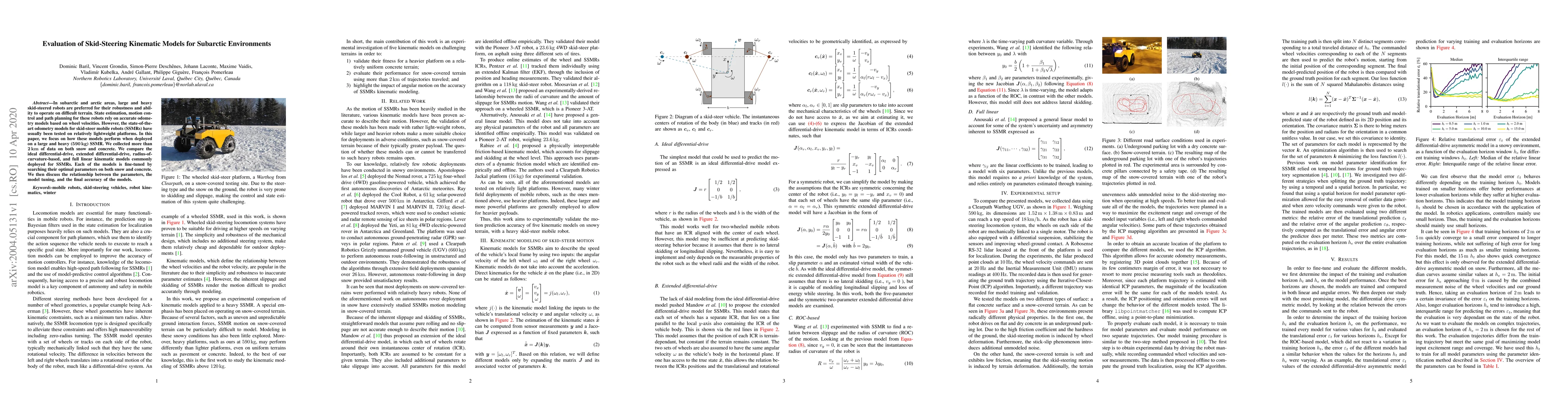
In subarctic and arctic areas, large and heavy skid-steered robots are preferred for their robustness and ability to operate on difficult terrain. State estimation, motion control and path planning ...
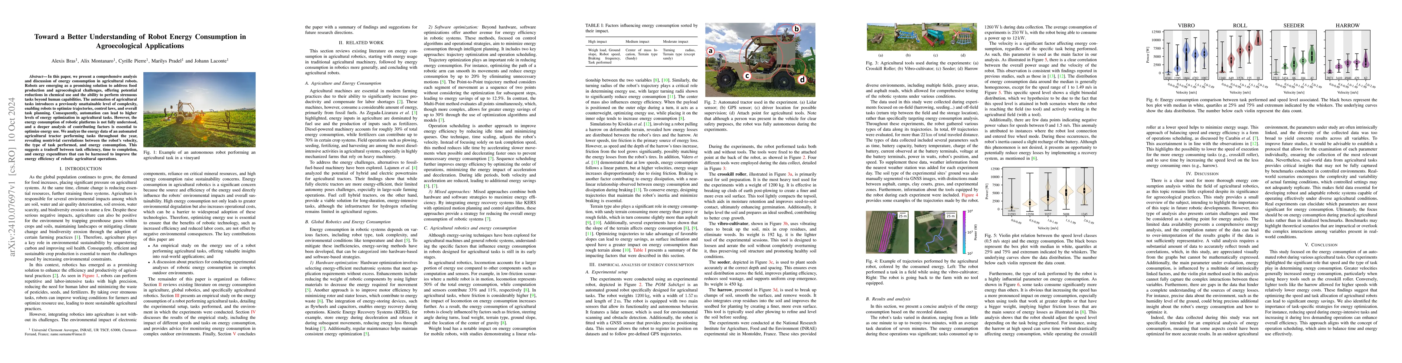
In this paper, we present a comprehensive analysis and discussion of energy consumption in agricultural robots. Robots are emerging as a promising solution to address food production and agroecologica...
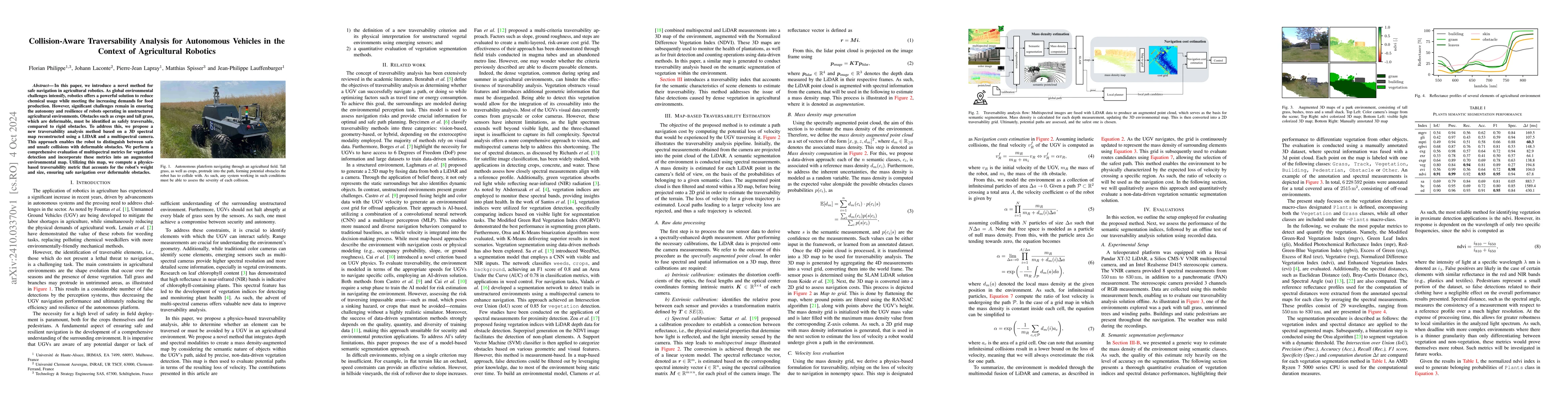
In this paper, we introduce a novel method for safe navigation in agricultural robotics. As global environmental challenges intensify, robotics offers a powerful solution to reduce chemical usage whil...
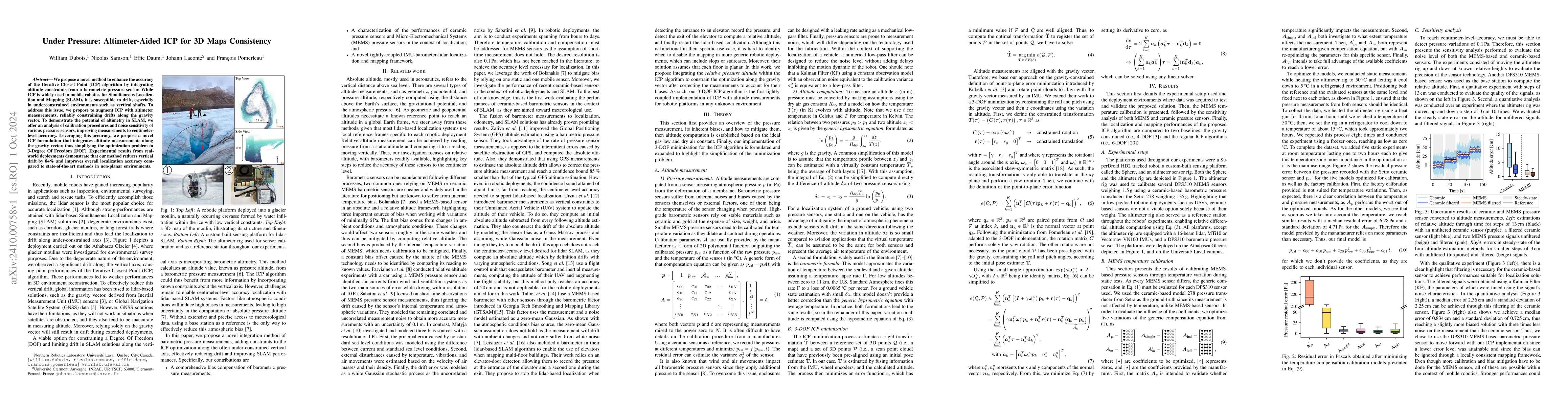
We propose a novel method to enhance the accuracy of the Iterative Closest Point (ICP) algorithm by integrating altitude constraints from a barometric pressure sensor. While ICP is widely used in mobi...
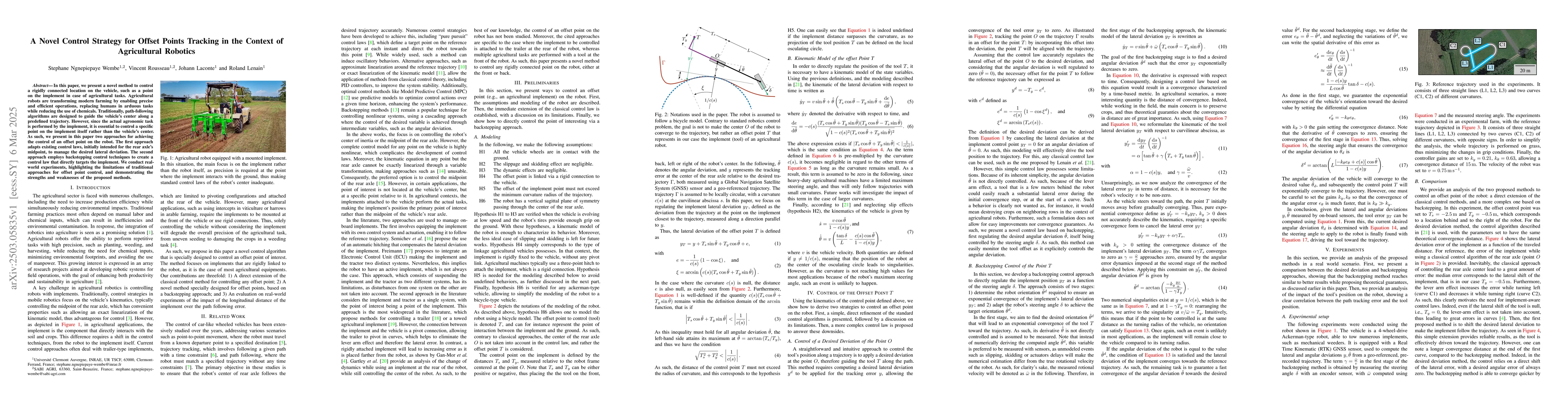
In this paper, we present a novel method to control a rigidly connected location on the vehicle, such as a point on the implement in case of agricultural tasks. Agricultural robots are transforming mo...
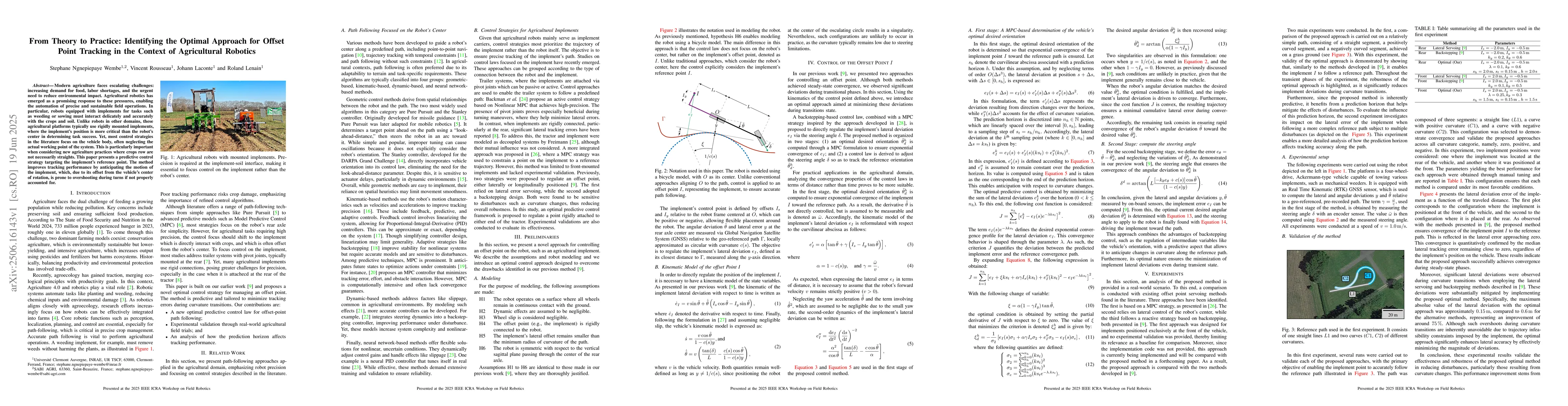
Modern agriculture faces escalating challenges: increasing demand for food, labor shortages, and the urgent need to reduce environmental impact. Agricultural robotics has emerged as a promising respon...
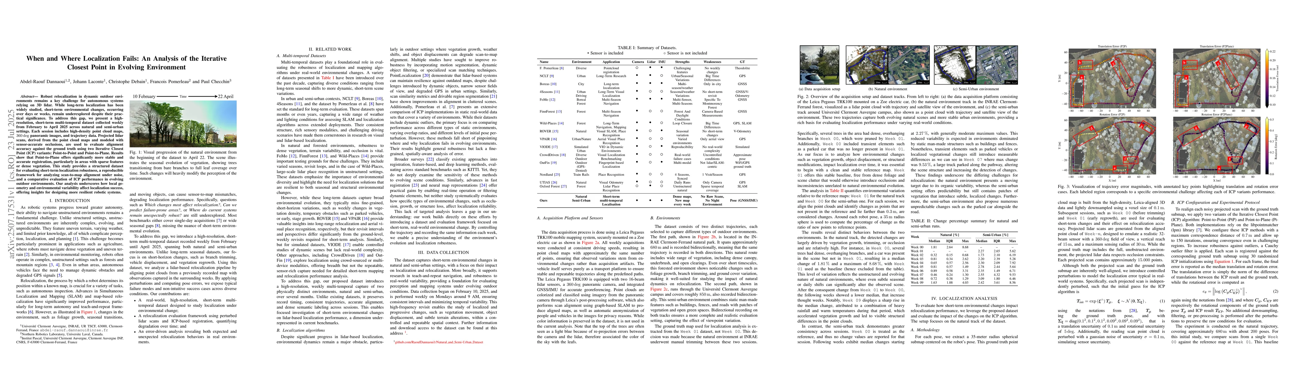
Robust relocalization in dynamic outdoor environments remains a key challenge for autonomous systems relying on 3D lidar. While long-term localization has been widely studied, short-term environmental...
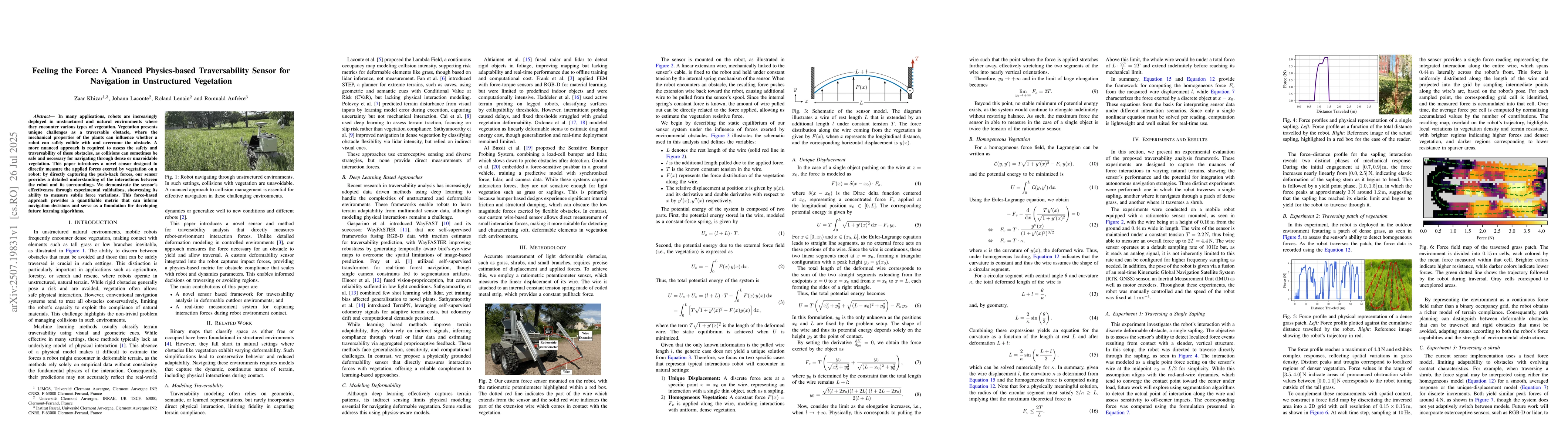
In many applications, robots are increasingly deployed in unstructured and natural environments where they encounter various types of vegetation. Vegetation presents unique challenges as a traversable...
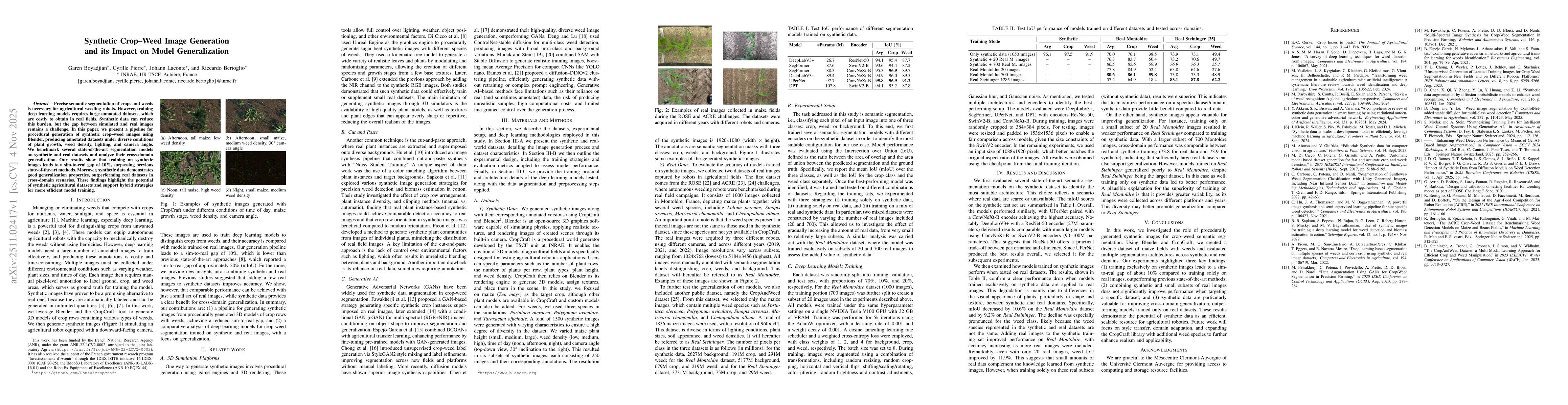
Precise semantic segmentation of crops and weeds is necessary for agricultural weeding robots. However, training deep learning models requires large annotated datasets, which are costly to obtain in r...
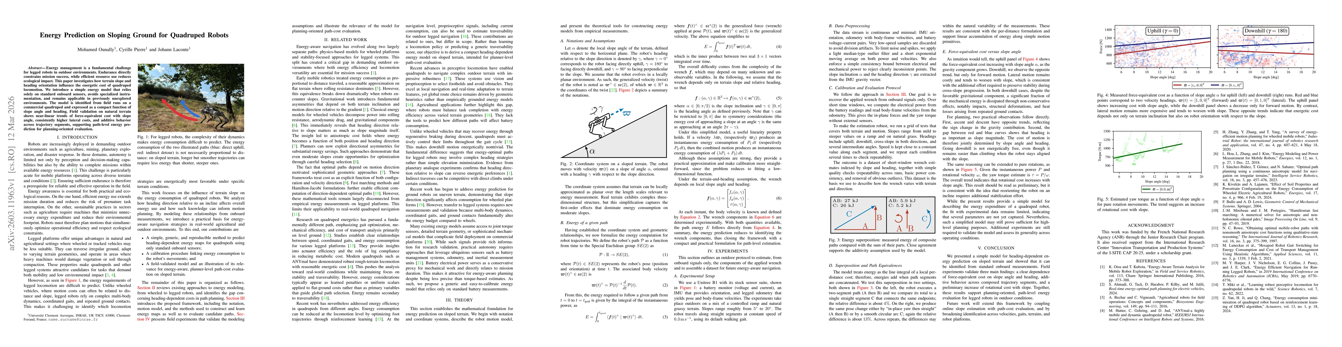
Energy management is a fundamental challenge for legged robots in outdoor environments. Endurance directly constrains mission success, while efficient resource use reduces ecological impact. This pape...
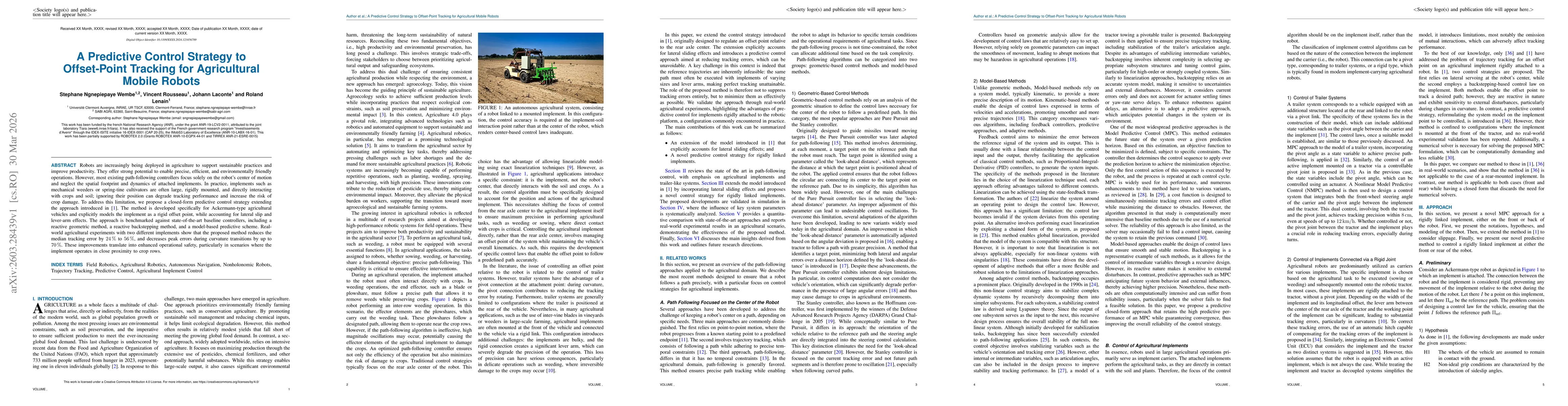
Robots are increasingly being deployed in agriculture to support sustainable practices and improve productivity. They offer strong potential to enable precise, efficient, and environmentally friendly ...