On the Importance of Quantifying Visibility for Autonomous Vehicles under Extreme Precipitation
Publication
Metrics
AI Quick Summary
This paper proposes a new metric to quantify lidar visibility loss during extreme precipitation for autonomous vehicles, evaluating its effectiveness on the CADC dataset. It highlights the robustness of the ICP algorithm against snowfall but notes its vulnerability to abrupt snow gusts, emphasizing the need for improved datasets to better understand these extreme weather impacts.
Paper Preview
Abstract
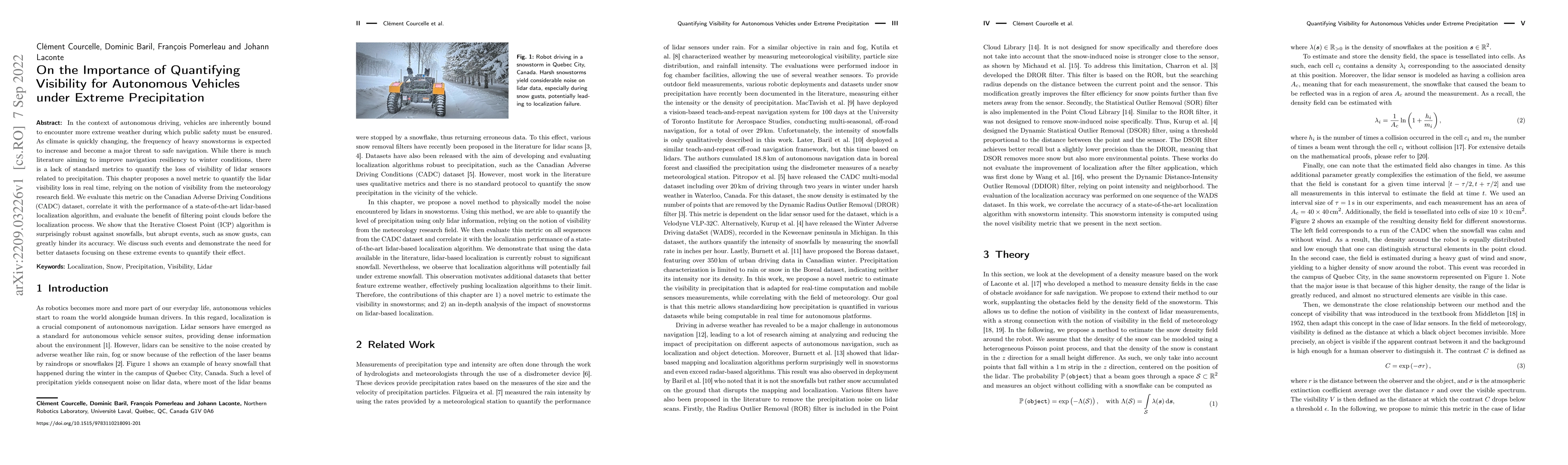
In the context of autonomous driving, vehicles are inherently bound to encounter more extreme weather during which public safety must be ensured. As climate is quickly changing, the frequency of heavy snowstorms is expected to increase and become a major threat to safe navigation. While there is much literature aiming to improve navigation resiliency to winter conditions, there is a lack of standard metrics to quantify the loss of visibility of lidar sensors related to precipitation. This chapter proposes a novel metric to quantify the lidar visibility loss in real time, relying on the notion of visibility from the meteorology research field. We evaluate this metric on the Canadian Adverse Driving Conditions (CADC) dataset, correlate it with the performance of a state-of-the-art lidar-based localization algorithm, and evaluate the benefit of filtering point clouds before the localization process. We show that the Iterative Closest Point (ICP) algorithm is surprisingly robust against snowfalls, but abrupt events, such as snow gusts, can greatly hinder its accuracy. We discuss such events and demonstrate the need for better datasets focusing on these extreme events to quantify their effect.
AI Key Findings
Get AI-generated insights about this paper's methodology, results, significance, and more — seven facets brought into focus.
Impact
Paper Details
Authors
PDF Preview
Key Terms
Citation Network
Current paper (gray), citations (green), references (blue)
Display is limited for performance on very large graphs.
Discussion 0