Academic Profile
Statistics
Similar Authors
Papers on arXiv
The analysis of time-sequence satellite images is a powerful tool in remote sensing; it is used to explore the statics and dynamics of the surface of the earth. Usually, the quality of multitemporal...
Remote sensing (RS) images are important to monitor and survey earth at varying spatial scales. Continuous observations from various RS sources complement single observations to improve applications...
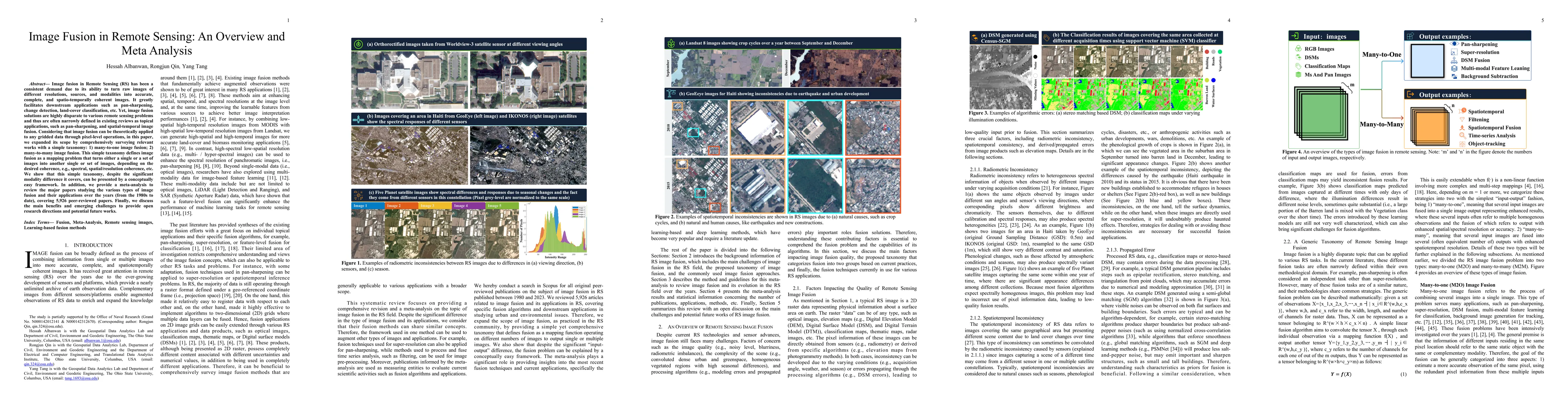
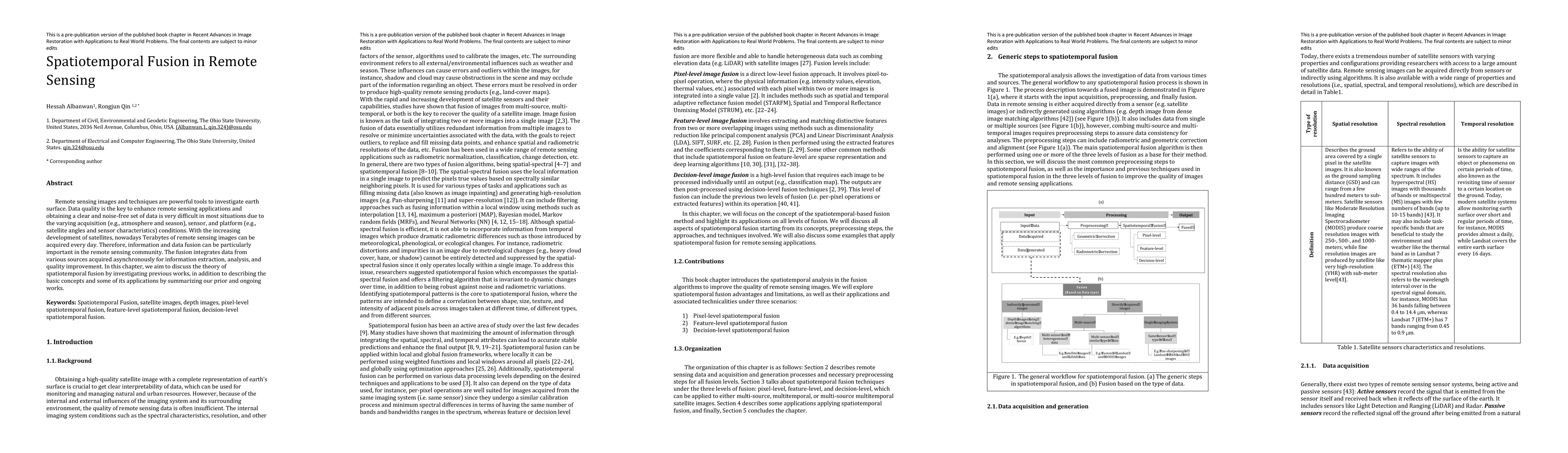
Image fusion in Remote Sensing (RS) has been a consistent demand due to its ability to turn raw images of different resolutions, sources, and modalities into accurate, complete, and spatio-temporall...
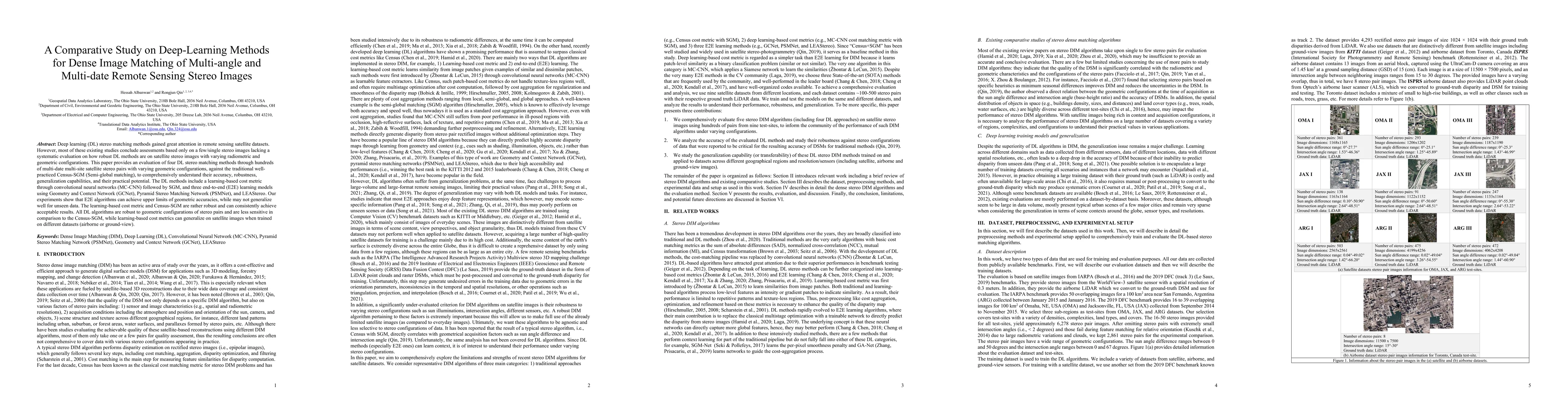
Deep learning (DL) stereo matching methods gained great attention in remote sensing satellite datasets. However, most of these existing studies conclude assessments based only on a few/single stereo...
The evolution of mobile mapping systems (MMSs) has gained more attention in the past few decades. MMSs have been widely used to provide valuable assets in different applications. This has been facil...
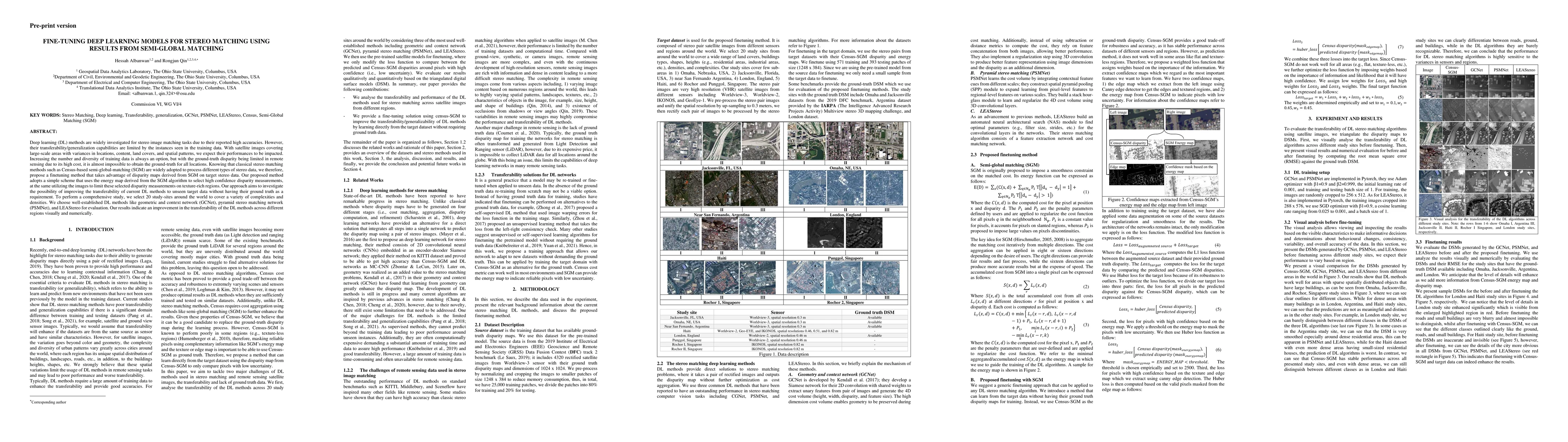
Deep learning (DL) methods are widely investigated for stereo image matching tasks due to their reported high accuracies. However, their transferability/generalization capabilities are limited by th...
Remote sensing images and techniques are powerful tools to investigate earth surface. Data quality is the key to enhance remote sensing applications and obtaining a clear and noise-free set of data ...
The current practice in land cover/land use change analysis relies heavily on the individually classified maps of the multitemporal data set. Due to varying acquisition conditions (e.g., illuminatio...
A critical step in the digital surface models(DSM) generation is feature matching. Off-track (or multi-date) satellite stereo images, in particular, can challenge the performance of feature matching d...