Academic Profile
Statistics
Similar Authors
Papers on arXiv
5G New Radio Time of Arrival (ToA) data has the potential to revolutionize indoor localization for micro aerial vehicles (MAVs). However, its performance under varying network setups, especially whe...
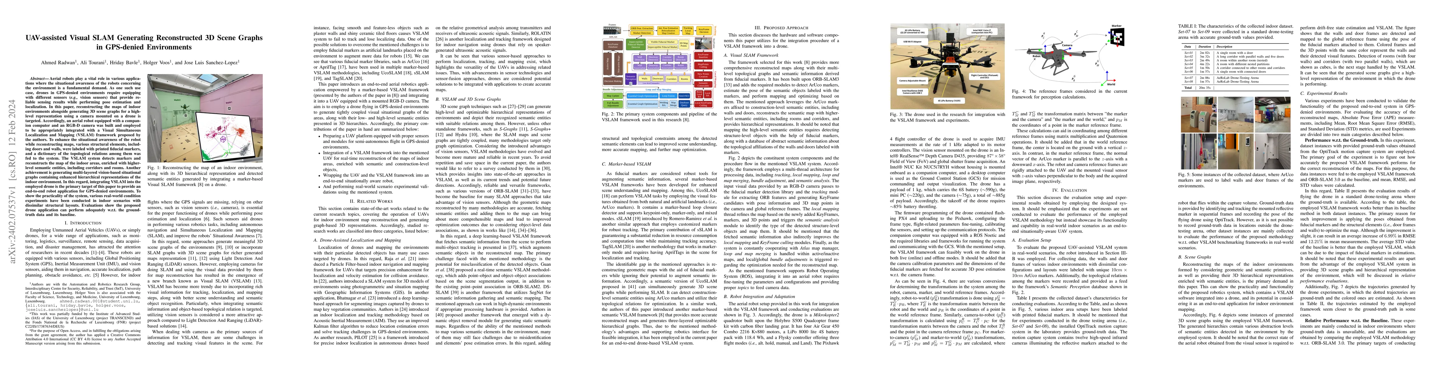
Aerial robots play a vital role in various applications where the situational awareness of the robots concerning the environment is a fundamental demand. As one such use case, drones in GPS-denied e...
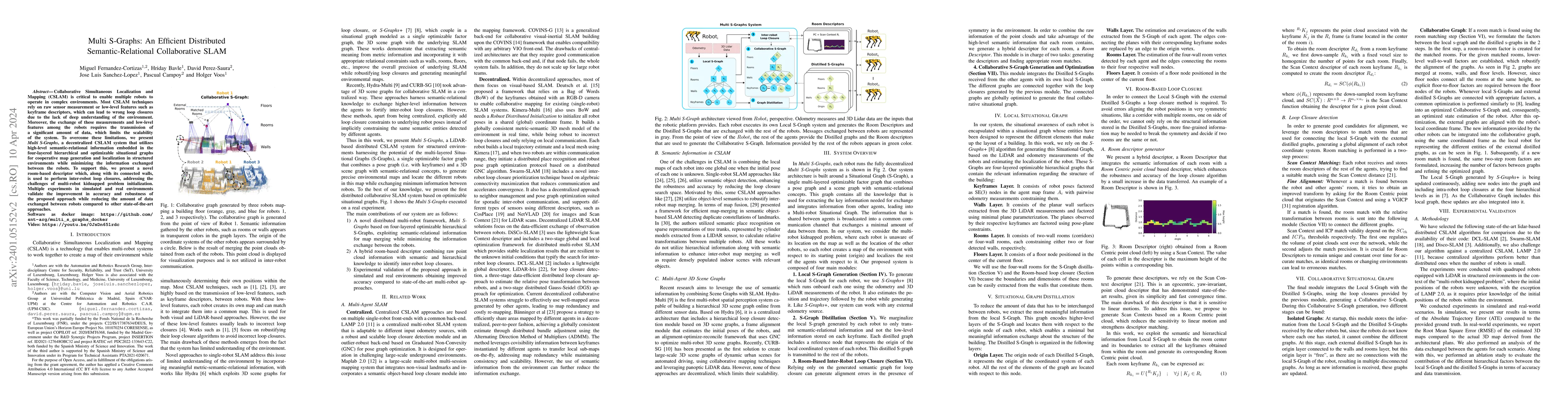
Collaborative Simultaneous Localization and Mapping (CSLAM) is critical to enable multiple robots to operate in complex environments. Most CSLAM techniques rely on raw sensor measurement or low-leve...
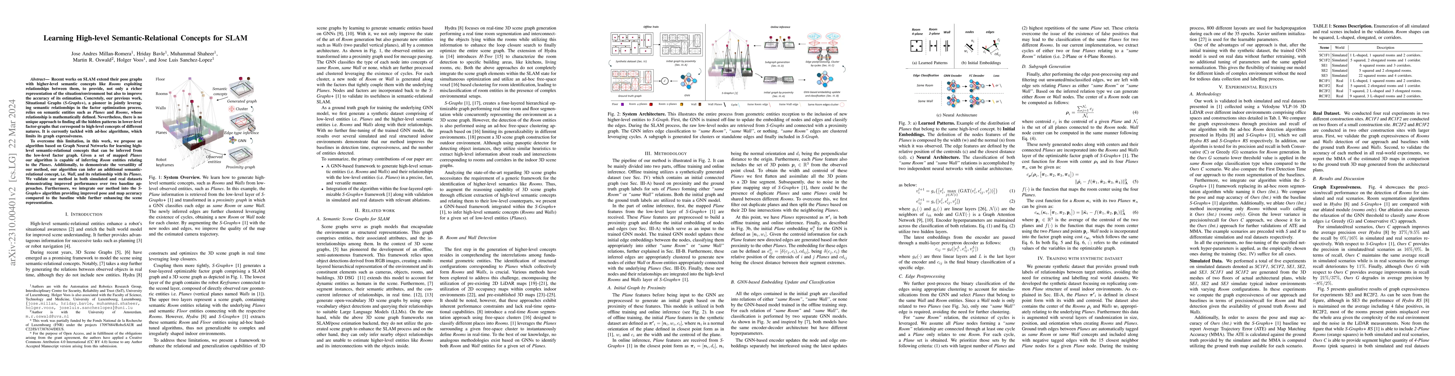
Recent works on SLAM extend their pose graphs with higher-level semantic concepts like Rooms exploiting relationships between them, to provide, not only a richer representation of the situation/envi...
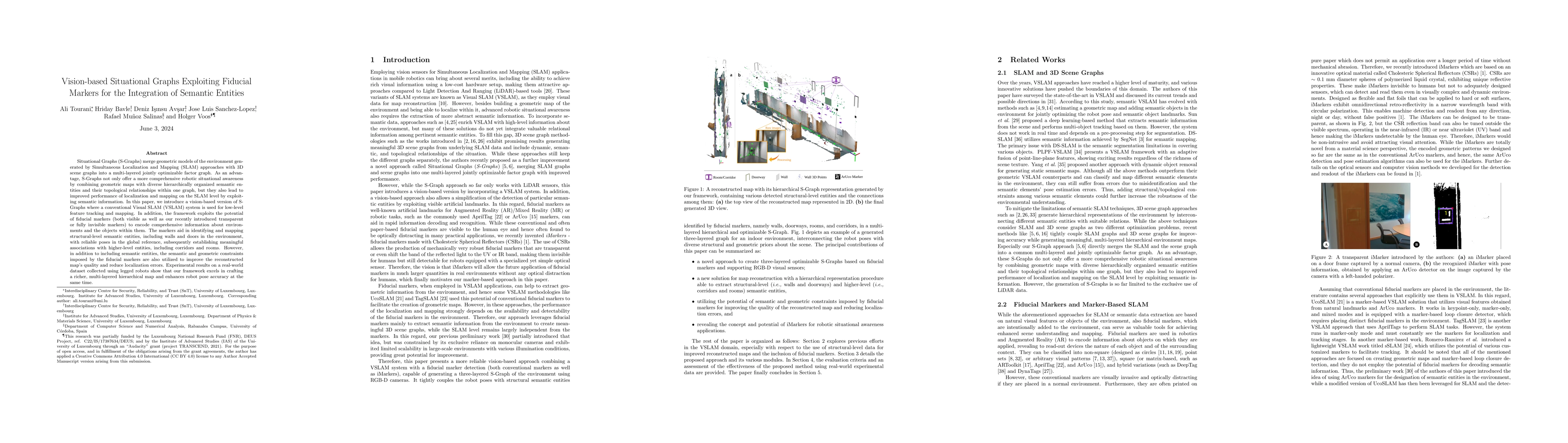
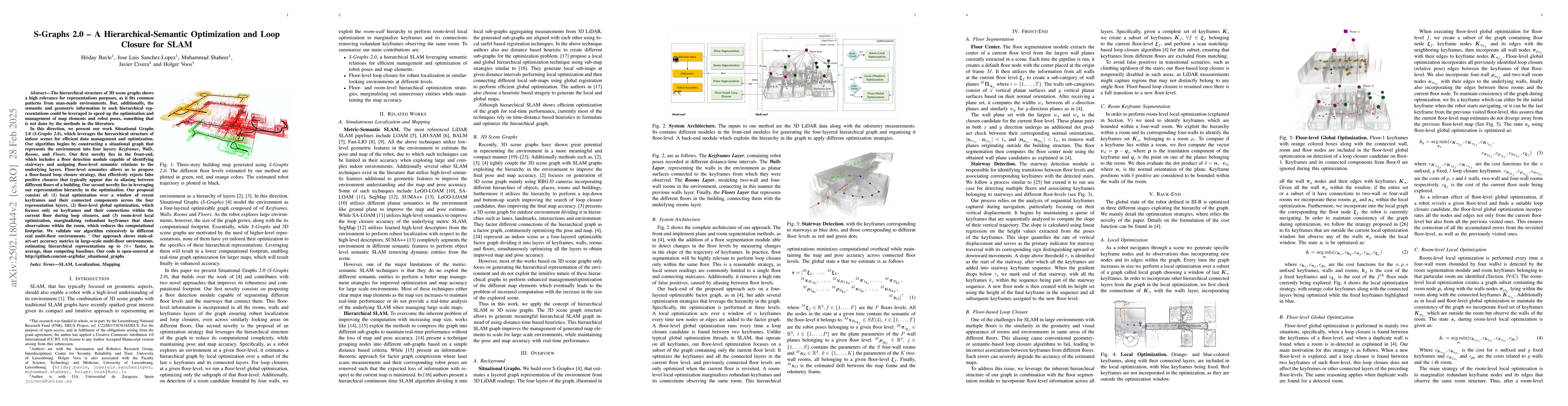
Situational Graphs (S-Graphs) merge geometric models of the environment generated by Simultaneous Localization and Mapping (SLAM) approaches with 3D scene graphs into a multi-layered jointly optimiz...
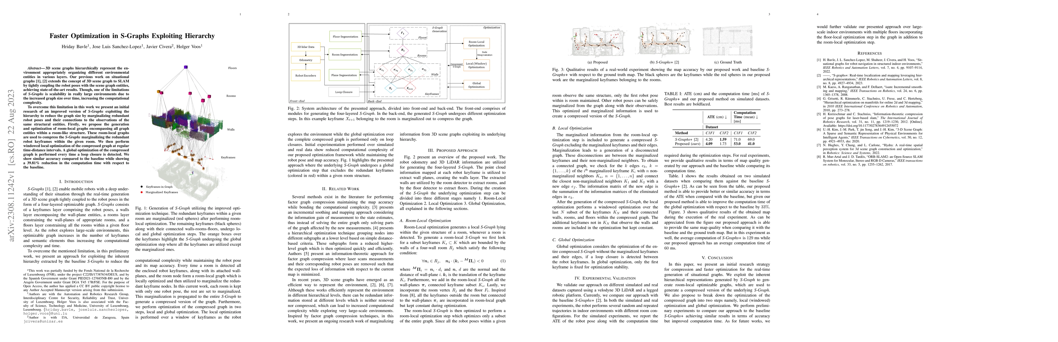
3D scene graphs hierarchically represent the environment appropriately organizing different environmental entities in various layers. Our previous work on situational graphs extends the concept of 3...
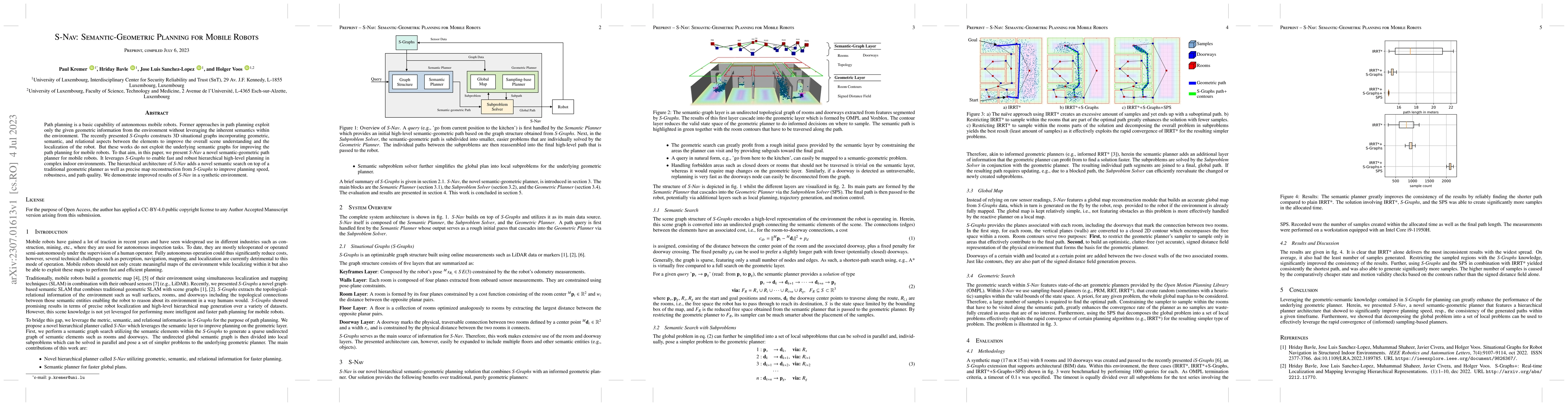
Path planning is a basic capability of autonomous mobile robots. Former approaches in path planning exploit only the given geometric information from the environment without leveraging the inherent ...
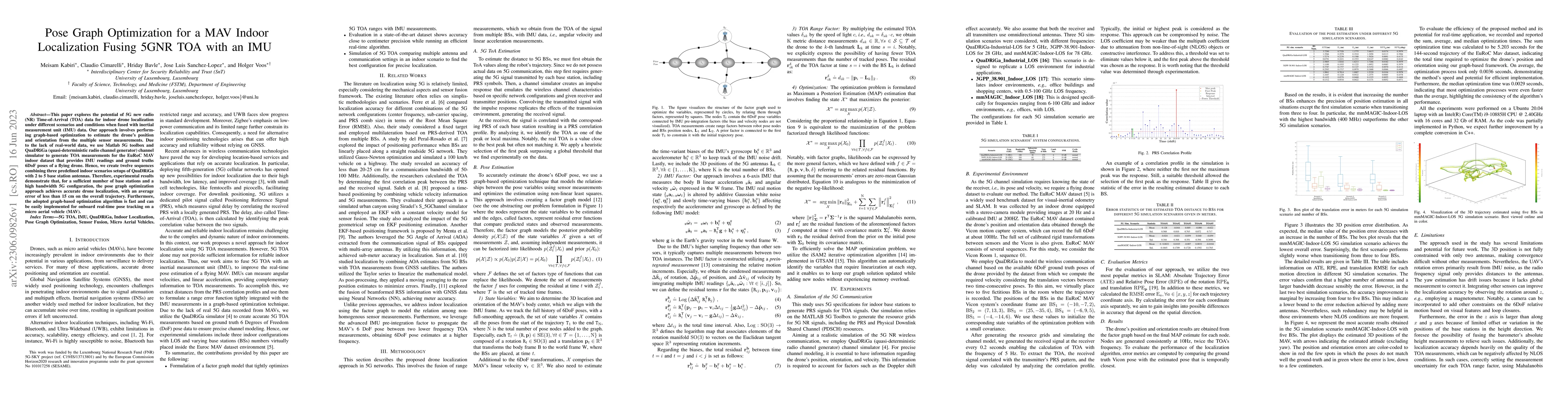
This paper explores the potential of 5G new radio (NR) Time-of-Arrival (TOA) data for indoor drone localization under different scenarios and conditions when fused with inertial measurement unit (IM...
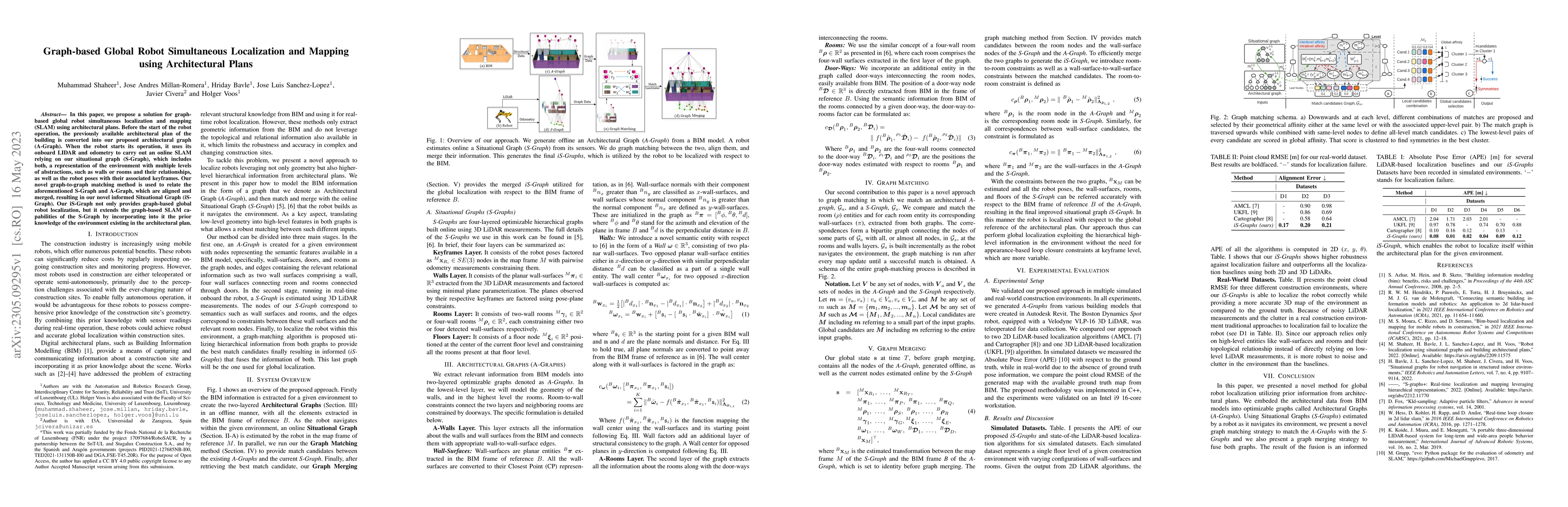
In this paper, we propose a solution for graph-based global robot simultaneous localization and mapping (SLAM) using architectural plans. Before the start of the robot operation, the previously avai...
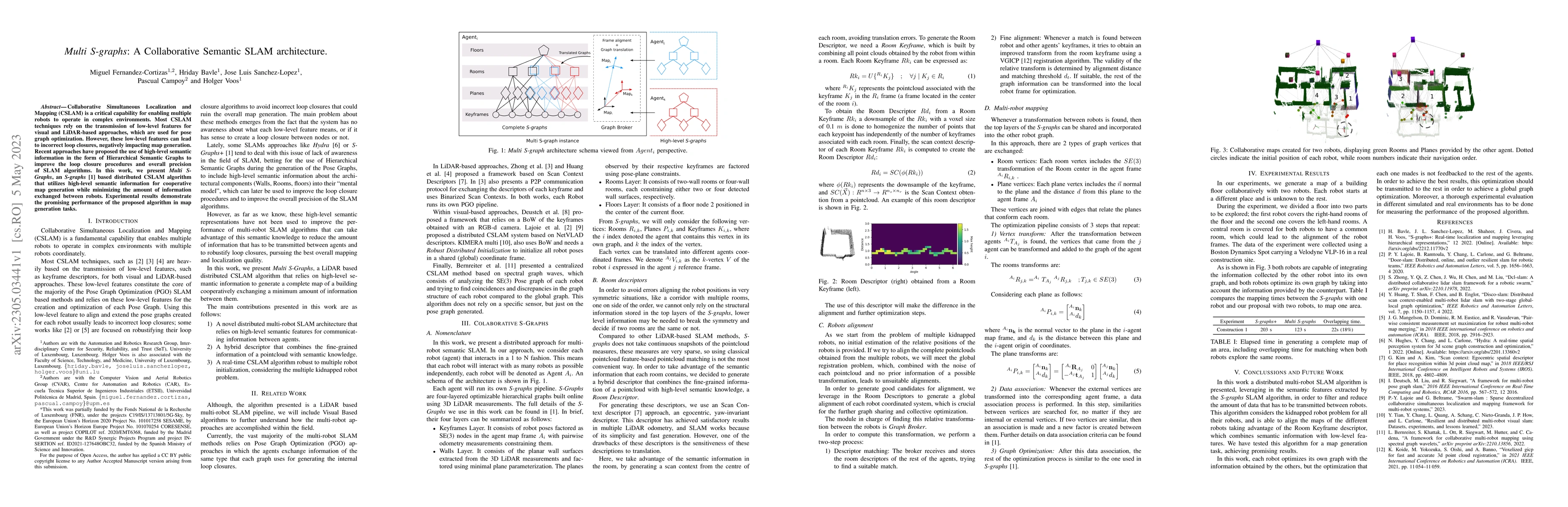
Collaborative Simultaneous Localization and Mapping (CSLAM) is a critical capability for enabling multiple robots to operate in complex environments. Most CSLAM techniques rely on the transmission o...
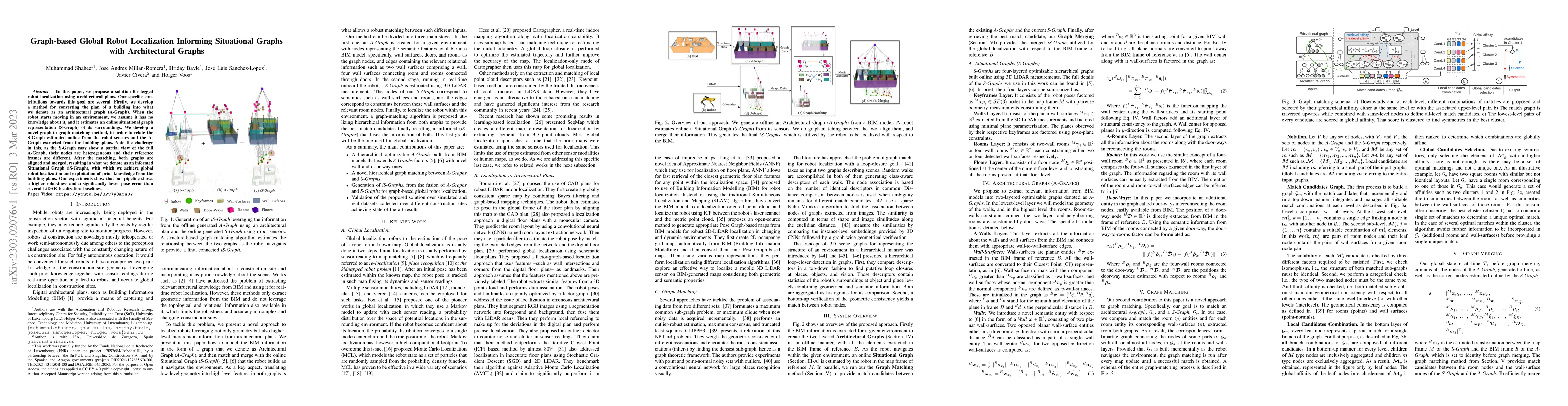
In this paper, we propose a solution for legged robot localization using architectural plans. Our specific contributions towards this goal are several. Firstly, we develop a method for converting th...
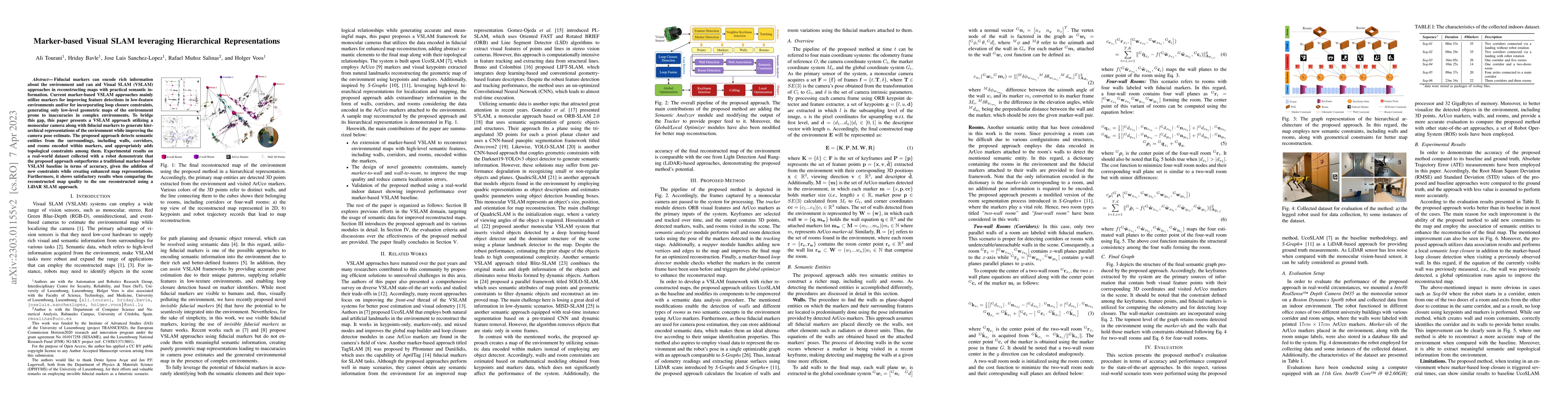
Fiducial markers can encode rich information about the environment and can aid Visual SLAM (VSLAM) approaches in reconstructing maps with practical semantic information. Current marker-based VSLAM a...
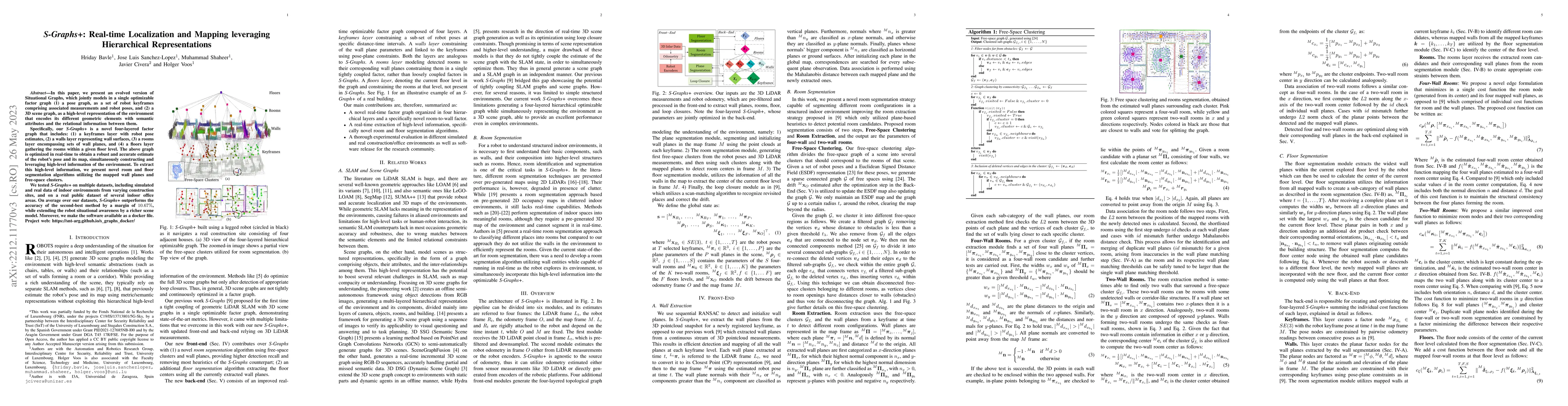
In this paper, we present an evolved version of Situational Graphs, which jointly models in a single optimizable factor graph (1) a pose graph, as a set of robot keyframes comprising associated meas...
Efficient localization plays a vital role in many modern applications of Unmanned Ground Vehicles (UGV) and Unmanned aerial vehicles (UAVs), which would contribute to improved control, safety, power...
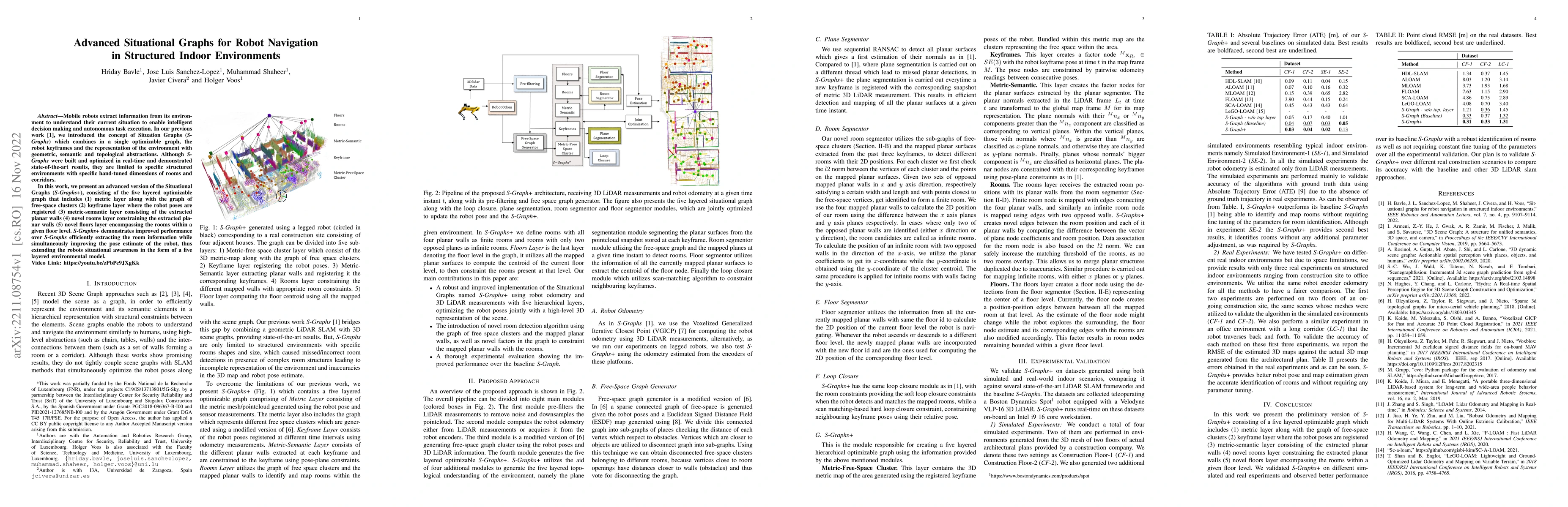
Mobile robots extract information from its environment to understand their current situation to enable intelligent decision making and autonomous task execution. In our previous work, we introduced ...
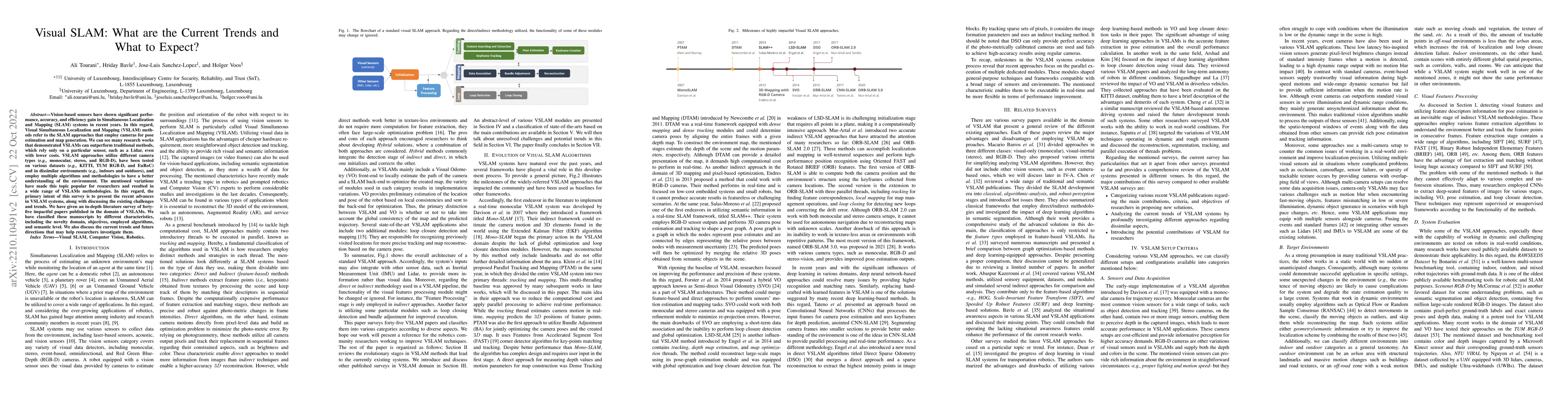
Vision-based sensors have shown significant performance, accuracy, and efficiency gain in Simultaneous Localization and Mapping (SLAM) systems in recent years. In this regard, Visual Simultaneous Lo...
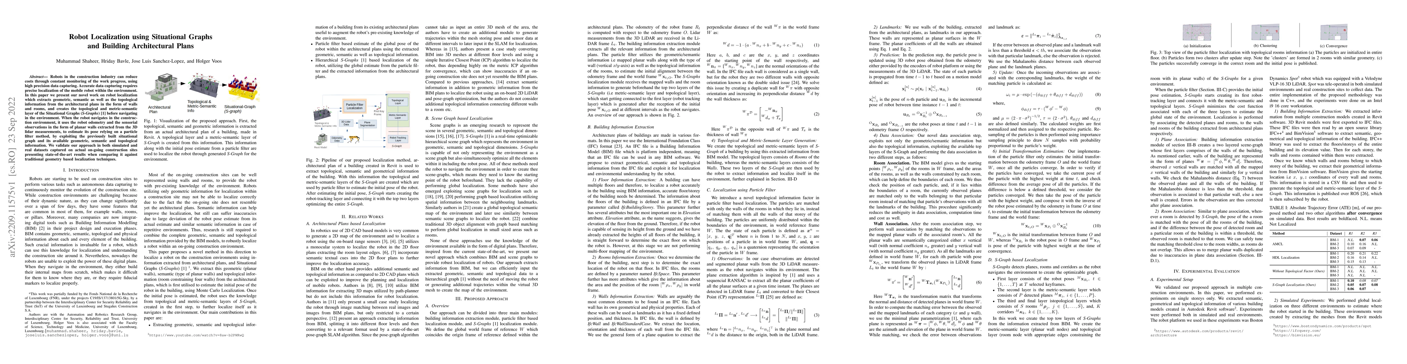
Robots in the construction industry can reduce costs through constant monitoring of the work progress, using high precision data capturing. Accurate data capturing requires precise localization of t...
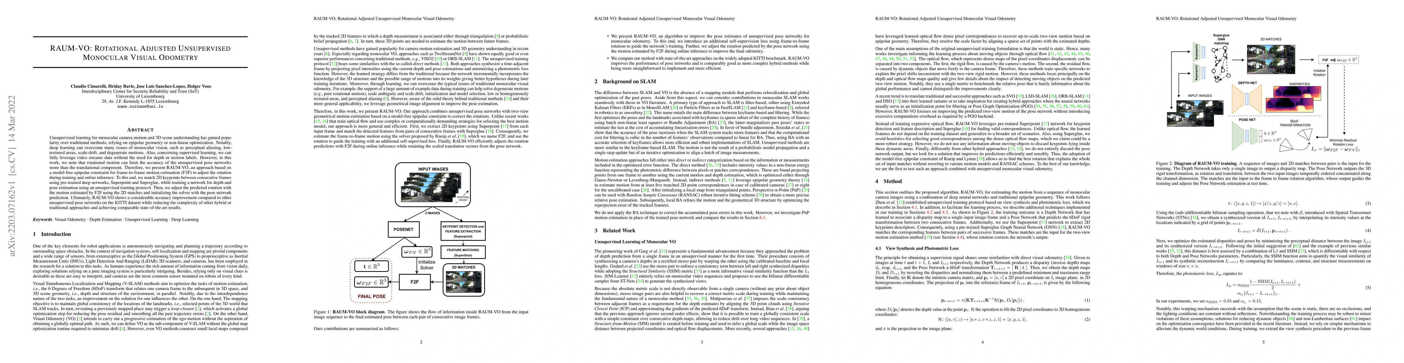
Unsupervised learning for monocular camera motion and 3D scene understanding has gained popularity over traditional methods, relying on epipolar geometry or non-linear optimization. Notably, deep le...
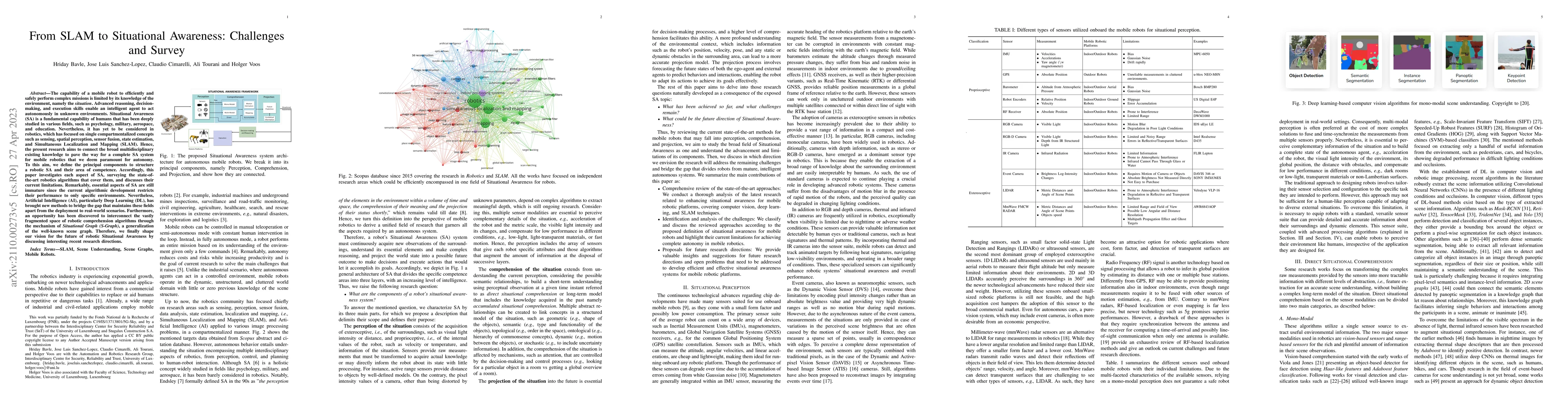
Mobile robots should be aware of their situation, comprising the deep understanding of their surrounding environment along with the estimation of its own state, to successfully make intelligent deci...
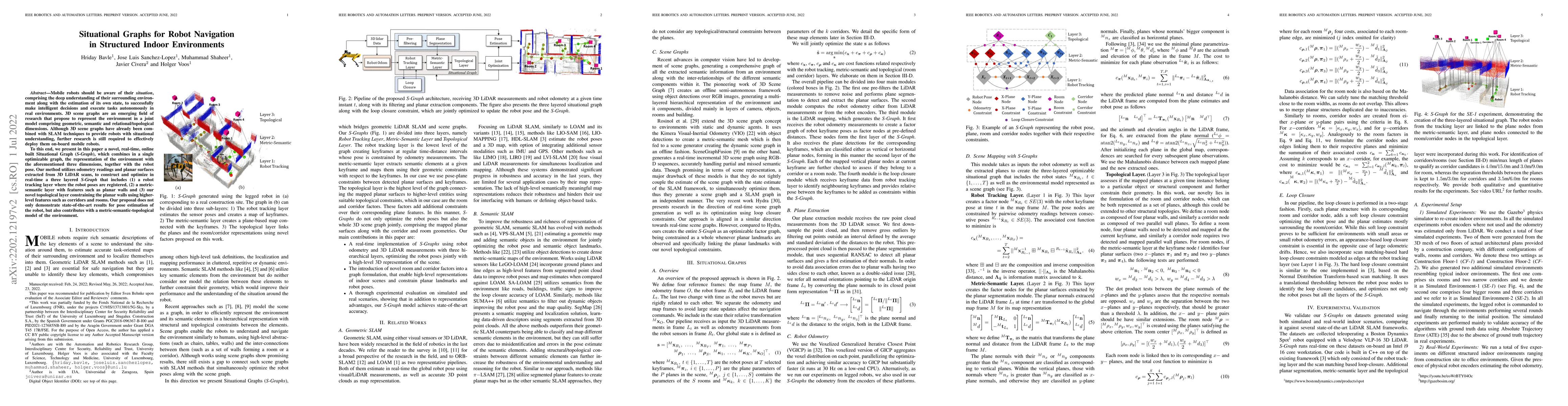
The capability of a mobile robot to efficiently and safely perform complex missions is limited by its knowledge of the environment, namely the situation. Advanced reasoning, decision-making, and exe...
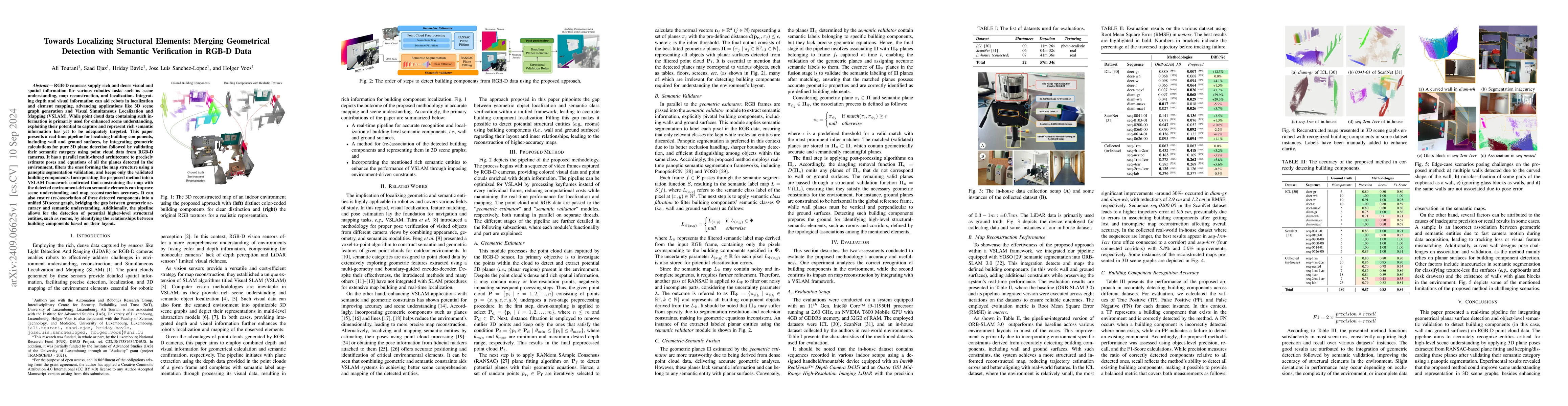
RGB-D cameras supply rich and dense visual and spatial information for various robotics tasks such as scene understanding, map reconstruction, and localization. Integrating depth and visual informatio...
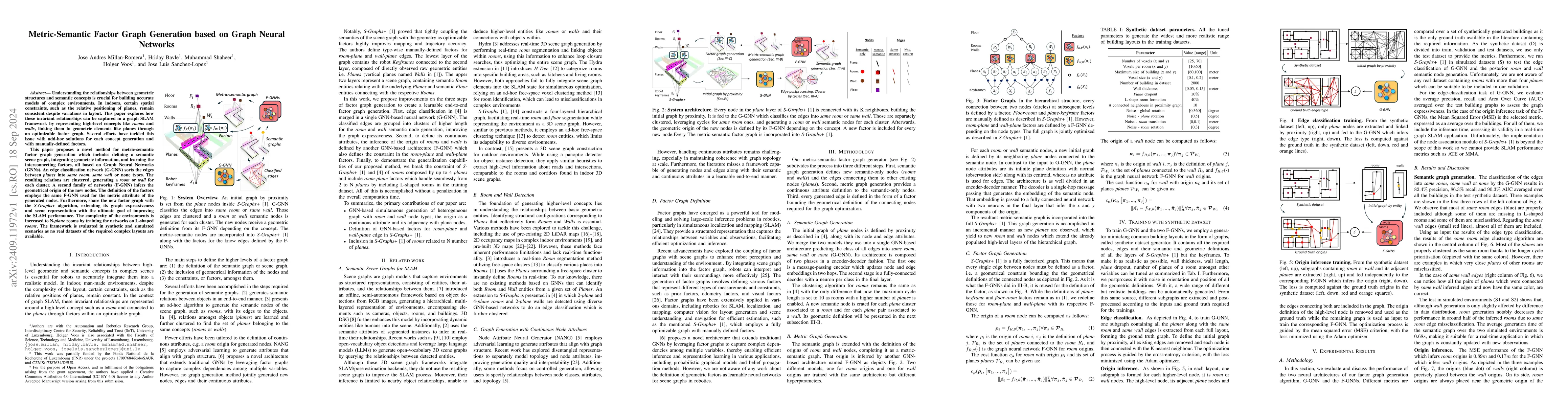
Understanding the relationships between geometric structures and semantic concepts is crucial for building accurate models of complex environments. In indoors, certain spatial constraints, such as the...
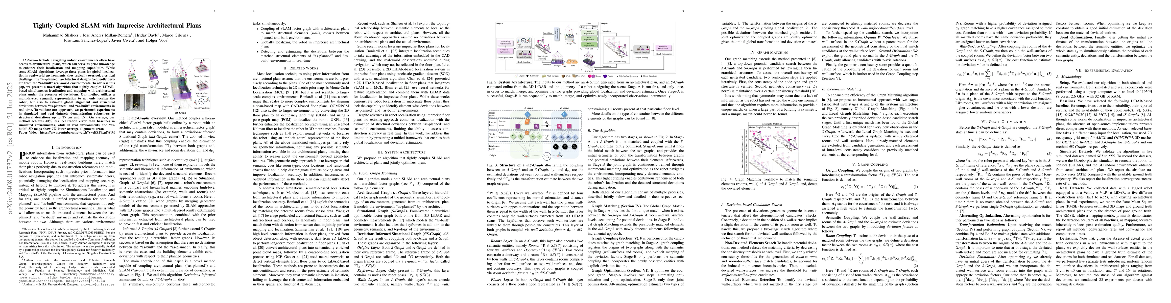
Robots navigating indoor environments often have access to architectural plans, which can serve as prior knowledge to enhance their localization and mapping capabilities. While some SLAM algorithms le...
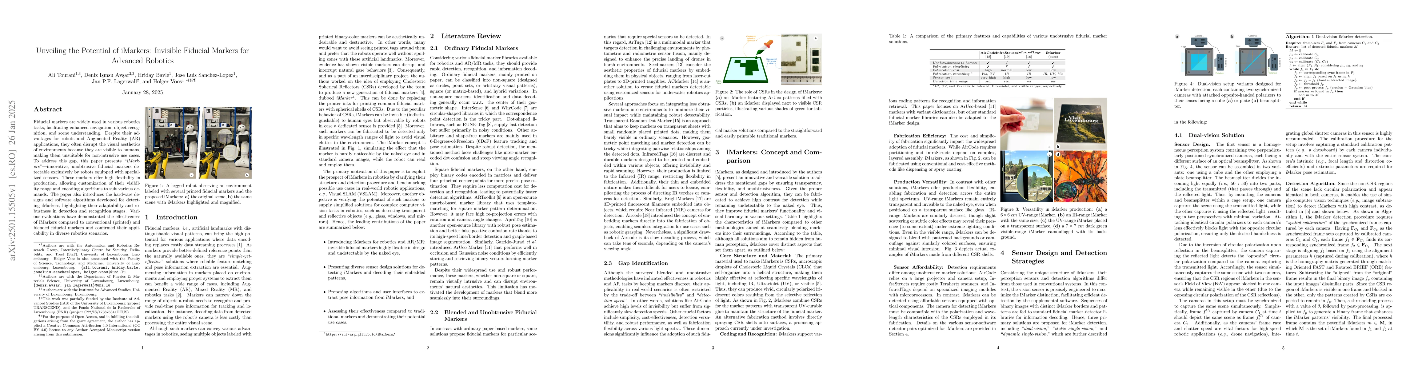
Fiducial markers are widely used in various robotics tasks, facilitating enhanced navigation, object recognition, and scene understanding. Despite their advantages for robots and Augmented Reality (AR...
Works based on localization and mapping do not exploit the inherent semantic-relational information from the environment for faster and efficient management and optimization of the robot poses and its...
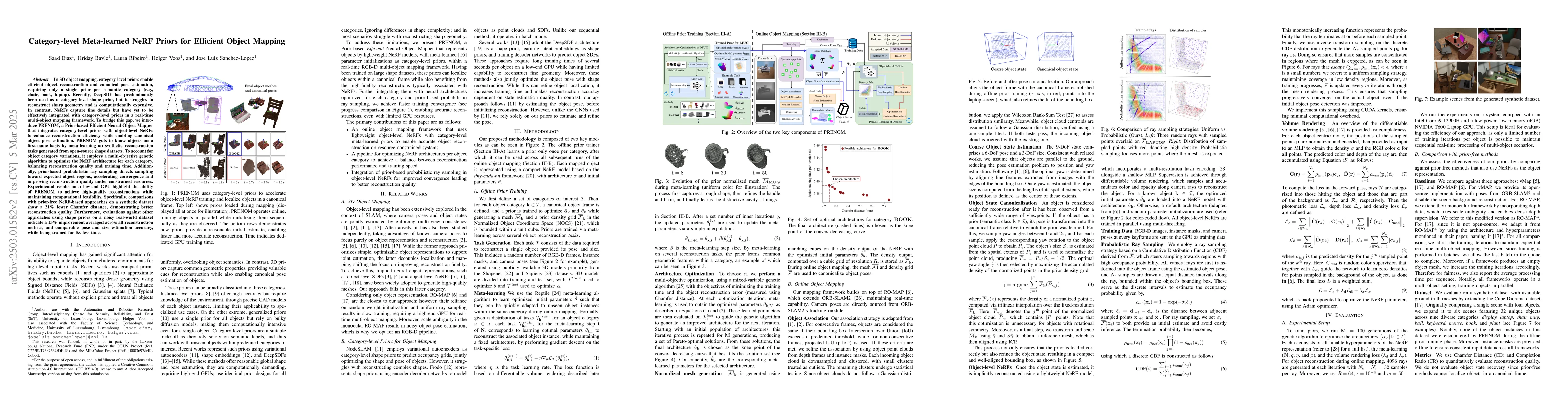
In 3D object mapping, category-level priors enable efficient object reconstruction and canonical pose estimation, requiring only a single prior per semantic category (e.g., chair, book, laptop). Recen...
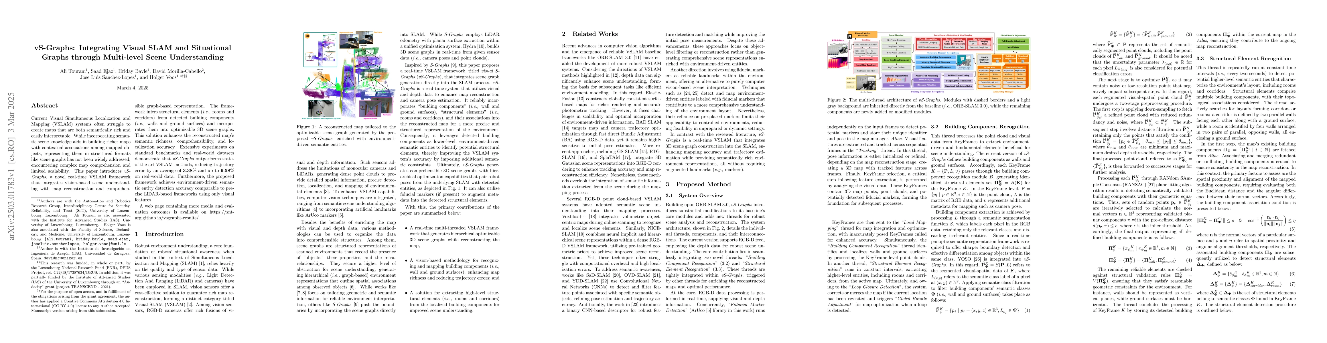
Current Visual Simultaneous Localization and Mapping (VSLAM) systems often struggle to create maps that are both semantically rich and easily interpretable. While incorporating semantic scene knowledg...
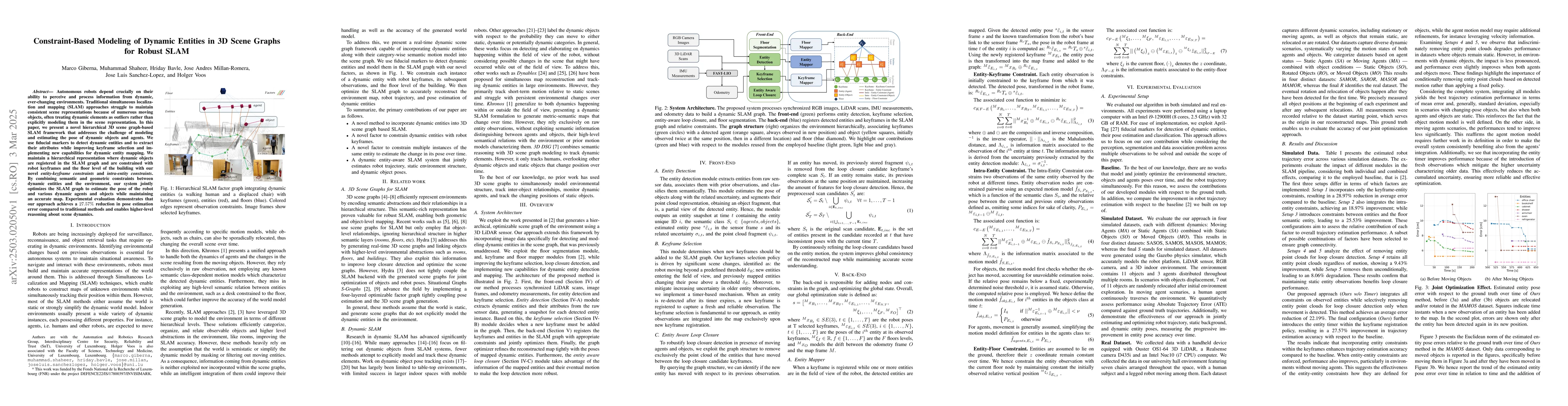
Autonomous robots depend crucially on their ability to perceive and process information from dynamic, ever-changing environments. Traditional simultaneous localization and mapping (SLAM) approaches st...
Augmented reality (AR) applications for construction monitoring rely on real-time environmental tracking to visualize architectural elements. However, construction sites present significant challenges...