Graph-based Global Robot Localization Informing Situational Graphs with Architectural Graphs
Publication
Metrics
AI Quick Summary
This paper proposes a method for legged robot localization using architectural plans by converting building plans into architectural graphs and matching them with online situational graphs. The resulting informed situational graph enhances localization accuracy and robustness compared to LiDAR-based methods.
Paper Preview
Abstract
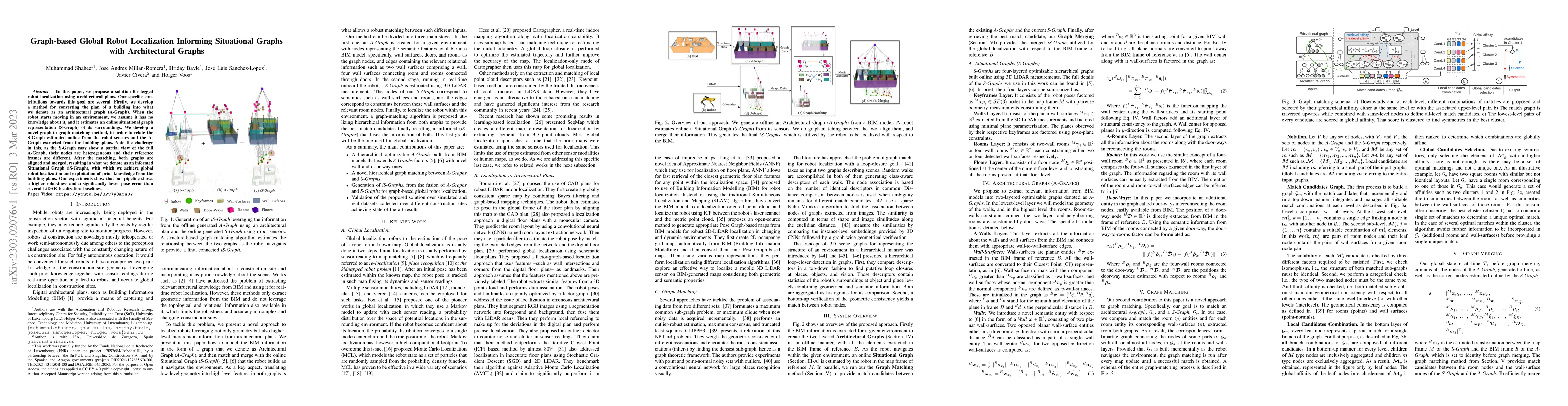
In this paper, we propose a solution for legged robot localization using architectural plans. Our specific contributions towards this goal are several. Firstly, we develop a method for converting the plan of a building into what we denote as an architectural graph (A-Graph). When the robot starts moving in an environment, we assume it has no knowledge about it, and it estimates an online situational graph representation (S-Graph) of its surroundings. We develop a novel graph-to-graph matching method, in order to relate the S-Graph estimated online from the robot sensors and the A-Graph extracted from the building plans. Note the challenge in this, as the S-Graph may show a partial view of the full A-Graph, their nodes are heterogeneous and their reference frames are different. After the matching, both graphs are aligned and merged, resulting in what we denote as an informed Situational Graph (iS-Graph), with which we achieve global robot localization and exploitation of prior knowledge from the building plans. Our experiments show that our pipeline shows a higher robustness and a significantly lower pose error than several LiDAR localization baselines.
AI Key Findings
Get AI-generated insights about this paper's methodology, results, significance, and more — seven facets brought into focus.
Impact
Paper Details
Authors
PDF Preview
Key Terms
Citation Network
Current paper (gray), citations (green), references (blue)
Display is limited for performance on very large graphs.
Discussion 0