Academic Profile
Statistics
Similar Authors
Papers on arXiv
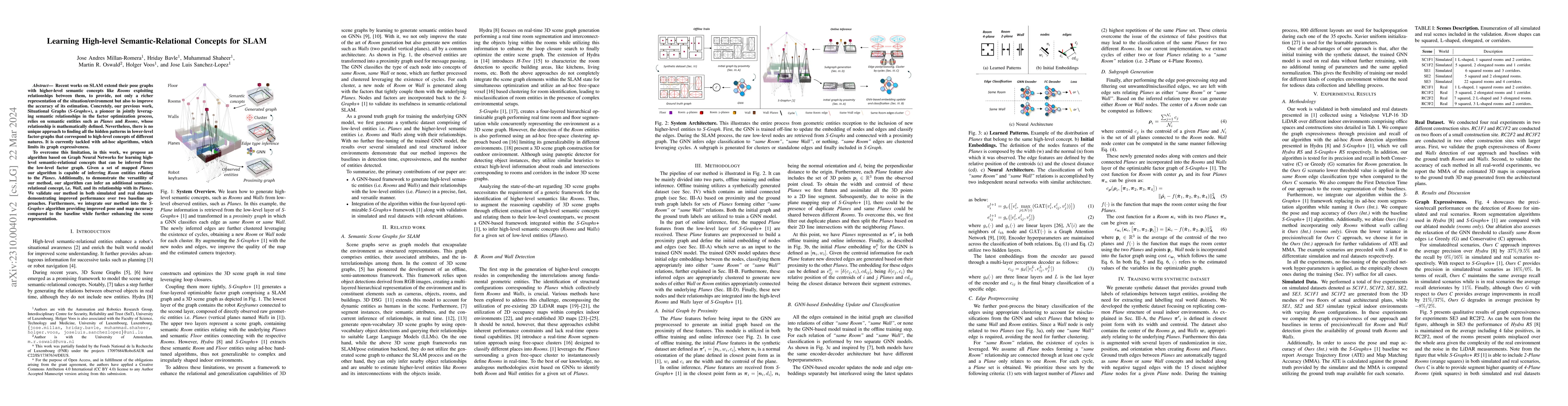
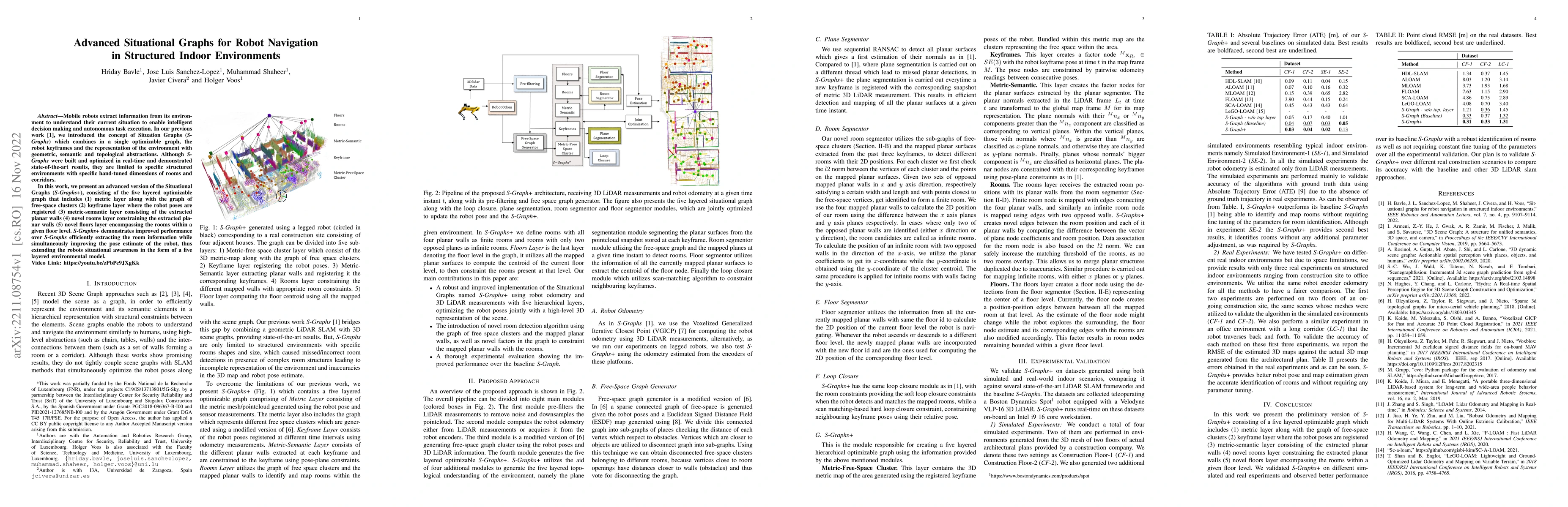
Recent works on SLAM extend their pose graphs with higher-level semantic concepts like Rooms exploiting relationships between them, to provide, not only a richer representation of the situation/envi...
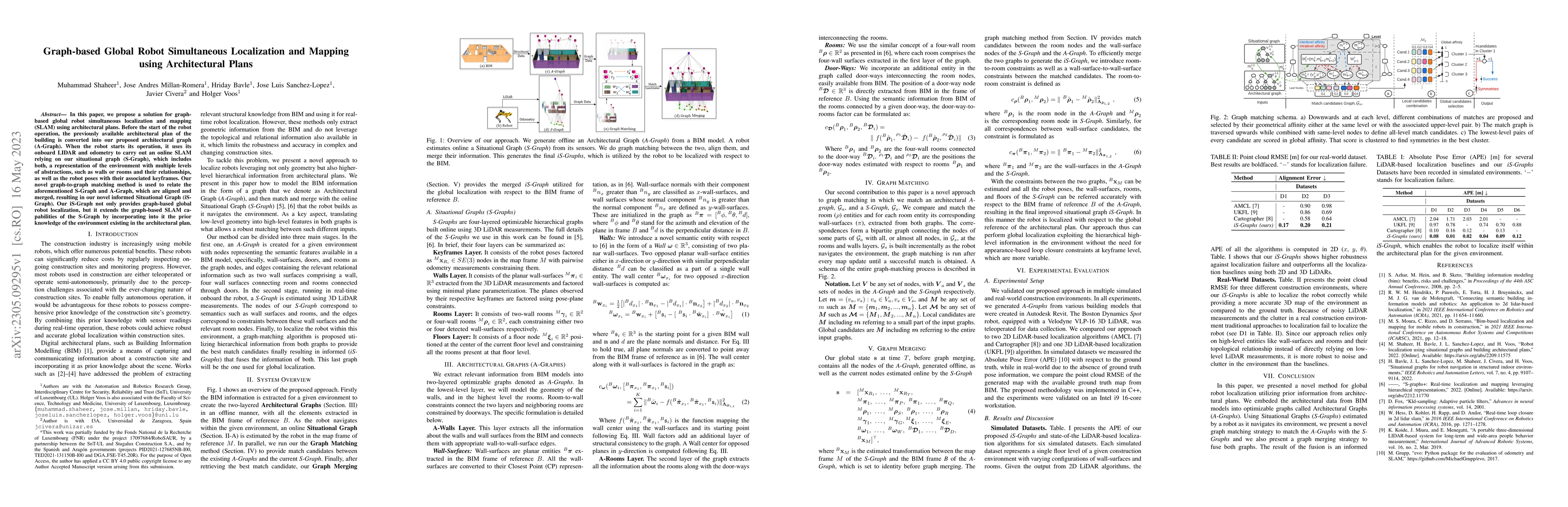
In this paper, we propose a solution for graph-based global robot simultaneous localization and mapping (SLAM) using architectural plans. Before the start of the robot operation, the previously avai...
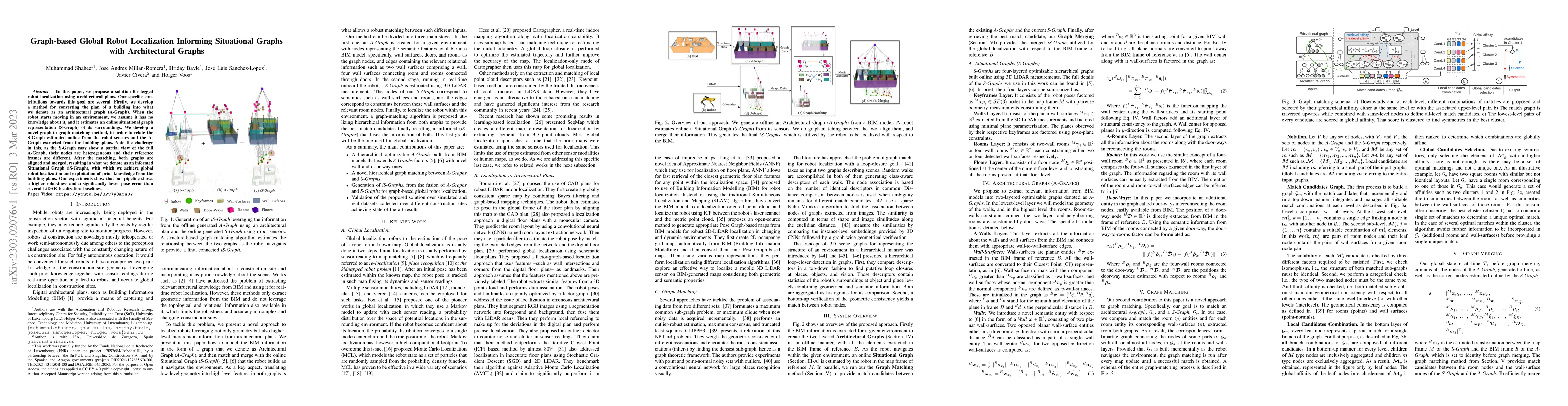
In this paper, we propose a solution for legged robot localization using architectural plans. Our specific contributions towards this goal are several. Firstly, we develop a method for converting th...
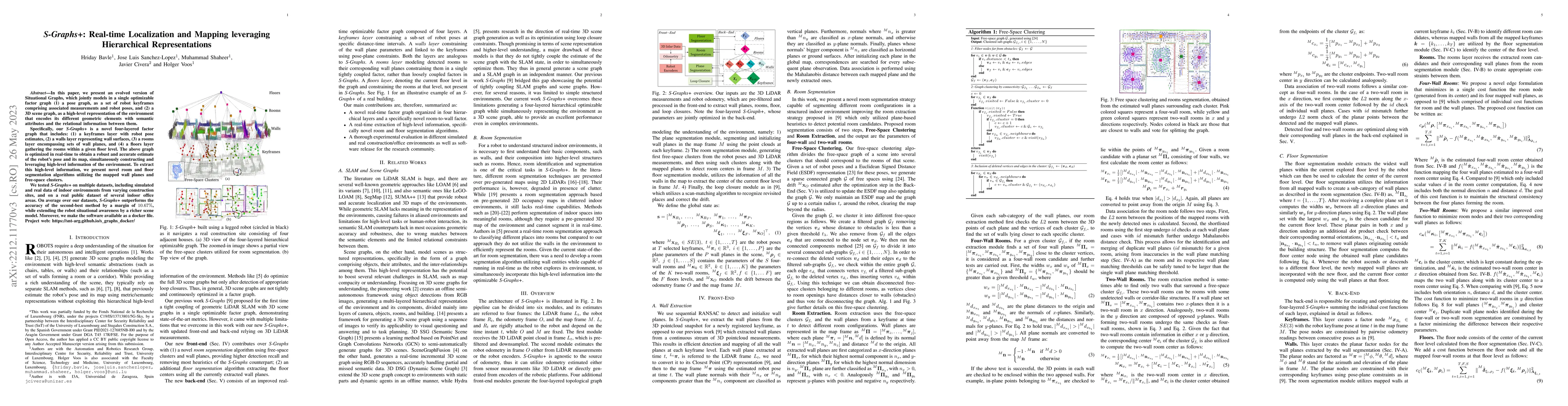
In this paper, we present an evolved version of Situational Graphs, which jointly models in a single optimizable factor graph (1) a pose graph, as a set of robot keyframes comprising associated meas...
Mobile robots extract information from its environment to understand their current situation to enable intelligent decision making and autonomous task execution. In our previous work, we introduced ...
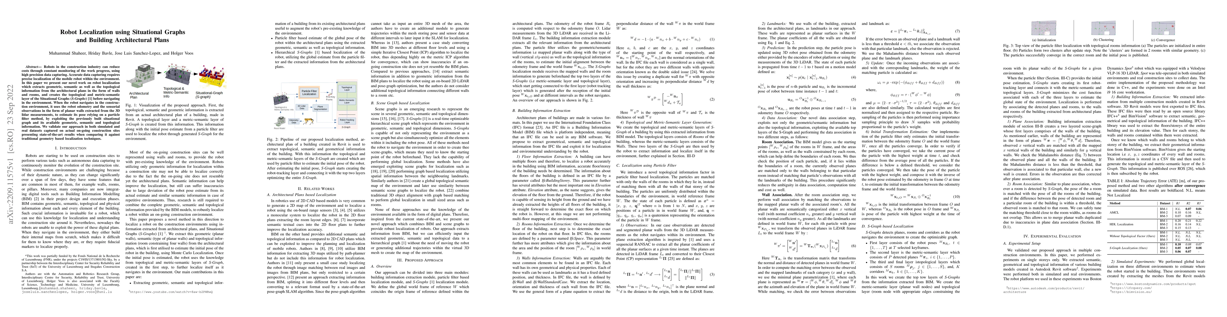
Robots in the construction industry can reduce costs through constant monitoring of the work progress, using high precision data capturing. Accurate data capturing requires precise localization of t...
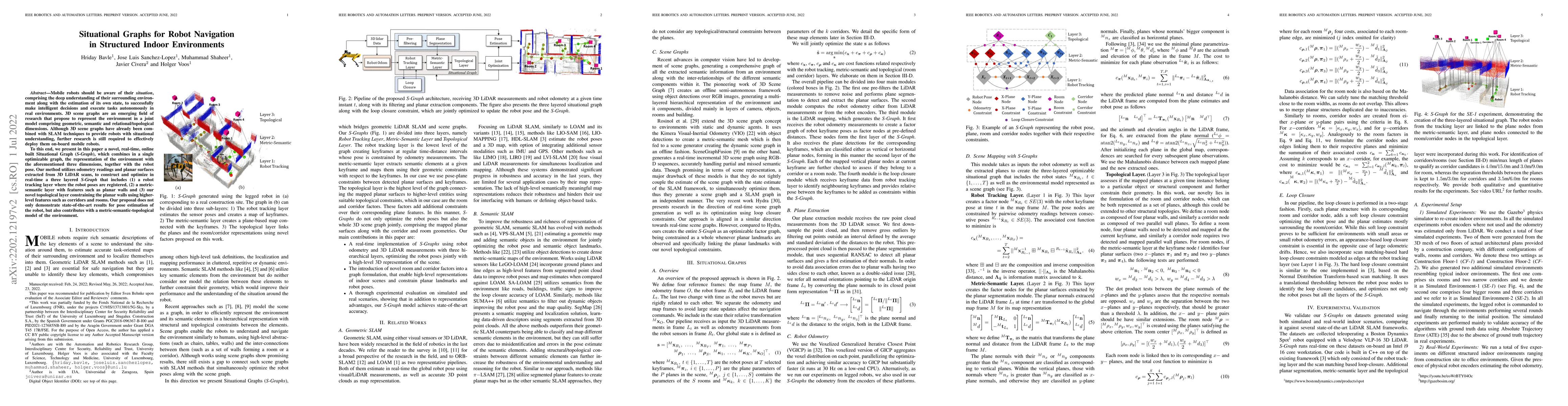
Mobile robots should be aware of their situation, comprising the deep understanding of their surrounding environment along with the estimation of its own state, to successfully make intelligent deci...
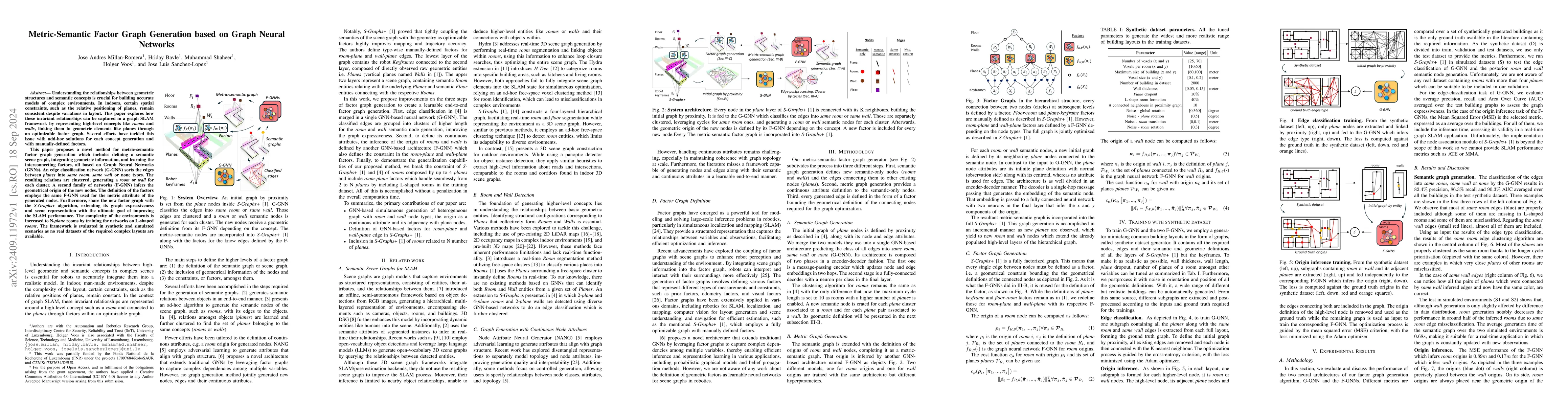
Understanding the relationships between geometric structures and semantic concepts is crucial for building accurate models of complex environments. In indoors, certain spatial constraints, such as the...
Robots navigating indoor environments often have access to architectural plans, which can serve as prior knowledge to enhance their localization and mapping capabilities. While some SLAM algorithms le...
Works based on localization and mapping do not exploit the inherent semantic-relational information from the environment for faster and efficient management and optimization of the robot poses and its...
Autonomous robots depend crucially on their ability to perceive and process information from dynamic, ever-changing environments. Traditional simultaneous localization and mapping (SLAM) approaches st...
Augmented reality (AR) applications for construction monitoring rely on real-time environmental tracking to visualize architectural elements. However, construction sites present significant challenges...
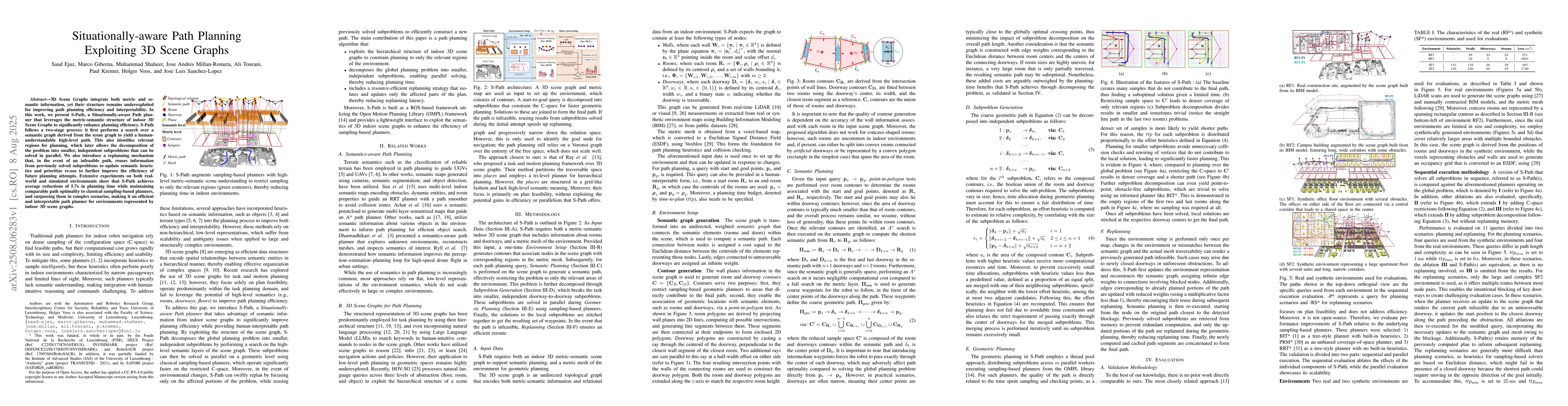
3D Scene Graphs integrate both metric and semantic information, yet their structure remains underutilized for improving path planning efficiency and interpretability. In this work, we present S-Path, ...
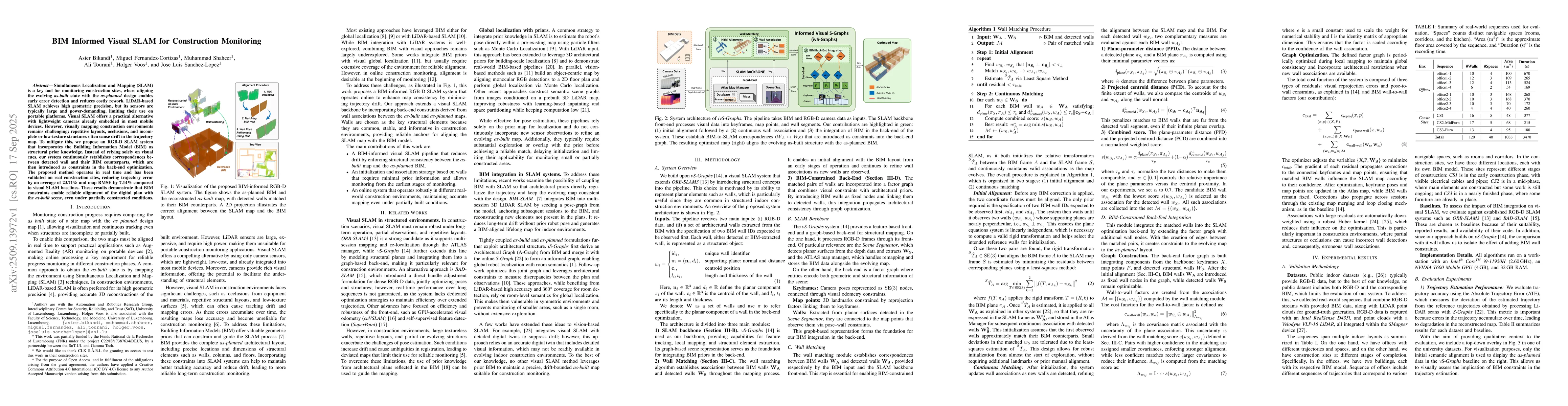
Simultaneous Localization and Mapping (SLAM) is a key tool for monitoring construction sites, where aligning the evolving as-built state with the as-planned design enables early error detection and re...
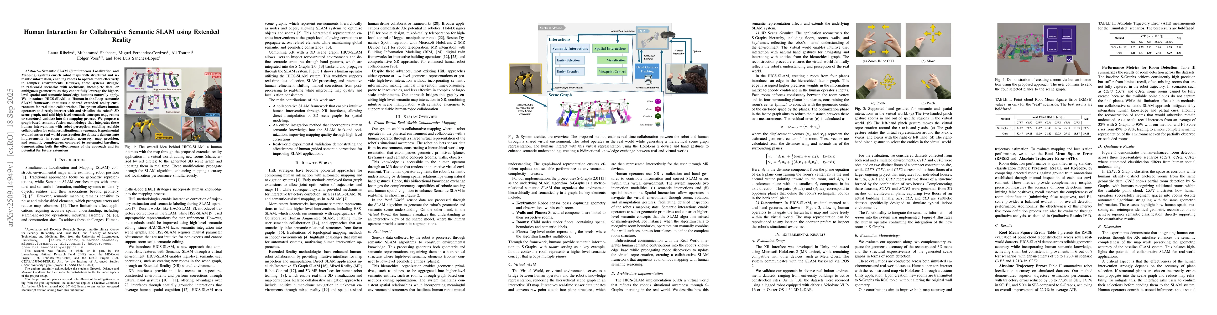
Semantic SLAM (Simultaneous Localization and Mapping) systems enrich robot maps with structural and semantic information, enabling robots to operate more effectively in complex environments. However, ...
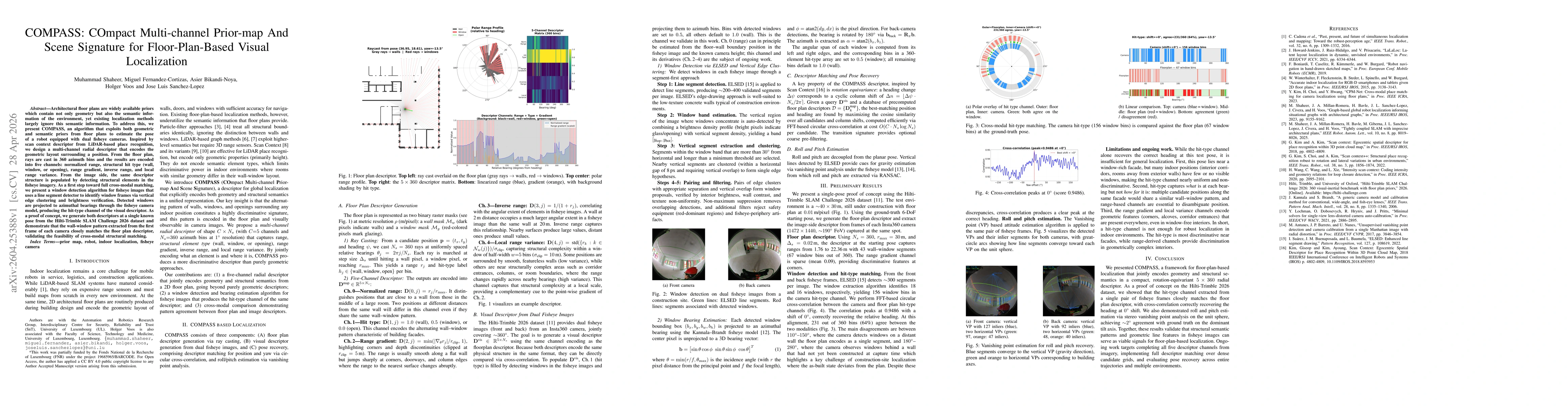
Architectural floor plans are widely available priors which contain not only geometry but also the semantic information of the environment, yet existing localization methods largely ignore this semant...