Publication
Metrics
AI Quick Summary
This paper proposes a novel SLAM algorithm that integrates imprecise architectural plans into LIDAR-based mapping and localization, addressing discrepancies between planned and actual construction. The method achieves significant reductions in localization error by estimating alignment and deviations in real-time.
Paper Preview
Abstract
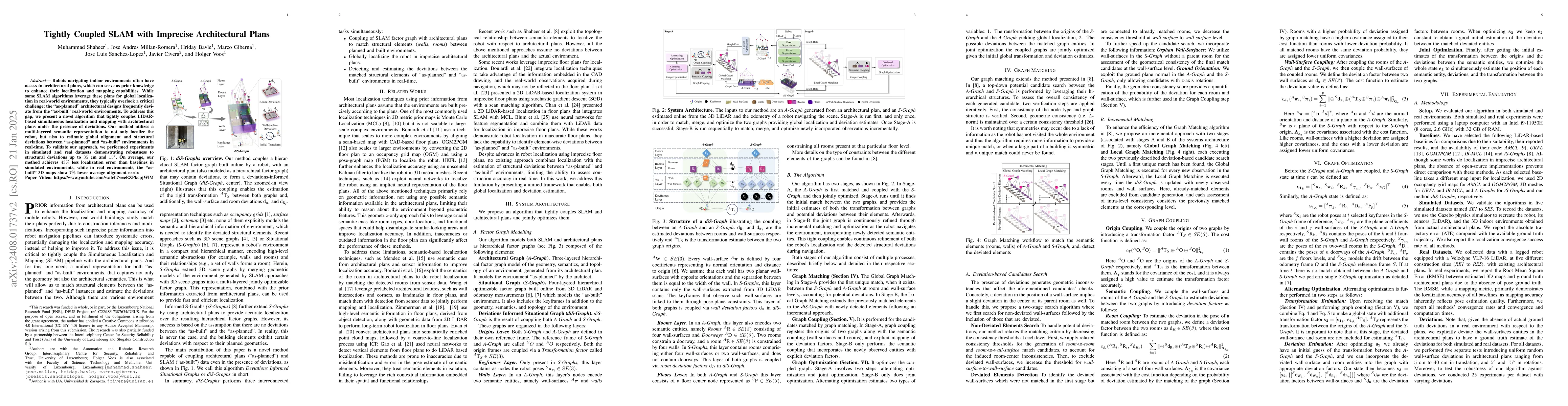
Robots navigating indoor environments often have access to architectural plans, which can serve as prior knowledge to enhance their localization and mapping capabilities. While some SLAM algorithms leverage these plans for global localization in real-world environments, they typically overlook a critical challenge: the "as-planned" architectural designs frequently deviate from the "as-built" real-world environments. To address this gap, we present a novel algorithm that tightly couples LIDAR-based simultaneous localization and mapping with architectural plans under the presence of deviations. Our method utilizes a multi-layered semantic representation to not only localize the robot, but also to estimate global alignment and structural deviations between "as-planned" and as-built environments in real-time. To validate our approach, we performed experiments in simulated and real datasets demonstrating robustness to structural deviations up to 35 cm and 15 degrees. On average, our method achieves 43% less localization error than baselines in simulated environments, while in real environments, the as-built 3D maps show 7% lower average alignment error
AI Key Findings
Get AI-generated insights about this paper's methodology, results, significance, and more — seven facets brought into focus.
Authors
PDF Preview
Related Papers
No references found for this paper.
Discussion 0