Academic Profile
Statistics
Similar Authors
Papers on arXiv
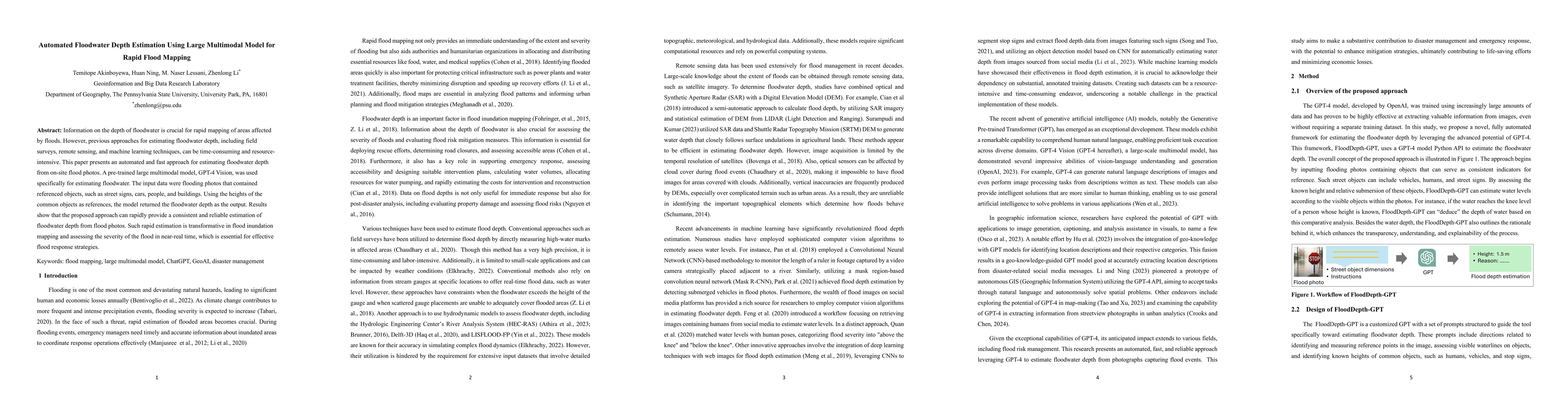
Information on the depth of floodwater is crucial for rapid mapping of areas affected by floods. However, previous approaches for estimating floodwater depth, including field surveys, remote sensing...
Large Language Models (LLMs), such as ChatGPT, demonstrate a strong understanding of human natural language and have been explored and applied in various fields, including reasoning, creative writin...
In response to the soaring needs of human mobility data, especially during disaster events such as the COVID-19 pandemic, and the associated big data challenges, we develop a scalable online platfor...
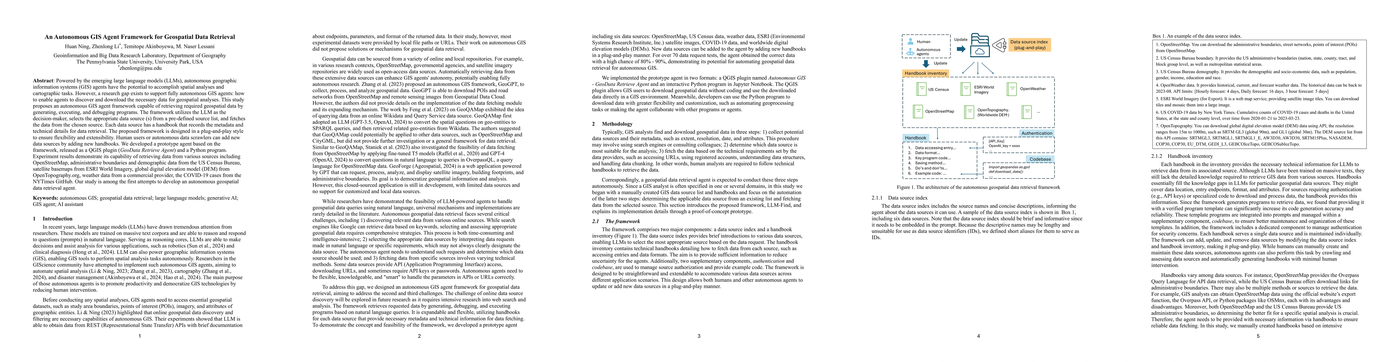
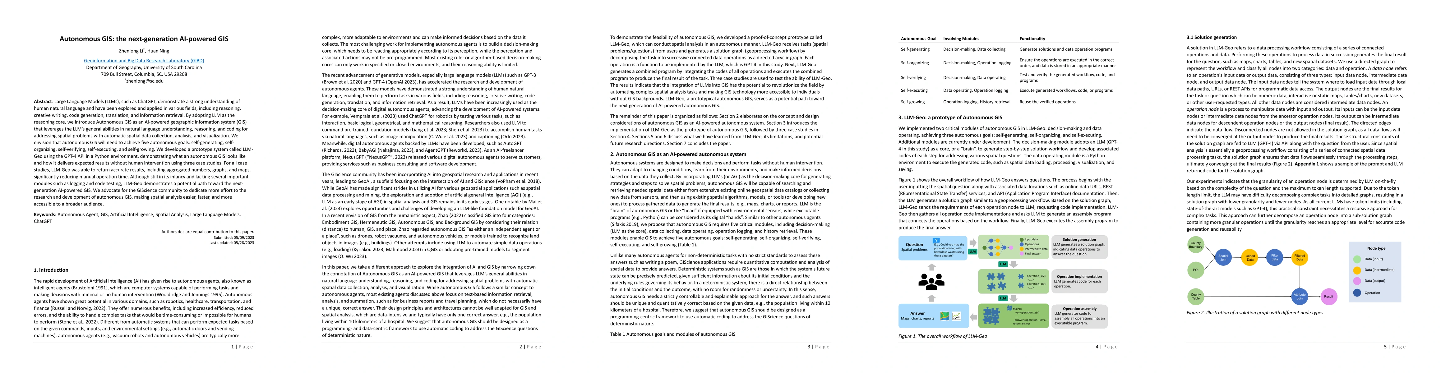
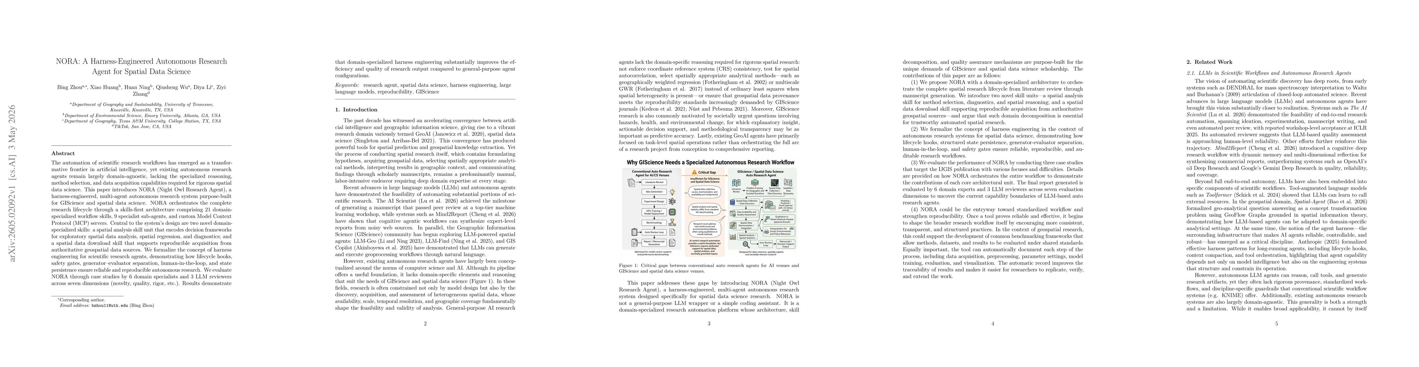
Powered by the emerging large language models (LLMs), autonomous geographic information systems (GIS) agents have the potential to accomplish spatial analyses and cartographic tasks. However, a resear...
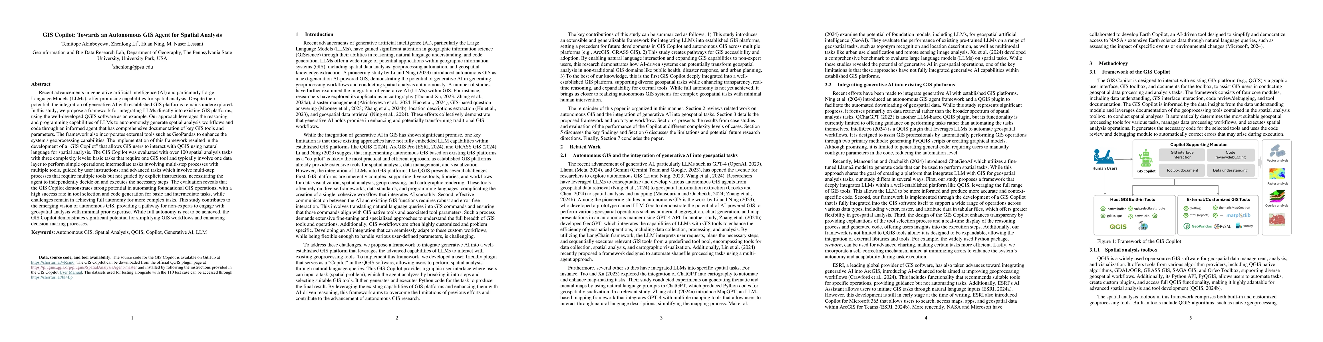
Recent advancements in Generative AI offer promising capabilities for spatial analysis. Despite their potential, the integration of generative AI with established GIS platforms remains underexplored. ...
Numerous researchers have utilized GPS-enabled vehicle data and SafeGraph mobility data to analyze human movements. However, the comparison of their ability to capture human mobility remains unexplore...
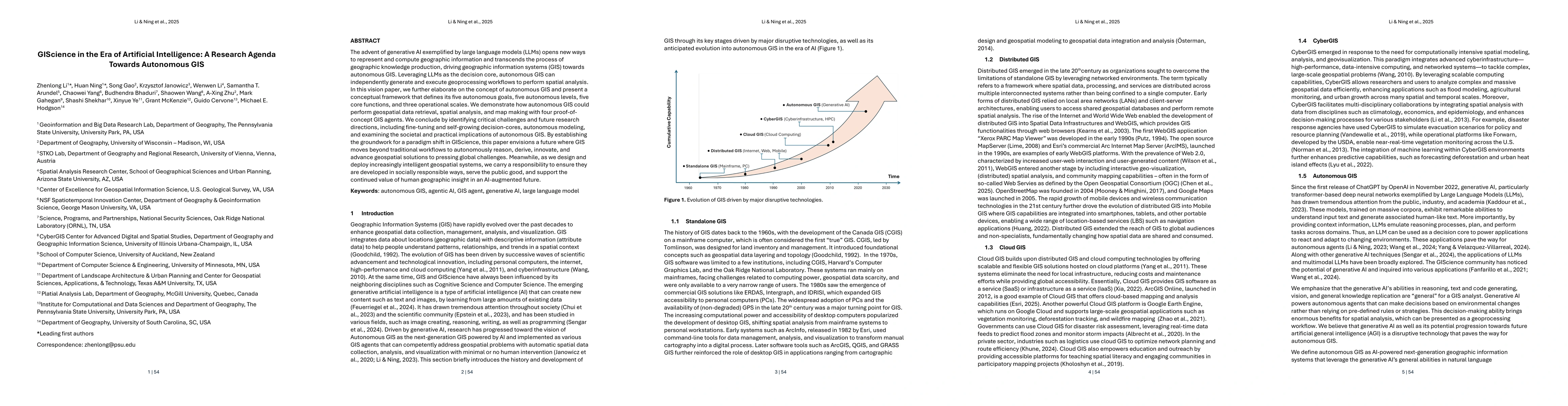
The advent of generative AI exemplified by large language models (LLMs) opens new ways to represent and compute geographic information and transcends the process of geographic knowledge production, dr...
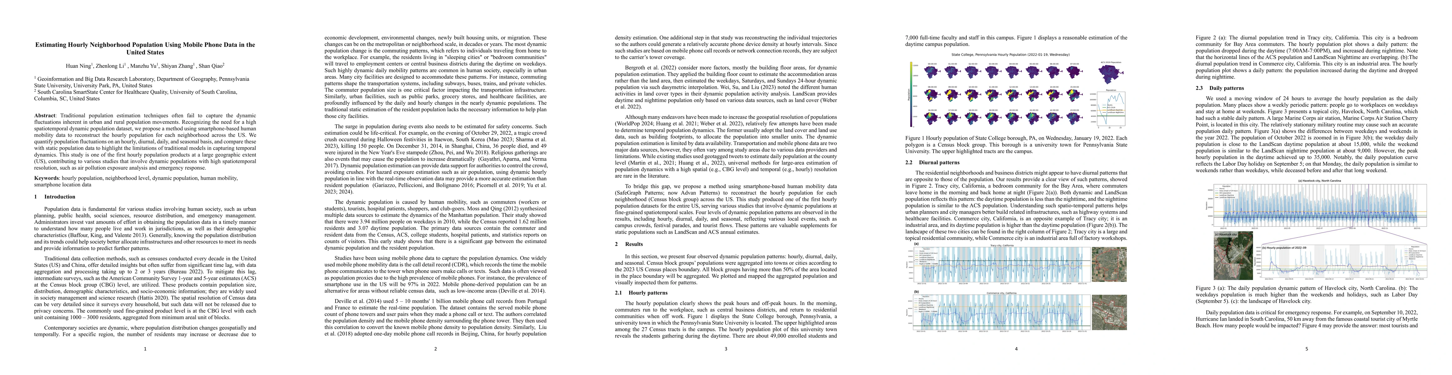
Traditional population estimation techniques often fail to capture the dynamic fluctuations inherent in urban and rural population movements. Recognizing the need for a high spatiotemporal dynamic pop...
Built environment auditing refers to the systematic documentation and assessment of urban and rural spaces' physical, social, and environmental characteristics, such as walkability, road conditions, a...
Traditional population datasets are largely static and therefore unable to capture the strong temporal dynamics of human presence driven by daily mobility. Recent smartphone-based mobility data offer ...
The automation of scientific research workflows has emerged as a transformative frontier in artificial intelligence, yet existing autonomous research agents remain largely domain-agnostic, lacking the...