Academic Profile
Statistics
Similar Authors
Papers on arXiv
Estimating canopy height and canopy height change at meter resolution from satellite imagery has numerous applications, such as monitoring forest health, logging activities, wood resources, and carbon...
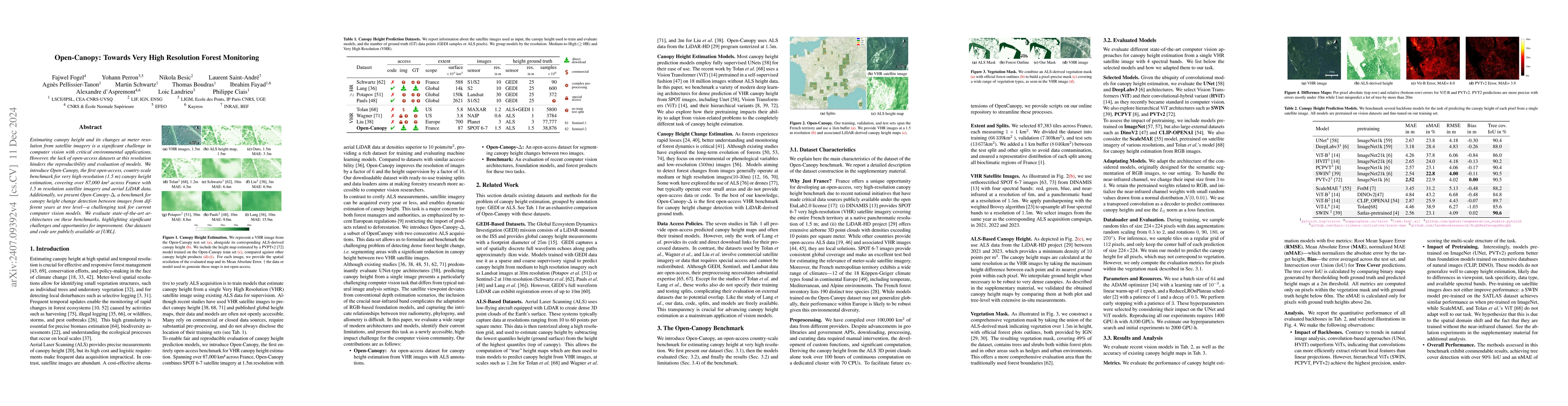
Accurate and timely monitoring of forest canopy heights is critical for assessing forest dynamics, biodiversity, carbon sequestration as well as forest degradation and deforestation. Recent advances...
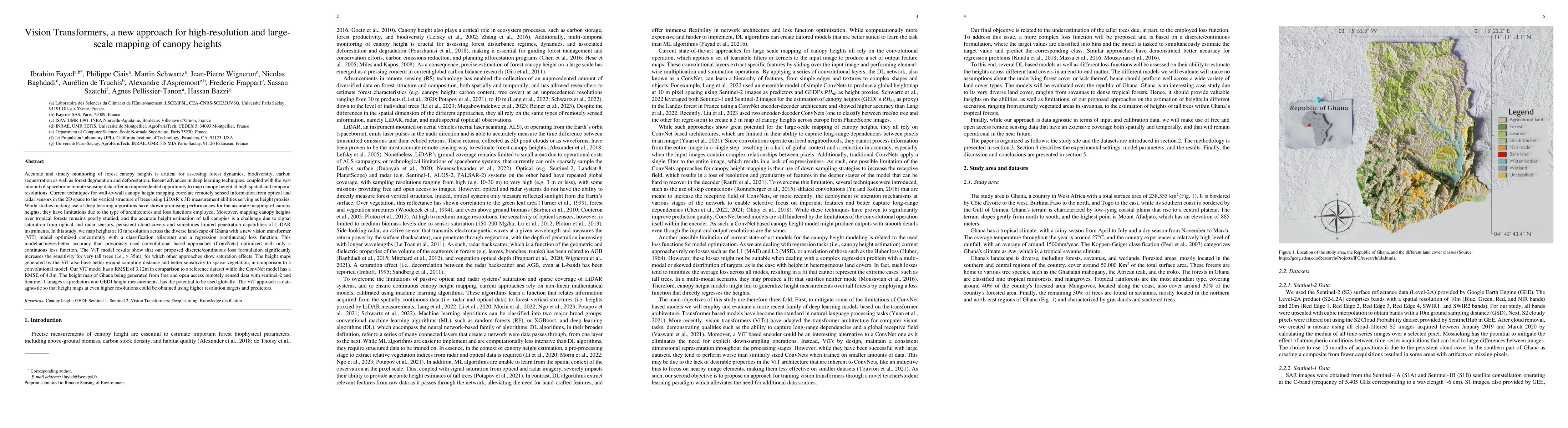
In intensively managed forests in Europe, where forests are divided into stands of small size and may show heterogeneity within stands, a high spatial resolution (10 - 20 meters) is arguably needed ...
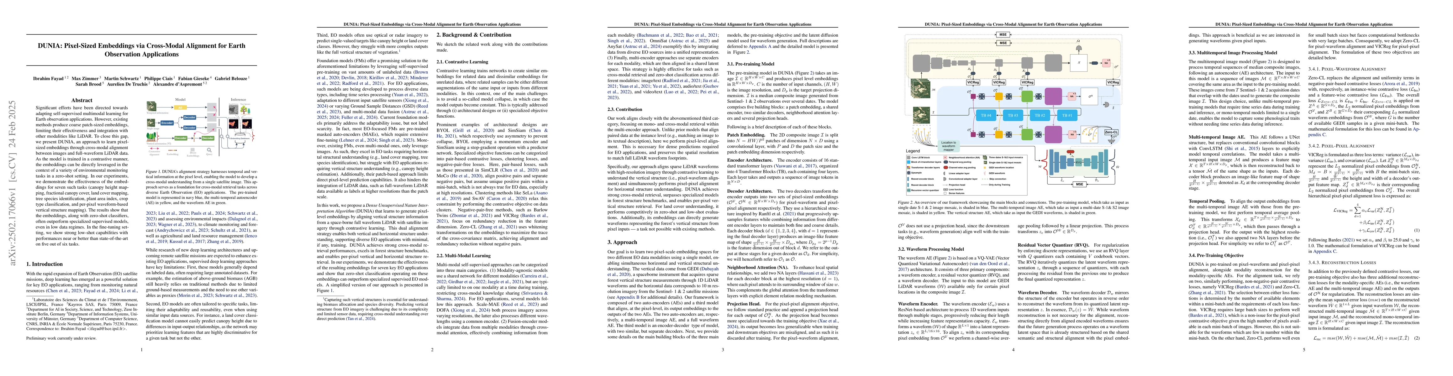
Significant efforts have been directed towards adapting self-supervised multimodal learning for Earth observation applications. However, existing methods produce coarse patch-sized embeddings, limitin...
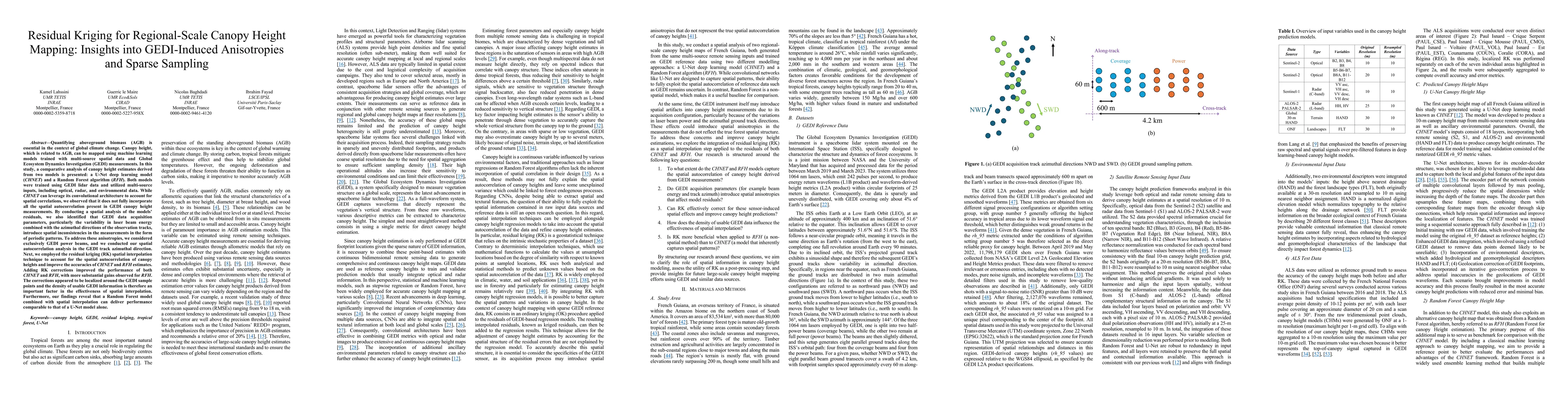
Quantifying aboveground biomass (AGB) is essential in the context of global climate change. Canopy height, which is related to AGB, can be mapped using machine learning models trained with multi-sourc...
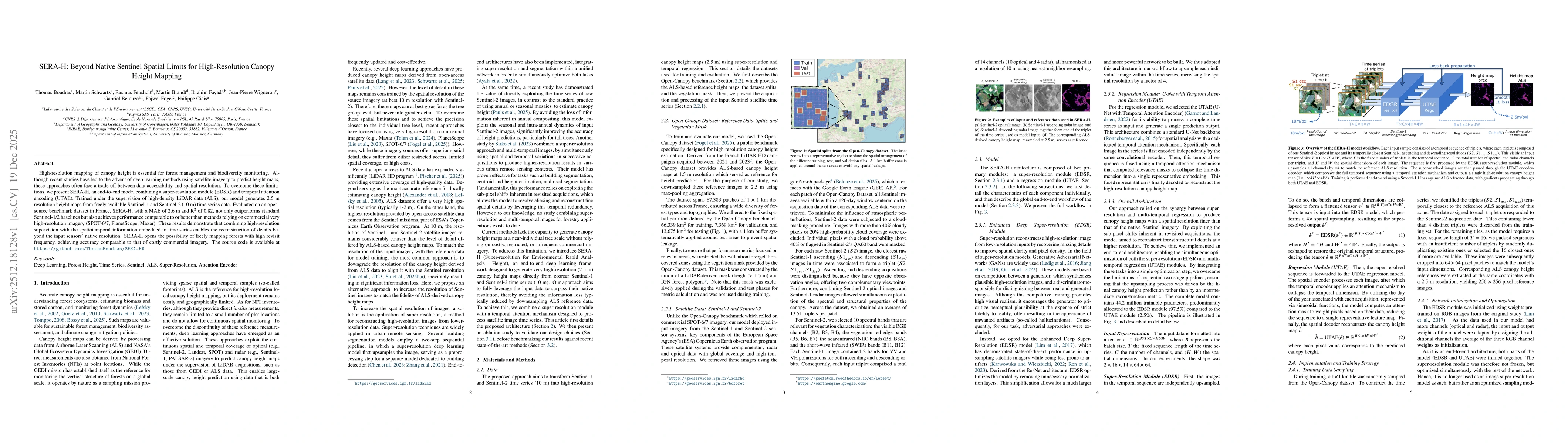
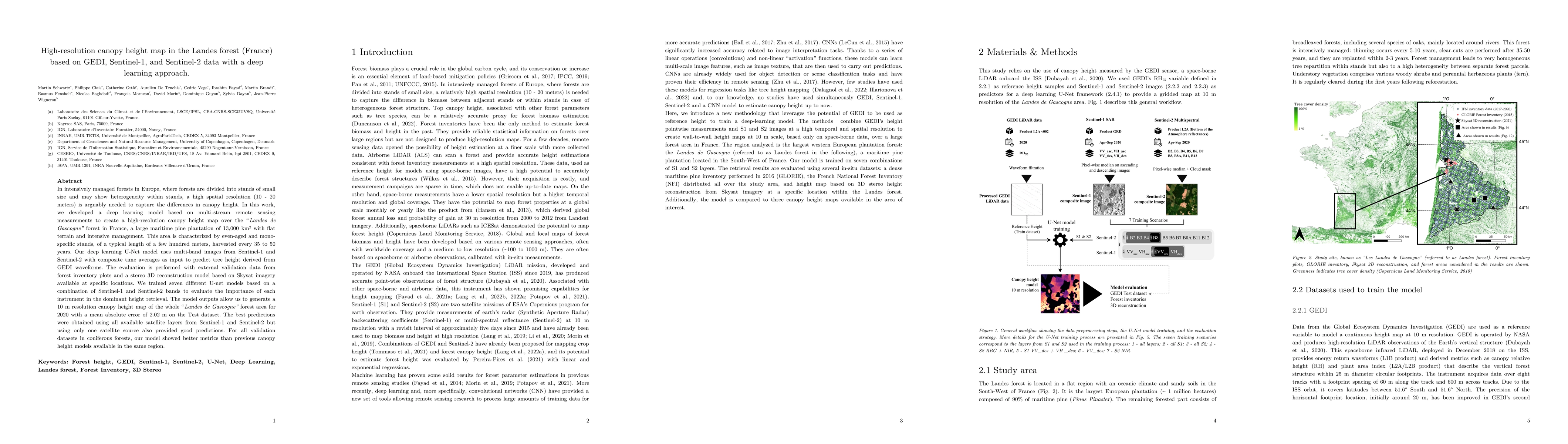
High-resolution mapping of canopy height is essential for forest management and biodiversity monitoring. Although recent studies have led to the advent of deep learning methods using satellite imagery...