Academic Profile
Statistics
Similar Authors
Papers on arXiv
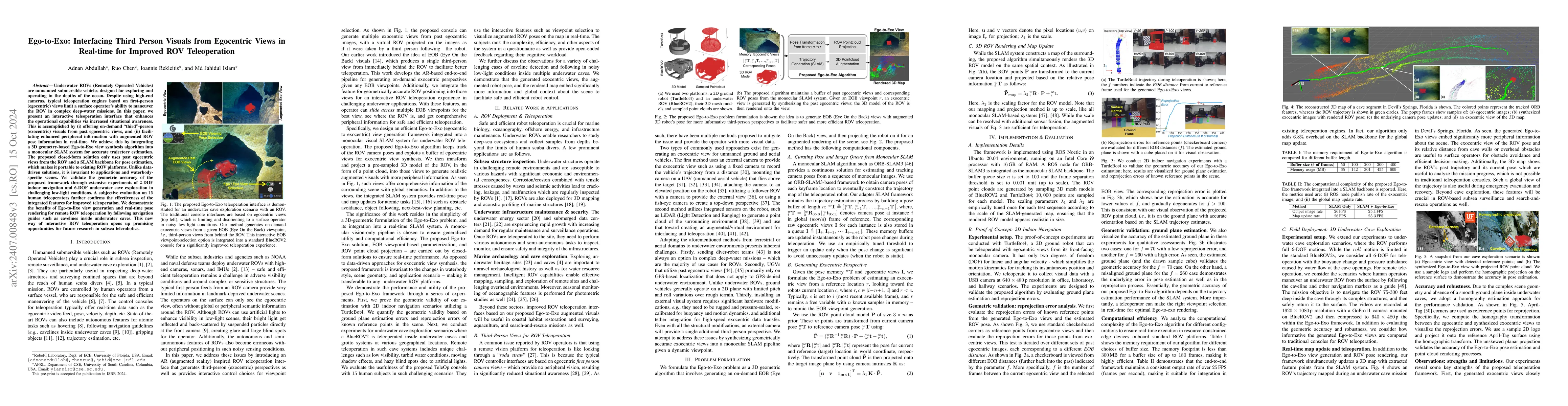
Underwater ROVs (Remotely Operated Vehicles) are unmanned submersible vehicles designed for exploring and operating in the depths of the ocean. Despite using high-end cameras, typical teleoperation ...
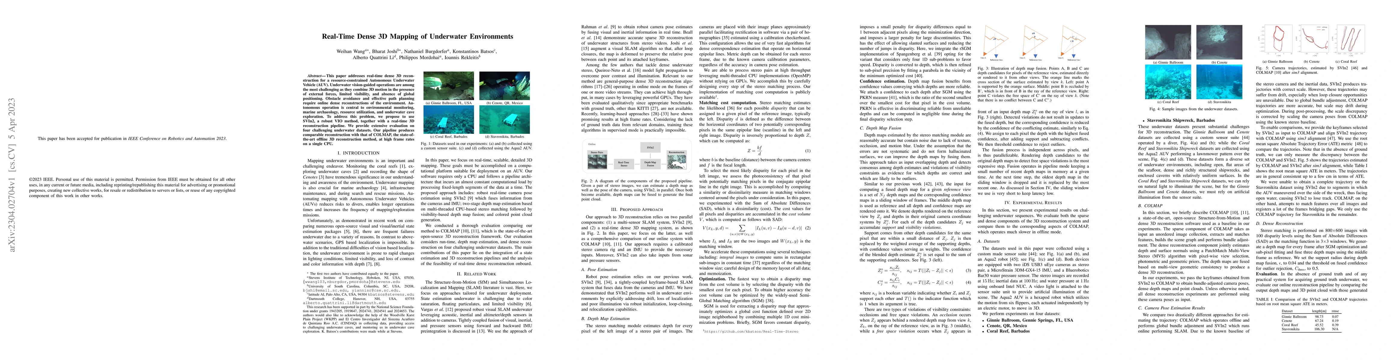
This paper addresses real-time dense 3D reconstruction for a resource-constrained Autonomous Underwater Vehicle (AUV). Underwater vision-guided operations are among the most challenging as they comb...
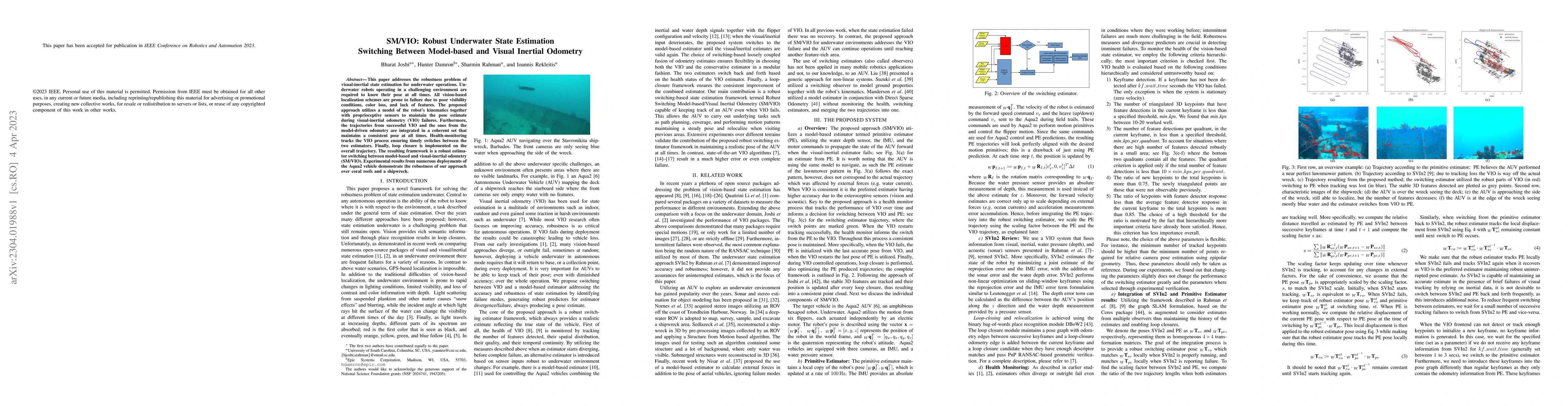
This paper addresses the robustness problem of visual-inertial state estimation for underwater operations. Underwater robots operating in a challenging environment are required to know their pose at...
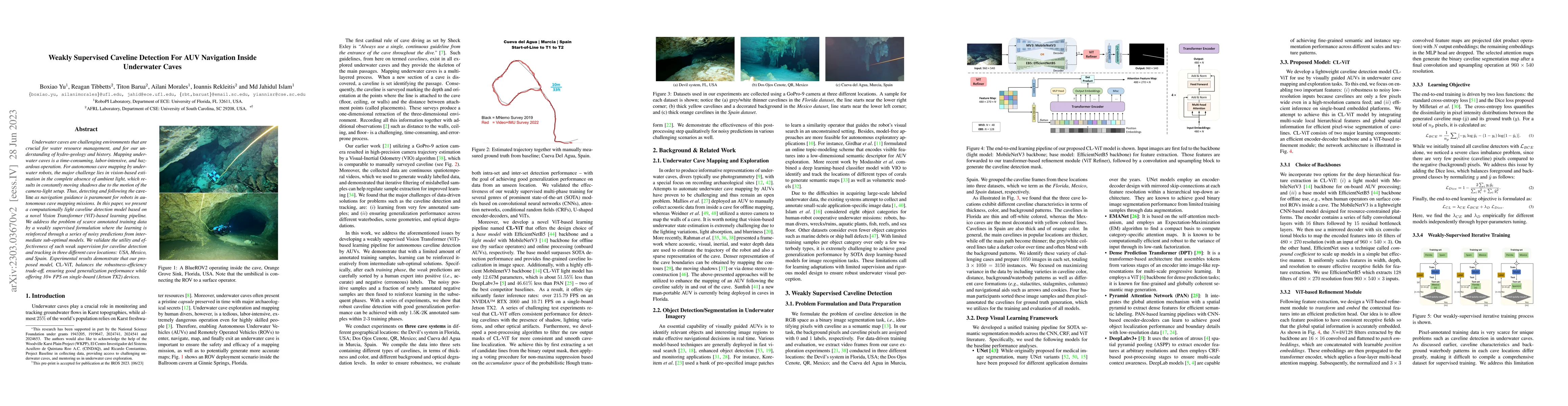
Underwater caves are challenging environments that are crucial for water resource management, and for our understanding of hydro-geology and history. Mapping underwater caves is a time-consuming, la...
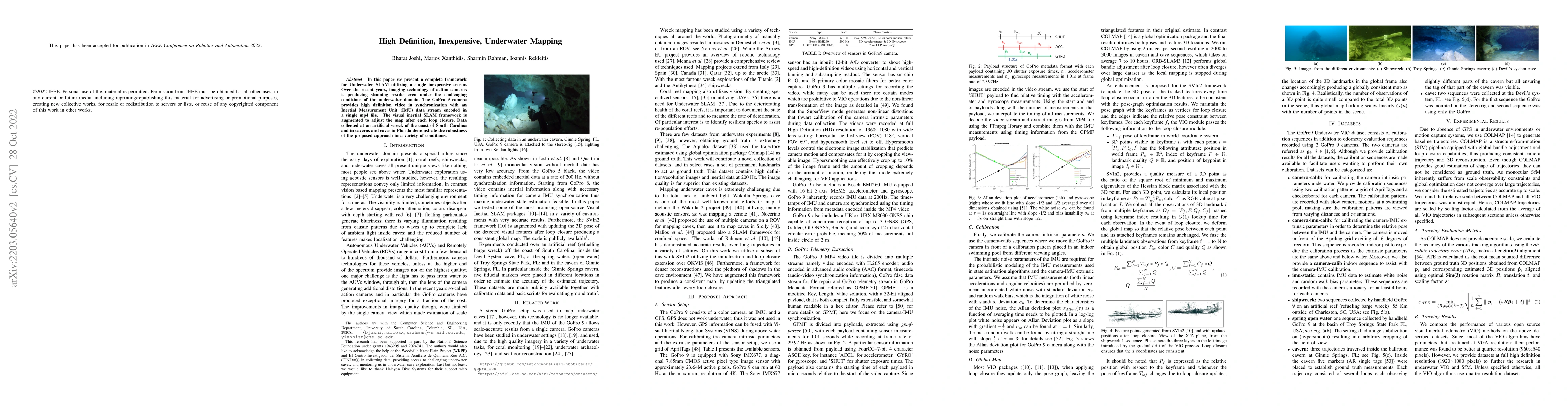
In this paper we present a complete framework for Underwater SLAM utilizing a single inexpensive sensor. Over the recent years, imaging technology of action cameras is producing stunning results eve...
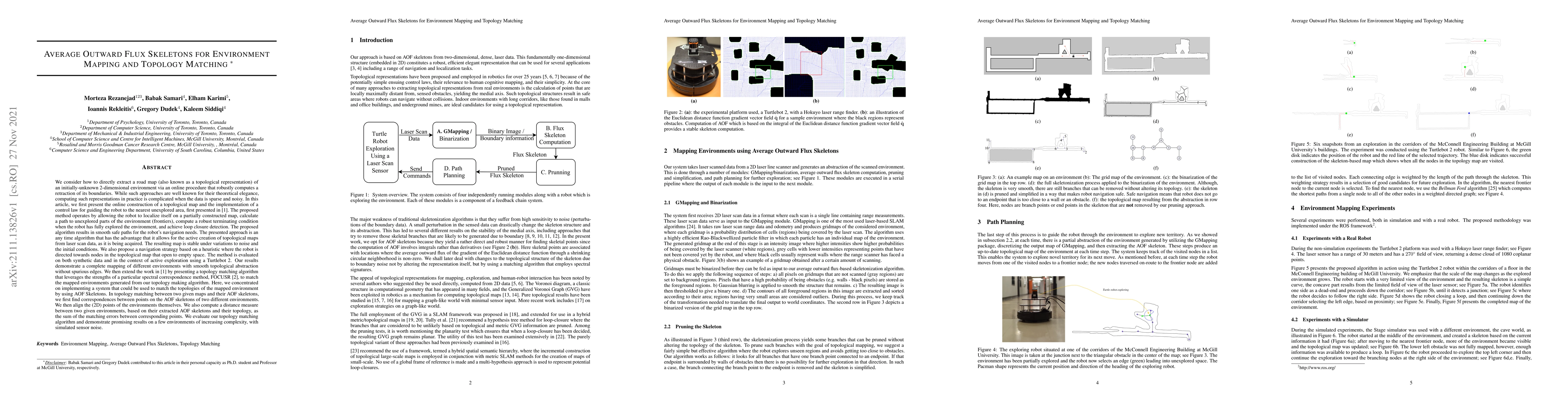
We consider how to directly extract a road map (also known as a topological representation) of an initially-unknown 2-dimensional environment via an online procedure that robustly computes a retract...
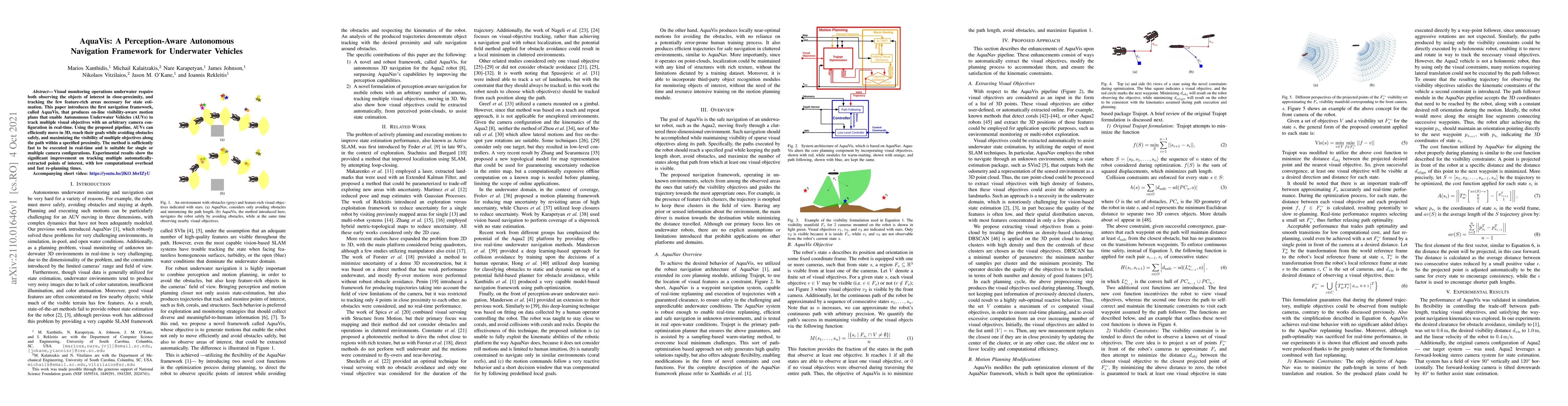
Visual monitoring operations underwater require both observing the objects of interest in close-proximity, and tracking the few feature-rich areas necessary for state estimation.This paper introduce...
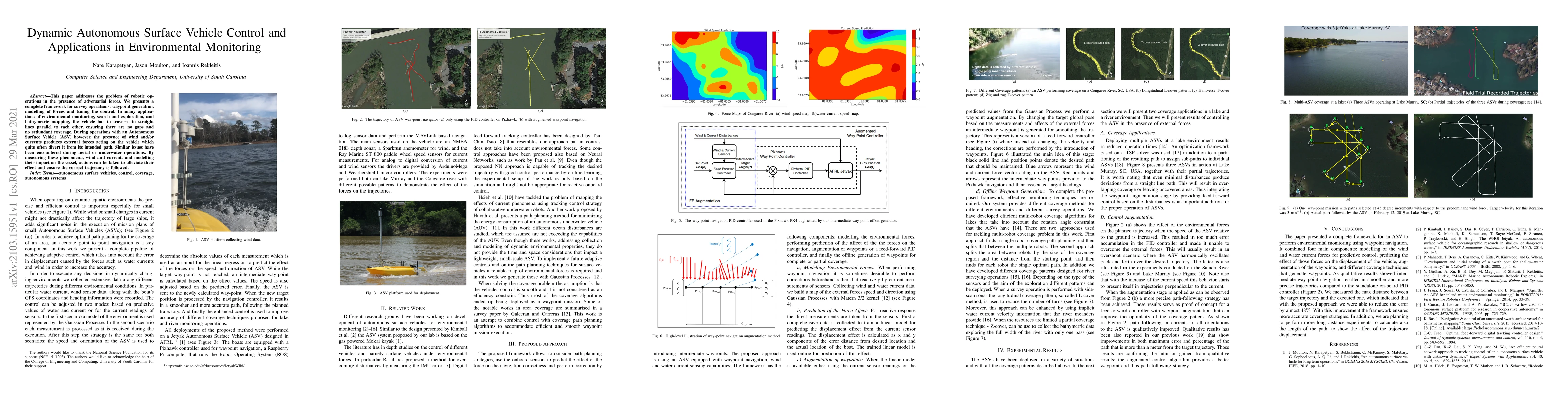
This paper addresses the problem of robotic operations in the presence of adversarial forces. We presents a complete framework for survey operations: waypoint generation,modelling of forces and tuni...
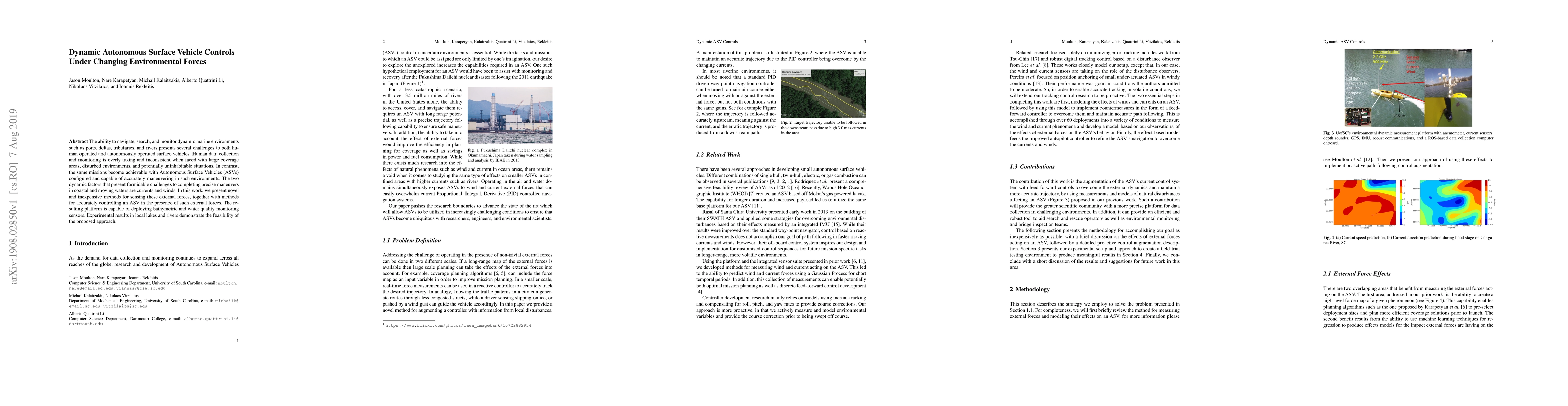
The ability to navigate, search, and monitor dynamic marine environments such as ports, deltas, tributaries, and rivers presents several challenges to both human operated and autonomously operated s...
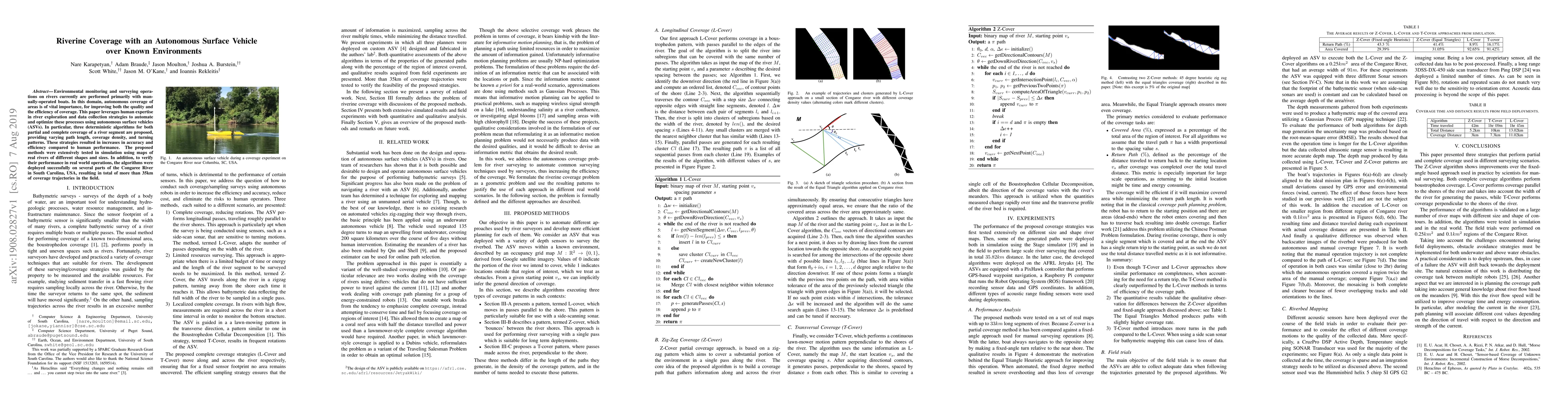
Environmental monitoring and surveying operations on rivers currently are performed primarily with manually-operated boats. In this domain, autonomous coverage of areas is of vital importance, for i...
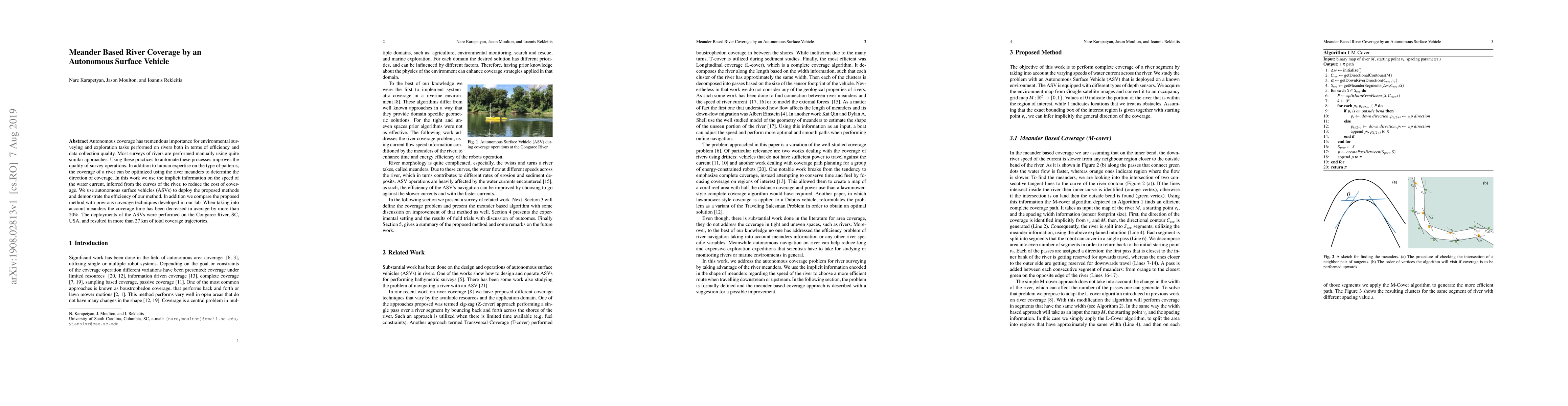
Autonomous coverage has tremendous importance for environmental surveying and exploration tasks performed on rivers both in terms of efficiency and data collection quality. Most surveys of rivers ar...
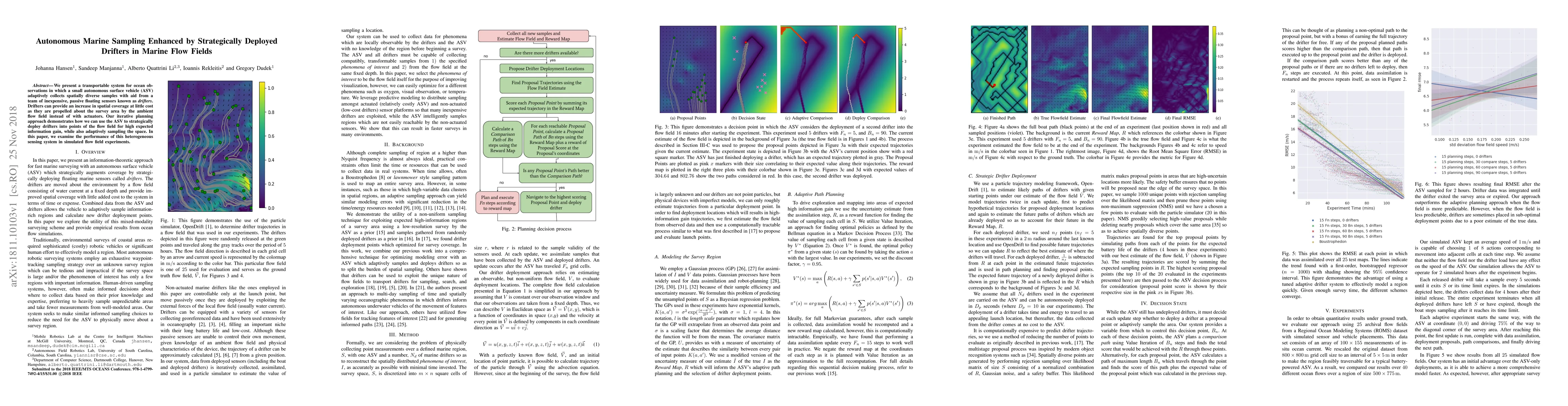
We present a transportable system for ocean observations in which a small autonomous surface vehicle (ASV) adaptively collects spatially diverse samples with aid from a team of inexpensive, passive ...
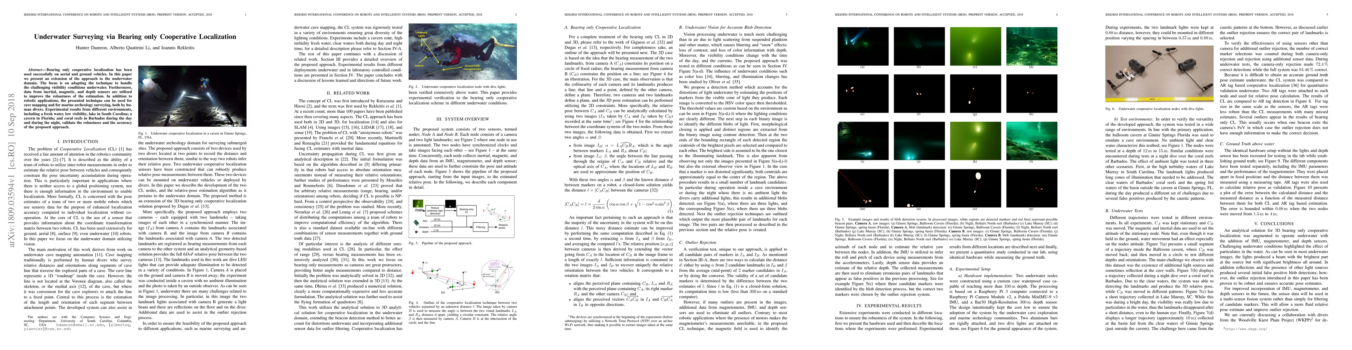
Bearing only cooperative localization has been used successfully on aerial and ground vehicles. In this paper we present an extension of the approach to the underwater domain. The focus is on adapti...
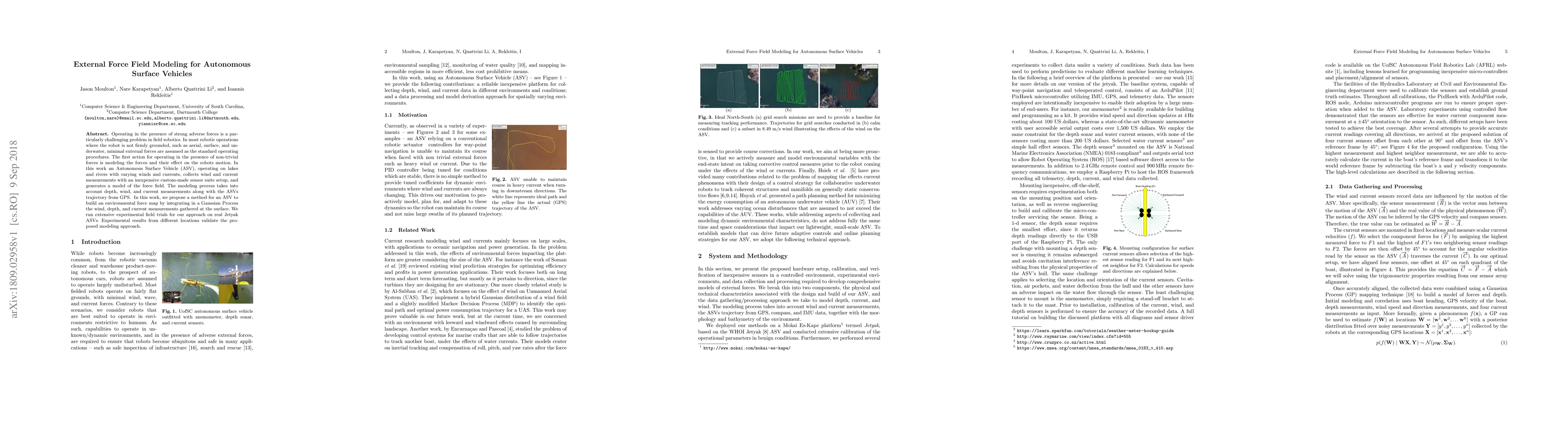
Operating in the presence of strong adverse forces is a particularly challenging problem in field robotics. In most robotic operations where the robot is not firmly grounded, such as aerial, surface...
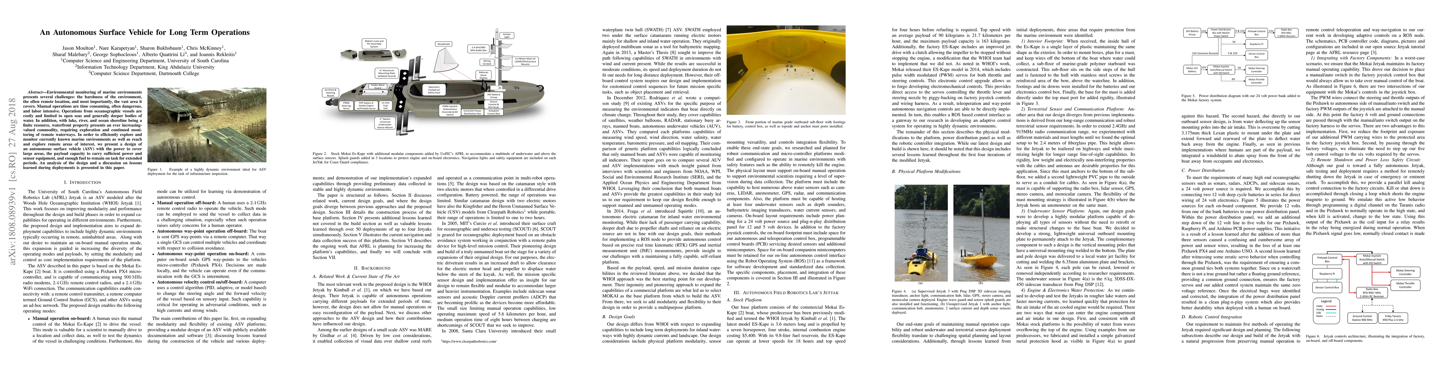
Environmental monitoring of marine environments presents several challenges: the harshness of the environment, the often remote location, and most importantly, the vast area it covers. Manual operat...
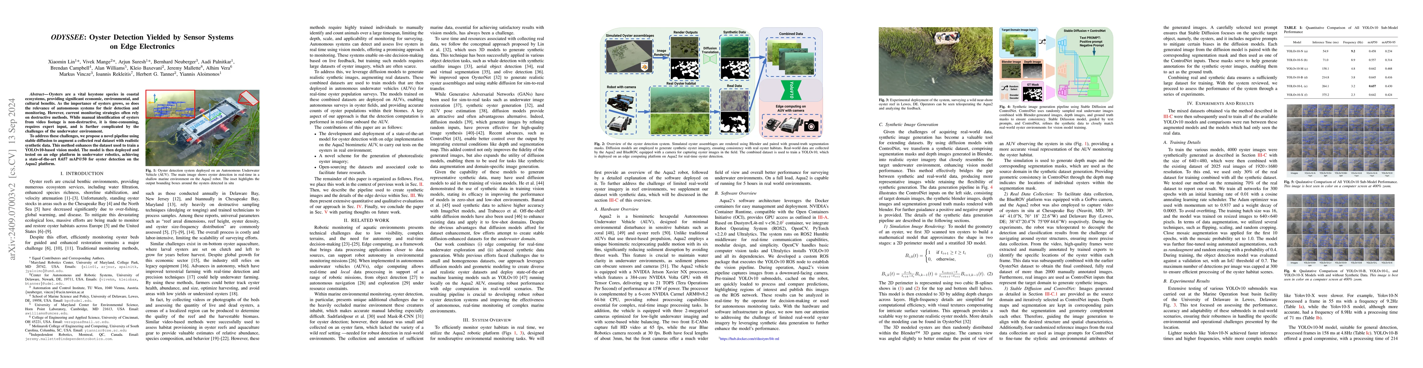
Oysters are a keystone species in coastal ecosystems, offering significant economic, environmental, and cultural benefits. However, current monitoring systems are often destructive, typically involvin...
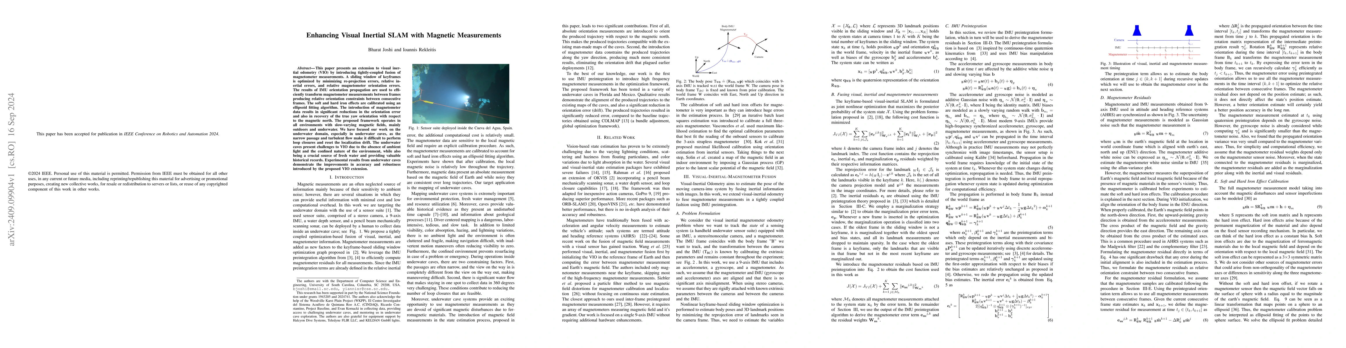
This paper presents an extension to visual inertial odometry (VIO) by introducing tightly-coupled fusion of magnetometer measurements. A sliding window of keyframes is optimized by minimizing re-proje...
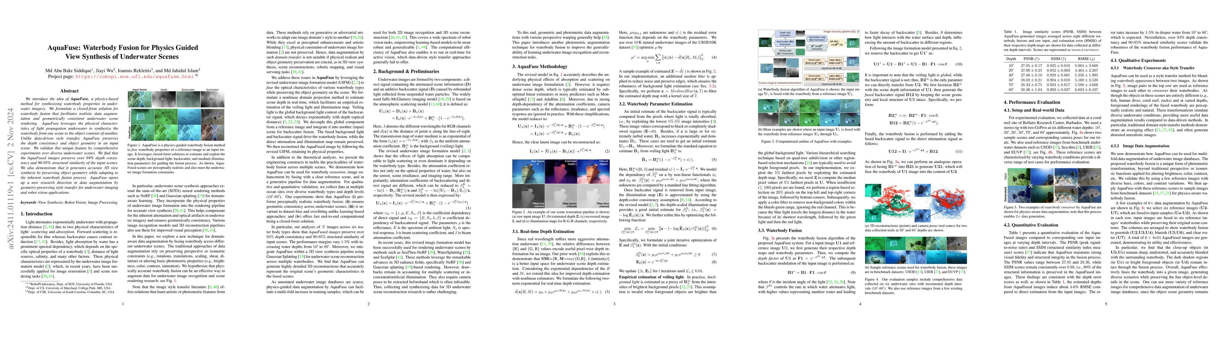
We introduce the idea of AquaFuse, a physics-based method for synthesizing waterbody properties in underwater imagery. We formulate a closed-form solution for waterbody fusion that facilitates realist...
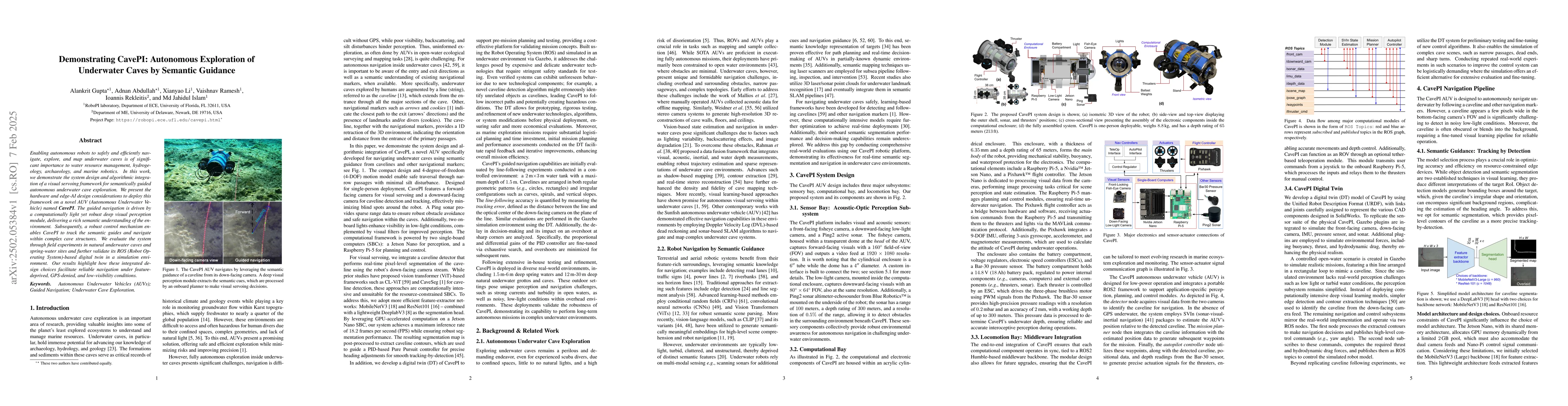
Enabling autonomous robots to safely and efficiently navigate, explore, and map underwater caves is of significant importance to water resource management, hydrogeology, archaeology, and marine roboti...
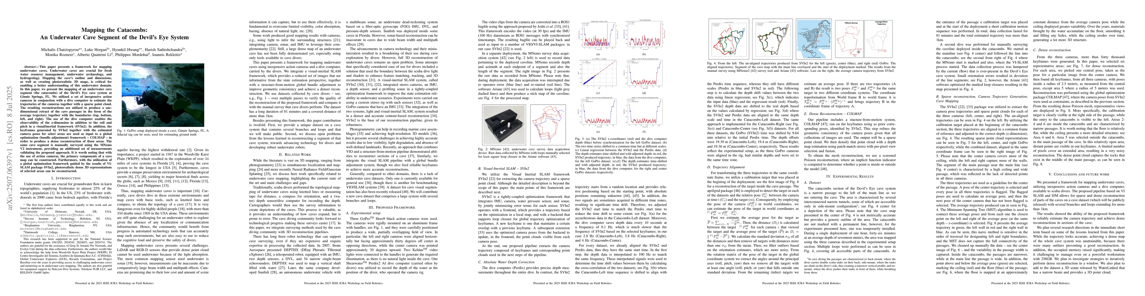
This paper presents a framework for mapping underwater caves. Underwater caves are crucial for fresh water resource management, underwater archaeology, and hydrogeology. Mapping the cave's outline and...
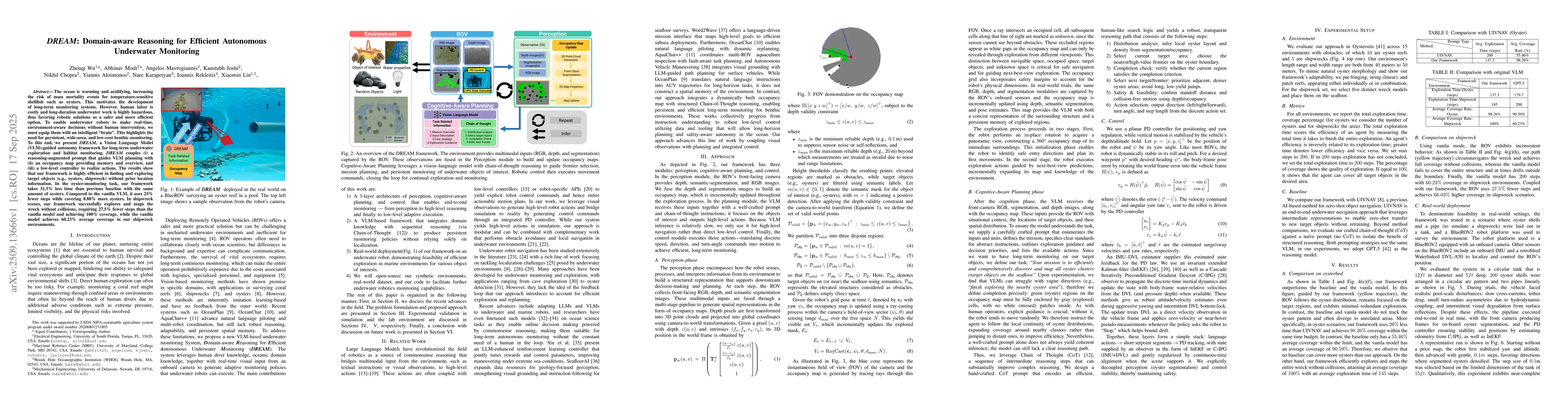
The ocean is warming and acidifying, increasing the risk of mass mortality events for temperature-sensitive shellfish such as oysters. This motivates the development of long-term monitoring systems. H...
In the past decade, the adoption of compact 3D range sensors, such as LiDARs, has driven the developments of robust state-estimation pipelines, making them a standard sensor for aerial, ground, and sp...
This paper presents a framework for multi-session mapping of underwater environments utilizing an affordable action camera. The Visual-Inertial data are augmented by water depth recordings from a dive...