ArxivLens
J
Researcher

Jai G Singla

8 papers on arXiv

8 arXiv Papers
19 Total Publications
Profile

Academic Profile

Name J. Singla
Total Papers 19
Scholar Profile View on Semantic Scholar
Metrics

Statistics

8 arXiv Papers
19 Total Publications
Publications

Papers on arXiv

Thumbnail for Tree level change detection over Ahmedabad city using very high
  resolution satellite images and Deep Learning
arXiv
Tree level change detection over Ahmedabad city using very high resolution satellite images and Deep Learning

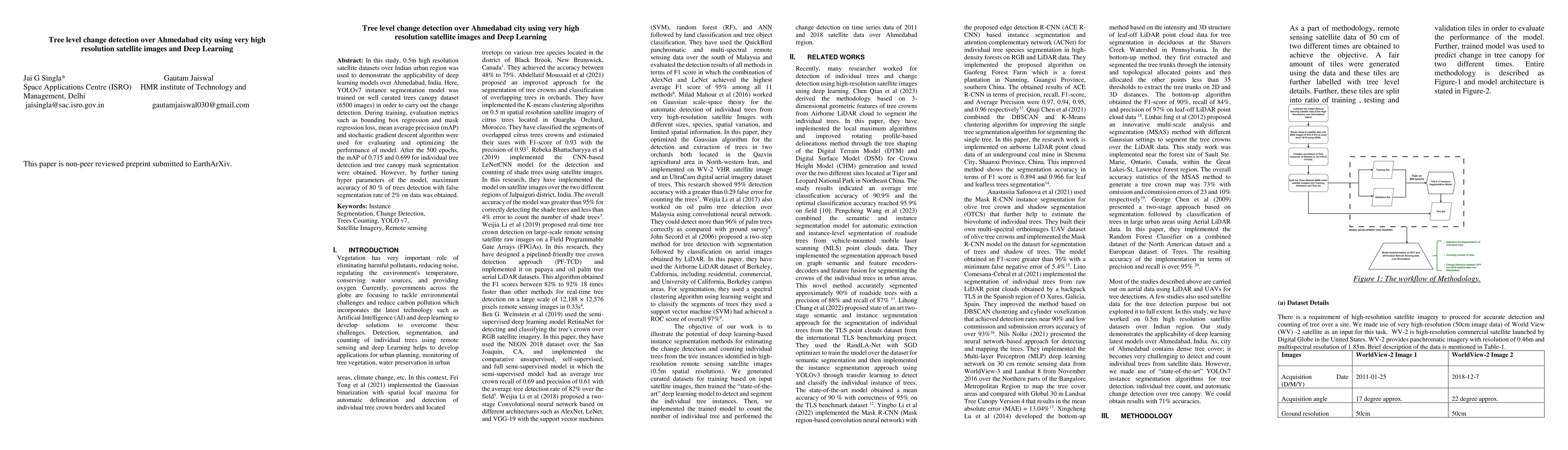
In this study, 0.5m high resolution satellite datasets over Indian urban region was used to demonstrate the applicability of deep learning models over Ahmedabad, India. Here, YOLOv7 instance segmentat...

Thumbnail for Population estimation using 3D city modelling and Carto2S datasets -- A
  case study
arXiv
Population estimation using 3D city modelling and Carto2S datasets -- A case study

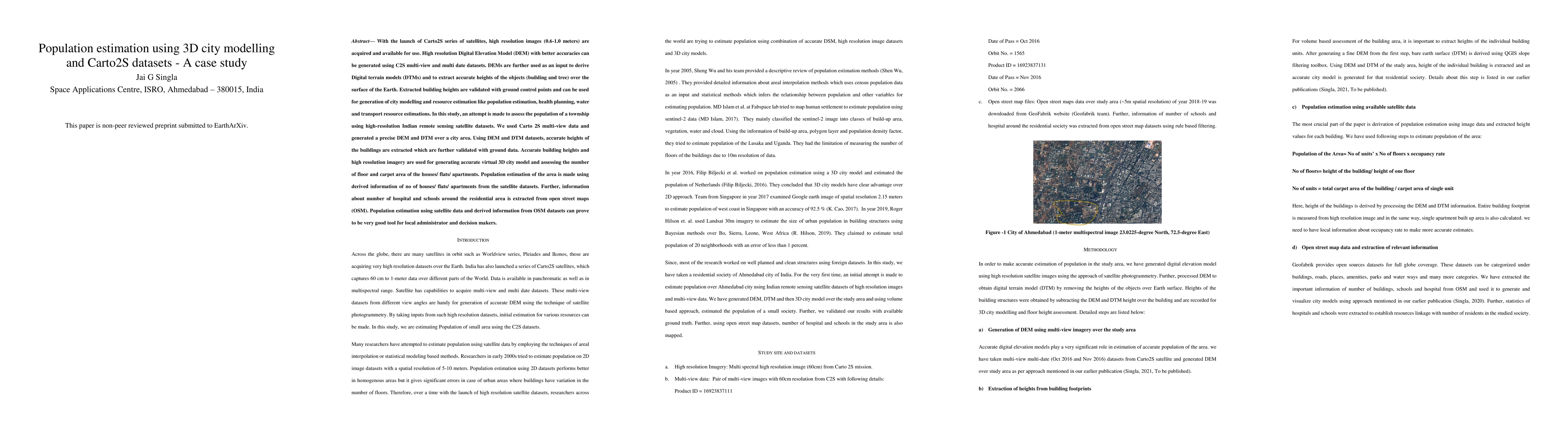
With the launch of Carto2S series of satellites, high resolution images (0.6-1.0 meters) are acquired and available for use. High resolution Digital Elevation Model (DEM) with better accuracies can be...

Thumbnail for Classification of residential and non-residential buildings based on
  satellite data using deep learning
arXiv
Classification of residential and non-residential buildings based on satellite data using deep learning

Accurate classification of buildings into residential and non-residential categories is crucial for urban planning, infrastructure development, population estimation and resource allocation. It is a c...

Thumbnail for Semantic segmentation on multi-resolution optical and microwave data
  using deep learning
arXiv
Semantic segmentation on multi-resolution optical and microwave data using deep learning

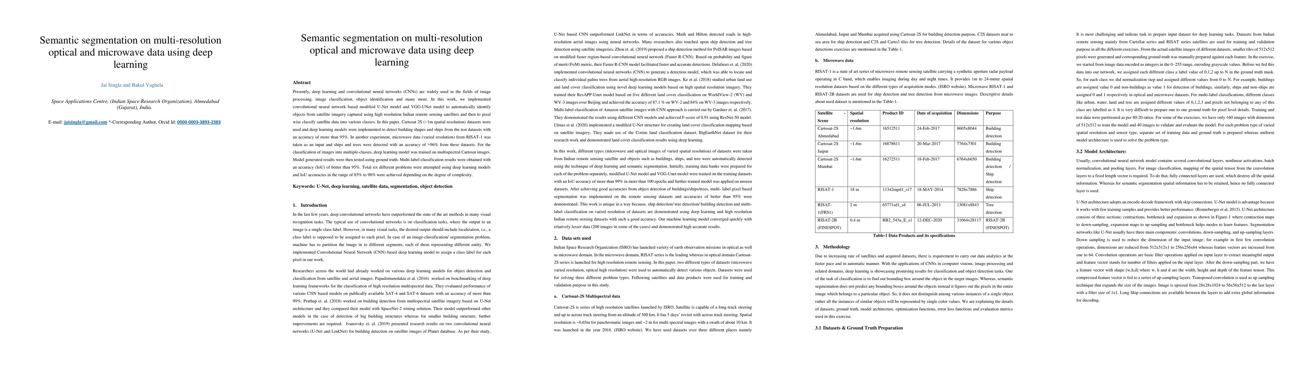
Presently, deep learning and convolutional neural networks (CNNs) are widely used in the fields of image processing, image classification, object identification and many more. In this work, we impleme...

Thumbnail for Examining quality of DGNSS derived positioning in data in urban city --
  A case study of an urban city in India
arXiv
Examining quality of DGNSS derived positioning in data in urban city -- A case study of an urban city in India

GNSS observations are carried out in static mode/ Differential global navigation satellite system (DGNSS) and dynamic mode / Real time Kinematics (RTK) mainly. RTK mode of observation is useful in cas...

Thumbnail for Deep Learning Aided Vision System for Planetary Rovers
arXiv
Deep Learning Aided Vision System for Planetary Rovers

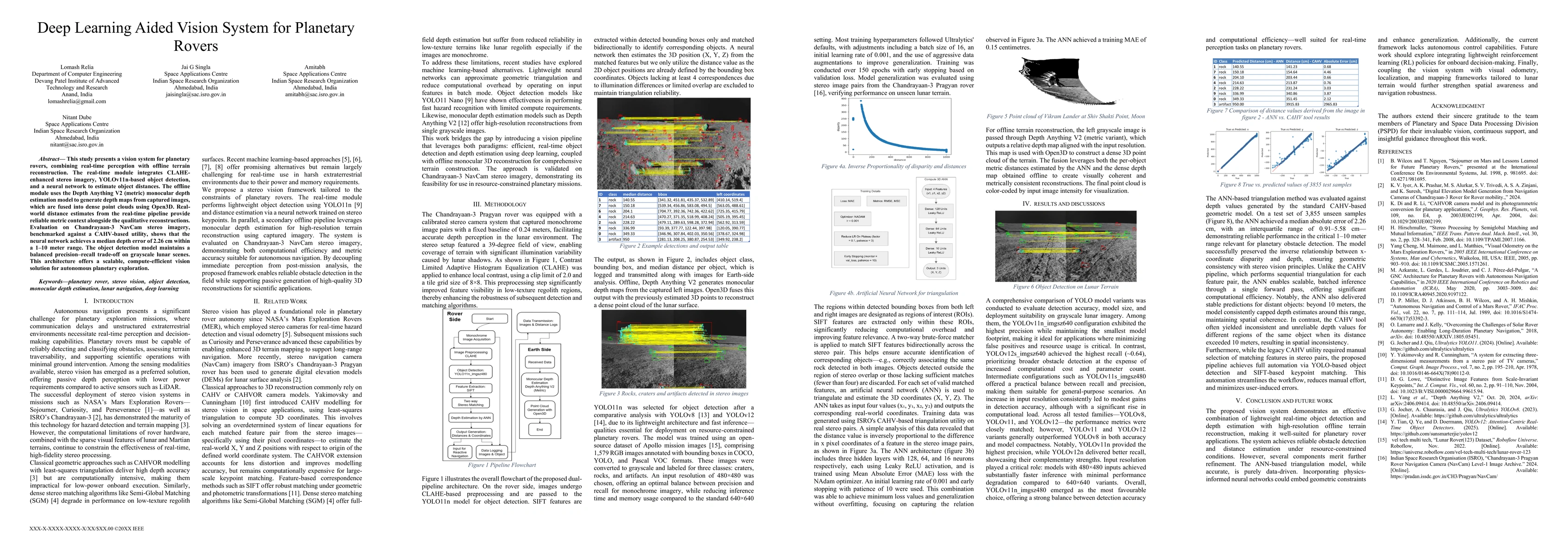
This study presents a vision system for planetary rovers, combining real-time perception with offline terrain reconstruction. The real-time module integrates CLAHE enhanced stereo imagery, YOLOv11n ba...

Thumbnail for Depth-Aware Rover: A Study of Edge AI and Monocular Vision for Real-World Implementation
arXiv
Depth-Aware Rover: A Study of Edge AI and Monocular Vision for Real-World Implementation

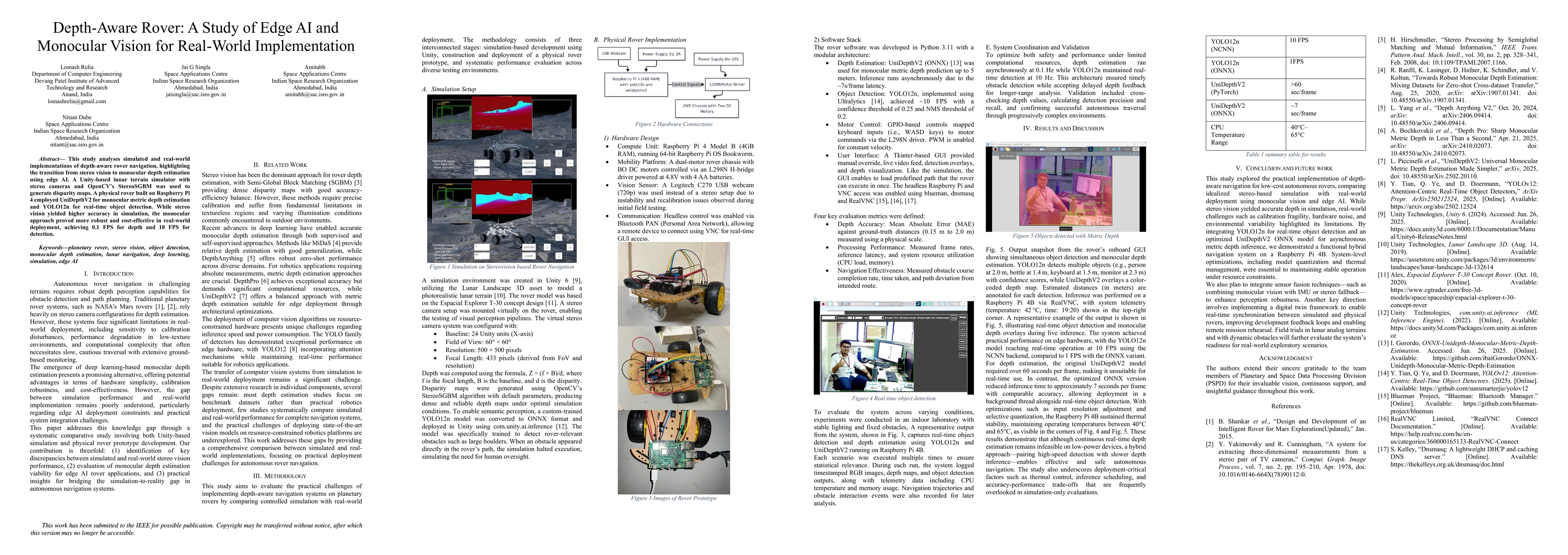
This study analyses simulated and real-world implementations of depth-aware rover navigation, highlighting the transition from stereo vision to monocular depth estimation using edge AI. A Unity-based ...

Thumbnail for Evaluation of image simulation open source solutions for simulation of synthetic images in lunar environment
arXiv
Evaluation of image simulation open source solutions for simulation of synthetic images in lunar environment

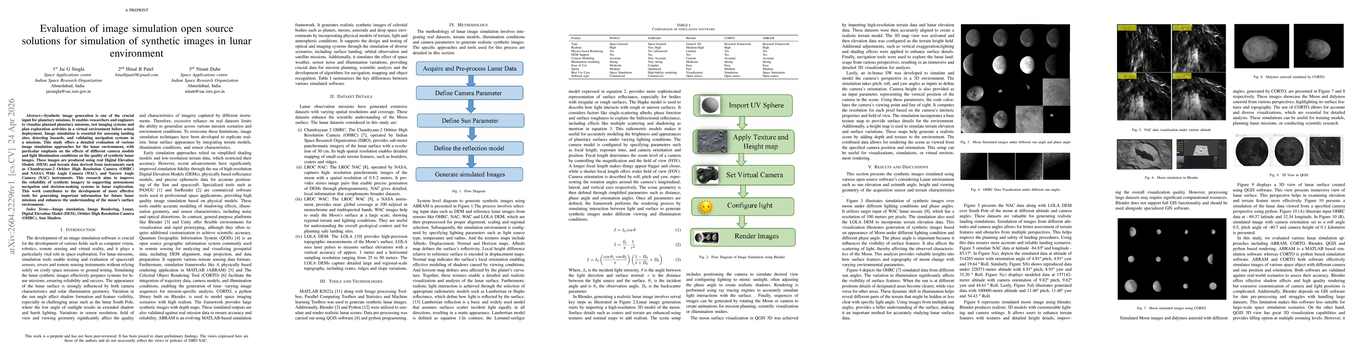
Synthetic image generation is one of the crucial input for planetary missions. It enables researchers and engineers to visualize planned planetary missions, test imaging systems and plan exploration a...

This website uses cookies to ensure you get the best experience. Learn more