Academic Profile
Statistics
Similar Authors
Papers on arXiv
Thanks to the application of deep learning technology in point cloud processing of the remote sensing field, point cloud segmentation has become a research hotspot in recent years, which can be appl...
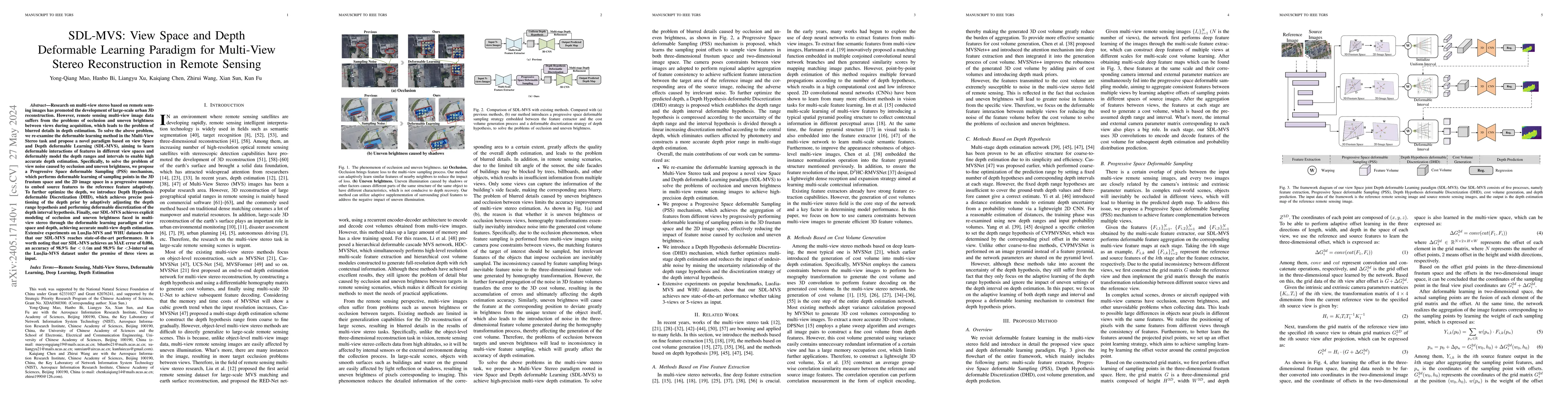
Research on multi-view stereo based on remote sensing images has promoted the development of large-scale urban 3D reconstruction. However, remote sensing multi-view image data suffers from the probl...
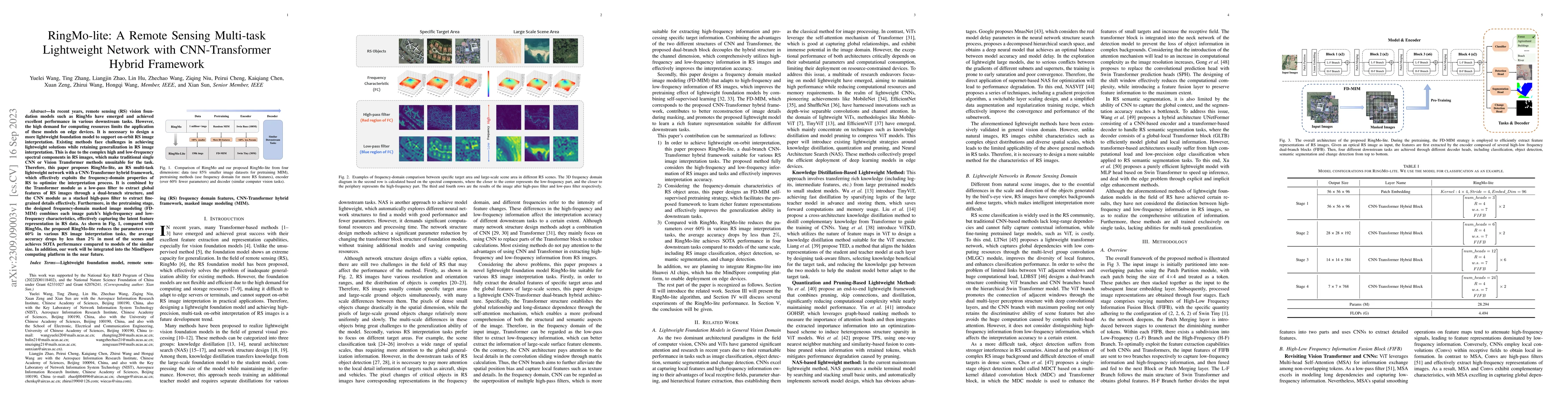
In recent years, remote sensing (RS) vision foundation models such as RingMo have emerged and achieved excellent performance in various downstream tasks. However, the high demand for computing resou...
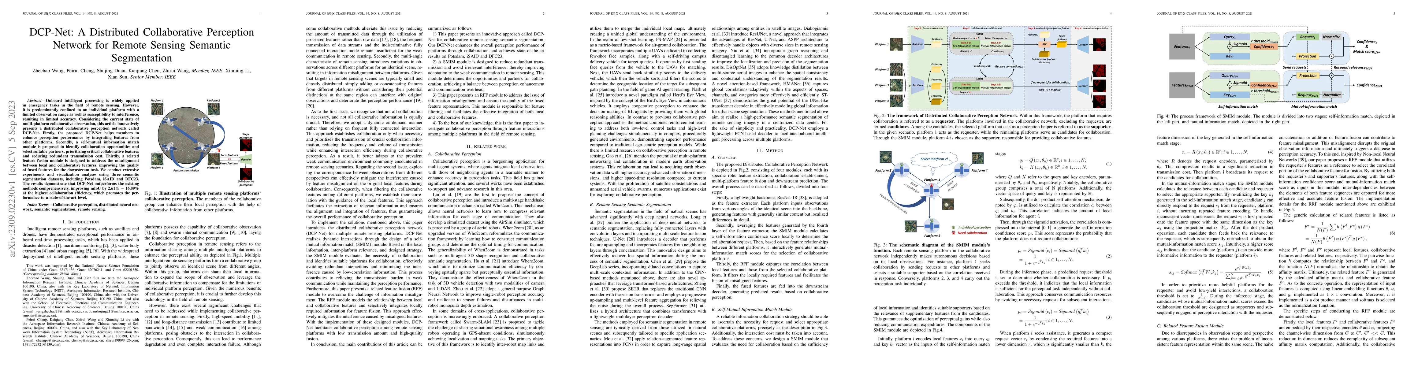
Onboard intelligent processing is widely applied in emergency tasks in the field of remote sensing. However, it is predominantly confined to an individual platform with a limited observation range a...
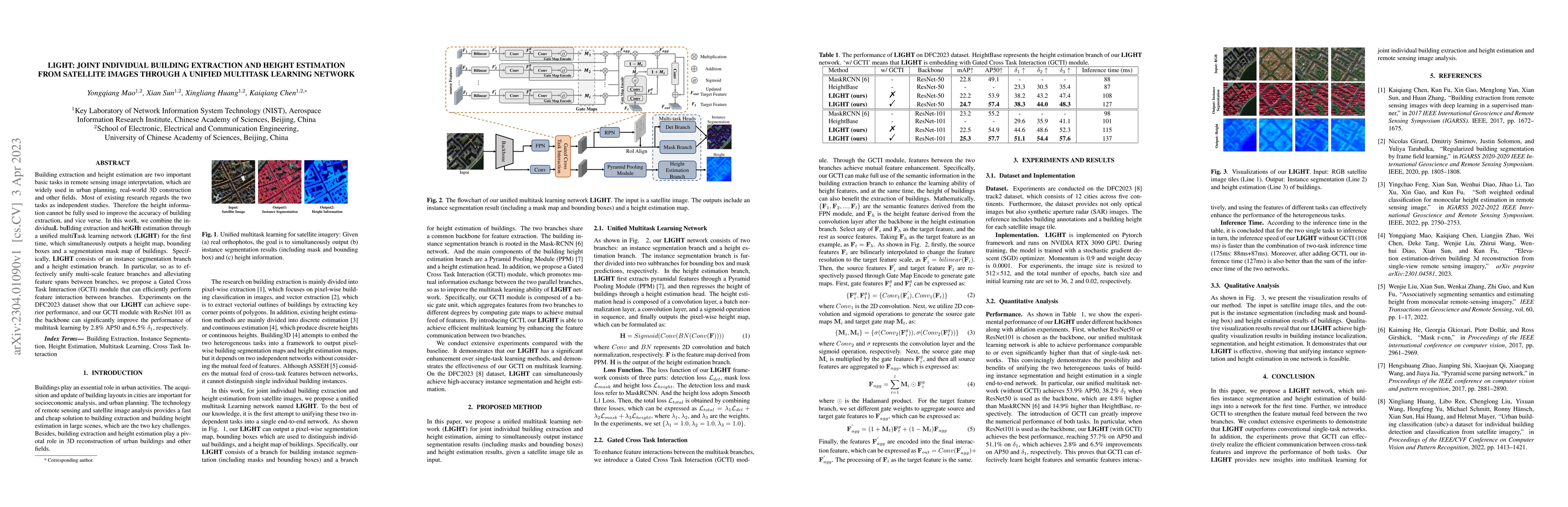
Building extraction and height estimation are two important basic tasks in remote sensing image interpretation, which are widely used in urban planning, real-world 3D construction, and other fields....
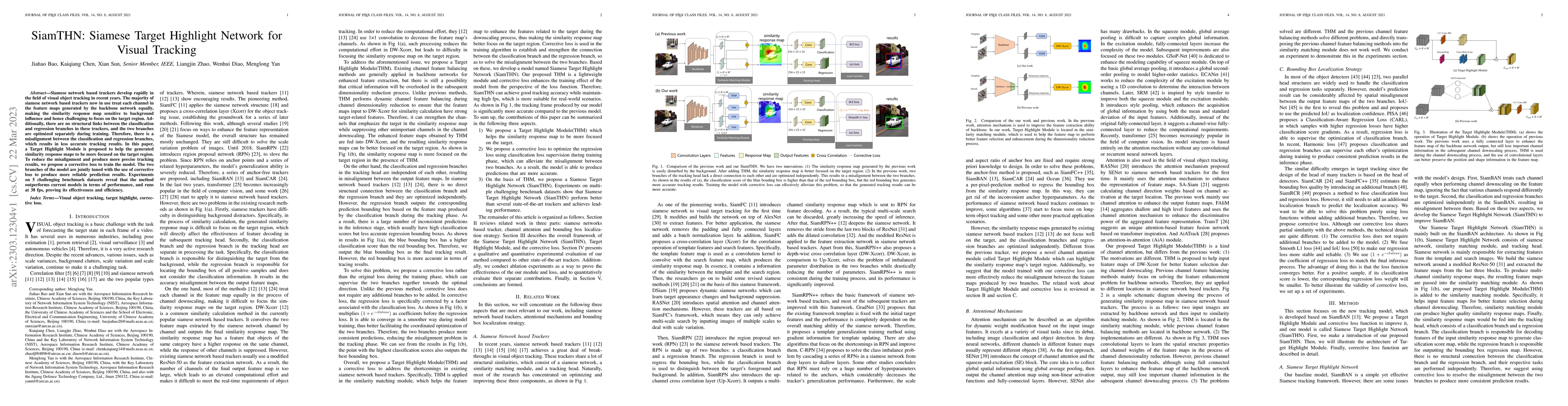
Siamese network based trackers develop rapidly in the field of visual object tracking in recent years. The majority of siamese network based trackers now in use treat each channel in the feature map...
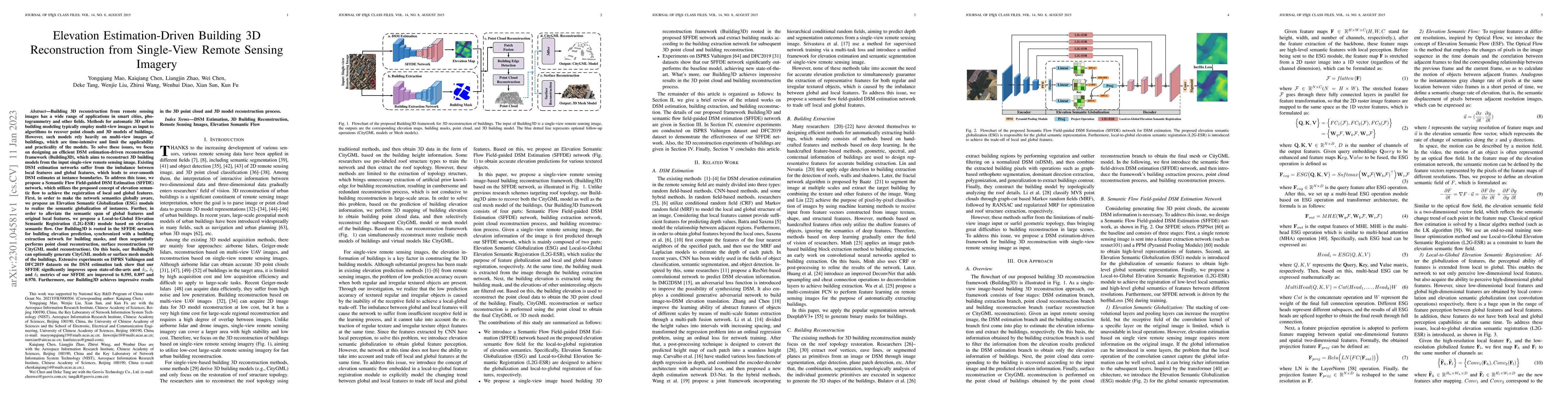
Building 3D reconstruction from remote sensing images has a wide range of applications in smart cities, photogrammetry and other fields. Methods for automatic 3D urban building modeling typically em...
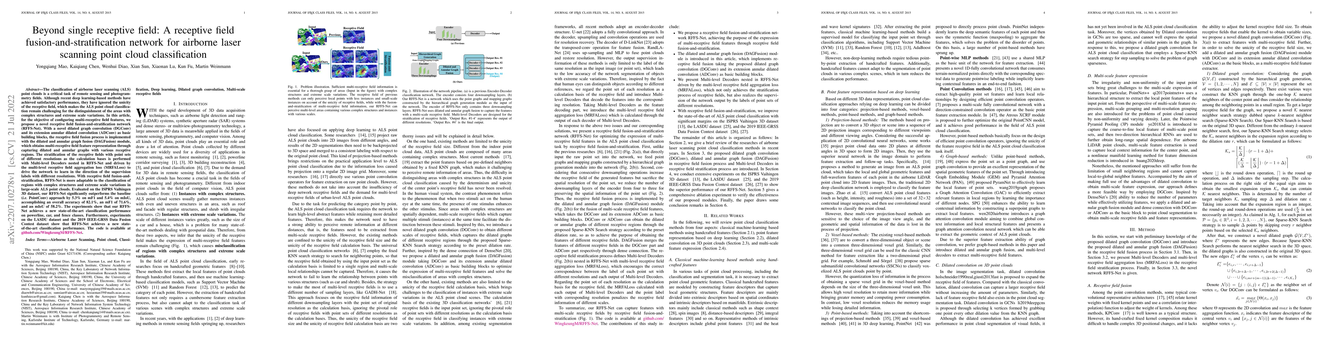
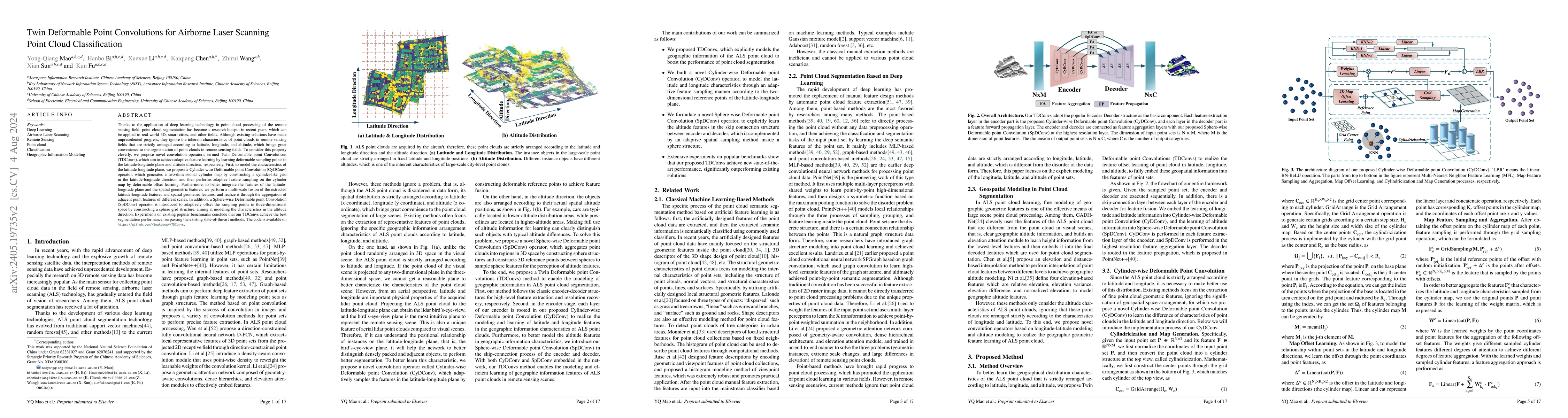
The classification of airborne laser scanning (ALS) point clouds is a critical task of remote sensing and photogrammetry fields. Although recent deep learning-based methods have achieved satisfactor...
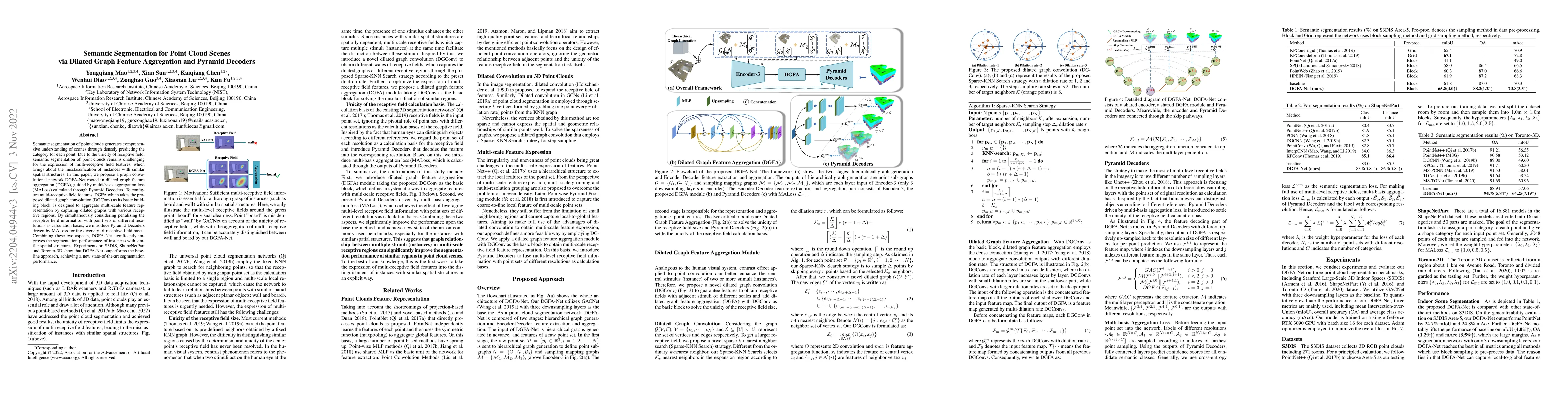
Semantic segmentation of point clouds generates comprehensive understanding of scenes through densely predicting the category for each point. Due to the unicity of receptive field, semantic segmenta...
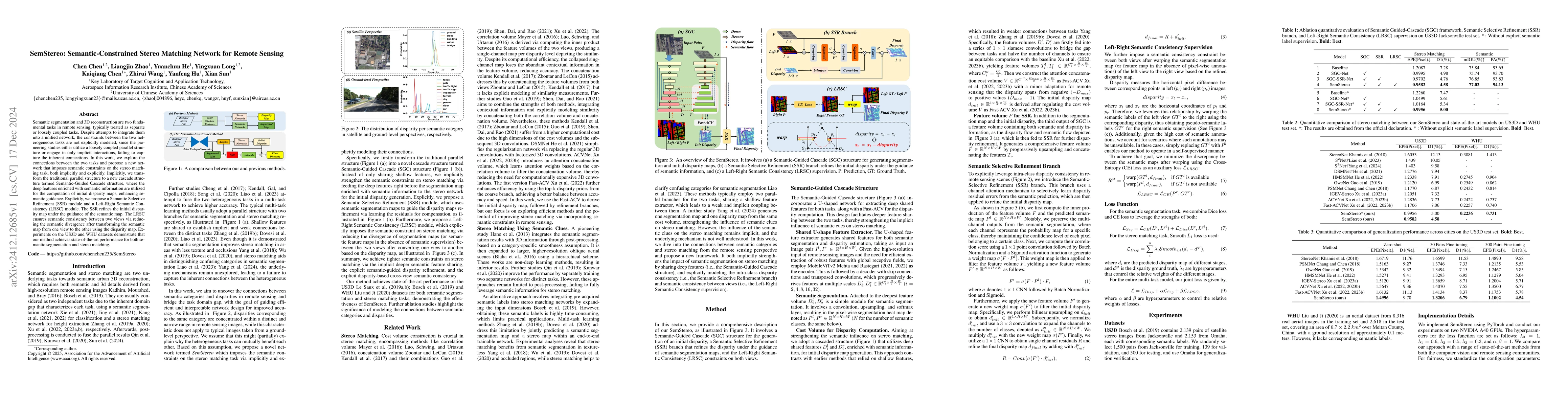
Semantic segmentation and 3D reconstruction are two fundamental tasks in remote sensing, typically treated as separate or loosely coupled tasks. Despite attempts to integrate them into a unified netwo...
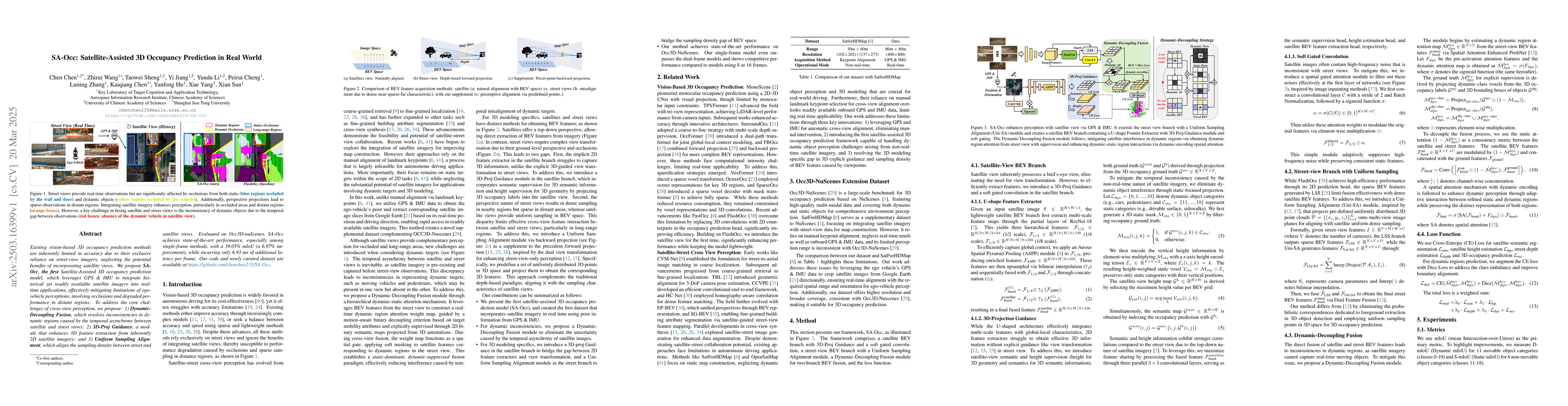
Existing vision-based 3D occupancy prediction methods are inherently limited in accuracy due to their exclusive reliance on street-view imagery, neglecting the potential benefits of incorporating sate...