Academic Profile
Statistics
Similar Authors
Papers on arXiv
Intuitively, there is a relation between measures of spatial dependence and information theoretical measures of entropy. For instance, we can provide an intuition of why spatial data is special by s...
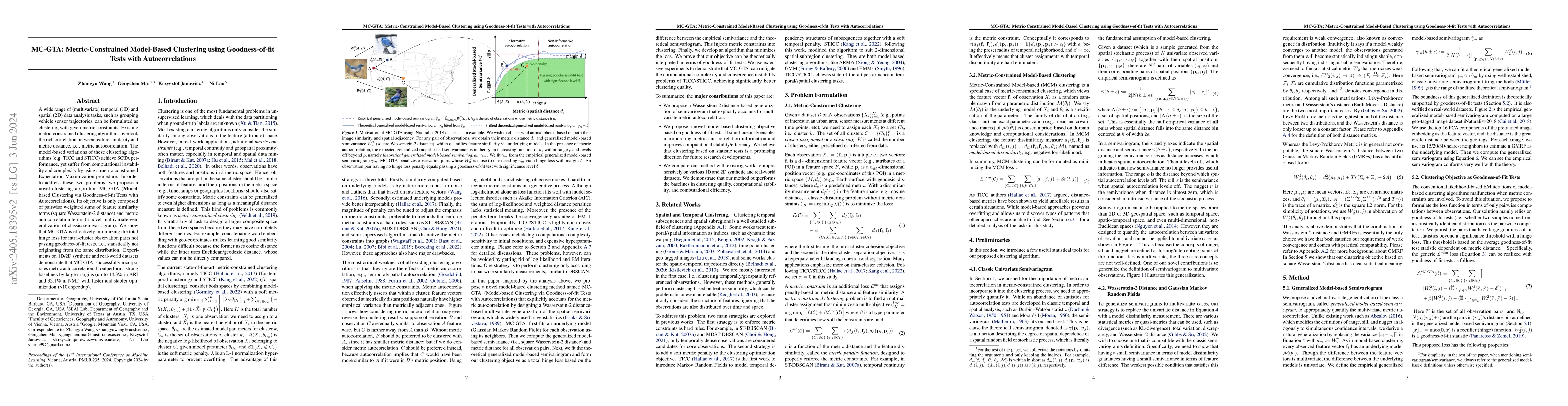
A wide range of (multivariate) temporal (1D) and spatial (2D) data analysis tasks, such as grouping vehicle sensor trajectories, can be formulated as clustering with given metric constraints. Existi...
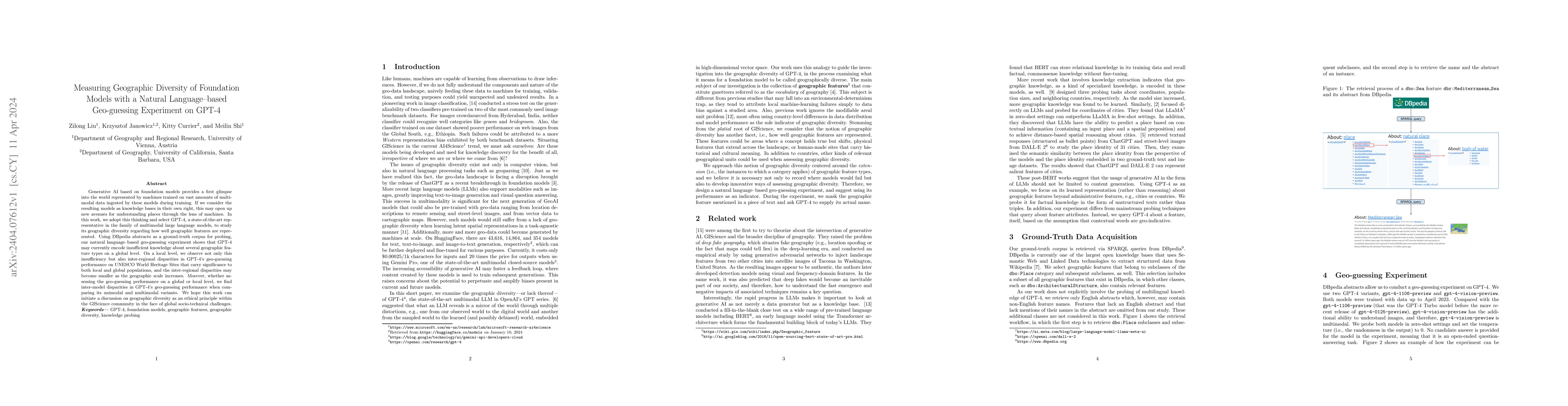
Generative AI based on foundation models provides a first glimpse into the world represented by machines trained on vast amounts of multimodal data ingested by these models during training. If we co...
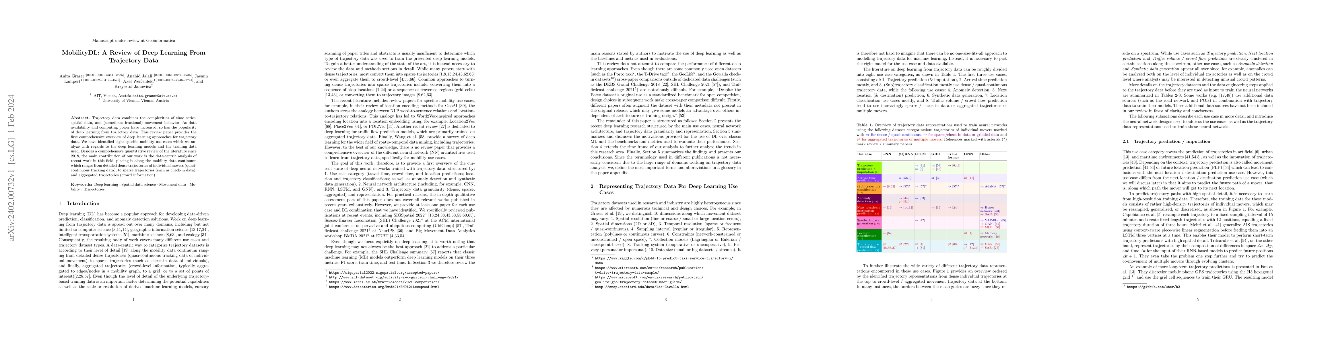
Trajectory data combines the complexities of time series, spatial data, and (sometimes irrational) movement behavior. As data availability and computing power have increased, so has the popularity o...
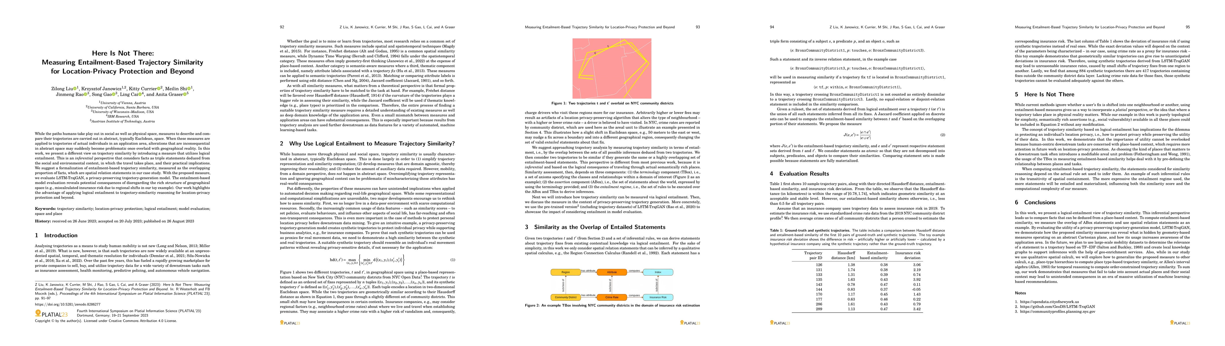
While the paths humans take play out in social as well as physical space, measures to describe and compare their trajectories are carried out in abstract, typically Euclidean, space. When these meas...
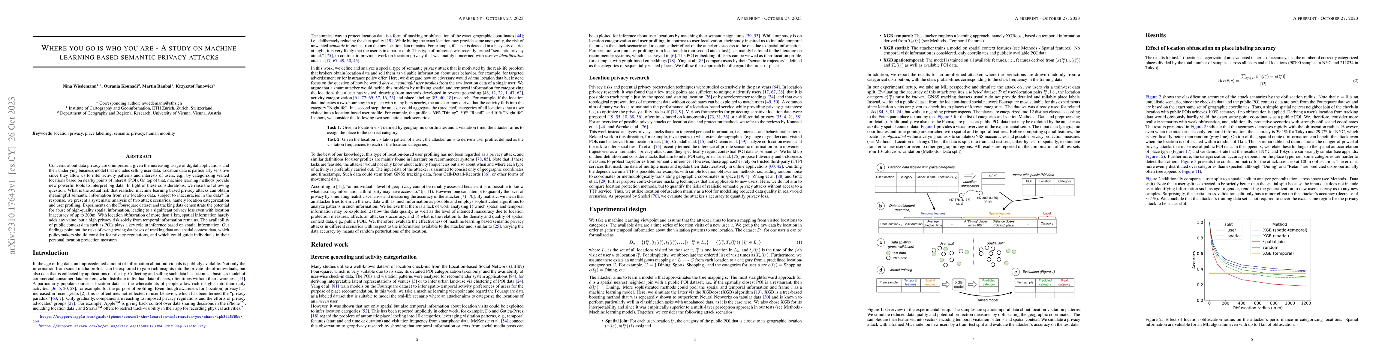
Concerns about data privacy are omnipresent, given the increasing usage of digital applications and their underlying business model that includes selling user data. Location data is particularly sen...
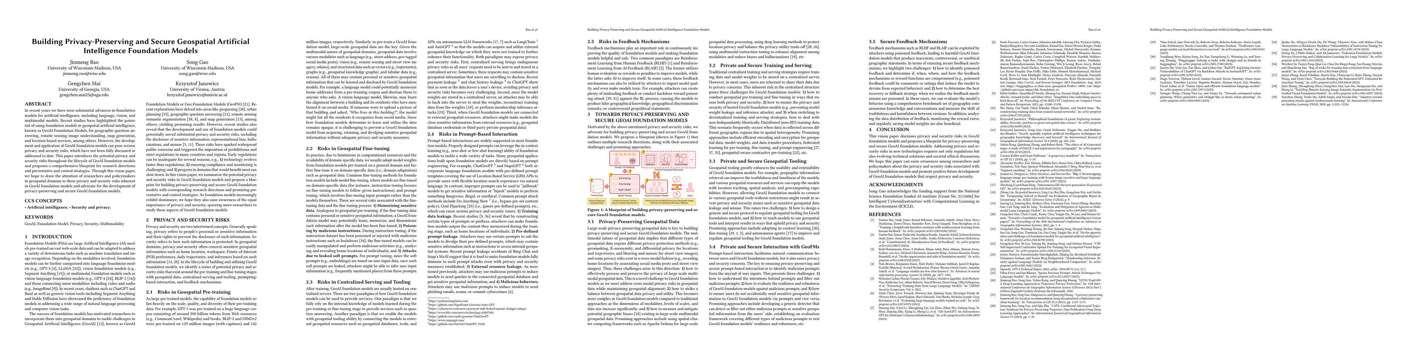
In recent years we have seen substantial advances in foundation models for artificial intelligence, including language, vision, and multimodal models. Recent studies have highlighted the potential o...
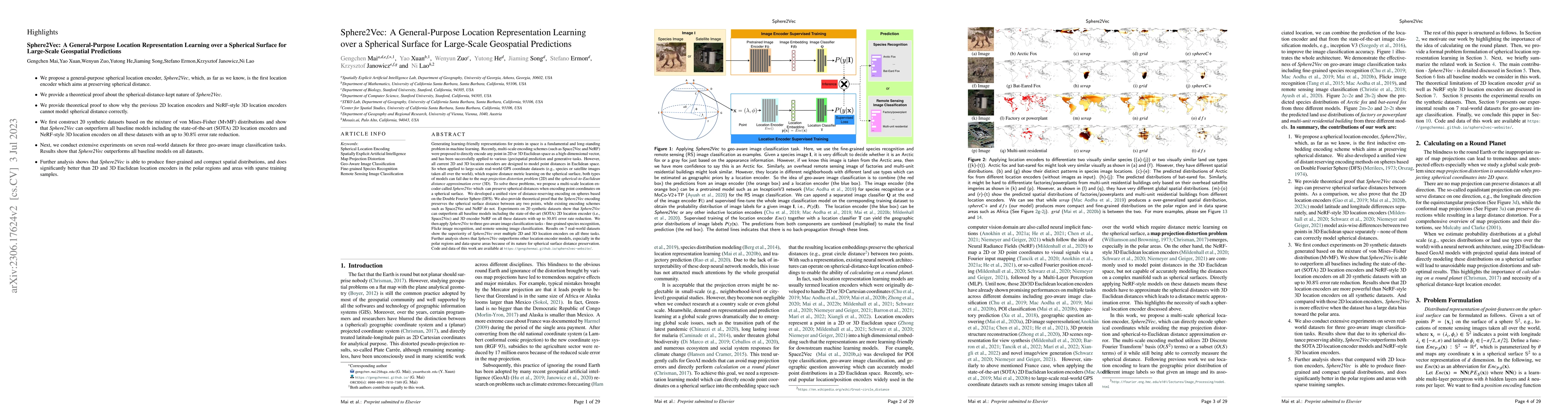
Generating learning-friendly representations for points in space is a fundamental and long-standing problem in ML. Recently, multi-scale encoding schemes (such as Space2Vec and NeRF) were proposed t...
This chapter presents some of the fundamental assumptions and principles that could form the philosophical foundation of GeoAI and spatial data science. Instead of reviewing the well-established cha...
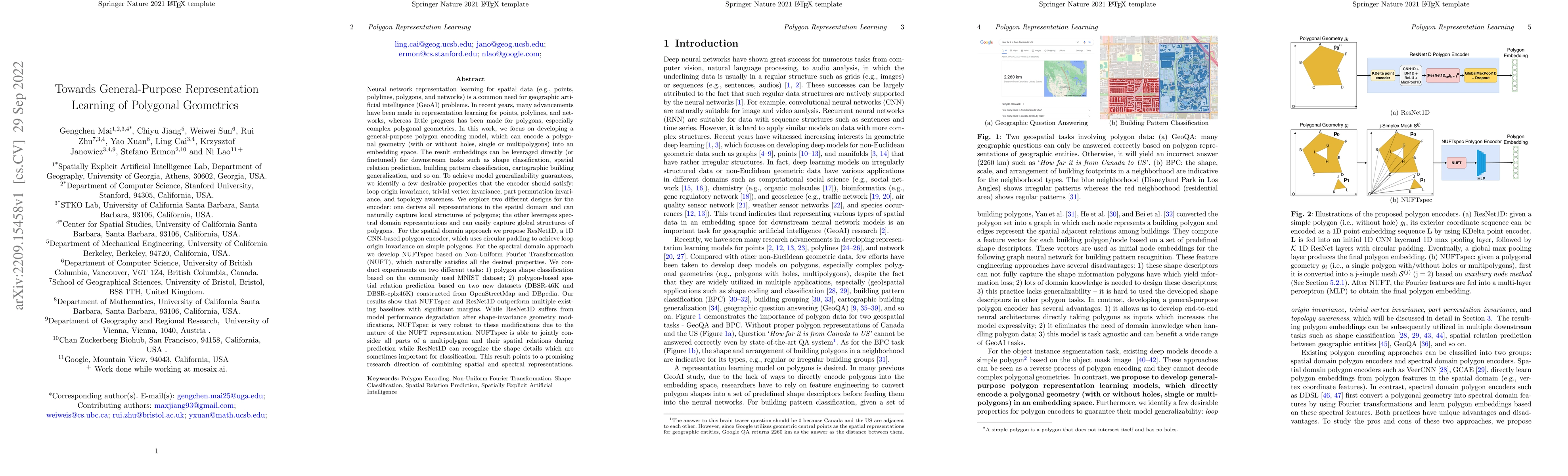
Neural network representation learning for spatial data is a common need for geographic artificial intelligence (GeoAI) problems. In recent years, many advancements have been made in representation ...
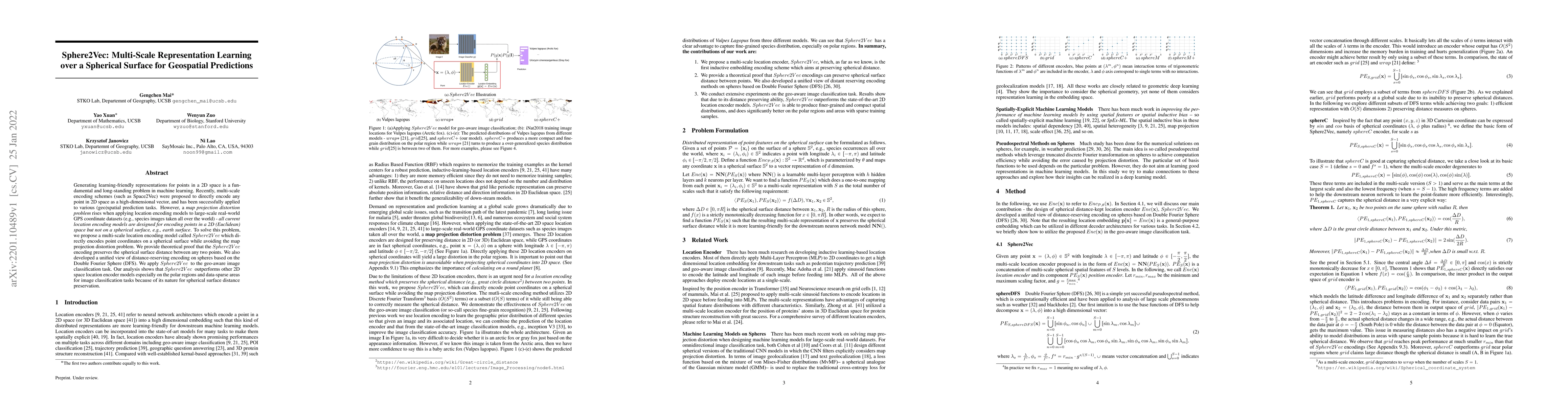
Generating learning-friendly representations for points in a 2D space is a fundamental and long-standing problem in machine learning. Recently, multi-scale encoding schemes (such as Space2Vec) were ...
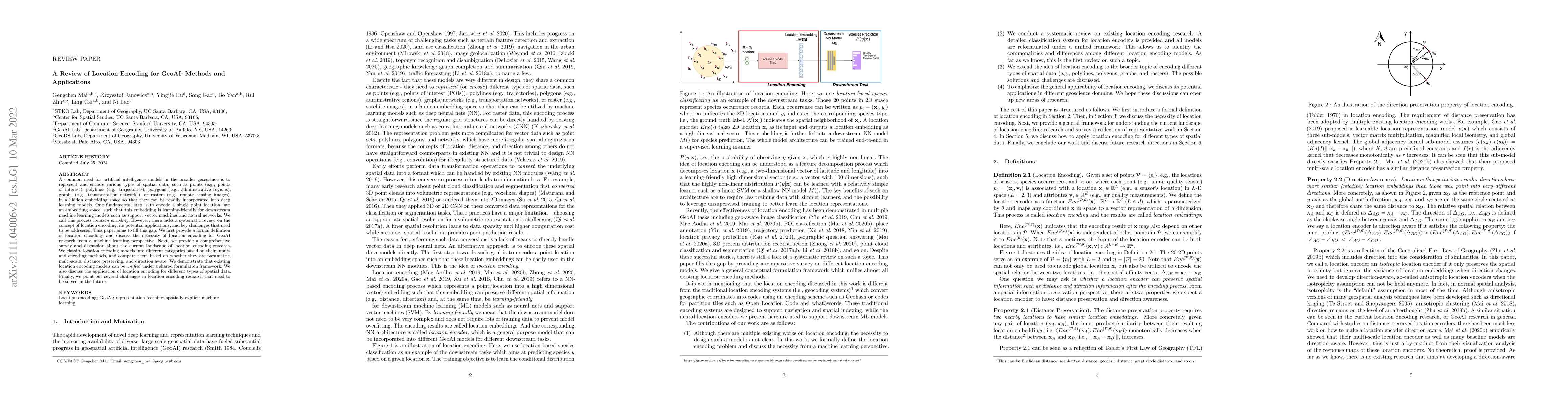
A common need for artificial intelligence models in the broader geoscience is to represent and encode various types of spatial data, such as points (e.g., points of interest), polylines (e.g., traje...
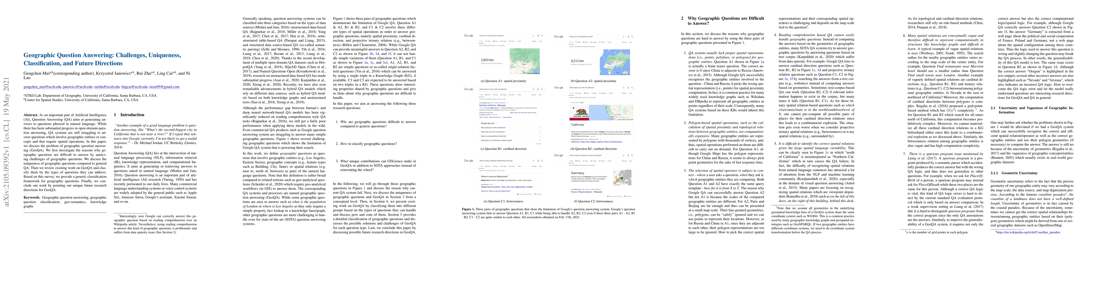
As an important part of Artificial Intelligence (AI), Question Answering (QA) aims at generating answers to questions phrased in natural language. While there has been substantial progress in open-d...
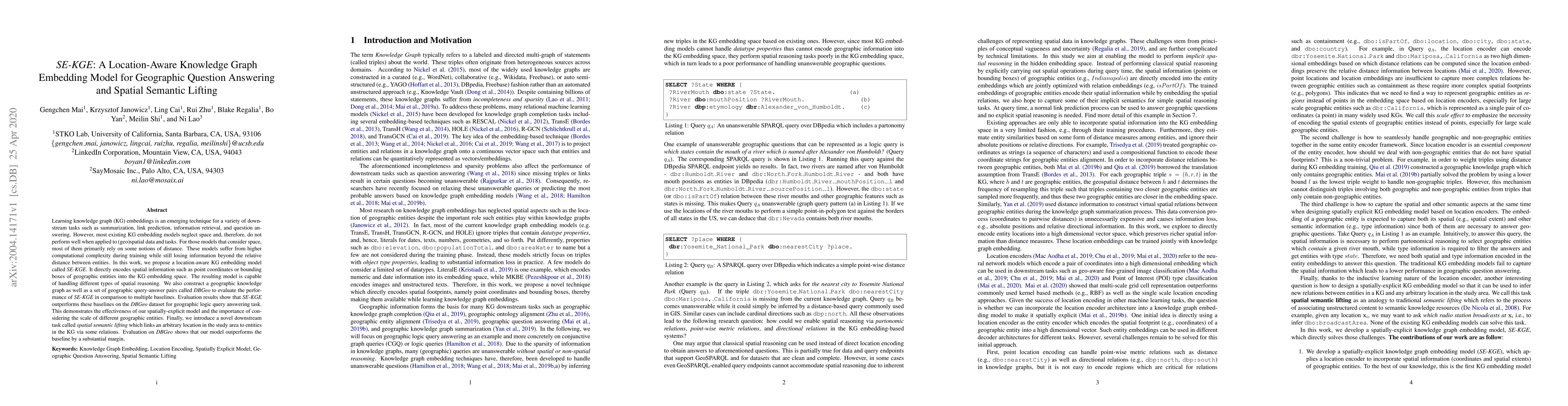
Learning knowledge graph (KG) embeddings is an emerging technique for a variety of downstream tasks such as summarization, link prediction, information retrieval, and question answering. However, mo...
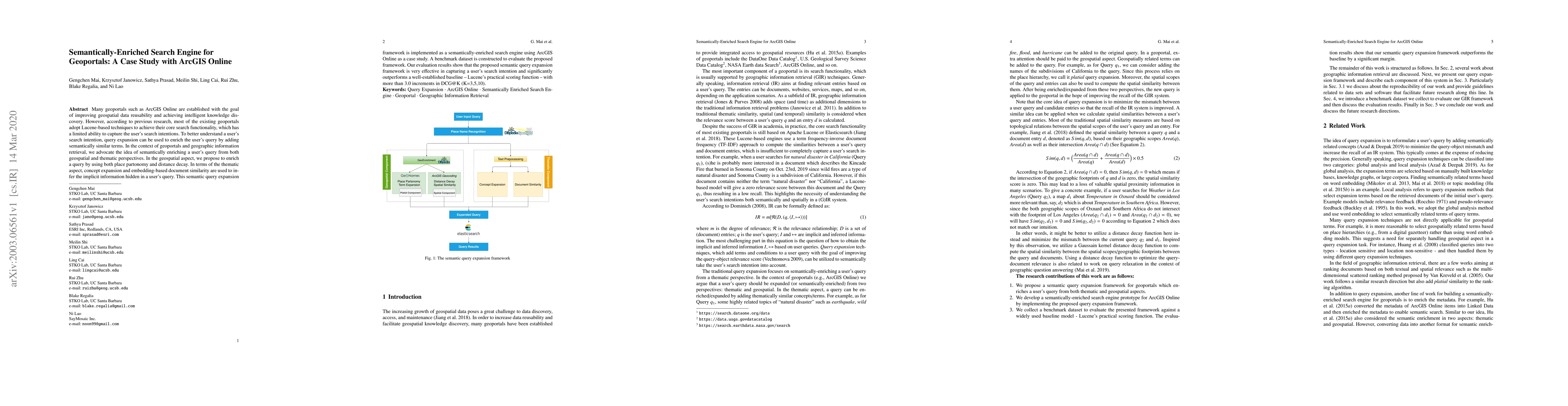
Many geoportals such as ArcGIS Online are established with the goal of improving geospatial data reusability and achieving intelligent knowledge discovery. However, according to previous research, m...
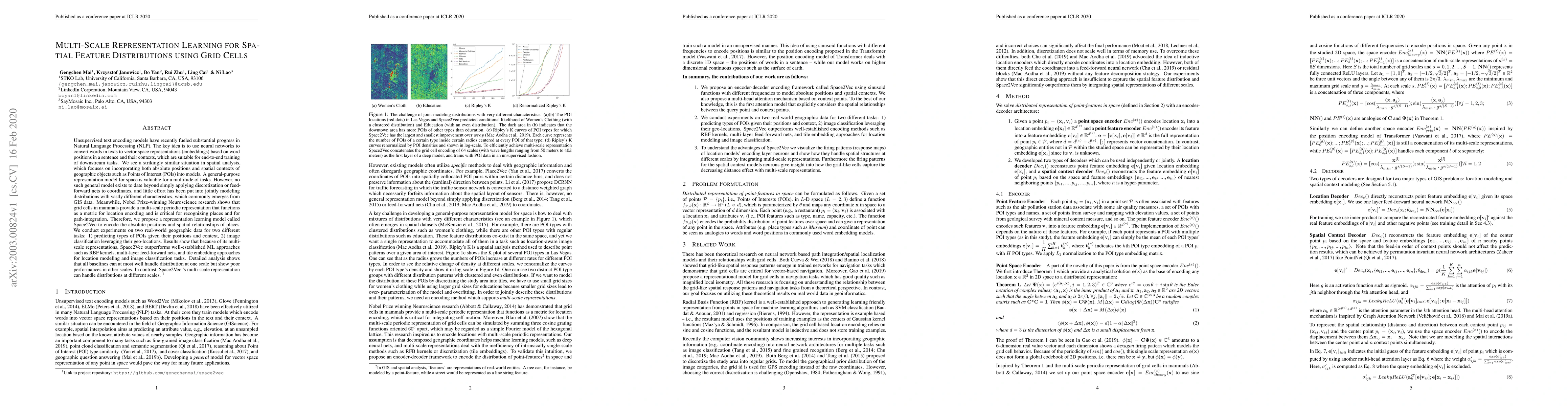
Unsupervised text encoding models have recently fueled substantial progress in NLP. The key idea is to use neural networks to convert words in texts to vector space representations based on word pos...
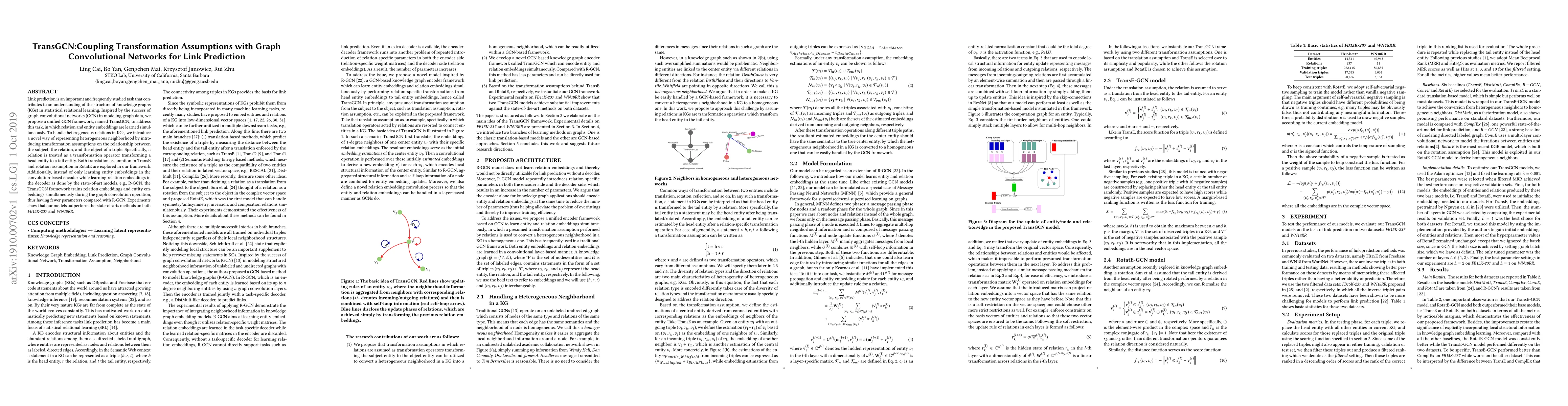
Link prediction is an important and frequently studied task that contributes to an understanding of the structure of knowledge graphs (KGs) in statistical relational learning. Inspired by the succes...
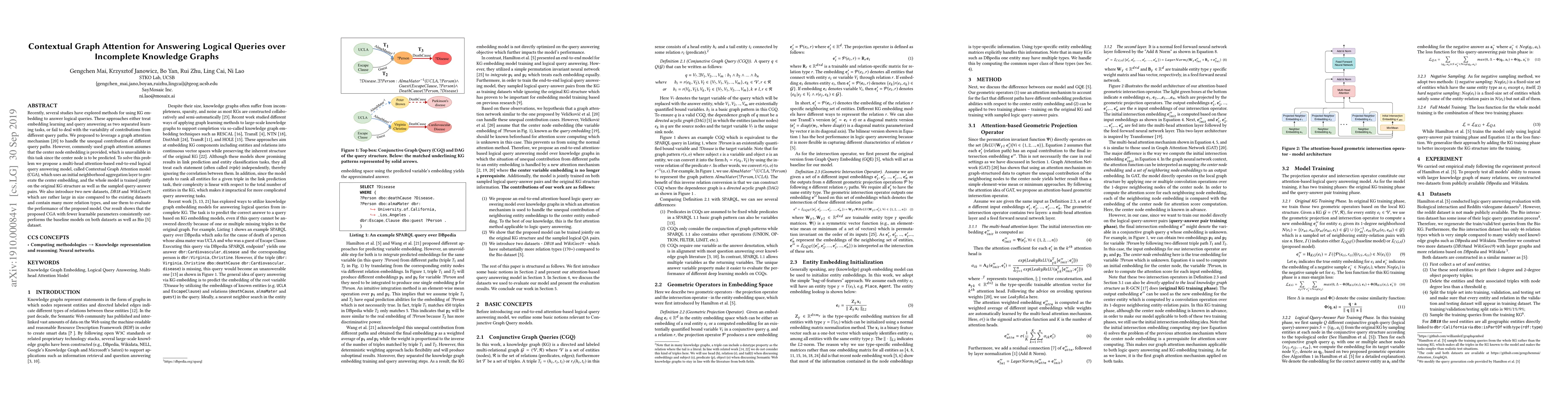
Recently, several studies have explored methods for using KG embedding to answer logical queries. These approaches either treat embedding learning and query answering as two separated learning tasks...
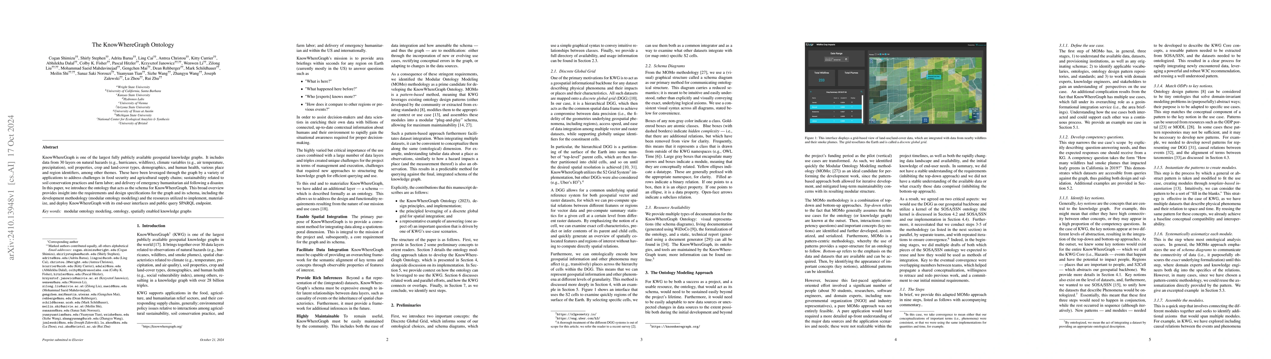
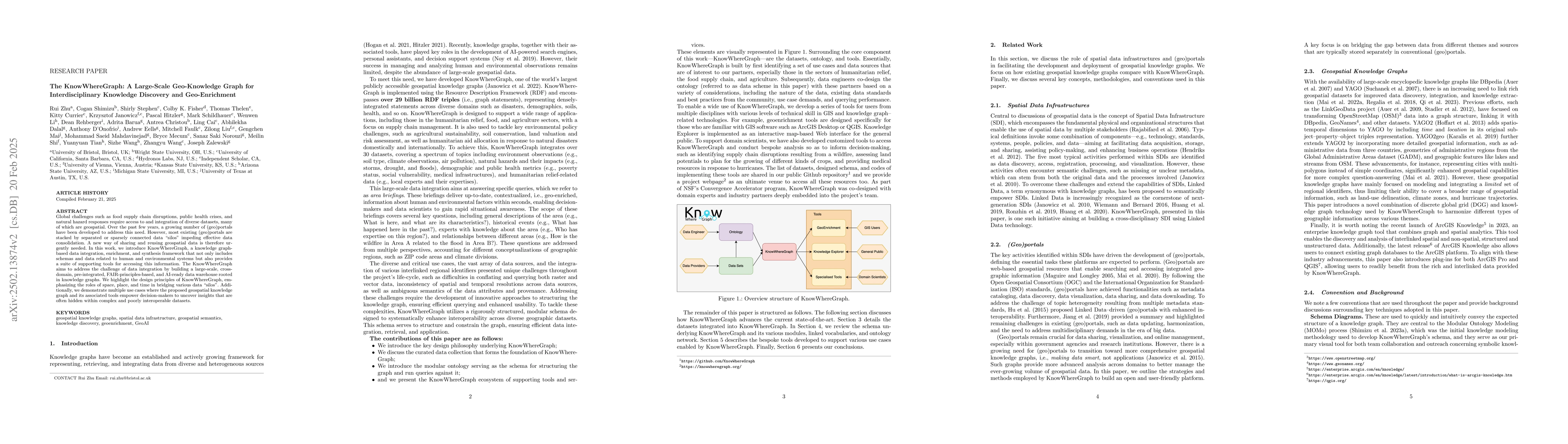
KnowWhereGraph is one of the largest fully publicly available geospatial knowledge graphs. It includes data from 30 layers on natural hazards (e.g., hurricanes, wildfires), climate variables (e.g., ai...
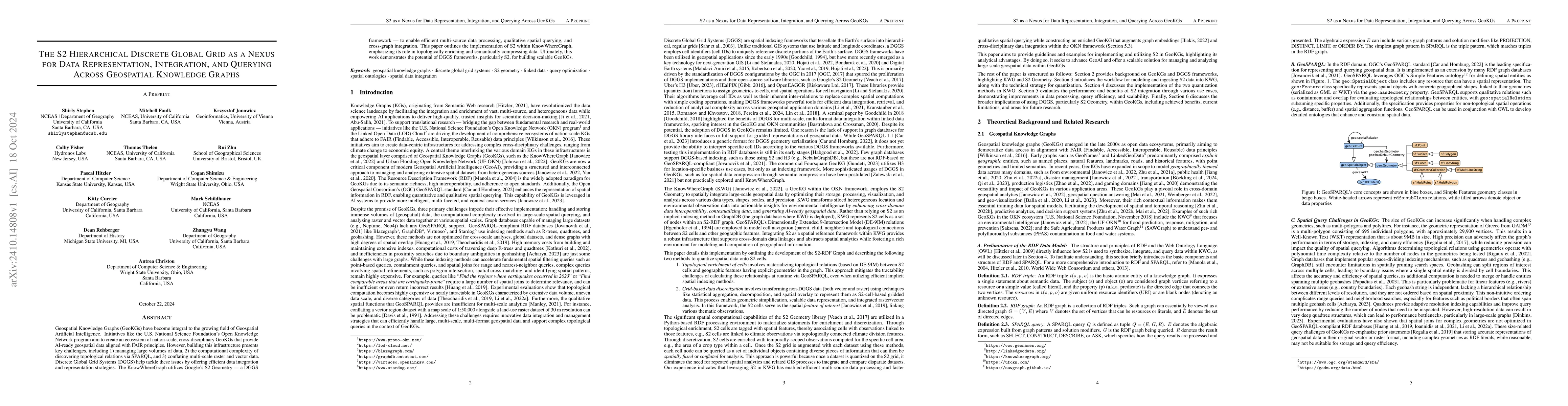
Geospatial Knowledge Graphs (GeoKGs) have become integral to the growing field of Geospatial Artificial Intelligence. Initiatives like the U.S. National Science Foundation's Open Knowledge Network pro...
Regional defaults describe the emerging phenomenon that text-to-image (T2I) foundation models used in generative AI are prone to over-proportionally depicting certain geographic regions to the exclusi...
Global challenges such as food supply chain disruptions, public health crises, and natural hazard responses require access to and integration of diverse datasets, many of which are geospatial. Over th...
The advent of generative AI exemplified by large language models (LLMs) opens new ways to represent and compute geographic information and transcends the process of geographic knowledge production, dr...
Applying AI foundation models directly to geospatial datasets remains challenging due to their limited ability to represent and reason with geographical entities, specifically vector-based geometries ...
AI (super) alignment describes the challenge of ensuring (future) AI systems behave in accordance with societal norms and goals. While a quickly evolving literature is addressing biases and inequaliti...
Large-scale pre-trained machine learning models have reshaped our understanding of artificial intelligence across numerous domains, including our own field of geography. As with any new technology, tr...
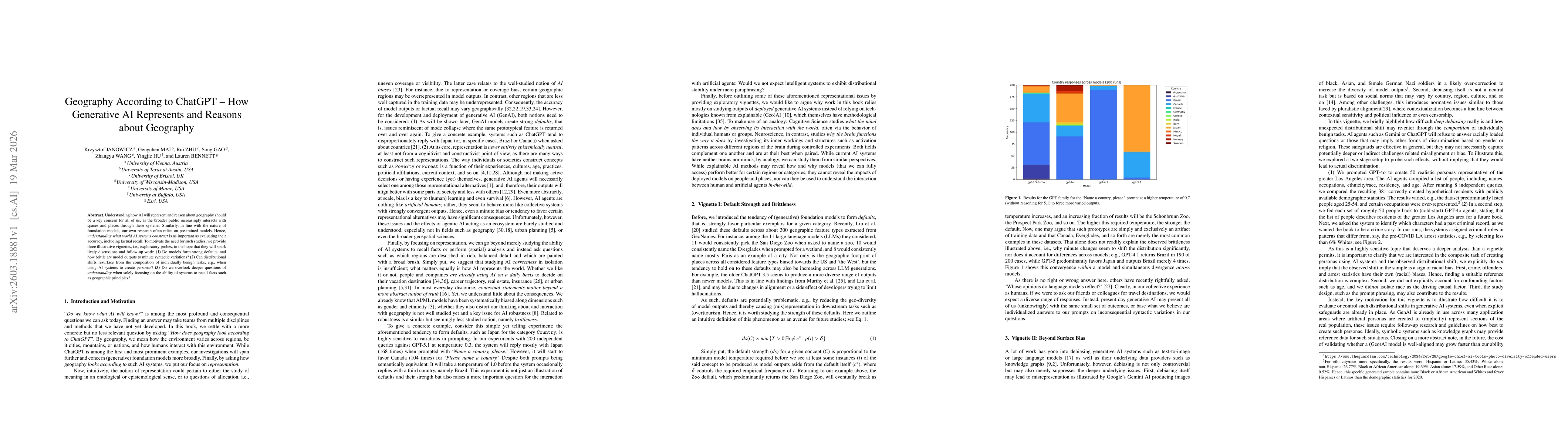
Understanding how AI will represent and reason about geography should be a key concern for all of us, as the broader public increasingly interacts with spaces and places through these systems. Similar...