Academic Profile
Statistics
Similar Authors
Papers on arXiv
Public participation is indispensable for an insightful understanding of the ethics issues raised by AI technologies. Twitter is selected in this paper to serve as an online public sphere for explor...

CityGML is a widely adopted standard by the Open Geospatial Consortium (OGC) for representing and exchanging 3D city models. The representation of semantic and topological properties in CityGML make...
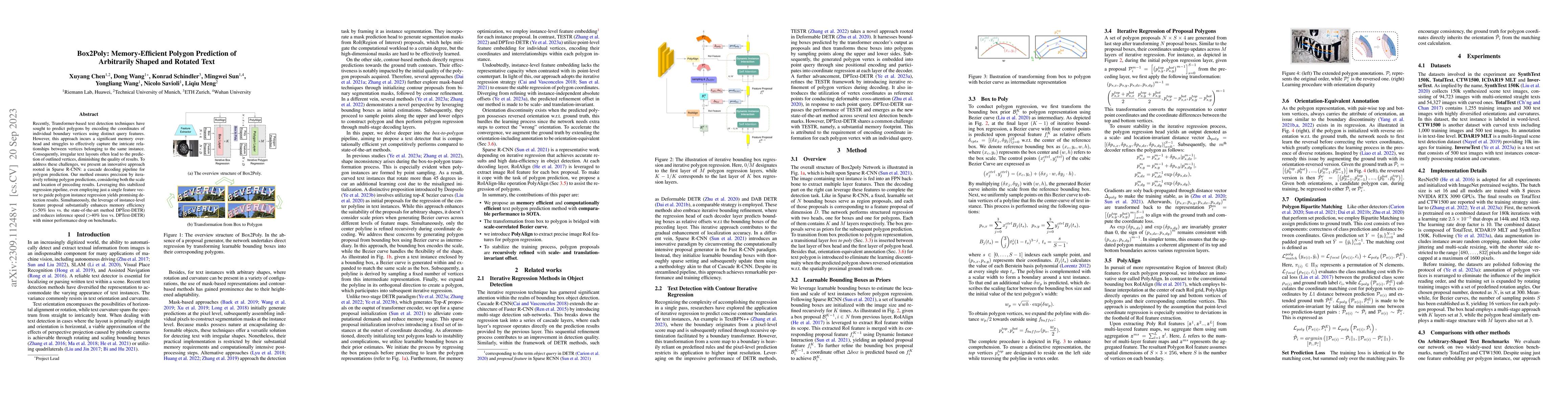
Recently, Transformer-based text detection techniques have sought to predict polygons by encoding the coordinates of individual boundary vertices using distinct query features. However, this approac...
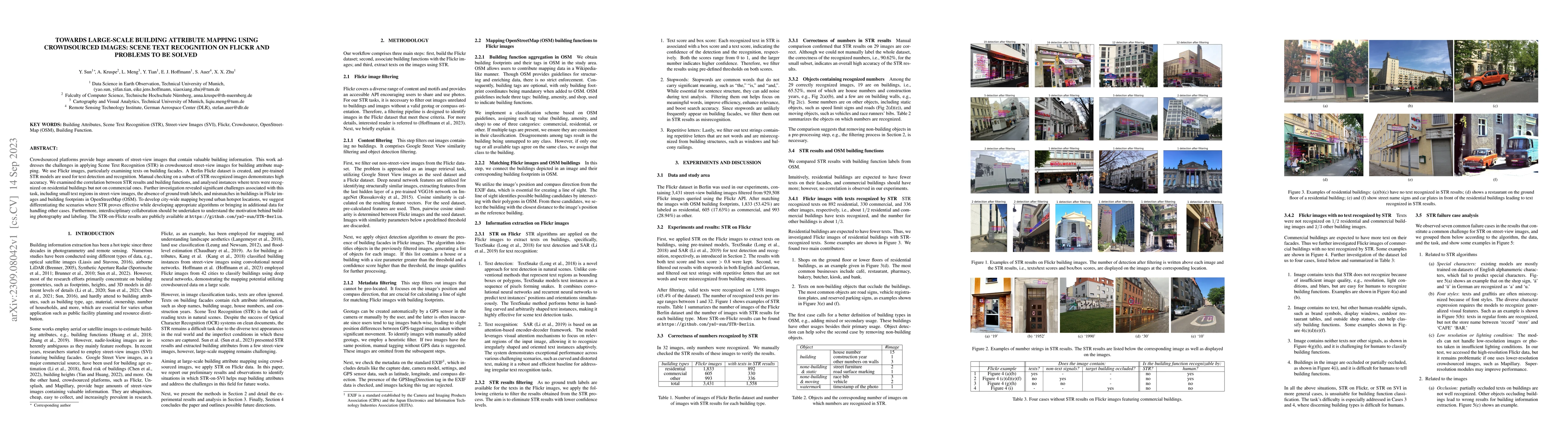
Crowdsourced platforms provide huge amounts of street-view images that contain valuable building information. This work addresses the challenges in applying Scene Text Recognition (STR) in crowdsour...
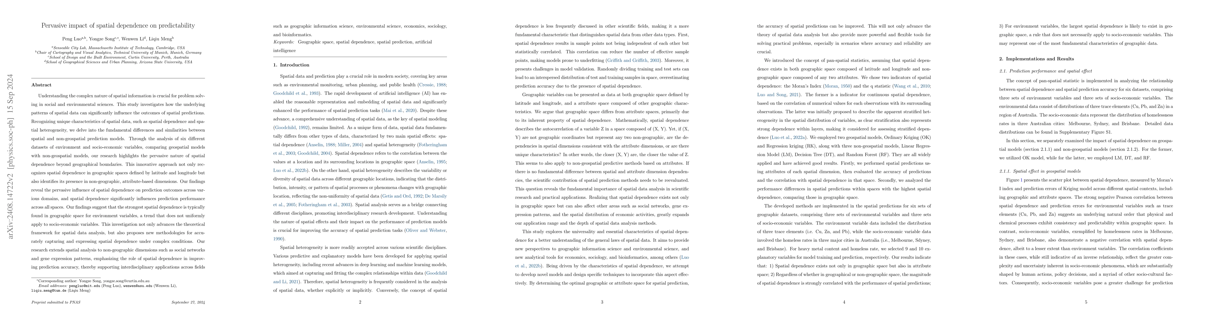
Understanding the complex nature of spatial information is crucial for problem solving in social and environmental sciences. This study investigates how the underlying patterns of spatial data can sig...
Spatial prediction is a fundamental task in geography. In recent years, with advances in geospatial artificial intelligence (GeoAI), numerous models have been developed to improve the accuracy of geog...
Spatial analysis can generate both exogenous and endogenous biases, which will lead to ethics issues. Exogenous biases arise from external factors or environments and are unrelated to internal operati...
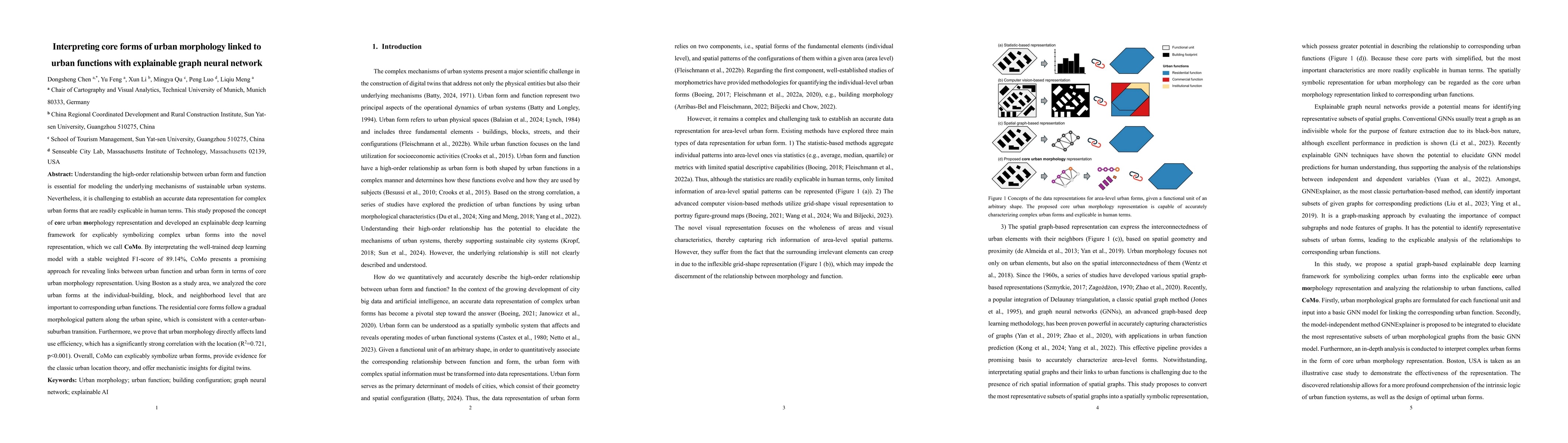
Understanding the high-order relationship between urban form and function is essential for modeling the underlying mechanisms of sustainable urban systems. Nevertheless, it is challenging to establish...
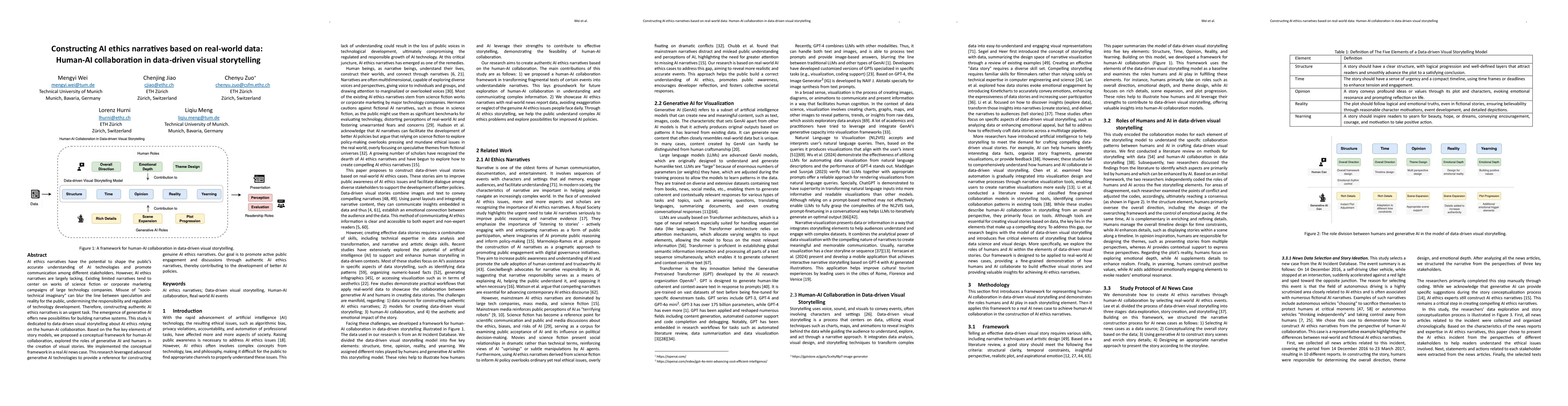
AI ethics narratives have the potential to shape the public accurate understanding of AI technologies and promote communication among different stakeholders. However, AI ethics narratives are largely ...
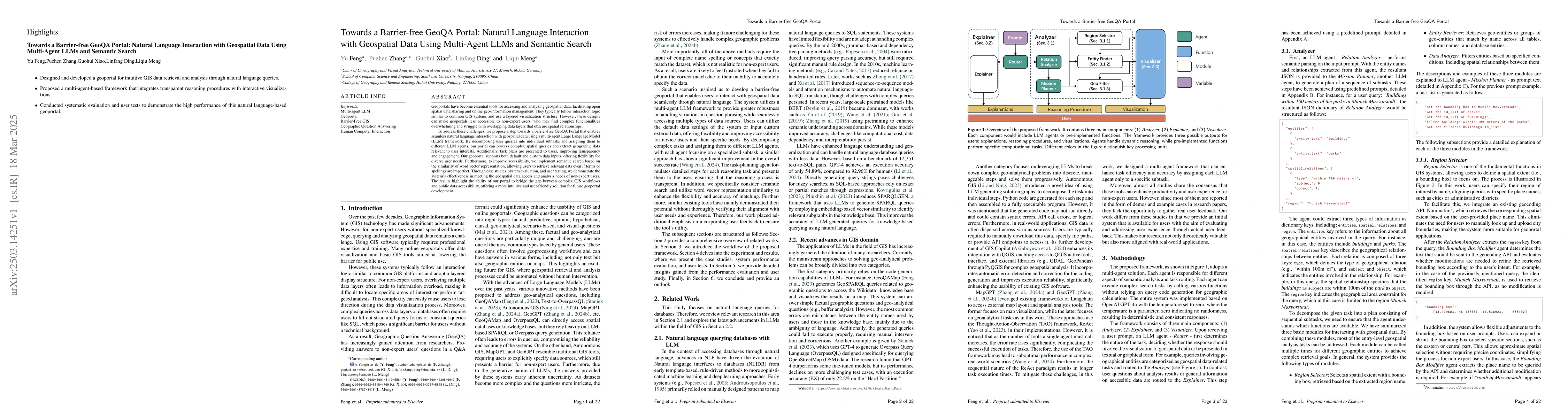
A Barrier-Free GeoQA Portal: Enhancing Geospatial Data Accessibility with a Multi-Agent LLM Framework Geoportals are vital for accessing and analyzing geospatial data, promoting open spatial data sh...
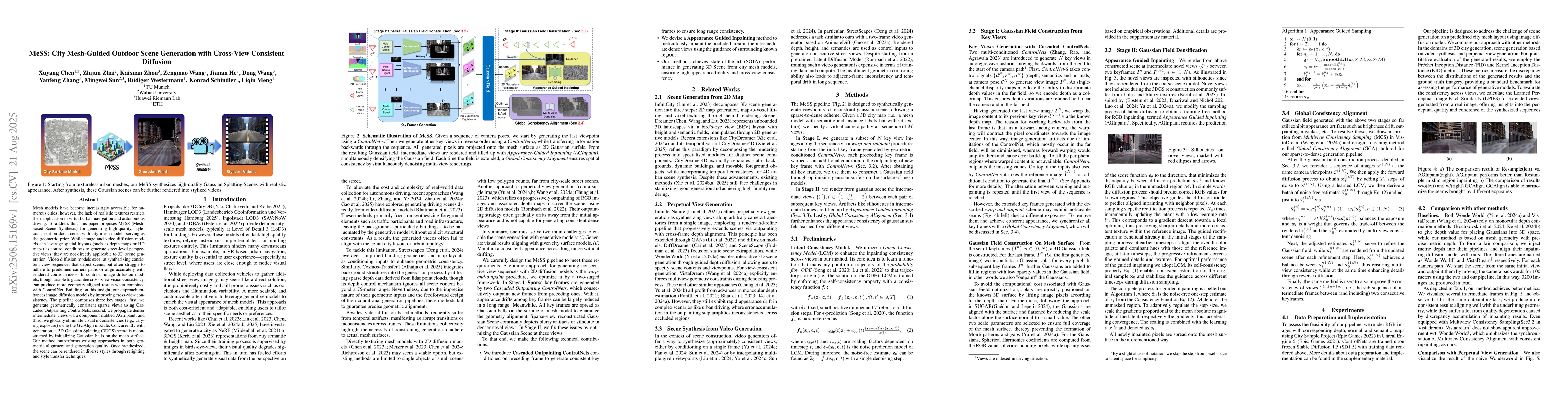
Mesh models have become increasingly accessible for numerous cities; however, the lack of realistic textures restricts their application in virtual urban navigation and autonomous driving. To address ...
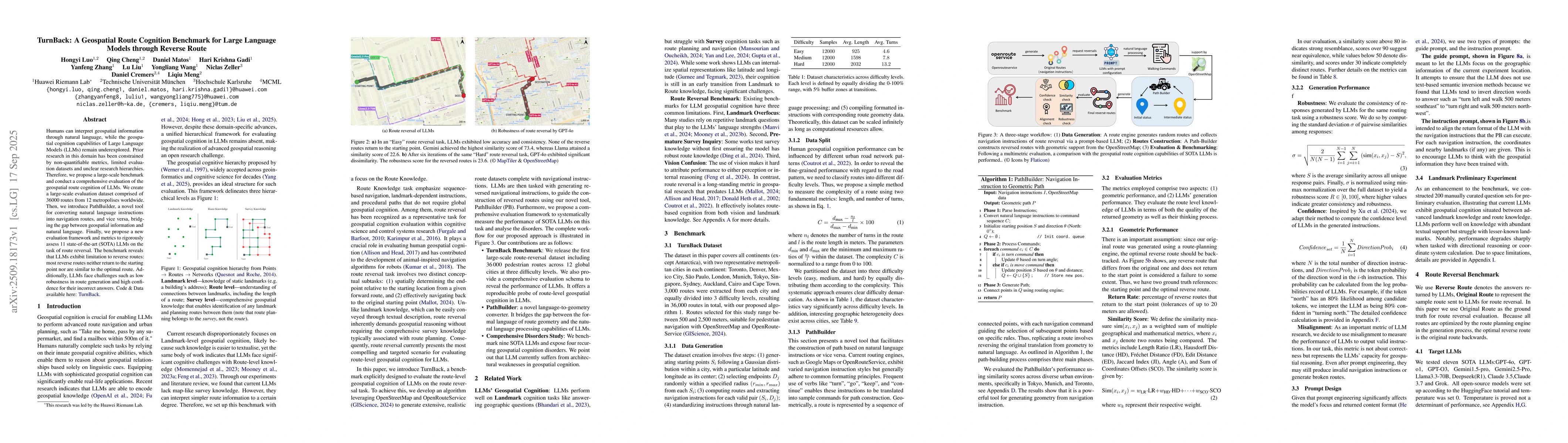
Humans can interpret geospatial information through natural language, while the geospatial cognition capabilities of Large Language Models (LLMs) remain underexplored. Prior research in this domain ha...
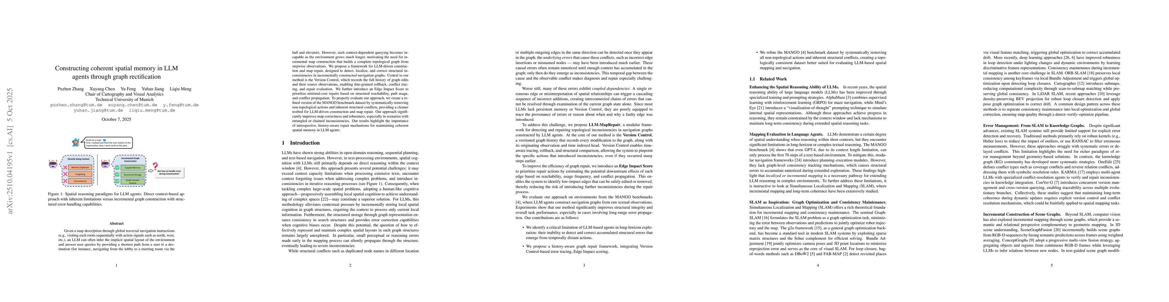
Given a map description through global traversal navigation instructions (e.g., visiting each room sequentially with action signals such as north, west, etc.), an LLM can often infer the implicit spat...
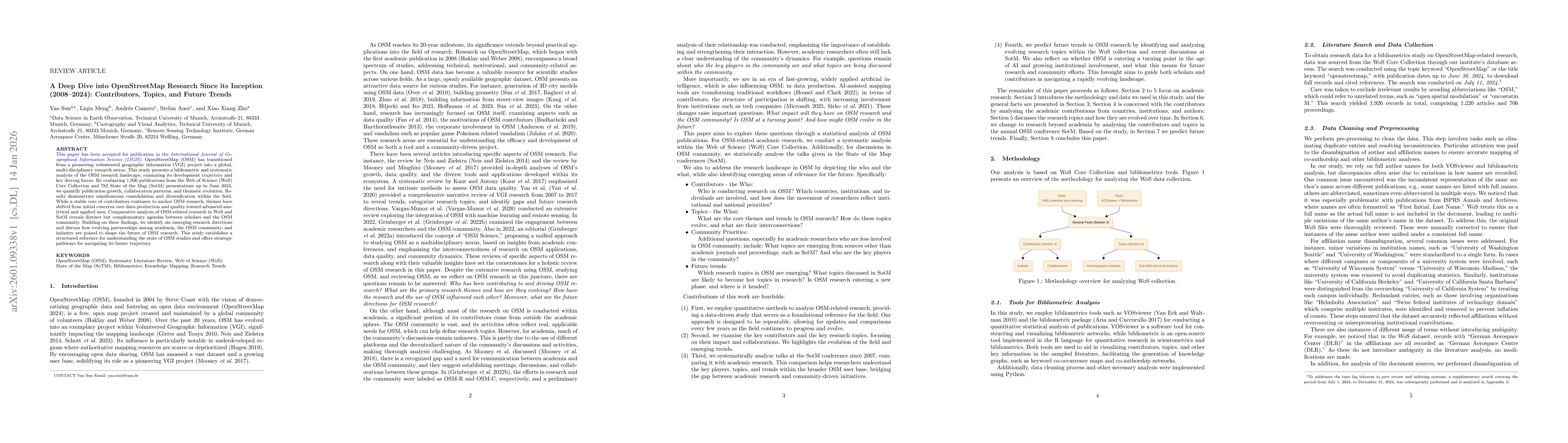
OpenStreetMap (OSM) has transitioned from a pioneering volunteered geographic information (VGI) project into a global, multi-disciplinary research nexus. This study presents a bibliometric and systema...

Visual geolocalization, the task of predicting where an image was taken, remains challenging due to global scale, visual ambiguity, and the inherently hierarchical structure of geography. Existing par...
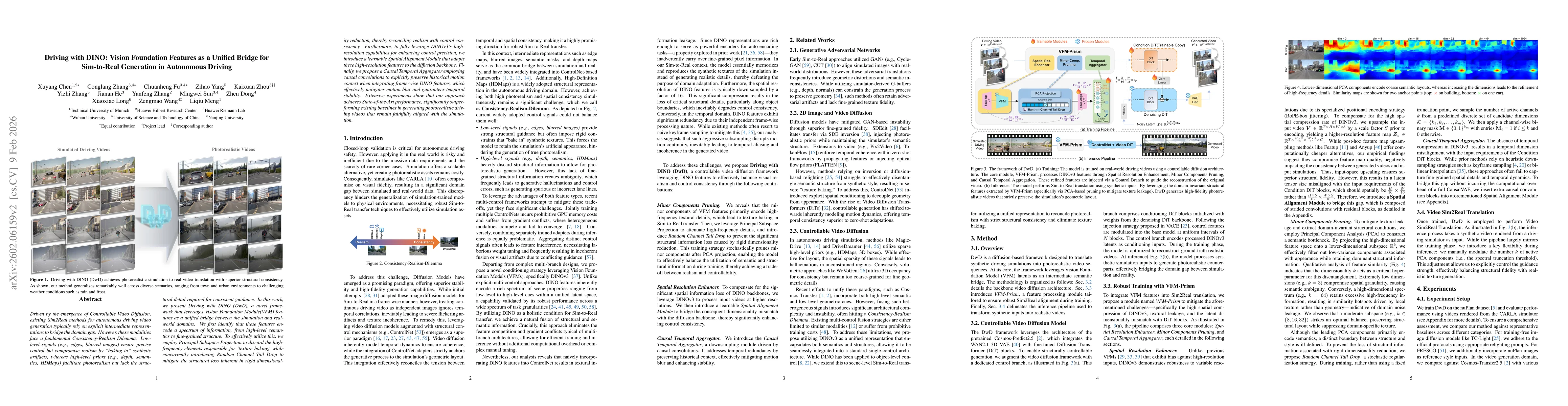
Driven by the emergence of Controllable Video Diffusion, existing Sim2Real methods for autonomous driving video generation typically rely on explicit intermediate representations to bridge the domain ...
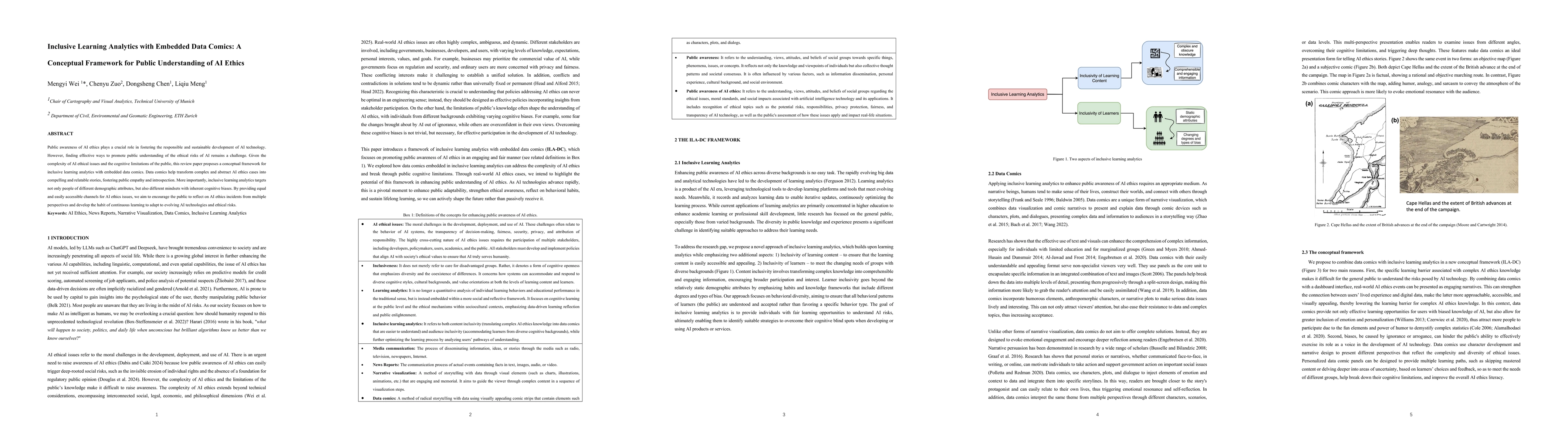
Public awareness of AI ethics plays a crucial role in fostering the responsible and sustainable development of AI technology. However, finding effective ways to promote public understanding of the eth...
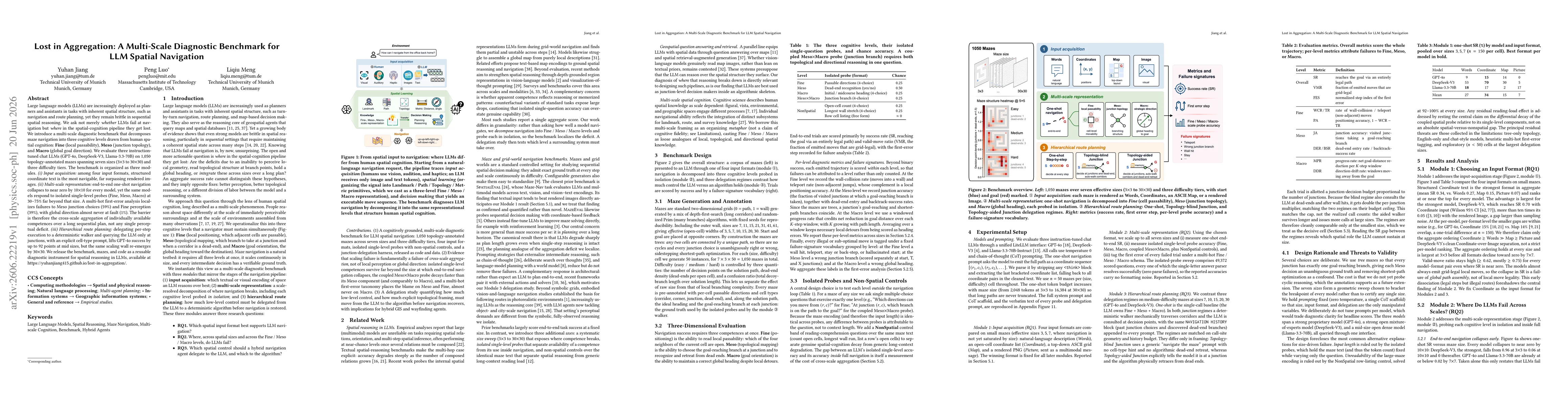
Large language models (LLMs) are increasingly deployed as planners and assistants in tasks with inherent spatial structure, such as navigation and route planning, yet they remain brittle in sequential...