Academic Profile
Statistics
Similar Authors
Papers on arXiv
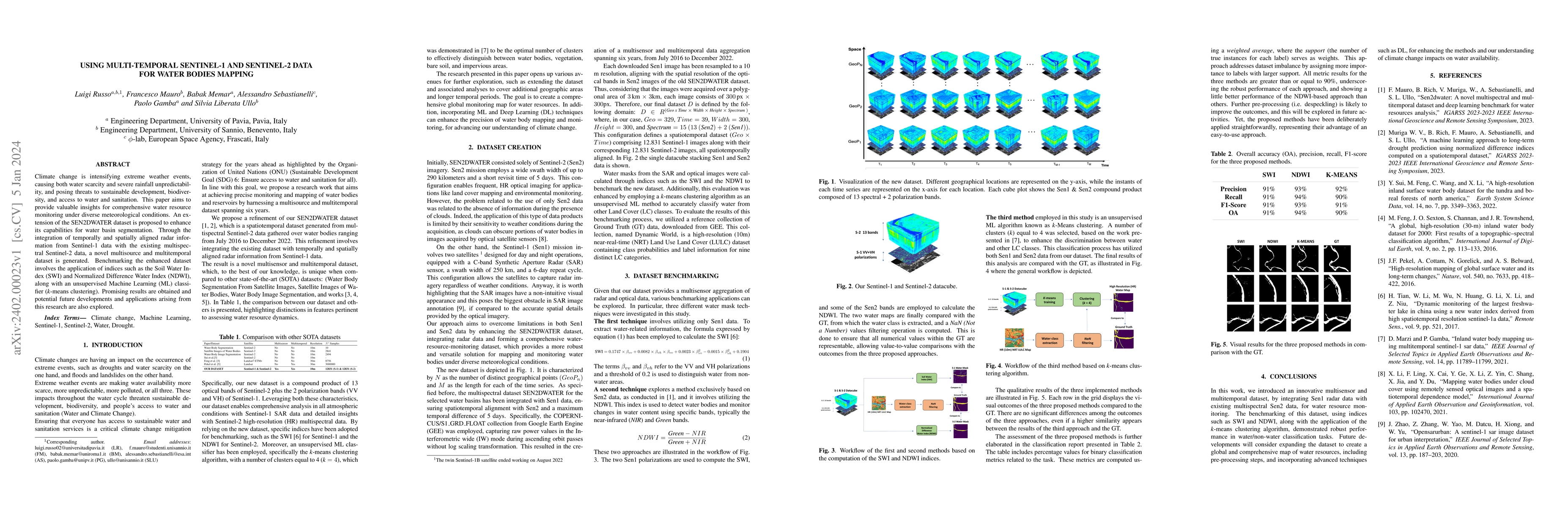
Climate change is intensifying extreme weather events, causing both water scarcity and severe rainfall unpredictability, and posing threats to sustainable development, biodiversity, and access to wa...
This study aims to analyse the Nitrogen Dioxide (NO2) pollution in the Emilia Romagna Region (Northern Italy) during 2019, with the help of satellite retrievals from the Sentinel-5P mission of the E...
We propose a supervised learning framework for computing solutions of multi-parametric Mixed Integer Linear Programs (MILPs) that arise in Model Predictive Control. Our approach also quantifies sub-...
A novel prize-winner algorithm designed for a path following problem within the Unmanned Aerial Vehicle (UAV) field is presented in this paper. The proposed approach exploits the advantages offered ...
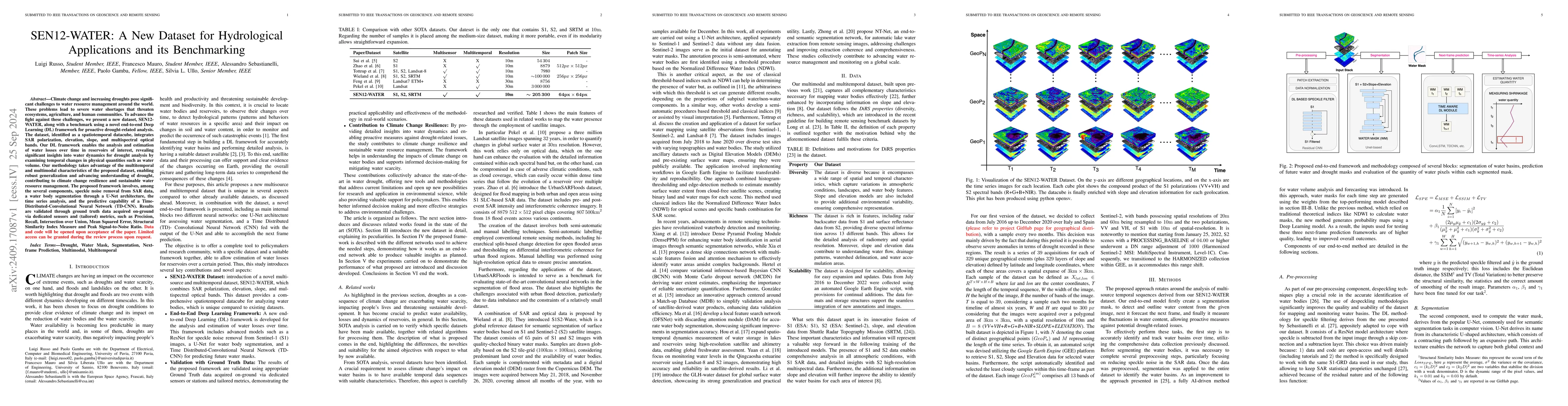
Climate change and increasing droughts pose significant challenges to water resource management around the world. These problems lead to severe water shortages that threaten ecosystems, agriculture, a...
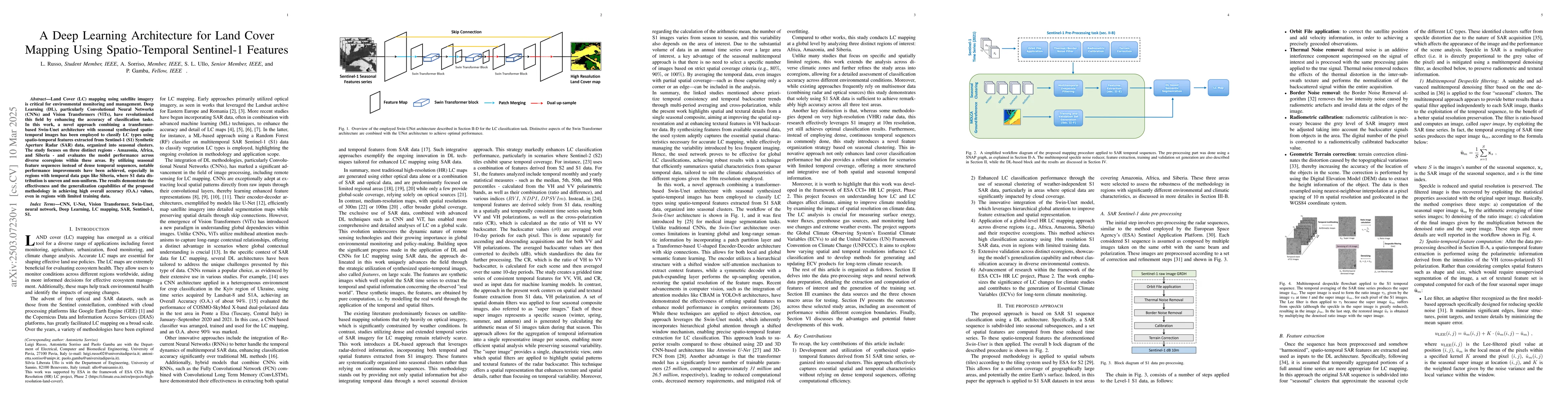
Land Cover (LC) mapping using satellite imagery is critical for environmental monitoring and management. Deep Learning (DL), particularly Convolutional Neural Networks (CNNs) and Vision Transformers (...
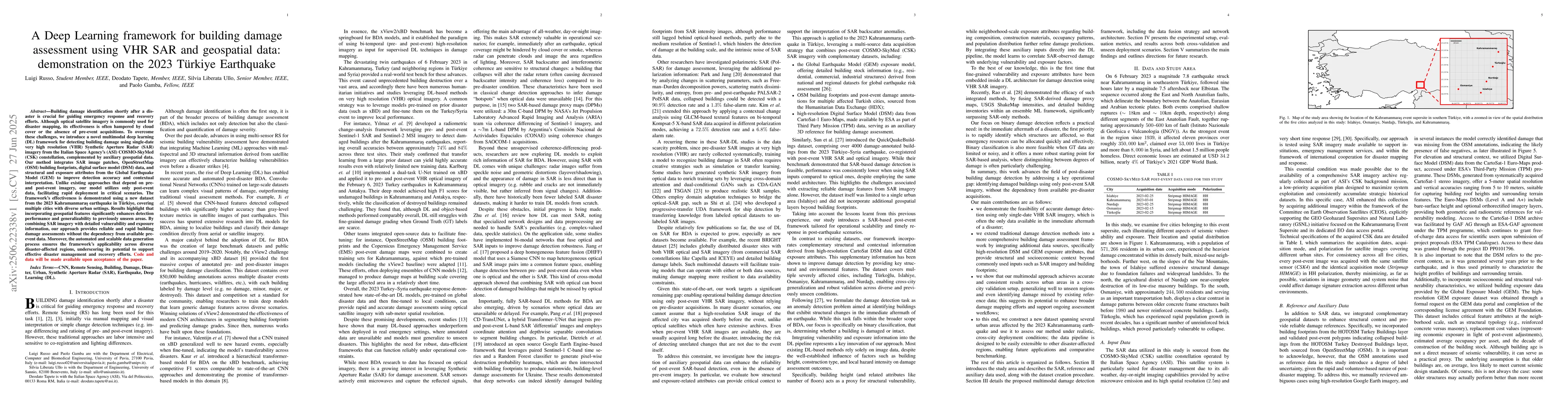
Building damage identification shortly after a disaster is crucial for guiding emergency response and recovery efforts. Although optical satellite imagery is commonly used for disaster mapping, its ef...
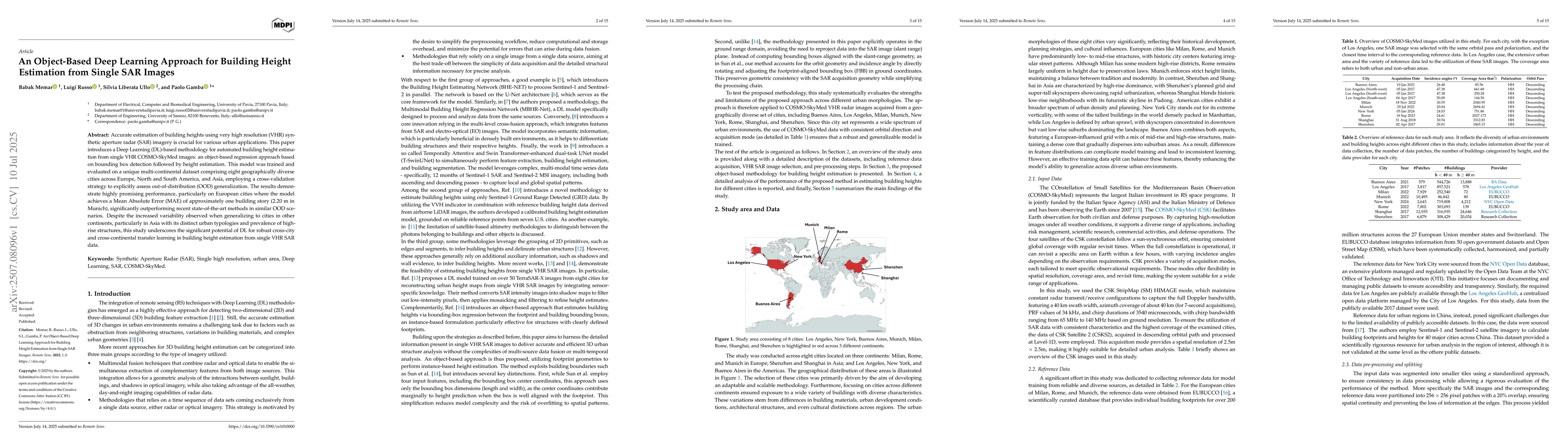
Accurate estimation of building heights using very high resolution (VHR) synthetic aperture radar (SAR) imagery is crucial for various urban applications. This paper introduces a Deep Learning (DL)-ba...
Building segmentation in urban areas is essential in fields such as urban planning, disaster response, and population mapping. Yet accurately segmenting buildings in dense urban regions presents chall...