Martin Schwartz

9 papers on arXiv

Academic Profile

Name: M. Schwartz
Total Papers: 6

Statistics

arXiv Papers 9
Total Publications 6

Papers on arXiv

Thumbnail for Open-Canopy: A Country-Scale Benchmark for Canopy Height Estimation at
  Very High Resolution

Open-Canopy: A Country-Scale Benchmark for Canopy Height Estimation at Very High Resolution

Estimating canopy height and canopy height change at meter resolution from satellite imagery has numerous applications, such as monitoring forest health, logging activities, wood resources, and carbon...

Thumbnail for Estimating Canopy Height at Scale

Estimating Canopy Height at Scale

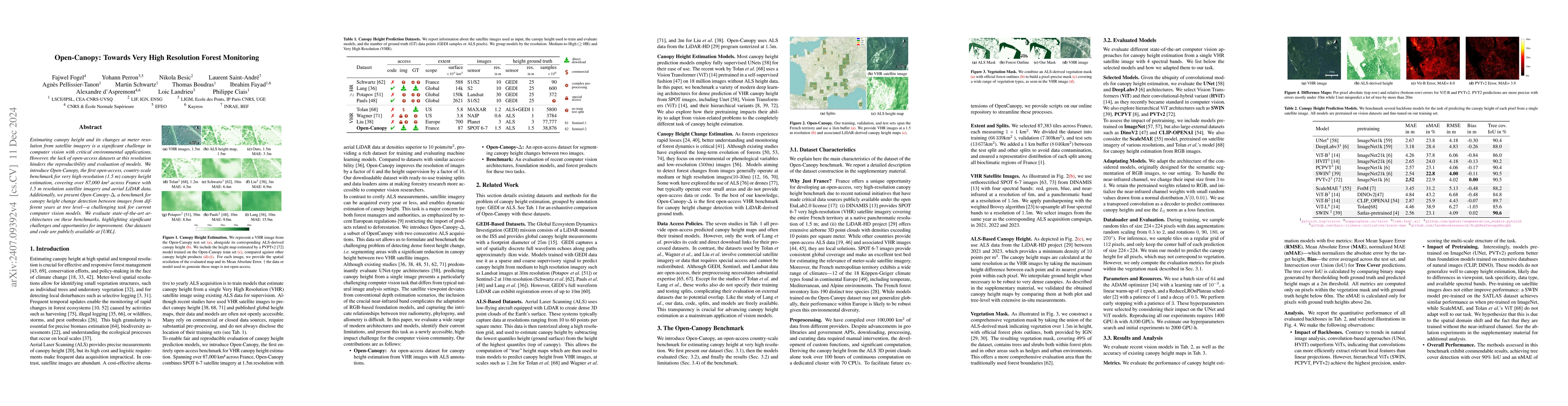
We propose a framework for global-scale canopy height estimation based on satellite data. Our model leverages advanced data preprocessing techniques, resorts to a novel loss function designed to cou...

Thumbnail for Vision Transformers, a new approach for high-resolution and large-scale
  mapping of canopy heights

Vision Transformers, a new approach for high-resolution and large-scale mapping of canopy heights

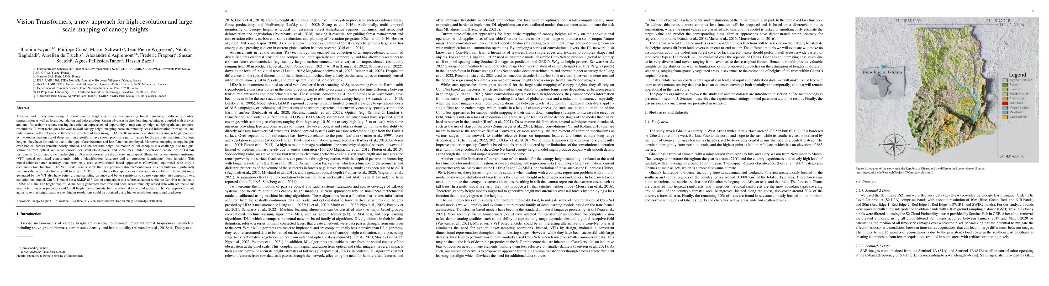
Accurate and timely monitoring of forest canopy heights is critical for assessing forest dynamics, biodiversity, carbon sequestration as well as forest degradation and deforestation. Recent advances...

Thumbnail for High-resolution canopy height map in the Landes forest (France) based on
  GEDI, Sentinel-1, and Sentinel-2 data with a deep learning approach

High-resolution canopy height map in the Landes forest (France) based on GEDI, Sentinel-1, and Sentinel-2 data with a deep learning approach

In intensively managed forests in Europe, where forests are divided into stands of small size and may show heterogeneity within stands, a high spatial resolution (10 - 20 meters) is arguably needed ...

Thumbnail for Fully Automated and Standardized Segmentation of Adipose Tissue
  Compartments by Deep Learning in Three-dimensional Whole-body MRI of
  Epidemiological Cohort Studies

Fully Automated and Standardized Segmentation of Adipose Tissue Compartments by Deep Learning in Three-dimensional Whole-body MRI of Epidemiological Cohort Studies

Purpose: To enable fast and reliable assessment of subcutaneous and visceral adipose tissue compartments derived from whole-body MRI. Methods: Quantification and localization of different adipose ti...

Thumbnail for DUNIA: Pixel-Sized Embeddings via Cross-Modal Alignment for Earth
  Observation Applications

DUNIA: Pixel-Sized Embeddings via Cross-Modal Alignment for Earth Observation Applications

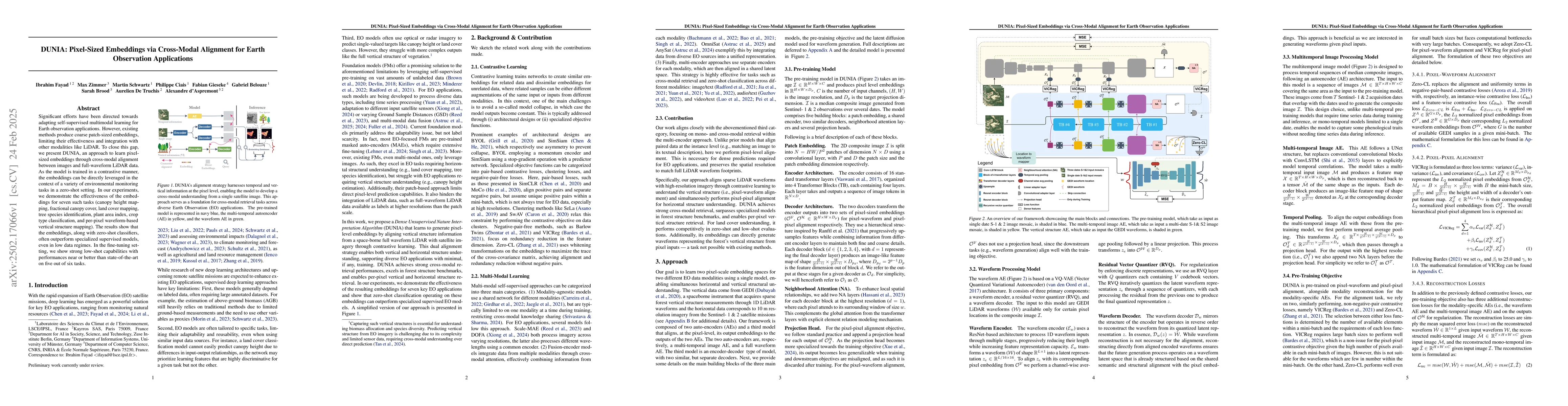
Significant efforts have been directed towards adapting self-supervised multimodal learning for Earth observation applications. However, existing methods produce coarse patch-sized embeddings, limitin...

Thumbnail for FORMSpoT: A Decade of Tree-Level, Country-Scale Forest Monitoring

FORMSpoT: A Decade of Tree-Level, Country-Scale Forest Monitoring

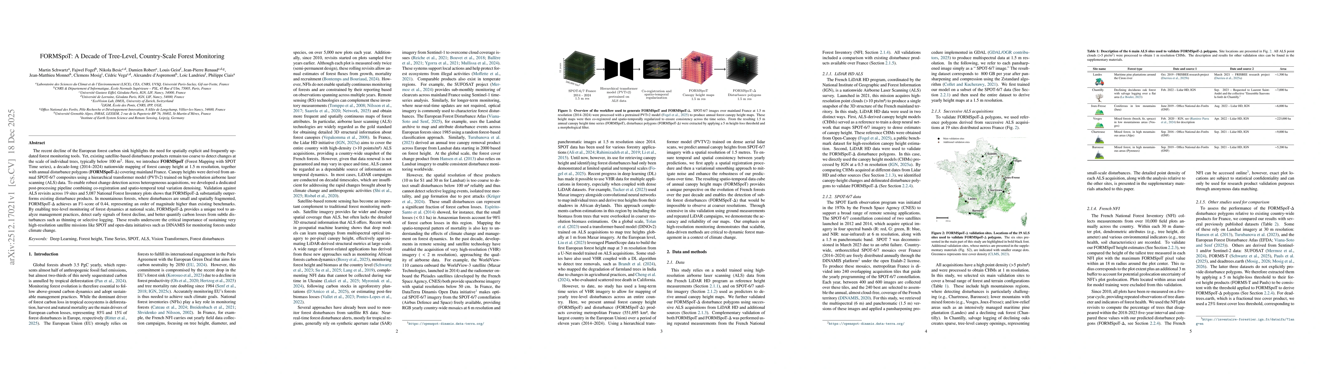
The recent decline of the European forest carbon sink highlights the need for spatially explicit and frequently updated forest monitoring tools. Yet, existing satellite-based disturbance products rema...

Thumbnail for SERA-H: Beyond Native Sentinel Spatial Limits for High-Resolution Canopy Height Mapping

SERA-H: Beyond Native Sentinel Spatial Limits for High-Resolution Canopy Height Mapping

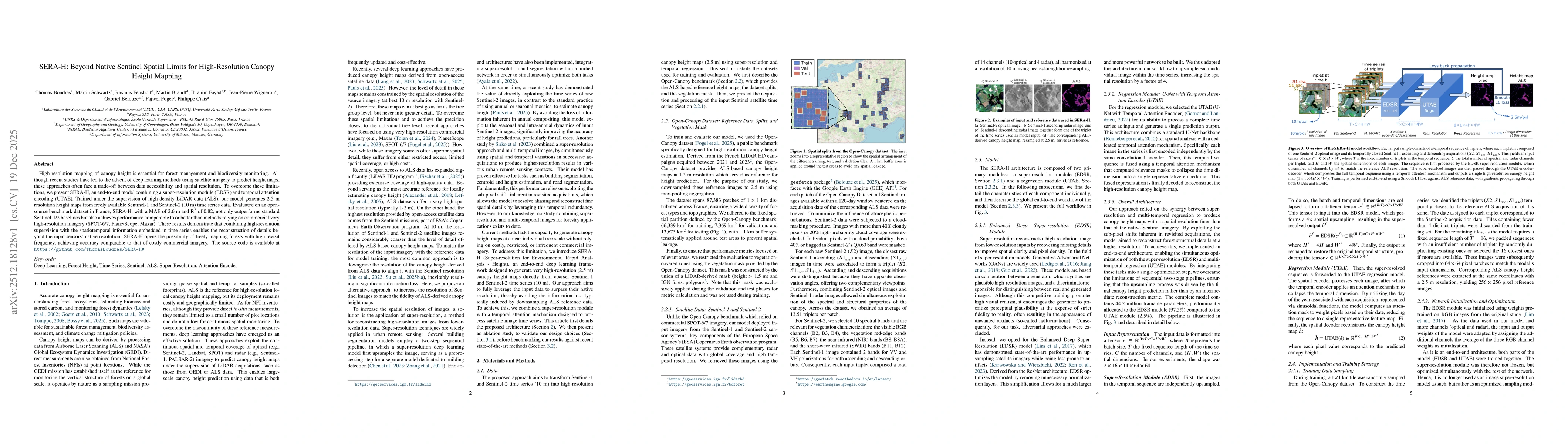
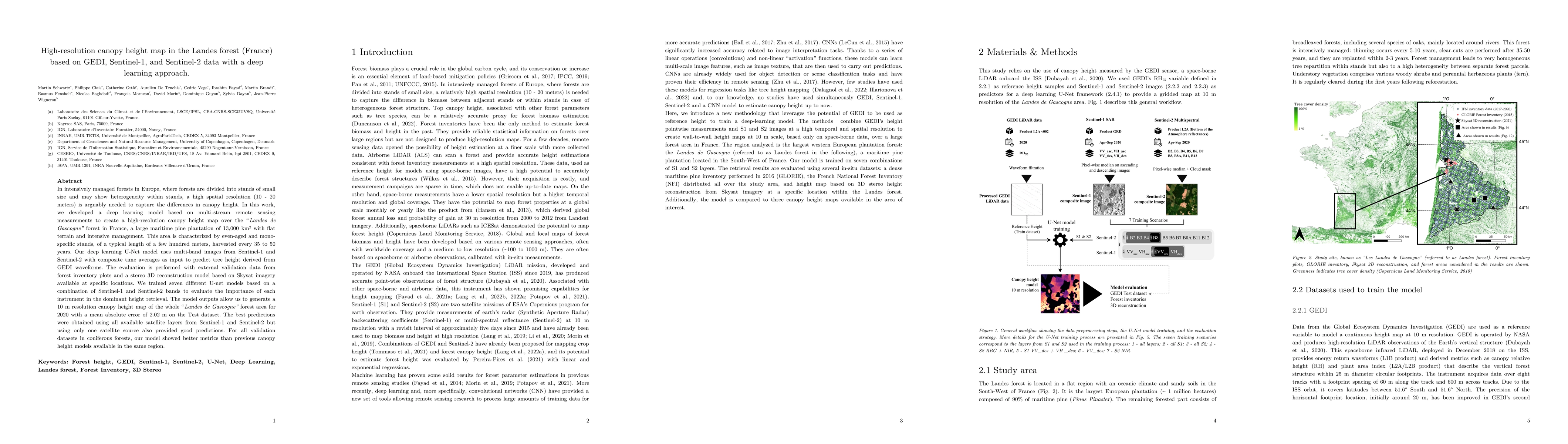
High-resolution mapping of canopy height is essential for forest management and biodiversity monitoring. Although recent studies have led to the advent of deep learning methods using satellite imagery...

Thumbnail for ECHOSAT: Estimating Canopy Height Over Space And Time

ECHOSAT: Estimating Canopy Height Over Space And Time

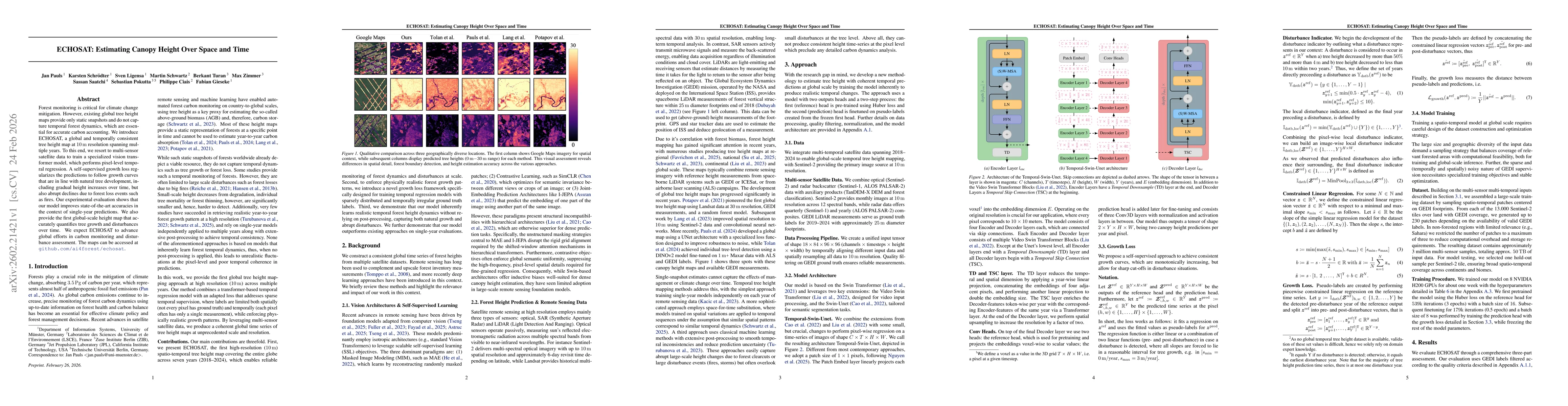
Forest monitoring is critical for climate change mitigation. However, existing global tree height maps provide only static snapshots and do not capture temporal forest dynamics, which are essential fo...

This website uses cookies to ensure you get the best experience. Learn more