Academic Profile
Statistics
Similar Authors
Papers on arXiv
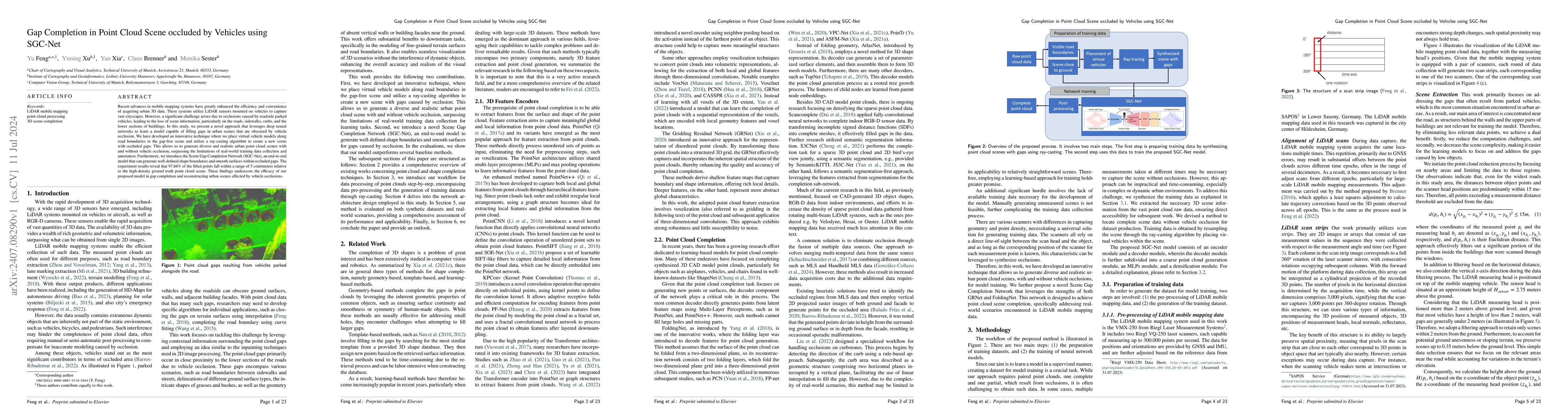
Recent advances in mobile mapping systems have greatly enhanced the efficiency and convenience of acquiring urban 3D data. These systems utilize LiDAR sensors mounted on vehicles to capture vast citys...
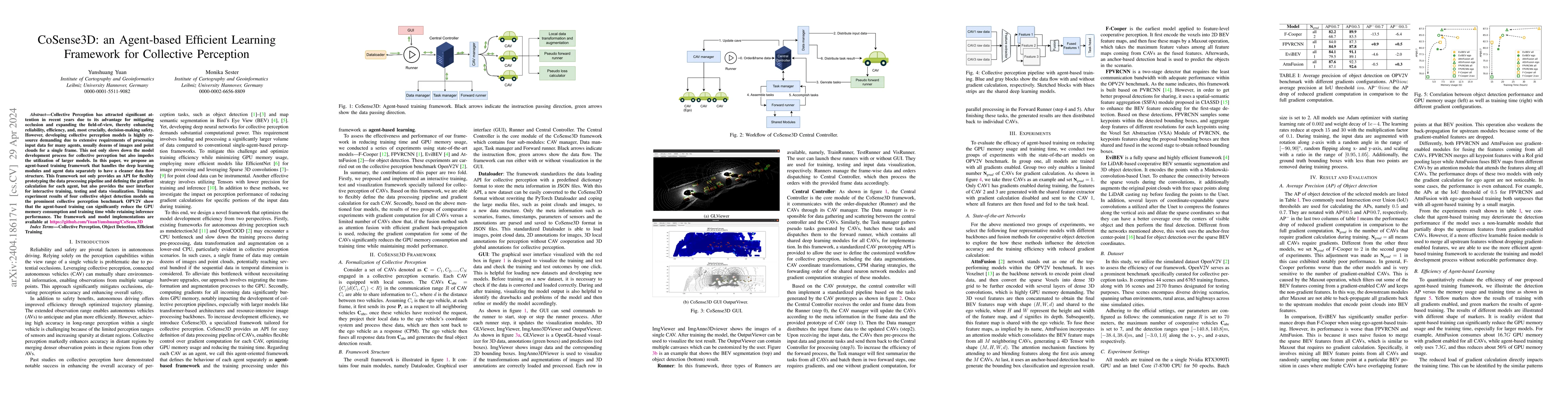
Collective Perception has attracted significant attention in recent years due to its advantage for mitigating occlusion and expanding the field-of-view, thereby enhancing reliability, efficiency, an...
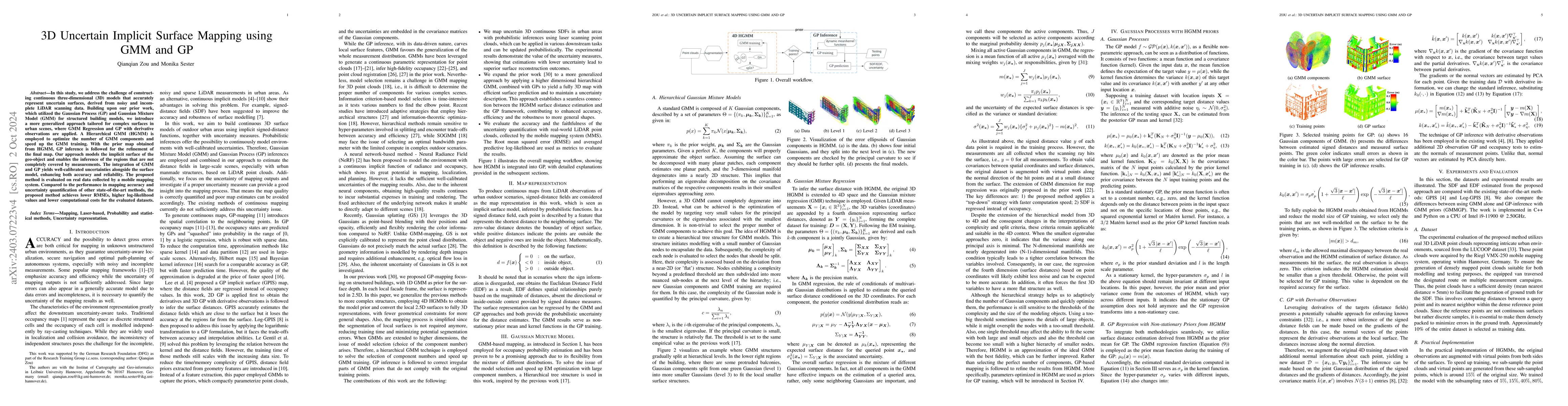
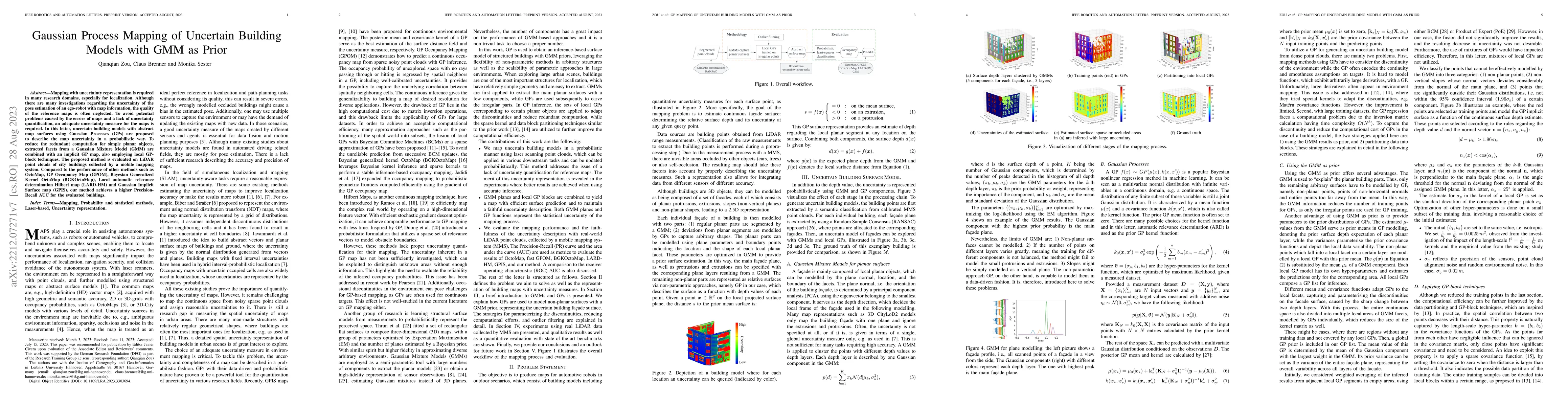
In this study, we address the challenge of constructing continuous three-dimensional (3D) models that accurately represent uncertain surfaces, derived from noisy and incomplete LiDAR scanning data. ...
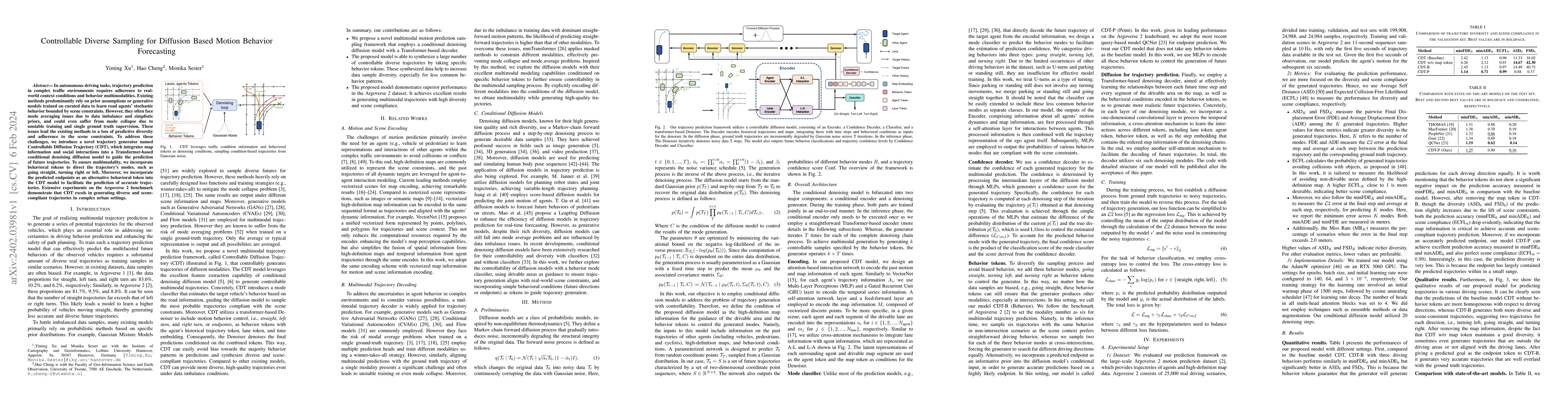
In autonomous driving tasks, trajectory prediction in complex traffic environments requires adherence to real-world context conditions and behavior multimodalities. Existing methods predominantly re...
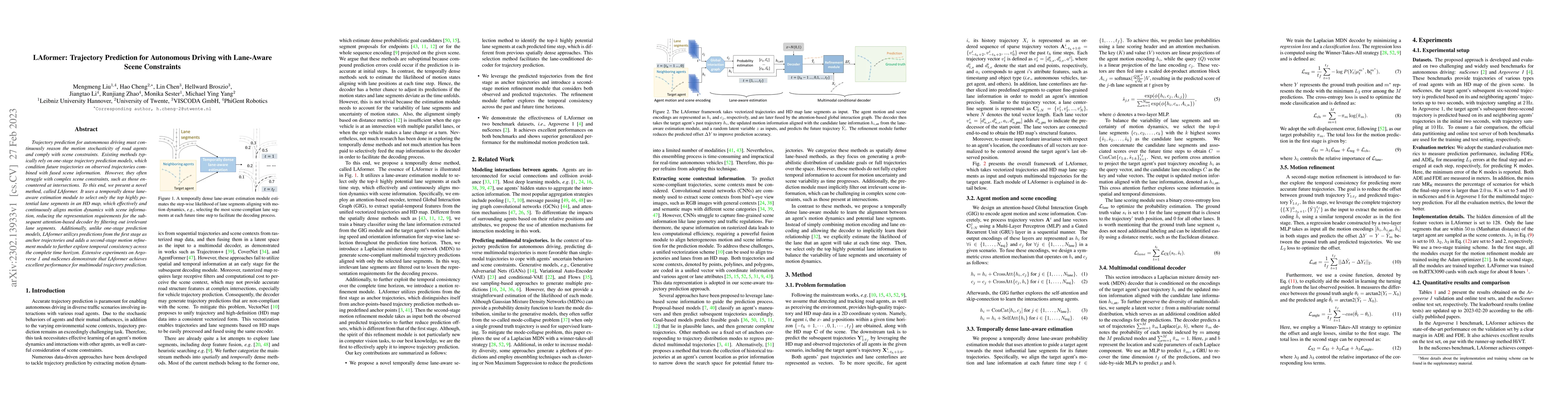
Trajectory prediction for autonomous driving must continuously reason the motion stochasticity of road agents and comply with scene constraints. Existing methods typically rely on one-stage trajecto...
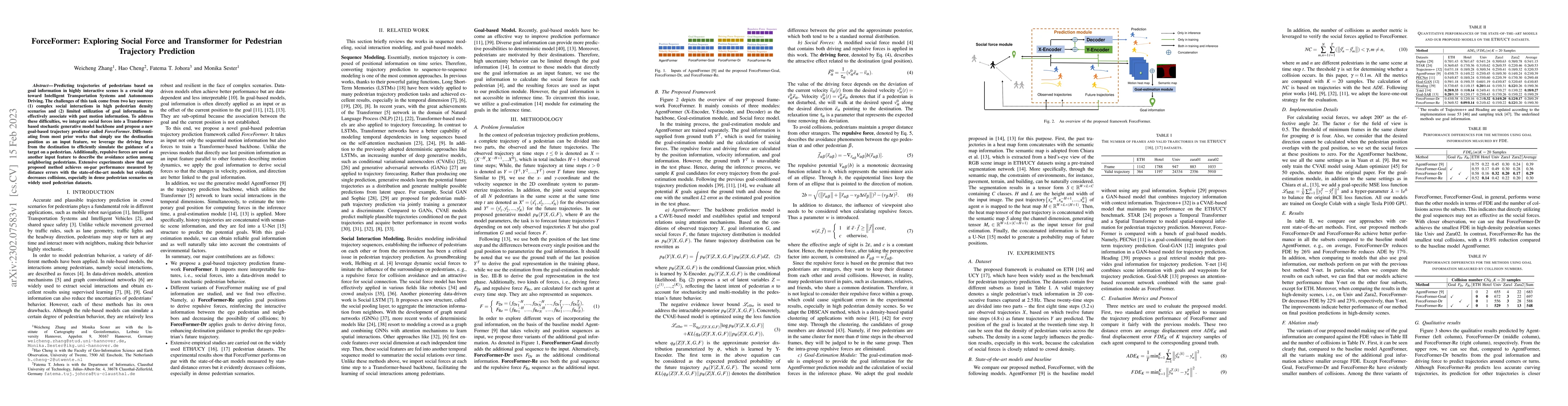
Predicting trajectories of pedestrians based on goal information in highly interactive scenes is a crucial step toward Intelligent Transportation Systems and Autonomous Driving. The challenges of th...
Safety is critical for autonomous driving, and one aspect of improving safety is to accurately capture the uncertainties of the perception system, especially knowing the unknown. Different from only...
Mapping with uncertainty representation is required in many research domains, especially for localization. Although there are many investigations regarding the uncertainty of the pose estimation of ...
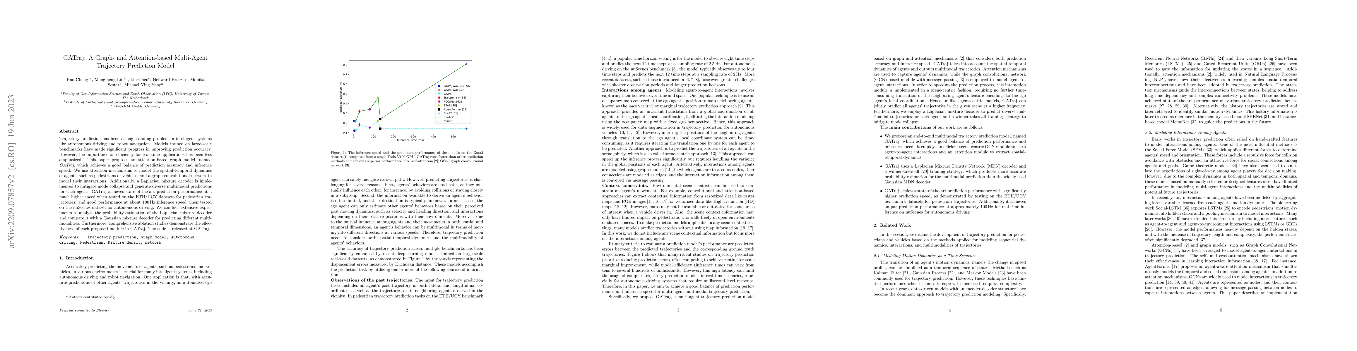
Trajectory prediction has been a long-standing problem in intelligent systems like autonomous driving and robot navigation. Models trained on large-scale benchmarks have made significant progress in...
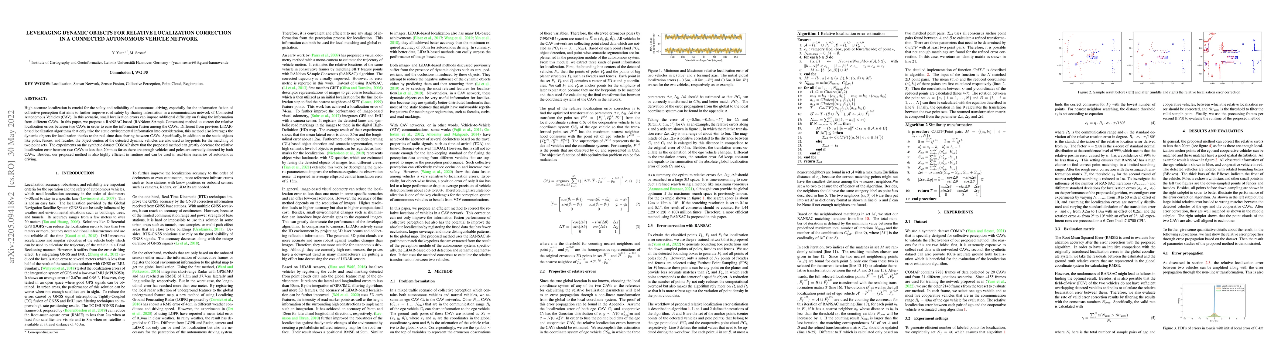
High-accurate localization is crucial for the safety and reliability of autonomous driving, especially for the information fusion of collective perception that aims to further improve road safety by...
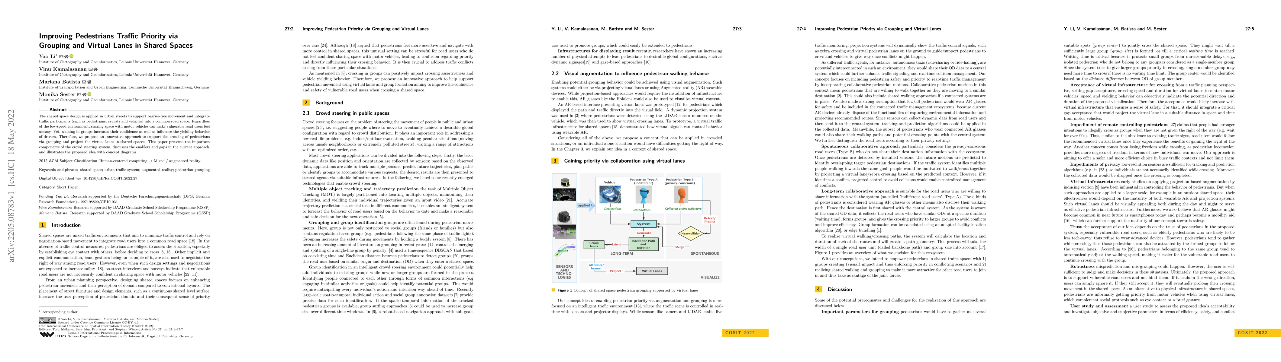
The shared space design is applied in urban streets to support barrier-free movement and integrate traffic participants (such as pedestrians, cyclists and vehicles) into a common road space. Regardl...
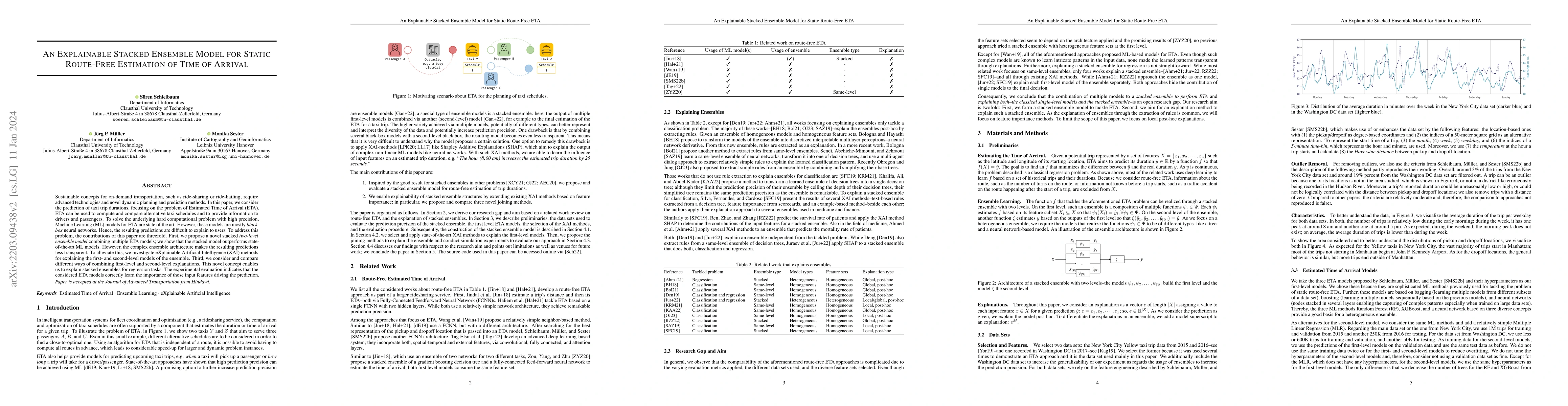
To compare alternative taxi schedules and to compute them, as well as to provide insights into an upcoming taxi trip to drivers and passengers, the duration of a trip or its Estimated Time of Arriva...
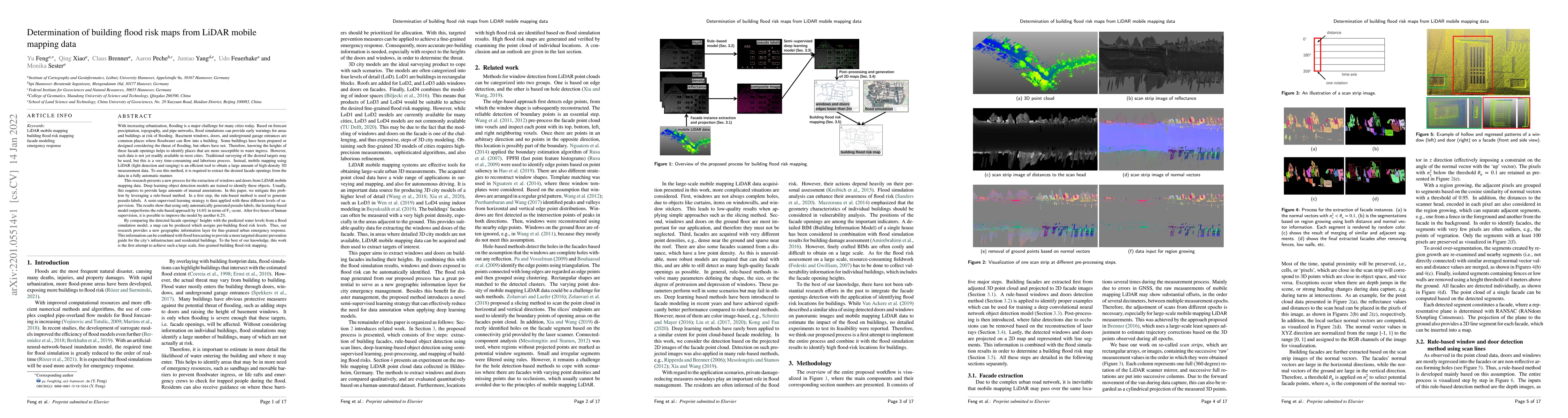
With increasing urbanization, flooding is a major challenge for many cities today. Based on forecast precipitation, topography, and pipe networks, flood simulations can provide early warnings for ar...
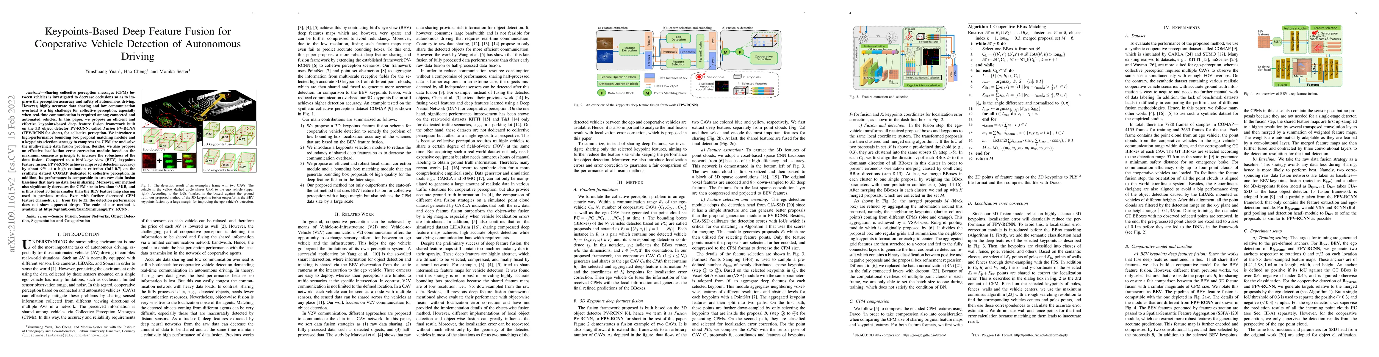
Sharing collective perception messages (CPM) between vehicles is investigated to decrease occlusions so as to improve the perception accuracy and safety of autonomous driving. However, highly accura...
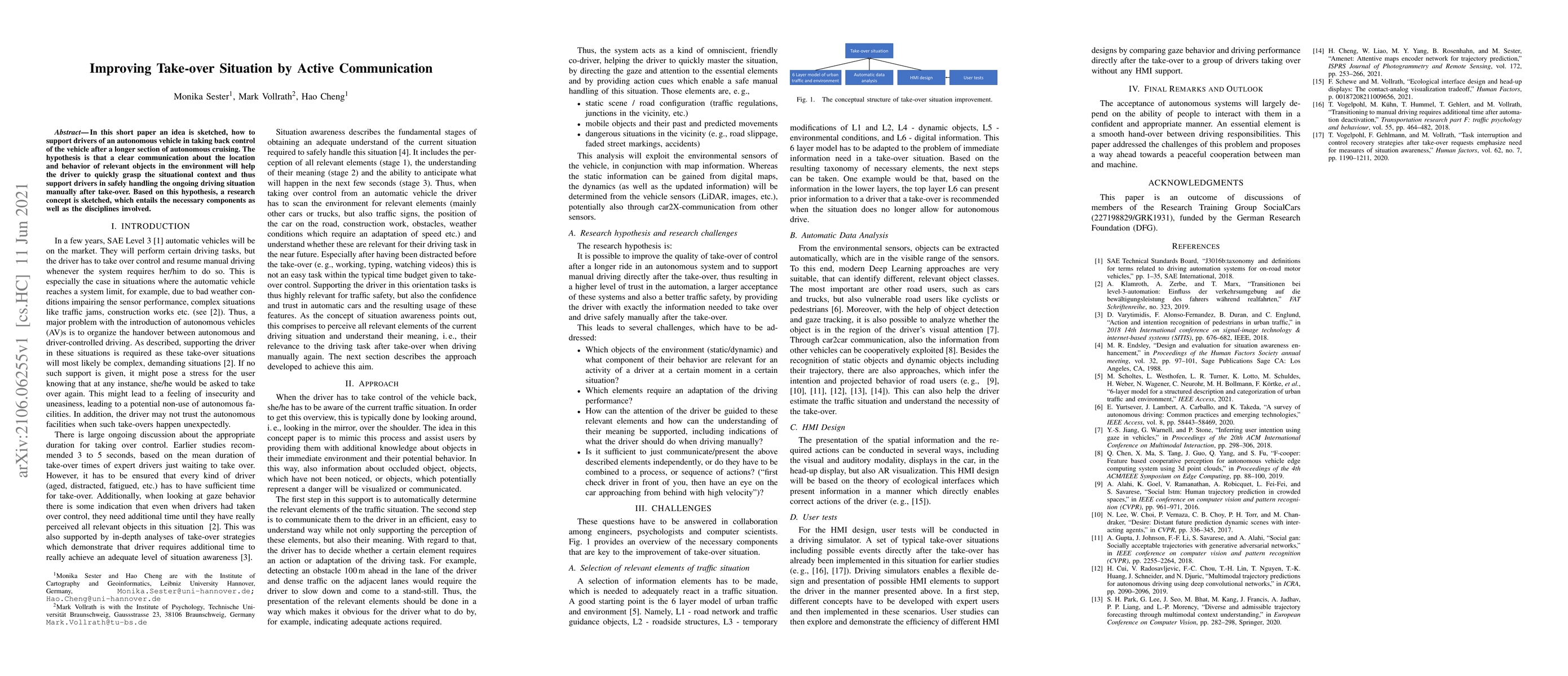
In this short paper an idea is sketched, how to support drivers of an autonomous vehicle in taking back control of the vehicle after a longer section of autonomous cruising. The hypothesis is that a...
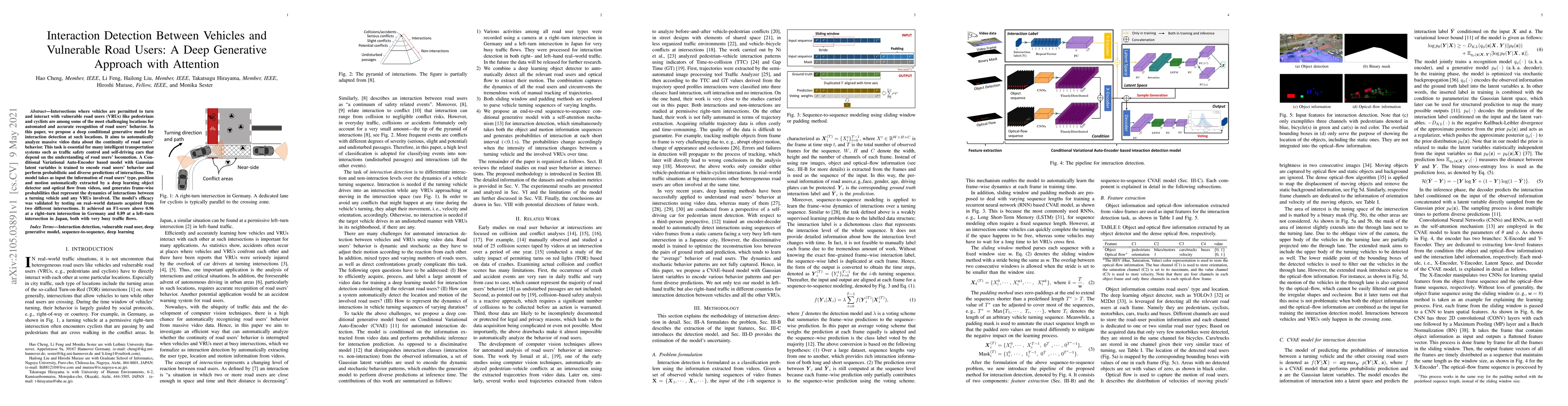
Intersections where vehicles are permitted to turn and interact with vulnerable road users (VRUs) like pedestrians and cyclists are among some of the most challenging locations for automated and acc...
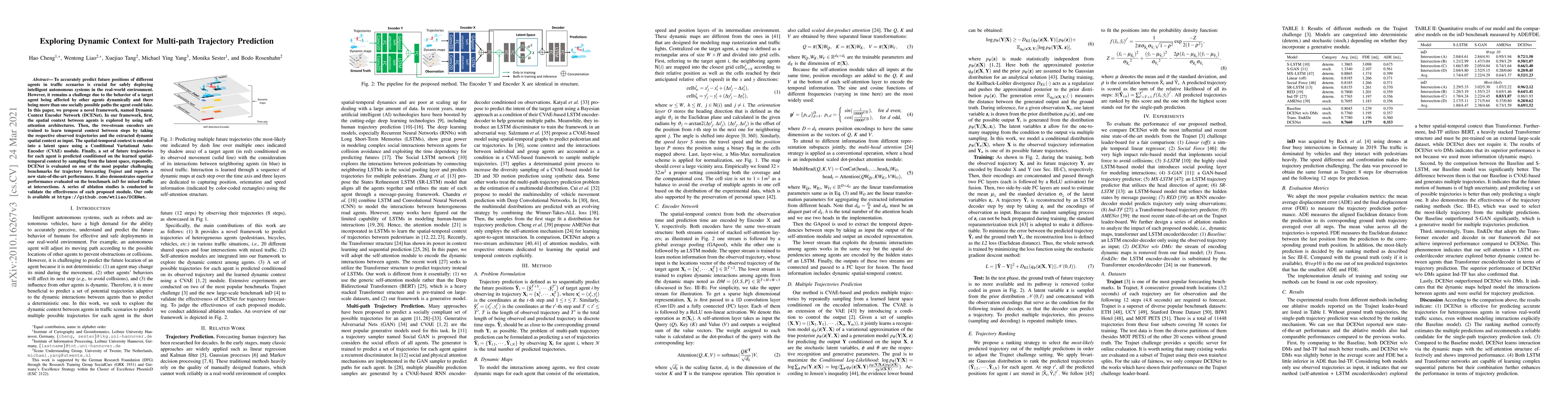
To accurately predict future positions of different agents in traffic scenarios is crucial for safely deploying intelligent autonomous systems in the real-world environment. However, it remains a ch...
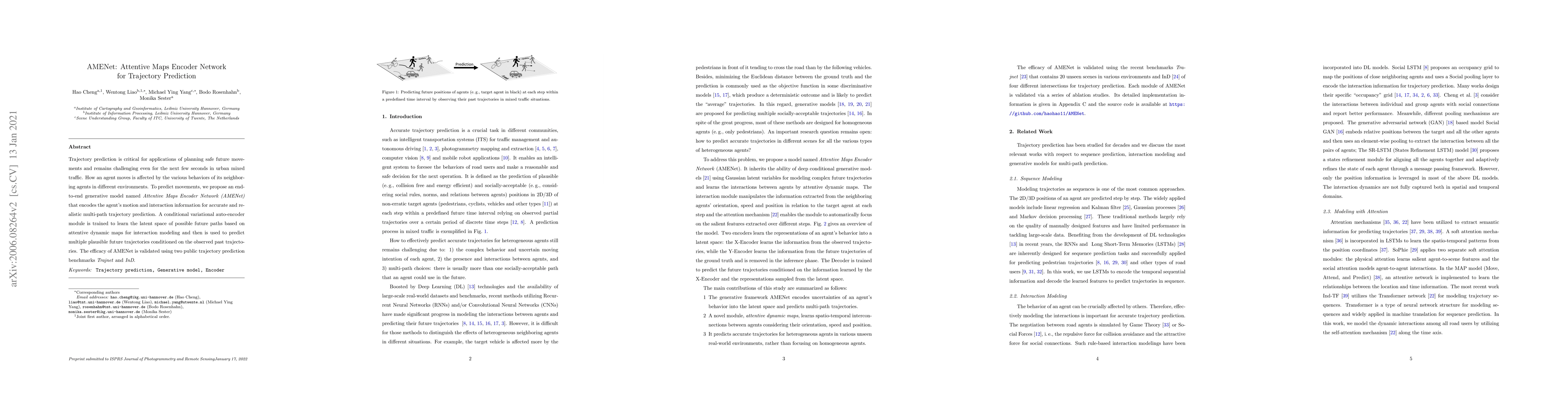
Trajectory prediction is critical for applications of planning safe future movements and remains challenging even for the next few seconds in urban mixed traffic. How an agent moves is affected by t...
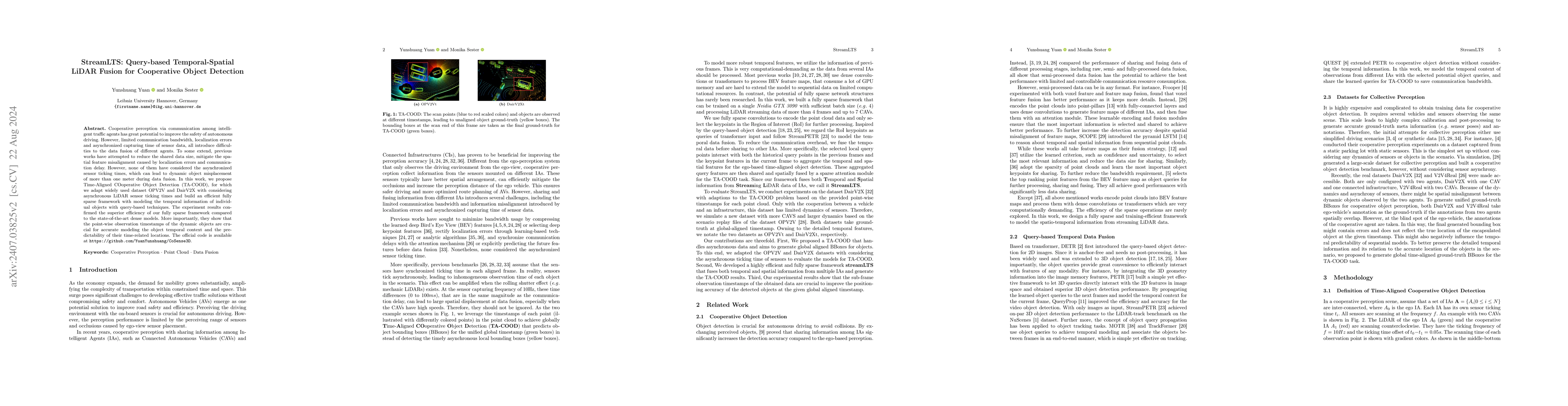
Cooperative perception via communication among intelligent traffic agents has great potential to improve the safety of autonomous driving. However, limited communication bandwidth, localization errors...
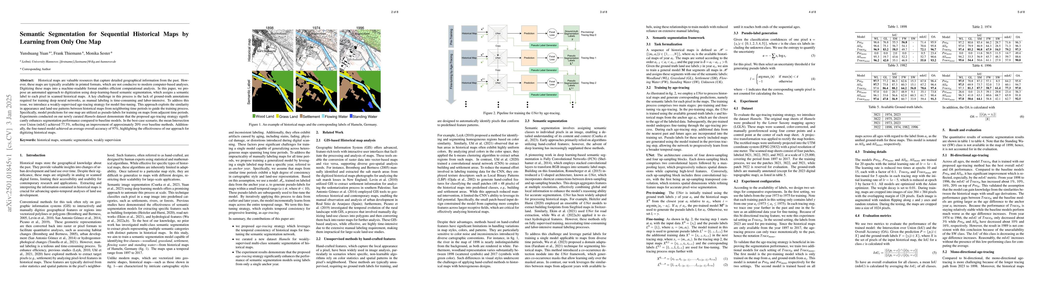
Historical maps are valuable resources that capture detailed geographical information from the past. However, these maps are typically available in printed formats, which are not conducive to modern c...
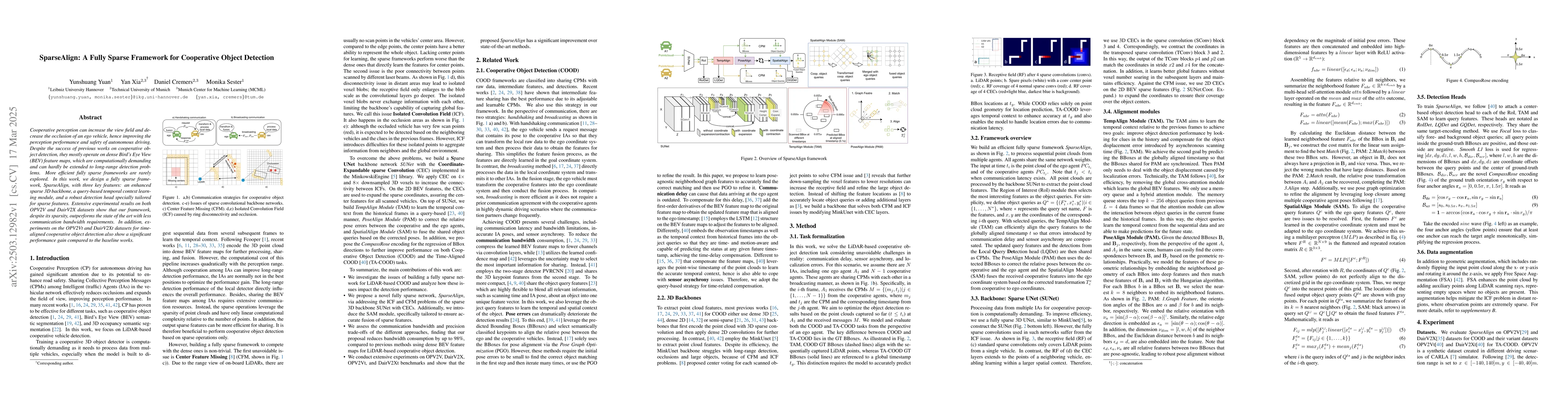
Cooperative perception can increase the view field and decrease the occlusion of an ego vehicle, hence improving the perception performance and safety of autonomous driving. Despite the success of pre...
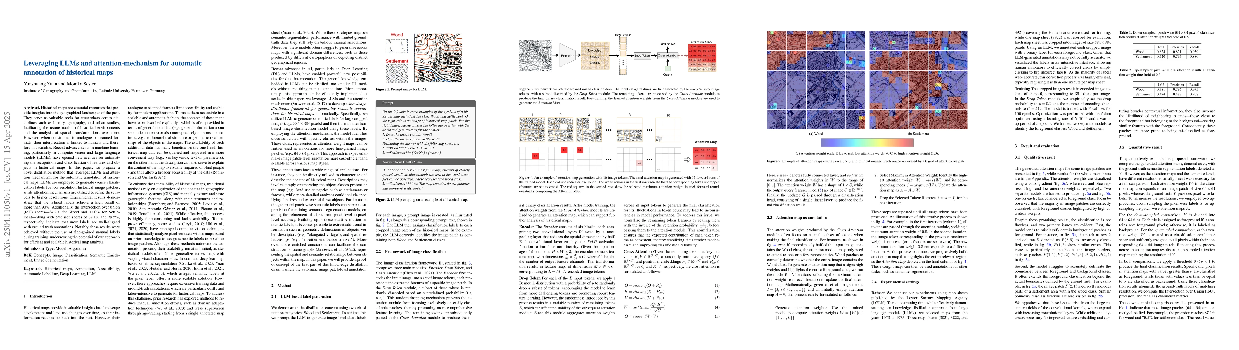
Historical maps are essential resources that provide insights into the geographical landscapes of the past. They serve as valuable tools for researchers across disciplines such as history, geography, ...
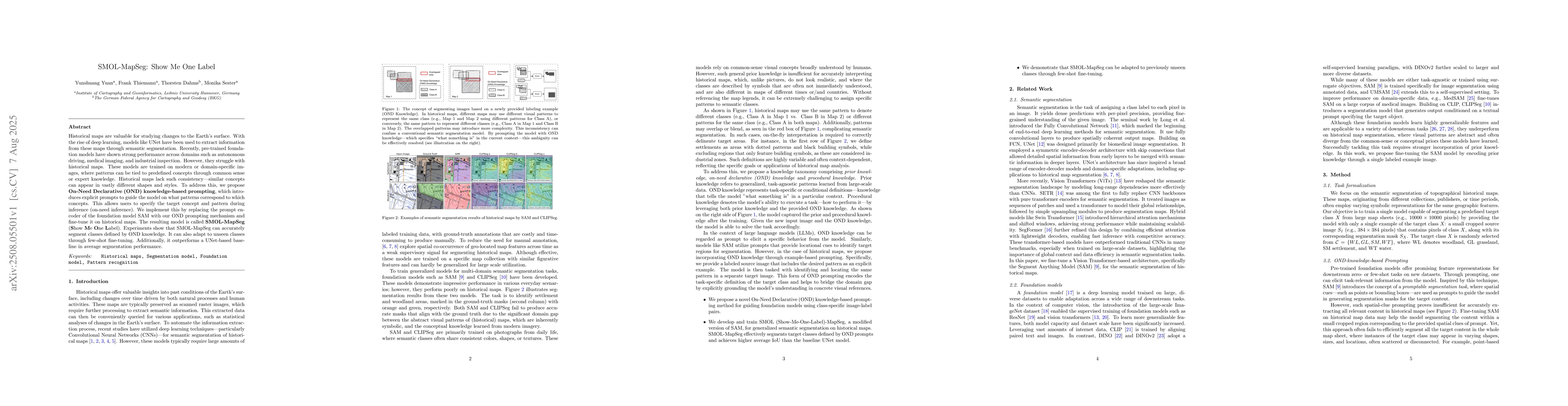
Historical maps are valuable for studying changes to the Earth's surface. With the rise of deep learning, models like UNet have been used to extract information from these maps through semantic segmen...
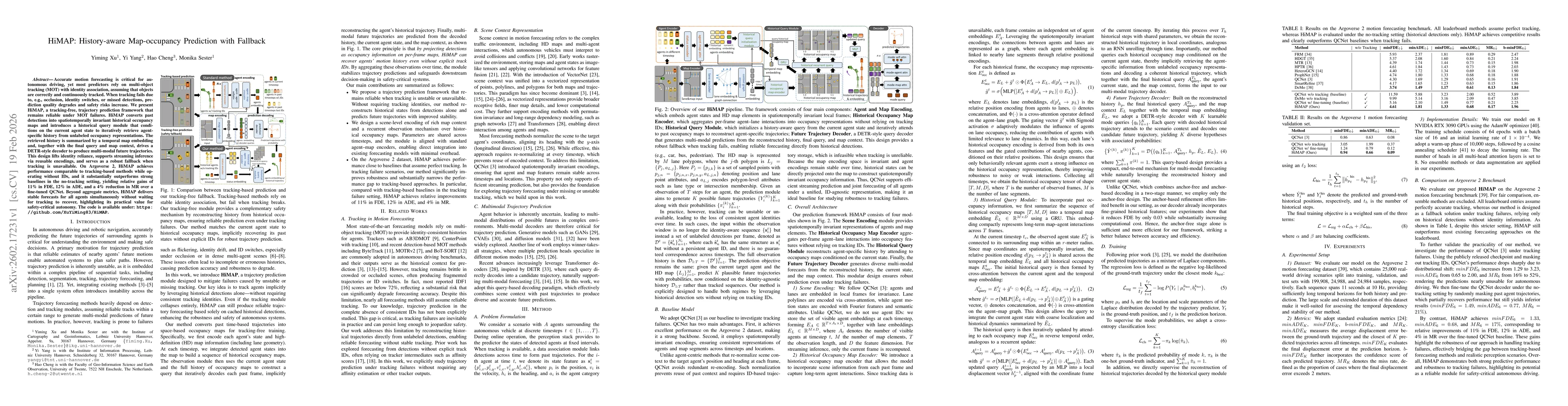
Accurate motion forecasting is critical for autonomous driving, yet most predictors rely on multi-object tracking (MOT) with identity association, assuming that objects are correctly and continuously ...