Academic Profile
Statistics
Papers on arXiv
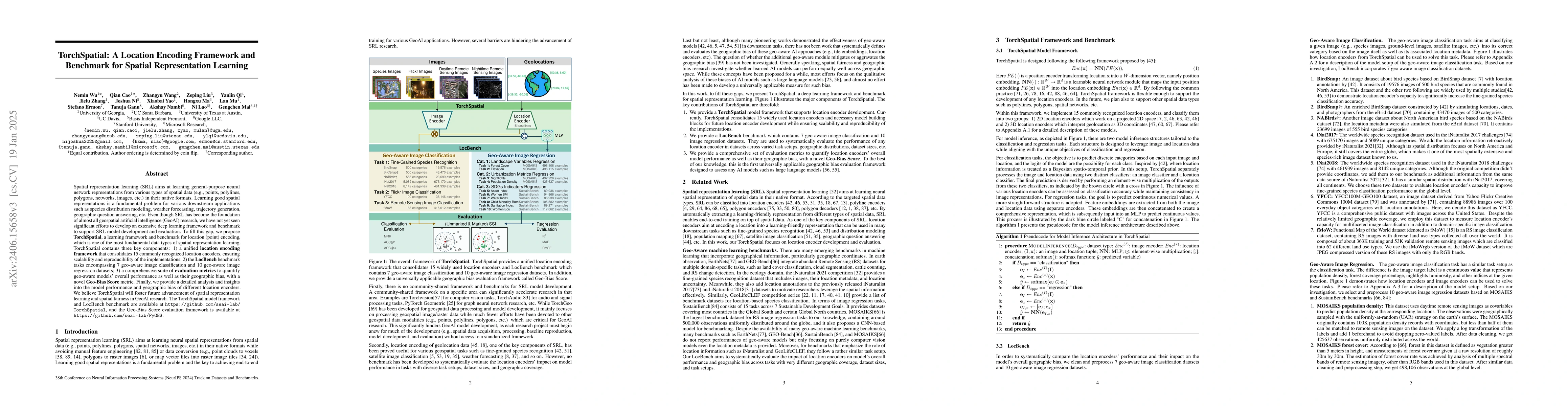
Spatial representation learning (SRL) aims at learning general-purpose neural network representations from various types of spatial data (e.g., points, polylines, polygons, networks, images, etc.) i...
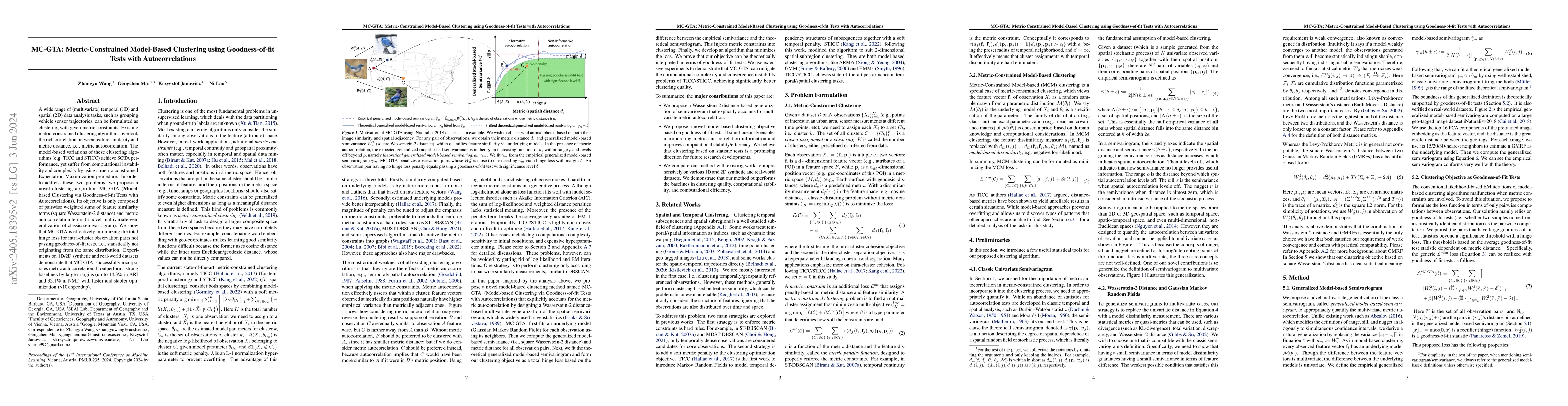
A wide range of (multivariate) temporal (1D) and spatial (2D) data analysis tasks, such as grouping vehicle sensor trajectories, can be formulated as clustering with given metric constraints. Existi...
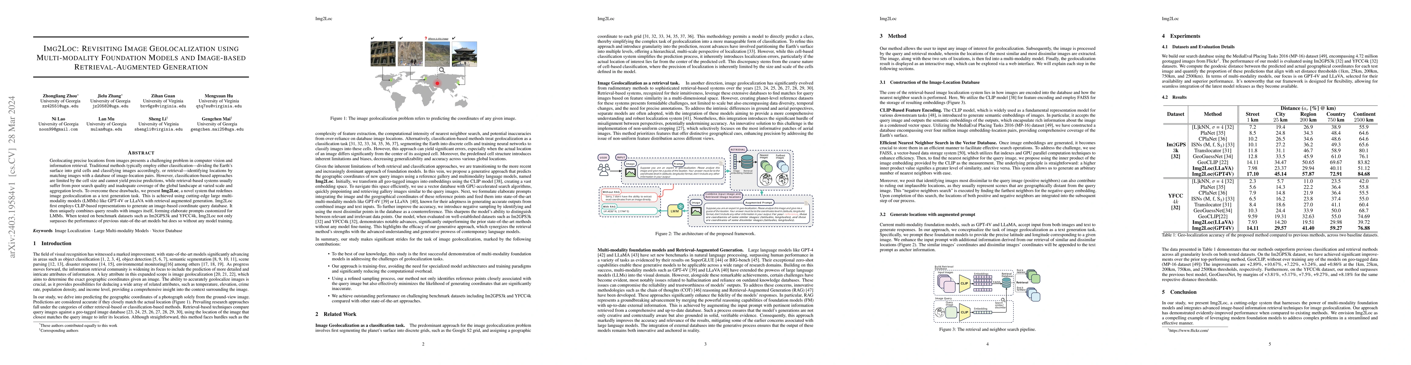
Geolocating precise locations from images presents a challenging problem in computer vision and information retrieval.Traditional methods typically employ either classification, which dividing the E...
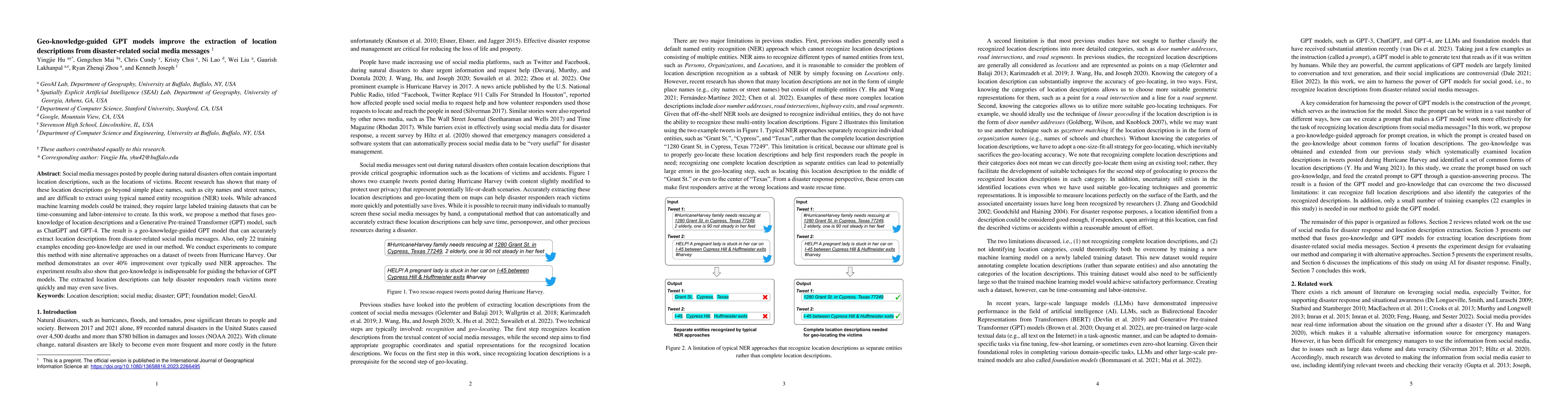
Social media messages posted by people during natural disasters often contain important location descriptions, such as the locations of victims. Recent research has shown that many of these location...
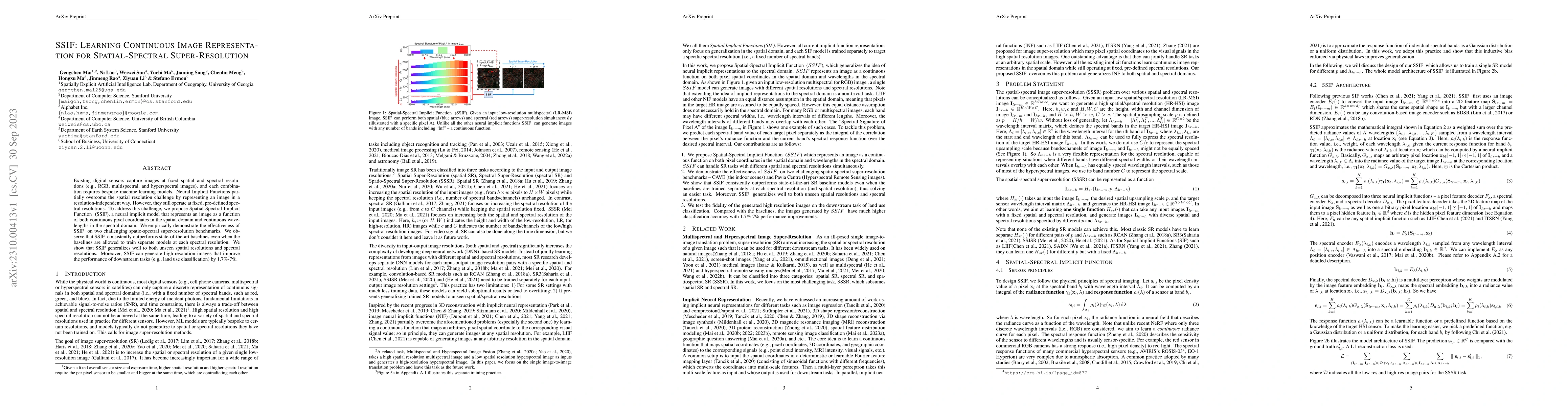
Existing digital sensors capture images at fixed spatial and spectral resolutions (e.g., RGB, multispectral, and hyperspectral images), and each combination requires bespoke machine learning models....
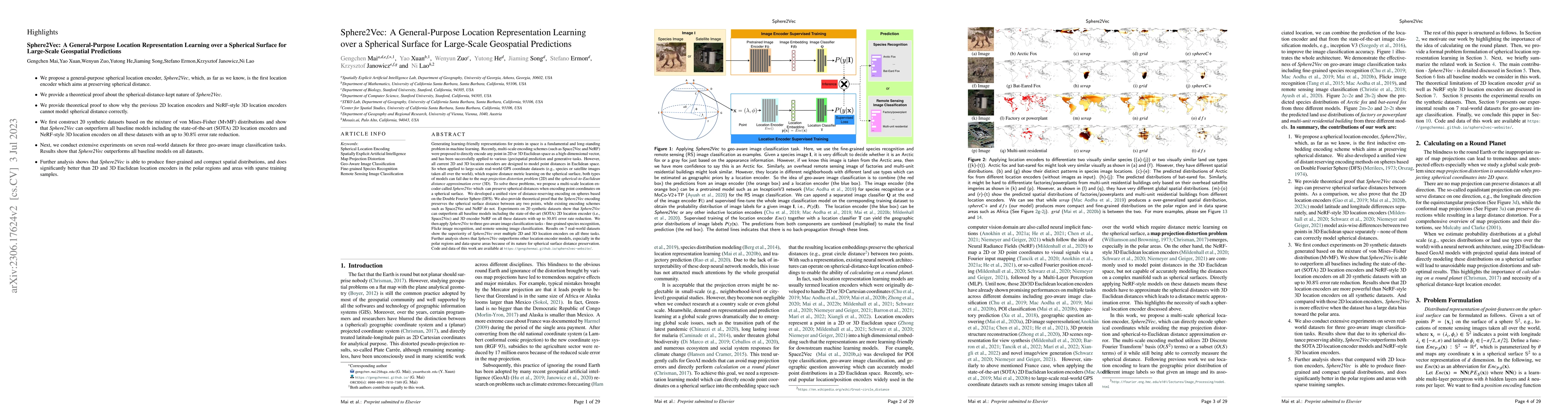
Generating learning-friendly representations for points in space is a fundamental and long-standing problem in ML. Recently, multi-scale encoding schemes (such as Space2Vec and NeRF) were proposed t...
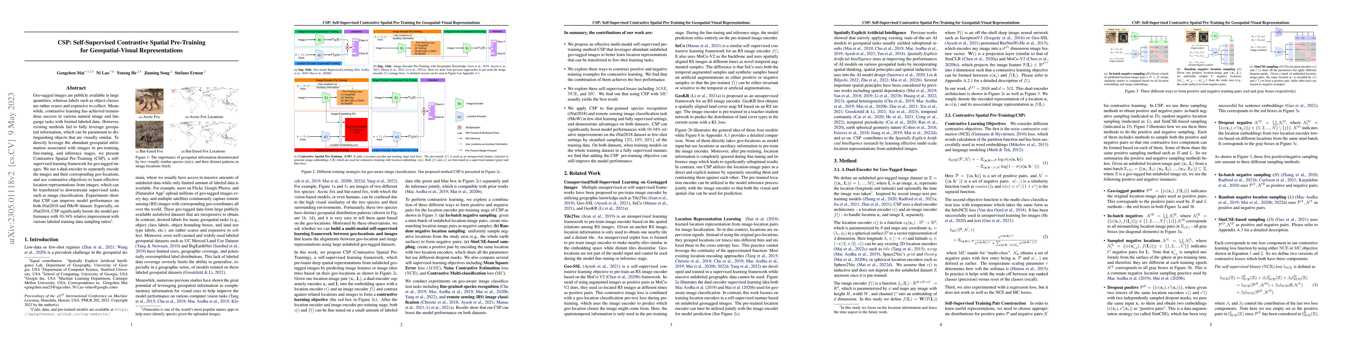
Geo-tagged images are publicly available in large quantities, whereas labels such as object classes are rather scarce and expensive to collect. Meanwhile, contrastive learning has achieved tremendou...
Large pre-trained models, also known as foundation models (FMs), are trained in a task-agnostic manner on large-scale data and can be adapted to a wide range of downstream tasks by fine-tuning, few-...
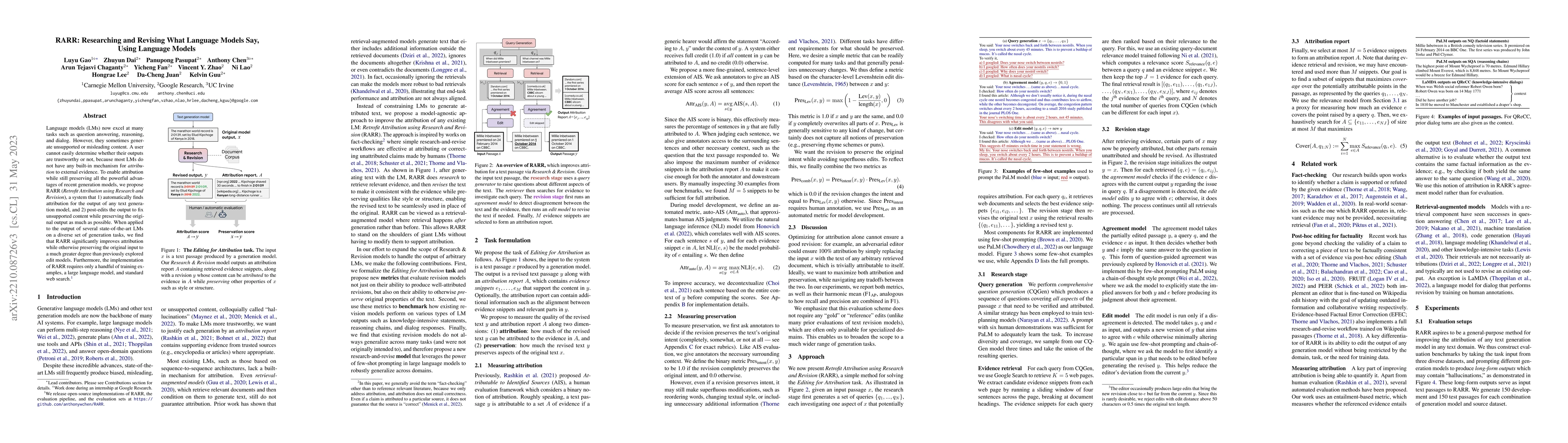
Language models (LMs) now excel at many tasks such as few-shot learning, question answering, reasoning, and dialog. However, they sometimes generate unsupported or misleading content. A user cannot ...
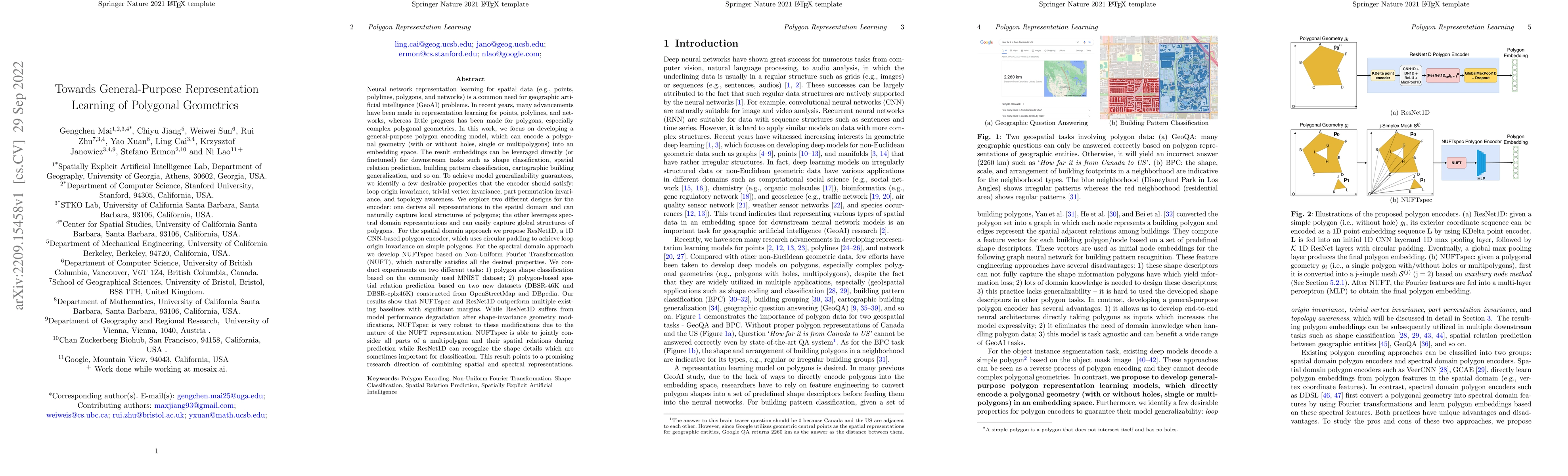
Neural network representation learning for spatial data is a common need for geographic artificial intelligence (GeoAI) problems. In recent years, many advancements have been made in representation ...
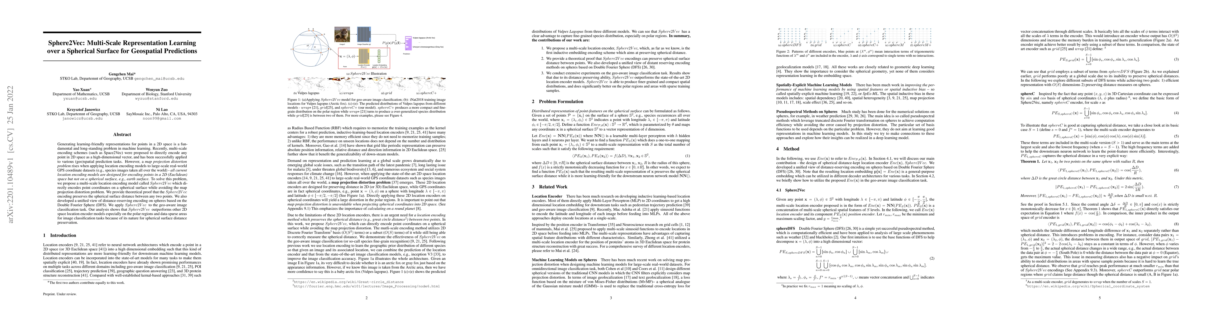
Generating learning-friendly representations for points in a 2D space is a fundamental and long-standing problem in machine learning. Recently, multi-scale encoding schemes (such as Space2Vec) were ...
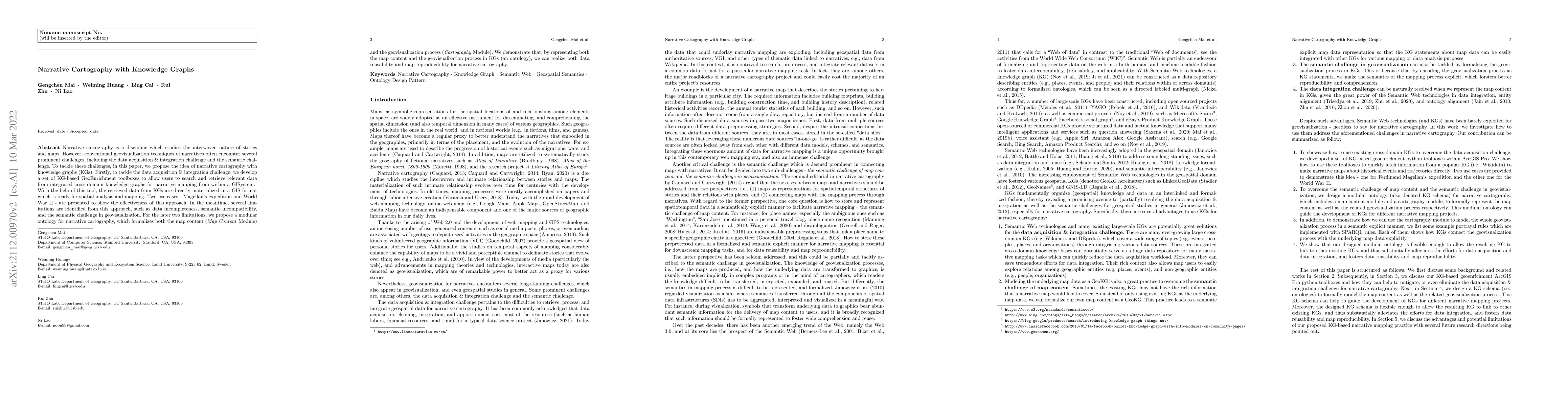
Narrative cartography is a discipline which studies the interwoven nature of stories and maps. However, conventional geovisualization techniques of narratives often encounter several prominent chall...
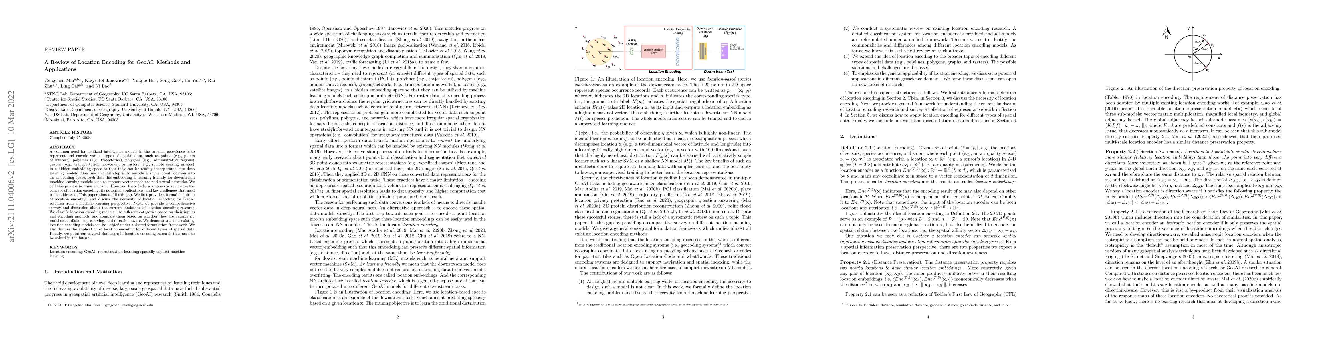
A common need for artificial intelligence models in the broader geoscience is to represent and encode various types of spatial data, such as points (e.g., points of interest), polylines (e.g., traje...
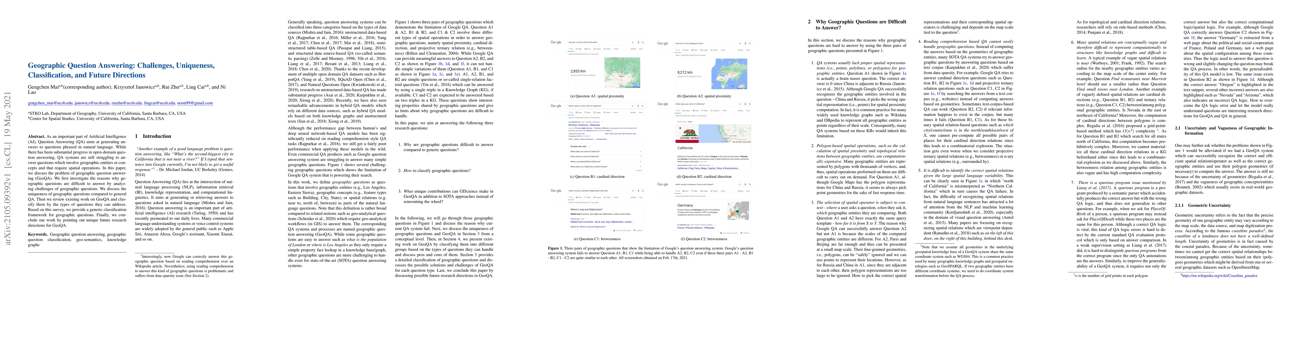
As an important part of Artificial Intelligence (AI), Question Answering (QA) aims at generating answers to questions phrased in natural language. While there has been substantial progress in open-d...
Learning knowledge graph (KG) embeddings is an emerging technique for a variety of downstream tasks such as summarization, link prediction, information retrieval, and question answering. However, mo...
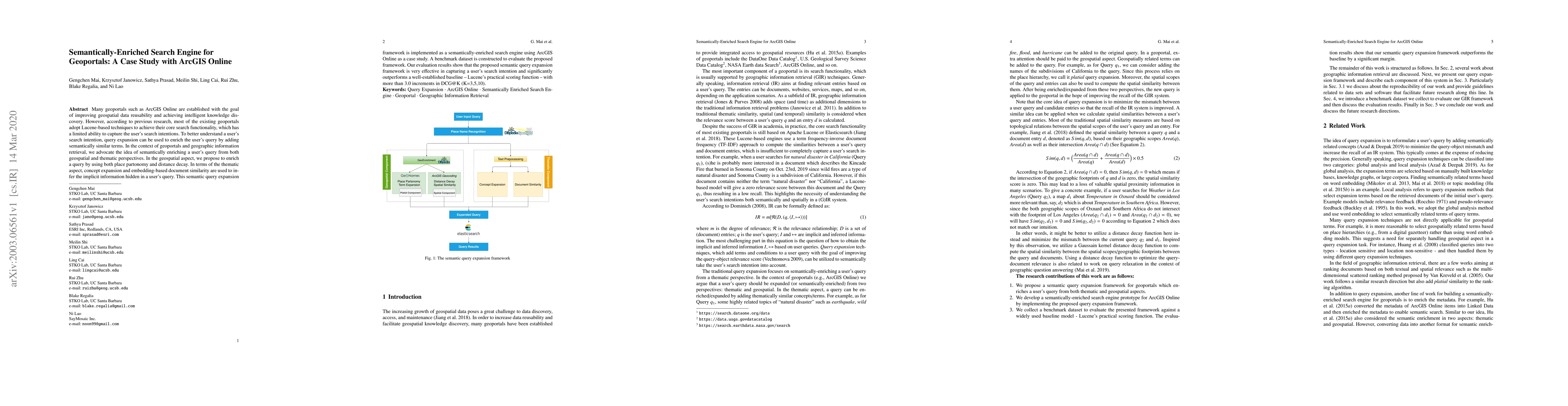
Many geoportals such as ArcGIS Online are established with the goal of improving geospatial data reusability and achieving intelligent knowledge discovery. However, according to previous research, m...
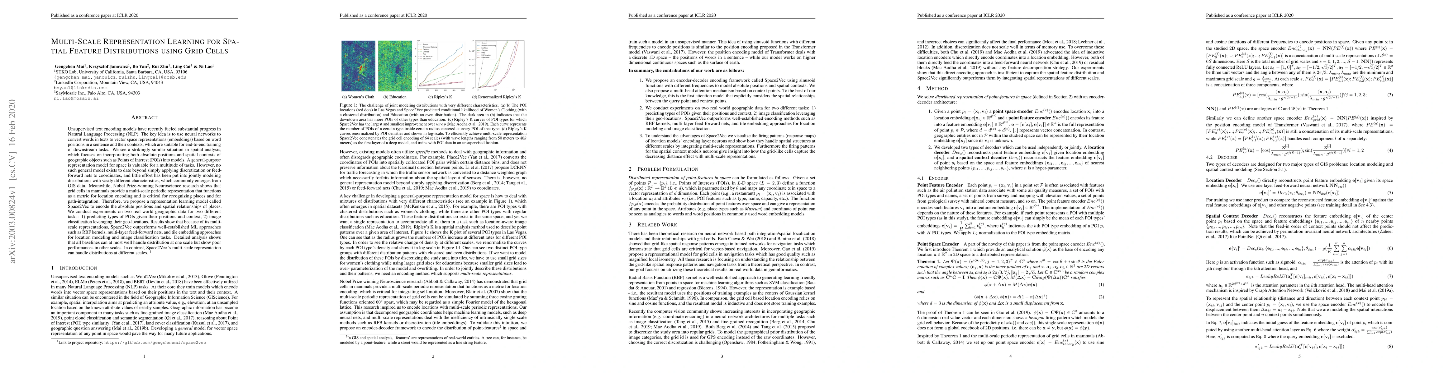
Unsupervised text encoding models have recently fueled substantial progress in NLP. The key idea is to use neural networks to convert words in texts to vector space representations based on word pos...
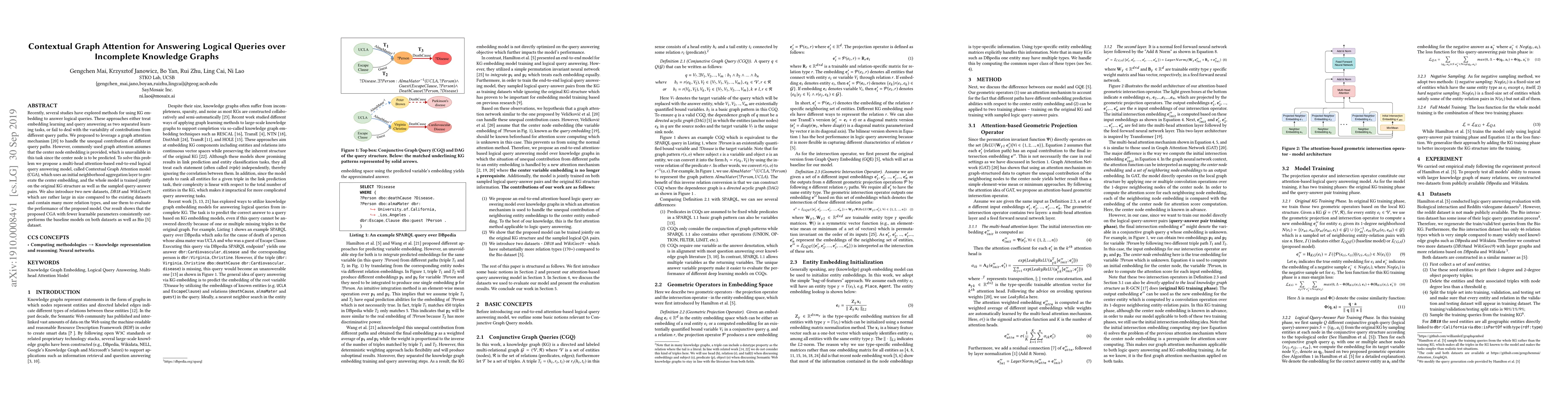
Recently, several studies have explored methods for using KG embedding to answer logical queries. These approaches either treat embedding learning and query answering as two separated learning tasks...
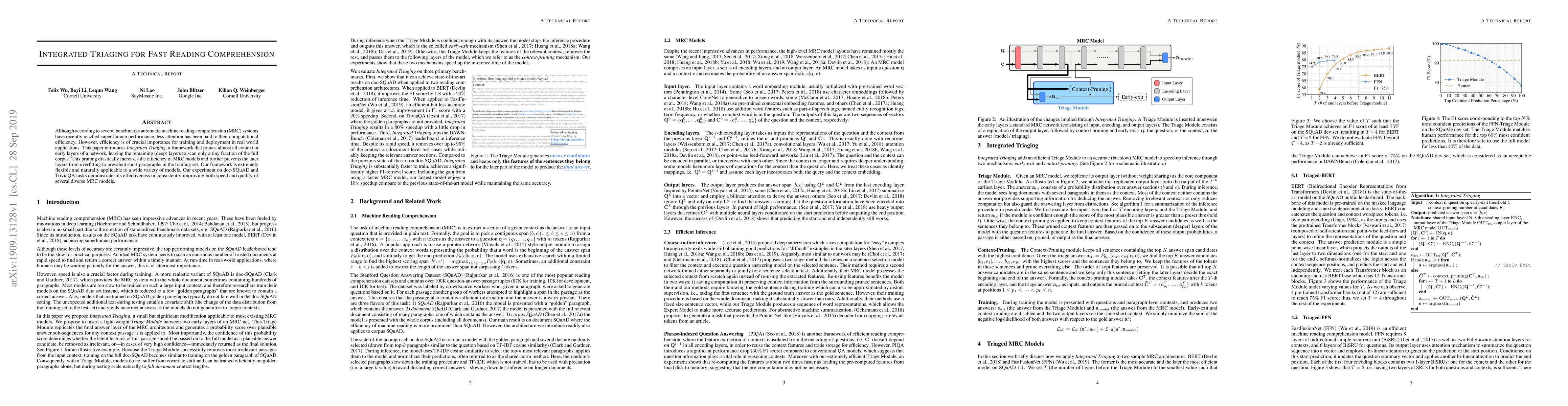
Although according to several benchmarks automatic machine reading comprehension (MRC) systems have recently reached super-human performance, less attention has been paid to their computational effi...
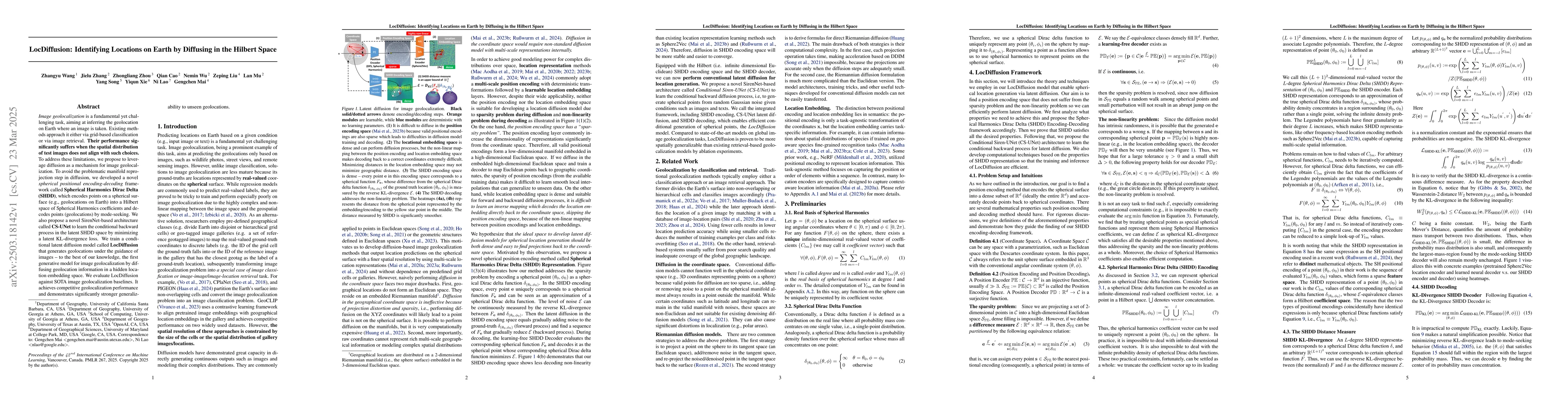
Image geolocalization is a fundamental yet challenging task, aiming at inferring the geolocation on Earth where an image is taken. Existing methods approach it either via grid-based classification or ...
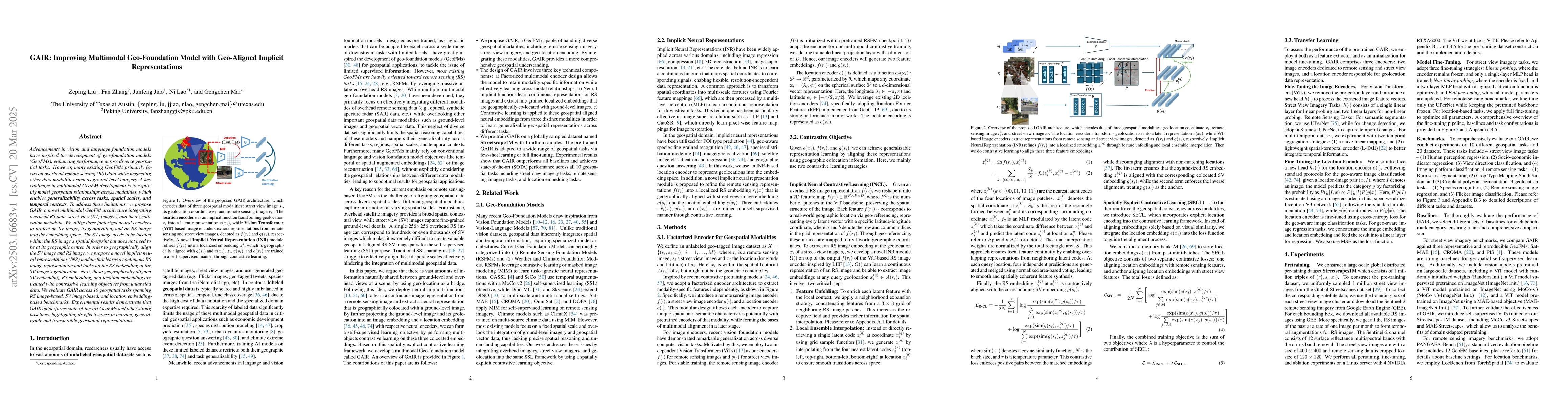
Advancements in vision and language foundation models have inspired the development of geo-foundation models (GeoFMs), enhancing performance across diverse geospatial tasks. However, many existing Geo...
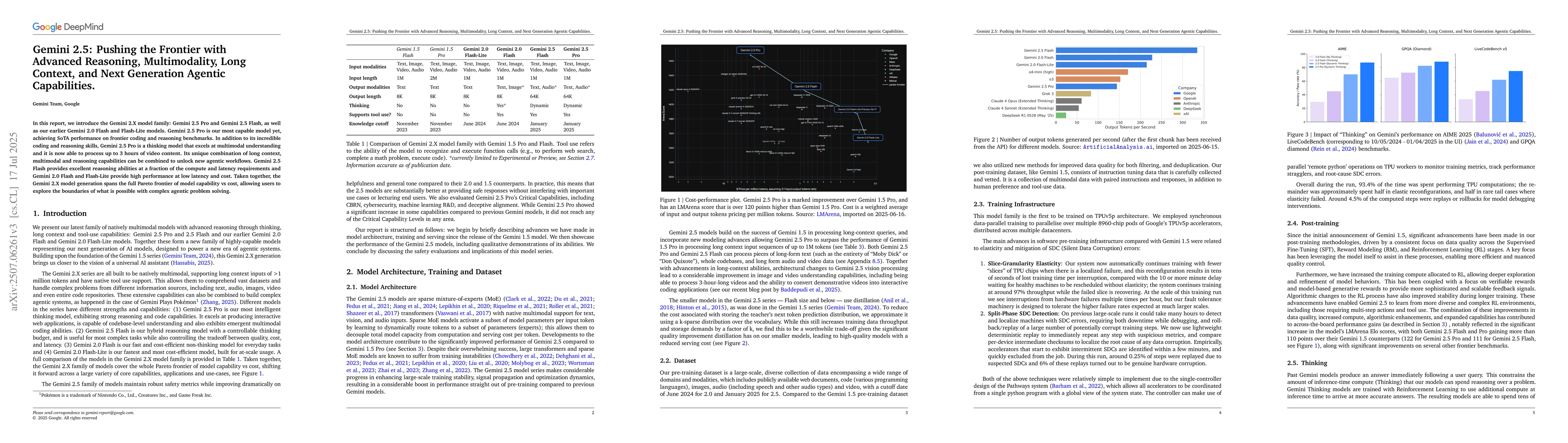
In this report, we introduce the Gemini 2.X model family: Gemini 2.5 Pro and Gemini 2.5 Flash, as well as our earlier Gemini 2.0 Flash and Flash-Lite models. Gemini 2.5 Pro is our most capable model y...
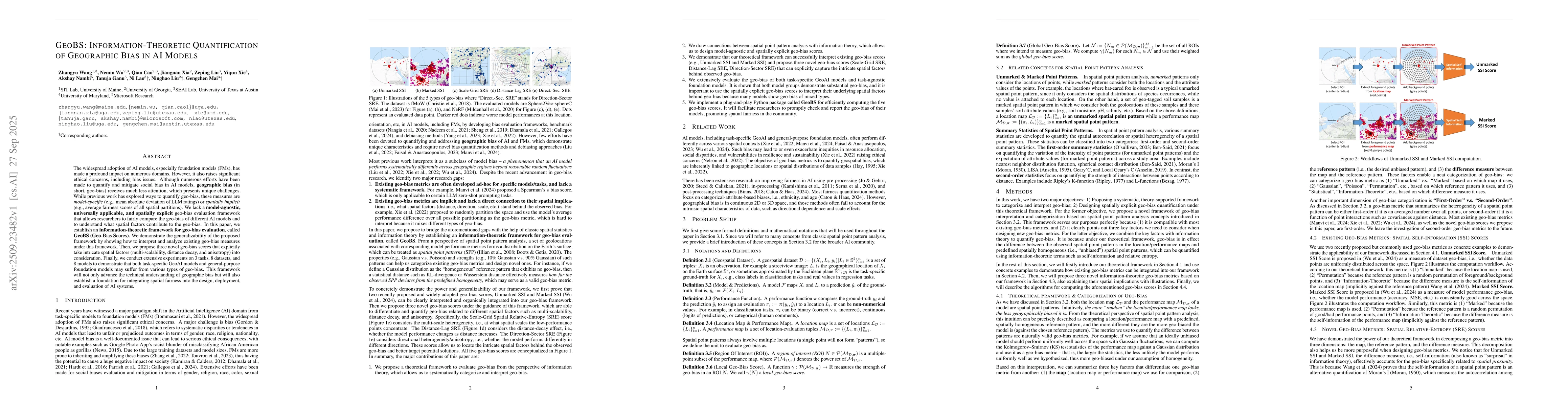
The widespread adoption of AI models, especially foundation models (FMs), has made a profound impact on numerous domains. However, it also raises significant ethical concerns, including bias issues. A...
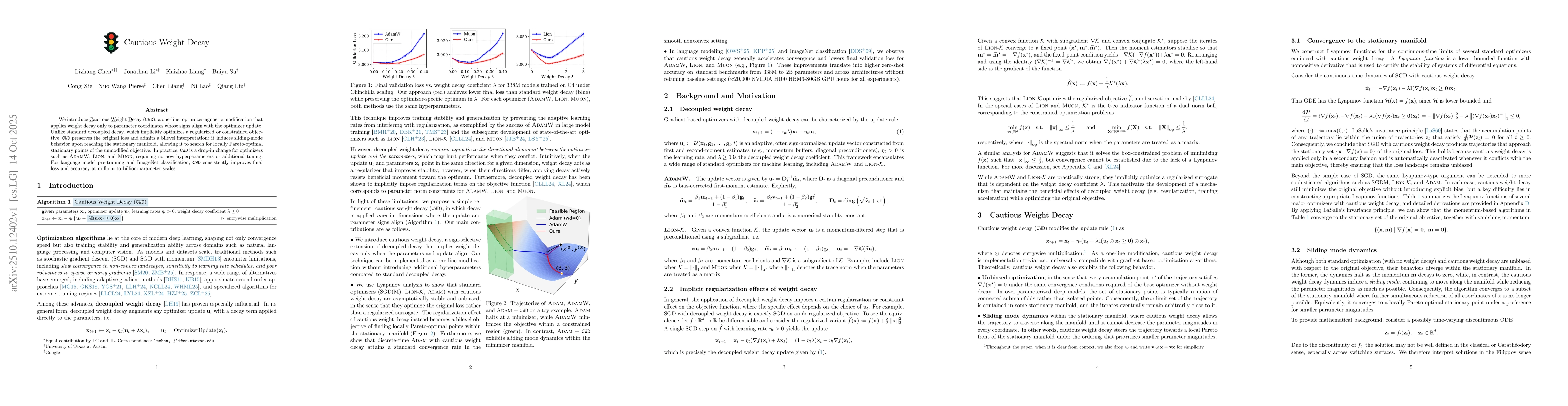
We introduce Cautious Weight Decay (CWD), a one-line, optimizer-agnostic modification that applies weight decay only to parameter coordinates whose signs align with the optimizer update. Unlike standa...
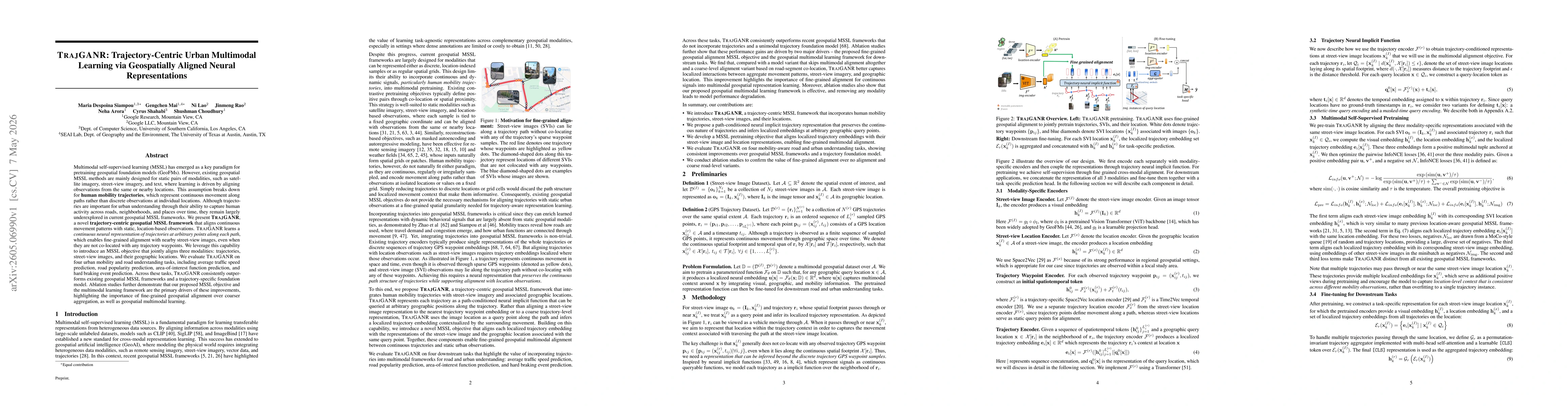
Multimodal self-supervised learning (MSSL) has emerged as a key paradigm for pretraining geospatial foundation models. However, existing geospatial MSSL methods are mainly designed for static pairs of...
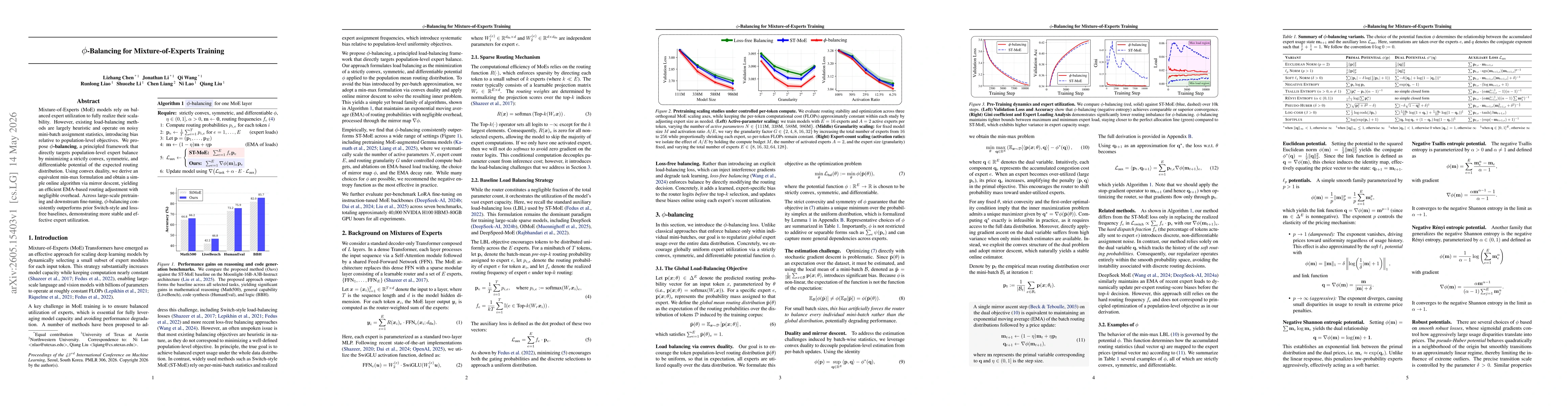
Mixture-of-Experts (MoE) models rely on balanced expert utilization to fully realize their scalability. However, existing load-balancing methods are largely heuristic and operate on noisy mini-batch a...
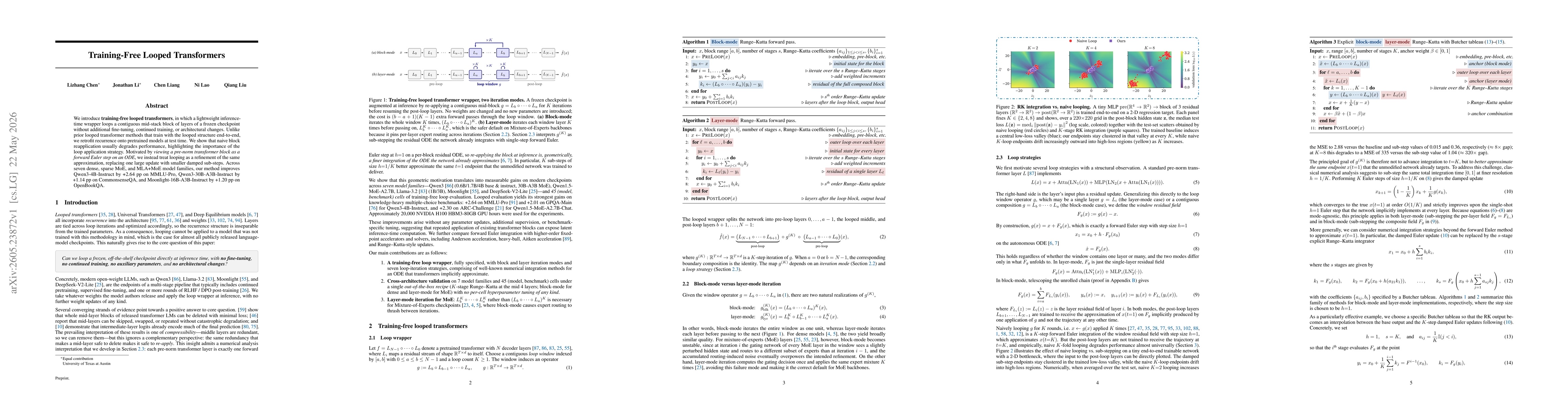
We introduce training-free looped transformers, in which a lightweight inference-time wrapper loops a contiguous mid-stack block of layers of a frozen checkpoint without additional fine-tuning, contin...