Academic Profile
Statistics
Similar Authors
Papers on arXiv
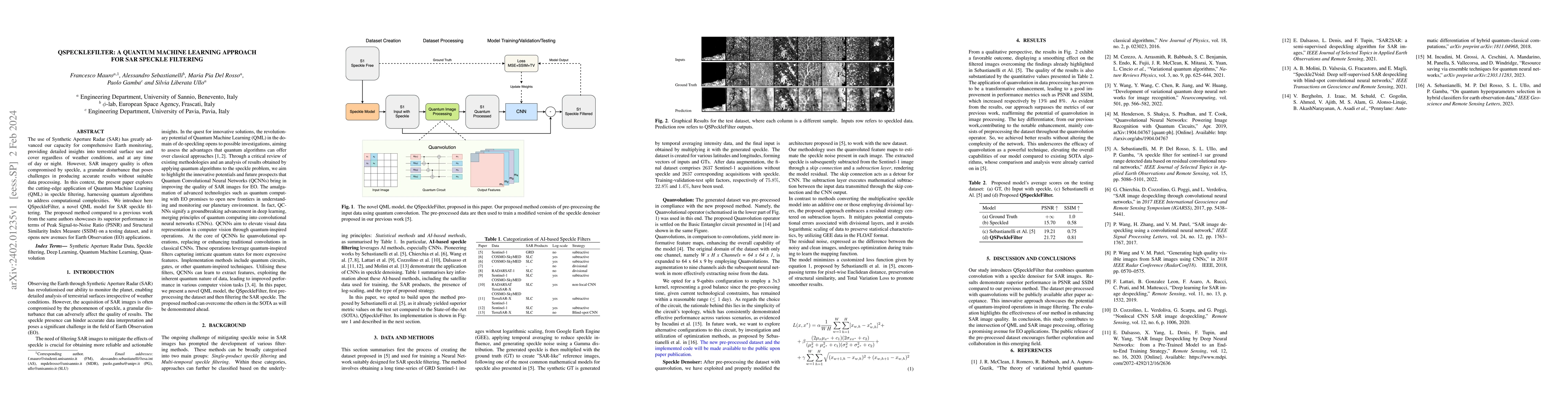
The use of Synthetic Aperture Radar (SAR) has greatly advanced our capacity for comprehensive Earth monitoring, providing detailed insights into terrestrial surface use and cover regardless of weath...
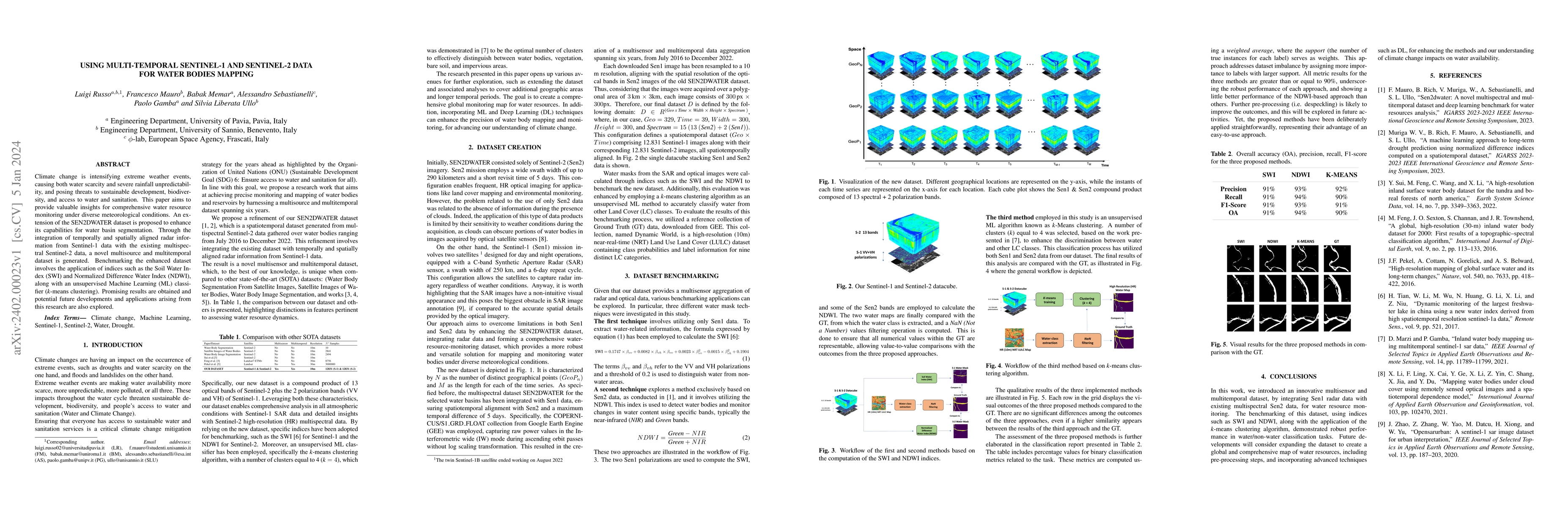
Climate change is intensifying extreme weather events, causing both water scarcity and severe rainfall unpredictability, and posing threats to sustainable development, biodiversity, and access to wa...
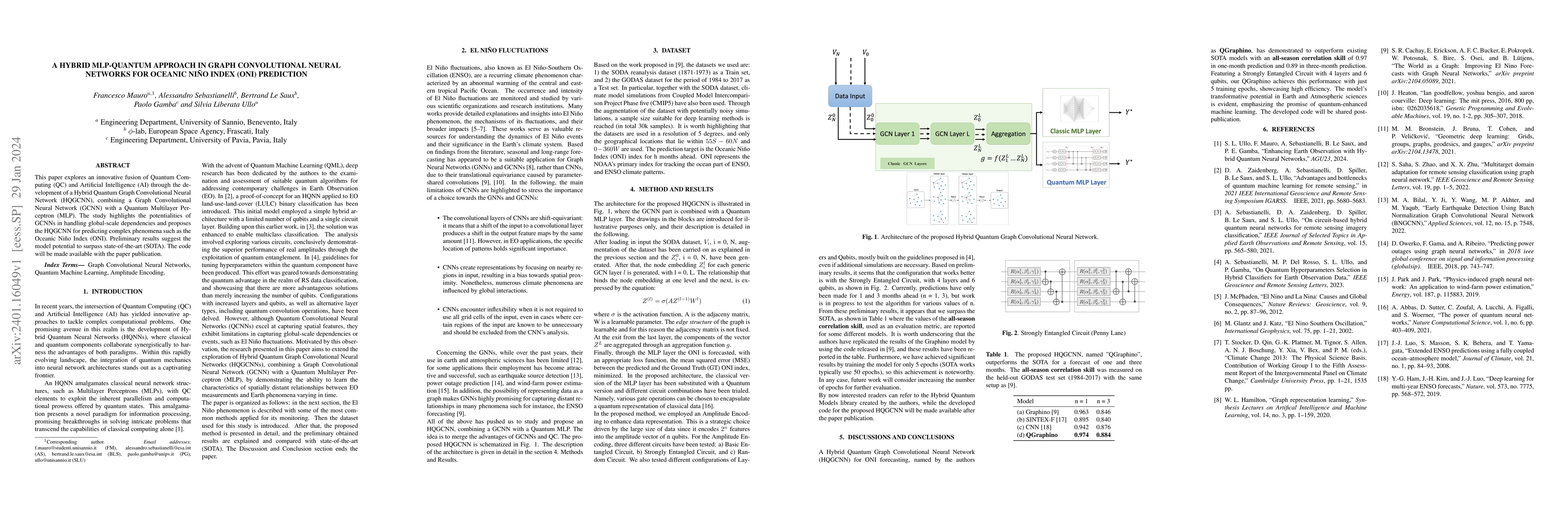
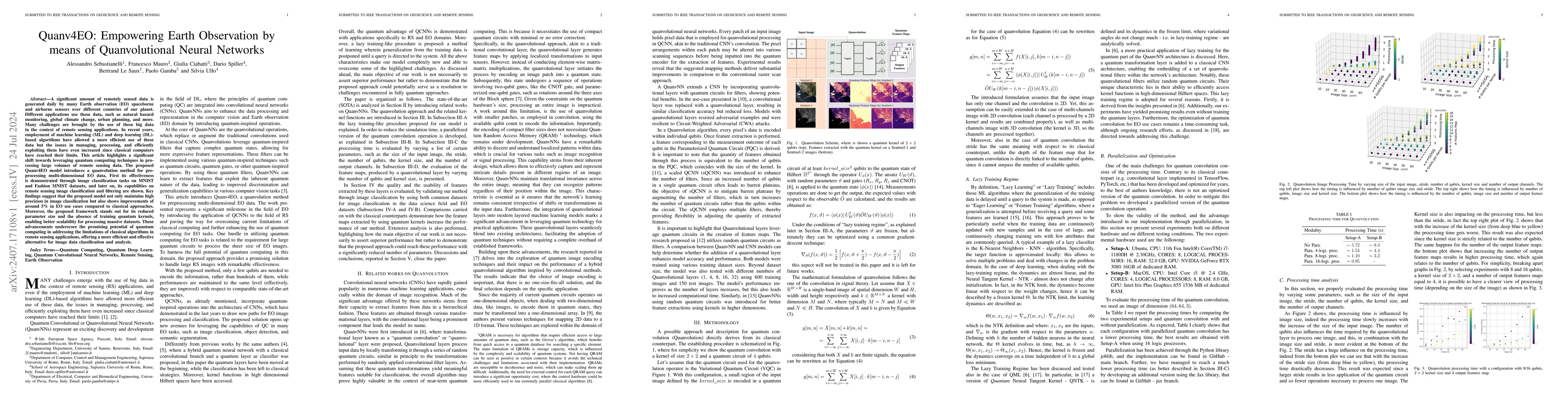
This paper explores an innovative fusion of Quantum Computing (QC) and Artificial Intelligence (AI) through the development of a Hybrid Quantum Graph Convolutional Neural Network (HQGCNN), combining...
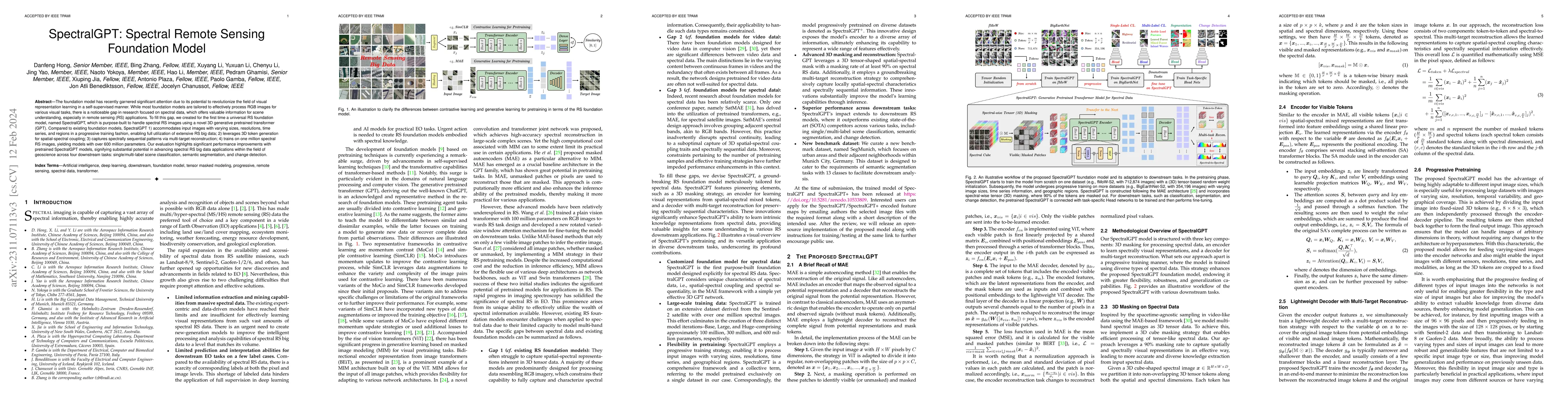
The foundation model has recently garnered significant attention due to its potential to revolutionize the field of visual representation learning in a self-supervised manner. While most foundation ...
In recent years, machine learning (ML) algorithms have become widespread in all the fields of remote sensing (RS) and earth observation (EO). This has allowed the rapid development of new procedures...
Extensive attention has been widely paid to enhance the spatial resolution of hyperspectral (HS) images with the aid of multispectral (MS) images in remote sensing. However, the ability in the fusio...
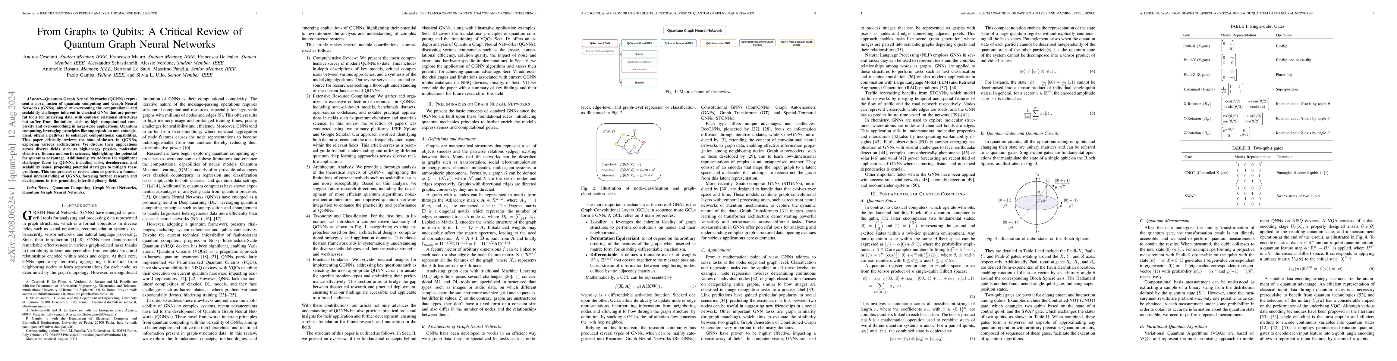
Quantum Graph Neural Networks (QGNNs) represent a novel fusion of quantum computing and Graph Neural Networks (GNNs), aimed at overcoming the computational and scalability challenges inherent in class...
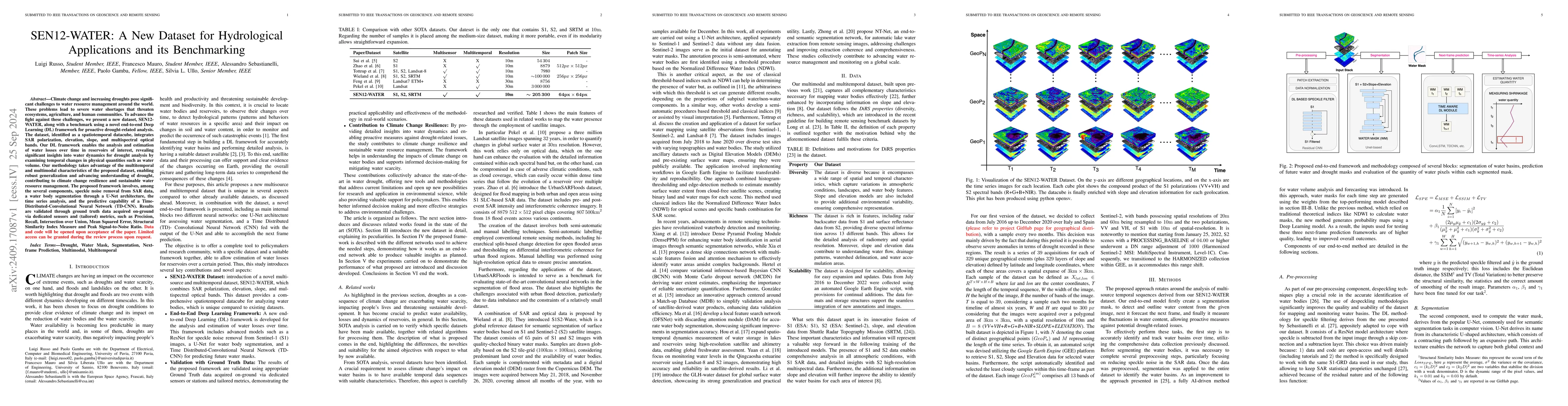
Climate change and increasing droughts pose significant challenges to water resource management around the world. These problems lead to severe water shortages that threaten ecosystems, agriculture, a...
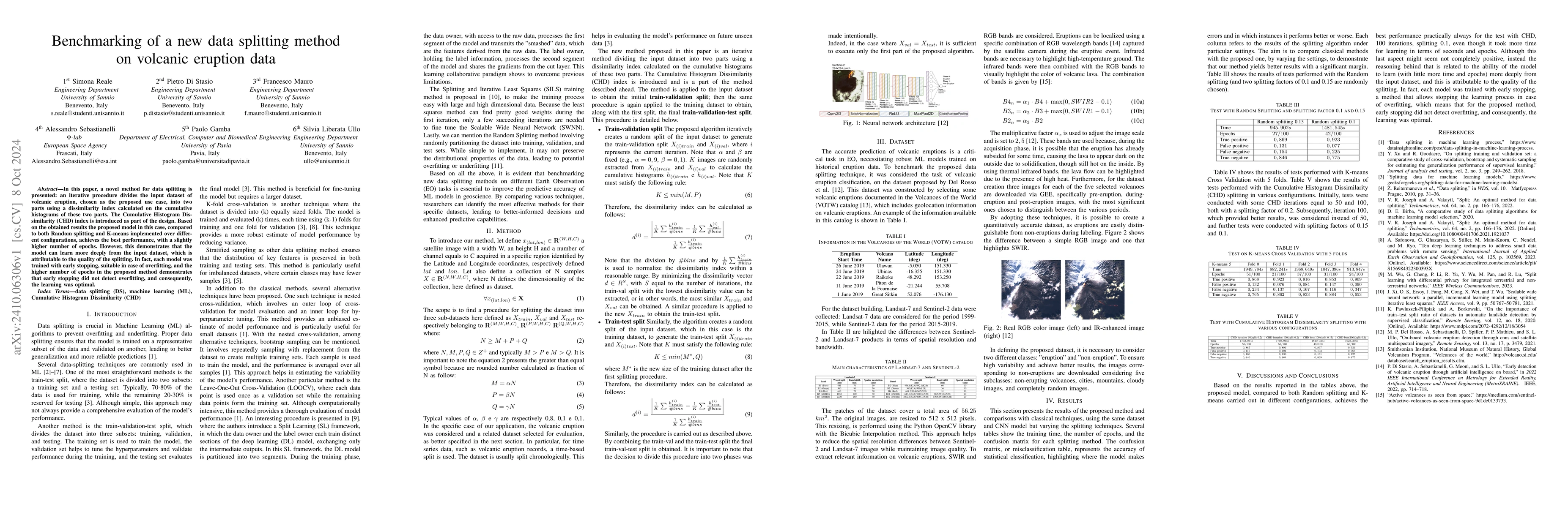
In this paper, a novel method for data splitting is presented: an iterative procedure divides the input dataset of volcanic eruption, chosen as the proposed use case, into two parts using a dissimilar...
A significant amount of remotely sensed data is generated daily by many Earth observation (EO) spaceborne and airborne sensors over different countries of our planet. Different applications use those ...
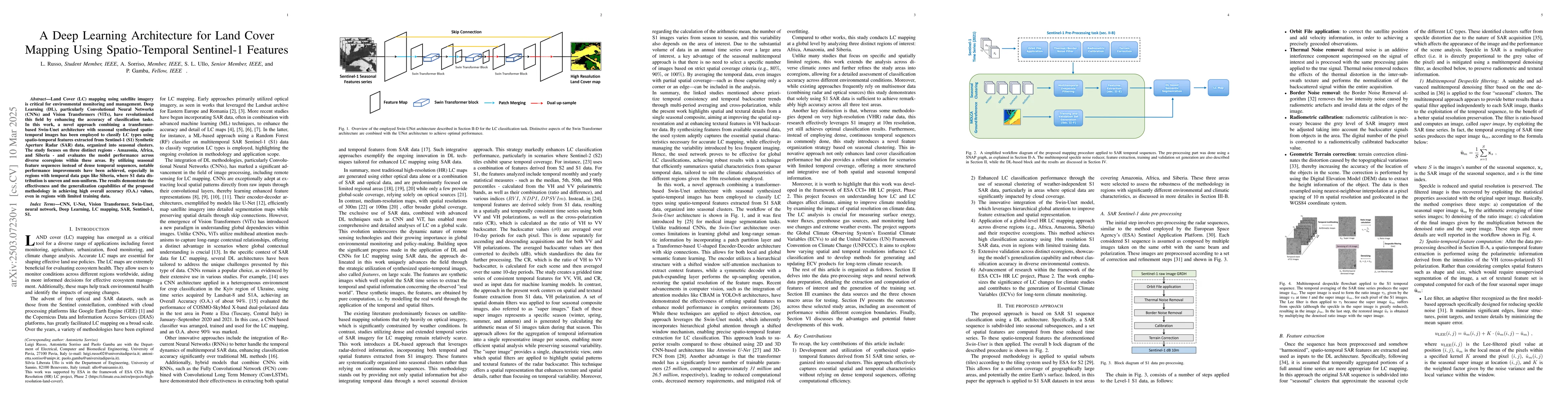
Land Cover (LC) mapping using satellite imagery is critical for environmental monitoring and management. Deep Learning (DL), particularly Convolutional Neural Networks (CNNs) and Vision Transformers (...
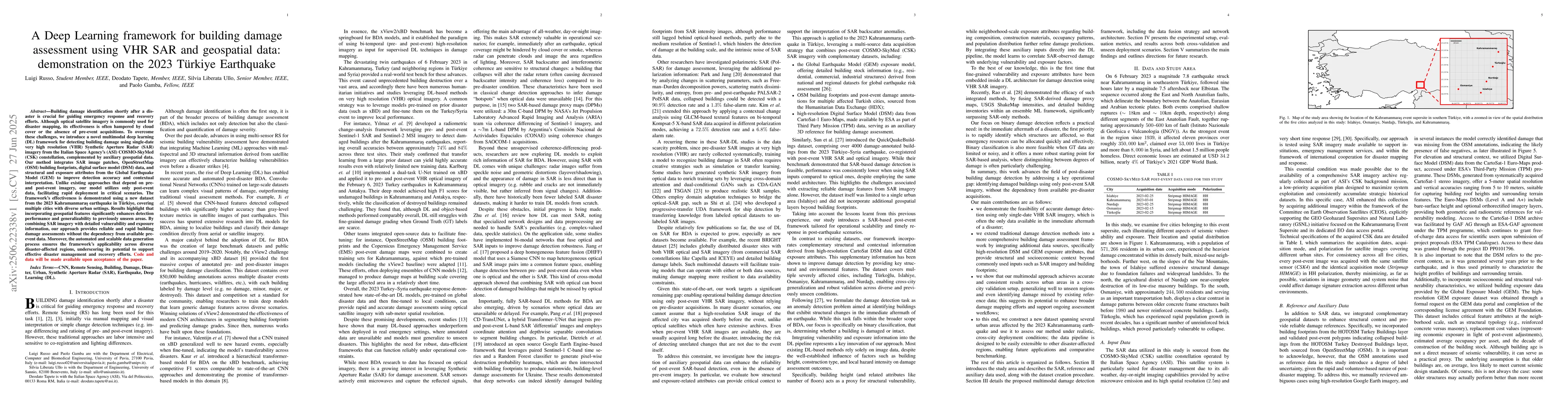
Building damage identification shortly after a disaster is crucial for guiding emergency response and recovery efforts. Although optical satellite imagery is commonly used for disaster mapping, its ef...
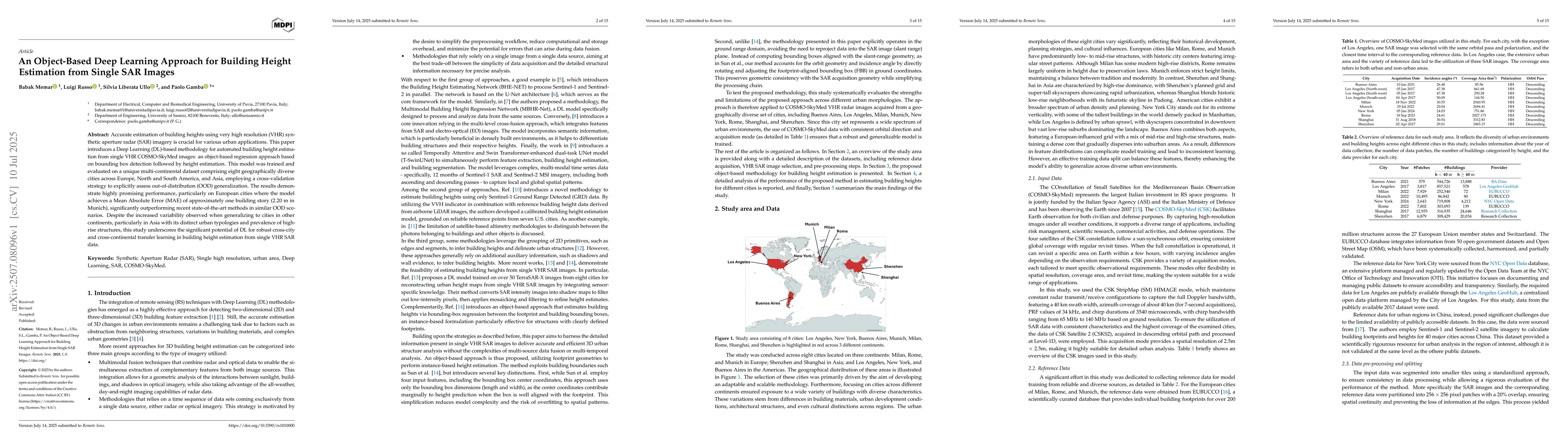
Accurate estimation of building heights using very high resolution (VHR) synthetic aperture radar (SAR) imagery is crucial for various urban applications. This paper introduces a Deep Learning (DL)-ba...
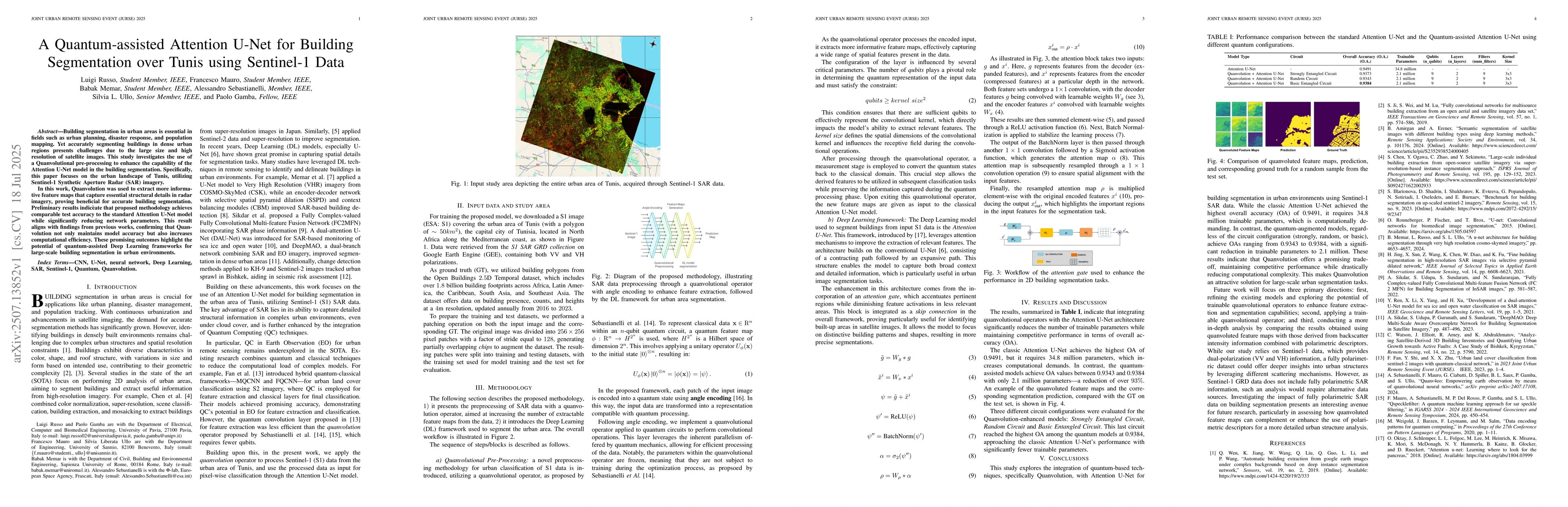
Building segmentation in urban areas is essential in fields such as urban planning, disaster response, and population mapping. Yet accurately segmenting buildings in dense urban regions presents chall...
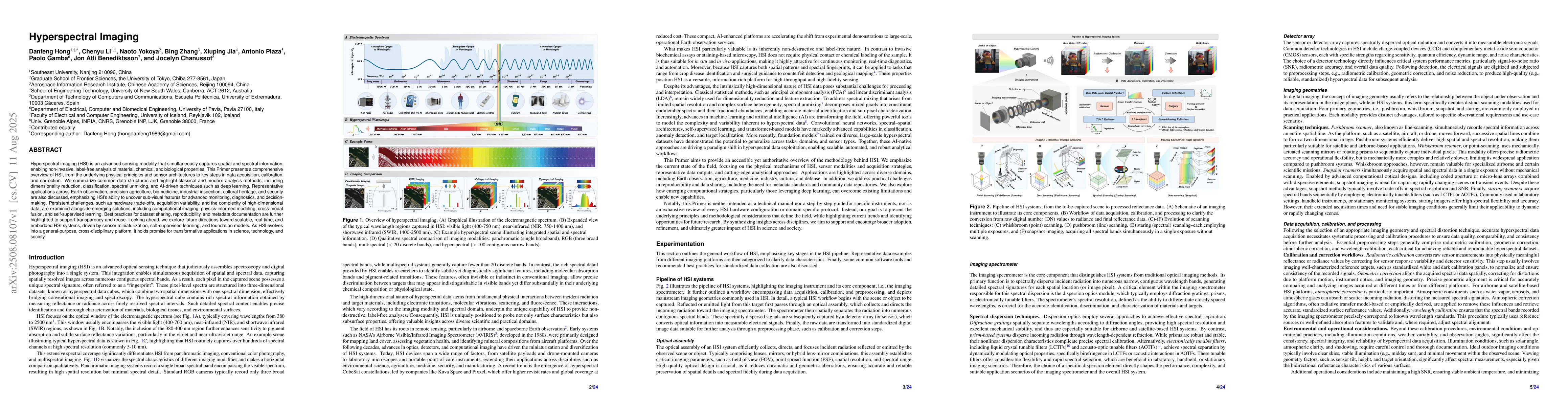
Hyperspectral imaging (HSI) is an advanced sensing modality that simultaneously captures spatial and spectral information, enabling non-invasive, label-free analysis of material, chemical, and biologi...

The rapid adoption of diffusion models (DMs) in the Earth Observation (EO) domain has unlocked new generative capabilities aimed at producing new samples, whose statistical properties closely match re...
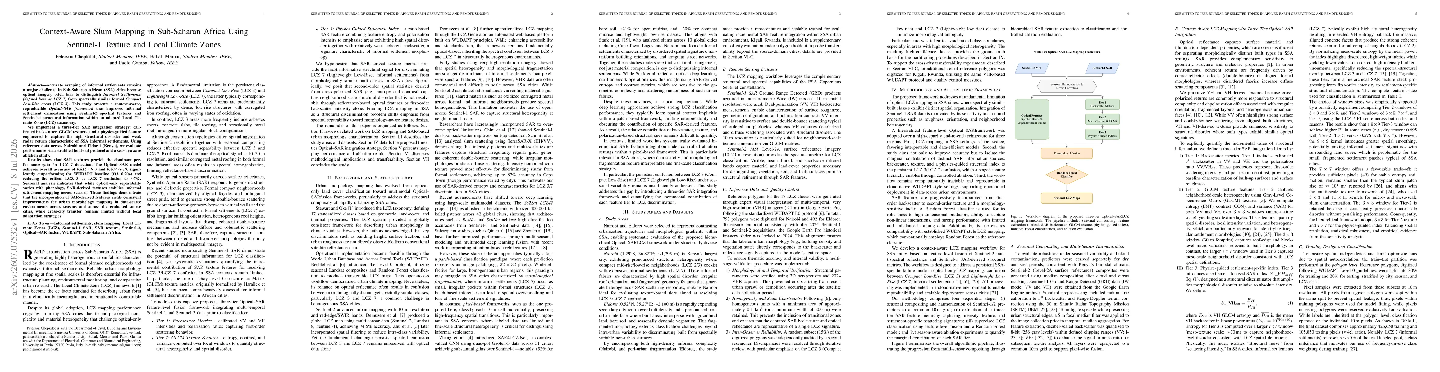
Accurate mapping of informal settlements remains a major challenge in Sub-Saharan African (SSA) cities because optical imagery often fails to distinguish Informal Settlements (defined here as LCZ 7) f...