Academic Profile
Statistics
Similar Authors
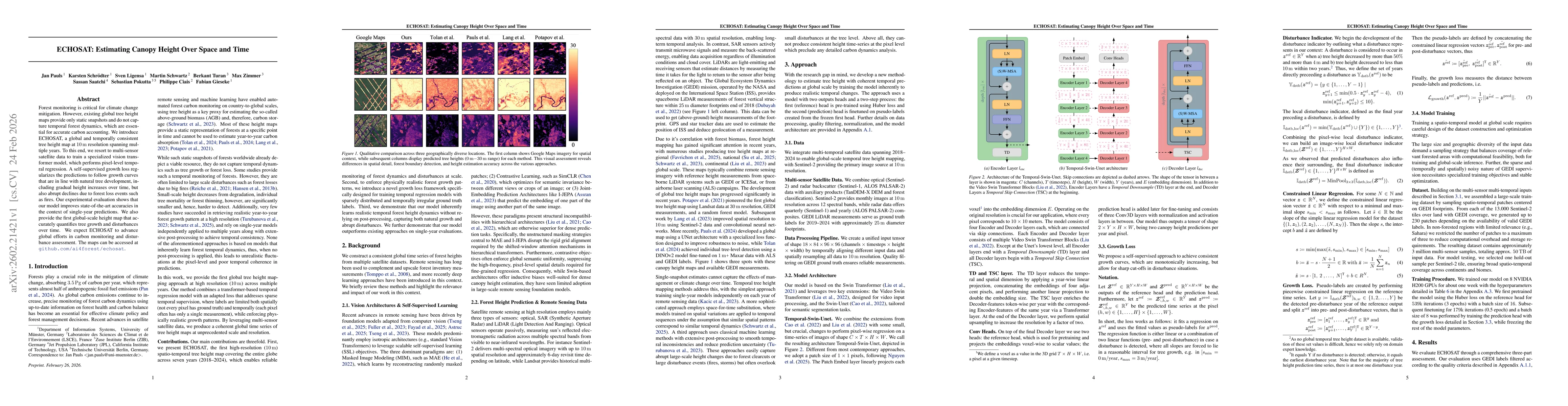
Papers on arXiv
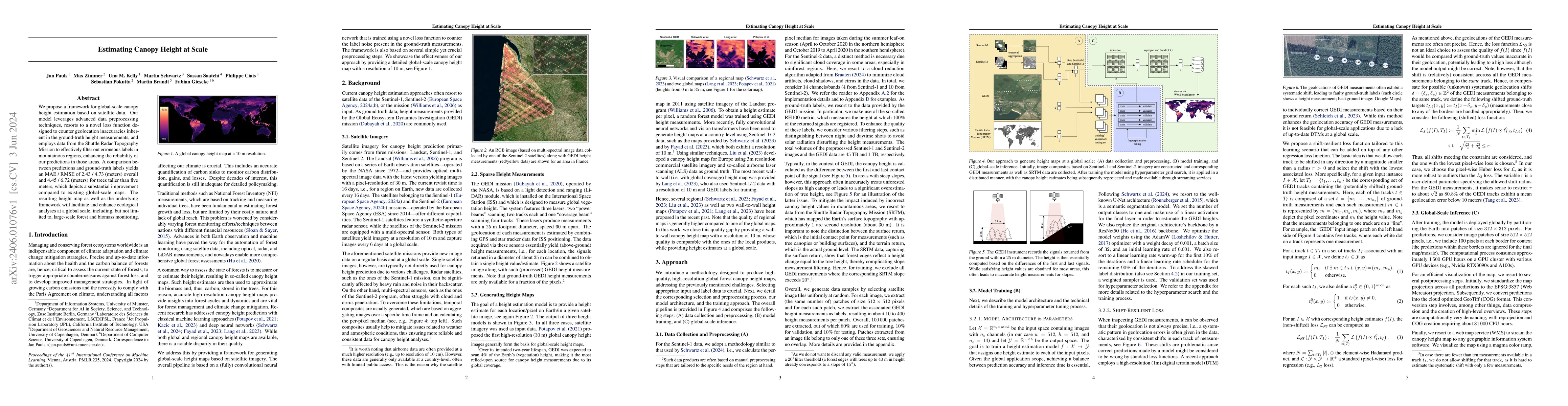
We propose a framework for global-scale canopy height estimation based on satellite data. Our model leverages advanced data preprocessing techniques, resorts to a novel loss function designed to cou...
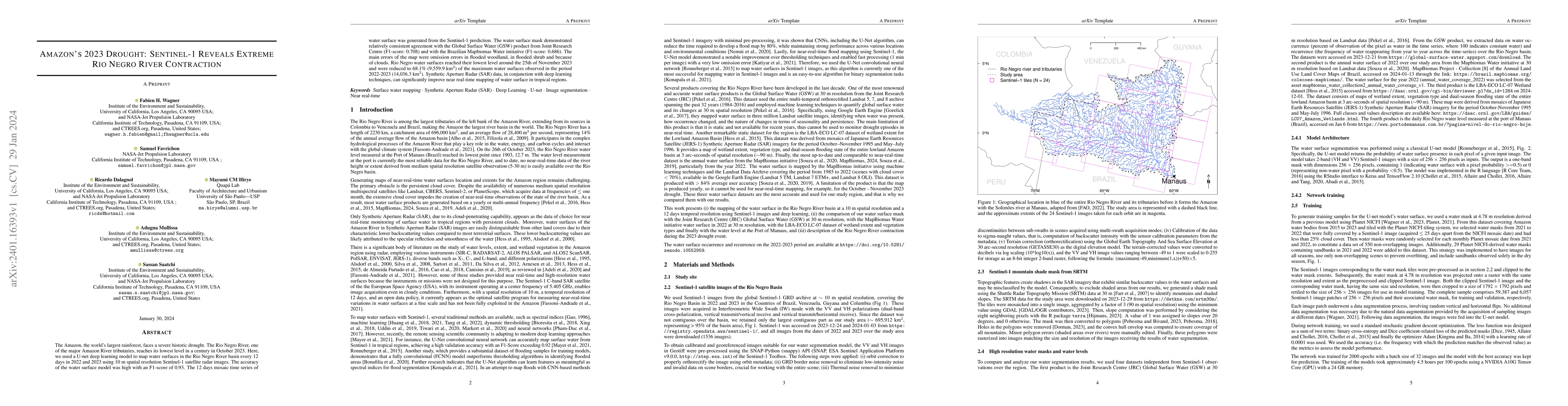
The Amazon, the world's largest rainforest, faces a severe historic drought. The Rio Negro River, one of the major Amazon River tributaries, reaches its lowest level in a century in October 2023. He...
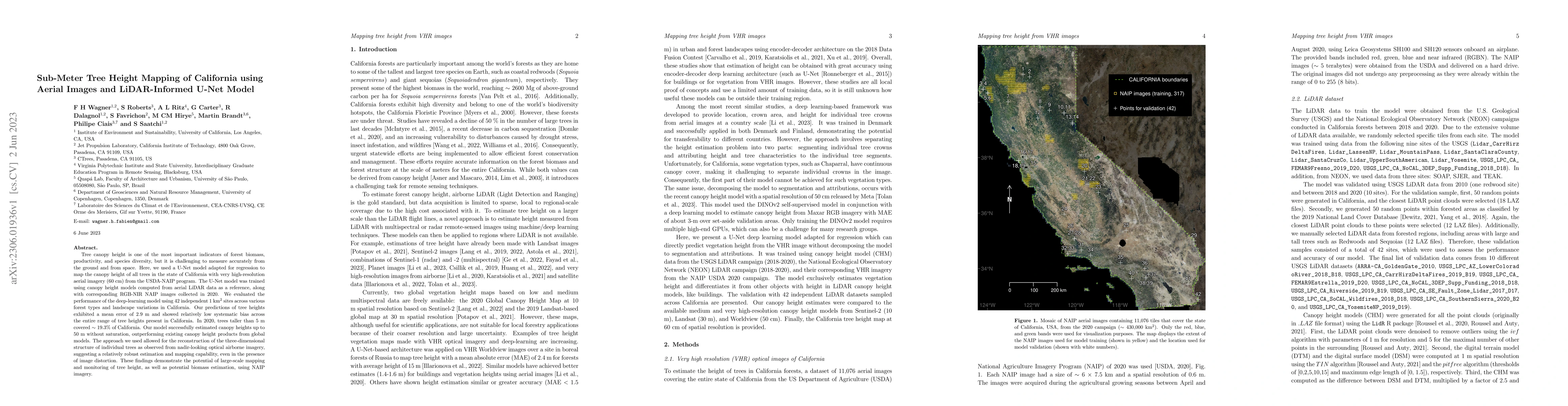
Tree canopy height is one of the most important indicators of forest biomass, productivity, and species diversity, but it is challenging to measure accurately from the ground and from space. Here, w...
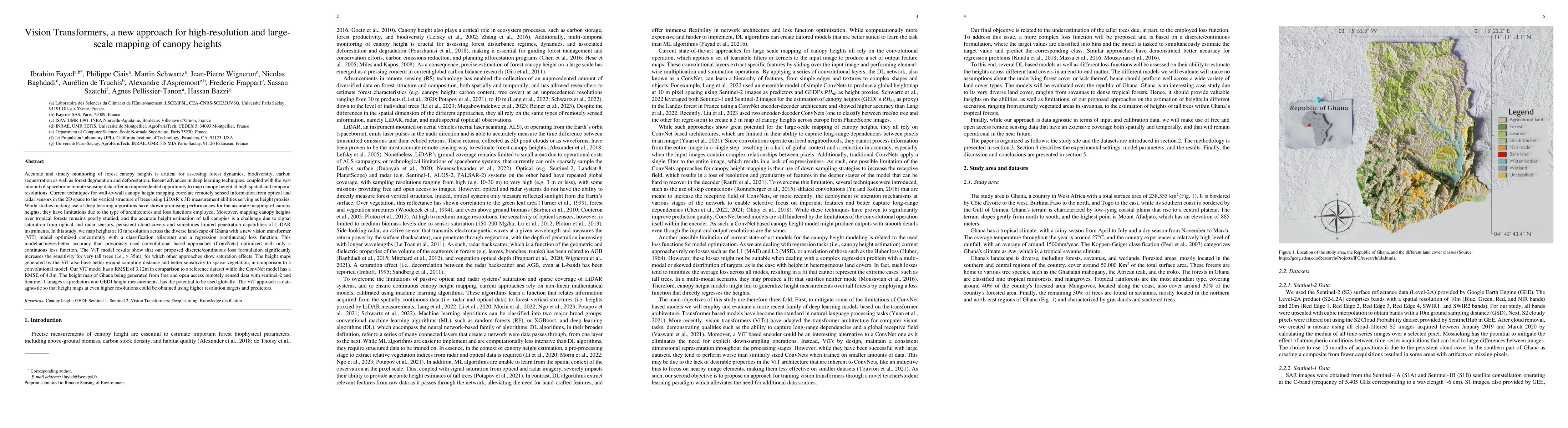
Accurate and timely monitoring of forest canopy heights is critical for assessing forest dynamics, biodiversity, carbon sequestration as well as forest degradation and deforestation. Recent advances...
Monitoring changes in tree cover for rapid assessment of deforestation is considered the critical component of any climate mitigation policy for reducing carbon. Here, we map tropical tree cover and...
Deep learning self-supervised algorithms that can segment an image in a fixed number of hard labels such as the k-means algorithm and relying only on deep learning techniques are still lacking. Here...
Tropical forests play an important role in regulating the global carbon cycle and are crucial for maintaining the tropical forest biodiversity. Therefore, there is an urgent need to map the extent of ...
Tree canopy height is one of the most important indicators of forest biomass, productivity, and ecosystem structure, but it is challenging to measure accurately from the ground and from space. Here, w...
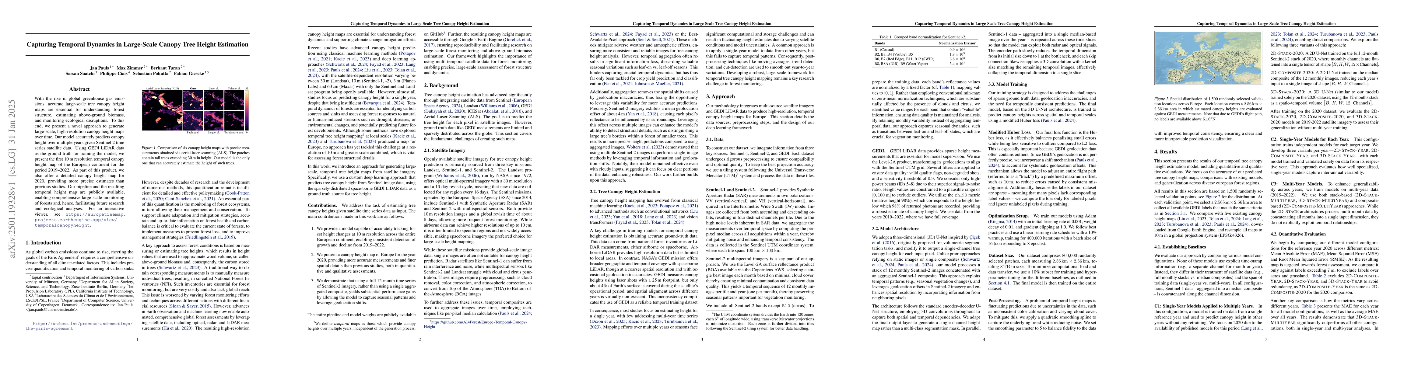
With the rise in global greenhouse gas emissions, accurate large-scale tree canopy height maps are essential for understanding forest structure, estimating above-ground biomass, and monitoring ecologi...
Forest monitoring is critical for climate change mitigation. However, existing global tree height maps provide only static snapshots and do not capture temporal forest dynamics, which are essential fo...