Academic Profile
Statistics
Similar Authors
Papers on arXiv
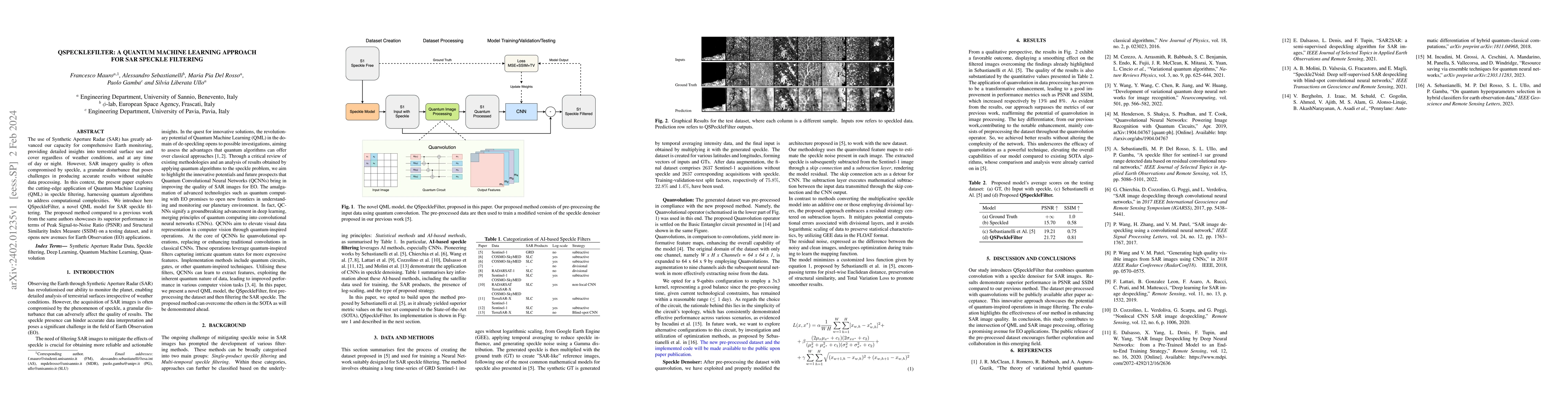
The use of Synthetic Aperture Radar (SAR) has greatly advanced our capacity for comprehensive Earth monitoring, providing detailed insights into terrestrial surface use and cover regardless of weath...
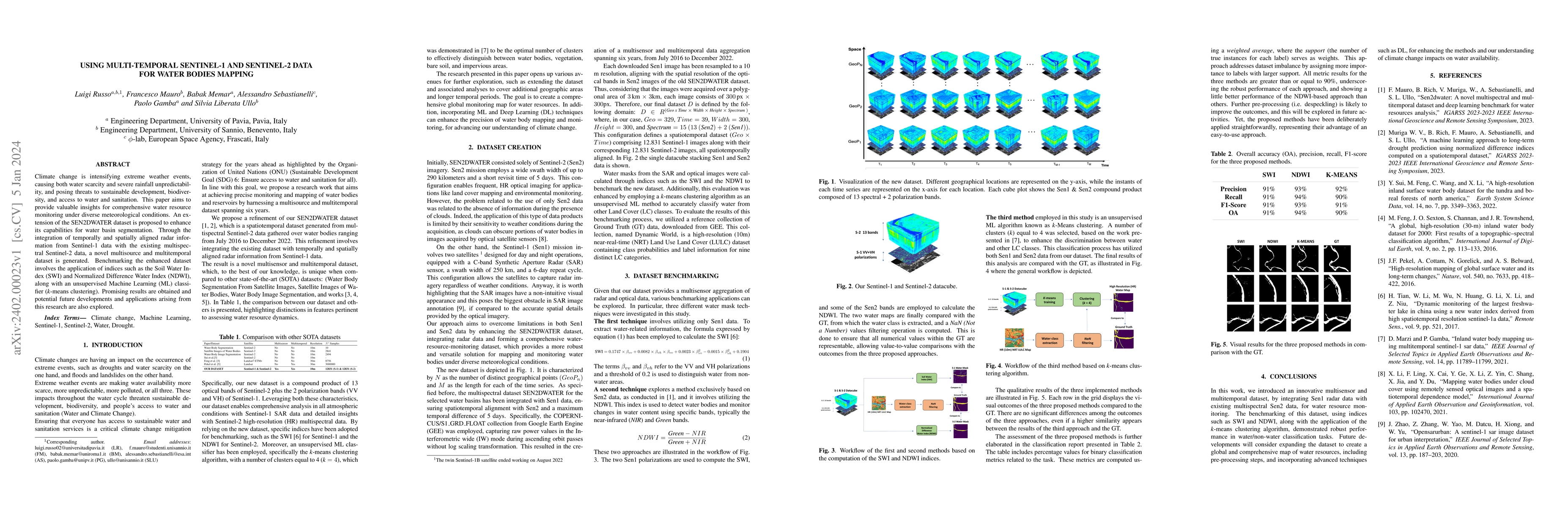
Climate change is intensifying extreme weather events, causing both water scarcity and severe rainfall unpredictability, and posing threats to sustainable development, biodiversity, and access to wa...
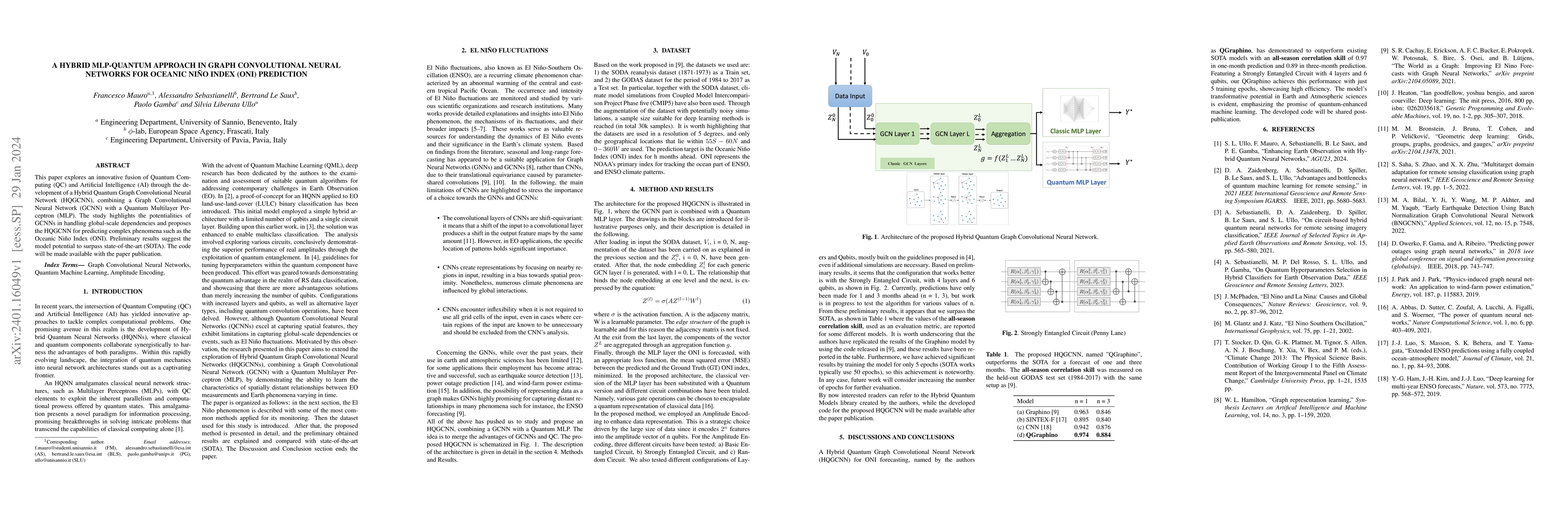
This paper explores an innovative fusion of Quantum Computing (QC) and Artificial Intelligence (AI) through the development of a Hybrid Quantum Graph Convolutional Neural Network (HQGCNN), combining...
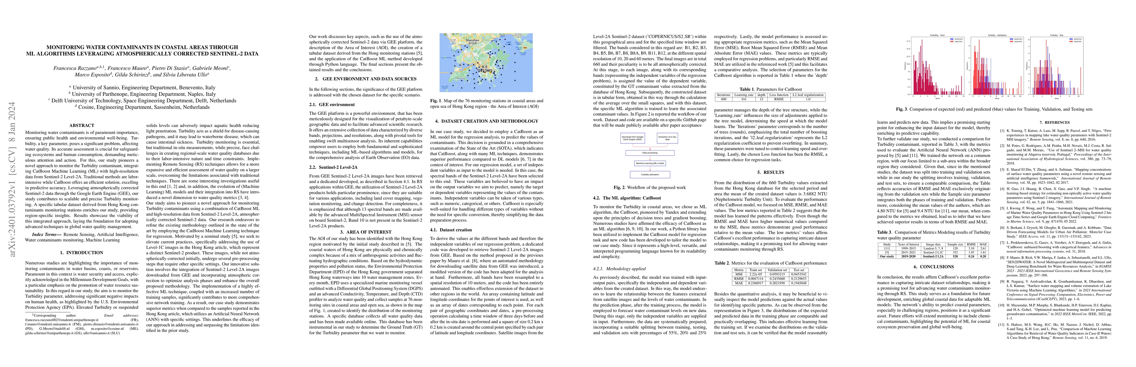
Monitoring water contaminants is of paramount importance, ensuring public health and environmental well-being. Turbidity, a key parameter, poses a significant problem, affecting water quality. Its a...
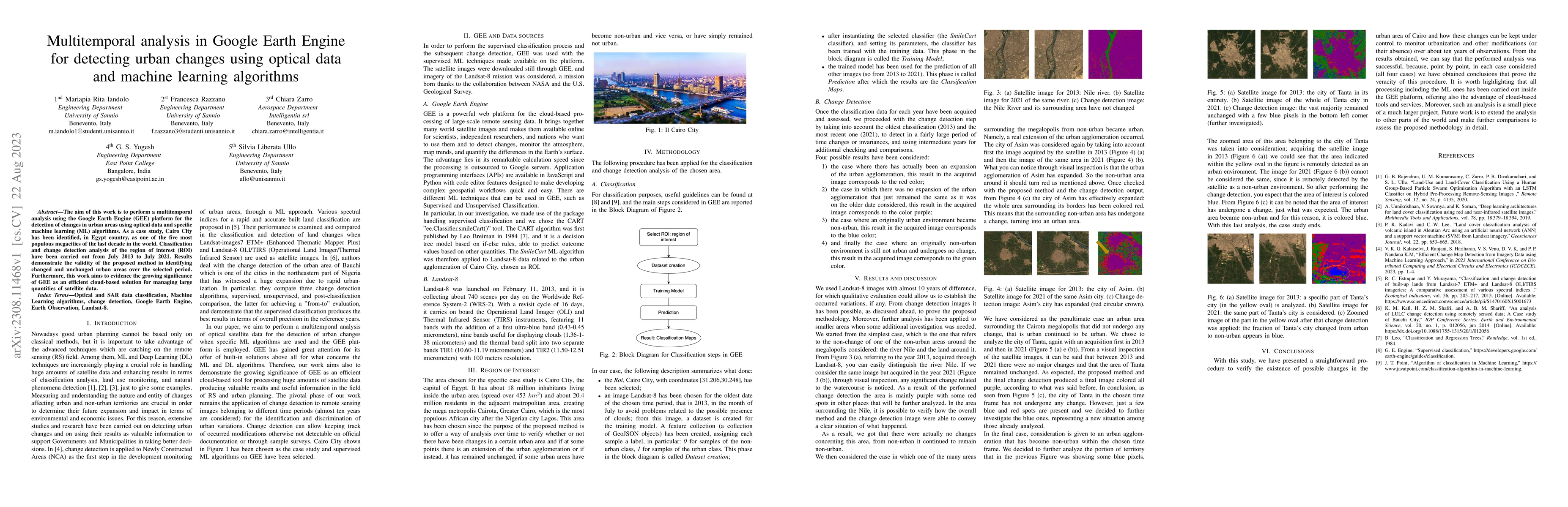
The aim of this work is to perform a multitemporal analysis using the Google Earth Engine (GEE) platform for the detection of changes in urban areas using optical data and specific machine learning ...
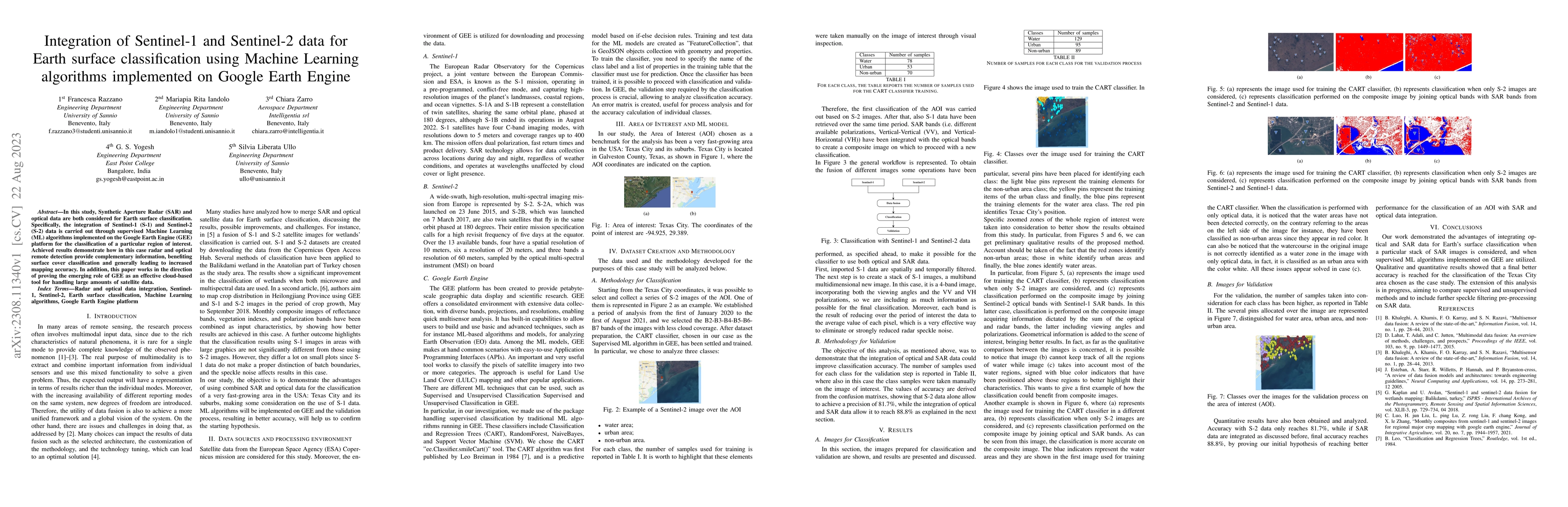
In this study, Synthetic Aperture Radar (SAR) and optical data are both considered for Earth surface classification. Specifically, the integration of Sentinel-1 (S-1) and Sentinel-2 (S-2) data is ca...
This study aims to analyse the Nitrogen Dioxide (NO2) pollution in the Emilia Romagna Region (Northern Italy) during 2019, with the help of satellite retrievals from the Sentinel-5P mission of the E...
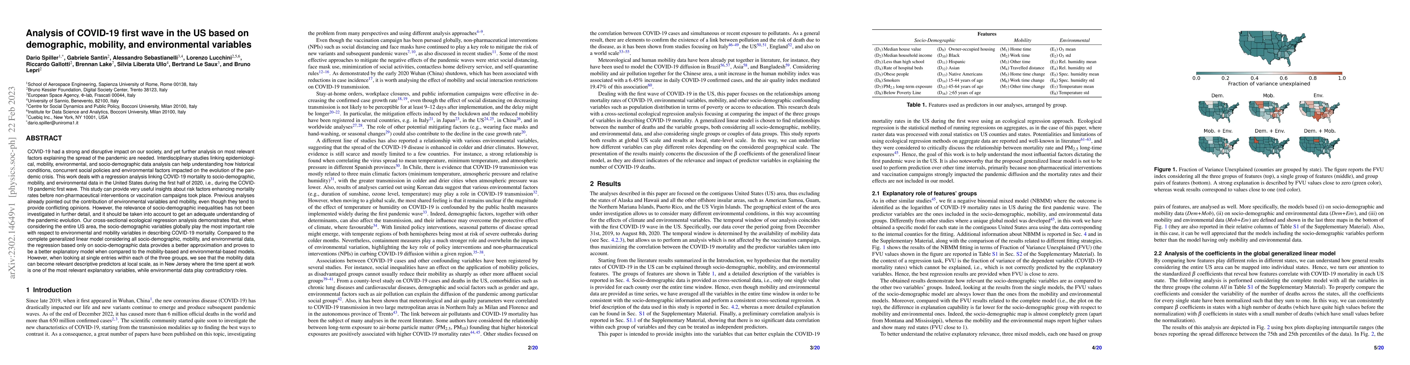
COVID-19 had a strong and disruptive impact on our society, and yet further analyses on most relevant factors explaining the spread of the pandemic are needed. Interdisciplinary studies linking epid...
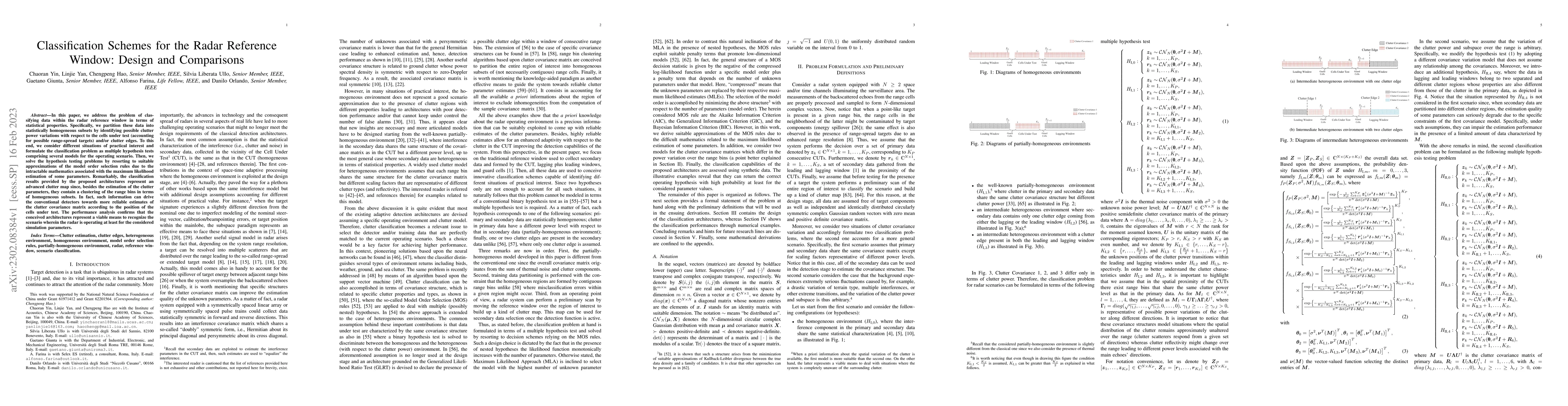
In this paper, we address the problem of classifying data within the radar reference window in terms of statistical properties. Specifically, we partition these data into statistically homogeneous s...
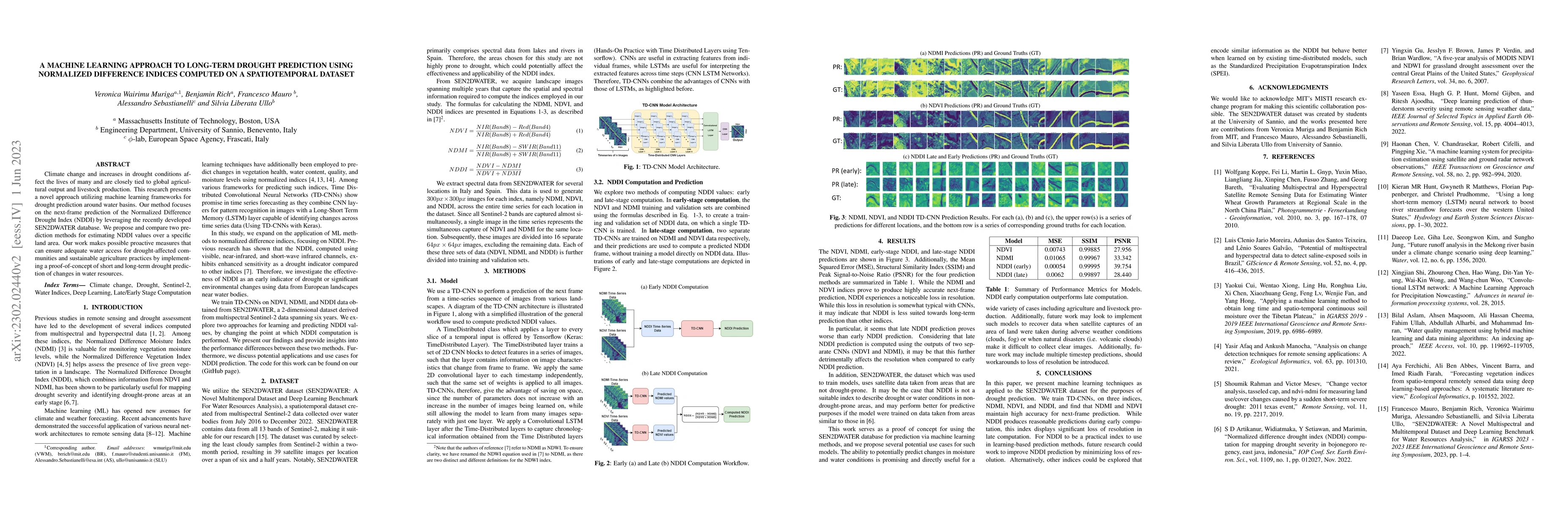
Climate change and increases in drought conditions affect the lives of many and are closely tied to global agricultural output and livestock production. This research presents a novel approach utili...
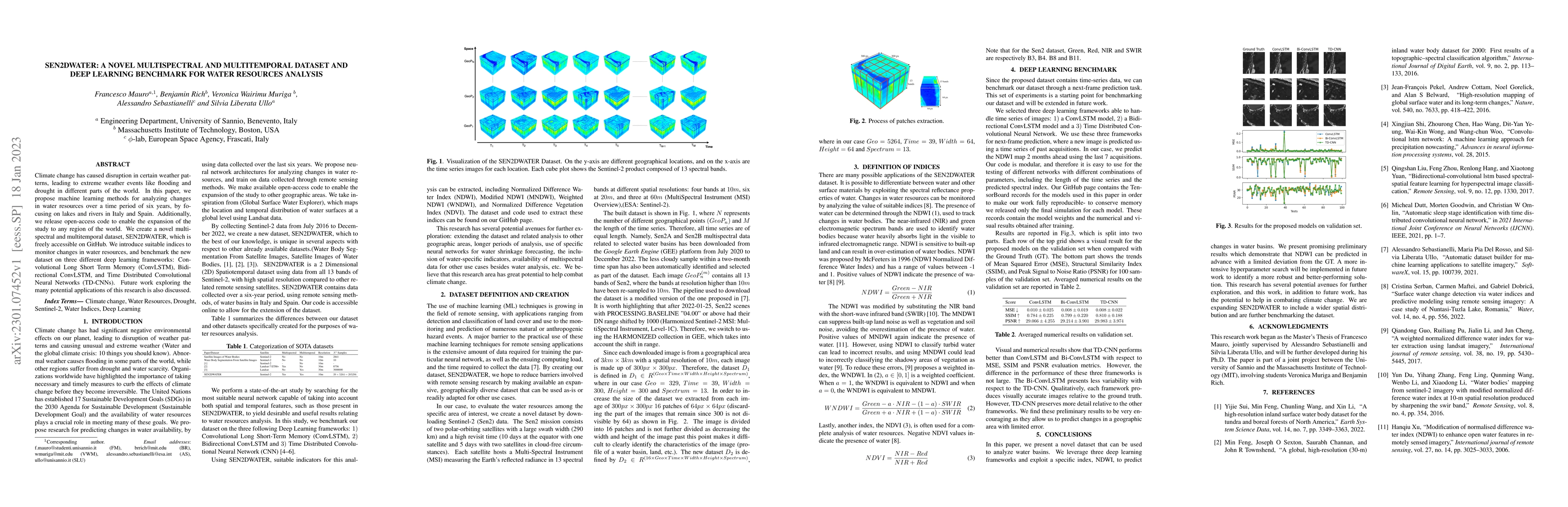
Climate change has caused disruption in certain weather patterns, leading to extreme weather events like flooding and drought in different parts of the world. In this paper, we propose machine learn...
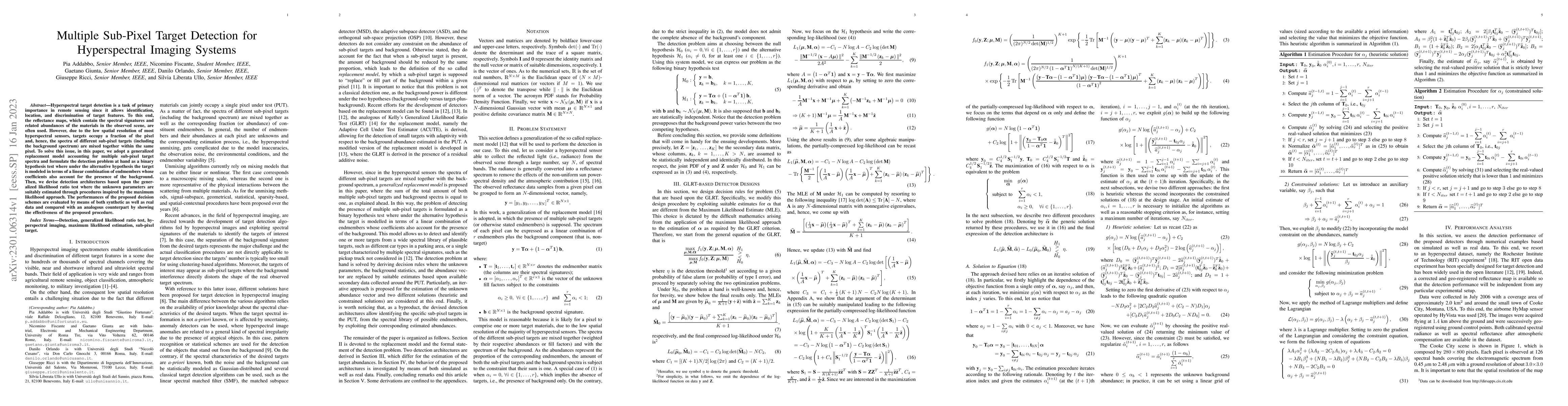
Hyperspectral target detection is a task of primary importance in remote sensing since it allows identification, location, and discrimination of target features. To this end, the reflectance maps, w...
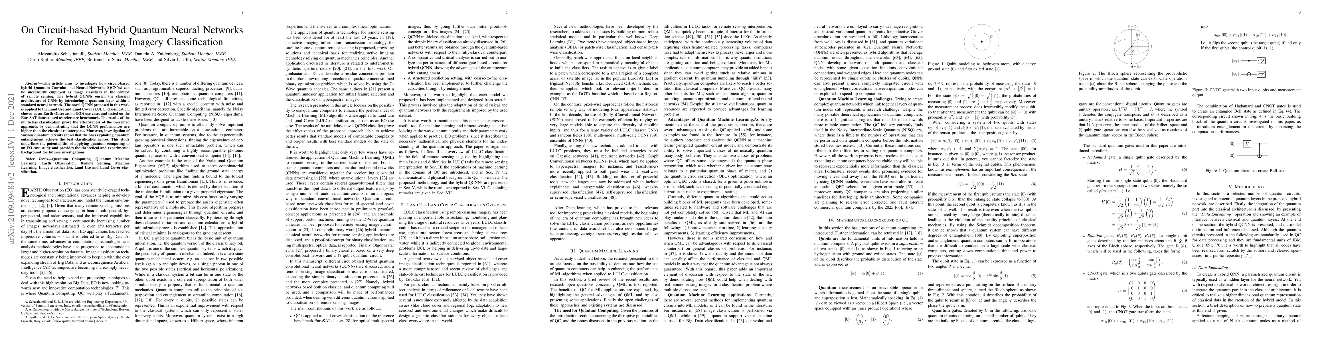
This article aims to investigate how circuit-based hybrid Quantum Convolutional Neural Networks (QCNNs) can be successfully employed as image classifiers in the context of remote sensing. The hybrid...
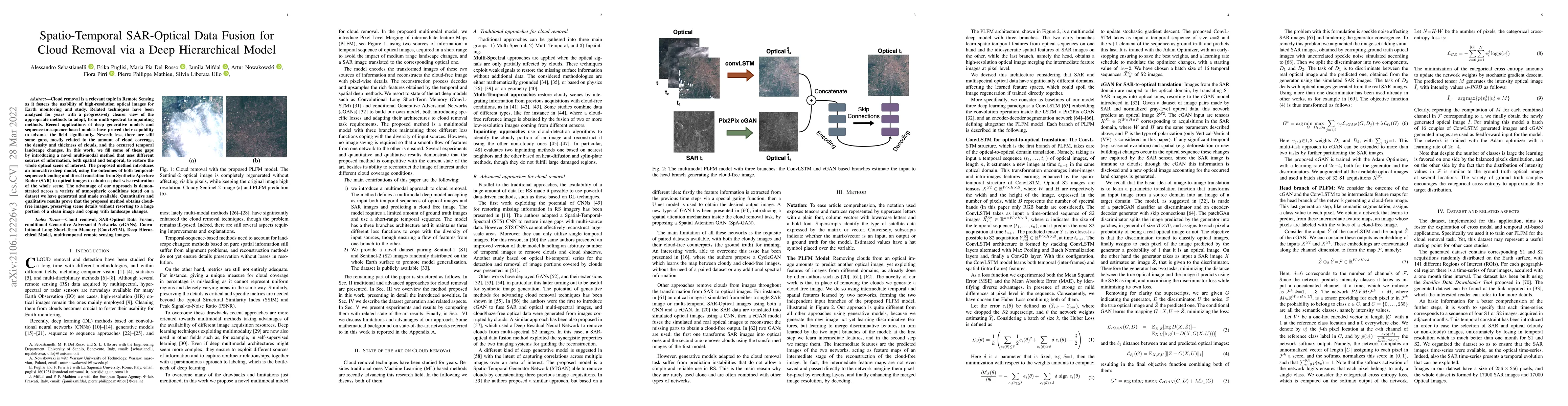
Cloud removal is a relevant topic in Remote Sensing as it fosters the usability of high-resolution optical images for Earth monitoring and study. Related techniques have been analyzed for years with...
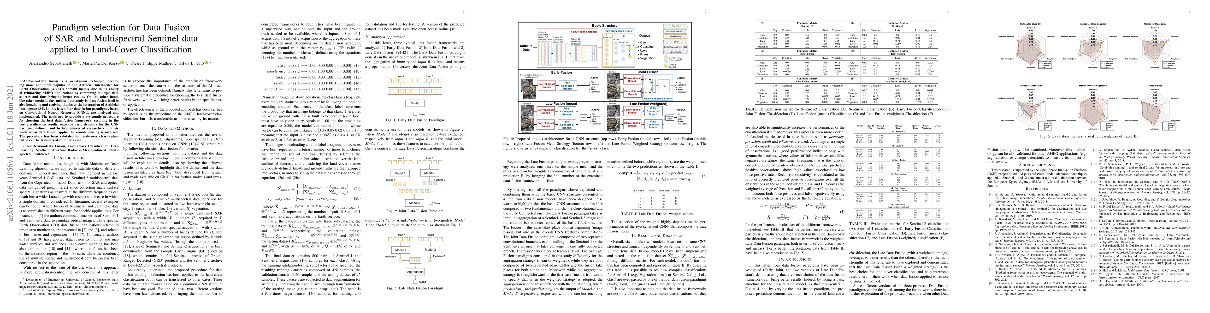
Data fusion is a well-known technique, becoming more and more popular in the Artificial Intelligence for Earth Observation (AI4EO) domain mainly due to its ability of reinforcing AI4EO applications ...
In recent years, machine learning (ML) algorithms have become widespread in all the fields of remote sensing (RS) and earth observation (EO). This has allowed the rapid development of new procedures...
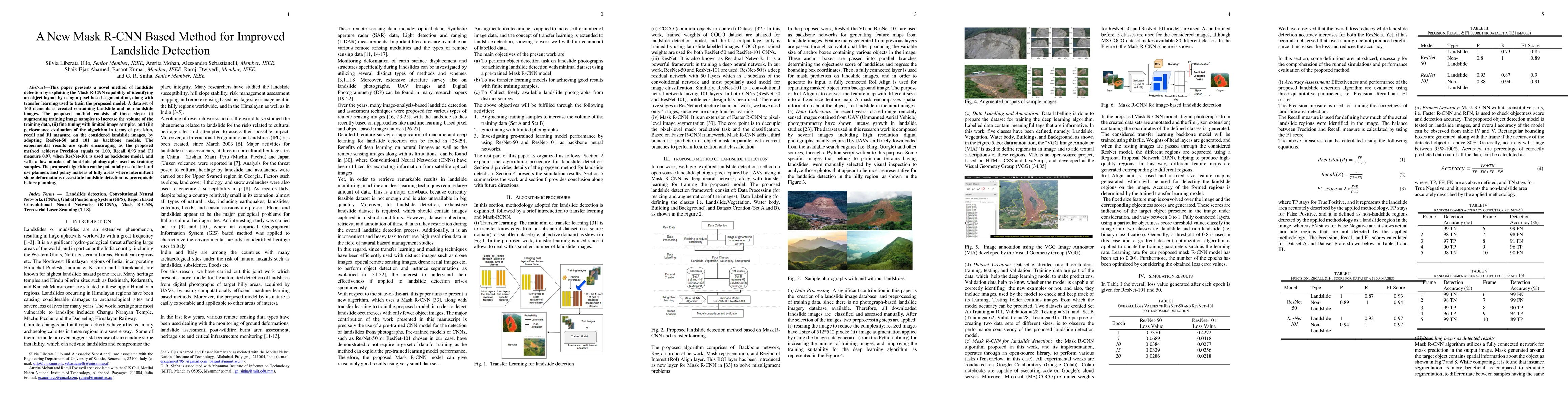
This paper presents a novel method of landslide detection by exploiting the Mask R-CNN capability of identifying an object layout by using a pixel-based segmentation, along with transfer learning us...
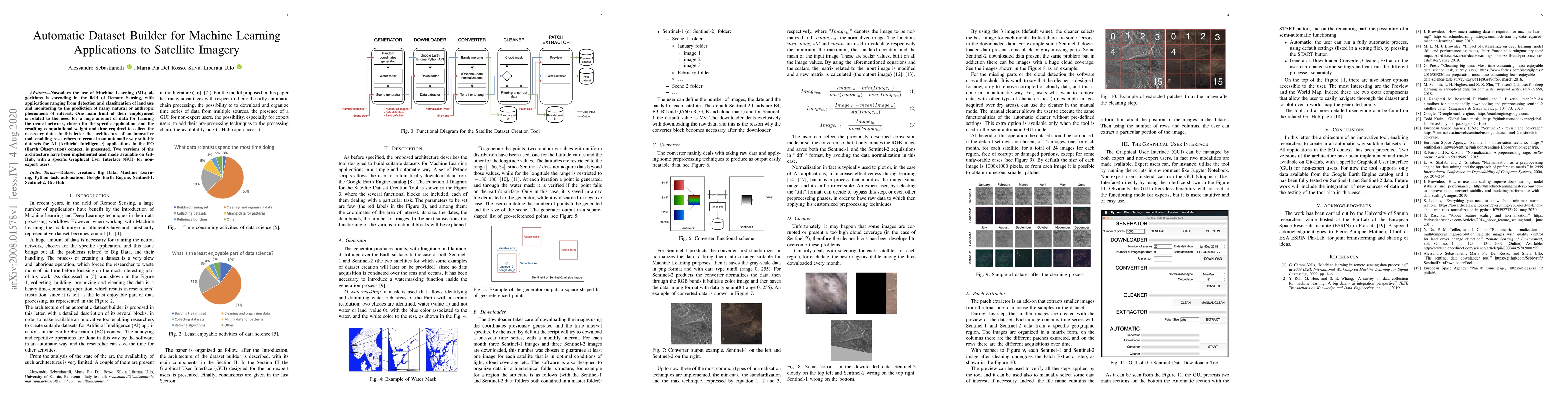
Nowadays the use of Machine Learning (ML) algorithms is spreading in the field of Remote Sensing, with applications ranging from detection and classification of land use and monitoring to the predic...
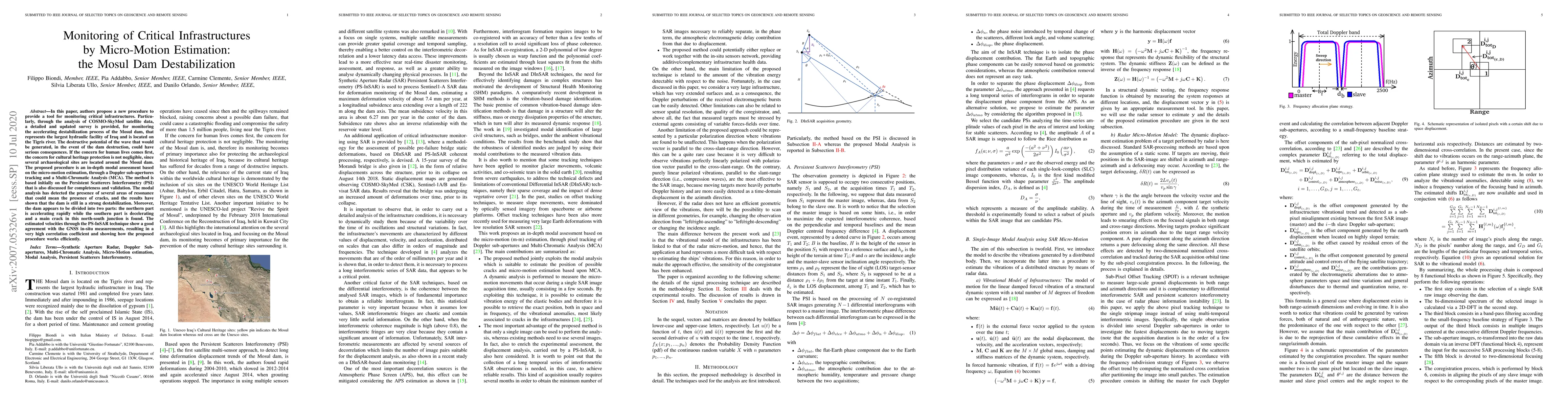
In this paper, authors propose a new procedure to provide a tool for monitoring critical infrastructures. Particularly, through the analysis of COSMO-SkyMed satellite data, a detailed and updated su...
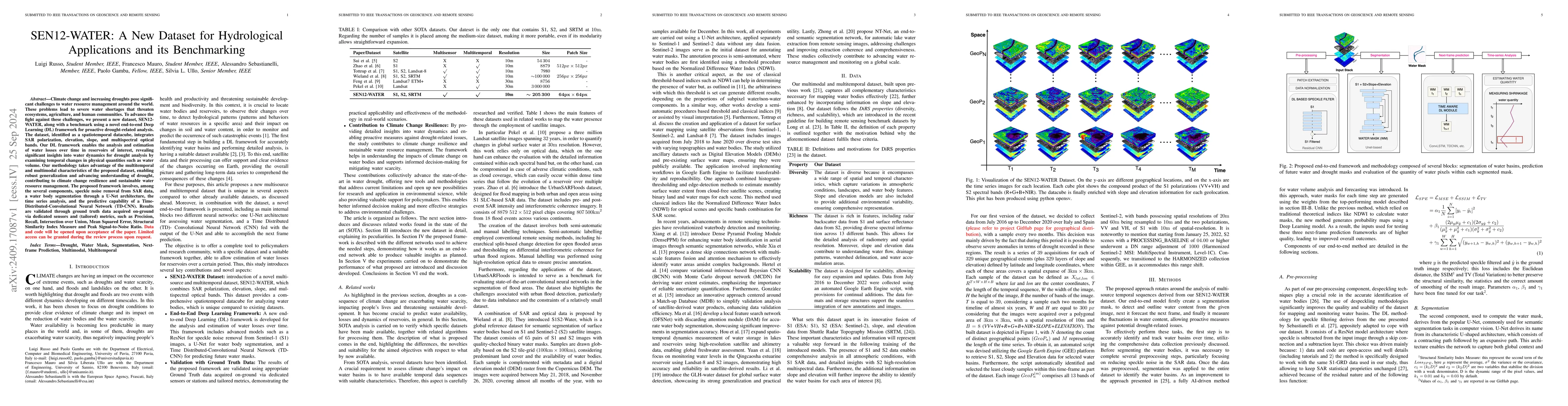
Climate change and increasing droughts pose significant challenges to water resource management around the world. These problems lead to severe water shortages that threaten ecosystems, agriculture, a...
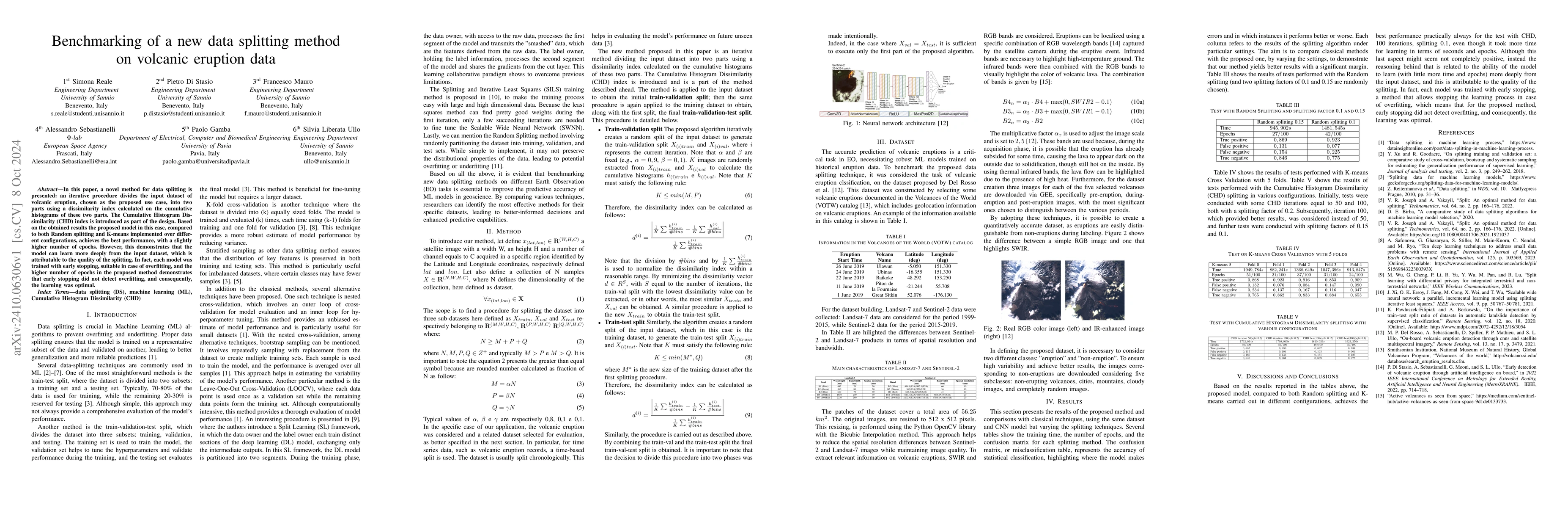
In this paper, a novel method for data splitting is presented: an iterative procedure divides the input dataset of volcanic eruption, chosen as the proposed use case, into two parts using a dissimilar...
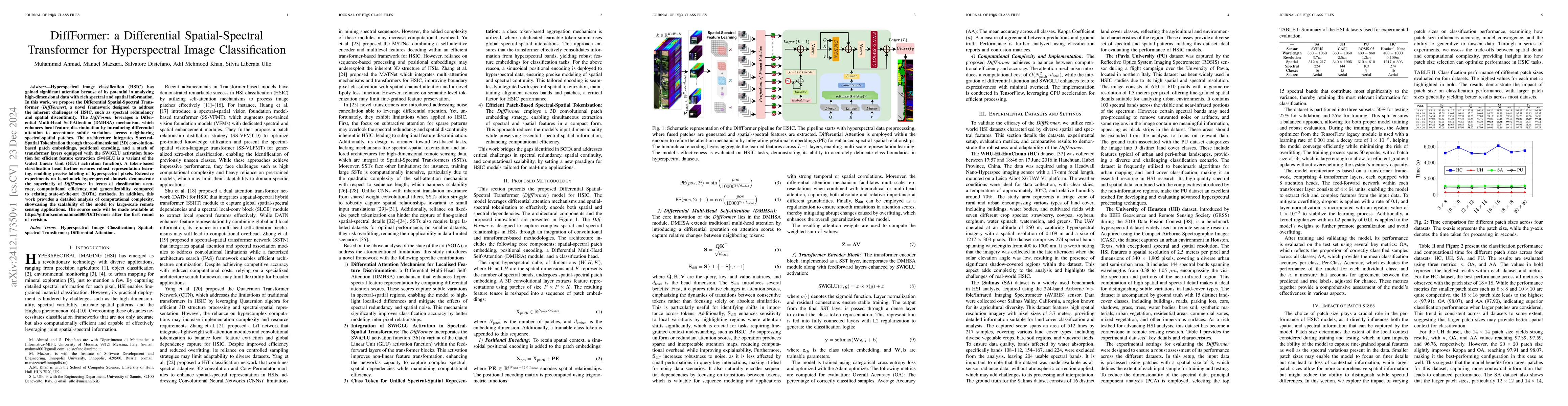
Hyperspectral image classification (HSIC) has gained significant attention because of its potential in analyzing high-dimensional data with rich spectral and spatial information. In this work, we prop...
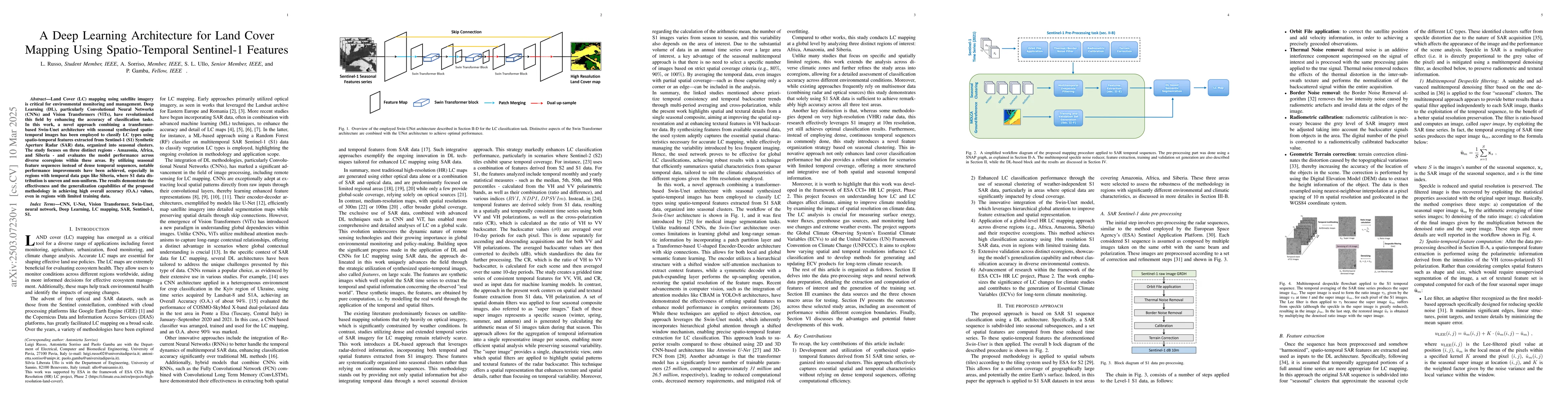
Land Cover (LC) mapping using satellite imagery is critical for environmental monitoring and management. Deep Learning (DL), particularly Convolutional Neural Networks (CNNs) and Vision Transformers (...
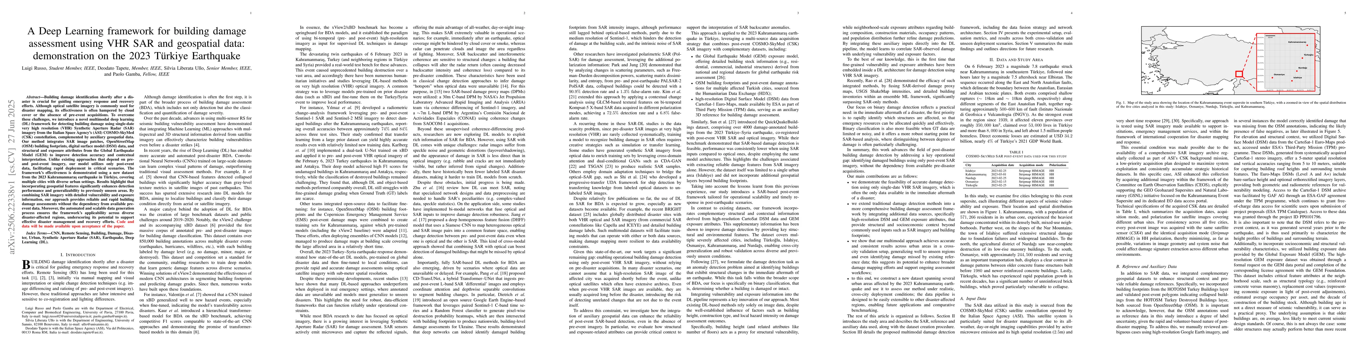
Building damage identification shortly after a disaster is crucial for guiding emergency response and recovery efforts. Although optical satellite imagery is commonly used for disaster mapping, its ef...
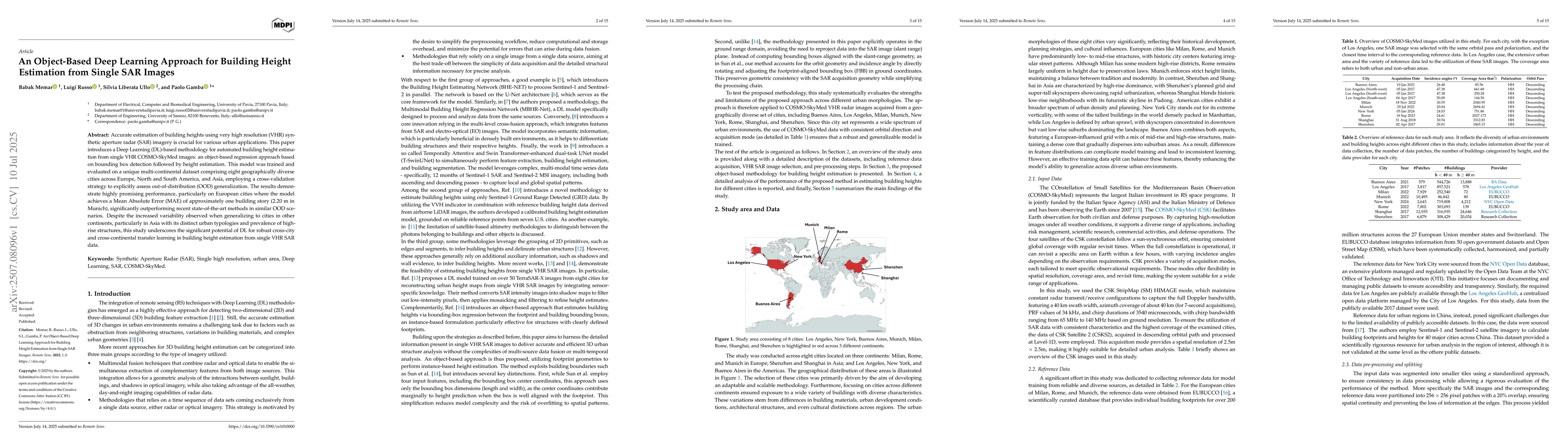
Accurate estimation of building heights using very high resolution (VHR) synthetic aperture radar (SAR) imagery is crucial for various urban applications. This paper introduces a Deep Learning (DL)-ba...
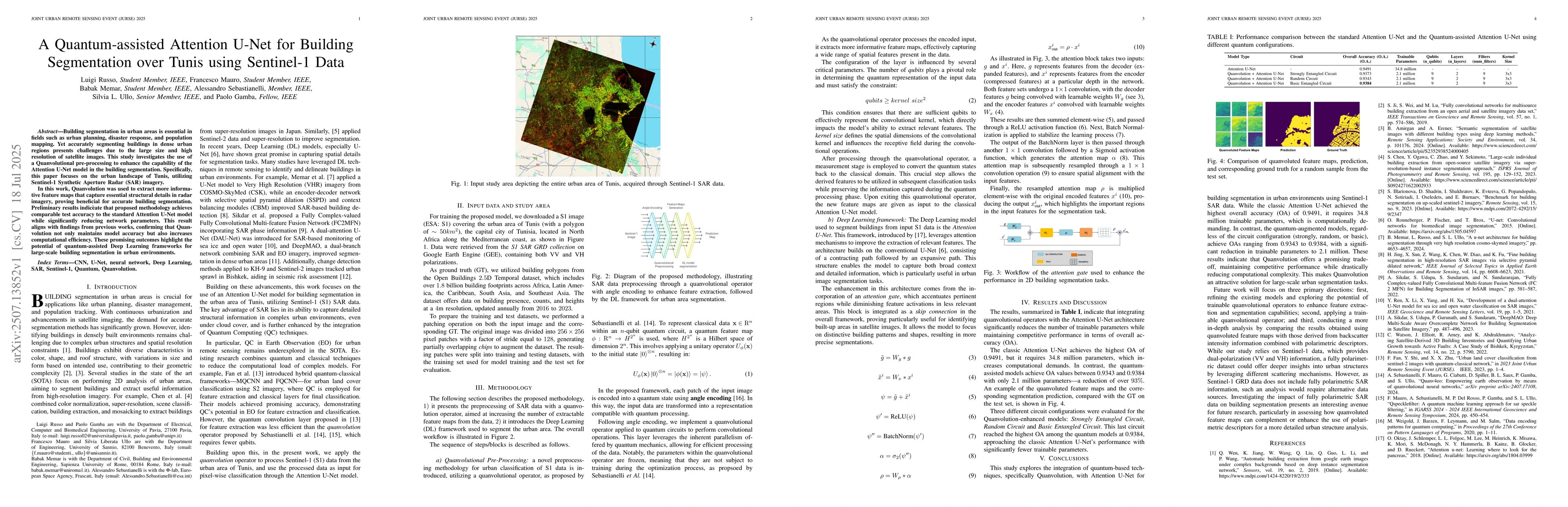
Building segmentation in urban areas is essential in fields such as urban planning, disaster response, and population mapping. Yet accurately segmenting buildings in dense urban regions presents chall...
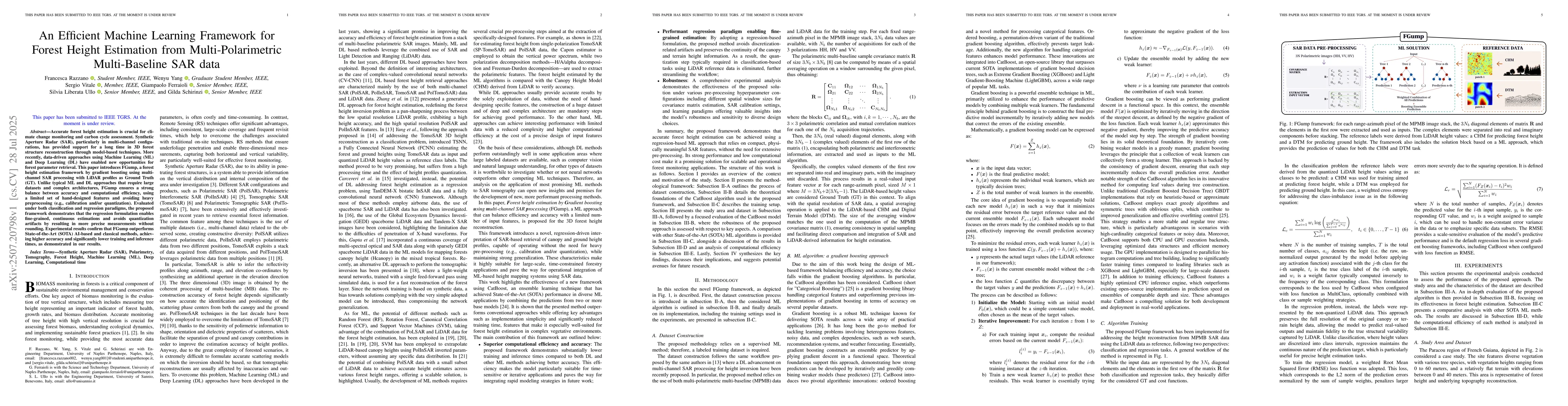
Accurate forest height estimation is crucial for climate change monitoring and carbon cycle assessment. Synthetic Aperture Radar (SAR), particularly in multi-channel configurations, has provided suppo...
Machine Learning (ML) has been widely applied across numerous domains due to its ability to automatically identify informative patterns from data for various tasks. The availability of large-scale dat...