Academic Profile
Statistics
Similar Authors
Papers on arXiv
A chained hydrologic-hydraulic model is implemented using predicted runoff from a large-scale hydrologic model (namely ISBA-CTRIP) as inputs to local hydrodynamic models (TELEMAC-2D) to issue foreca...
In spite of astonishing advances and developments in remote sensing technologies, meeting the spatio-temporal requirements for flood hydrodynamic modeling remains a great challenge for Earth Observa...
Monte Carlo (MC) sampling is a popular method for estimating the statistics (e.g. expectation and variance) of a random variable. Its slow convergence has led to the emergence of advanced techniques...
The challenges in operational flood forecasting lie in producing reliable forecasts given constrained computational resources and within processing times that are compatible with near-real-time fore...
Owing to advances in data assimilation, notably Ensemble Kalman Filter (EnKF), flood simulation and forecast capabilities have greatly improved in recent years. The motivation of the research work i...
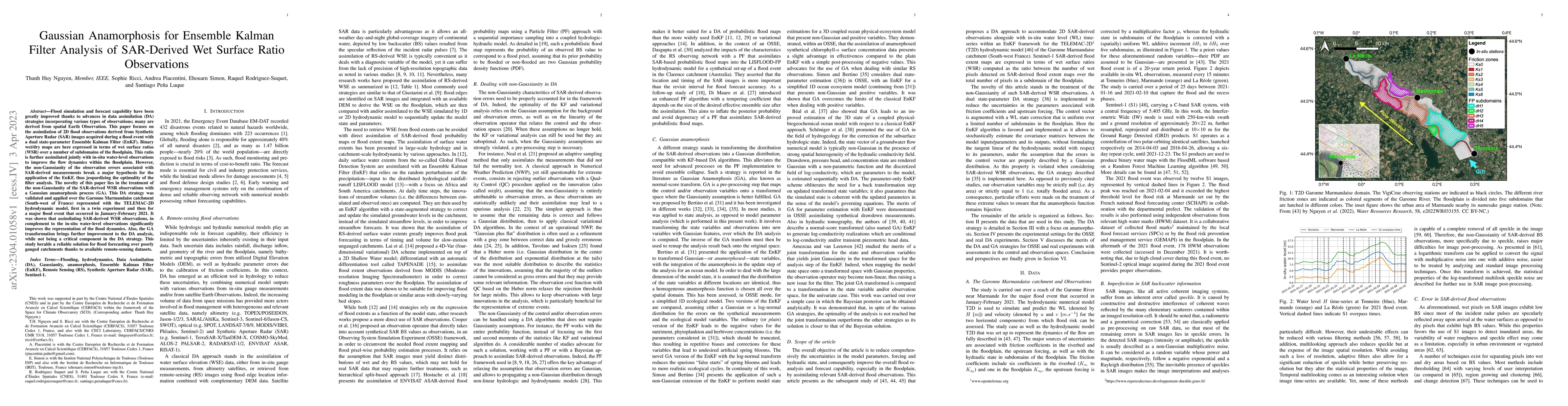
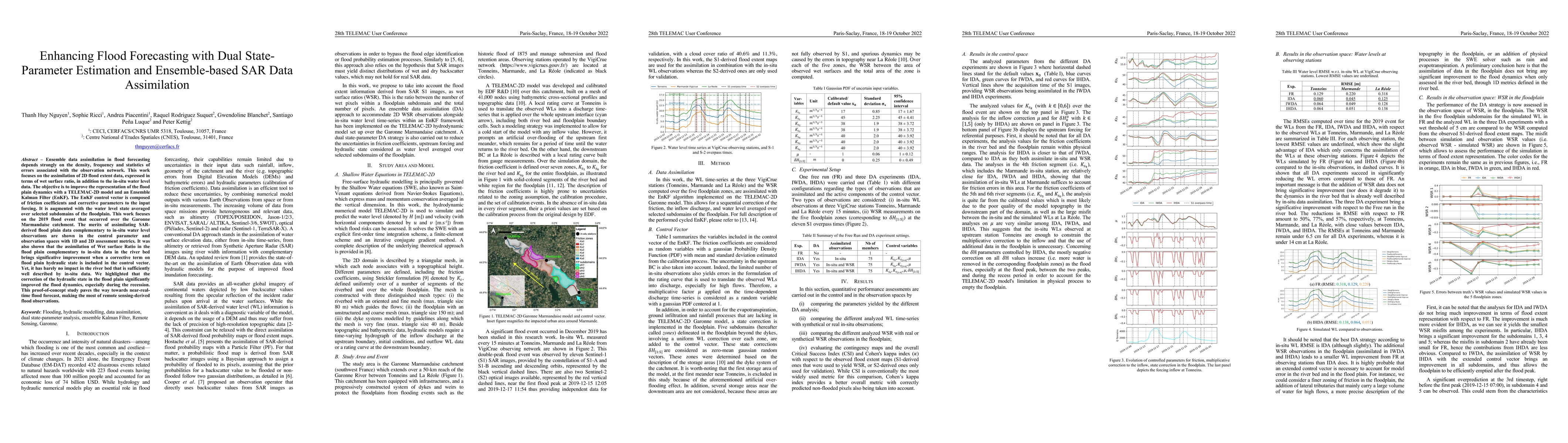
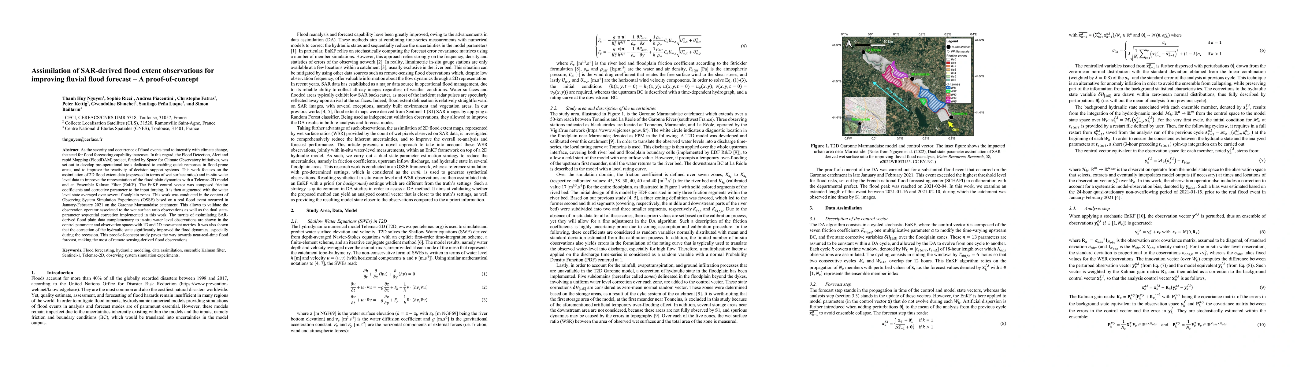
Flood simulation and forecast capability have been greatly improved thanks to advances in data assimilation (DA) strategies incorporating various types of observations; many are derived from spatial...
Ensemble data assimilation in flood forecasting depends strongly on the density, frequency and statistics of errors associated with the observation network. This work focuses on the assimilation of ...
As the severity and occurrence of flood events tend to intensify with climate change, the need for flood forecasting capability increases. In this regard, the Flood Detection, Alert and rapid Mappin...
Flood simulation and forecast capability have been greatly improved thanks to advances in data assimilation. Such an approach combines in-situ gauge measurements with numerical hydrodynamic models t...
Relevant comprehension of flood hazards has emerged as a crucial necessity, especially as the severity and the occurrence of flood events intensify with climate changes. Flood simulation and forecas...
Numerical simulation models associated with hydraulic engineering take a wide array of data into account to produce predictions: rainfall contribution to the drainage basin (characterized by soil na...
Direct economic impacts of flooding are essential for flood mitigation policies, and are based upon multiple tools, among which 2D hydrodynamic models. These models are dependent on multiple parameter...
Floods are one of the most common and devastating natural disasters worldwide. The contribution of remote sensing is important for reducing the impact of flooding both during the event itself and for ...