Academic Profile
Statistics
Similar Authors
Papers on arXiv
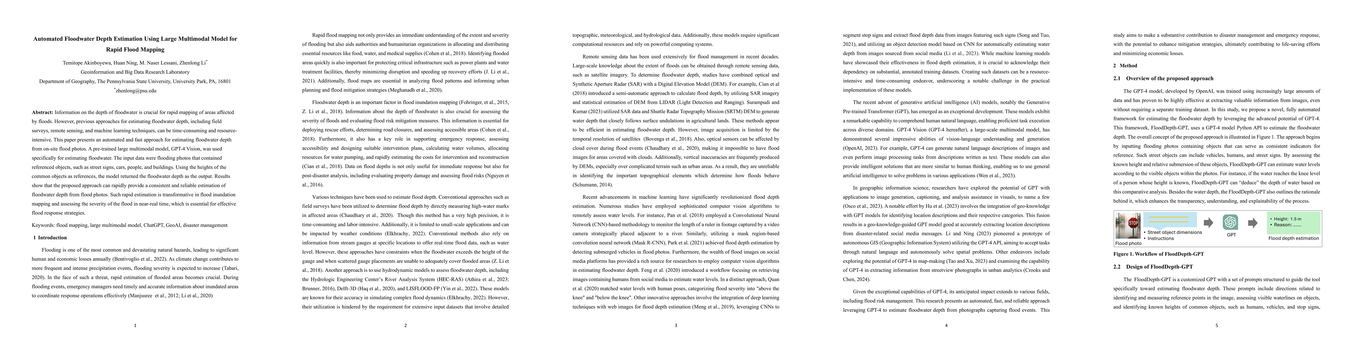
Information on the depth of floodwater is crucial for rapid mapping of areas affected by floods. However, previous approaches for estimating floodwater depth, including field surveys, remote sensing...
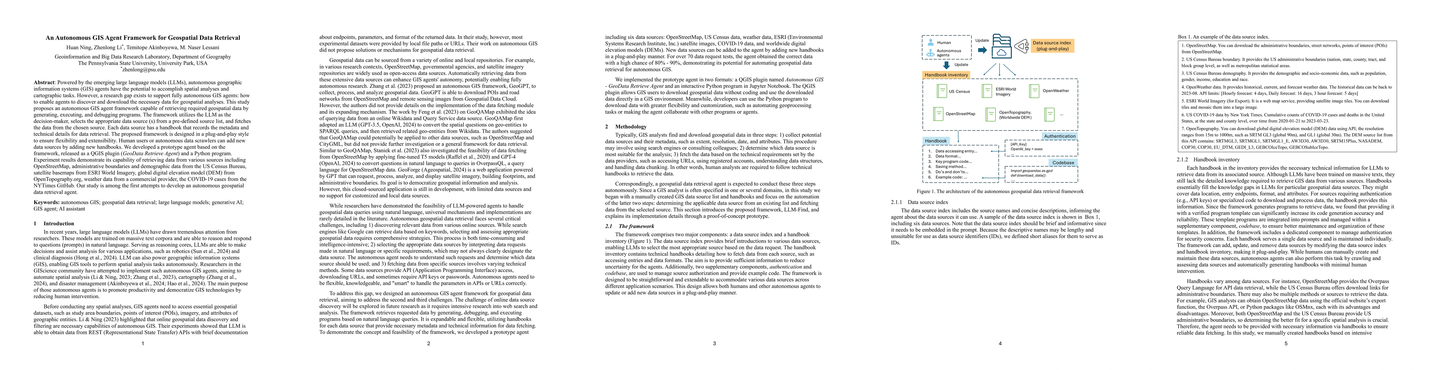
Powered by the emerging large language models (LLMs), autonomous geographic information systems (GIS) agents have the potential to accomplish spatial analyses and cartographic tasks. However, a resear...
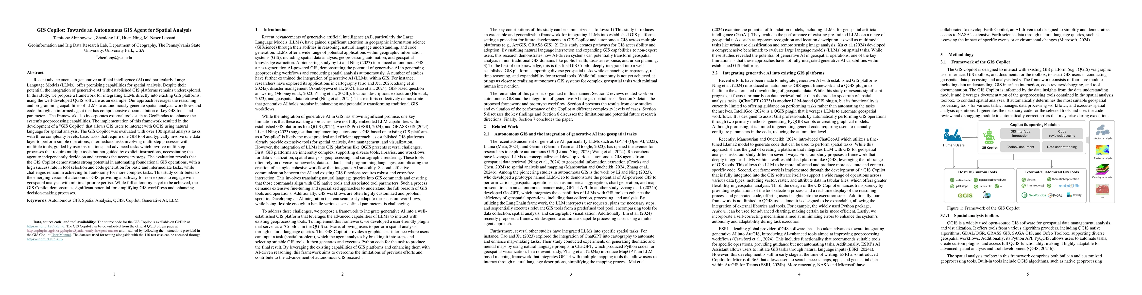
Recent advancements in Generative AI offer promising capabilities for spatial analysis. Despite their potential, the integration of generative AI with established GIS platforms remains underexplored. ...