Academic Profile
Statistics
Similar Authors
Papers on arXiv
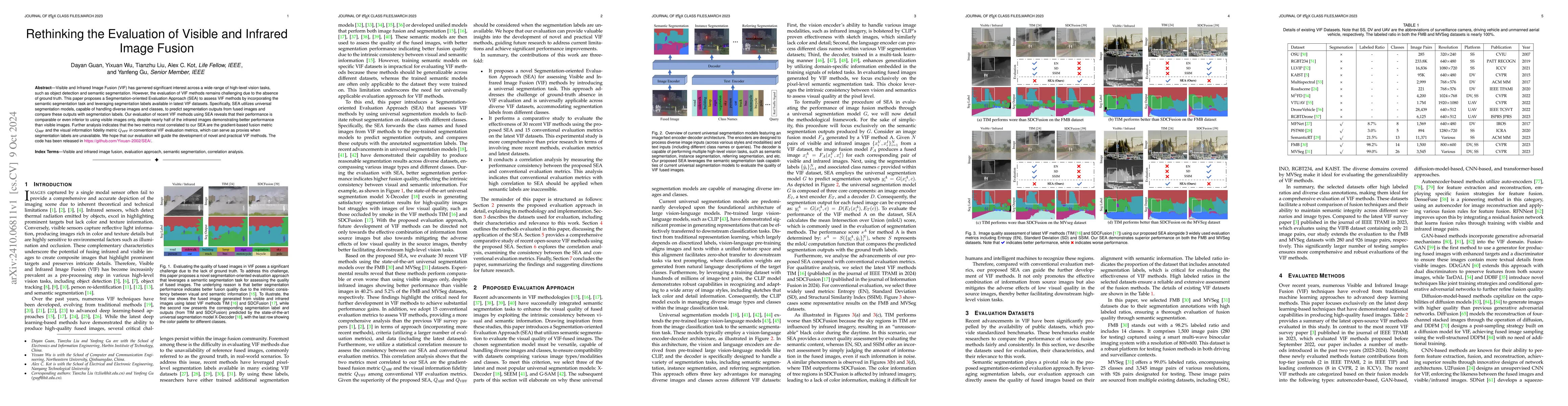
Visible and Infrared Image Fusion (VIF) has garnered significant interest across a wide range of high-level vision tasks, such as object detection and semantic segmentation. However, the evaluation of...
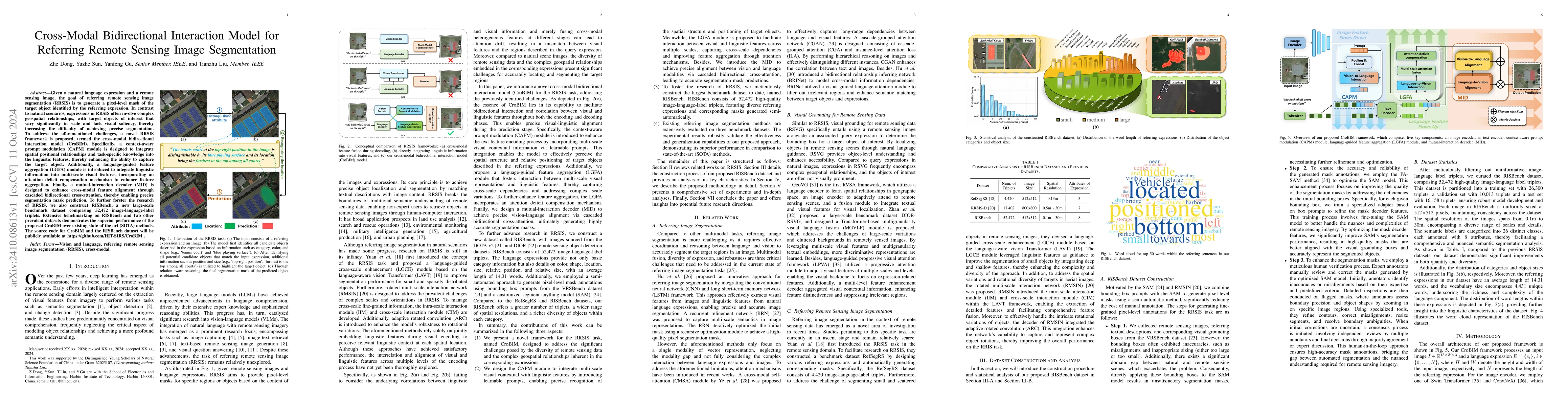
Given a natural language expression and a remote sensing image, the goal of referring remote sensing image segmentation (RRSIS) is to generate a pixel-level mask of the target object identified by the...
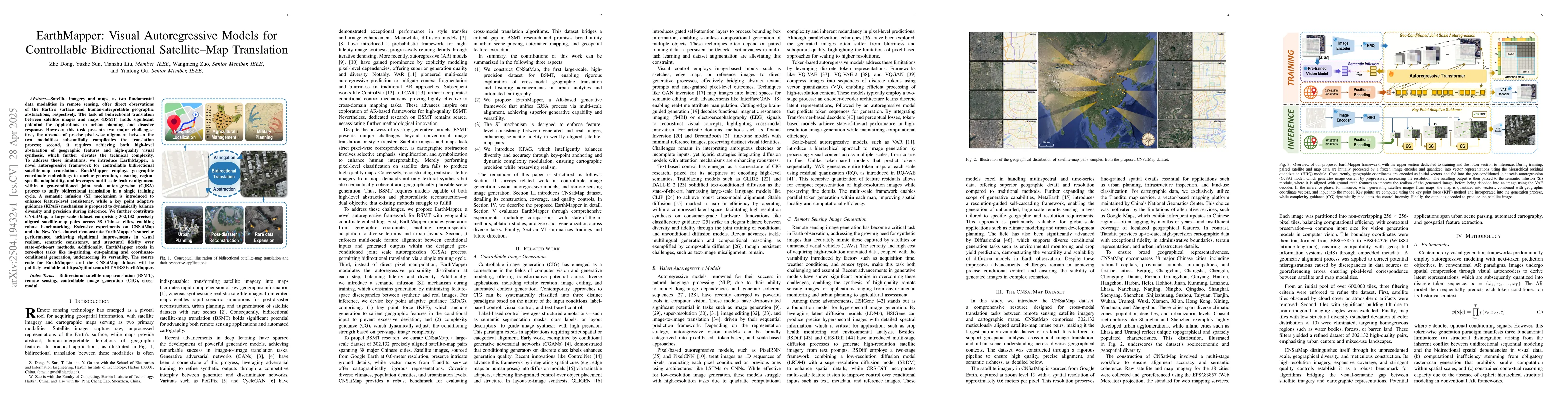
Satellite imagery and maps, as two fundamental data modalities in remote sensing, offer direct observations of the Earth's surface and human-interpretable geographic abstractions, respectively. The ta...
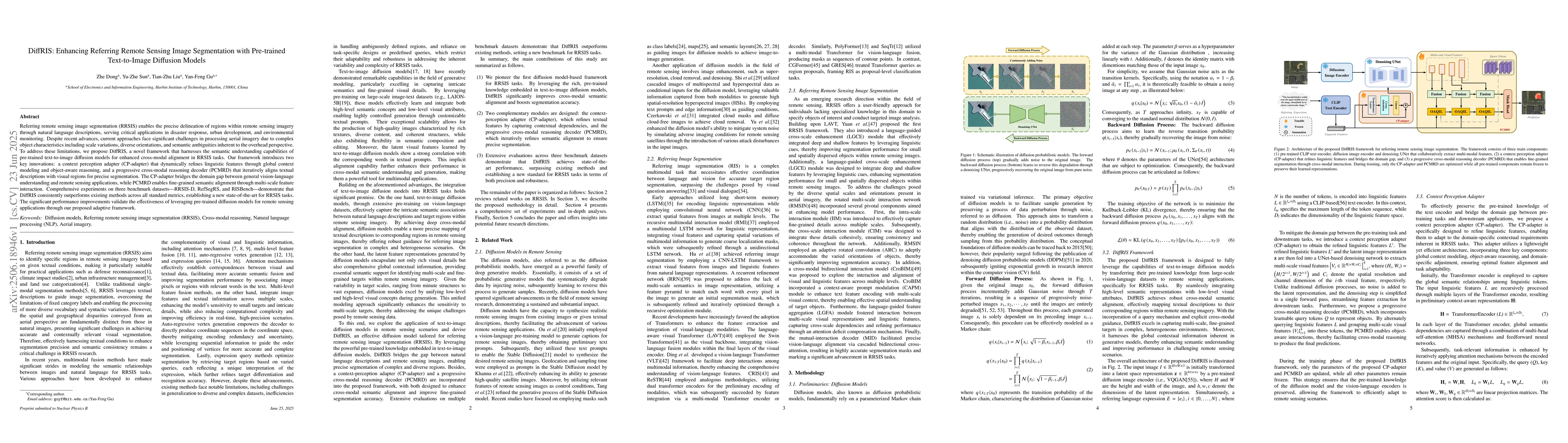
Referring remote sensing image segmentation (RRSIS) enables the precise delineation of regions within remote sensing imagery through natural language descriptions, serving critical applications in dis...
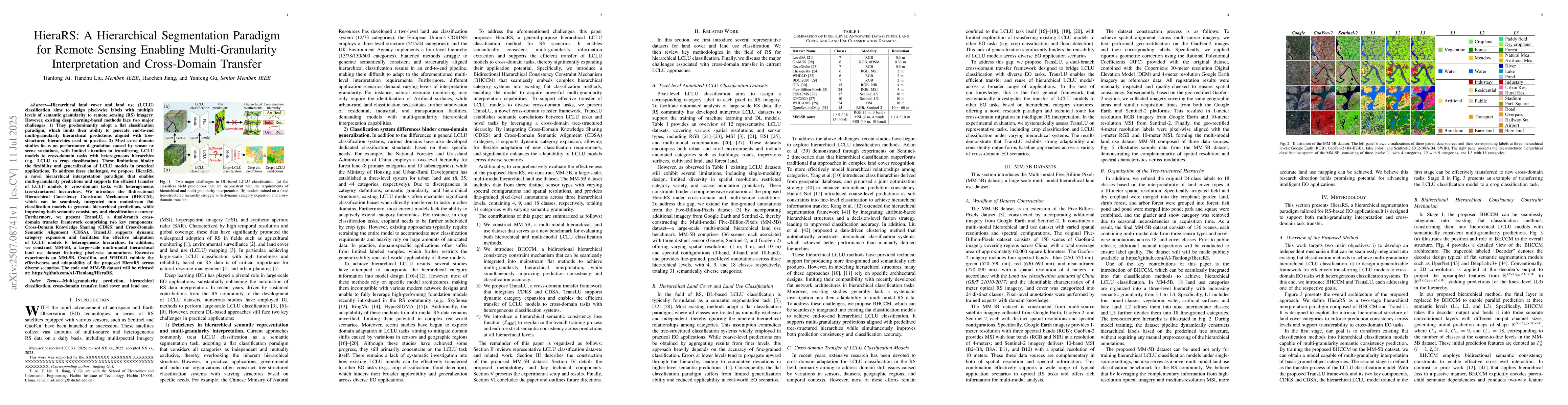
Hierarchical land cover and land use (LCLU) classification aims to assign pixel-wise labels with multiple levels of semantic granularity to remote sensing (RS) imagery. However, existing deep learning...
Spectral imaging technology has long-faced fundamental challenges in balancing spectral, spatial, and temporal resolutions. While compressive sensing-based Coded Aperture Snapshot Spectral Imaging (CA...
Remote sensing images inevitably suffer from various degradation factors during acquisition, including atmospheric interference, sensor limitations, and imaging conditions. These complex and heterogen...
Referring remote sensing image segmentation aims to localize specific targets described by natural language within complex overhead imagery. However, due to extreme scale variations, dense similar dis...
Snapshot Broadband Filter Array (BFA) imaging provides high light throughput for spectral reconstruction but introduces severe spectral aliasing due to complex modulation. Current deep learning approa...