Xin-Yi Tong
5 papers on arXiv
Academic Profile
Statistics
Similar Authors
Papers on arXiv
Global High Categorical Resolution Land Cover Mapping via Weak Supervision
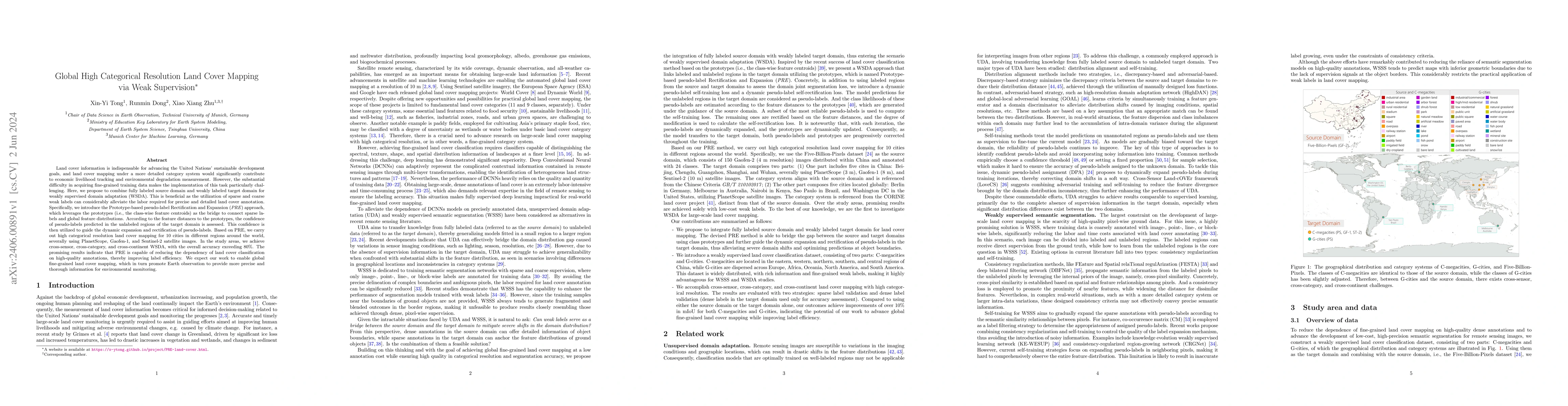
Land cover information is indispensable for advancing the United Nations' sustainable development goals, and land cover mapping under a more detailed category system would significantly contribute t...
Enabling Country-Scale Land Cover Mapping with Meter-Resolution Satellite Imagery
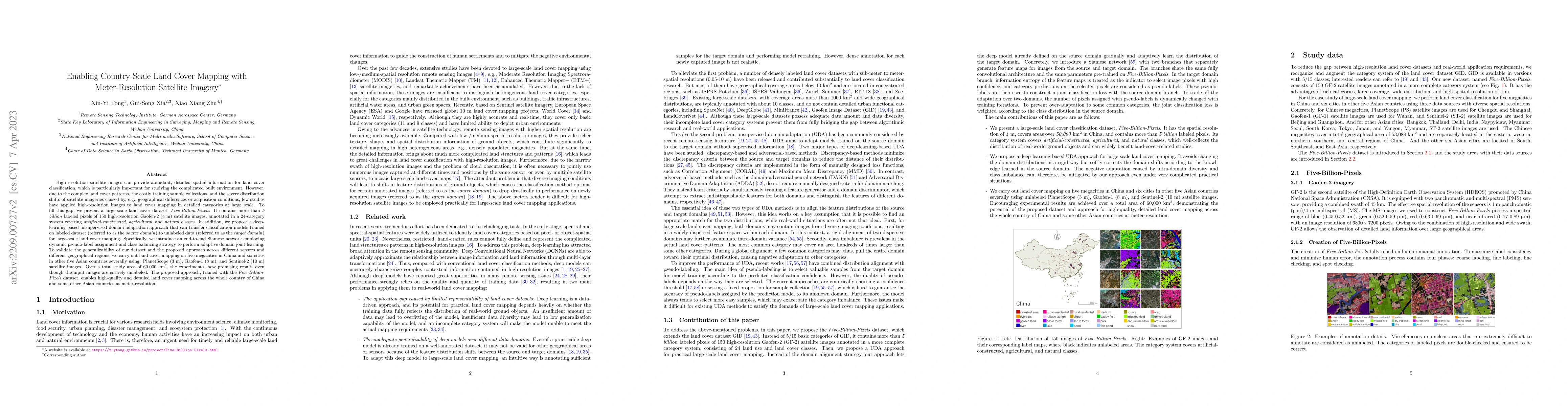
High-resolution satellite images can provide abundant, detailed spatial information for land cover classification, which is particularly important for studying the complicated built environment. How...
Hidden Path Selection Network for Semantic Segmentation of Remote Sensing Images
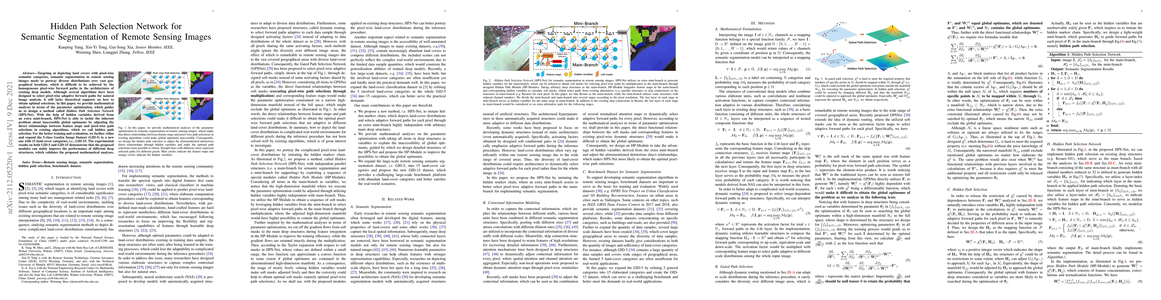
Targeting at depicting land covers with pixel-wise semantic categories, semantic segmentation in remote sensing images needs to portray diverse distributions over vast geographical locations, which ...
Land-Cover Classification with High-Resolution Remote Sensing Images Using Transferable Deep Models
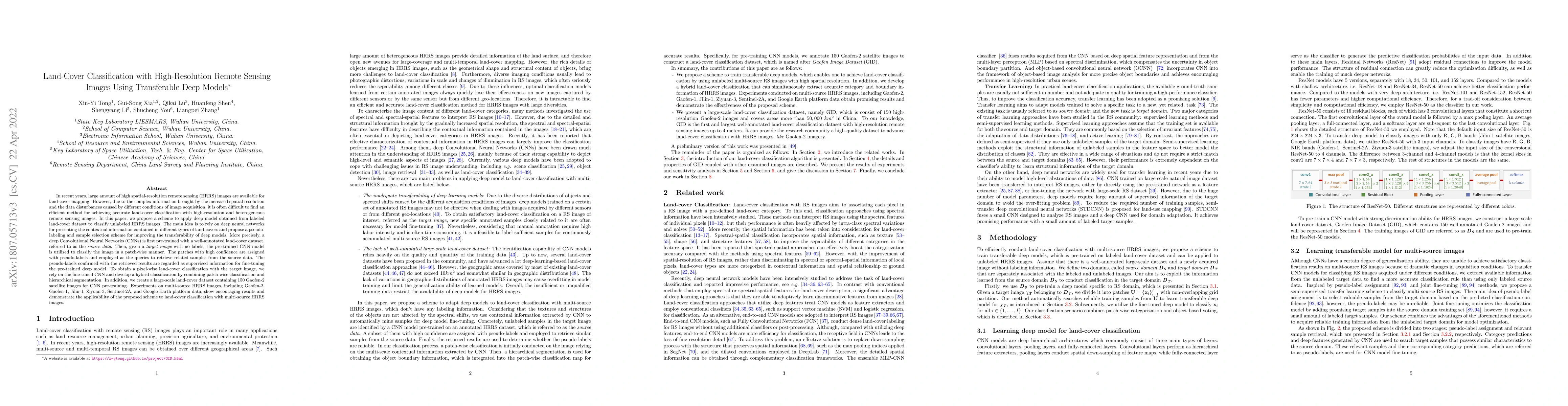
In recent years, large amount of high spatial-resolution remote sensing (HRRS) images are available for land-cover mapping. However, due to the complex information brought by the increased spatial r...
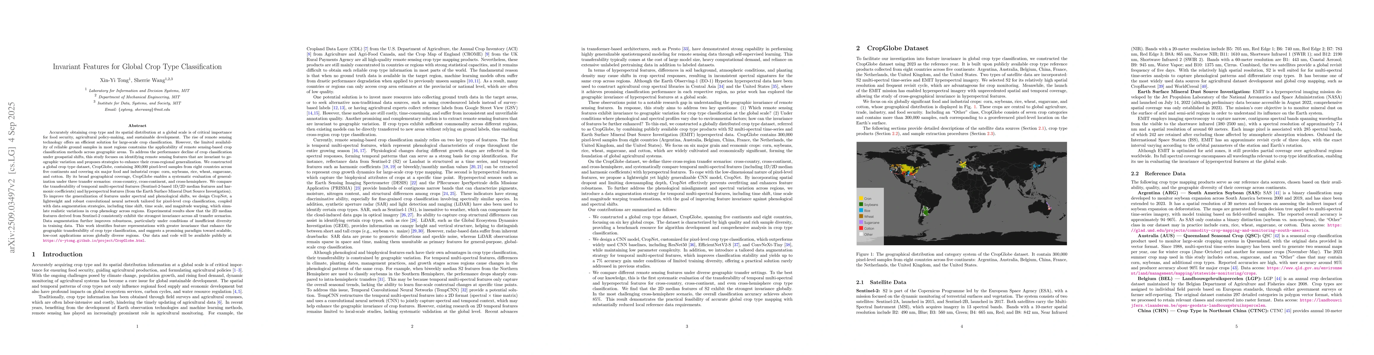
Invariant Features for Global Crop Type Classification
Accurately obtaining crop type and its spatial distribution at a global scale is critical for food security, agricultural policy-making, and sustainable development. Remote sensing offers an efficient...